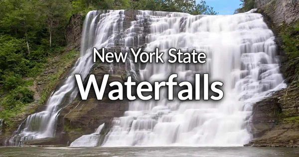
Discover the ultimate New York State Waterfalls directory—your all-in-one guide featuring over 2,000 waterfalls in more than 600 locations, complete with photos, maps, and in-depth guides to help you explore every cascade from Niagara to the Finger Lakes. Whether you’re planning a photography trip, researching waterfall geology, or just curious about the best falls across NY, this page has everything you need to find, learn about, and experience the stunning waterfalls of New York State.
New York State Waterfalls List
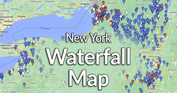
New York Waterfall Location Map
Over 2,000 waterfalls in over 600 locations across New York State, the map plots public, private, and unknown properties to help you find the falls you want to learn more about. Not a map person? Check out the COUNTY list below.
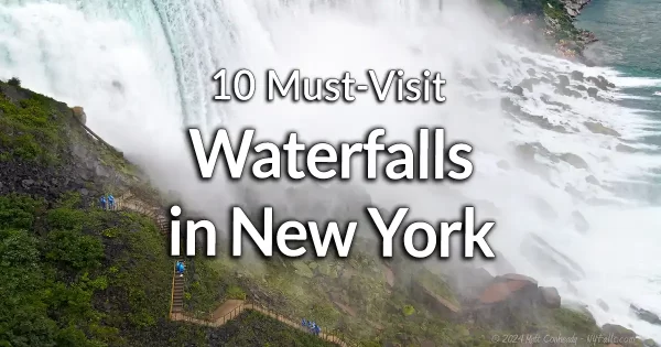
10 Must-Visit Waterfalls in New York
The 10 most beautiful, popular, and accessible waterfalls in the State of New York.
Waterfalls Listed by City Area
Click a city below to see all the waterfalls in that area.
Waterfalls Listed by County
Click a county below to see all the waterfalls in that area.

New York City Waterfall Art Project (2008)
In the summer of 2008, Danish artist Olafur Eliasson erected 4 artificial waterfalls around the East River and the New York Harbor. Some say it was worth the effort. Some say it was a huge disappointment.
Cohoes Falls |  A massive falls, 65 ft high and up to 800 ft wide on the Mohawk River, just outside of Albany. A massive falls, 65 ft high and up to 800 ft wide on the Mohawk River, just outside of Albany.1 waterfall – Map |
Dickinson Falls | Nothing is known about these large multi-tiered falls on Hannacroix Creek. Unknown number of waterfalls. Map |
Fox Creek Falls |  A series of cascades from 2 to 4 ft high along a short stretch of Fox Creek in the hamlet of Berne. A historic mill and axe factory site. A series of cascades from 2 to 4 ft high along a short stretch of Fox Creek in the hamlet of Berne. A historic mill and axe factory site.Multiple waterfalls – Map |
Hannacroix Ravine |  A 30 ft tall cascade in this Helderberg Ravine on Nature Conservancy property in the Town of New Scotland. It can be seen from the trail in early spring or after the leaves fall, or you can hike up the creek to get to the base. A 30 ft tall cascade in this Helderberg Ravine on Nature Conservancy property in the Town of New Scotland. It can be seen from the trail in early spring or after the leaves fall, or you can hike up the creek to get to the base.1 waterfall – Map |
Horton Falls | Nothing is known about these massive falls on Vly Creek. Unknown number of waterfalls. – Map |
John Boyd Thacher State Park | This State Park has miles of trails and over 20 waterfalls along the Helderberg Escarpment. Multiple waterfalls – Map |
Partridge Run Falls |  Several accessible waterfalls in the Partridge Run Game Management Area in the town of Berne, west of Albany. Several accessible waterfalls in the Partridge Run Game Management Area in the town of Berne, west of Albany.Multiple waterfalls in 2 or 3 close locations in the WMA – Map |
Rensselaerville Falls | 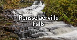 A large 70 ft tall falls on Ten Mile Creek in the Edmond Niles Huyck Nature Preserve 30 miles southwest of Albany. A large 70 ft tall falls on Ten Mile Creek in the Edmond Niles Huyck Nature Preserve 30 miles southwest of Albany.1 waterfall – Map |
Slide Rock Falls | See Hannacroix Ravine. |
Switzkill Farm | A rural park and preserve in the Town of Berne was once a land game farm and estate. The town purchased the land to use as a preserve. There are 2 waterfalls on Switzkill that are within the bounds of the property. There’s currently a land dispute about the conservation easement and the land is prepping to be put up for private sale. At this time I am not sure if it is accessible. 2 waterfalls – Map |
West Berne Falls | An 8 ft tall cascade on Cobbleskill Creek in West Berne. Easily seen from Dutch Settlement Rd or Bradt Hollow Rd. 1 waterfall – Map |
Allen Lake State Forest Falls | A semicircular man-made dam on the Genesee River in the village of Belmont. Easily seen from the NY-19 bridge. Man-made dam – Map |
Belmont Falls | Not much is known about these falls in Allen Lake State Forest. Unknown number of waterfalls. – Map |
Cold Creek Falls | See Hume Falls. |
Five Falls | A small stretch of Canaseraga Creek east of the village that has 5 drops totally over 25 ft high. Completely on private property and not accessible. A series of 5 drops – Map |
Hume Falls |  22 ft and 5 ft high cascades on Cold Creek, village of Hume. It’s right under the NY-19 bridge, but a hike upstream is the best way to view it. 22 ft and 5 ft high cascades on Cold Creek, village of Hume. It’s right under the NY-19 bridge, but a hike upstream is the best way to view it.1 waterfall – Map |
Mills Mills Falls |  A 8-10 ft dam waterfall leads to a series of cascades that are about 20 ft in height (Private Property. No trespassing) Visible from the bridge above. A 8-10 ft dam waterfall leads to a series of cascades that are about 20 ft in height (Private Property. No trespassing) Visible from the bridge above.Multiple Waterfalls – Map |
Sun Valley Campsite Falls | This private campground features three waterfalls along a small stretch of Canaserega Creek. 3 waterfalls – Map |
Wiscoy Falls | 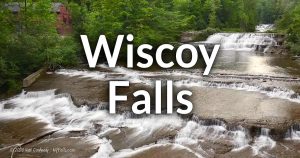 A 40 ft series of 5 drops make up this picturesque creek. A 40 ft series of 5 drops make up this picturesque creek.1 waterfall – Map |
Broome County
IBM Glen |  On the former site of the IBM Country Club (between Endicott and Johnson City) is now a natural area with old growth trees, bridges and a beautiful waterfall. Accessible from Grays Creek Trail. On the former site of the IBM Country Club (between Endicott and Johnson City) is now a natural area with old growth trees, bridges and a beautiful waterfall. Accessible from Grays Creek Trail.1 waterfall – Map |
Wolfe Creek | 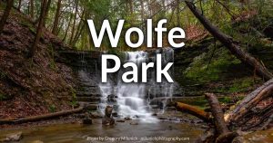 A 10-12 ft tall waterfall in this Chenango town park north of Binghamton. A 10-12 ft tall waterfall in this Chenango town park north of Binghamton.1 waterfall – Map |
Buttermilk Falls | See Schoolmarm Falls. |
Bridal Falls | A 40 ft high seasonal falls that empties into Stoddard Creek in Allegany State Park. 1 waterfall – Map |
Cattaraugus Creek Falls | A 12 ft cascade on Cattaraugus Creek in East Otto. Access is unknown, but it’s close to the road. 1 waterfall – Map |
Mill Brook Falls | A small waterfall on a tributary to Cattaraugus Creek. Located on the Cattaraugus Reservation. Little is known about it. 1 waterfall – Map |
Otto Falls | See Cattaraugus Creek Falls. |
Riceville Falls | Estimated 40 ft high falls on Gooseneck Creek in Riceville. (Property status unknown). Possibly visible from Rt. 240 (county Rt. 32). 1 waterfall – Map |
Schoolmarm Falls |  Often called Waterman’s Cascade or Buttermilk Falls, this 70 ft high ribbon cascade is a roadside falls east of Zoar Valley. Often called Waterman’s Cascade or Buttermilk Falls, this 70 ft high ribbon cascade is a roadside falls east of Zoar Valley.1 waterfall – Map |
Waterman’s Cascade | See Schoolmarm Falls. |
Zoar Valley Waterfalls | Zoar Valley, a state Multi-Use Area, is home to over 14 waterfalls; most of which are publicly accessible. Zoar Valley falls within Erie and Cattaraugus counties. Some unnamed, private falls are not listed here. 14+ waterfalls total. The falls can be grouped into 2 sections of the valley: |
Cattaraugus Creek Falls: 6 Falls | |
-Barebutt Falls | An 80 ft falls segmented into 7 drops (only 2 being visible). |
-Bare buns Falls | See Barebutt Falls. |
-Bridal Veil Falls | See Ross’s Falls. |
-Free Fall Falls | See Stony Creek Falls. |
-Holcomb Falls | An 80 ft drop. Accessible by raft and a short hike. |
-Joshua’s Cascade | An 80 ft seasonal cascade down a tributary into Cattaraugus Creek. Accessible by raft and a short hike. |
-Plunge Cascade | See Joshua’s Cascade. |
-Ross’s Falls | A 120 ft tall, 50 ft wide cascade near the south branch junction. |
-Skinny Dip Falls | See Ross’s Falls. |
-Stony Creek Falls | An 80 ft steep ribbon then falls directly into the main creek. Visible by raft. |
South Branch Cattaraugus Creek Falls: 6+ Falls | |
-Big Falls | An 18 ft plunge into the creek. This falls is on Nature Sanctuary Society of Western New York land. Society members are permitted to visit the falls if permission is granted. |
-Buff Falls | A 120 ft tall seasonal ribbon cascade that empties into the south branch of Cattaraugus Creek. |
-Deer Lick Falls | An 80 ft falls segmented into 2 drops. Only the bottom 70 ft is visible. This falls is on The Nature Conservancy land and access is not permitted – Though you can still see the lower (6 ft tall) falls from state land. |
-Forty Falls | A 75 ft segmented cascade that passes under Forty Rd. |
-Gossamer Cascade | A 130 ft tall seasonal ribbon cascade that empties into the south branch of Cattaraugus Creek. |
-Plumb Brook Falls | This 45 ft ribbon cascade is on private property (no trespassing). |
Waterman’s Cascade | See Schoolmarm Falls. |
Angel Falls | See Carpenter Falls. |
Auburn Falls | See Mill Street Dam. |
Bear Swamp Cascades | A series of waterfalls along a private stretch of Bear Swamp Creek upstream from Bahar Nature Preserve. Private property. Multiple waterfalls |
Carpenter Falls | 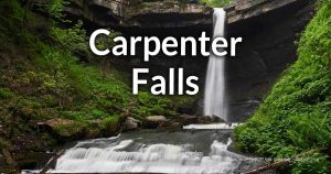 A difficult trail leads to a breathtaking horseshoe gully with a powerful 90 ft ribbon plunge and a 62 ft freefall/cascade. The large cap rock allows visitors to walk behind the falls (with caution). A difficult trail leads to a breathtaking horseshoe gully with a powerful 90 ft ribbon plunge and a 62 ft freefall/cascade. The large cap rock allows visitors to walk behind the falls (with caution).4 waterfalls (2 Accessible) – Map |
Clifton Falls | On the east end of Cayuga Lake, south of Wells College in Aurora. (Private Property) 1 waterfall – Map |
Decker Creek Falls | One 10 ft and one 6 ft waterfall only 1/2 mile from Montville Falls. UPDATE – Land is now private 2 waterfalls – Map |
Dodty Falls | A tall and narrow cascade on Private Property just north of Moravia and Parsons Falls. It can be seen from NY-38 (W Lake Rd). 1 waterfall – Map |
Fillmore Glen State Park | 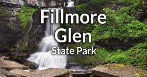 Similar to Watkins Glen and Stony Brook. A glacier-carved glen. Similar to Watkins Glen and Stony Brook. A glacier-carved glen.5 waterfalls – Map |
Great Gully Falls | This deep ravine offers 3 small cascades and one 20 ft plunge. The majority of this gully is on private property. 4 waterfalls – Map |
Hackney Falls | A 20 ft high waterfall at an old factory dam complex. Construction has been taking place (around 2019) and it appears as though a viewing platform is being installed. It’s viewable from the top from the N Division Sr bridge, while access from other points is TBD. 1 man-made waterfall – Map |
Lower Dam Falls | See Wadsworth Dam |
Mill Street Dam | At the north end of Owasco Lake is a hydroelectric and flood control dam (about 22 ft high) that control the flow into the Owasco Outlet. It has a walkway that is accessible from Miller St or from an access road off of Osborne St. 1 man-made waterfall – Map |
Montville Falls | A giant 75 ft cascade. Decker Creek falls is nearby. UPDATE – Land is now private 1 waterfall – Map |
Moonshine Falls | Nothing is known about these falls on Paines Creek. Unknown number of waterfalls. – Map |
New Hope Mill Falls |  Two man-made falls help power an historic mill was once accessible, but is now private property and off limits to visitors. Two man-made falls help power an historic mill was once accessible, but is now private property and off limits to visitors.2 waterfalls (dams) – Map |
Parsons Falls | A 140 ft waterfall and another one of unknown height south of Owasco Lake near Moravia. Property status unknown. 2+ waterfalls – Map |
Simons Dam | An old dam in Sterling yields a waterfall several feet high. It’s on private property, but viewable from 104A. 1 man-made waterfall – Map |
Sterling Dam | See Simons Dam. |
Sterling Valley Falls | A falls created by a dam on Sterling Valley Creek, south of Sterling. It’s on private property, but easily viewable from the 104A bridge. Do not park in what seems to be a parking area on Maroney Rd. 1 man-made waterfall – Map |
Van Natta’s Falls | See Wells Falls. |
Wadsworth Dam | Two dams span the Owasco Lake outlet and sit next to the ruined foundations of the Scythe Manufactory. This stretch of the outlet is a part of the Henry & Allen Brownfield site and is suspected to be contaminated. Property Status is unknown. I recommend you refrain from visiting. 2 man-made waterfalls – Map |
Arkwright Falls |  A 25 ft cascade finishes up this well-worn creek-walk up Canadaway Creek. A tributary creates a 28 ft ribbon cascade and pools. (Private Property). A 25 ft cascade finishes up this well-worn creek-walk up Canadaway Creek. A tributary creates a 28 ft ribbon cascade and pools. (Private Property).2 waterfalls – Map |
Barcelona Falls | 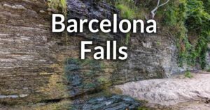 Seasonal tributaries that pour over a cliff and onto the beach at Lake Erie in the hamlet of Barcelona. Seasonal tributaries that pour over a cliff and onto the beach at Lake Erie in the hamlet of Barcelona.4 waterfalls – Map |
Beaver Creek Falls | Estimated 40 ft falls on Beaver Creek in the town of Sheridan. A short trail from a rest stop on Rt. 39 leads to the falls. Property status unknown. 1 waterfall – no map |
Brookside Beach | This private campground on Lake Erie, just west of Westfield, has a narrow chute-type waterfall along a small glen that empties into the lake at a short cascade. 2 waterfalls – Map |
Dotty Creek Falls (Ottaway Park) | A small winding glen lines the west side of this peaceful town park. Upstream right at the culvert at E Lake Rd is a small cascade. 1 waterfall – Map |
Hawley Dam Falls | 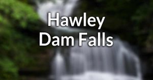 An old dam once used by the Westfield Waterworks with a 6-8 ft cascade. Several other small cascades can be found on the hike up Chautauqua Creek. An old dam once used by the Westfield Waterworks with a 6-8 ft cascade. Several other small cascades can be found on the hike up Chautauqua Creek.Multiple small waterfalls – Map |
Laona Falls |  A roadside dam and cascade at an estimated 12 ft in height, near Fredonia. A roadside dam and cascade at an estimated 12 ft in height, near Fredonia.1 waterfall and man-made dam – Map |
Shumla Falls | A 20 ft falls and a smaller falls on Canadaway Creek, south of Laona Falls. (Private Property) 2 waterfall – Map |
Skinny Dip Falls |  As the name says, the pool below the 6 ft fall is within a nudist area in Chautauqua Gorge, south of Westfield. There are several other small waterfalls you can see on this hike and probably naked butts too. As the name says, the pool below the 6 ft fall is within a nudist area in Chautauqua Gorge, south of Westfield. There are several other small waterfalls you can see on this hike and probably naked butts too.Multiple waterfalls – Map |
Walnut Creek (unnamed waterfall) | A small cascade, possibly visible from the roadside (CR-85), in the northwest corner of the town of Arkwright. Unverified. Accessibility unknown. 1 waterfall – Map |
Walnut Falls |  A 20 ft roadside cascade set in the heart of the village of Forestville. A 20 ft roadside cascade set in the heart of the village of Forestville.1 waterfall – Map |
Chemung County and the City of Elmira
There are no known waterfalls in this county.
Chenango County
Buckley Hollow | Incorrect name for Frozen Rocks. |
Bucks Brook State Forest | Bucks Brook Rd follows the brook through the forest. From the road you should be able to spot falls along the creek. They are all pretty small, but the natural environment and ease of access makes this route a worthy trek. Start at the intersection of Bucks Brook Rd and Valley View Road and head NE up Bucks Brook. Multiple small waterfalls – Map |
Buttermilk Falls (New Berlin) | Hunts pond empties into a tributary that exits the state forest at New Berlin to the south and falls down 5 significant waterfalls as it makes its way to the Unadilla River. Some reports indicate that it is accessible. Other’s say only the first falls is viewable from the roadside. Keep an eye out for posted signs. 5 waterfalls – Map |
Center Brook Falls | While the surrounding are pretty flat including most of Center Brook, this small little patch of fissures in the creekbed create a pleasing roadside sight with a 3-5 ft jumbled cascade. View it from NY-80 south of Columbus. 1 waterfall – Map |
Chenango Lake Outlet Falls | A handful of cascades, including an 8 ft fall one, a short walk from Sheff Rd in the town of New Berlin, east of Norwich. Property status is unknown. It is reported to be private property above the large falls. Multiple waterfalls – Map |
Chippewa Falls | A 200 ft high seasonal ribbon falls along the Finger Lakes Trail in the Cuyler Hill State Forest near Cortland. 1 waterfall – Map |
Eddy Creek Falls | A 6 ft cascade and a 2 foot drop on Eddy Brook. South of Oxford. Private Property. 2 waterfalls – Map |
Frozen Rocks | There are 3 waterfalls on Buckley Creek (near Buckley Hollow) along this stretch of the Finger Lakes Trail (M25TF). One is simple a series of fissures in the flat bedrock. When water is fulling flowing, it looks like cracked ice. 3 waterfalls – Map |
Greens Gulf | See Mill Brook Falls (New Berlin). |
Mill Brook Falls (New Berlin) | A stretch of Mill Brook Falls on the west side of New Berlin that reportedly has 5 or so cascades of unknown sizes. Property status is unknown at this time, but it appears to be all on private property. Unknown number of falls – Map |
Mill Brook Run | Mill Brook empties into the Unadilla River at this remnant of a man-made mill run. A saw and a grist mill once sat on this spot. It can be seen from NY-80 or Academy St. 1 man-made waterfall – Map |
Perkins Pond Outlet Falls | A cascade just north of Perkins Pond in the Perkins Pond State Forest east of South Otselic. Best after extended rain. Easily accessible with a short walk from CR-42 near John Lane Rd. 1 waterfall – Map |
Pharsalia Wildlife Management Area | Within the WMA, a tributary the Thompson Brook has a few waterfalls when there has been recent rainfall. From the parking area marked below, follow the trailhead and white blazes to the creek. 3 waterfalls – Map |
Rexford Falls |  A 75 ft high drop on Mad Brook within a park in Sherburne. There is a small park to the north off of NY-80 and a historic footbridge over the falls. A trail on the southern side can get you into the gorge and below the falls. A 75 ft high drop on Mad Brook within a park in Sherburne. There is a small park to the north off of NY-80 and a historic footbridge over the falls. A trail on the southern side can get you into the gorge and below the falls.1 waterfall – Map |
Unadilla Falls | Another site incorrectly labeled this falls, which is on Mill Creek, not the Unadilla River. See Mill Brook Run. |
Unnamed falls outside of Pharsalia Wildlife Management Area | Another site incorrectly reported this fall as “Otselic State Forest Waterfalls.” The area does not fall within the bounds of the forest property or the WMA and is private property. Unknown number of waterfalls – Map |
Upperville Falls | An 8 ft high freefall on Pleasant Brook in Upperville. Viewable from the Quaker Hill Rd bridge. 1 waterfall – Map |
White Store Falls | A beautiful cascade tributary to Unadilla River. It gets its name from a prominent white-painted store that once existed in the hamlet. It’s on private property – Do not access. 1 waterfall – Map |
Clinton County and the City of Plattsburgh
Alice Falls | At over 30 ft high Alice Falls is interesting in that its perpendicular to the river that its on. This is because of adjacent hydro dam that redirects water south beyond the natural flow of the river. It flows behind a small rock island and loops back up to the river basin. The adjacent dam was built with concrete steps at the base, making it seem more natural when flow is high and water spills over. The falls can be seen from the power facility off of US-9. 1 man-made dam and waterfall – Map |
Anderson Falls | A 10-15 ft high slide-like waterfall on the Ausable River in the village of Keeseville. Easily seen from the Main St bridge. 1 waterfall – Map |
Ausable Chasm | I have included this in Essex County (based on access) |
Cadyville Falls | A 30 ft tall natural cascade that’s perpendicular to a 35 ft tall hydroelectric dam on the Saranac River in the village of Cadyville, town of Plattsburgh. This falls only flows when river levels are high. A set of small drops can be found further downstream near a second hydro station. Park at the lot on the utility road near the intersection with Goddeau Rd. 1 man-made dam and 2 waterfalls – Map |
East Street Dam (Mooers) | A small dam on the Great Chazy River in the villages of Mooers. Visible from the East St bridge or the lot by the monitoring station next to the dam. 1 man-made dam – Map |
Ellenburg Depot Dam and Falls | A small dam and a small waterfall (often referred to as rapids) on the Great Chazy River in the hamlet of Ellenburg Depot. It can be seen from Canaan Rd. 1 man-made dam and natural waterfall – Map |
The Gulf Unique Area | The red trail through this DEC Unique Area leads to cheer cliffs above “The Gulf” and ends at the Canadian border. There aren’t any year-round waterfalls here, but in snowmelt and early spring seasonal run-off will create a cascade that runs 60-70 ft down the cliffs. Ice climbers will frequent this runoff on the coldest days. 1 seasonal waterfall – Map (approximate) |
High Falls (Saranac) | See Saranac Falls (Wilson Rd). |
High Falls Dam and Falls | A large hydroelectric dam and and natural falls just south of Moffitsville in the town of Saranac. The dam creates a smooth cascade that is flanks on the east and west sides by steep rock cliffs. When the dam has considerable spillage, these create beautifully roaring falls. that funnel towards the center. There’s a parking area on Wilson Rd, just west of the dam and view can be had from the top in a designated viewing area. 1 man-made dam and waterfall – Map |
Imperial Mills Dam | A power dam on the Saranac in the city of Plattsburgh. It’s a beautiful modern dam but adjacent to some older industrial buildings and foundations. The dam’s uneven construction makes for a pleasing and frothy cascade. Check it out from the north side of the river where there are athletics fields and some grassy areas. 1 man-made dam – Map |
Kent Falls (and Kent Falls Dam) | Kent Falls refers to stretch of the Saranac River, east of Cadyville that features several falls and whitewater. On the west is a large hydroelectric dam that rests on top of a natural falls. Downstream from there, the that narrows into a long connected series of rapids and cascades. This is what is officially dubbed Kent Falls. I’m unsure about access, but there is a road running along the south of the river, leading to the dam and a parking area. Several waterfalls and rapids as well as 1 man-made dam – Map |
Little Falls | See Alice Falls. |
Lower Saranac Hydroelectric Project and Falls | There are two dams on the Saranac in this location just outside of the city of Plattsburgh. On the north branch is a V-shaped dam. On the south branch is more of an L shape. Under the long edge of that dam the bed rock slopes, creating a natural cascade under the spillway. Depending on the flow, different sides of each dam have cascades. Further downstream, where the two branches join up again, is a 5 ft natural cascade. A parking area on the island in-between the two dams is the best access point I can find. There may be access to the the south, but this is unverified. 2 man-made dams and 1 natural waterfall – Map |
Mill C Dam | A hydroelectric dam on the Saranac in Plattsburgh. There is a small natural cascade below the falls, but visibility is very limited. Access is through the utility road off of Kent Falls Rd. 1 man-made dam and waterfall – Map |
Oxbow Falls | See Mill C Dam. |
Saranac River Falls (Wilson Rd) | This stretch of the Saranac River descends about 140 ft over a third of a mile. It’s tough to access the river at this point because of the lack of trails and uneven land. Satellite imagery shows multiple drops and rapids of various sizes upstream from here. At least one of the falls is over 50 ft high. Accessibility is unknown. Multiple waterfalls – Map |
Saranac River Falls (I-87) | I have seen this falls referred to as Pleasant Ridge Falls. This is a 4 ft cascade on the Saranac River on the west side of Plattsburgh. It can be seen briefly from I-87, but to get a closer/longer look you will need to hike along the river from an access point east at the apex of the bend on NY-22. 1 waterfall – Map |
Schuyler Falls | A stretch of the Salmon River with very small drops in the village of Schuyler Falls, southwest of Plattsburgh. The creek drops about 40 feet along this run, but each individual drop is pretty small–there are no large falls here. The creek is on private property but it can be seen from above on the Pleasant St bridge. Multiples waterfalls – Map |
Tefft Pond Falls | A set of rapids and a drop totaling 8-10 ft high on the Saranac River, north of Silver Lake in the town of Black Brook. Only accessible to paddlers. 1 waterfall/rapids – Map |
Union Falls | An 8 ft hydroelectric dam atop a 15 ft natural rock cascade on the north end of Union Falls Pond in the town of Black Brook. You can park on Union Falls Rd, just west of the dam. 1 man-made dam and natural waterfall – Map |
Woods Falls | A 15-20 ft cascade on the Great Chazy River in the town of Mooers. You can spot it from the Woods Falls Rd bridge. 1 waterfall – Map |
Beaver Cotton Mill |  Also known ad Beaver Mill Falls, this dam-topped waterfall in Valatie was the home to several cotton and paper mills/factories. Also known ad Beaver Mill Falls, this dam-topped waterfall in Valatie was the home to several cotton and paper mills/factories.1 waterfall and dam – Map |
Beebe Hill Falls | A 5 ft and 20 ft cascade in Beebe Hill State Forest. 2 waterfalls – No map |
Columbiaville Rapids | A series of small ledges on Stockport Creek just south of Columbia. Can be seen from the CR-22 bridge. Rapids – No Map |
Davenport Falls | Near Spencertown, NY. Private Property – No trespassing. 2 waterfalls – No map |
High Falls | 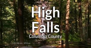 A 70 ft or taller ribbon falls and a historic dam in the High Falls Conservation Area in Philmont. A 70 ft or taller ribbon falls and a historic dam in the High Falls Conservation Area in Philmont.1 waterfall – Map |
Rossman Falls | Nothing is known about these man made falls on Kinderhook Creek. Unknown number of waterfalls. – Map |
Stuyvesant Falls |  Two waterfalls, one with a man-made dam top on Kinderhook Creek, south of Albany. A popular local watering hole. Two waterfalls, one with a man-made dam top on Kinderhook Creek, south of Albany. A popular local watering hole.2 waterfalls – Map |
Summit Dam |  An old dam on the top of “Factory Hill” and above High Falls in Philmont. An old dam on the top of “Factory Hill” and above High Falls in Philmont.1 man-made waterfall – Map |
Bud Brook Falls |  Numbers small falls (1-3 ft tall) along this stretch of Bud Brook, south of Dryden. Accessible through the Finger Lakes Trail. Numbers small falls (1-3 ft tall) along this stretch of Bud Brook, south of Dryden. Accessible through the Finger Lakes Trail.Multiple waterfalls – Map |
Enchanted Hollow Falls | 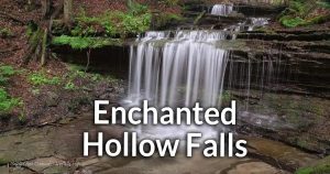 A small, seasonal waterfall, set in a beautiful section of Morgan Hill State Forest, along the Onondaga section of the Finger Lakes Trail. A small, seasonal waterfall, set in a beautiful section of Morgan Hill State Forest, along the Onondaga section of the Finger Lakes Trail.1 waterfall – Map |
Hemlock Falls | See Enchanted Hollow Falls. |
Maxon Creek State Forest | Several small falls on Maxon Creek and its seasonal tributaries. Multiple waterfalls – Map |
Morgan Hill Falls | Several small falls on Morgan Creek near Truxton. Property status unknown. Multiple waterfalls – Map |
Spicer Falls | A 50 ft falls spread out like a fan. The Onondaga section of the Finger Lakes Trail passes through here, yet the property status of the falls is unknown. 1 waterfall – Map |
Tinker Falls |  This tributary to Labrador Creek jumps 50 ft from a hanging caprock and then cascades another 30. This tributary to Labrador Creek jumps 50 ft from a hanging caprock and then cascades another 30.1 waterfall – Map |
Delaware County
Bryants Brook Falls | The creek in Canada Hollow is a tributary to Bryant’s creek. Just upstream from where they join is this 2-3 ft waterfalls in a beautiful section of the creek. Park roadside and take a short hike to the brook to see it. 1 waterfall – Map |
Canada Falls | Located west of Margaretville along NY–28, on an unnamed creek that flows through Canada Hollow, this waterfall is estimated to be 20 ft tall or more, and has two tiers. Little more is known. Private Property, but slightly visible from the roadside. 1 waterfall – Map |
Canada Hollow Falls | Improper name. See Bryants Brook Falls. Unknown number of waterfalls. – Map |
Emerald Falls | The outlet from a marsh in the Delaware-Otsego Audubon Society Sanctuary (south of Oneonta) creates this cascade in a dense forest. I’m not 100% sure this falls within the bounds of the sanctuary as claimed by some less diligent websites. Keep an eye out for posted signs. 1 waterfall – Map |
Hardenburgh Falls | A 20 ft high falls, that is about half plunge and half cascade, on Bear Creek just before it empties into the Schoharie Reservoir near Prattsville. It can be spotted from the Intake Rd bridge above the falls. To get down to the creek bed below a fishing permit is required. 1 waterfall – Map |
More Falls | A moderately sized, but seasonal series of roadside falls (approximately 15 ft tall) on an unnamed tributary to the East Branch of the Delaware River between Grand Gorge and Roxbury. It seems to have 3 distinct drops (although there may be more upstream). It can be seen from NY-30, of which the bottom cascade is found underneath. Multiple waterfalls – Map |
Russel Brook Falls | A 30 ft tall cascade in a secluded glen in the Delaware Wild Forest south of Pepacton Reservoir in the town of Colchester. There are reportedly a few more waterfalls upstream, but difficult to access. 2 waterfalls – Map |
Stratton Falls | A 25 ft horsetail falls that is a part of a newly opened luxury boutique hotel The Roxbury (which looks awesome). Guests at the hotel will have access to the falls via a trail the owners were building (as of 2020). Others can view the falls from Cold Spring Road where there is a pullover. Respect the privacy of the hotel guests. 1 waterfall – Map |
Tompkins Falls | Estimated to be 26 ft in height on the Barkaboom Stream. Property status unknown, but it can be viewed from the road. 1 waterfall – Map |
Watauga Falls | Watauga Falls is pretty sizable, with multiple tiers at least 60 ft or taller in total. Photos often only show parts of it. Old postcards show a picturesque 3-tiered falls, which is only the bottom half. Reports of trespassing arrest tells us this is on Private Property. 1 waterfall – Map |
Watauga Falls (Lower) | A 12 ft overhanging drop downstream from the larger Watauga Falls. On Private Property and not accessible. Do not trespass. 1 waterfall – Map |
Dutchess County and the City of Poughkeepsie
Dover Stone Church |  2 small cascades Stone Church Brook with one inside an 80 ft tall natural rock grotto. 2 small cascades Stone Church Brook with one inside an 80 ft tall natural rock grotto.2 waterfalls – Map |
Fishkill Overlook Falls | 2 waterfalls – Map |
Tioronda Falls | 1 waterfall – Map |
Wappingers Falls | 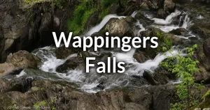 A concrete hydro dam and spillway form the upper falls, while the lower falls consists of a 50 ft natural waterfall. A concrete hydro dam and spillway form the upper falls, while the lower falls consists of a 50 ft natural waterfall.Multiple waterfalls – Map |
Zabriskie’s Waterfall | 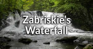 A 15 ft high cascade on Saw Kill next to Bard College in Annandale-on-Hudson. A 15 ft high cascade on Saw Kill next to Bard College in Annandale-on-Hudson.1 waterfall – Map |
Akron Falls | 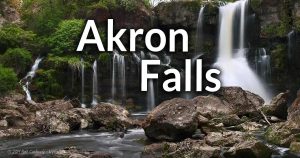 Lower Akron Falls is roughly 44 ft high and Upper Falls is less than 30. Both are located along Murder Creek in Akron. Lower Akron Falls is roughly 44 ft high and Upper Falls is less than 30. Both are located along Murder Creek in Akron.2 waterfalls – Map |
Buttermilk Falls | A steep cascade totaling almost 70 ft high in a tributary to Eighteenmile Creek in the Town of Lakeview. A well-worn trail leads down from the road, and it does seem accessible. 1 waterfall – Map |
Cazenovia Creek Falls | A series of small cascades under the Orchard Park Bridge in West Seneca, east of Cazenovia Park. Visible from the bridge. 1 waterfall – Map |
Cazenovia Park Falls | A U-shaped cascade in the middle of a park designed by the Olmsted Firm. Depending on the water level of Cazenovia Creek, the falls can be as tall as 9 ft. Best seen in moderately low flow. 1 waterfall – Map |
Clarksburg Falls | A 20 ft falls on Eighteenmile Creek in Clarksburg. Somewhat visible from the road. Private Property – No trespassing 1 waterfall – Map |
Colden Falls |  A 15 ft drop at a sharp bend in the west branch of Cazenovia Creek in the village of Colden. A 15 ft drop at a sharp bend in the west branch of Cazenovia Creek in the village of Colden.1 waterfall – Map |
Como Park Dam | Como Lake Park is a 250+ acre park that sits along Cayuga Creek east of Buffalo. A 8 ft dam spans the creek on the western end of the park. 1 man-made waterfall – Map |
Ellicott Creek Falls at Bowmansville | The Genesee St Bridge over Ellicott Creek in Bowmansville has short cascades on either side. They can be seen from the shoulder of the bridge. Best in lower flow. Multiple small falls – Map |
Emery Park Falls | 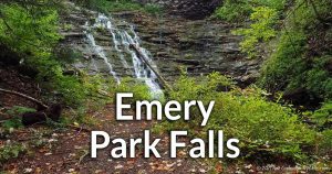 This county park in South Wales hosts 4 falls. North Emery Falls is roughly 30 ft high, South Emery Falls is less than 15 ft high, Emery Falls is 40 ft high, and Harrigan’s Falls is 10 ft high. This county park in South Wales hosts 4 falls. North Emery Falls is roughly 30 ft high, South Emery Falls is less than 15 ft high, Emery Falls is 40 ft high, and Harrigan’s Falls is 10 ft high.4 waterfalls – Map |
Eternal Flame Falls |  This unique, 30 ft high cascade is made from shale with high natural gas content. Small flames can be lit from the gas leaking from the rock behind the falls. This unique, 30 ft high cascade is made from shale with high natural gas content. Small flames can be lit from the gas leaking from the rock behind the falls.3 waterfalls – Map |
Franklin Gulf County Park | 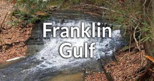 An undeveloped park in North Collins with 5 waterfalls in a branching ravine. An undeveloped park in North Collins with 5 waterfalls in a branching ravine.5 waterfalls – Map |
Glen Falls | 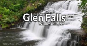 A multi-tiered falls, totaling 27 ft high in a small park in the village of Williamsville. A multi-tiered falls, totaling 27 ft high in a small park in the village of Williamsville.1 waterfall – Map |
Griffins Mills | A small set of cascades on the West Branch of Cazenovia Creek that seem accessible. 2 waterfalls (?) – Map |
Harrigan’s Falls | See Emery Park Falls. |
JP Nicely Memorial Park | See West Falls JP Nicely Park. |
Kenneglen Scenic and Nature Preserve | Small ledges along Hunter Creek in this 131 acre preserve just east of East Aurora. The tallest one is just over a foot in height. Multiple small ledges – Map |
Owens Falls Sanctuary | 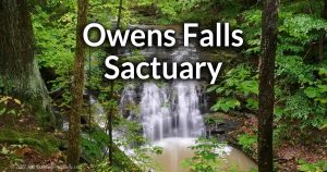 Two 10-20ft tall cascades and some small ledges found on this small tributary to Cazenovia Creek within a new nature preserve in East Aurora. Two 10-20ft tall cascades and some small ledges found on this small tributary to Cazenovia Creek within a new nature preserve in East Aurora.2 Waterfalls – Map |
Scoby Dam Park |  A 30 ft high historic dam next to a small park on Cattaraugus Creek in the town of Ashford. A 30 ft high historic dam next to a small park on Cattaraugus Creek in the town of Ashford.1 man-made waterfall – Map |
Serenity Falls | 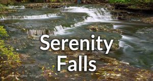 A small series of cascades within Forest Lawn Cemetery. Buffalo’s only natural waterfall. A small series of cascades within Forest Lawn Cemetery. Buffalo’s only natural waterfall.1 waterfall – Map |
Spring Brook Falls | A 5 ft tall drop across Cazenovia Creek near Spring Brook in the town of Elma. Viewable from the road or a small pullover on Northrup Rd. 1 waterfall – Map |
Tannery Falls | A 20 ft cascade into the west branch of Cazenovia Creek south of East Aurora. 1 waterfall – Map |
West Branch Falls | See Griffins Mills. |
West Falls |  A man-made dam of 5 ft with some small natural ledges below. In the village of West Falls, town of Aurora. A man-made dam of 5 ft with some small natural ledges below. In the village of West Falls, town of Aurora.1 waterfall – Map |
West Falls JP Nicely Park | This East Aurora town park off of West Falls Rd, has access to Cazenovia Creek. If conditions are right, across the bank from the park you can see a seasonal waterfall falling from the cliff. 1 waterfall – Map |
Zoar Valley Falls | Zoar Valley falls within Erie and Cattaraugus counties. Click here. 13+ waterfalls |
A Mill Dam Falls (LaChute River) | There are several dams on the LaChute River in the hamlet of Ticonderoga as it travels from Lake George to Lake Champaign. They are lettered from A through D. This one is at the outlet of Lake Gorge to the south. The dam appears to be 20 ft high with a natural cascade over large boulders just below it. Park on Alexandria RD, just south of the dam and walk the footpath. 1 man-made dam and waterfall – Map |
Adirondack Mountain Reserve | The ADR is a 7,000 acre private wildlife reserve owned by the Ausable Club. An easement allows for hikers to access most of the property, with some restrictions (such as no pets). The reserve contains the Upper & Lower Ausable Lakes and the upper reaches of the East Branch Ausable River. There are numerous notable waterfalls in this area, and countless small unnamed and unmapped falls. Artists Falls, Beaver Meadows Falls, Gill Brook Steps, Gill Brook Flume, Fairy Ladder Falls, Pyramid Falls, Rainbow Falls, Wedge Brook Cascades, and Wedge Brook Falls are all listed below. Multiple waterfalls – DEC Trail Map |
Alice Falls | Access is through Clinton County. |
Allen Falls | A mountain runoff cascade on Allen Brook. It’s a few hundred feet up Allen Mountain from Skylight Brook. It can be seen from the last stretch of the Allen Mountain Trail. It’s less than 10ft high and can be easily missed. 1 waterfall – Map |
Anderson Falls | This is listed in Clinton County. |
Artists Falls (Adirondack Mountain Preserve) | A 20 ft high cascade in Gill Brook in the Town of Keene. It is located within the Adirondack Mountain Reserve Conservation Easement Tract. Additional small falls can be found upstream. It can be found on the Gill Brook Trail, which may be best accessed from the North Hudson parking area. Multiple falls (along Gill Brook) – Map |
Ausable Chasm | A private attraction on the Ausable River that features 7 waterfalls, including Rainbow Falls and Horseshoe Falls, as well as caves. Guided tours are also available. Admission is charged for pretty much everything. The more you pay, the more you see. Multiple falls – Map |
B Mill Falls (LaChute River) | There are several dams on the La Chute River in the hamlet of Ticonderoga as it travels from Lake George to Lake Champaign. They are lettered from A through D This one is just north of A Mill. There is an L-shaped dam up top, but since it is long since decommissioned, water often doesn’t flow over the top, rather the sides where there are open spillways. From there it falls gradually about 15 ft over the upper section, then a more dramatic drop 10ft downstream, and then about 50 ft further downstream is a very small cascade, almost rapids. Access is from a parking area off of Lord Howe St. 1 man-made dam and 3 waterfalls – Map |
Beaver Meadows Falls (Adirondack Mountain Preserve) | A beautiful 60 ft cascade falls on a tributary to the East Branch of the Ausable River within the Adirondack Mountain Reserve Conservation Easement Tract. It can be found on the West River Trail, at the north end of the marsh downstream from Lower Ausable Lake. Beaver Meadow Trail will also get you there. 1 waterfall – Map |
Beede Brook Falls | A steep gully in Keene Valley. A nearby “Dipper Pond” may be why it’s often called Dipper Brook, but GIS info shows this is the source of Beede Brook, not a tributary. About a half mile up the gully from NY-73 is a roughly 30 ft high bridal-veil-style falls that cuts through a steep cliff. There are a few additional, but small waterfalls to encounter downstream. 1 waterfall – Map |
Beer Walls Falls | A 150 ft cascade down a sheer cliff in the Keene Valley, just west of Chapel Pond. The cliffs here often used by both rock and ice climbers. It’s accessible from NY-73 where a trailhead with a wooden footbridge takes you westward into the woods. The falls are only flowing in early spring or after heavy rain. Take one down and pass it around! 1 waterfall – Map (approximate) |
Birmingham Falls | See Rainbow Falls (2) |
Black Mountain Chute | A narrow chute falls on a tributary to Nichols Brook on the south side of Black Mountain in the town of Keene. It drops just over 10 ft through a shallow V-shaped notch of mossy rock. It can be found by heading up the tributary from the Jackrabbit Trail that runs along Nichols Brook 1 waterfall – Map |
Blue Ridge Falls | A stretch of The Branch near Blue Ridge Falls Campground that features several small, turbulent drops totaling 15-20 ft. It can be seen briefly via drive-by from Blue Ridge Rd (NY-84), and there’s a parking area right at that clearing if you want to scramble down and wade in the river. 1 waterfall/rapids – Map |
Bouquet River Falls (North Fork) | The river runs over a large solid rock escarpment here, creating a few drops, slides, and pools that add up to 30 ft of descent or more. It’s accessible from the Boquet Forks Trail, which starts at NY-73 to the east. 1 waterfall – Map |
Bouquet River Falls (South Fork) | Several small falls on this stretch of the South Fork. Multiple falls – Map |
Bushnell Falls | A 5 mile hike up Johns Brook Primitive Area (via the Phelps Trail), will lead you to this 20 ft fall within a secluded gorge. Access starts at “The Garden” parking area at the end of Interbrook Rd east in the hamlet of Keene Valley. 1 waterfall – Map |
Buttermilk Falls (Chesterfield) | A large cascade, possibly over 120 ft high, created as Little Trout Brook descends the mountainside towards Lake Champlain. The falls is on Private Property, but the owners have been known to grant access to respectful visitors. 1 waterfall – Map |
C Mill Dam Falls (LaChute River) | There are several dams on the LaChute River in the hamlet of Ticonderoga as it travels from Lake George to Lake Champaign. They are lettered from A through D. This one is is located towards the center of Ticonderoga, where the river changes direction from northward to the east. This is an old mill pond dam (a few ft high) on top of one natural ledge. There’s a parking area an historic marker off of Lord Howe St. 1 man-made dam – Map |
Cascade Lake Falls | A large cascade, dropping over 100 ft from cascade mountain near Upper and Lower Cascade Lakes. Easily seen from Route 73 and a small park at it’s base. A trail leads from there to the small gorge below the falls. IT dries up by summer. 1 waterfall – Map |
Champagne Falls | Several small cascades on the East Branch of the Ausable River just south of hamlet of Keene. Private property, but visible from Hulls Falls Rd. Multiple waterfalls – Map |
Clifford Falls | A hodgepodge of small falls (including slopes, cascades, and drops) on Clifford Brook, north of the hamlet of Keene. The falls are on Private Property and only visible form the Clifford Falls Rd Bridge. Multiple waterfalls – Map |
D Mill Dam (LaChute River) | This one is is located towards the center of Ticonderoga, near Montcalm St. This dam is one of the more modern ones on the river, and is used to generate power. The dam is 6-8 ft high and in high flow some natural cascades form on the sides. There’s a roadway that passes by the dam near the intersection of Lake Gorge Ave and Father Jogues Pl.
1 man-made dam – Map |
Deer Brook Falls | An 80 ft cascade is the centerpiece of Deer Brook, a tributary to the East Branch of the Ausable River, north of Saint Huberts. Deer Brook has numerous small waterfalls downstream from the big one. The Deer Brook Trail will get you there. Pick it up from the east at NY-73. Multiple falls – Map |
Dipper Brook Falls | See Beede Brook Falls. |
Fairy Ladder Falls (Adirondack Mountain Preserve) | A 90 ft high staircase cascade on Gill Brook within the Adirondack Mountain Reserve Conservation Easement Tract. Located upstream from Artists Falls, this is considered to be the highest (elevation) waterfall in the Adirondacks. 1 waterfall – Map |
Falls Brook | Several waterfalls, some on Private Property on this small creek north of Minerva. Falls Brook Yurt Rentals offers cabins that may allow access for some of the falls. Multiple falls – Map |
Falls of Clarion | Downstream from Lachute Falls, on the Ticonderoga River (the outlet of Lake George) is this wide falls and covered bridge. 1 waterfall – Map |
The Flume Fall | A series of 3 drops in a narrow stretch of the West Branch of the Ausable River located between Wilmington and High Falls Gorge/Whiteface Mountain. There’s a parking lot by the bridge and small trails allowing for up close views. 3 waterfalls – Map |
Giant Washbowl Falls | A seasonal waterfall on a cliff (known as Creature Wall) below Giant Washbowl that forms in early spring or after periods of heavy rain. It’s at least 30 ft high. Park at the Chapel Pond lot off of NY-73 and head up the ridge trail, then veer left down Creature Wall Access Pat which will get you to the cliff. 1 seasonal waterfall – Map |
Gill Brook Flume (Adirondack Mountain Reserve) | A waterfall just over 10 ft in height in this very narrow slice of gorge on Gill Brook in the Adirondack Mountain Reserve Conservation Easement Tract. Access is through a small trail off of Lake Road (a private rd–foot traffic only). There are several waterfalls along Gill Brook. 1 waterfall – Map |
Gill Brook Steps (Adirondack Mountain Reserve) | Very small and uneven drops along Gill Brook in the Adirondack Mountain Reserve Conservation Easement Tract. It’s not much to look at, but they are one of many stops along Gill Brook one can easily see. They are located near the north end of the Gill Brook Trail by Lake Rd (private road, foot traffic only). Several very small drops – Map |
Hague Brook Falls | A 15 ft high and a 10 ft high roadside falls on Hague Brook near Hague. 2 waterfalls – Map |
Hanging Spear Falls | A beautiful 80 ft high, horsetail falls and pool on the Opalescent River near Calamity Mtn. Access is from the East River Trail, which can be picked up at the end of Opalescent Rd, a few mile to the south. The trial gets you to other falls along the Opalescent. 1 waterfall – Map |
High Falls Gorge | This commercial property along the West Branch of the Ausable River near Lake Placid that features well-maintained trails and bridges to get you excellent views of Climax Falls (50 ft), Rainbow Falls, Mini Falls, and Main Falls—one right after another. A café is also on the premises. The waterfalls here total roughly 80 ft and the hike to see them all is a third of a mile. Admission is charged at the door. 4 waterfalls – Map |
Hoffman Notch Brook | Several small waterfalls along the steep northern end of Hoffman Notch Brook. Multiple falls – Map |
Hoisington Brook Cascade | A small (6 ft) cascade under a footbridge in Lee Park in the hamlet of Westport. This park is also a great place to access Lake Champlain. 1 waterfall – Map |
Horseshoe Falls (Ausable Chasm) | See Ausable Chasm. |
Hulls Falls | Two drops (totaling about 20 ft high) falls on the East Branch of the Ausable River, south of Keene. The lower can be seen from the Hulls Falls Rd (13A) bridge, the drop that’s under the bridge can be seen via short scramble below. 2 waterfalls – Map |
Indian Falls | A 25 ft high sloping falls on Marcy brook in the town of Keene, that overlooks the MacIntyre Mountain Range and is a popular rest stop for hikers on their way to Mt Marcy; NY’s highest peak. Either the Indian Falls/Lake Arnold Crossover Trail or the Van Hoevenberg/Indian Falls Trail will get you there. 1 waterfall – Map |
Jay Falls | The East Branch of the Ausable River drops roughly 8-10 feet down this rock outcropping in the village of Jay. While the falls itself isn’t much, just upstream is a large wooden covered bridge, making this a very picturesque scene. Parking is available on both sides of the bridge and there’s a small gravel parking area and path downstream from the falls that leads to the the rock outcropping and nice views. 1 waterfall – Map |
Knob Lock Mountain Falls | Two large cascades along this tributary to The Branch, in the Green Mountain Wilderness area. The hike to see them would involve scaling about halfway up Knob Lock (about 600 ft ascent max). Start from the North Trail trailhead off of NY-9N and head south. Keep and eye out for a western trail offshoot that heads to this creek. Best in early spring. 2 waterfalls – Map |
Lee Park (Westport) | See Hoisington Brook Cascade. |
Lake Arnold Outlet Falls | 3 cascades can be found on this small outlet from an equally small lake tucked away in the valley east of Mt Colden. The Lake Arnold Trail can be picked up from the Indian Falls Trail/Van Hoevenberg Tail to get here. 3 waterfalls – Map (approximate) |
Lake Colden Dam | A small dam, that also serves as a trail footbridge to cross the Opalescent River, at the south end of Lake Colden creates a small 2-3 ft waterfall. It’s where 3 trails meet and offers a breathtaking view of the lake. 1 man-made dam – Map |
Linsey Falls | A stretch of very mild rapids on the Schroon River in the town of North Hudson. The USGS has this listed as “Falls,” but it’s very far from that. It’s barely noticeable as a rapids. It’s more of a “babbling brook” section of the river. I’m only listing it for informational purposes. Access is questionable. Rapids – Map |
Lower Ausable Lake Dam (Adirondack Mountain Reserve) | A 4 ft dam at the north end of the Lower Ausable Lake within the Adirondack Mountain Reserve Conservation Easement Tract. It can be seen on the way to Rainbow Falls. 1 man-made dam – Map |
MacIntyre Brook Falls | The journey along the Algonquin Peak Trail to Wright Peak in the Town of North Elba will lead you to this 15 ft cascade on MacIntyre Brook. 1 waterfall – Map |
Mill Brook Falls (Port Henry) | Mill Brook creates several cascades as it makes it’s final descent towards Lake Champlain in the hamlet of Port Henry. There are at least 6 cascades upstream from the NY-9N bridge, but access is limited to just views from the bridge, which is the last 2 of them. 2 visible waterfalls – Map |
Millers Falls | A cascade on Cold River in the town of Newcomb’s northwest corner. More info is needed. The Northville-Placid Trail runs along the northern bank of the river. 1 waterfall – Map |
Mink Falls | Several waterfalls (possibly 3) on the Nate Pond Brook as it becomes the outlet from Mink Pond in the town of Minerva. The gradient increases drastically as the outlet approaches the Hudson River just west of Virgin Falls. The first of these falls is often a quick stop for Hudson River rafting tours. I know of no other way to access the falls on foot. At least 1 waterfall – Map |
Monument Falls | A 6 ft high cascade on the Ausable River, near Lake Placid and High Falls Gorge. It’s named for nearby monuments erected to commemorate the state’s preserve system. They are located just a few hundred ft south at the parking area. 1 waterfall – Map |
Mossy Cascade | A 40 ft high cascade in Mossy Cascade Brook, a tributary to East Branch of the Ausable River, North of St. Huberts. Another 10 ft cascade is found further downstream. Park to the south on NY-73 just south of the bridge over the Ausable at a pull-off, grab the trailhead from here. 2 waterfalls – Map |
Niagara Brook Falls | A 30+ ft waterfall formed by Niagara Brook as it descends Sunrise Mountain in the town of North Hudson. 1 waterfall – Map |
Natural Stone Bridge | The commercial attraction Natural Stone Bridge and Caves on Trout Brook features an 8 foot waterfall, a marble natural stone bridge, and several caves (one of which with a waterfall within). Multiple falls – Map |
New Russia Falls | A small (5 ft) cascade (composed of 2 distinct drops) on the Boquet River in the hamlet of New Russia. It’s on private property so this one may only be for paddlers. 1 waterfall – Map |
Nichols Brook Tributary Falls | See Black Mountain Chute. |
Olmstedville Dam | A 5 ft tall manmade dam on Minerva Stream on the west side of the hamlet of Olmstedville in the town of Minerva. There’s parking off of A P Morse Hwy on both sides of the bridge and a small park along the stream. 1 man-made dam – Map |
Opalescent Falls | A 15 ft cascade on the Opalescent River in the town of Newcomb, just upstream from Hanging Spear Falls. The East River Trail runs along the Opalescent and passes quite a few waterfalls along the way. 1 waterfall – Map |
Opalescent Falls (Upper) | This one is tough to see, but with the other falls present along this trail, it’s worth a shot. This is located between Opalescent Falls and Hanging Spear Falls (both on the East River Trail). You can spot it through the trees.
1 waterfall – Map |
Opalescent Flume | This steep flume falls inspired the classic painting The Flume of the Opalescent by Alexander Helwig Wyant. It’s found on the section of the Opalescent that flows northwest through the mountains south of Mt Colden towards Lake Colden. It’s a very narrow falls that flows through a steep fissure in the rock, estimated at 20-30 ft high, although some of it is obscured from view. There is a small cascade just downstream. It’s accessible from the Mount Marcy Trail. 1 waterfall – Map |
Ord Falls | A set of class II rapids on the Hudson River south of Newcomb. Access may be for paddlers only. Rapids – Map |
Outlet Dam Falls (La Chute) | See A Mill Dam (La Chute). Unknown number of waterfalls – Map |
Paradise Alley | A few small cascades on Hewitt Pond Brook, just west of Hayes Mountain in the town of Minerva. Multiple waterfalls – Map |
Phelps Falls | A multitiered cascade (estimated 6 ft high) on Phelps Brook northeast of Keene Valley. This waterfall is named after Orson “Old Mountain” Phelps (1817-1905), an Adirondack pioneer guide who named many of the high peaks. The falls appears to be on private property, but it’s possible it can be spotted form the Barret Road side. 1 Waterfall – Map |
Pyramid Falls (Adirondack Mountain Reserve) | Pyramid Creek, a tributary to the East Branch of the Ausable River, has a 20 and 15 ft drop at a bend in the creek. The falls fan out from a notch above the bulbous cliff-face, forming a pyramid shape. After a pool at the bottom, the water drops again in a narrow crevice. This is one to see in early spring or after heavy rain. It’s accessed from the loop that takes you to Cathedral Rocks from the West River Trail. 2 waterfalls – Map |
Rainbow Falls (Adirondack Mountain Reserve) | A spectacular 150 ft cascade on Cascade Brook, a tributary to the East Branch of the Ausable River at Lower Ausable Lake. The falls is in a deep and secluded gorge in the Adirondack Mountain Reserve Conservation Easement Tract, which it often fills with mist. The A. W. Weld Trail, which can be picked up at the Lower Ausable Lake Dam, leads to the Rainbow Falls Trail. 1 waterfall – Map |
Rainbow Falls (Ausable Chasm) | See Ausable Chasm. |
Rices Falls | A series of cascades (totaling about 20-25 ft in height) on The Branch just west of the hamlet of Elizabethtown. There’s a roadside parking area off of NY-9N and a pathway that leads down the the stream. Multiple waterfalls – Map |
Richards Dam | An old mill dam on the LaChute River in Ticonderoga. The mill sits atop a sloping slab of bedrock, thus the dam’s height varies along it’s length. In High flow, more water spills over onto this stone. On the north end is an old mill wheelhouse. There’s a parking area off of Adirondack Park. 1 man-made dam – Map |
Roaring Brook Falls | A tall and narrow falls that drops nearly 300 ft in two segments. The flow is low and it looks best in spring or after heavy rain. It’s located southeast of Saint Huberts in the Giant Mountain Wilderness Area. A trail leads from a parking area just west on NY-73. 1 waterfall – Map |
Rocky Falls | A small 6 ft falls over a massive rock outcropping on the Indian Pass Brook near Heart Lake in the town of North Elba. The Heart Lake Parking lot is the best place to start. Take the Indian Pass trail to get to an offshoot to the falls. 1 waterfall – Map |
Russell Falls | A small falls and remands of a power dam and plant on the East Branch of the Ausable River, adjacent to the Ausable Club Building. It’s partly on private property and off limits. 1 waterfall and man-made dam – Map |
Schroon Falls | A tiny drop on the Schroon River in the middle of Schroon Falls, NY. At one time there was a stone mill dam here. While there are some ruins left of the dam, all that’s left is this tiny drop, nothing I would consider a “true waterfall.” Nonetheless, hopefully I saved you some time hunting for it. 1 small ledge (barely a waterfall) – Map |
Split Rock Falls | A popular and picturesque multitiered cascade over a beautifully jagged rock that tends to split the first drop into two. They rejoin at a pool at in the middle and then fall a second time as a single cascade. Further downstream a rock outcropping creates another cascade of about 10 ft high. Located on the Bouquet River in the southwest corner of the town of Elizabeth town. A parking area is on the shoulder of US-9. 2 waterfalls – Map |
Stag Brook Falls | At least 1 sizable waterfall on this mountainside stream at the Whiteface Mountain Ski Resort. The stream is small, so it’s best to visit in early spring when there’s plenty of water. Park in the main lot and head over the bridge, past the main lodge (on your left) and then the Edu center (on your right). Look for a marker denoting the trailhead. The main falls, which is a 30 ft high horsetail cascade comes right after the start of the trail. There are plentiful smaller cascade upstream, but I’m not entirely sure of they are accessible. Multiple waterfalls – Map |
Staircase Falls | 4 drops lined up on Putnam Creek near Crown Point Center in the town of Crown Point. They vary in height from 3 ft to one over 15 ft high. They seem to be on posted land, so seeing them all is a matter of getting on the right road for the best vantage point. There’s a small pull-off on Middle Rd next to the bridge that leads to a pathway to one of the falls. Multiple waterfalls – Map |
Underwood Falls | Not an official name. See Unnamed Falls (Bouquet River near Split Rock). |
Unnamed Falls (Ausable River in the Adirondack Mountain Preserve) | While there are many unnamed falls on the Ausable in the Adirondack Mountain Preserve, this one stands out. At over 20 ft high, it pours out of an isolated bend in a deep section of the gorge. Best seen from the West River Trail. 1 waterfall – Map |
Unnamed Falls (Bouquet River near Split Rock) | A cascade 20-30 ft in height located on private property just downstream (northeast) of Split Rock Falls. Views can be had from the roadside. Park at the split rock area and carefully walk the US-9 for about700 ft to the next bend. 1 waterfall – Map |
Unnamed Falls (Lake Colden Tributary) | Several cascades are reported in this mountain gorge north of Lake Colden. The creek is unnamed and seasonal, so the best time to see falls will be in early spring or after heavy rain. The Algonquin Trail runs the length of the gorge and can be picked up from the Lake Colden Trail. Unknown number of waterfalls – Map (approximate) |
Unnamed Falls (near Boquet Forks Trailhead) | A nice little seasonal cascade over 20 ft high tucked away in the woods near the parking area for the Boquet Forks Trailhead off of NY-73 in Keene. From the parking on the side of the road, head eat up towards the hill. It’s only a short walk. Flows in early spring or after heavy rain. 1 waterfall – Map |
Unnamed Falls (near Lake Colden) | A 25 ft cascade near Lake Colden with other smaller falls along the way. Multiple falls – Map |
Unnamed Falls (Nichols Brook) | Several cascades (two large falls) on this tributary to Nichols Brook. Southwest of Keene. Multiple falls – Map |
Unnamed Falls (Boquet River and NY-73) | In addition to the other falls near the Boquet Forks Trailhead and NY-73 in the town of Keene, this set of cascade and pools (less than 10 ft tall in total) is easily seen on the west side from the NY-73 bridge as you pass over the river. Parking is located just north of the bridge if you want a close look. 3 small waterfalls – Map |
Uphill Falls Brook | Uphill Falls Brook starts between Mt Redfield and Mt Skylight and descends over 440 ft northwest to the Opalescent River. Along the way there are several small cascades, including one just over 10 ft tall. Multiple waterfalls – Map |
Upper Dam Falls | See D Mill Dam. |
Virgin Falls | A waterfall on the the outlet from Huntley Pond just before it meets with the Hudson River at the Blue Ledge Rapids in the town of Minerva. A blue-blazed trail from North Woods Club Road will get you down to the Falls and River. 1 waterfall – Map |
Wadhams Falls | A large waterfall on the Bouquet River in the center of Wadhams, near Lake Champlain. It’s topped by a dam 6-8 ft in height, then after gradual cascade over uneven stone it drops about 20 ft into a pool. Just before it crosses under the NY-22 bridge, the river constricts through a narrow fissure in the rock, creating a flume. 1 waterfall – Map |
Wanika Falls | A tight series of 3 cascading drops totaling over 100 feet along the Chubb River and the Northville Placid Trail in the Town of North Elba. 1 waterfall – Map |
Wedge Brook Cascades (Adirondack Mountain Reserve) | Upstream from the dam at Lower Ausable Lake, Wedge Brook tumbles over a series of picturesque cascades. The trail leading to these cascades starts at the Adirondack Mountain Reserve parking lot on Ausable Road. Follow the West River Trail until you reach Wedge Brook. The cascades are especially stunning after periods of heavy rain or during the spring snowmelt. Multiple cascades – Map |
Whales Tail Falls | A unique waterfall located on the Chubb River in the town of North Elba. It features a rock formation that resembles the tail of a whale. Best seen from the Northville Placid Trail. The waterfall is about 15 ft high and can be reached via a moderate hike. 1 waterfall – Map |
Whiteface Mountain Falls | These falls are located on the Whiteface Mountain Ski Resort property and are fed by the West Branch of the Ausable River. They are visible from the main road leading to the resort, but access to the base of the falls may require permission or coordination with the resort. The falls drop approximately 30 ft over a rocky ledge and are most impressive during the spring thaw or after heavy rainfall. 1 waterfall – Map |
Wilmington Flume | Located near the town of Wilmington, this scenic gorge features a series of waterfalls and cascades along the West Branch of the Ausable River. The flume can be accessed via the Wilmington Flume Trail, which offers breathtaking views of the rushing water and surrounding forest. The trail is moderate in difficulty and suitable for hikers of all skill levels. Multiple waterfalls – Map |
Wilmington Notch Falls | Also known as High Falls Gorge, these stunning waterfalls are nestled within the scenic Wilmington Notch. Visitors can explore the gorge via well-maintained walkways and bridges, offering spectacular views of the cascading water and towering cliffs. The falls are easily accessible from Route 86 and are a popular attraction in the Adirondack region. Multiple waterfalls – Map |
Wilmington Slide | This impressive cascade is located in the town of Wilmington and is accessible via the Wilmington Flume Trail. The slide features a steep drop as the water rushes down a smooth rock face, creating a breathtaking display of natural beauty. The trail offers excellent vantage points for viewing the slide and is a popular destination for hikers and outdoor enthusiasts. 1 waterfall – Map |
Ampersand Chasm Falls | See Chateaugay Chasm. |
Augerhole Falls | A series of rapids in a narrow section of the West Branch of St. Regis River, north of McDonald Pond in the town of Waverly. In rare times of low flow there are small drops visible, but for the most part this is not a true waterfall. Private Property. Rapids – Map |
Brayton Hollow | At Brayton Hollow (in the town of Chateaugay), the Chateaugay River narrows and speeds up creating a series of rapids that stretches nearly 400 ft long, dropping nearly 60 ft along the way. There are at least 2 drops that can be considered waterfalls. Accessibility is unknown. 2 small waterfalls and rapids – Map |
Brushton Dam | A beautiful 12-15 ft high stone masonry mill dam on Little Salmon Creek in the village of Brushton, torn of Moira. Easily seen from Washington St. 1 man-made dam – Map |
Burke Falls | A 15 ft cascade on the Little Trout River in the south end of the Village of Burke. An island splits the river just below the falls. After downstream from the island there are a few small riffles, but nothing to count as a second falls. Parking is roadside on Depot St. A trail leads from behind St. George’s Church to a spot downstream from the falls. 1 waterfall – Map |
Chasm Falls | A hydroelectric dam sits atop the this massive 120+ ft waterfall on the Salmon River northwest of Owl’s Head. From the 8 ft dam, water tumbles and slides down a rock outcropping for 30 ft or so. It levels out for a bit and then enters a narrow chasm and mostly out of view as it travels north for nearly 300 ft, dropping over 60 ft more. The falls widens as the gorge opens up at its base, but because of the dam, the falls is rarely at full flow. There’s a parking area near the dam at Fayette St. A grass pathway leads downstream towards the base of the falls. 1 waterfall and man-made dam – Map |
Chateaugay Chasm | A narrow gorge on the Chateaugay River between the village of Chateaugay and Brayton Hollow. The river drops over 120 ft along this run. The existence of the Ampersand Chasm Falls Hydro Plant leads me to believe there’s a waterfalls here. Accessibility is unknown. Unknown number of falls – Map |
Chateaugay Lake Dam | See Forge Dam. |
Cobbie Rd Dam | A man-made power dam southeast of Dickenson Center, town of Dickenson. It can be seen from Cobbie Rd. 1 man made-dam – Map |
Deer River Flow Dam | A man-made pond dam and small falls on the Deer River within the Deer River Primitive Area in the Town of Santa Clara. 1 man made-dam and waterfall – Map |
Deer River “Rapids” | USGS maps label this as “Rapids” but it’s actually a series of small ledges and a 6 ft waterfall. It’s located within the Deer River Primitive Area in the town of Santa Clara. Trails are not well established here, so paddling or bushwhacking is probably the only want to access it. There’s is a dirt access road off of Red Tavern Rd (CR-14) just west of hear that leads to the river a ways upstream. 1 waterfall – Map |
Everton Falls | A complex cascade no more than 20 ft high on the East Branch of the St. Regis River northwest of Stacy Mountain in the town of Santa Clara. The falls is over a rock outcropping in the river and creates cascades, slides, a chute, and an island. Park along Red Tavern Rd and there’s a pathway just downstream. 1 waterfall – Map |
Everton Falls (unnamed falls downstream) | Located about 3/4 of a mile downstream (west) of Everton Falls, this unnamed waterfall is a just a small 2-3 ft cascade and a small set of rapids. It’s within state forest land and accessible. 1 waterfall and rapids – Map |
Forge Dam | Also referred to as “The Forge,” this man-made dam on the Chateaugay River in the town of Bellmont is about 10 ft tall. There’s a parking area and small park next to the dam off of Cromp Rd. 1 man-made dam – Map |
Franklin Falls | A hydroelectric dam and natural waterfall on the Saranac River, in the town of Franklin, that creates Franklin Falls Pond. The dam is roughly 30 ft tall and the natural cascade bellow is estimated at another 5-10 ft. Unfortunately it’s posted and not accessible. 1 man-made dam and waterfall- Map |
High Falls (Chateaugay) | Located on the Chateaugay River in High Falls Park within the town of Chateaugay. Comprised of two large tiers, the top is a plunge, while the bottom cascades over several steps. Estimated at 120 ft tall, and surrounded by lush foliage, it’s one of the more picturesque falls in the region. A nominal fee is charged for park entry. 1 waterfall – Map |
High Falls (Bellmont) | Located on the Salmon River 1.5 miles west of Mountain View in the town of Bolmont, is this multitiered winding waterfall in the Titusville Mountain State Forest. At about 30 ft high, it starts out as a set of small drops and rapids in a narrow gorge just above the main drop. A parking area and trail can be found east at Barnsville, Rd. 1 waterfall – Map |
Howe Road Falls | A very gradual cascade between two marshes west of Saint Regis Falls in the town of Waverly. Accessibility is unknown. 1 waterfall – Map |
Lake Ozonia Outlet Rapids | Small drops (and rapids on the Lake Ozonia Outlet as it approaches the St Regis River between Nicholville and Saint Regis Falls. Easily spotted from the Santa Clara Rd Bridge (both sides). Rapids – Map |
Lamica Lake Dam | A hydroelectric dam on the Salmon River just north of the village of Malone. Accessibility is not known. 1 man-made dam – Map |
Lower Falls (Raquette River) | See Raquette Falls. |
Malone Dam | A man-made dam on the Salmon River in the village of Malone. It can be seem from the Main St Bridge. 1 man-made dam – Map |
Malone Dam (NCCC) | A man-made hydroelectric dam on the Salmon River adjacent to North Country Community College. There’s a parking area at the back of the college near the dam. 1 man-made dam – Map |
Meacham Falls | A cascade on the St Regis River, just west of Meacham Lake, in the town of Duane. The river drops about 15-20 ft over a stretch of 150 ft. About 100 ft upstream from the falls is a small 2 ft tall dam at Meacham Lake. There’s a parking area at the dam. 1 waterfall and 1 man-made dam – Map |
Raquette Falls | There are 3 rapid-like waterfalls on this half-mile stretch of the Raquette River in Harrietstown. Furthest upstream is Upper Falls, a 6-8ft drop followed by some small rapids. Raquette Falls, itself, is a series of small drops and rapids totaling 10-12 ft in height. Downstream is Lower Falls, which is drop and small set of rapids about 5ft high that occurs at a bend in the river. The Raquette Falls Trail can be picked up about 5 miles north at Ampersand Rd near Coreys Rd. Rapids – Map |
Santa Clara Falls | A gradual cascade estimated at 20-30 ft in height on the St Regis River near the hamlet of Santa Clara. Property access is unknown. 1 waterfall – Map |
St. Regis Dam and Pumphouse | A picturesque hydroelectric dam and wooden pumphouse o the St Regis River in Saint Regis, just upstream from the camp and St. Regis Falls. 1 man-made dam – Map |
St. Regis Falls | A 350-30 ft high cascade on the St Regis River within the St. Regis Falls Scenic Campsite, town of Waverly. The best access is through the campsite, which doesn’t seem to charge a fee. There’s a viewing platform next to the falls as well as a footbridge downstream that offers nice views. 1 waterfall – Map |
Shingle Mill Falls | Small drops totally about 10 ft high on the Heron Marsh Outlet near Paul Smith’s College in the town of Brighton. Park at the pull-off on Keeses Mill Rd. 1 waterfall – Map |
Upper Falls (Raquette River) | See Raquette Falls. |
Fulton County and the City of Gloversville
Broomstick Lake Outlet | A moderate uphill hike to Broomstick Lake in the town of Caroga has a few small waterfalls and a 15 ft slide-like falls. A trail leads from NY-10 where there is roadside parking. Multiple waterfalls – Map |
Buttermilk Falls (Mayfield) | A 6 ft high cascade on a unnamed tributary to the Jacksonville Reservoir at Jackson Summit in the town of Mayfield. The trail leads from the bend on Jackson Summit Road West It seems to be an ATV Trail. 1 waterfall – Map |
Cayadutta Creek Falls (Johnstown) | A few sources claim a waterfall here on Cayadutta Creek, just west of the city of Johnstown. GIS and satellite information disagree. It seems to be rapids. There is a dam just to the north. Accessibility is unknown. Unknown – Map |
Crum Creek | Waterfalls reported on Crum Creek in the town of Oppenheim, in the southwest corner of the county. This extends south into Montgomery County. Accessibility is unknown, but it appears to be on private property. Unknown – Map |
Diamond Hill Falls | There are three drops and rapids along Spruce Creek as it descends from Spruce Lake down Diamond Hill in the town of Salisbury. Reports indicate they are private property. The middle drop, at about 10 ft high is visible through the trees from Dairy Hill Rd. 3 waterfalls – Map |
Dolgeville Mill Falls | A hydroelectric dam and small gradual cascade on East Canada Creek in the village of Dolgeville. The best views are had from the Fulton County side of the creek at Dodge Ave Ext. 1 man-made dam and 1 waterfall – Map |
High Falls (Dolgeville) | A large hydroelectric dam followed by a natural waterfall on East Canada Creek at the south end of Dolgeville. Access is not permitted, but a brief view can be had from CR-120 as you pass by. 1 man-made dam and waterfall – Map |
Nine Corner Lake Trail | A series of waterfalls, including cascades and slides along the Nine Corner Lake outlet as it descends towards the Canada Lake Valley in Caroga. The trail starts at a paved parking area off of NY-29A, just west of Pine Lake Park. Multiple waterfalls – Map |
North Creek Tributaries | Several hill-top lakes, of which Spectacle Lake is the largest, drain through a handful of valleys into North Creek just east of Knappville in the town of Stratford. Spectacle Lake, Long Pond, Dexter Lake, Knapps Long Lake, and Waters Millpond all have outlets that darin down into the valley creating small waterfalls as they go. These are mostly seasonal and getting to them would require bushwhacking and navigation skills. Multiple waterfalls – Map (Approximate) |
Sprite Creek Falls (Stratford) | A small falls on Sprite Creek, north of Middle Sprite, in the town of Stratford. Accessibility is unknown. 1 waterfall – Map |
Third Lake Outlet | Several small falls reported on this small hillside outlet from Third Lake to Long Lake in the northeast corner of the town of Statford. This is at the start of North Creek. Multiple waterfalls – Map |
Stoner Lakes Outlet | Small waterfalls reported on the outlet from Stoner Lakes, south of Roster Hill in the town of Caroga. Park on E Stoner Lake Rd near the intersection with NY-10. Multiple waterfalls – Map |
Redhouse Lake Outlet | Small waterfalls reported on the outlet from Red Lake, next to Oregon Mountain, in the north end of the town of Stratford. Multiple waterfalls – Map |
Genesee County and the City of Batavia Area
Buttermilk Falls | 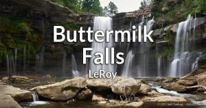 A 70 ft tall falls on Oatka Creek north of Leroy. (Private Property) A 70 ft tall falls on Oatka Creek north of Leroy. (Private Property)1 waterfall – Map |
Darien Falls | A seasonal waterfall in Darien Lake State Park on a tributary to Eighteenmile Creek and adjacent to the Finger Lakes Trail. I don’t have any other details. 1 waterfall – Map |
Dodge Falls | A large fanning cascade topped with a dam, at an old mill site on Tonawanda Creek in the hamlet of Linden. On the old site of the former Dodge and Bosworth grist mill. Property status unknown. 1 waterfall, 1 man-made dam – Map |
Indian Falls |  A 20 ft falls on Tonawanda Creek. Enjoy this falls from the Log Cabin Restaurant. A 20 ft falls on Tonawanda Creek. Enjoy this falls from the Log Cabin Restaurant.1 waterfall – Map |
LeRoy Falls |  A 6 ft high natural waterfall and 11 ft high dam spanning over 150 ft across Oatka Creek in the center of LeRoy. A 6 ft high natural waterfall and 11 ft high dam spanning over 150 ft across Oatka Creek in the center of LeRoy.2 waterfalls – Map |
Morganville Falls | A 25 ft cascade down a jagged cliff on Black Creek, near Batavia. (Private Property) 1 waterfall – Map |
Old Buttermilk Falls | See LeRoy Falls |
Pembroke Falls | Two small cascades that can be see from Rt-5 in Pembroke. Best in low flow. 2 waterfalls – Map |
Rectory Drive Dams | Two dams on Tonawanda Creek in Batavia. Easily viewed from a small park along Rectory Drive. 2 man-made dams – Map |
Greene County
Artist Falls |  A 15 ft tall waterfall below a covered footbridge on Kistatom Brook at the north end of Winter Clove (town of Cairo). Artist Falls starts out as a flume and then plunges into a pool. Upstream is Venus Bath. Access is through the Winter Clove Inn, and thus private property, but the resort tends to let visitors access it given permission. This policy could change at any time, so be sure to ask at the desk. A 15 ft tall waterfall below a covered footbridge on Kistatom Brook at the north end of Winter Clove (town of Cairo). Artist Falls starts out as a flume and then plunges into a pool. Upstream is Venus Bath. Access is through the Winter Clove Inn, and thus private property, but the resort tends to let visitors access it given permission. This policy could change at any time, so be sure to ask at the desk.2 waterfalls – Map |
Ashley Falls | See Mary’s Glen. |
Austin Falls | A wide cascade across Catskill Creek, south of Leeds in a section called Austin Glen. Estimated at just under 10 ft high, the best chance of a view is from the NY-23A bridge. There’s no parking nearby, so you may need to walk a distance to get a view. 1 waterfall – Map |
Austin Glen Cascades | Where the NYS Thruway crosses Catskill Creek, there are several cascades on either side. They are not easily viewable while driving, and stopping is discouraged. Land around the stretch of drops seems to be private and not accessible. 1 waterfall – Map |
Bastion Falls |  A roadside set of 2 falls on Spruce Creek, downstream from Kaaterskill Falls. NY-23A swoops upstream and turns back right at the base of the falls. The first drop is about 20 ft and the last is roughly 50. A trail leads down from Kaaterskill Falls and the parking lot on Laurel house Rd. A roadside set of 2 falls on Spruce Creek, downstream from Kaaterskill Falls. NY-23A swoops upstream and turns back right at the base of the falls. The first drop is about 20 ft and the last is roughly 50. A trail leads down from Kaaterskill Falls and the parking lot on Laurel house Rd.1 waterfall – Map |
Beaches Corners Falls | Several small cascades on East Kill near the old Camp Beecher site, in the town of Jewett. Maps show this is surrounded by private residential land, but you may be able to view the falls from an access point at the end of Beaches Corners Rd on the north end. Maps show the road crosses the kill, but that bridge has been removed recently. Multiple waterfalls – Map |
Becker Hollow Falls | A broken concrete dam and a multitiered cascade of about 8-10 ft tall on the trail leading up to Hunter Mountain, through Becker Hollow. There is a DEC parking area off of NY-215 near Lane Rd. 1 waterfall – Map |
Black Chasm | Multiple falls line this ravine, a tributary to Platteskill Clove and Kaaterskill Creek. The tallest falls are estimated at 80 ft. A very difficult and dangerous hike with no defined trails. Multiple waterfalls – Map |
Bridal Veil Falls (Plattekill Clove) | At 90 ft tall, this is the tallest falls in Plattekill Clove. It’s located just below Plattekill Falls and only the top is accessible on a difficult down-gorge trail that starts out at Platte Clove Rd. Climbing down is not advised. 1 Waterfall – Map |
Bridal Veil Falls (Cairo) | See Glen Falls. |
Bronck Mill Flume | The outlet from Broncks Lake and Reservoir flows east and down a cliff at the old Bronck Mill Site in Coxsackie. The flume is estimated to be over 30ft in height. A cascade is reported to be above it. It’s on private property. Unknown number of waterfalls – Map |
Bushnellville Creek Falls | See Halcott Falls. |
Buttermilk Falls (Kaaterskill Clove) | See Buttermilk Ravine. |
Buttermilk Falls (Athens, near Greens Lake) | Three waterfalls (20 ft, 6ft, and 30 ft tall) on an unnamed tributary west of Greens Lake, near the hamlet of Leeds. Best in the wet season. This is a part of the Athens Forest Preserve and parking can be found off of Buttermilk Falls Rd. 3 waterfalls – Map |
Buttermilk Falls (Hunter) | See Buttermilk Ravine. |
Buttermilk Ravine | Buttermilk Ravine is one of several waterfall-filled mountainside creeks that can be visited if you branch off of the Long Trail, which runs the length of Roundtop Mountain and High Peak, in the town of Hunter. While this ravine has no official name, it is known locally for the most prominent falls within. Here you can find about 4 large waterfalls and several small cascades, although they tend to be a trickle by late-summer. This site includes (from mountaintop down):
Multiple large waterfalls – Map |
Camp Beecher Falls | See Beaches Corners Falls. |
Cauterskill Rd Falls | Where Cauterskill Rd crosses over Kaaterskill Creek, in the town of Catskill, there is a small dam under the bridge and a small drop downstream. 1 man-made dam, and 1 small waterfall – Map |
Colgate Lake Dam | A dam and footbridge on Colgate Lake, within the Colgate Lake Wild Forest in the town of Jewitt. It’s filled by East Kill comes from the east at Lake Capra, where there is another dam. There’s a parking area on the other side of CR-78. 1 man-made dam – Map |
Countryman Kill Falls | Countryman Kill is a small stream that starts out at Stoppel Point and becomes Dutcher Creek near the base of the mountain (in the town of Cairo). There are a total of 5 waterfalls (from 10-25 ft high). The Dutcher Notch Trail has some offshoots that lead to the upper falls. The Yankee Smith Trail branches from the Winter Clove Trail for an approach from the south. 5 waterfalls – Map (approximate) |
Coxsackie Creek Falls | Coxsackie Creek makes its way through a preserve, protected by the Greene Land Trust, just before it joins with the Hudson River in the town of Coxsackie. On the west end of the preserve there are several rock outcroppings along the way that form multiple cascades. There’s no parking that I know of. You may need to find a shoulder to pull onto and walk towards the creek. Multiple small waterfalls – Map |
Crystal Brook Resort Falls | See Riedbauers Waterfall. |
Deans Mill Falls | Hannacrois Creek cascades about 30 ft down striking large rock layers and boulders in the town of East Baltimore. The falls is on private property and not accessible. 1 waterfall – Map |
Delmura Falls | A 20-25 ft tall waterfall of a ledge along Kaaterskill Creek, east of Haines Falls, in the town of Hunter. A small gravel parking area on NY-23A has a trailhead for a short downhill path that leads to the falls. Five Cascades can be found upstream. 1 waterfall – Map |
Diamond Notch Falls | Dual 15 ft tall drops along West Kill at the top of Diamond Notch on the west side of Hunter Mountain. 1 waterfall – Map |
Drummond Falls | A 2-3 ft drop with a large pool on Kaaterskill Creek, southeast of Palenville. It’s a popular swimming location for locals. The land around the creek and falls is posted. I am unsure if this includes the falls, so proceed with caution. Park on Drummond Falls Rd, on the north (wooded) side of the bridge and walk upstream. 1 waterfall – Map |
Durham Falls | Where NY-145 crosses over an unnamed tributary in the hamlet of Durham, some small drops can be seen on either side. A few small ledges – Map |
East Durham Falls | A 25 ft high waterfall in a deep gorge on Throp Creek in East Durham. There’s parking next to the Stonebridge Rd Ext. The falls is viewable from the bridge. Upstream from the large falls are some small ledges and a mill pond dam. 1 large waterfalls, some small cascades, and a man-made dam – Map |
East Kill Falls (Near Colgate Lake) | As the Colgate Lake Trail reaches East Kill, in the town of Jewett, there are two falls from 6-12 ft high. 1 waterfall – Map |
Evergreen Falls (Plattekill Clove) | At 40 ft high, Evergreen Falls starts out as a cascade over and overhanging jagged cliff, then it plunges into an emerald pool. It’s located downstream from Red Rock Falls, in Plattekill Clove. 1 waterfall – Map |
Fawns Leap | A constriction in the jagged gorge creates a 30 ft flume-like falls on Kaaterskill Creek (within Kaaterskill Clove, town of Catskill). Roadside parking is scarce, and the cliffs here are pretty dangerous. Moore’s Bridge Cascade is just downstream. 1 waterfall – Map |
Ferndale Falls | See Niobe Falls. |
Five Cascades | A beautiful series of five cascades on Kaaterskill Creek that total about 150 ft. Just upstream is Haines Falls, which, if included in this height total, would push the height to over 360 ft (the tallest in the state). The 5 drops in Five Cascades seem to zigzag through the gorge, one after another, making this one of the more picturesque falls in the region. It’s on private property and not accessible. 1 waterfall – Map |
Gavin’s Irish Country Inn | This family resort in East Durham is located along Thorp Creek. There is a large cascade on the west end of the property (estimated at 30 ft high) and a small cascade downstream. Guests have access to the trails and falls. 1 waterfall – Map |
Glen Falls | 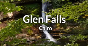 Glen Falls is a 25 ft high waterfall on Kiskatom Creek near the hamlet of Round Top, town of Cairo. A 25 ft high ribbon cascade, known as Bridal Veil Falls, can be seen across the gorge from the viewing platform. The management of the adjacent Glen Falls House may grant access to the viewing platform to see these 2 falls, although the 3rd waterfall, the 35 ft high Icebox Falls, is only accessible to booked guests. Glen Falls is a 25 ft high waterfall on Kiskatom Creek near the hamlet of Round Top, town of Cairo. A 25 ft high ribbon cascade, known as Bridal Veil Falls, can be seen across the gorge from the viewing platform. The management of the adjacent Glen Falls House may grant access to the viewing platform to see these 2 falls, although the 3rd waterfall, the 35 ft high Icebox Falls, is only accessible to booked guests.3 waterfalls – Map |
Gray Rock Falls (Plattekill Clove) | A 10-12 ft high waterfall in Plattekill Clove, located downstream from Evergreen Falls. 1 waterfall – Map |
Haines Falls | Estimated at 160-180 ft tall, Haines Falls marks the start of Kaaterskill Clove. Located just upstream from Five Cascades on Kaaterskill Creek, it is, unfortunately, on private property and not accessible. 1 waterfall – Map |
Halcott Falls | Right next to NY-42, but hidden away in the wooded roadside, Halcott Falls is a 40 ft cascade down a jagged cliff within the Catskill’s Deep Clove. The falls is on a seasonal tributary and thus dries up pretty quickly. A parking area for Halcott Mountain trailhead is found immediately north of the falls. 1 waterfall – Map |
Hannacroix Creek Falls | A 20 ft drop on Hannacoix Creek, within the Hannacroix Creek Preserve, southeast of New Baltimore. Just below the falls is the historic New Baltimore Swimming Hole. The Laverne Irving Trail will get you there. 1 waterfall – Map |
Helena Falls | 2 drops on Kaaterskill Creek in Palensville. NY-32A crosses the creek between the two drops, and is the only point at which to view them. The upper drop is about 10 ft tall and the lower drop is about 6 ft tall. 2 waterfalls – Map |
Hell’s Hole | Multiple falls follow this short, but steep, gully before it enters Plattekill Clove. Multiple small falls – Map |
High Falls (Catskill) | A 40-50 ft waterfall in a narrow gorge on Kaaterskill Creek in the town of Catskill. It starts cascading over a few rock layers and then plunges down into a sizable pool. It can only be seen from above if you walk down into the gorge from the bridge. Upstream from the High Falls bridge is another cascade of about 20 ft. 2 waterfalls – Map |
Hillyer Ravine | Hillyer Ravine is one of several waterfall-filled mountainside creeks that can be visited if you branch off of the Long Trail, which runs the length of Roundtop Mountain and High Peak, in the town of Hunter. Here you can find about 20 large waterfalls, although they tend to be a trickle by mid-summer. This site includes (from mountaintop down):
Multiple large waterfalls – Map |
Horseshoe Falls | See Bastion Falls. |
Horseshoe Bend Falls | See Gray Rock Falls. |
Icebox Falls | See Glen Falls. |
Japanese Falls (Plattekill Clove) | A steep multitiered cascade, totaling over 100 ft in height found in Plattekill Clove, just bellow Rainbow Falls. This section of the gorge is very difficult to access. 1 waterfall – Map |
Kaaterskill Falls |  A massive 231 ft falls in two tiers, Kaaterskill Falls is as tall as it is iconic. The first drop, an overhanging plunge, is 167 ft tall. A 3/4 of a mile hike down from the Laurel House Road parking area isn’t an easy hike, but well-travelled. Hike further down to see Bastion Falls. 1 waterfall – Map A massive 231 ft falls in two tiers, Kaaterskill Falls is as tall as it is iconic. The first drop, an overhanging plunge, is 167 ft tall. A 3/4 of a mile hike down from the Laurel House Road parking area isn’t an easy hike, but well-travelled. Hike further down to see Bastion Falls. 1 waterfall – Map |
Klein’s Falls | A 12 ft cascade on Kaaterskill Creek, west of the village of Catskill. The falls spans a particularly wide section of the creek. There’s a small pullover area on CR-30 (Cauterskill Ave) and a short path that leads to the base of the falls. 1 waterfall – Map |
Lake Capra Dam | A dam on Lake Capra, in the town of Jewitt. It drains into East Kill which fills Colgate Lake, where there is another dam. There’s parking, and a viewing area next to the dam. There is a resort on this lake and I’m not sure if the dam is on the property of the resort. 1 man-made dam with 2 spillways – Map |
Leeds Falls | This section of the Catskill Creek, at the southern end of the hamlet of Leeds, has 3 cascades. The Lower of which is historically referred to as Leeds Falls. It now has an old dam on top of it. The two upstream cascades are just around the bend from the pond. Private Property. 3 waterfalls; one topped with a man-made dam – Map |
Lover’s Glen Falls | See Diamond Notch Falls. |
Lucas Kill Waterfalls | Lucas Kill carves a relatively small ravine out of the plateau just north of Plattekill Clove. There are 4 waterfalls to be found near the top. Flow is generally low, so visit after periods of rain. the first three falls are 15, 60, and 58 ft in height. The largest in the bunch is over 100 ft, but doesn’t seem to be accessible due to steep cliffs. An offshoot from the Huckleberry point trail near a mountaintop stream crossing is the most direct route there. 4 waterfalls – Map |
Mary’s Glen | A 40 ft high waterfall (Known as Ashley Falls) located within the North-South Lake Campground of Catskill Park. It’s located along the Mary Glen Trail just after the first junction. There are a few smaller waterfalls further upstream. A day pass purchase is required if not staying at the campground. Multiple waterfalls – Map |
Meadow Falls | USGS maps have this waterfall marked an unnamed tributary to Hannacrois Creek in the town of New Baltimore, but information is scarce. Property status is unknown. Unknown number of waterfalls – Map |
Mill Pond Falls (Leeds) | See Leeds Falls. |
Moore’s Bridge Falls | Downstream from Fawns Leap, this 10 ft cascade, near the bridge where NY-23A crosses over Kaaterskill Creek, in the town of Cairo. The falls and pool below are popular with tourists. 1 waterfall – Map |
Niobe Falls | Niobe Falls is located on Kaaterskill Creek, between Kaaterskill Clove and Palenville. It’s an 8 ft tall drop off of a large slab of uneven rock. Downstream there are some smaller drops off of very straight ledges. Private Property. Access is for guests of The Waterfall House. 1 small waterfall – Map |
Old Footbridge Falls | A very small drop on Kaaterskill Creek in Palenville. It’s not much, but easy to see from Mill Rd. 1 small waterfall – Map |
Old Mill Falls (Plattekill Clove) | A 10 ft falls in two parts below a footbridge just upstream from Plattekill Falls in Plattekill Clove. This is the most accessible of the falls in the Clove and is an easy walk from the trailhead at Platte Clove Rd. 1 waterfall – Map |
Onteora Pond Dam | A dam under a bridge on the south end of this pond in the town of hunter. Access is via Kip Rd. 1 man-made dam – Map |
Paradox Falls | See Buttermilk Ravine. |
Plattekill Clove | Often erroneously called “Platte Clove” (which is the name of the old settlement on the west end and now the surrounding preserve) Plattekill Clove is a very steep ravine mostly in the town of Hunter, Greene County, but ends in Saugerties, Ulster County. The Clove, which was carved out by Kaaterskill Creek, features several large waterfalls, some of which are in the top 10 largest in the state. Unfortunately, getting to the majority of involves a dangerous hike, with climbing, risk of flash floods, and no maintained trails. I have listed the known waterfalls in the clove separately in their respective counties. |
Plattekill Falls (Plattekill Clove) | An estimated 60 ft high waterfall Plattekill Clove. All falls located in the Plattekill Clove are considered dangerous and extreme caution should be exercised when visiting and climbing around. 1 waterfall – Map |
Pomeroy Falls | See Platteskill Falls. |
Potuck Reservoir Dam and Falls | The east side of the reservoir, in the town of Coxaskie, flows over this dam and then a natural falls, on its way to Potic Creek. The only access is through the filtration plant at the dam, and it is off limits. 1 man-made dam and natural waterfall – Map |
Rainbow Falls (Plattekill Clove) | A beautiful ribbon plunge down a mossy cliff in Plattekill Clove, just below Bridal Veil Falls. Getting down here is difficult and not advised. 1 Waterfall – Map |
Red Barn Falls | See Old Footbridge Falls. |
Red Falls (Plattekill Clove) | A waterfall in Plattekill Clove, downstream from Gray Rock Falls, that is about 30 ft in height and often split into two distinct drops, the left being a cascade straight down a mossy cliff, while the right one winding more gradually around rock. 1 Waterfall – Map |
Red Falls (Prattsville) | A jumbled series of cascades and ledges that occurs over an outcropping of stone in the Batavia Kill east of Prattsville. The outcropping totals over 25 ft and the falls takes on different characters based on flow. It can be seen from NY-23 or pull over to get a closer view. 1 Waterfall – Map |
Red Rock Falls (Plattekill Clove) | There are 3 parts to this falls (although most websites state just an upper and lower sections) within Plattekill Clove. A small cascade of 3-4 ft high empties into a small pool, which then tumbles down the Upper Falls (estimated at 25 ft high). After another small pool, the creek goes over the Lower Falls (35 ft tall) often in two distinct ribbon cascades, and then winds up in a larger pool. The lower falls is the most accessible of the bunch, and while very dangerous, still seems to attract swimmers. 3 waterfalls – Map |
Riedlbauers Waterfall | A 20-25 ft plunge on Crystal Brook, south of Glen Falls, in the town of Cairo. Located in a wooded area near Crystal Brook Resort property, but it seems to be accessible via the Riedlbauers Waterfall Trail coming from the north (start at Riedlbauers Resort). 1 waterfall – Map |
Rip Van Winkle Falls (Leeds) | See Leeds Falls. |
Rip Van Winkle Hollow Falls | The Sleepy Hollow Trail is a footpath that runs up Rip Van Winkle Hollow (AKA Sleepy Hollow) on the east side of North Mountain. Here is the foundation of the Rip Van Winkle House, which was built over Stony Brook where there are several cascades. The site of the old “mountain house” is on private property and not accessible, but the falls can be seen from the trail. The trailhead is located at the end of Mountain House Rd to the east. Multiple small waterfalls – Map |
Roaring Kill Falls | There are a few small cascades on Roaring Kill, at the base of Sugarloaf Mountain, along a trail that follows the kill. The Roaring Kill Parking area leads to the Pecoy Notch Trail. Instead of using this path, head northwest to where Roaring Kill Rd crosses the kill and look for a footpath on the left. Multiple small waterfalls – Map |
Rumble Tumble Falls | See Zoom Flume Water Park. |
Santa Cruz Falls | See Santa Cruz Ravine. |
Santa Cruz Ravine | Santa Cruz Ravine is one of several waterfall-filled mountainside creeks alongside Roundtop Mountain and High Peak, in the town of Hunter. Santa Cruz Ravine is located west of Buttermilk Ravine and runs through private property. Landslides in recent years have made the location very dangerous. There are at least 4 large waterfalls here, but only one is accessible. The rest are off limits. This site includes (from mountaintop down):
Multiple large waterfalls – Map |
Shadow Falls | See Hillyer Ravine. |
Shelving Rock Falls | See Hillyer Ravine. |
Shimmering Falls | See Zoom Flume Water Park. |
Shinglekill Falls (Purling) |  A 32 ft tall waterfall in Purling, south of Cairo. It’s on Private Property, but accessible to guests of the B&Bs on either side of the creek. A 32 ft tall waterfall in Purling, south of Cairo. It’s on Private Property, but accessible to guests of the B&Bs on either side of the creek.1 waterfall – Map |
Silver Lake Dam | A dam and covered bridge at the south end of Silver Lake, in the town of Windham. It’s on private property, but viewable from High Peak Rd. 1 man-made dam – Map |
Silver Spur Road Falls | A waterfall is reported to be on this unnamed tributary to Catskill Creek, south of Cairo. The tributary runs down about 60 ft down to the valley, but details on the falls here are scarce. It seems to be on private property. 1 waterfall – Map |
Sleepy Hollow Lake Dam | A large dam at the south end of Sleepy Hollow Lake, which is fed by Murders Creek. The dam is mostly covered in grass, but the west end has a 360 ft long spillway. A utility road extends to the spillway from Sleepy Hollow Rd on the west side. 1 man-made dam – Map |
Sleepy Hollow Notch Falls | Downstream from Rip Van Winkle’s house and falls, is this series of 3 waterfalls, near the trailhead by Mountain House Rd. Reportedly 12, 6, and 4 ft tall. 3 waterfalls – Map |
Stony Brook Falls (Catskill) | Reported, but unconfirmed, waterfall in this tributary to Kaaterskill Creek in the town of Catskill. Accessibility is unknown. Unknown number of waterfalls – Map |
Stony Notch Falls | A seasonal mountainside cascade in Devils Tombstone, which is within the Stony Notch area of the town of Hunter. A parking area is off of NY-214 at Notch Lake. Take the Devil’s path trail up from there and veer right to an offshoot after about 300 ft. 1 waterfall – Map |
Surprise Falls | When driving on NY-81 in the town of Greenville, there is a waterfall on a unnamed creek hidden in the woods to the south. Look for it as you pass over the creek, across from hours number 3224. Best seen then the leaves are off the trees. 1 waterfall – Map |
Tannery Bridge Falls | A 2 ft drop along Kaaterskill Creek in Palenville. It’s just below the Woodstock Ave bridge. There’s a small parking area along the road north of the falls. 1 waterfall – Map |
Timber Lake Dam | A man-made dam at the southern end of North Timber Lake in the town of Lexington. Stones piled on the dam give it a natural appearance. It’s located within Timber Lake Camp, which is private. 1 man-made dam – Map |
Triple Falls | See Buttermilk Ravine. |
Unnamed Cascades (Plattekill Clove) | Downstream from Japanese Falls, in Plattekill Clove, the gorge narrows and several small waterfalls can be found (relative to the massive falls found upstream). 5 waterfalls – Map |
Unnamed Waterfall (Schoharie Creek west of Tannersville) | An old broken dam and ruins of a mill on Schoharie Creek, west of Tannersville. Accessibility is unknown. 1 man-made waterfall – Map |
Viola Falls | See Hillyer Ravine. |
Wildcat Falls | See Wildcat Ravine. |
Wildcat Ravine | Wildcat Ravine is one of several waterfall-filled mountainside creeks that can be visited if you branch off of the Long Trail, which runs the length of Roundtop Mountain and High Peak, in the town of Hunter. Wildcat Ravine is located in-between Hillyer and Buttermilk Ravines. Within the ravine are 5 large waterfalls, although they tend to dry up by late-summer. This site includes (from mountaintop down):
Multiple large waterfalls – Map |
Winter Clove Falls | Large multitiered cascade that runs almost 100 ft along Kiskatom Brook, within Winter Clove, about halfway up North Mountain. Take the Winter Clove Falls Trail, which can be picked up from the Webster’s Pass Trail in Winter Clove. 1 waterfall – Map |
Woodstock Dam and Falls | An old broken dam and a few waterfalls on Catskill Creek in Woodstock in the town of Cairo (not the famous town of Woodstock). The upper falls can be seen from the NY-32 bridge. The lower falls can be access through a path on the south side. You may have to park far down the road and walk to the site. 2 waterfalls – Map |
Zoom Flume Water Park | Amidst the chlorinated attractions at this water park in Durham, a tributary to Cornwall Creek carves out a gorge and creates two natural waterfalls that flow through the park. Rumble Tumble Falls and Shimmering Falls downstream can be best seen from the footbridges over the creek. 2 waterfalls – Map |
Arietta Falls | A cascade down rock formation that intersects with the West Branch of the Sacandaga River in the town of Arietta. There’s a roadside parking area and trailhead just west on NY-10. 1 waterfall – Map |
Auger Falls | A series of drops totaling roughly 100 ft high in this slanted narrow gorge on the Sacandaga River in the town of Wells. The trail loop can be picked up to the west on NY-8. There are small drops and wading areas in the gorge upstream from the falls. Multiple falls – Map |
Austin Falls | A 40 ft long gradual chute-like falls, tumbling across large slanted rock formations, in a narrow section of the Sacandaga River in the town of Well (east of Lake Pleasant). There are some pull-over areas on NY-8 with trails to get to the river. One common one is to the south near the Old Rt 30 bridge. 1 waterfall – Map |
Beaver Brook Falls | As Beaver Brook makes its last descent towards Indian Lake, it drops over 50 ft over a few hundred yards. The extent of it being a waterfall is uncertain. 1 waterfall – Map |
Bray House Falls | In the southwest corner of the town of Arietta, East Canada Creek drops about 15 feet over a bulge of rock creating a foaming falls. There are pools and a few small drops downstream. Park on Powley Road and follow the trail east to the creek. 1 waterfall – Map |
Buckhorn Lake Falls | A small 30-40 ft cascade in a gorge on the outlet of Buckhorn Lake, east of Piseco Lake, in the town of Lake Pleasant. The Northville-Placid Trail can be accessed from the northwest off of NY-8, near Rudeston. The trail leads to a footbridge over the outlet, with an offshoot to the falls. 1 waterfall – Map |
Buttermilk Falls (Arietta) | A wide and frothy cascade on the Raquette River in the town of Arietta, nestled in a scenic valley. This 25 ft high waterfall is one of the most popular in the Adirondacks. Parking is available roadside on North Point Rd (CR-3), with a short path leading into the woods to the river. 1 waterfall – Map |
Cascade Falls | A 35 ft waterfall off a sheer cliff in the town of Inlet, occurring on the Cascade Lake Inlet, with the lake just downstream. Accessible via the Cascade Lake Trail, with parking on Big Moose Rd, north of the hamlet of Eagle Bay. 1 waterfall – Map |
Cascade Pond Outlet | Cascade Pond, south of Blue Mountain Lake in the town of Indian Lake, flows north through a mountaintop marsh, then turns east, dropping over 80 ft in a fifth of a mile. Along this stretch, there is a 5-foot waterfall and several very small drops. Multiple waterfalls – Map |
Cedar River Falls | A set of rapid-like drops on the Cedar River in the town of Indian Lake, more resembling rapids than falls. Located adjacent to the Cedar River Golf Course, with a small trail leading from Deer Trail Road. Rapids – Map |
Christine Falls | An estimated 40 ft tiered cascade and hydroelectric dam in a narrow gorge on the Sacandaga River in the town of Wells. Accessible from a pull-over on NY-8 right at the falls, or from upstream, crossing the 12-ton wooden bridge to loop around for a different view. 1 waterfall and man-made dam – Map |
Cold Brook Falls | Features 5 and 20 ft cascades on Cold Brook, a tributary of the West Sacandaga River, just north of Big Hedgehog Mountain. It’s close to West Sacandaga River Falls, less than half a mile upriver. Accessible via the Northville-Placid Trail which runs east of the location, with an offshoot leading west towards these falls. 2 waterfalls – Map |
Cold Stream Falls | Reports two waterfalls on Cold Stream in the Town of Arietta, north of Piseco Lake. The Northville-Placid Trail runs east of this area. Access might require bushwhacking. 2 waterfalls (unconfirmed) – Map |
Cotter Brook Falls | A small 4 ft cascade on Cotter Brook in the town of Wells. The hike begins at the Gorge Creek Trailhead off of NY-8 to the north, then turns right at the Cotter Brook Trail intersection. 1 waterfall – Map |
County Line Brook | Within the first 2 miles up County Line Brook, in the town of Wells, are 3 waterfalls, one reportedly over 20 ft tall. A trail runs along the west side of the brook. 3 waterfalls – Map |
Crotched Pond Outlet | At least 1 waterfall reported on this outlet from Crotched Pond in the town of Indian Lake as it leads down to Indian Lake. The trail begins at the end of Crotched Pond Road. Unknown number of waterfalls – Map |
Death Falls | A 50 ft high cascade south of the Golden Beach campground on Indian Lake. Named for Death Brook, which it empties into, although it’s not actually on Death Brook. Accessible via a well-known trail from a dirt road off of NY-28, near the campground entrance. 1 waterfall – Map |
Dug Mountain Falls | Features one 4 ft and one 40 ft cascade on Dug Brook, just before it empties into the Jessup River, south of Indian Lake. May require bushwhacking for complete access, although a branch of the old Dug Mountain Road leads close to the brook and falls. Popular with paddlers on the Jessup River. 2 waterfalls – Map |
East Inlet Brook | Several small cascades can be found in this valley south of East Inlet Mountain, in the town of Long Lake. Multiple small waterfalls – Map |
Extract Brook | Runs from Macomber and Buckhorn mountains in the town of Wells, south to the East Branch of the Sacandaga River. Features multiple small cascades along its course. Multiple waterfalls – Map |
Falls Pond Outlet | At least one waterfall is reported on the outlet from Falls Pond in the town of Inlet. The outlet is on the north end of the pond. There’s a parking area on Otter Brook Road, and the Brooktrout Lake Trail leads to where it branches off to the Falls Pond Trail, which parallels this trail. Unknown number of waterfalls – Map |
Fishing Brook Falls | A small pond dam under a footbridge over Fishing Brook in the town of Long Lake, about 4 or 5 ft tall, with a pile of stones at the base, giving it some natural characteristics. The land is posted, but it can be seen from NY-29N (Newcomb Rd). 1 man-made dam – Map |
Frenchs Vly Falls | A 10-15 ft cascade on a tributary to Frenchs Vly, near the base of Bethune Mountain in the town of Morehouse. 1 waterfall – Map |
Goldmine Falls | About 30 ft high, the top third tumbles over jagged rock, then flows through a narrow channel for the last two-thirds. Located on Goldmine Creek in the town of Arietta. The trail starts out in the east on Powley Rd, is not well marked, but leads directly to the falls. 1 waterfall – Map |
Griffin Falls | A series of short drops totaling 5-8 ft in height along the East Branch of the Sacandaga River in the town of Wells. Accessible by a dirt road (Teachout Rd) off of NY-8 that leads to a bridge just upstream from the falls. Parking is available roadside just north of the bridge. 1 waterfall – Map |
Groff Creek Falls | Three falls on Groff Creek in the towns of Hope and Benson, just south of Southerland Mountain. Includes a thin 18 ft ribbon cascade (lower fall), a middle falls about 30 ft in two parts, and an upper falls, a 15 ft ribbon cascade over a steep mossy cliff. Access is via River Road, which terminates east of the gorge but continues as a trail leading to the falls. 3 waterfalls – Map |
Harris Rift | Named for a stretch of the Hudson River that cuts a deep gorge in the mountains, featuring mild rapids. The Kettle Rapids are located just west of this area. Rapids – Map |
Hatchery Creek Falls | See Whiskey Brook Falls. |
Hope Falls | See Tenant Creek Falls. |
Indian Head Rapids | A stretch of Rapids on the Indian River northeast of Lake Abanakee, in the town of Indian Lake. Paths lead straight down from Chain Lakes Road. Rapids – Map |
Indian Lake Outlet | Within the West Canada Lake Wilderness, the outlet runs northwest from Indian Lake to the Indian River. Features 3 sizable cascades and several very small drops. 3 waterfalls – Map |
Indian River Falls (Indian Lake) | See Indian Head Rapids. |
Jimmy Creek Falls (East) | Three cascades ranging from 20-30 ft on a trail along Jimmy Creek in the town of Wells. Parking available at the trailhead off NY-8. 3 waterfalls – Map |
Jimmy Creek Falls (West) | A 15 ft and a 30 ft falls on Jimmy Creek. Parking spot on West River Road just west of the bridge over the creek. A trail leads upstream to the falls. 2 waterfalls – Map |
Jockeybush Outlet | Runs from Jockeybush Lake towards Pine Mountain and the West Branch of the Sacandaga River, featuring a few cascades, one over 20 ft. Trail runs from NY-10 to the lake. Multiple waterfalls – Map |
Johnny Mack Brook | A 10-15 ft cascade seen just off the southern end of the Rock Lake Trail, in the town of Indian Lake. 1 waterfall – Map |
Kettle Mountain Rapids | Upstream from Harris Rift, these rapids on the Hudson River feature defined ledges that may be considered small waterfalls by some. Rapids – Map |
Kunjamuk River Falls | Small sets of ledges on the Kunjamuk River near Poplar Hill in the town of Wells. The southern part of the Kunjamuk River Trail passes by here. Several small ledges – Map |
Lake Algonquin Dam | A 6-8 ft tall hydroelectric dam at the south end of Lake Algonquin in the hamlet of Wells. Small parking area off CR-5. 1 man-made dam – Map |
Lambda Falls | Unverified report of a waterfall on a tributary to Robbs Creek in the town of Wells. This falls is reported on the tributary coming from the east. Unknown – Map |
Loon Brook Ledges | Small ledges on Loon Brook washed out by rising levels of Utowana Lake. The ledges no longer exist. No longer exists – Map |
Macomber Creek Falls | A waterfall on Macomber Creek just before it empties into the Sacandaga River, north of Auger Falls. Access via a snowmobile trail. 1 waterfall – Map |
North Branch Sacandaga | Small cascade on the North Branch of the Sacandaga River near Sherman Mountain in the town of Arietta. Trail from NY-10 leads to the falls. 1 waterfall – Map |
OK Slip Falls | Massive multi-tiered falls about 150 ft in height on state land, visible from Kettle Mountain. Parking off NY-28 and a 3-mile hike to the falls. 1 waterfall – Map |
Owl Pond Outlet Falls | A 6-10 ft sliding cascade on the outlet from Owl Pond to the West Branch of the Sacandaga River in the town of Arietta. No known trails. 1 waterfall – Map |
Pashley Falls | Barely a waterfall, but an enjoyable hike along the Cedar River near Indian Lake. Access via the Pashley Falls Loop at the end of Pelon Rd. 1 small waterfall – Map |
Potholers Falls | See Bray House Falls. |
The Rifts | See Harris Rift. |
Robbs Creek Falls | See Lambda Falls. |
Rock Dam | A natural rock wall across the South Branch of the Moose River, creating a small drop. Access via Rock Dam Road and a 1.4 mile trail. 1 natural dam – Map |
Rock River Cascades | Small drops on the Rock River, north of Rock Lake in the town of Indian Lake. Off-trail exploration may be needed from the Rock River Trail. 1 waterfall – Map |
Round Lake Stream | Old man-made dam and small cascades/rapids on the outlet from Round Lake in the town of Long Lake. Access via the Round Lake Trail. 1 man-made dam and multiple waterfalls/rapids – Map |
Sampson Bog Outlet Falls | A 4-6 ft sliding cascade on the Sampson Bog Outlet in the West Canada Lake Wilderness, town of Arietta. Near the Northville Placid Trail’s footbridge. 1 waterfall – Map |
Secret Falls | See Death Falls. |
Shingle Brook Falls | Multitiered ribbon cascade on Shingle Brook before it meets the Kunjamuk River in the town of Wells. 1 waterfall – Map |
Shingle Brook Falls (Upper) | Multitiered cascade on Shingle Brook, upstream of the other Shingle Brook Falls in the town of Wells. 1 waterfall – Map |
Squaw Brook Falls | A small roadside falls below a bridge on the west side of Indian Lake in the town of Indian Lake. Visible from the NY-30 Bridge. 1 waterfall – Map |
South Inlet Cascades | Small drops on the South Inlet to Raquette Lake. Access via Sagamore Lake Trail from Sagamore Rd. 1 waterfall – Map |
T Lake Falls | Possibly the highest waterfall in the state, with a total drop over 500 ft on an unnamed tributary of the South Branch West Canada Creek. Access via a trail from CR-24 in Piseco. 1 waterfall – Map |
Tenant Creek Falls | A 40 ft tall cascade on Tenant Creek, north of Rand Mountain in the town of Hope, with two smaller falls upstream. Popular hiking destination. 3 waterfalls – Map |
Touey Falls | A waterfall of unknown type/height on the Salmon Lake Outlet in the town of Long Lake. No trails leading to the location. 1 waterfall – Map |
Twin Lakes Falls | A waterfall on the Twin Lakes Outlet in the town of Piseco. Access via the trail to T Lake Falls, then south to Twin Lakes. 1 waterfall – Map |
Utowana Lake Spillway | A small dam on the west end of Utowana Lake, accessible by a dirt road from NY-28. 1 man-made dam – Map |
Vly Creek Falls | A 30 ft cascade on Vly Creek in the south end of the town of Wells. Trail access from the end of Hermandez Rd. 1 waterfall – Map |
Wakely Dam | A 6 ft dam under a bridge at the north end of the Cedar River Flow, near the Cedar River Campsites. 1 man-made dam – Map |
West Sacandaga River Falls | 12 and 8 ft cascades on the West Sacandaga River in the town of Wells. Access via the Northfield-Placid Trail. 2 waterfalls – Map |
West Sacandaga River Falls 2 | Additional 10 and 20 ft high waterfalls on the West Sacandaga River, further along the Northfield-Placid Trail. 2 waterfalls – Map |
West Stony Creek Falls | A small 4 ft cascade on the North Branch of West Stony Creek in the town of Benson. Accessible via the Northville-Placid Trail. 1 waterfall – Map |
Whiskey Brook Falls | A 6 ft high cascade on Hatchery Creek, north of Lake Pleasant. Short walk from roadside parking on NY-30. 1 waterfall – Map |
Yale Brook | Unverified reports of waterfalls on Yale Brook, east of Panther Mountain, in the town of Inlet. Accessed via a logging road. Unknown number of waterfalls – Map |
Alder Creek Falls (near Cowboy Beaver Meadow) | A waterfall on Alder Creek, just east of the county line, that seems to be an old mill site. It’s possible there is a dam here. There is a building nearby, so I’m not sure if this falls is accessible. 1 waterfall – Map |
Baby Lake Falls | See Jacks Falls. |
Barbara Smit Young Arboretum Waterfall | See Robert B. Woodruff Outdoor Learning Center. |
Beardslee Falls | A 40-50 ft falls on East Canada Creek on the border of Herkimer and Montgomery Counties. The upper portion is a gradual cascade, which ends in a pond. The creek then follows a narrow channel on the Herkimer side of the creek as it makes its way to the lower falls. The dam holding back East Canada Lake diverts a great deal of the water that would make this falls a pretty amazing sight at full flow. The falls is on private property and is currently posted. 1 waterfall – Map |
Beaver River Cascades (near Moshier Falls) | Downstream from Moshier Falls are a few rock outcroppings that create small cascades along the Beaver River in the town of Webb. Private Property. Multiple waterfall – Map |
Beckus Gulf | Beckus Gulf, in the town of Litchfield, descends over 250 ft as it heads towards the Ilion Gorge. The gorge can be hiked along Jerusalem Hill Rd, starting from NY-51. Along the way this beautiful creek has several very small cascades. Multiple small waterfalls – Map |
Black Creek (Norway) | A small stretch of Black Creek in the town of Norway that has some drops over a rock outcropping. This is just east of the Gray-Wilmurt Rd bridge over the Creek. Property status is unknown. Several small drops – Map |
Bloodsucker Pond Outlet | The outlet of this small pond in the town of Webb almost immediately slides down a 120ft hillside. In that short span, there’s at least one small waterfall. Unknown number of waterfalls – Map |
Boyer Lake Outlet | See Stony Brook. |
Buttermilk Falls (Frankfort) | A cascade in an undeveloped gorge along Starch Factory Creek, south Of Utica. Access is unknown. 1 waterfall – Map |
Buttermilk Falls (Little Falls) | An unnamed creek has this beautiful 40 ft waterfall in the city of Little Falls. A small park least to a trailhead. Park at the lot at the end of Burch St. 1 waterfall – Map |
Castle Road Falls | See Old City Falls. |
Cheese Box Falls | See Robert B. Woodruff Outdoor Learning Center. |
Clapsaddle Falls | A tall cascade located on an unnamed tributary in South Ilion. Access is through Sapsaddle Farms, which has events and activities open to the public. 1 waterfall – Map |
Cold Brook | I have seen this referenced as “Cold Brook,” but according to the USGS this waterway is unnamed. Located between an upland marsh and the Middle Branch of the Black River, in the town of Ohio, this brook drops about 120 ft as it approaches the Black River, creating at least 4 small waterfalls along the way. A trail starts out at Wolf Creek Road to the west and crosses the brook. Multiple waterfalls – Map |
Creamery Falls | See Robert B. Woodruff Outdoor Learning Center. |
Dave’s Look Out Falls | See Robert B. Woodruff Outdoor Learning Center. |
Dolgeville Mill Falls | Access is best through Fulton County. |
East Canada Lake Dam | A hydroelectric dam on the south end of East Canada Lake, just north of Beardslee Falls. Currently posted and off limits. 1 Man-made dam – Map |
Farrington Road Falls | See Old City Falls (Upper). |
Faville Falls | A series of cascades, over 60 ft in total height, on Ransom Creek in the town of Manheim. There’s roadside parking on Peckville Rd, just west of where it merges with Moore Rd. A short trail leads south and to tall the falls. Multiple waterfalls – Map |
Foxes Falls | There is some confusion on the name. This is a small tributary to Spinnerville Gulf, which is northeast of Spinnerville. This creek walk features multiple waterfalls and one Foxes Falls, which is one of the most unique in the state. Framed by a massive jagged limestone cliffs, the falls cascades over 30 feet into the cathedral-like gorge. There are smaller waterfalls to find downstream. A dirt access road off of Spinnerville Gulf Road can get you there. I’m unsure about accessibility. Multiple waterfalls – Map (Approximate) |
Frankfort Gorge | A stretch of Moyer Creek, west of the village of Frankfort that features several roadside drops. They can be spotted from NY-171 or park at the intersection of Furnace Rd and NY-171 and head there on foot. Multiple small waterfalls – Map |
High Falls (Dolgeville) | Access from Herkimer County is off limits. A view is possible from the Fulton County side. |
High Falls (Old City) | See Wolf Hollow Falls. |
High Falls (Wilmurt) | A 10 ft high U-shaped waterfall on West Canada Creek, north of Butler Lake, in the town of Ohio. Views can be had from the Gray-Wilmurt Bridge over the creek. 1 waterfall – Map |
Hinckley Reservoir Dam | Constructed in 1915 to feed the Erie Canal, Hinckley Reservoir has a surface area of about 4.5 miles. The Southwest end has a large dam and moderately sized power facility. There is a parking area off of Cady Rd. 1 man-made dam – Map |
Hole in the Wall Falls | See November Falls. |
Honnedaga Falls | See Jacks Falls. |
Jacks Falls | A 30 ft high cascade on Honnedaga Brook, downstream from Honnedaga and Baby Lakes in the town of Cold Brook. There are a few smaller cascades along the brook. The Baby Lake Falls Trail follows the brook and passes the falls. Multiple Falls – Map |
Kelly Falls | See Robert B. Woodruff Outdoor Learning Center. |
Kettle Hole Falls | 3 small waterfalls on the outlet from Raven Lake as it drains into the Stillwater Reservoir in the town of Webb. There’s a trailhead of of Necessary Dam Rd to the north. 3 waterfalls – Map |
Limekiln Falls | A 6 ft high waterfall on the South Branch of the Moose River in the town of Ohio. A trail heads southwest from the Limekiln State Campground, site #87 for the trailhead. A day use fee may be charged at the campground. 1 waterfall – Map |
Little Falls | A series of 4 dam drops and rapids where the Erie Canal splits and rejoins the Mohawk River in the middle of the city of Little Falls. They are easily visible from the NY-167 bridge and various business parking lots along the river. Multiple man-made dams and rapids – Map |
Little South Lake Dam | A man-made has a spout that creates a waterfall kicking off the South Branch of the Black River, in the town of Ohio. A trail passes by here, but I’m not sure of the name of it. 1 man-made dam – Map |
Maltanner Creek Falls | A handful of small cascades and drops on Maltanner Creek, in the town of Fairfield. They can be seen from the NY-29 stone arch bridge over the creek. Multiple waterfalls – Map |
Middle Branch Black River (near North Lake) | The Middle Branch of the Black River descends about 100 ft just before it joins with North Lake in the town of Ohio. There are some small cascades along this stretch. A walk upstream from Wolf Creek Rd is probably the best wat to explore this area. Multiple small waterfalls – Map |
Middle Branch Lake Outlet | The outlet from Middle Branch Lake, in the town of Webb, has a single waterfall. The best way to reach it is to take the Big Otter Lake Trail to the lake. You then may need to bushwhack a bit to get to the south end and then follow the outlet to the falls. 1 waterfall – Map |
Mill Creek Falls | A handful of small waterfalls appear on Mill Creek in the town of Russia, east of Trenton Falls. You can park by the intersection of Russia and Hinkley Roads, then scramble down to the creek from Russia Rd. Multiple small waterfalls – Map |
Miracle Mile Cascade | A seasonal runoff ribbon cascade on the south end of Little Falls, right along the Miracle Mile Fitness Trail. Easily seen from Danube St. 1 waterfall – Map |
Morgan Dam | A hydroelectric dam at about 4 ft high and a small natural drop just downstream. It can be seen from the Dover Rd Bridge. 1 man-made dam and 1 small waterfall – Map |
Moshier Falls | A hydroelectric dam tops this 600 ft long cascade on the Beaver River in the town of Webb. Over that length, the river droops over 65 ft. This one is best when water level are high. Park along Moshier Rd, and head towards the river where there is a kayak put in area. 1 man-made dam and 1 waterfall – Map |
Newport Dam | A 6ft tall hydroelectric dam on West Canada Creek in the town of Newport. The best views are from the historic stone arch bridge that crosses just downstream from the dam. 1 man-made dam – Map |
Nobleboro Falls | Listed as a waterfall on some website, this is a barely noticeable single drop on West Canada Creek in the town of Ohio. There is a scenic overlook off of NY-8 and Haskell Rd that gives a direct view of it. 1 small waterfall – Map |
North Gage Road Falls | A series of small waterfalls and slides on an unnamed tributary to West Canada Creek in the town of Newport. Some are visible from North Gage Rd. The property status for land around the falls is unknown. Multiple waterfall – Map |
November Falls | A waterfall of unknown characteristics reported on Twin Lakes Stream in the town of Forest Port. The Twin Lakes Trail runs along the north side of the creek, but uphill from the water. Unknown number of waterfalls – Map (approximate) |
Ohisa Creek Falls | Ohisa Creek cuts out a sizable gorge as it heads north through the town of Stark. From NY-168, you can hike south along the Creek passing several small drops, 10 and 15 ft waterfalls, and reach the 80 ft cascade at the end. Start the creek walk from a pullover just west of the creek on NY-168. The hike is just over a mile one way (head southwest). Best in higher flow. 3 waterfalls – Map (parking) |
Old City Falls (Lower) | A 45 ft cascade in two sections just below an old stone arch bridge on Wolf Hollow Creek. This location, known as “Old City” was one of the first settlements of Herkimer County. The bottom half of the falls is viewable from the stone arch bridge. 1 waterfall – Map |
Old City Falls (Upper) | A 12 ft cascade in two sections upstream from the lower falls. It’s on private property, but viewable from Farrington Rd. 1 waterfall – Map |
Partridge Hill Falls | A 40 ft cascade on an unnamed outlet of a man-made pond in the hamlet of Trenton Falls, town of Trenton. The falls is on Private Property (do not trespass), but clearly visible from Partridge Hill Rd. 1 waterfall – Map |
Poly-Miller Gulf | See Foxes Falls. |
Remsen Falls | A short set of rapids, with a drop of only a few feet, on the Moose River South Branch in the town of Webb. The Remsen Falls Trail leads north to the falls from Wolf Lake Landing Road. Rapids – Map |
Robert B. Woodruff Outdoor Learning Center | The Owen D Young Central School District has developed this historically and naturally significant trail and opened it for the public to enjoy. This stretch of Otsquago Creek in Van Hornsville hosts 7 waterfalls and a few limestone caves across a short hike. Visitors will also find a remnants of an old dam, sawmill, and foundation of an old cheesebox factory. Multiple falls and caves – Map |
Sand Lake Falls | Sand Lake drains into Woodhull Creek which drops over 150 ft along the first mile. The Sand Lake Trail passes by two sets of rapids and a cascade at this point. A third set of rapids can be found by exploring further downstream. 1 waterfall and 3 sets of rapids – Map |
Saw Mill Falls | See Robert B. Woodruff Outdoor Learning Center. |
Sliding Falls | USGS maps have this waterfall listed on the Robinson River in the town of Webb. I can’t find any photographs or information on the falls. Satellite images don’t show anything promising. It’s possible there’s rapids or a very shallow slide over flat rock. Accessibility is unknown. Unknown – Map |
Smokey Hollow | Two small waterfalls can be found on Shed Brook as it joins with Smokey Hollow in the town of Newport. The falls can be seen from the side of Newport Rd. 2 waterfalls – Map |
Spinnerville Gulf | See Foxes Falls. |
Spruce Creek Falls (Salisbury Center) | 2 moderately-sized waterfalls on Spruce Creek in the hamlet of Salisbury Center. The upper falls is about 10 ft high and slide-like. Upstream from here is a historic covered bridge. The bridge has some small drops/rapids below it. Downstream from the upper falls is another slide, also 10 ft high. There’s a parking area on Fairview Rd, and the north end of the creek has a short pathway offering nice views of the falls and bridge. 2 waterfalls and rapids – Map |
Spruce Lake Dam | A hydroelectric dam at the south end of Spruce Lake in the town of Salisbury. There’s a parking area at the end of Tucker Drive and a footpath to the dam. 1 man-made dam – Map |
Stony Brook (near Boyer Lake) | Boyer Lake is in the northeast corner of the town of Salisbury. It’s outlet is Stony Brook. Just southwest of the lake, the outlet runs down a hillside creating at least one small drop just before it reaches a small marsh. Unknown number of waterfalls – Map |
T R Proctor Park | A man-made step cascade on Starch Factory Creek as it passes under Welsh Bush Rd at the south end of this municipal park in Utica. 1 man-made waterfall – Map |
Trenton Falls | West Canada Creek is half in Herkimer and half in Oneida. Access to these waterfalls are through Oneida County. |
Twitchell Creek Falls | A slide-like waterfall no more than 10 ft tall, just south of Twitchell Lake, in the town of Webb. It’s a short hike to the creek from Twitchell Rd before. 1 waterfalls – Map |
Van Hornsville Falls | See Robert B. Woodruff Outdoor Learning Center. |
White Pond Outlet Falls | This short outlet from White Pond, in the town of Forestport, runs down a 8 ft cascade just before it empties in a smaller, unnamed pond. White Pond Trail starts out to the south off of Rock Dam Rd. 1 waterfall – Map |
Windfall Pond Outlet | A small cascade on Windfall Pond Outlet in the town of Webb, near the second bridge on the trail. The trailhead is off of Big Moose Rd. 1 small waterfall – Map |
Wolf Hollow Falls | Upstream from Old City Falls, this is a slide-like falls with a few small drops in this narrow section of Wolf Hollow. It’s about 15 ft high in total. Accessibility is unknown. 1 waterfall – Map |
Woodhull Creek Falls | See Sand Lake Falls. |
Jefferson County and the City of Watertown
Adams Dam Falls | A dam and a small v-shaped ledge on Sandy Creek in the middle of the village of Adams. It’s viewable from the S. Park St Bridge (be mindful of traffic) or via a small footpath on the north end of the bridge. 1 man-made dam and small ledge. – Map |
Barrett Creek Falls | Reported waterfall on Barrett Creek south of Clayton. The presence of a mill pond upstream leads me to believe there is a dam. It’s on private property. Unknown – Map |
Beaver Falls | A 20 ft cascade on an unnamed tributary to the Beaver Meadows Marsh, southwest of Watertown. Private Property. 1 waterfall – Map |
Beebee Island Main Dam | See Great Falls (Watertown). |
Belleville Falls | A series of small ledges along Sandy Creak in Belleville. It’s not much, maybe a foot tall in total. Surrounded by Private Property and fishing rights to not extend this far. A series of very small drops – Map |
Black River Falls | See Black River Power Dam. |
Black River Power Dam | At the north end of the Black River Trail (near the village of Black River) is the Black River Power Dam. It creates a roughly 20 cascade over steep, almost concave, surface. It then tumbles over a few feet of natural rock layers. On the west side is a modern power house, and on the right is a small wheelhouse and the foundation for a much older mill or power plant. Parking is off of NY-3 at the trail Rd. You can also get a good view from the bridge. Other websites classify some small seasonal runoff into the gorge as waterfalls, so if you want to find those, head south on the trail. 1 man-made waterfall – Map |
Black River Trail Falls | See Black River Power Dam. |
Black River Village Falls | A series of small drops (no more than 3 ft or so in total) on the Black River in the village of Black River. It is flanked by the foundations of an old dam. It can be seen from the S Main St bridge, or from E Dexter St. See the Kamargo Power Dam nearby. 1 small waterfall – Map |
Bovine Falls | When flowing Philomel Creek drops 40 ft off a steep cliff into the Black River Gorge in the village of Brownville. To see it, park in the lot on the other side of the Bridge St bridge and catch a view from the opposite side of the gorge. It’s best in high flow, so early spring or after several days of heavy rain. 1 waterfall – Map |
Boynton-Jacobs Falls | A several waterfalls, including a sizable waterfall where Boyton Creek meets Jacobs Creek in Watertown. While many sites list these falls as different locations and using various names, I have listed them as one since they are in one potentially viewable location. Private Property/No Trespassing. Estimated 3 waterfalls – Map |
Brownville Falls | See Bovine Falls. |
Burrs Mill Falls | See Burrville Falls. |
Burrville Falls | A large natural and frothy cascade toped by a small dam behind an rustic cider mill on Jacobs Creek in the town of Watertown. While it can be seen from Plank Rd (CR-156), a large portion of the 30 ft falls is below the road’s view. Stop into the mill to grab some snacks and check out the falls from the viewing deck. A series of very small drops – Map |
Buttermilk Creek Falls (Clayton) | Buttermilk Creek is a small tributary to the Chaumont River just south of the hamlet of Depauville in the town of Clayton. As the creek emerges from the CR179 culvert it falls roughly 30-40 ft over jagged layers of rock, creating a frothy cascade. The very top of it may be visible from the roadside. Private Property. 1 waterfall – Map |
Butternut Falls | A 35 ft cascade on an unnamed tributary to the Black River. The watershed for this creek is Rutland Hollow, which is sizeable, so it can get decent flow at times, but it usually dries in late summer. The first 30 ft are gradual over thin layers of stone, and then reaches a ledge near the bottom and then drops another 4-5 feet. Private Property. 1 waterfall – Map |
Butterville Falls | A 20 ft cascade on a seasonal tributary to Crystal Lake in Butterville, west of Adams. The falls is on Private Property, but it’s easily seen from CR-75 (Butterville Rd). 1 waterfall – Map |
Cantwells Carrier Ridge Falls | See Carrier Ridge Falls. |
Carrier Ridge Falls | A pre-historic and flooded St Lawrence River created land ridges outlining the lake and marking the old shoreline. Carrier Ridge passes by the village of Clayton, crating a handful of small seasonal waterfalls as small tributaries head towards the River. One of these falls is here. A trail leads to it from the end of Cantwell Drive, but a report says the falls may be on private property. The ridge itself is 20-60 ft high depending on location. I’m not sure of the height of this falls. 1 waterfall – Map |
Carrthage Dams (Black River) | There are at least 5 dams on the Black River between Carthage and West Carthage (more if you count the smaller segments). The centermost dam (officially called Carthage State Dam) has rapids extending downstream. This often referred to as “Long Falls” for which the original settlement was named after. There’s a park at the end of Riverside Drive that will allow for a view of the longest dam above the falls. It may also be possible to drive down Bender S Ln to the island and get a view from there. Multiple man-made dams – Map |
Catfish Falls | The Chaumont River drops about 20 ft over this waterfall hamlet of Depauville. A storage building, which may have been built over the foundation of a mill bisects the falls into two parts. From the CR-179 bridge you can see just above the falls, but unfortunately this gem is not viewable from the other side. Private Property. 2 waterfalls – Map |
Chaumont River Falls | The Chaumont River meets an outcropping of large stones southeast of La Fargeville, creating this waterfall. Part of it can be seen from Zang Rd but it’s not much. I suspect the outcropping gets quite a bit of white water in high flow, but unfortunately the land seems to be on Private Property, so better views will have to wait. 1 waterfall – Map |
Childs Falls | A 12-15 ft cascade on Black Creek, just south of the village of Philadelphia. The falls is on private property, but part of it may be visible from CR-29 (plant Road) although the angle isn’t perfect. 1 waterfall – Map |
Cider Mill Falls | See Burrville Falls. |
Clayton Country Club Falls | See Carrier Ridge Falls. |
Cook Road Falls | An old dam and waterfall on Jacobs Creek southeast of Watertown. Located on private property and not accessible. 1 unknown type of waterfall – Map |
Deferiet Dam (Black River) | A 700 ft long hydroelectric dam on the Black River southeast of Deferiet. Accessible from a fishing access site off of NY-3 in Daferiet. A trail leads to the bank near the power station, which is on the northern end of the dam. 1 man-made waterfall – Map |
Delano Island Diversion Dam | The Black River has at least 17 dams with 8 of them in the Watertown area. This dam is on the east side of Delano Island and was built to control water flow to the power house downstream. It spans about 700ft and creates a waterfall a few feet high. View it roadside from the south on Ridge Rd. 1 man-made waterfall – Map |
Delano Falls | Delano Falls is a natural waterfall on the Black River in Watertown that has been built over with a U-shaped hydroelectric dam (Watertown Municipal Power Dam). Because the river has so many dams and man-made pools, it’s often flooded to the top. In low water levels you can see more of the natural rock layers just below the dam. The man-made portion drops about 3 ft onto a jumble of natural stone for about 5 more feet. Best seen from the Eastern Blvd bridge (NY-3). 1 waterfall surrounded by a man-made dam – Map |
Dexter Dam and Falls | As the Black River passes through the village of Dexter it is diverted by islands, marsh, and this set of dams, one of which has an overflow that tumbles down natural bedrock. The dams are about 20 ft high and in substantial flow this section of the river can be quite a sight. See it all from the NY-180 bridge over the river, or from the south bank where there is a small parking area near the bend on Lee Rd. 2 man-made waterfalls, 1 natural waterfall (in high flow) – Map |
Diamond Island Dam | On the channel across the Diamond Island Diversion Dam is this dam at the Diamond Island Power Station. The 3-4 ft waterfall created by the plant’s outlet can be spotted from Water Street. The dam itself is behind the plant and is only visible from private property. 1 man-made waterfall – Map |
Diamond Island Diversion Dam | This dam on the Black River in Watertown divers water towards the hydroelectric power house on the opposite channel. It spans 230 ft and creates a falls about 3-6 ft high. It can be spotted from the roadside south on Huntingtin St. 1 man-made waterfall – Map |
Dry Hill Falls | A small 2-3 ft falls created by an old dam. Easily seen roadside from Cagwin Rd northeast of Adams Center. Not worth the trek. 1 man-made waterfall – Map |
East Rodman Falls | A 10-15 ft cascade on Sandy Creek in the village of East Rodman. It’s on private property and not accessible. 1 waterfall – Map |
Evans Mill Falls | See Pleasant Creek Falls. |
Felts Mills Falls | A small drop on the Black River in the hamlet of Felts Mills, south of Fort Drum. An old stone dam spans half the river channel here. Check it out from the end of Island Drive. 1 man-made waterfall – Map |
French Creek Falls | See Sperrys Falls. |
Gillette Creek Falls | A waterfall roughly 8-10 ft in height found between CR-15 (Perch Lake Rd) and I-80 just outside of the Perch Lake State Game Management Area. While a trail leads there from Perch Lake Rd, I have seen reports that this is private property. You can see it for a split second as you pass by on I-80 northbound. 1 waterfall – Map |
Glen Park Falls | While on property owned by the Glen Park Hydroelectric Project, the land surrounding this hydroelectric dam in the village is accessible to the public during daylight hours. On warm weekends, 11am to 4pm, less water is diverted allowing the 15 ft waterfall to shine and whitewater enthusiasts to conquer the falls. There is parking just west of the dam on the north side off of NY-12E. Cross the dam to get views of the falls. 1 waterfall and 2 man-made dams – Map |
Great Falls (Watertown) | A very interesting looking waterfall topped by a u-shaped dam on the Black River in Watertown. The 25 ft falls and adjacent power house is easily seen from the sidewalk on the Mill Street Bridge, or downstream from Newell St. 1 natural waterfall capped by a dam – Map |
Helsinki Falls | A 15ft cascade on Staplin Creek north of Burrs Mills. Private Property and not accessible. 1 waterfall – Map |
Herrings Dam (Black River) | An L-shaped hydroelectric dam on the Black River in Herrings. An access road on the north side leads to the dam. There is a trail network on the south side, but access is unconfirmed for both locations. 1 man-made dam – Map |
High Falls (Theresa) | See Theresa Power Dam. |
Indian River Dam (Theresa) | This is a dam and power station on a narrow channel in the Indian River south of the village of Theresa. Access status is unknown. 1 man-made dam waterfall – Map |
Indian River Falls (Philadelphia) | A diversion created by a mill dam creates an island in the middle of the Indian River west of Philadelphia. In high flow, the diversion drops almost 40 feet over boulders. It can be seen from Sandy Hollow Road. 1 waterfall – Map |
Jacobs Creek Dam Falls | A concrete dam creates a 10 ft plunge on Jacobs Creek. Private Property and not accessible. 1 man-made waterfall – Map |
Kamargo Dam (Black River) | With a similar name to the dam just west of here, this diversion dam is unique in that is spans 600 ft across the river creating a long 8ft high cascade. The sides are flanked by natural stone, and in high flow these can overrun with a rush of water. Access is questionable. It seems viewable from Poors Island on the east end of the Kamargo Trail, but this needs confirmation. 1 man-made waterfall – Map |
Kamargo Power Dam (Black River) | This hydroelectric dam in the village of Black River runs lengthwise along the south branch of the river in two parts, creating 2 man-made falls. In very high flow the longer end of the dam can overrun allowing water to spill over the natural rock of the island creating a jumble of water just below the dam at top. The southern end can be seen from the S Main St bridge (along with Black River Village Falls) and the longer western part can be seen from a parking area on W Dexter St. The dam height varies from about 10-20 ft. 2 man-made waterfalls – Map |
Lefebvre Mill Dam | An old mill dam east of Felts Mills built in 1907-1910 and used by a paper mill (the foundation of which can be found on the southern bank). There are two dams here arranged in a V shape. The northern stretch of the eastern arm often has a spill creating a waterfall. A trailhead from Old St Rte 3 heads to the southern bank and the abandoned mill. On the north side, the Black River Trail (at Great Bend) will get you there. Man-made dams creating a few falls – Map |
Limerick Falls | A waterfall (possible over 10 ft in height) and an old mill foundation on the Perch River west of the hamlet of Limerick. Private Property and not accessible. 1 waterfall – Map |
Long Falls (Carthage) | See Carthage Dams. |
Lowell Creek Falls | A tiered cascade over thick layers of limestone on Lowell Creek north of Pamelia Four Corners, before it joins with Gillette Creek. Just upstream from this site Lowell creek dips underground for about 500ft before it reemerges just before Keyser Rd. Private property and not accessible. 1 waterfall – Map |
Lower Jacobs Falls | See Jacobs Creek Dam Falls. |
Mill Creek Falls (Redwood) | Historical records referred to this feeder stream that runs from Mud Creek to Butterfield Lake in Redfield as “Mill Creek” although that name doesn’t seem to be on a modern map. Topo information shows a steep gradient, and satellite images show a hint of a waterfall. It seems to be on private property. Unknown number of waterfalls – Map |
Monitor Mill Falls | This dam and waterfall on Sandy Creek north of Ellisburg is on private property. Public fishing rights, and a DEC owned parking area can be found south of the Monitor Mills Rd bridge. Reports say that the landowner doesn’t mind visitors to the falls, but definitely keep an eye out for posted signs. It can also be seen from the bridge above. The dam, built in 1905 to replace one built in 1854, is about 8 ft above the rock. After the dam, water drop down a 5 ft natural cascade, turns 90 degrees, and then drops down another 5-6 ft. 1 man-made dam and natural waterfall – Map |
Natural Bridge Falls | One of the most interesting waterfalls sites in the state, Natural Bridge refers to a section of the Indian River in the hamlet of Natural Bridge, east of Fort Drum. There are 5 waterfalls here (satellite imagery may show a very inaccessible 6th in high flow). 2 Falls, both less than 10 ft in height are visible from the CR-4 (Depot St) bridge. Below the bridge is a dam that creates a 10 ft drop. From N Croghan Rd we west-most falls may be visible, but it’s down in the gully and trees are in the way. The largest falls, a stepped cascade of about 20-25 ft on the east side, is hidden away on restricted land and cannot be seen at this time. 5 waterfalls – Map |
Paper Mill Falls (Brownville) | See Bovine Falls. |
Philadelphia Falls | There are several waterfalls on the Indian River in this small section of the west side of the village of Philadelphia. The river here splits, twists, and turns several times as it makes it’s way through a jagged rock outcropping. There are at least 4 falls here, with the most picturesque ones being viewable from private property. The upper falls and some rapids are viewable from the Garden Rd Bridge. Everything else is heavily posted. 1 man-made dam falls and at least 4 natural falls – Map |
Philomel Creek Falls | See Bovine Falls. |
Pine Hill Falls | Reported seasonal waterfall(s) over 30 ft high (?) in tributary to Stony Creek that is fed from a hilltop marsh Near Pine Hill, west of Adams Center. Property Status unknown. Unknown number of waterfalls – Map |
Pleasant Creek Falls | A 2-tiered cascade, about 10 ft tall on Pleasant Creek in Evans Mills. Spot it from foot above on the N Main Street bridge, or head behind the Public library for a view from below. 1 waterfall – Map |
Old Dam (Adams) | An old mill dam along Sandy Creek in Adams. Some of the mill wheelhouse foundation can be seen on the north bank. It’s only a couple of feet tall, but it’s a little interesting in it’s state of decay. There’s an empty lot north of the falls that may provide access. 1 man-made dam – Map |
Old Dam (Great Bend) | An old and broken mill dam on the Black River in Great Bend, south of Fort Drum. It often has 1 or 2 spills over some collapsed portions creating waterfalls roughly 4 ft high. 1 man-made dam – Map |
Really Cool Water Walking Place | See Sandy Creek Flat Rock (Woodville). |
Redwood Falls | See Mill Creek Falls (Redwood). |
Rutland Hollow Falls | A waterfall above Butternut Falls that is estimated to be 20-30 ft in height, possibly taller if some upstream drops are considered. Like Butternut Falls, it is on private property. 1 waterfall – Map |
Sackets Harbor Falls | A very small set of drops on Mill Creek on the east side of Sackets Harbor. It’s maybe about a foot tall. Easily spotted from the Military Rd bridge. 1 small waterfall – Map |
Salisbury’s Mills Falls | The village of Henderson was once called Salisbury Mills due to the prominence of the mill here that were once owned by Lodowick Salisbury. The mills one Stony Creek on are gone, but the dam still exists, creating a 15 ft tall drop. A small park off of NY-178 allows for access. 1 man-made waterfall – Map |
Sandy Creek Falls – General Note | Another waterfall website lists several “waterfalls on Sandy Creek” (between Woodville and Adams). There is a white mark on some satellite imagery, but is is verified as a series of riffles. Not a waterfall. |
Sandy Creek Flat Rock (Woodville) | Google maps has this labeled as “Really Cool Water Walking Place” by a user, which is an inaccurate but creative name. This part of Sandy Creek, north of Woodville, doesn’t have an official name. Often, stretches of waterways that dry up to reveal large flat and traversable bedrock are referred to “Flat Rock.” That’s what you will find here in summer. It apparently IS a “really cool water walking place” if conditions are favorable. In early spring the creek levels are high, making walking a challenge. A handful of drops about a foot in height make for some nice white water. There’s a parking area right off of Allard Rd. 2 small waterfalls in a walkable section of the creek – Map |
Sewalls North Channel Dam | A 90 ft dam on the Black River in Watertown. It crosses the north channel to Sewalls Island creating a waterfall roughly 6-10 ft in height. It can be spotted from an empty lot to the north off of Water St. 1 man-made waterfall – Map |
Sewalls South Channel Dam | This is an L-shaped power diversion dam on the Black River in Watertown. One end spans 240 ft across the river while the other side runs 380 perpendicular and creates a taller. The falls are about 8 ft in height. There’s a small hydroelectric station at the end. It’s visible from a pull-off on Huntington Street. 2 man-made waterfalls – Map |
Second Falls | See Rutland Hollow Falls. |
Shaver Creek Falls | Not much of a waterfall here. Normally I wouldn’t classify it as such. It’s some very small ledges across 20 yards totaling about 2-3 feet in height. It’s located just west of Three Mile Bay. It’s on private property but can be seen from the roadside (Empie Rd) if you are so inclined to leave your car for it. A few very small ledges. – Map |
Shingle Gulf Falls | Shingle Gulf skims the northing end of the Tug Hill State Forest. A tributary to the gulf creates a 60ft high cascade in early spring and after heavy rain. The top is accessible from the trail heading north from the end of Plank Rd. 1 cascade – Map |
South Park Street Falls | See Adams Dam Falls. |
South Sandy Creek Falls 1 | This waterfall appears on USGS Maps. Located on South Sandy Creek east of Ellisburg. It appears to be on Private Property, but is unconfirmed. Unknown number of waterfalls – Map |
South Sandy Creek Falls 2 | This waterfall appears on USGS Maps. Located on South Sandy Creek east of Ellisburg, further upstream than the first falls. Satellite imagery shows a decently-sized waterfall surrounded by Private Property, but it is unconfirmed. Unknown number of waterfalls – Map |
Sperrys Falls | Two waterfalls on an unnamed tributaries to French Creek in the Town of Clayton. A DEC fishing access trail leads towards the bottom falls (a 20 ft cascade) and a climb will need to the upper falls (6-8 ft stepped cascade). These dry up quickly so visit in early spring. 1 waterfall – Map |
Staplin Creek Falls | Several waterfalls along a mile stretch of Staplin Creek, upstream from Helsinki Falls (north of Burr Mills). Property access is unknown. Unknown number of waterfalls – Map |
Talcott Falls | A beautiful cascade on Big Stony Creek in Talcott Corners in the town of Adams. It is on Private Property, but viewable from US-11 if you are careful. 1 waterfall – Map |
Three Mile Creek (Lyme) | A 5 ft falls over a stone outcrop on Three Mile Creek in the town of Lyme. I’m unsure of property status, but it may be visible from Robinson Rd. 1 waterfall – Map |
Theresa Power Dam | A hydroelectric dam on the Indian River in the village of Theresa that creates a falls more than 30 ft high. Access may be possible through a portage put in behind a red brick building on Main St, but that route may require a hand launched craft. 1 man-made dam waterfall – Map |
Totman Gulf | Fox Creek passes through Totman Gulf, which is south of Adams. While Fox Creek itself lacks any falls, a tributary coming from the north creates a beautiful 45 ft horsetail falls that empties into a popular swimming hole. A pull-off to the south where Lemay Rd meets Mooney Gulf Rd leads to a short walk to the falls. Save this one for the wet season. 1 waterfall – Map |
Towle Gulf | A small gully that runs parallel to CR-97 in the town of Lorraine. Another site reports a waterfall here. This is unconfirmed. In my research, I have found this area is not a part of the adjacent park and may be private property. Unknown number of waterfalls – Map |
Trout Brook Falls | A 15-20 ft cascade on private property north east of Evans Mills. It’s slightly visible from Elm Ridge Road when the leaves are off the trees. Do not trespass. 1 waterfall – Map |
Watertown Falls | See Great Falls (Watertown). |
Watertown Municipal Power Dam | See Delano Falls. |
Watertown Power House | Jest west of Delano Falls, the Watertown Power House uses the Black River to generate electricity for the city. When in operation this outlet from the plant creates a powerful plunge back into the river. You can see it from the Waterworks Park trail across the river off of Huntington St. 1 man-made waterfall – Map |
Willow Creek Falls | An unnamed tributary to Fish Creek creates this 15 ft cascade as it falls into the Fish Creek gully south of Rodman. It can be spotted from Washington Park Rd (CR-97). Since it’s within 10 ft of the road, it should be accessible for a closer look. 1 waterfall – Map |
Woodville Falls | Sandy Creek is wide, but this waterfall is barely worth venturing out for. I’m only listing it to assist enthusiast who need to fact check the less-reliable sites that will list anything they find as a waterfall. This is a series of tiny drops along Sandy Creek In Woodville. In high flow, you would never see it. There’s public fishing access on the south bank that will get you close enough to see it, but you have to head west on CR-12 and find the parking area and trailhead. You can spot it from above on the NY-193 bridge. Barely anything – Map |
Agers Falls | A natural waterfall (18 ft) a man-made dam, and class III rapids on the Moose River in Lyonsdale. A park off of Lyonsdale Rd provides views. 1 natural waterfall, 1 man-made dam, rapids – Map |
Beaver Falls | The village of Beaver Falls (town of New Bremen) has two hydroelectric dams one right after another. The upper dam is easily seen from the park on the north end. The park also has a swimming beach for the pond. The lower dam is not accessible/viewable. 2 man-made dams, small natural ledges underneath – Map |
Belfort Dam and Falls | This hydroelectric dam (~15 ft tall) on the Beaver River creates Belfort Pond. You can see the dam and its smooth and convex cascade from the Belfort Rd Bridge. Below the dam the water tumbles down natural stone about 10 more feet as the gorge narrows. 1 man-made dam, small natural waterfall – Map |
Bisha’s Mill | An old mill site on the West Branch of the Oswegatchie River. There are remnants of the dam. I’m not sure if it still creates a drop. There’s some confusion about this being called “Besha Falls.” Besha is a misspelling of Bisha, who owned a cheese factory here in the early 1900s. I’m unsure about access. 1 man-made dam – Map |
Blanchard Creek Falls | This one is kind of out in the middle of nowhere. Combine it with a trip to Jerden Falls, which just is to the south. Find a very small cascade in the woods just across from the dirt road and take a short walk into the woods. It’s not more than 10 ft tall and will dry up in summer. 1 waterfall – Map |
Burnt Falls | An 11 ft gradual cascade over a rocky outcropping on the Middle Branch of the Oswegatchie River in the town of Diana. Private Property. The only way to see it is by kayak/canoe. 1 waterfall – Map |
Collinsville (falls near) | A seasonal tiered cascade on a small tributary to the Black River, west of Lyons Falls in Collinsville. Because of the farm upstream, it appears as though the source of the flow is farm runoff. This may be a man-made cascade with very limited flow. It can be seen from NY-12D near the intersection with Payne Rd. 1 waterfall – Map |
Copenhagen Falls | Not much of a waterfall here. In moderate to high flow these small ledges won’t even be visible. The Deer River has many of these small ledges as it winds through the village of Copenhagen. See them from the High St bridge. Multiple small drops – Map |
Croghan Island Mill | As the Beaver River passes through the village of Croghan, it splits and creates an island. Each side of the island has an old mill dam. On the island is a historic red sawmill, built around 1840, that is still family owned and operated. You can see the northern dam easily from a small area across the road from the mill. The southern dam is obscured by the mill. 2 man-made dams – Map |
Crystal Falls | A stretch of the Moose River, just west of the Powerline Rapids that features a 25 ft drop and class V rapids. Accessibility is primarily by kayak or connecting with a paddling group to tag along and catch photos. Public access may be better received during the Moose River Fest (October). The access point is through the Fortis US power office off of Lyonsdale Rd. 1 waterfall – Map |
Deer River Falls | Located in the hamlet of Deer River (town of Denmark). The Deer River turns here to the falls looks parallel to the path of the river. Adding to that oddity the 13-15 ft drop is over jagged steps of limestone, making for a very interesting falls. It can be seen from the NY-26 bridge. 1 waterfall – Map |
Denley Dam (Black River) | A man-made dam on the Black River, south of Port Leyden, with some boulders near the bottom, giving it some natural features. Estimated at 8 ft tall. Accessible from the lot adjacent to the hydro building off of NY-12. 1 man-made dam – Map |
Double Drop | Some refer to this as “Falls” some call it “Rapids.” It often depends on who’s a kayaker or not, and what the water level is when you are looking at it. When the water is high it appears to be just rapids. In low-to moderate flow, it’s clearly a waterfall made up of two drops, totaling about 12 ft in height. It can be seen from a parking area on Lowdale Rd (across from the Twin Rivers Paper Company) or the footbridge just north of there. Lyonsdale Falls and T-Bone falls are also in this spot. 1 waterfall – Map |
Double Eddies | See Taylorville Dam Falls. |
Eagle Falls | Beaver River just south of the Soft Maple Reservoir. There are two sections on this stretch that different sources call Eagle Falls. Historically an extremely narrow section of the north gorge with some powerful rapids was referred to as Eagle Falls. Further downstream 10 ft falls on a small S-shaped bend. I see this referred to Eagle Falls more commonly. The cliff just above the falls is a popular rock climbing location. Further upstream is a dam with waterfall below it. Parking can be found on the dirt road off of Soft Maple Rd. 1 waterfalls and a man-made dam – Map |
Eatonville Falls | This refers to a set of 3 falls/rapids on Otter Creek in the town of Greig. They are each less than 8-10 ft tall and can be easily mistaken for rapids in high flow. There’s a parking area and trails just north of the Eatonville Rd bridge over Otter Creek. 3 waterfalls – Map |
Effley Falls | The dam atop these falls creates Effley Falls Pond, while water empties from the falls into Elmer Falls Pond. Because water levels in the lower pond may vary, the height of the falls also does. While the lower portion can easily be enveloped, times of low flow can reveal a falls 50 ft or higher as the gorge the ponds occupy are pretty deep. Access to this location is unknown. There is a dirt road on the north side, but I’m unsure if it is public. 1 waterfall topped with a man-made dam – Map |
Elmer Falls | An L-shaped dam and waterfall next to a hydroelectric plant on the Beaver River in the town of Croghan, west of Effley Falls. The dam creates Elmer Pond upstream. Not accessible to the public. 1 waterfall topped with a man-made dam – Map |
Fall Brook Falls (Osceola) | A series of waterfalls 20 to 30 ft in total just north of Osceola in Fall Brook. Finding it is tough. There’s a small footpath from the west off of N Osceola Rd near the intersection with Nichu Rd (there are actually 2 ATV trailheads there. Follow them into the woods and look for a footpath heading east into the woods. Multiple waterfalls – Map (approximate) |
Fey Mill | An old mill/manufacturing site (still in operation) with an old mill dam and waterfall on Point Rock Creek in the town of West Leyden. The creek has public fishing access rights, but the mill site is presumably on private property. Access may come from entering the creek from the south at Fey Rd and heading upstream. 1 waterfall of unknown type – Map |
Fish Creek Falls | A small (4 ft) waterfall on Fish Creek in the town of Greig. It somewhat visible from Fish Creek Rd. 1 waterfall – Map |
Fowlerville Falls | Fowlerville Falls is pretty high volume falls on the Moose River in the town of Lyonsdale. It’s about 30 ft high 45° cascade, often with two distinct flows across the escarpment. There’s an old diversion dam that spans 2/3rds of the top of it. It’s accessible to paddlers only. 1 waterfall – Map |
Fowlerville Lower Falls | Downstream from Fowlerville Falls is this small drop. It’s no more that 6 ft in height and in high flow it just looks like a short stretch of rapids. There’s a small island in the center. Paddlers only. 1 waterfall – Map |
The Funnel | Just past Fowlerville Falls, in the town of Lyonsdale, the Moose River hits an abrupt rock ridge which diverts the flow 45° and down a narrow channel. Here the water speeds up as it plows through the channel. There’s a distinct drop of about 4 ft at the start then a gradual procession of white water another 5 ft from there. Paddlers only. 1 waterfall/rapids – Map |
Gleasmans Falls | Gleasmans Falls refers to a series of small cascades on a narrow section of the Independence River in the town of Watson. It can be accessed from the trailhead at the end of Beach Mill Pond Rd to the northwest. Multiple waterfalls – Map |
Goulds Mills Falls | The name references two falls in the Moose River, split by an island, east of the village of Lyons Falls. On the northern channel the water drops down a diversion dam, building up whitewater as it tumbles over an uneven patch making its way to a large drop where it turns 90 degrees. From there it makes its way around large rock formations. Overall the waterfall travels about 70 feet downstream as it makes its way 35 ft down. On the southern channel there is a hydroelectric dam. The release here is pretty much straight down half of the way, then hits the natural rock, creating some frothy whitewater. Park on the side of Shibley Rd, near the intersection with Kosterville, Rd and follow the trail. Multiple waterfalls and 2 man-made dams – Map |
Grunerts Falls (Rapids) | Water tumbles creating rapids as it flows over a rounded protrusion of bedrock on the West Branch of the Oswegatchie River in the town of Croghan. This is one of those borderline rapids/falls spots where, depending on the amount of flow, it could be either. The drop is pretty significant at over 30 ft. There’s a DEC fishing access parking lot on Long Pond Rd just after the bridge. A trail leads to these falls and further downstream. Multiple waterfalls and 2 man-made dams – Map |
Hidden Falls | A series of rapids and drops on the Independence River, east of the village of Glenfield, in the town of Greig. It can be seen from the Rudd Rd bridge over the falls. I’m unsure about the property status of the falls themselves. Multiple waterfalls/rapids – Map |
High Falls (Copenhagen) | A man-made dam and twisting cascade that drops 166 ft into the deep Deer River Gorge just east of the village of Copenhagen. There are conflicting reports on its accessibility. The land around it is private. Some say it’s accessible from hiking the gorge upstream from King Falls. Either way, the gorge is a dangerous spot to be in because of flash floods. Use caution and don’t trespass. 1 man-made dam and 1 large waterfall – Map |
High Falls (Croghan) | A hydroelectric dam and natural waterfall on the Beaver River north of Croghan. When flow if high, water can flow over a 700ft long stretch of the dam. The dam itself is roughly 40 ft high, followed by another 30 ft or so of natural rock, which brings the total to 70 ft or more. Below the dam, there are a handful of small islands and various drops of differing heights. It’s quite complex to categorize this one. It can be accessed from a dirt road leading to the hydro facility off of High Falls Rd. 1 large man-made dam and waterfall – Map |
High Falls (Croghan – Oswegatchie River) | A cascade (50 – 60 ft tall) on the West Branch of the Oswegatchie River northwest of the village of Croghan. The land is private but the DEC has a conservation easement that allows public access. A plan revealed in 2019 lists the future development of more trails, campsites, and parking areas in the area, so access may improve. Access is best (as of 2020) from the DEC fishing access lot and trailhead to the east on Besha Rd. 1 waterfall – Map |
House Creek Falls | An irregular 40 ft cascade on House Creek, south of the hamlet of Glenfield in the town of Turin. It’s on private property, but you can see it from the roadside (Lovers Lane Rd) when the leaves are off the trees. 1 waterfall – Map |
House Creek Falls (Houseville) | A series of falls just west of the other House Creek Falls. This one is at a private residence just outside of the hamlet of Houseville in the town of Turin. In total, the 3 falls are about 25 ft high. Private property, but partially visible from E Rd. 3 waterfalls – Map |
Iowa Falls | Two falls on the West Branch of the Oswegatchie River, north of Grunerts Falls, in the town of Croghan. The waterfalls are estimated at 35 ft tall. An island divides the river, with the wider eastern side having a very irregular cascade (often with multiple ribbons of falls in low flow) and a narrower western sliding falls. A DEC fishing access trail from the parking lot near Grunerts Falls will get you there. 2 waterfalls – Map |
Jerden Falls | Here the West Branch of the Oswegatchie River narrows as it passes though a hard rock formation. There’s a small drop of about a foot and then the river slides another 20 ft down winding left and right and creating some pretty exciting whitewater. The location used to be a part of a tannery. Access is through a trail that starts at a small dirt parking area to the north on Blanchard Creek Truck Trail. Stay right on that trail. 1 waterfall – Map |
Johnson Dam (Black River) | A large dam on the Black River just north of Port Leyden. Accessibility unknown. 1 man-made dam – Map |
Kilbourn Falls | A 35-40 ft cascade on the West Branch of the Oswegatchie River in the town of Croghan (southeast of Jerden Falls). There is a fishing access site lot and trail to straight to the south off of Kilbourn Rd at the end of an unnamed dirt road. 1 waterfall – Map |
Kimballs Mill Falls | A series of several small cascades on the West Branch of the Oswegatchie River in the Town of Diana. The largest of the falls is several feet high. A trail leading downstream from a small parking area just west of the Kimballs Mills Falls Bridge leads to the downstream falls (about 500 ft downstream). Maps show this is not a part of the state forest and that it may be private property, but this is unconfirmed. There are some drops upstream from the bridge, but no apparently trail to access them. Multiple small waterfalls – Map |
Kings Falls | At 38 ft high, Kings Falls is a uniquely beautiful waterfall on the Deer River in the town of Denmark. A stepped cascade through beautifully parallel rock strata, the face is cut by two large fissures that have eroded away to create channels for ribbons of water. A pool below the falls has been a popular swimming hole for over 100 years. A large serrated dam crowns the falls. Unfortunately recent drownings and vandalism as cause the owners to post the property. Private Property – No trespassing. 1 waterfall and man-made dam – Map |
Knife Edge (Rapids) | As the Moose River heads west towards Lyonsdale, it hits a series of ridges aligned southwest, which changes the direction of the river into a straight path along those ridges for about a half-mile. The ridges also constrict the flow, causing the water to deepen and speed up. Depending on waterflow, the rapids can be anywhere from 300 to 600 ft in length. Park at the intersection of Lyonsdale and Lowville Rds, across from the paper factory, then head northeast across the bridges. Continue down the road and look for a trailhead on the right. Rapids – Map |
Kosterville Falls | See Magilla Falls. |
Lyons Falls | A large and powerful 63 ft cascade on the Black River in the Village of Lyons Falls. The best place to see it is from the eastern bank, off of Lyons Falls Rd, at the end of a short dirt road that leads down to the river. 1 waterfall – Map |
Lyons Falls Hydroelectric Gouldtown Dam | See Goulds Mills Falls. |
Lyonsdale Falls | A beautiful 20 ft cascade with an hour-glass shape and a decent amount of flow. There’s a small hydroelectric dam up top. The river splits here, creating two falls, but the northeast channel’s drop is commonly referred to as T-Bone Falls. You can see this one from the same trail used to get to Double Drop and Knife Edge (Lowdale Rd.) 1 waterfall and man-made dam – Map |
Magilla Falls | A 25 ft falls topped by hydroelectric dam on the Moose River just east of Goulds Mill (and Falls). It’s accessible from the hydro plant property on the north shore, just off of Shibley Rd. 1 waterfall and man-made dam – Map |
Martinsburg Falls | A small falls in a narrow gorge (reminiscent of a Finger Lakes region gorge) on Roaring Creek in the hamlet of Martinsburg. There is a chute-like section and smaller cascades. It’s just below the Cemetery Rd bridge over the creek, or take a small path through the brush on Alger Rd. A few small waterfalls – Map |
Milk House Falls | A few waterfalls on Douglass Creek from this location and a half mile east as the creek enters the Black Creek Valley. I don’t have any further information. This is most likely Private Property. Multiple waterfalls – Map |
Mill Creek Falls (Turin) | A 20 ft cascade on Mill Creek in the town of Turin, north east of the village of Lyons Falls. The falls can be partially seen from the roadside where Turin Rd crosses Mill Creek. Further east there are a few cascades as the creek descends into the valley, but these are on private property. 1 accessible waterfall – Map |
Mill Drop Falls | A 24 ft tall cascade on the Middle Branch of the Oswegatchie River in the town of Diana, just east of the Frank E Jadwin Memorial State Forest. Private Property. Accessible by kayak/canoe only. 1 waterfall – Map |
Moores Falls | 3 cascades between 4 and 20 ft high on Silver Creek on the west side of Lowville. Private Property. No trespassing. 3 waterfalls – Map |
Natural Bridge Falls | Most of this waterfall is found in Jefferson County. |
Osceola Falls | See Fall Brook Falls (Osceola). |
Point Rock Creek Falls | See Fey Mills. |
Port Leyden Dam and Falls | A man-made dam built between the gaps of large rock boulders. It sort of looks like large boulders were dropped on it. In total it’s about 6-8 ft high. See it from the small hydro plant on the east bank, off of E. Main St or on the west from the woods next to the elementary school (when not in session). A man-made dam with natural elements – Map |
Powerline Rapids (Moose River) | A quarter mile stretch of the Moose River west of Lyonsdale with class III rapids and large protruding rocks. No waterfalls, but a very exciting part of the river and worth checking out if you are visiting the other falls in the area. Use parking lot off of Lyonsdale Rd. Rapids – Map |
Rainbow Falls (Dianna) | Two beautiful cascades over large jagged rock layers on the Middle Branch of the Oswegatchie River in the town of Diana. Both falls are roughly 10 ft high each with decent sized pools beneath. Unfortunately, they are on Private Property and only accessible to paddlers. I could not find fishing access rights for this stretch of the river. 2 waterfalls – Map |
Rainbow Falls (Pinckney) | A 100 ft cascade created as a tributary meets Gulf Stream in the Tug Hill State Forest in the town of Pinckney. Take the Inman Glide Trail for about a mile to see it. Getting into the gorge for a close look isn’t possible. Enjoy it from a distance. Start the hike from the John Young Trailhead off of Williams Rd and make a right as it meets the Inman Glide Trail. 1 waterfall – Map |
Roaring Brook Falls – Lower (Brokeback Gorge) | There are two big and beautiful Roaring Brook waterfalls in this gorge west of Martinsburg. This one seems to be the most people miss. About 1.55 miles upstream from the trailhead, a hanging valley comes in south from the main branch, pouring over and creating a beautiful 60 ft cascade. There’s a parking area and trailhead on W Rd (CR-29). On the way, see the lower falls. It’s possible some of this hike is on private property. I could not verify this. Obey posted signs. 1 waterfall – Map |
Roaring Brook Falls – Upper (Brokeback Gorge) | There are two big and beautiful Roaring Brook waterfalls in this gorge west of Martinsburg. This one seems to be the most people find. It’s located about 1.75 miles upstream on the northern branch. It’s a beautiful multi-tiered cascade that emerges and widens from a narrow gorge. The falls seems to be well over 50 ft high, but it’s hard to tell if there’s more hiding back in the gorge. There’s a parking area and trailhead on W Rd (CR-29). On the way, see the lower falls. It’s possible some of this hike is on private property. I could not verify this. Obey posted signs. 1 waterfall – Map |
Rock Island Dam and Falls | Located on the Black River just east of Port Leyden is this hydroelectric dam with a set of falls/rapids just beneath. Access it from the lot at the powerplant by following the access road east from Lincoln St. 1 man-made dam, waterfall, and rapids – Map |
Rome Reservoir Dam | A large dam that creates the Rome Reservoir and falls on the East Branch of Fish Creek. Estimated at 30 ft in height, the dam creates a smooth cascade with its overflow. Hydro Dam Rd leads to a small parking area and access to the dam. 1 waterfall – Map |
Scenic Overlook Falls | See Soft Maple Reservoir Dam and Falls. |
Shingle Mill Falls (Oswegatchie Rapids) | These appear to be more like rapids than falls, but when the flow is low, you can see more distinct drops, but they are pretty small. Located on the West Branch of the Oswegatchie River between Bisha’s Mill and High Falls. Rapids – Map |
Shingle Mill Falls (Otter Creek) | A series of 3 cascades on Otter Creek, north of Brantingham Lake in the town of Greig. The falls are a few feet each and one right after another. A parking area and trailhead can be found just to the south on Partridgeville Rd. 3 waterfalls – Map |
Shurform (Falls) | A 20-25 ft roaring cascade on the Moose River between Kosterville and Lyonsdale. 3 waterfalls – Map |
Singing Waters Falls | Singing Waters Park is a camping and picnic area on Fish Creek in the town of Greig. There are a few very small cascades and some rapids. A parking area is on the side of Fish Creek Rd and a footbridge over the creek leads into the park. Multiple waterfalls and rapids – Map |
Silver Creek Falls/Silver Mine Falls | See Moores Falls. |
Sluice Falls | A very narrow section of the Middle Branch of the Oswegatchie River in the town of Diana. The river is redirected into southwest by a ridge in the bedrock. It narrows and speeds up creating rapids as it goes over two 10-12 ft cascades. Only accessible to paddlers. 2 waterfalls and rapids – Map |
Sugar River Falls | See Talcottville Falls. |
Soft Maple Reservoir Dam and Falls | A dam on the Beaver River in the town of Croghan creates a 10-15 ft smooth cascade, and then downstream there are a few small cascades to explore in the woods (from 3-20 ft high). There’s a roadside dirt parking area off of Soft Maple Rd just west of the dam. Follow the trail north from there to see the first natural falls. Follow the river no more than 1,000 ft downstream to see the rest. Multiple waterfalls – Map |
Swancott Mill Dam | See Rome Reservoir Dam. |
Swans Falls | A multi-tiered cascade on Whetstone Creek in the hamlet of Glendale (northwest of Glenfield) in the town of Greig. It’s on private property, but the bottom tiers are visible from Glendale Rd. 1 waterfall – Map |
T-Bone | This is the name of a small, but infamous stretch of rapids on the Moose River in Lyonsdale. It’s on the north branch of the River, which is split by an island at this point. The lower branch contains Lyondsdale Falls. While the total drop in elevation can’t be more than 15-20 ft, the T shape is quite unique and gives the spot its name. Water speeds up as it enters the narrow channel under the bridge and as it approaches the island it is diverted by a rock channel (common in this area) that redirects the water in the SW and NE directions. 1 waterfall – Map |
Talcottville Falls | An estimated 20 ft cascade on the Sugar River in the village of Talcottville, town of Leyden. Several feet above the falls there is an old mill dam of about 2 ft tall. The falls are on private property, but access is common from a pull-off on 12-D and a dirt path that leads to the river. I am not 100% sure that path is private or not. Alternate access is to view it from the roadside from the intersection of NY-12D and Cheese Factory Rd. 1 waterfall and a man-made dam- Map |
Taylorville Dam Falls | Two dams create Taylorville Pond on the Beaver River in the town of Croghan just east of Belfort. The southern dam is about 370 ft long while the northern section, separated by a small island, is about 300 ft long (with an overflow of about 120ft in length). The dams create cascades of about 20 ft high and from there the river tumbles over rock formations creates rapids and drops for about another 20 ft. Downstream from the southern falls is another series of rapids/drops. Access is through a small lot at the hydroelectric building at the north, at the end of Double Eddy Rd. 3 waterfalls/rapids and 2 man-made dams – Map |
Trout Falls | A 20 ft cascade on the West Branch of the Oswegatchie River on the west side of the town of Croghan near Long and Round Ponds. It’s accessible from the Jakes Pond Trail. 1 waterfall – Map |
Twin Bridges Rapids | A stretch of rapids and very small drops on Black Creek in the town of New Bremen. Viewable from the Erie Canal Rd bridge. There’s a roadside parking area just south of the bridge and a trailhead just to the north. Rapids – Map |
Unnamed Falls near Port Lyden | A seasonal cascade on an unnamed tributary to the Black River, just north of Port Lyden in the town of Lyden. Estimated at 80 ft high, it could be considered over 100 ft high if accounting for the drops up to and past the road. There are a few small cascades up the hill on private property. Property status is unknown, but it can be spotted from NY-12. 1 waterfall – Map |
Whetstone Gulf State Park | Whetstone Creek carved this three mile gorge out of the eastern edge of the Tug Hill Plateau in the town of Martinsburg. A 50 ft cascade is the main attraction, but there are several smaller falls along the way. Trails loop the gorge with one heading up the creek itself. Some of the falls may require some exploration in the upper section of the gorge. Multiple falls – Map |
Whitaker Falls Park | This Martinsburg town park (Whittaker Falls Park) on Roaring Brook, features a large flume, sizable cascade and a few smaller drops. Multiple falls – Map |
Allens Brook Falls | No information on this one yet. Property status unknown. 1 waterfall? – Map |
Ashantee Falls | Smack in the middle of Ashantee, NY is this 10 ft high man-made falls. You can see it from Littleville Rd. (Private Property) 1 waterfall – Map |
Beards Creek Falls |  An estimated 60 ft plunge falls on a gorge in Leicester, west of Geneseo. Private Property. An estimated 60 ft plunge falls on a gorge in Leicester, west of Geneseo. Private Property.1 waterfall – Map |
Canaseraga Falls | A roadside waterfall south of Ossian. One viewable from the bridge over the creek. There are several cascades downstream (lower falls) accessible from small pathway from Faulkner Road. |
County Line Falls | 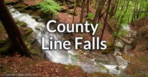 On an unnamed tributary to Hemlock Lake, a 50 ft and 25 ft cascade in a small ravine in the Hemlock-Canadice State Forest. On an unnamed tributary to Hemlock Lake, a 50 ft and 25 ft cascade in a small ravine in the Hemlock-Canadice State Forest.2 waterfalls – Map |
Fall Brook Falls (Geneseo) | 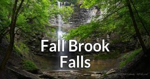 A spectacular 80+ ft falls just south of Geneseo. (Private Property, but accessible via a private arrangement) A spectacular 80+ ft falls just south of Geneseo. (Private Property, but accessible via a private arrangement)1 waterfall – Map |
Honeoye Creek | In North Bloomfield the creek falls over several serial 1-2 ft drops. Multiple waterfalls – Map |
Indian Fort Falls |  Two waterfalls in ravines that were a part of a 15th century Seneca stronghold. Located in Indian Fort Preserve, south of Geneseo. Two waterfalls in ravines that were a part of a 15th century Seneca stronghold. Located in Indian Fort Preserve, south of Geneseo.2 waterfalls – Map |
Keshequa Creek Falls | Sonyea State Forest features several small ledges, a gradual slide over a slanting slab of rock, and a 4 ft cascade. Multiple waterfalls – Map |
Littleville Falls | This 20 ft falls (and small dam above it) is located upstream from Ashantee Falls. This falls is on (Private Property), but you may be able to spot it through the trees as you drive by. 1 waterfall – Map |
Letchworth State Park | 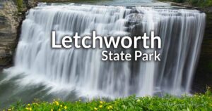 The “Grand Canyon of the East.” 3 Major waterfalls on the Genesee River. Several other falls. Most trails and facilities are on the Wyoming County side of the park. The “Grand Canyon of the East.” 3 Major waterfalls on the Genesee River. Several other falls. Most trails and facilities are on the Wyoming County side of the park.Multiple waterfalls – Map |
Papermill Falls (Gibsonville) |  A 45 ft cascade in three parts. In the vanished village of Gibsonville, within Letchworth State Park. A 45 ft cascade in three parts. In the vanished village of Gibsonville, within Letchworth State Park.1 waterfall – Map |
Little Conesus Creek (Unnamed waterfall or dam) | A waterfall or dam can be seen from Pole Bridge Rd, south of the village of Avon. Best seen in winter when the leaves are off the trees. Unknown property status. 1 waterfall – Map |
Papermill Falls |  A 15 ft cascade within a small community park in Avon. A 15 ft cascade within a small community park in Avon.1 waterfall – Map |
Patterson Gully | A small gully north of Dansville that has 35 ft and 80+ ft tall waterfalls (Off limits – Private Property). Multiple waterfalls – Map |
Reynolds Gully |  On the south end of Hemlock lake, Near county line falls. 3 of these falls are Private Property- no trespassing. On the south end of Hemlock lake, Near county line falls. 3 of these falls are Private Property- no trespassing.6 waterfalls (only 2 visible in the public section) – Map |
South MacMillan Creek Falls | Roughly 20 ft high in 2 segments. (Private Property) 1 waterfall – No map |
Stone Falls | Estimated to be 30 ft. (Private Property). 1 waterfall – Map |
Sugar Creek Glen |  A private campground with an excellent creek-walk. A private campground with an excellent creek-walk.Multiple waterfalls – Map |
Albert J. Woodford Memorial State Forest | 3 seasonal arcades on a small stream (unofficially called Blair’s Brook) found on a hike up Tassell Hill. 3 Seasonal waterfalls – Map (best guess) |
Buttermilk Falls (Canastota) | A 30 ft cascade on private property south of Canastota. It is possible to see the falls from the roadside in winter and fall when the leaves are off the trees. 1 waterfall – Map |
Button Falls | A 40 ft falls visible from the road or from the edge of a steep gorge. Some have been able to get to the bottom. Private property. Do not visit. 1 waterfall – Map |
Canastota Falls | Found on the north end of the Ridges of Madison County “Link Trail” near an abandoned waterworks pumping station. Pick up the trail from the west on Nelson Rd where there is a pullover. 2 abandoned dams – Map |
Chittenango Falls |  Chittenango Falls cascades dramatically over a 167-foot limestone ledge into a lush, wooded gorge near Cazenovia, NY. Famous for its scenic beauty and unique geology, the waterfall is a favorite subject for photographers and nature enthusiasts. Chittenango Falls cascades dramatically over a 167-foot limestone ledge into a lush, wooded gorge near Cazenovia, NY. Famous for its scenic beauty and unique geology, the waterfall is a favorite subject for photographers and nature enthusiasts.1 waterfall – Map |
Delphi Falls | 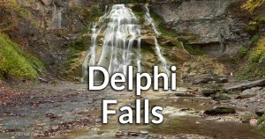 Two beautiful waterfalls on Limestone Creek, south of Pompey. Once private, it is now a public park, offering views of the upper and lower falls. Two beautiful waterfalls on Limestone Creek, south of Pompey. Once private, it is now a public park, offering views of the upper and lower falls.2 waterfalls – Map |
Frostbite Falls | See Albert J. Woodford Memorial State Forest. |
Lost Pond Outlet Falls | Tucked away in the Charles E Baker State Forest this seasonal creek creates several beautiful and relatively unknown falls. The first fans out from a narrow notch in the caprock, followed by a few small cascades. The final falls is a 25 ft tall cascade. Visit in spring or after heavy rain and follow Truck Trail 1 to where a small creek flows underneath it (between Truck Trail 5 and Truck Trail 2) head downstream. 3 waterfalls – Map |
Oxbow Falls |  3 waterfalls with one reaching 100 ft in height along Heidelberg Escarpment in a county park, near Clockville. 3 waterfalls with one reaching 100 ft in height along Heidelberg Escarpment in a county park, near Clockville.3 waterfalls – Map |
Perryville Falls | Just northeast of Chittenango Falls, this cascade tumbles down the same rock. Estimated 150ft high. Most likely on Private property. Access is not allowed. Do not trespass. 1 waterfall – Map |
Stockbridge Falls |  This stretch of Oneida Creek near Munnsville has a large series of step cascades. The falls are on Private property, but you can view a decent chunk of them from the Falls Rd bridge. This stretch of Oneida Creek near Munnsville has a large series of step cascades. The falls are on Private property, but you can view a decent chunk of them from the Falls Rd bridge.Multiple waterfalls – Map |
Monroe County and the City of Rochester Area
10 Must-see Waterfalls Around Rochester, NY | 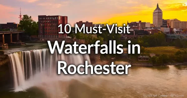 |
Bullock’s Woods Waterfall | See Turning Point Falls |
Churchville Dam |  A dam on Black creek in the village of Churchville is only 6 ft high, but is illuminated nightly (starting at 9:30pm) throughout the year. Parking is available on the west side of the dam. A dam on Black creek in the village of Churchville is only 6 ft high, but is illuminated nightly (starting at 9:30pm) throughout the year. Parking is available on the west side of the dam.1 man-made dam – Map |
Corbett’s Glen |  An oasis of preserved land in the middle of the town of Penfield that features nature trials and 3 small waterfalls, one is under a historic stone tunnel. An oasis of preserved land in the middle of the town of Penfield that features nature trials and 3 small waterfalls, one is under a historic stone tunnel.3 waterfalls – Map |
Dam at Oatka Creek Canoe and Kayak Launch | A man-made dam across Oatka Creek easily seen from the adjacent hand-boat launch off of Munson St. in LeRoy. 1 man-made dam – Map |
Densmore Falls |  A 15 ft cascade and some small ledges in a wooded section in the town of Irondequoit. A 15 ft cascade and some small ledges in a wooded section in the town of Irondequoit.1 waterfall – Map |
Honeoye Falls |  The upper falls is a 30 ft high adjacent to a picturesque “Red Sawmill.” The Lower falls is only 3 ft high and located in Harry Allen Park only a short distance away, but not exactly worth the visit. The upper falls is a 30 ft high adjacent to a picturesque “Red Sawmill.” The Lower falls is only 3 ft high and located in Harry Allen Park only a short distance away, but not exactly worth the visit. |
Linear Park Cascades | See Philbrick Park |
Lock 32 Whitewater Park |  A 25-ft man-made spill way on the Erie Canal serves as the backdrop for this community whitewater park. A 25-ft man-made spill way on the Erie Canal serves as the backdrop for this community whitewater park.1 man-made waterfall- Map |
Mumford Abandoned Mill | The foundation of an abandoned mill and a dam on a tributary to Oatka Creek in Mumford. Likely Private Property (no trespassing). 1 man-made dam – Map |
Norton’s Falls | 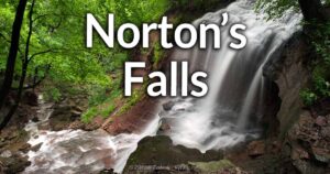 50 ft high falls along a historic Native American trail, located in the city of Rochester, that leads to the Genesee River. 50 ft high falls along a historic Native American trail, located in the city of Rochester, that leads to the Genesee River.1 waterfall – Map |
Philbrick Park |  A series of small cascades, rapids and historic mill sites on this stretch of Irondequoit Creek. A 30 ft falls hidden away along the trails. Formerly known as Linear Park, now Channing H. Philbrick Memorial Park. A series of small cascades, rapids and historic mill sites on this stretch of Irondequoit Creek. A 30 ft falls hidden away along the trails. Formerly known as Linear Park, now Channing H. Philbrick Memorial Park.Multiple waterfalls – Map |
Rochester High Falls | 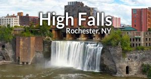 The 3 historic falls can be found in the heart of the City of Rochester. Heavily used and easily accessible, the upper falls anchors the High Falls district, with its many old factories and historic mill sites. Development has begun to turn it into a state park. The 3 historic falls can be found in the heart of the City of Rochester. Heavily used and easily accessible, the upper falls anchors the High Falls district, with its many old factories and historic mill sites. Development has begun to turn it into a state park.1 waterfall – Map |
Rochester Middle and Lower Falls | 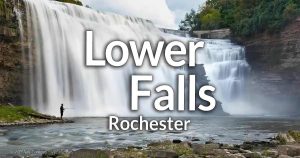 Rochester’s Middle and Lower Falls are impressive cascades along the Genesee River, historically powering mills that fueled the city’s industrial growth. Middle Falls, partially hidden within a steep gorge, is viewable from scenic overlooks along the Genesee Riverway Trail. Lower Falls, plunging roughly 110 feet, is surrounded by rugged cliffs and visible from Lower Falls Park, offering a striking glimpse into Rochester’s geological past. Rochester’s Middle and Lower Falls are impressive cascades along the Genesee River, historically powering mills that fueled the city’s industrial growth. Middle Falls, partially hidden within a steep gorge, is viewable from scenic overlooks along the Genesee Riverway Trail. Lower Falls, plunging roughly 110 feet, is surrounded by rugged cliffs and visible from Lower Falls Park, offering a striking glimpse into Rochester’s geological past.2 waterfalls (one covered with a man-made dam and hydro plant) – Map |
Red Falls | See Turning Point Falls |
Rush Dam (Veterans Memorial Park) | 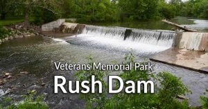 A 4-6 ft high dam on Honeoye Creek in the Town of Rush. Access is through Veterans Memorial Park on Lehigh St, or catch a glimpse of it while driving over the creek on NY-15A. A 4-6 ft high dam on Honeoye Creek in the Town of Rush. Access is through Veterans Memorial Park on Lehigh St, or catch a glimpse of it while driving over the creek on NY-15A.1 man-made dam – Map |
Turning Point Falls |  2 falls that empty into the Genesee River at Turning Point Park. Often referred to as Red Falls and Brown (or Bullock’s Woods) Falls. 2 falls that empty into the Genesee River at Turning Point Park. Often referred to as Red Falls and Brown (or Bullock’s Woods) Falls. |
Zoo Falls & Zoo Cascade |  2 falls on unnamed seasonal tributaries that empty into the Genesee River at Seneca Park. 2 falls on unnamed seasonal tributaries that empty into the Genesee River at Seneca Park.2 waterfalls – Map |
Montgomery County
Beardslee Falls | Listed under Montgomery County. |
Buttermilk Falls | See Yatesville Falls. |
Canajoharie Falls (Lower Gorge) | At the end of Floral Drive is a small parking area. This section of the gorge has a sizable dam (6 ft) and several small cascades and drops. There are a few potholes along the creek bed and one large one called the Boiling Pot. No trespassing signs have been put up in recent years, but that hasn’t deterred people from walking up the screen and swimming. A great deal of the falls can be seen from a path without going into the gorge. There also seems to be a parking area on the west side of the creek at Mill St. 1 man-made dam and several small waterfalls – Map |
Canajoharie Falls (Upper Gorge) | Wintergreen Park, which is just south of Canajoharie hugs the wide creek as it descends over 100 feet along the run of the park. Most of the gorge here is the creek bed revealed rock layer by layer forming small drops, most of which are completely engulfed in high flow. Still a hike along the gorge is a beautiful one. At the very north is Canajoharie Falls, which is a picturesque 45 ft tall cascade. A parking area is nearby and a wooden deck is available for viewing. 1 large waterfall and many very small drops upstream – Map |
Cemetery Falls | Found between Lower and Upper Canajoharie Gorges is this seasonal waterfall created from an unnamed tributary falling into the gorge just north of Canajoharie Falls Cemetery. Estimated at over 40 ft tall, the top of it may be accessible from the north east end of the cemetery. I’m unsure about seeing it from below. 1 seasonal waterfall – Map |
Schoharie Creek Preserve | See Wilsey Creek Falls. |
Sprakers Falls | A very wide and approximately 50-ft tall waterfall on Flat Creek, south of Sprakers in the town of Root. (Property status unknown) 1 waterfall – Map |
Vroomans Falls | See Yatesville Falls. |
Wintergreen Falls | See Canajoharie Falls (Upper Gorge). |
Wilsey Creek Falls | A series of waterfalls along Wilsey Creek in the Schoharie Creek Preserve, in the town of Charleston. Multiple waterfalls – Map |
Yatesville Falls | Yatesville Falls State Forest is a 71-acre preserve along Yatesville Creek, a tributary to the Mohawk River. It’s a 35 ft high cascade with a chunky limestone caprock. Seeing it is easy. NY State Preserve Rd (off of CH-106) heads right to it. The falls is on the right just before the preserve road ends. Visit in early spring or after heavy rain, or it will most likely be dry. 1 large waterfall and several small falls along the creek – Map |
Zimmerman Falls | Not much is known about these falls on Zimmerman Creek. Access is via a power plant and permission needs to be obtained. (Private Property). Unknown number of waterfalls – Map |
Burt Dam | 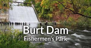 A very tall manmade dam and beautiful 49-foot spillway on Eighteenmile Creek, near Olcott. Accessible through the adjacent Fisherman’s Park. A very tall manmade dam and beautiful 49-foot spillway on Eighteenmile Creek, near Olcott. Accessible through the adjacent Fisherman’s Park.1 manmade dam – Map |
Indian Falls |  A 6 ft high waterfall on West Branch Eighteenmile Creek can be found in the Rolin T Grant Gulf Wilderness Park in the City of Lockport. It’s dry most of the year, but the park is a wonderful spot for a hike. A 6 ft high waterfall on West Branch Eighteenmile Creek can be found in the Rolin T Grant Gulf Wilderness Park in the City of Lockport. It’s dry most of the year, but the park is a wonderful spot for a hike.1 waterfall – Map |
Jeddo Creek Falls | If you have information on this falls, let us know in our Forum. Unknown number of waterfalls – No map |
Lockport Canal Falls (Flight of Five) | 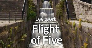 The historic canal locks in downtown Lockport, NY, known as the “Flight of Five,” were an engineering marvel when completed in the 1820s as part of the Erie Canal. These original stone locks, along with the modern set still in operation today, demonstrate the evolution of canal technology and continue to attract visitors interested in transportation history. The historic canal locks in downtown Lockport, NY, known as the “Flight of Five,” were an engineering marvel when completed in the 1820s as part of the Erie Canal. These original stone locks, along with the modern set still in operation today, demonstrate the evolution of canal technology and continue to attract visitors interested in transportation history.5 drops from this canal overflow total 56 ft in height.5 man-made waterfalls – Map |
Mill Pond Falls |  A 20 ft historic dam and falls on Eightmile Creek, below Mill Pond, and within a historic mill district. A 20 ft historic dam and falls on Eightmile Creek, below Mill Pond, and within a historic mill district.1 man-made dam – Map |
Niagara Falls | 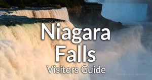 Niagara Falls, one of the world’s most famous natural wonders, consists of three majestic waterfalls—Horseshoe, American, and Bridal Veil—straddling the U.S.-Canada border. Renowned for their powerful beauty and significant role in hydroelectric power generation, these falls have attracted explorers, tourists, and artists for centuries. Niagara Falls, one of the world’s most famous natural wonders, consists of three majestic waterfalls—Horseshoe, American, and Bridal Veil—straddling the U.S.-Canada border. Renowned for their powerful beauty and significant role in hydroelectric power generation, these falls have attracted explorers, tourists, and artists for centuries.
3 waterfalls – Map |
Norton’s Falls | See Royalton Falls |
Otto Dam | See Mill Pond Falls |
Royalton Ravine Falls | 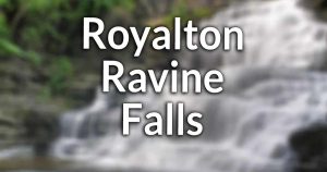 A 15 ft cascade on East Branch Eighteenmile Creek and a 25 ft high cascade on a tributary in Gasport’s Royalton Ravine Park. A 15 ft cascade on East Branch Eighteenmile Creek and a 25 ft high cascade on a tributary in Gasport’s Royalton Ravine Park.2 waterfalls – Map |
Toenniessen Falls (Lockport Nature Trail) | 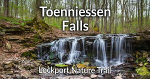 A 6ft waterfall surrounded by red medina sandstone that can be found on the beautiful John B. Austin Nature Trail (also known as the Lockport Nature Trail) on the north side of Lockport. A 6ft waterfall surrounded by red medina sandstone that can be found on the beautiful John B. Austin Nature Trail (also known as the Lockport Nature Trail) on the north side of Lockport.1 waterfall – Map |
Whirlpool Rapids |  Breathtaking whitewater found just downstream from the falls and surrounded by parks and natural areas. The Niagara River Gorge narrows, causing the water to speed up to 22mph and standing waves reaching 10 ft high to form. Breathtaking whitewater found just downstream from the falls and surrounded by parks and natural areas. The Niagara River Gorge narrows, causing the water to speed up to 22mph and standing waves reaching 10 ft high to form.Rapids – Map |
Oneida County and the Cities of Troy and Rome
Alder Pond Outlet Falls | See Black River Canal Falls. |
Bakers Falls | A waterfall created by overflow from the (abandoned) Black River Canal in Boonville. While the canal is no longer used, it does carry water. Here it empties down into a ridge falling over this 30-40 ft multi-tiered cascade and then meets Lansing Kill right next to Lansing Kill Falls. There’s a pull-off on CR-46 (Gorge Rd) and a foot bridge next to a trailhead that leads to a view of the falls. 2 waterfalls (including Lansing Kill Falls) – Map |
Bartholomew Memorial Park | See Vernon Falls. |
Black River Canal Falls (Forestport) | A flood control surplus weir at the north end of Alder Pond at the (abandoned) Black River Canal channel. This is the same type of man-made waterfall seen at Holley Canal Falls in Monroe County. The fall creates a 15 ft cascade over large stones as it tumbles down towards the Black River and Forrest Port Reservoir. The falls will be flowing when water levels are high (early spring and after heavy rain). 1 man-made waterfall – Map |
Black River Canal Falls (Boonville) | An unnamed falls on the abandoned Black River Canal in Boonville, just north of Lansing Kill Falls and Bakers Falls. It’s about 5-7 ft tall. While NY-46 (Gorge Rd) runs parallel to the canal here, it’s on a ridge above the canal. The best way to get to the falls is from the trail that runs over the bridge and heads north at Lansing Kill Falls. 1 waterfall (not sure if it’s man-made) – Map |
Black River Dam (Forestport) | A 320 ft long dam on the north end of the Forestport Reservoir that creates a smooth cascade that’s at least 10 ft high. Below the falls the bedrock protrudes creating some nice rapids in high flow. Viewable from the River Rd bridge, or from a small park next to the dam off the same road. 1 man-made waterfall and some rapids – Map |
Cady Brook Falls | See Junction Road Falls. |
Camden Dam | A small dam on Fish Creek in the middle of the village of Camden. It’s next to the Mexico ST Bridge. On the west is a memorial park, on east is a viewing area next to parking lots. 1 man-made waterfall – Map |
Camden Dam (south) | A small dam (about 3 ft tall) on Fish Creek next to a small park on the south side of the village of Camden. 1 man-made waterfall – Map |
City of Rome Reservoir Dam | See Fish Creek Dam. |
Crandall Falls | A 4-6 ft waterfall on the Black River east of Kayuta Lake in Remsen. Swimmers used to come here to enjoy a deep pool above the falls, which may have prompted posted signs to go up on the surrounding land. It is within a DEC fishing access site. The trail can be found on Jeep Trail Road off of Muthig Rd. 1 waterfall – Map |
Cummings Creek Falls | Easily seen from Hawkinsville Rd in Boonville, its bottom half is natural cascade while the top half is man-made dam (possibly the site of an old mill). It is about 8-10 ft in height. Behind the dam is a beautiful pond, making this a very picturesque scene. 1 waterfall topped by a man-made dam – Map |
Dead Man’s Curve Falls | An 8 ft cascade on a bend in Cincinnati Creek north of Barneveld. The land is posted, so only views from Parker Hollow Rd are possible. This section of road is where the name comes from. It’s nearly a hairpin curve going downhill, so it’s advised you stay in your car and spot the falls as you drive past. 1 waterfall – Map |
Delta Dam | A 60 ft tall dam on the Mohawk River near Rome that creates the Delta Reservoir. It creates a steeply sloping cascade when water levels are high. See it from a small park off of Golf Course Rd on the west side of the river. 1 large dam – Map |
Fish Creek Dam | A 6 ft high dam on Fish Creek north of Taberg in Annsville. This is officially the City of Rome Reservoir Dam, but since it is far removed from the city, that name can be misleading. Walk from Frenchtown Rd up Fish Creek Dam Rd to get see it. 1 man-made waterfall – Map |
Five Falls (Fall Brook) | 5 waterfalls on Fall Book as it descends into Fish Creek in the town of Annsville. This is on private property, but there are some reports that access is allowed (last reported Summer 2019). If you see posted signs, don’t proceed further. 5 waterfalls – Map |
Flourence Creek Falls | See Glenmore Falls. |
Forestport Dam | See Black River Dam (Forestport). |
Glenmore Falls | A 5 ft cascade on Florence Creek in the middle of the hamlet of Glenmore in the town of Annsvile. Barely visible through the trees from Slater Rd just after the Glenmore Rd intersection. 1 waterfall – Map |
Hawkinsville Dam (Black River) | A 300 ft wide dam on the Black River in the village of Hawkinsville (town of Boonsville) that creates a 6 ft falls. Viewable from the Woodgate Dr bridge or a pull-off on Edmonds Rd. 1 man-made dam – Map |
Hinckley Reservoir Dam | See Herkimer County. |
Graves Cemetery Falls | A historic cemetery is adjacent to this 12 ft cascade on the Little River south of the hamlet of Florence. The parking area is right at the bend on River Rd. Near the homestead. There is a small blue sign. From there cross the old stone bridge to get to the cemetery. The falls is quite removed from the cemetery and I’m not sure if it is on municipal land. 1 waterfall – Map |
Junction Road Falls | A series of small cascades and a “swimming hole” on Cady Brook, west of the village of Prospect. Google Street View shows posted signs. Private Property. Multiple waterfalls – Map |
Lansing Kill Falls | Right across from Bakers Falls on Lansing Kill in Boonville is this large (35-40 ft) waterfall. It is almost a sheer drop off a cliff, but does bounced of some slight ledges. See Bakers Falls for more info. 2 waterfalls (including Bakers Falls) – Map |
Lock 64 Falls (Black River Canal) | See Black River Canal Falls 2. |
Little Black Creek Falls | This is a placeholder name for a waterfall reported on Little Black Creek in Remsen, east of where it meets the Black River and Crandall Falls. Satellite imagery shows a narrow chute cut through the same rock formation that runs up to create Crandall Falls. It’s most likely on private property. Unknown number of waterfalls – Map |
Little Black Creek Falls (Roberts Rd) | A very gradual series of small drops and large boulders on Little Black Creek, southeast of Crandall Falls in the town of Remsen. Easily seen from from the Roberts Rd bridge. 1 waterfall – Map |
Lost Pond Outlet Falls | Not much is known about these falls located in Charles E Baker State Forest. 1 waterfall – Map |
Maloney Brook Falls | A seasonal cascade seen from CR-68 north of Florence. Most likely only flowing in early spring and after heavy rain. 1 waterfall – Map |
McConnellsville Dam | A dam spanning 180 ft across the West Branch of Fish Creek in McConnellsville in the Town of Vienna. Access is through a parking area just upstream of the dam. 1 man-made dam – Map |
Mill Creek (Boonsville) | A small stretch of Mill Creek on the east side of Boonville has at least 1 small waterfall. There’s a spot to park on E Schuyler St at the Erwin Pkwy. Property status is unknown. Multiple waterfalls? – Map |
Newlands Falls | A few small waterfalls on Deans Creek that are a very short hike from Denslow Rd. A bit west of Utica near the hamlet of Helca. Multiple small waterfalls – Map |
Oneida City Reservoir Dam | A retaining dam (20 ft high or more) on Florence Creek that creates this reservoir as a water supply for the city of Oneida. Access is unknown. A man-made dam – Map |
Oriskany Falls |  A 20 ft high cascade on Oriskany Creek with a 6 ft man-made falls downstream. A 20 ft high cascade on Oriskany Creek with a 6 ft man-made falls downstream.2 waterfalls – Map |
Parker Hollow Falls | See Dead Man’s Curve Falls. |
Pixley Falls | 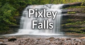 Pixley Falls State Park, which is located south of Boonville, features a 50 foot cascade. Throughout the park, there are a handful of small falls on tributaries to the Lansing kill gorge. Pixley Falls State Park, which is located south of Boonville, features a 50 foot cascade. Throughout the park, there are a handful of small falls on tributaries to the Lansing kill gorge.Multiple waterfalls. – Map |
Prospect Falls | A 25 ft tall smoothly sloping cascade on West Canada Creek on the east side of the village of Prospect. When at full flow, it can be as wide as 430 ft. It dries up pretty early in summer due to the dam upstream. You can catch a glimpse of it from the park at State and Summit Streets, or from the corner of N State and Park Ave. Otherwise it’s on private property. 1 waterfall – Map |
Prospect Gorge Falls | A 20 ft cascade dropping from a fissure in the gorge right across from prospect gorge. It’s on an unnamed seasonal tributary to West Canada Creek, and does not flow year-round. If access were permitted, it would probably be best viewed from the Herkimer County side of West Canada Creek, even though it is located on the Oneida side. Currently there is no suitable way of viewing it. 1 waterfall – Map |
Remsen Falls | A 18-20 ft tall overhanging waterfall on Cincinnati Creek within the south side of the village of Remsen. The foundations of old mills surround the falls, which I can’t tell if it’s man-made or not. Park roadside on Maple Ace and check it out from there. 1 waterfall – Map |
Sherrill Dam | An old mill dam on Sconondoa Creak in the city of Sherrill in the town of Vernon. 1 man-made waterfall – Map |
Towpath Falls | A waterfall on a tributary to Mill Creek that runs from the (abandoned Black River Canal). It’s easily accessible from the Canal Towpath trail in Boonville. It’s a 3-tier falls with two man-made dams up top, the first which is under a bridge. The final drop is a natural one. 1 waterfall – Map |
Trenton Falls | Trenton Falls refers to any number of hydro electric dams and natural waterfalls on West Canada Creek in the towns of Trenton and Russia – a place often referred to as Prospect Gorge. The Trenton Falls Scenic Trail allows visitors to spot most of the falls, something that was not possible for decades, but access is limited to scheduled days. Check the town’s website for dates. The creek is actually in both Oneida and Herkimer Counties, but access is through the Oneida side. The area includes the following from downstream (south) to upstream (north):
2 man-made dams, 1 man-made cascade, 4 natural waterfalls – Map |
Vernon Falls | A small cascade, roughly 3 ft in height on Sconondoa Creek in Vernon. Accessible through Bartholomew Memorial Park. 1 waterfall – Map |
Wesdale Dam | A small overflow dam on Fish Creek in Westdale, town of Camden. Access is through a DEC fishing access site on Cemetery Rd. 1 man-made dam – Map |
Onondaga County and the City of Syracuse Area
Bamerick Falls | A 40 ft horsetail cascade and cascade on Rush Creek in Dewitt. Private property. 1 waterfall – Map |
Blue Hole | See Rattlesnake Gulf. |
Brickyard Falls | A 50-60 ft cascade in Manlius. The falls in on Private Property, but you can catch a glimpse of it from the appropriately named Brickyard Falls View preserve downstream. 1 waterfall – Map |
Bucktail Falls | 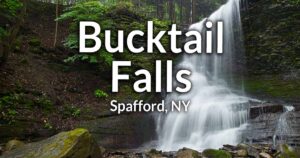 A 35 ft plunge/cascade tucked away in a small and lush gully. A quick and easy walk from the road. A 35 ft plunge/cascade tucked away in a small and lush gully. A quick and easy walk from the road.1 waterfall – Map |
Card Farm Falls | A waterfall seemingly on private property. 1 waterfall – Map |
The Cascades | A series of cascades on Cascades Creek in Tully. Private property. Do not trespass. Multiple waterfalls – Map |
Charlie C. Major Nature Trail | This short nature trail follows an abandoned rail bed parallel to Skaneateles Creek. There are several small riffles along the way and one small but interesting mill chute with the cement grates still standing. Park off of Crow Hill Road. 1 man-made waterfall – Map |
Clark Reservation State Park | The site of an ancient glacial waterfall, it now has deep pits an steep cliffs. Waterfalls can be seen from Mildred Faust Woodland Trail. Best after periods of rain. Multiple waterfalls – Map |
Coye Road Falls | On Rush Creek south of Jamesville. Details are unknown, and it’s on private property. Nothing is really visible from the road. 1 waterfall – Map |
Dunlaps Falls | Located next to Fiddlers Green Park in DeWitt, this waterfall is partially visible form the road, but it’s quite and obstructed view. The Falls itself are roughly 15 ft in height when the water is low. Posted signs are all over the place, it does not seem like one can get a closer look. 1 waterfall – Map |
Edwards Falls | 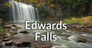 A large 50-60 ft tall drop on Limestone Creek in Manlius. A large 50-60 ft tall drop on Limestone Creek in Manlius.1 waterfall – Map |
Edwards Falls Dam | A 25-30 ft high old dam upstream and across the road from Edwards Falls in Manlius. 1 waterfall – Map |
Elmwood Park | Furnace Brook runs through his small municipal park in Syracuse. The creek basin was rebuild when the park was created. It has a 2-tiered, U-shaped man-made dam as well as very small drops along the creek with pretty stone bridges crossing occasionally. A man-made dam and some small drops – Map |
Emerson Gulf | North of Fellows Falls lies this gully with several falls. Private Property. Multiple waterfalls – Map |
Fellows Falls |  4 falls on Onondaga Creek ranging from 10 to 65 ft high. Property status varies. Parts seem accessible, others are posted. 4 falls on Onondaga Creek ranging from 10 to 65 ft high. Property status varies. Parts seem accessible, others are posted.Multiple waterfalls – Map |
Fiddlers Green Park | See Dunlaps Falls. |
Gamble Mills Falls | Not much is known about these falls on Rice Brook, a tributary to Otisco Lake. Private property. Do not trespass. Unknown number of waterfalls – Map |
Guppy Falls | 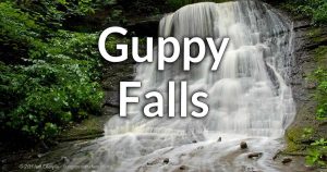 A 20 ft cascade in the Skaneateles Conservation Area. A 20 ft cascade in the Skaneateles Conservation Area.1 waterfall – Map |
High Hickory Wildlife Sanctuary | This CNY Land Trust preserve in the Town of Spafford has 4 small streams, one of which has a series of small waterfalls, including and overhanging plunge. Multiple waterfalls – Map |
Highland Forest | This Onondaga County Park in the Town of Fabius has 2 seasonal waterfalls that appear off the main trail after periods of rain. 2 seasonal waterfalls – Map |
Hinchcliff Family Preserve | Located on the east side of Skaneateles Lake, this former family farm is now a Finger Lakes Land Trust Preserve. A trail winds around the preserve and visitors have reported seeing at least one seasonal waterfall. It is not confirmed if Randall Falls is a part of this preserve. At least 1 waterfall – Map |
Hopper Glen | This wooded area in the south edge of Syracuse has a few small cascades. 2 waterfalls – Map |
Jamesville Reservoir Dam | A fairly large spillway from Jamesville Lake produces rushing water over a 35 ft high dam and crashes into the rocks below. It can be accessed from the DEC Fishing Access site on the northwest shore of the lake. 1 man-made waterfall – Map |
Jordan Dam Falls | A small dam that’s viewable from the Canalway Trail bridge (former aqueduct) over Skaneateles Creek in Jordan. 1 man-made waterfall – Map |
Lee Mulroy Rd Falls | A seasonal roadside falls seen from NY-174 south of Marcellus. It’s nothing special and only flows in the wet season or during rain. 1 waterfall on a cliff formed when the highway was constructed – Map |
Marcellus Falls | One picturesque 10 ft high man-made dam and one 10 ft cascade under a bridge in the village of Marcellus. The dam is Private Property, but visable from the road. Do not park in the resident’s lot. 2 waterfalls – Map |
Marcellus Park | This town park in Marcellus has 9 V-shaped stone dams, each about 1 foot tall across the park. While they aren’t spectacular by any means, they do fill the fill the whole park with the sounds of rushing water. 9 small man-made dams – Map |
Mason Hill Preserve | A seasonal creek found within this preserve has some small slopes. More information is needed. 1 small waterfall (maybe more?) – Map |
Falls on Ninemile Creek | A waterfall next to an old mill site south of Marcellus Falls and near the High School athletic field. Private Property. 1 waterfall – Map |
Lower Kennedy Rd Falls | A small seasonal stream exits a culvert and tumbles down some rocks next to NY-11 in Jamesville. It’s possibly seen from the roadside. I wouldn’t go out of my way to find this one. 1 waterfall – Map |
Old Dam in Marcellus | An old mill dam on private property just south of Marcellus Falls. 1 man-made waterfall – Map |
Otisco Lake Dam | This 15 ft dam maintains the water level of Otisco Lake and forms a pleasant man-made waterfall. Usually flowing after decent rainfall. 1 waterfall – Map |
Peppermill Gulf |  An interesting 90 ft limestone cascade awaits you at the end of a 1.8 mile creek walk. Private property. Do not trespass. An interesting 90 ft limestone cascade awaits you at the end of a 1.8 mile creek walk. Private property. Do not trespass.1 waterfall – Map |
Pratt’s Falls | 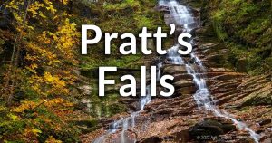 Pratt’s Falls, located in Pompey, NY, tumbles 137 feet over a rocky shale cliff, making it one of Central New York’s tallest waterfalls. Set within Pratt’s Falls Park, the waterfall is known for its picturesque beauty, peaceful woodland surroundings, and historical significance as the site of Onondaga County’s first mill operation in 1796. Pratt’s Falls, located in Pompey, NY, tumbles 137 feet over a rocky shale cliff, making it one of Central New York’s tallest waterfalls. Set within Pratt’s Falls Park, the waterfall is known for its picturesque beauty, peaceful woodland surroundings, and historical significance as the site of Onondaga County’s first mill operation in 1796.1 waterfall – Map |
Randall Falls | Not much is known about these falls on Randall Gulf. There is at least one large waterfall that starts off as and overhanging curtain and ends in a steep cascade. Reported to be on Private Property. Unknown number of waterfalls – Map |
Rattlesnake Gulf | 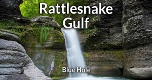 This active gully in the unstable Tully Valley that includes the Blue Hole, Mini Falls, Clay Slide Falls, Great Falls, Wedding Falls, and Bathtub Falls. It doesn’t seem like the private camp that once granted access in the past is in operation anymore. It is currently Private Property and not accessible. This active gully in the unstable Tully Valley that includes the Blue Hole, Mini Falls, Clay Slide Falls, Great Falls, Wedding Falls, and Bathtub Falls. It doesn’t seem like the private camp that once granted access in the past is in operation anymore. It is currently Private Property and not accessible.Multiple waterfalls –Map |
Richards Falls | A waterfall on private property east of Skaneateles. Details unknown. 1 waterfall –Map |
Rice Brook Falls | See Gamble Mills. |
Skaneateles Falls | Accessible through Kohilo Eco Park, there is a 4 ft falls and some smaller cascades along this stretch. The Hamlet of Skaneateles falls refers to several small waterfalls along this stretch of Skaneateles Creek, but most are on industrial property. A few small waterfalls – Map |
Sugar Bush Falls |  An oddly-shaped waterfall over a mineral deposit south of the village of Jordan. Its on Private Property and you can’t get close to it, but it is visible from the roadside. An oddly-shaped waterfall over a mineral deposit south of the village of Jordan. Its on Private Property and you can’t get close to it, but it is visible from the roadside.1 roadside waterfall – Map |
Three Falls Woods | 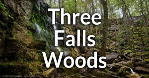 Three Falls Woods holds three 70 ft waterfalls in tributaries that combine shortly after dropping. Now protected by the Central New York Land Trust. Obey POSTED signs. Three Falls Woods holds three 70 ft waterfalls in tributaries that combine shortly after dropping. Now protected by the Central New York Land Trust. Obey POSTED signs.3 waterfalls – Map |
Affolter Gully | A large forking gully on the west side of Honeoye Lake. This area is assumed to be on private property. Multiple waterfalls –Map |
Barnes Creek Gully |  Onanda Park on Canandaigua Lake (south of the city of Canandaigua) has 3 falls ranging from 8 to 50 ft tall. Update: Only the first waterfall is accessible. Falls upstream are on private property. Onanda Park on Canandaigua Lake (south of the city of Canandaigua) has 3 falls ranging from 8 to 50 ft tall. Update: Only the first waterfall is accessible. Falls upstream are on private property.3 waterfalls – Map |
Bray Gully | Just north of Briggs gully on Honeoye Lake. This area is on private property. Multiple waterfalls – Map |
Briggs Gully | Part of the Wesley Hill Nature Preserve on the east side of Honeoye Lake. This massive gorge winds through an old growth forest. The section with waterfall is on private property. 1 waterfall – Map |
Burning Springs Falls | A 30 ft cascade on private property that is a historic landmark for the bedrock’s unique natural gas deposits. 2 waterfalls – Map |
Concrete Factory Falls | While this stretch of 5 drops on Flint Creek is surrounded by private property owned by a concrete factory, you can see the falls from the S Newark St Bridge that runs over the creek just upstream from the falls. 5 small drops – Map |
Devil’s Bedroom | An estimated 60 ft plunge in a small watershed. Private property. 1 waterfall – Map |
Double Drop Falls |  A series of small curtain falls running the width of Flint Creek in the village of Phelps. A series of small curtain falls running the width of Flint Creek in the village of Phelps.2 waterfalls – Map |
Grimes Glen | 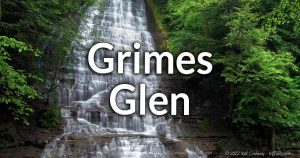 Grimes Glen in Naples, NY, is a narrow, wooded gorge carved by Grimes Creek, featuring a series of picturesque cascades and deep, clear swimming holes. The gorge’s moss-covered shale walls and historic stone bridge remnants speak to its 19th-century mill heritage. Today, the park’s shaded trails and natural pools make it a beloved spot for hiking. Grimes Glen in Naples, NY, is a narrow, wooded gorge carved by Grimes Creek, featuring a series of picturesque cascades and deep, clear swimming holes. The gorge’s moss-covered shale walls and historic stone bridge remnants speak to its 19th-century mill heritage. Today, the park’s shaded trails and natural pools make it a beloved spot for hiking.2 large waterfalls, several smaller ones along the way – Map |
Hatch Hill Falls | A seasonal waterfall in the Hi Tor area near the Naples Community Park. 1 waterfall – Map |
Kashong Glen | A large tributary to Seneca Lake containing numerous large waterfalls. Private property. Multiple waterfalls – Map |
Menteth Falls | A 60 ft cascade near Menteth Point on the west side of Canandaigua Lake. It is probably on private property. This site is recognized as having natural gas seepage from the bedrock. 1 waterfall – (possibly more upstream) – Map |
Mill Drop Falls | A 10 ft man-made falls on an old mill site in Littleville. 1 waterfall – Map |
Old Mill Falls (Flint Creek Falls) |  An 11 ft drop next to old mill, which is now a wine cafe, in village of Phelps. Additional falls can be found upstream. An 11 ft drop next to old mill, which is now a wine cafe, in village of Phelps. Additional falls can be found upstream.Multiple waterfalls – Map |
Onanda Park | See Barnes Creek Gully. |
Rocky Run Falls | A 4-ft cascade west of Clifton Springs, just north of CR-13. Likely on NYSEG property, which would mean no trespassing. 1 waterfall – Map |
Stemple Hill Gully | This gully on the west side of Canandaigua Lake has multiple waterfalls, including a very large one. Private property. Multiple waterfalls – Map |
Tannery Creek Falls | 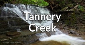 A well-preserved gully with tall rock formations and a lot of waterfalls. A challenging hike and was one of the best in the region, but the land above the first waterfall is now Private Property, making this one no longer worth a visit. A well-preserved gully with tall rock formations and a lot of waterfalls. A challenging hike and was one of the best in the region, but the land above the first waterfall is now Private Property, making this one no longer worth a visit.Multiple waterfalls – Map |
Mineral Springs Falls |  A 60 ft tall set of 3 cascades in Black Rock Forest near Cornwall. The forest is maintained by the Black Rock Consortium and contains facilities for enjoyment and study of the forest and Mineral Springs Brook. A 60 ft tall set of 3 cascades in Black Rock Forest near Cornwall. The forest is maintained by the Black Rock Consortium and contains facilities for enjoyment and study of the forest and Mineral Springs Brook.1 waterfall – Map |
Clarendon Falls | 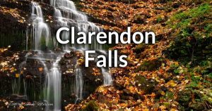 A 25 ft cascade in a small park in the center of the village of Clarendon. It is illuminated at night. A 25 ft cascade in a small park in the center of the village of Clarendon. It is illuminated at night.1 waterfall – Map |
Glen Falls | See Holley Falls. |
Glenwood Lake Dam | The dam at the north end of Glenwood Lake on Oak Orchard Creek (north of Media) creates a cascade over it’s face, and has a few natural drops below. It could possibly be access via a small trail leading from Nymo Rd on the west side, but this is unverified. 1 man-made dam and waterfall – Map |
Holley Falls |  Holley Canal Falls—often just called Holley Falls—is a 35-foot, man-made cascade over red Medina sandstone, built in the 1820s as an overflow outlet for the Erie Canal. It channels excess canal water into Sandy Creek, flowing heavily from April through mid-November before the canal is drained for winter. Surrounded by lush woodland, the falls showcase early American canal engineering. Holley Canal Falls—often just called Holley Falls—is a 35-foot, man-made cascade over red Medina sandstone, built in the 1820s as an overflow outlet for the Erie Canal. It channels excess canal water into Sandy Creek, flowing heavily from April through mid-November before the canal is drained for winter. Surrounded by lush woodland, the falls showcase early American canal engineering.1 waterfall – Map |
Holley Trap Chute | Sandy Creek flows over a small dam at a pumping station in Holley. Private Property. 1 man-made waterfall – Map |
Jeddo Creek Falls | A 24-ft high cascade, mostly visible from Salt Creek Rd. best seen then leaves are off the trees. Access into the creek bed is prohibited. Private Property. Do not trespass. 1 waterfall – Map |
Lyndonville Dam Falls |  An 11 ft high, 275 ft long dam on Lyndonville Creek. An 11 ft high, 275 ft long dam on Lyndonville Creek.1 waterfall – Map |
Medina Falls | 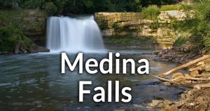 A 40 ft high steep cascade on Oak Orchard Creek, near where the Erie Canal crosses it in Medina. A 40 ft high steep cascade on Oak Orchard Creek, near where the Erie Canal crosses it in Medina.1 waterfall – Map |
Oak Orchard Falls | See Waterport Falls |
Waterport Falls |  A 40 ft man-made cascade sits below a dam on Oak Orchard Creek in the town of Carlton. A 40 ft man-made cascade sits below a dam on Oak Orchard Creek in the town of Carlton.1 man-made dam and waterfall – Map |
Fulton Dam and Lock 3 | A dam that spans the Oswego River in Fulton, flanked by a lock on the east and a hydroelectric station on the west. Viewable from the Oneida St bridge. 3 man-made waterfalls – Map |
Fulton Dam and Lock 2 | A U-shaped dam that spans the Oswego River in Fulton, flanked hydroelectric stations on both sides and a barge canal lock on the east. Viewable from the W Broadway bridge. 2 man-made waterfalls – Map |
High Breas Refuge | A “Christian Retreat Ministry” that owns property along Stony Brook in the town of Redfield. Within their camp there are three waterfalls, commonly referred to as Upper, Lower Stony Brook Falls, and Walkbridge Falls. Guests of the retreat have access to the falls. 3 waterfalls – Map |
Mad River Falls | A 20 ft waterfall on the Mad River in the Town of Redfield. It cascades over a few layers of limestone and then drops the rest of the way. Otto Mills Drive, a seasonal dirt road, will get you north of the falls. From there you can walk the creek less than a half mile south, passing the middle falls along the way, to the base of the this falls. 1 waterfall – Map |
Mad River Falls (middle) | I listed this separately, but it can be seen along the way to the main Mad River Falls. This is a smaller (2-3 ft tall) cascade. This is a very short walk south from Otto Mills Road’s terminus. Head 0.4 miles further to see the larger Mad River Falls. 1 waterfall – Map |
Mad River Falls (upper) | A 10-12 ft cascade in 2 tiers. This one can be found north of the other two falls and Otto Mills Road. It’s adjacent to private property, so obey the signs and avoid trespassing. 1 waterfall – Map |
Otto Mills | North (upstream) from the 3 Mad River Falls is this old sawmill site. A waterfall of unknown type is documented. Public fishing access rights extend to this point along the creek. 1 waterfall of unknown type – Map |
Phoenix Dam and Lock 1 | Two dam overflows on the Oswego River in the village of Phoenix (south of Fulton). It’s visible from the Lamson Rd Bridge and somewhat visible from the adjacent Lock Island Park. 2 man-made waterfalls – Map |
Salmon River Falls |  A 110 ft falls on the Salmon River, located in the Salmon River Unique Area. A 110 ft falls on the Salmon River, located in the Salmon River Unique Area.1 waterfall – Map |
Salmon River Reservoir Dam | A 20+ ft high dam on the Salmon River that creates the 2,660 acre Salmon River Reservoir. It creates a very steep cascade when flowing. Accessible from The end of Dam Rd on the north bank. 1 large man-made dam – Map |
Stony Brook Falls (Redfield) | See High Braes Refuge. |
Whitney Pond Dam | A small dam on the North Branch of Salmon Creek that creates Whitney Pond in the town of Parish. Access is off of Happy Valley Rd. 1 man made dam – Map |
Bear Cliff Falls | See Leatherstocking Falls. |
Buttermilk Falls (Decature) | A sizable waterfall on Oak Creek in the middle of the town of Decatur. While it is on private property, it can be seen from the CR-38 bridge that runs over the top of it. There’s room to pull over just south of the bridge. 1 waterfall – Map |
Cherry Valley Tributary Falls | A small tributary to Cherry Valley Creek has a 50 ft+ cascade in early spring and after heavy rainfall. It can be seen from the top/roadside. 1 waterfall – Map |
Falls Bridge | Falls Bridge Road is a decommissioned country road that had a bridge crossing the creek here. It was succeeded by the adjacent CR15 bridge. Topographic maps show a decent gradient in the gorge. The existence of falls and how many is unconfirmed. No information is known about the accessibility of the old road, bridge, and creek. Unknown number of waterfalls – Map |
Deowongo Falls | See Leatherstocking Falls. |
Hinman Hollow Falls | An unreliable NY waterfall website reports this falls existing in Hinman Hollow Northwest of Milford. They are wrong. No waterfall exists here. It’s made up. It’s a culvert. I’m listing it here to help people that mistakenly used that other terrible website. No waterfall exists here. Map |
Judds Falls |  Canajoharie Creek takes passes under US-20 and Salt Spring Rd in Cherry Valley and then cascades down about 135 ft with a overhang in the middle. A beautiful falls that can be seen from the top or via a short but challenging scramble down. Canajoharie Creek takes passes under US-20 and Salt Spring Rd in Cherry Valley and then cascades down about 135 ft with a overhang in the middle. A beautiful falls that can be seen from the top or via a short but challenging scramble down.1 waterfall – Map |
Leatherstocking Falls | Leatherstocking Creek is tributary to Otsego Lake. It tumbles down this narrow valley just before it hits the flats at the lake shore. Leatherstocking is over 20 ft high and has a unique shape in that it expands and contracts it’s width several times from top to bottom. It is on Private Property, and reports conflict on if it can be seen from the roadside (CR-28). 1 waterfall – Map |
Morris Pond Dam | An old mill pond and dam create a small (3-5 ft) yet beautiful falls that are easily seen from NY-51 near the intersection with Dimmock Hollow Rd southwest of Morris, NY. 1 man-made waterfall – Map |
Panther’s Leap | See Leatherstocking Falls. |
Saint Mary’s Falls | A series of small cascades along Morris Brook in the Dimock Hollow. This is a part of General Jacob Morris State Forest. Park on the south end of Dimmock Hollow Rd about a 3rd of a mile north of the intersection with NY-51. Look for a sign for the Otsego Land Trust Conservation Land. Multiple waterfalls – Map |
Shoemakers Falls | An old trolley line used to follow Chase Creek through this tight valley southeast of Cooperstown. Shoemakers Falls was one of the attractions along the way. It’s on private property, but it seems like it’s accessible for visitors to the Wisperin’ Pines Chalet. 2 waterfalls – Map |
Tekaharawa Falls | See Judd Falls. |
Wharton Creek Dam | A U-shaped dam on Wharton Creek east of New Berlin that creates a pleasing 2-3 ft waterfall when flow is high. A part of a roadside DEC fishing access site. Use the parking area off of NY-80 near the intersection with Musk Rd. 1 man-made waterfall (dam) – Map |
Worchester Falls | An unreliable-reliable source listed this location on Decatur Creek, north of Worchester, as a waterfall. I have been unable to verify. If it exists, it should be visible from Mowers Rd off of CR-39. Unknown number of waterfalls – Map |
New Croton Dam Falls | Part artificial and part natural, the falls spill over the man-made wall at an estimated 150 ft before spilling over natural rock. It is located inside the Croton Gorge Park. 1 waterfall – Map |
Rensselaer County and the City of Troy
Barberville Falls | A 60 ft cascade on Poesten Kill Creek. West of Troy. 1 waterfall – Map |
Black River Falls (lower) | A small waterfall dropping over a large slab of sandstone that often splits the flow. The foundation of an old mill and the remnants of the race can be found on site. 1 waterfall – Map |
Burden Falls | Three waterfalls on Waynants Kill along the Burden Pond Preserve Trail, near Troy. 3 waterfalls, one topped with a man-made dam – Map |
High Falls of Papscanee Creek | A waterfall below a culvert that goes under the Albany-Boston Railroad. (Private Property) 1 waterfall – Map |
Moordener Kill Falls | A man-made dam and natural cascade on Moordiner Kill, a tributary to the Hudson River. 2 waterfalls – Map |
Red Mill Falls | A sizable falls over rounded limestone in the middle of Rensselaer County. (accessibility unknown) 1 waterfall – Map |
Rensselaer Technology Park Falls | An 8 ft and a 40 ft waterfall in this tributary to the Hudson, near Albany. (accessibility unknown) 2 waterfalls – Map |
Saratoga County and the City of Saratoga Springs
Beecher Creek Falls |  A 20 ft cascade just upstream of the historic Copeland covered bridge in Edinburg. A 20 ft cascade just upstream of the historic Copeland covered bridge in Edinburg.1 waterfall – Map |
Curtis Falls (Curtis Mills) |  A dam and natural waterfall about 20 ft in height in the village of Corinth. It’s on the border of Saratoga and Warren Counties, but only visible from the Saratoga side. A dam and natural waterfall about 20 ft in height in the village of Corinth. It’s on the border of Saratoga and Warren Counties, but only visible from the Saratoga side.1 waterfall – Map |
Eggleston Falls | Nothing is known about these falls on Black Pond Creek. Unknown number of waterfalls – Map |
Jessup’s Great Falls | See Palmer Falls in Warren County. |
Jessup’s Little Falls | See Curtis Falls. |
Maple Shade Falls | A 15 ft high cascade on the east side of Saratoga Lake. 1 waterfall – Map |
Mill Branch Falls | See Maple Shade Falls |
Palmer Falls | A 70 ft high cascade on the Hudson in Corinth, NY. 1 waterfall – Map |
Rock City Falls | A 12 ft high cascade on Kayaderosseras Creek, west of Saratoga Springs. 1 waterfall – Map |
Rockwell Falls | See Warren County. 1 waterfall – Map |
Snook Kill Falls |  A 50+ ft step cascade in a small gorge north of Saratoga Springs. the hike down is very short but very steep. Private Property. A 50+ ft step cascade in a small gorge north of Saratoga Springs. the hike down is very short but very steep. Private Property.1 waterfall – Map |
Schenectady County and the City of Schenectady
Christman Sanctuary | A 30 ft tall waterfall within a 120-acre preserve, in Duanesburg, NY. 1 waterfall – Map |
Plotter Kill Falls | Plotter Kill Nature Preserve, just west of Schenectady, features over 632 acres of forest along the Plotter Kill tributary to the Mohawk River. The Upper Falls is 60 ft high; the Lower Falls and Rynex Creek Falls are 40 ft high. 3 waterfalls – Map |
Bouck’s Falls | Two falls, one small curtain cascade and one tall ribbon cascade in a narrow gorge on Panther Creek in the town of Fulton. POSTED/Private Property. 2 waterfalls – Map |
Brimstone Falls | See Dugway Falls. |
Button Falls | See Bouck’s Falls. |
Cole Hollow Falls | Reported waterfall on Cole Brook in Cole Hollow north of North Blenheim. Unconfirmed. Access unknown. Unknown number of waterfalls – Map |
Creamery Falls | A 2-tier waterfall on Mill Creek west of North Blenheim. It can be seen quite well from Creamery Rd or NY-30 or from a short creek walk across West Kill and then up Mill Creek, which may be a challenge in high flow. This name may not be accurate. 1 waterfall – Map |
Dibble Hollow Cascades | Reported waterfalls on a tributary to Panther Creek above Dibble Hollow on the west side of the town of Fulton. The creek is seasonal and it may be dry most of the year. Unverified. Access unknown. Unknown number of waterfalls – Map |
Dugway Falls | A 40 ft high cascade on a tributary to the Canajoharie River, just north of Sharon Springs. The creek emerges from a culvert in the road and fans out, twisting as it tumbles. In high flow it’s quite amazing. You can view part of it from the roadside at NY-10 (Main St). There’s room to pullover north around the bend. Some have gotten to the base of the falls. There may be access near the pullover. Watch for posted signs. 1 waterfall – Map |
High Street Bridge Falls | An old dam of 3 ft tops a 12 ft cascade on Bear Gulch in Richmondville. It’s slightly viewable from the east bank of the bridge, and it looks like the land on all other sides is posted. Some have reported it may be viewable from a creekwalk up from downstream, but this is unverified. 1 waterfall – Map |
Manor Kill Falls | Manor Kill Falls refers to a series of falls (about 100 ft in height) along Manor Kill just before it meets the Schoharie Reservoir southeast of Gilboa. The most popular and accessible segment can be seen from the CR-39 (Prattsville Rd) bridge over the creek. Some of the call upper drops can be seen from here as well. There is a small pull off area just south of the bridge with fishing (permit required) access in the creek bellow the last of the falls. The land upstream is fenced off and not accessible. Nicks Waterfall House on NY-990V does offer views of some upper cascades to patrons. A series of waterfalls – Map |
Mine Kill State Park | 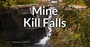 This State Park is located on the southwest of the Benheim-Gilboa Power Project, a lake created along Schoharie Creek in the Towns of Benheim and Gilboa. From the east Mine Kill cuts a narrow gorge in the land, creating the 80 ft high Mine Kill Falls. Entrance to the park is free, and there is a dedicated parking area for the falls, which is not seen from just one spot. 3 sections are viewable from various side trails. It can also be spotted from above on NY-30. This State Park is located on the southwest of the Benheim-Gilboa Power Project, a lake created along Schoharie Creek in the Towns of Benheim and Gilboa. From the east Mine Kill cuts a narrow gorge in the land, creating the 80 ft high Mine Kill Falls. Entrance to the park is free, and there is a dedicated parking area for the falls, which is not seen from just one spot. 3 sections are viewable from various side trails. It can also be spotted from above on NY-30.1 waterfall – Map |
Ravine Falls | See Dugway Falls. |
Secret Cavern Falls | This privately owned limestone underground cave has a 100 ft underground Waterfall. Located near Howe Caverns. Admission charged. 1 waterfall – Map |
Serenity Falls | A cascade and footbridge along the south end of the Long Path trail that extends beyond Mine Kill State Park. The creek is an unnamed tributary to Schoharie Creek and may be dry by late summer. 1 waterfall – Map |
Snyders Falls | Snyders Falls is a the local name for Creamery Falls. I believe “Creamery” was an improper name given based on road across from it. I’m not sure how this falls ended up with the name. Another site refers to this roadside falls on Mill Creek (west of Creamery Falls) as “Snyder Falls.” It can be viewed from CR-2 (N Rd) west of North Blenheim. 1 waterfall – Map |
Sulfur Springs Falls | See Dugway Falls. |
Aunt Sarah’s Falls | 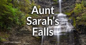 A dramatic 90 ft roadside falls right off of Rt. 14 in Montour Falls. A dramatic 90 ft roadside falls right off of Rt. 14 in Montour Falls.1 waterfall – Map |
Burdett Falls | 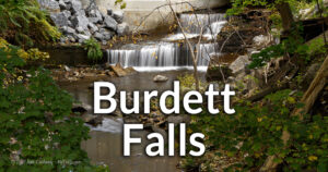 A series of waterfalls and a man-made dam along Hector Falls Creek in the hamlet of Burdett. A series of waterfalls and a man-made dam along Hector Falls Creek in the hamlet of Burdett.Multiple waterfalls – Map |
Catlin’s Falls | A small cascade on a Catlin Mill Creek in Odessa. Possibly an old mill site. More information is needed. Accessibility unknown. 1 Waterfall – Map |
Deckertown Falls | 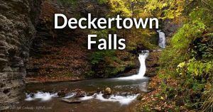 A narrow gorge and an easy-access 50+ ft cascade. More to explore in the gorge above for the daring. A narrow gorge and an easy-access 50+ ft cascade. More to explore in the gorge above for the daring.Multiple waterfalls – Map |
Eagle Cliff Falls | See Havana Glen. |
Excelsior Glen |  Across Seneca Lake from Watkins Glen, this narrow and secluded gorge is a steep climb to falls ranging from 8 to over 100 ft. Across Seneca Lake from Watkins Glen, this narrow and secluded gorge is a steep climb to falls ranging from 8 to over 100 ft.4 waterfalls – Map |
Fitzpatrick Glen | Reports say there are several waterfalls along the mile-long stretch bisected by Fitzpatrick Hill Road. Property Status is unknown. Multiple waterfalls – Map |
National Forest Gorge Trail | This trail in the Finger Lakes National Forrest offers scenic views, roadside falls and waterfalls in the gorge below. Multiple waterfalls – Map |
Havana Glen | 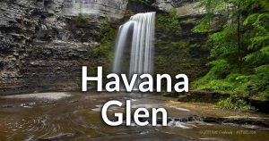 Havana Glen in Montour Falls is a shaded, hemlock-forested gorge where McClure Creek plunges over a series of waterfalls, the most prominent being the 40-foot Eagle Cliff Falls. Within a small campground park. Havana Glen in Montour Falls is a shaded, hemlock-forested gorge where McClure Creek plunges over a series of waterfalls, the most prominent being the 40-foot Eagle Cliff Falls. Within a small campground park.Multiple waterfalls – Map |
Hector Falls | 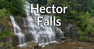 A road-side 165 ft cascade that runs right under NY-414, but only wholly visible from the lake (or across it). Well worth the detour while visiting Watkins Glen. A road-side 165 ft cascade that runs right under NY-414, but only wholly visible from the lake (or across it). Well worth the detour while visiting Watkins Glen.1 waterfall – Map |
Johns Creek | A few estimated 10-20 ft high (estimated) waterfalls on Johns Creek in the town of Montour Falls. Property status unknown. Multiple waterfalls – Map |
Quarter Mile Glen | A small glen north of Watkins Glen on the west side of Seneca Lake. Some drops visible from the sidewalk on Rt 14. More waterfalls have been reported to be further upstream. (Property status unknown) Multiple waterfalls – Map |
Shequaga Falls | 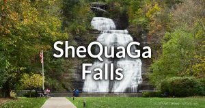 A 156 ft cascade pouring down the Portage Escarpment cliff in the village of Montour Falls. A 156 ft cascade pouring down the Portage Escarpment cliff in the village of Montour Falls.1 waterfall – Map |
Templar Falls | See Twin Falls. |
Twin Falls | 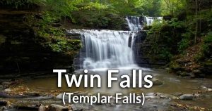 Two steep falls (11 and 15 ft) near Van Zandt Hollow, upstream from Watkins Glen. Two steep falls (11 and 15 ft) near Van Zandt Hollow, upstream from Watkins Glen.2 waterfalls – Map |
Tyrone Dam | An old dam and mill site on Tobehanna Creek in the hamlet of Tyrone, near Lamoka Lake. 1 man-made dam – Map |
Van Zandt Hollow | A small 3 ft tall cascade where Van Zandt Hollow meets Glen Creek, west of Watkins Glen, in the town of Orange. Park next to the bridge on the east side of the Vanzandt Hollow bridge and enter the gully to the north. Cross over and follow the creek that parallels the road. Continue upstream to find Templar Falls. 1 waterfall – Map |
Watkins Glen | 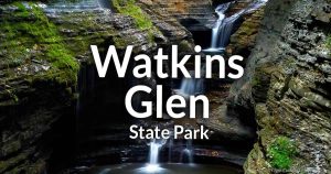 Watkins Glen State Park in the Finger Lakes is famed for its 400-foot-deep, narrow gorge carved by Glen Creek through layers of Devonian shale, sandstone, and limestone, with 19 waterfalls lining a two-mile Gorge Trail. First opened to the public in 1863 and acquired by New York State in 1906, the park’s historic stone bridges, staircases, and cantilevered walkways exemplify Victorian-era tourism infrastructure. One of the most iconic glens of the Finger Lakes Region. Watkins Glen State Park in the Finger Lakes is famed for its 400-foot-deep, narrow gorge carved by Glen Creek through layers of Devonian shale, sandstone, and limestone, with 19 waterfalls lining a two-mile Gorge Trail. First opened to the public in 1863 and acquired by New York State in 1906, the park’s historic stone bridges, staircases, and cantilevered walkways exemplify Victorian-era tourism infrastructure. One of the most iconic glens of the Finger Lakes Region.A right of passage for all waterfall and hiking enthusiasts. 19 waterfalls – Map |
Buttonwood Falls | A moderately sized (20-30 ft high?) cascade on privately-owned winery estate in Romulus. Come for a tasting and to tour the property. Cabins are available for rent. buttonwoodgrove.com 1 waterfall – Map |
Frontenac Falls | 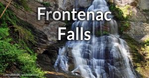 North of Taughannock Falls, this 95 ft fall is located within Camp Barton (a Boy Scout camp) (Private Property – Permission needed) North of Taughannock Falls, this 95 ft fall is located within Camp Barton (a Boy Scout camp) (Private Property – Permission needed)2 waterfalls – Map |
Groves Creek Falls | Not too far from Oak Tree Falls on the west side of Cayuga Lake is a roadside 30 ft falls topped with an 8 ft cascade. 2 waterfalls – Map |
Hosmer Falls | Barnum Creek on the west side of Cayuga Lake hosts this falls. (Private Property) 1 waterfall – Map |
Lehigh Valley Dam and Falls | A stretch of mill creek in west Lodi that features a man-made dam and several waterfalls. (Property status unknown) Multiple waterfall – Map |
Mill Creek Falls | A stretch of Mill Creek south of Lodi that features a few large cascades. (Property status unknown) Multiple waterfall – Map |
Oak Tree Falls | A creek-walk up Groves Creek (west side of Cayuga Lake) leads to a beautiful 60 ft plunge falls. 1 waterfall – Map |
Sheldrake Creek | Several waterfalls in this gully on the west side of Cayuga Lake. (Private Property) Multiple waterfalls – Map |
Silver Thread Falls | A 150 ft high cascade on Mill creek in the town of Lodi. (Private Property) 1 waterfall – Map |
Sixteen Falls Creek | Satellite imagery shows a massive (60 ft+ cascade within this gorge). As the name implies there may be 15 more. (Property status unknown – assumed private) Multiple waterfalls (?) – Map |
Wilson Creek | Multiple waterfalls – in this sizable gully on the northeast shore of Seneca Lake. (Private Property) Multiple waterfalls – Map |
Allen Falls | An estimated 35 ft curtain cascade on the St. Regis River. 1 waterfall – Map |
Bog River Falls | Two falls, totaling 30 ft in height. The lower falls is under a picturesque stone bridge crossing the Tupper Lake inlet in the Adirondacks. 2 waterfalls – Map |
Harper Falls | An estimated 60 ft drop cascade on the Grass River North Branch. 1 waterfall – Map |
Lampson Falls | Lampson Falls is a scenic, 40-foot waterfall located on the Grass River in Clare, NY, featuring a wide, gentle cascade into a popular swimming pool. Easily accessible via a short, family-friendly hike, it’s a favorite spot for swimming, photography, and relaxation. 1 waterfall – Map |
Rainbow Falls | A 40ft cascade on the south Branch of the Grasse River 1 waterfall – Map |
Rushton Falls | An estimated 10 ft. drop in the Grasse River on both sides of an island. 1 waterfall – Map |
Sylvan Falls | A large cataract spread out over a large stretch of the St. Regis River near Hopkington. 1 waterfall – Map |
Twin Falls | Two cascading falls along the Grasse River. One segment of the falls is estimated to be 50 ft tall. 2 waterfalls – Map |
Bear Falls | Not much is known about this waterfall. Unknown number of waterfalls – Map |
The Gully Preserve |  To the east of Dansville, this steep gully along Little Mill Creek and a tributary has 2 large waterfalls. Accessible via a Genesee Valley Conservancy preserve. To the east of Dansville, this steep gully along Little Mill Creek and a tributary has 2 large waterfalls. Accessible via a Genesee Valley Conservancy preserve.2 waterfalls – Map |
Damoth’s Gully | The owners of this property graciously allow respectful hikers to travel through this gully on the trail that pass two 4 ft falls and one 25 ft fall. 3 waterfalls – Map |
Little Niagara | Estimated 20 ft high cascade on Goodhue Creek. Private Property, but word is the owner allows access. If you see POSTED signs, don’t proceed any further. 1 waterfall – Map |
Mitchellsville Creek | Not much is known about the falls that line this creek. The Finger Lakes Trail (FLT) runs along the rim of the gorge through private properties. (Private Property). Unknown number of waterfalls – No Map |
Oskonsa Falls | Unknown number of waterfalls – Map |
| Nothing is known about these falls on Meyers Creek. Unknown number of waterfalls – Map | |
Stony Brook State Park |  Stony Brook State Park, established in 1928 and enhanced by the CCC and WPA, features a deep post-glacial gorge cut through an escarpment, with three waterfalls cascading over rugged cliffs and a semi-natural swimming pool formed by a small dam. Visitors can picnic, hike among woodlands on three moderately challenging one-mile trails—including the scenic Gorge Trail—or camp in the woodlands above the gorge. Its North Entrance offers day-use facilities like a stream-fed pool, picnic areas, and playgrounds, while the South Entrance provides 88 campsites, rustic cabins, and rentable shelters. Stony Brook State Park, established in 1928 and enhanced by the CCC and WPA, features a deep post-glacial gorge cut through an escarpment, with three waterfalls cascading over rugged cliffs and a semi-natural swimming pool formed by a small dam. Visitors can picnic, hike among woodlands on three moderately challenging one-mile trails—including the scenic Gorge Trail—or camp in the woodlands above the gorge. Its North Entrance offers day-use facilities like a stream-fed pool, picnic areas, and playgrounds, while the South Entrance provides 88 campsites, rustic cabins, and rentable shelters.9 waterfalls – Map |
Wagener Glen | At least 4 waterfalls in this deep gorge on the west branch of Keuka Lake (Private Property – No Access) Multiple waterfalls – Map |
Whiteman Gully | Some of this is on private property and not accessible. A great deal of it can be explored via The Gully Preserve. |
Caittail Brook Falls | A jagged and winding cascade visible from the roadside. Located just south west of Livingston Manor in the town of Rockland. 1 Waterfall – Map |
Denton Falls | A series of small cascades on the Neversink River. Multiple waterfalls – Map |
Katrina Falls | Located in the Neversink Unique Area, these falls drop 90 ft. from Davies Lake. 1 waterfall – Map |
High Falls | A small cascade on the Neversink River. 1 waterfall – Map |
Buttermilk Falls (Tioga) | 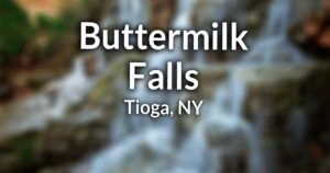 A 50 ft staircase-like cascade on a tributary to Catatonk Creek, north of Owego in the town of Tioga. Easily seed from the roadside. Additional falls are in the glen above, but the property may be posted. A 50 ft staircase-like cascade on a tributary to Catatonk Creek, north of Owego in the town of Tioga. Easily seed from the roadside. Additional falls are in the glen above, but the property may be posted.1 waterfall – Map |
Cornell Hollow Falls | A 30-35 ft cascade in private property in Owego, NY. (approximate location) 1 waterfall – Map |
Waverly Glen Falls | A 40-50 ft cascade and a small 4 ft dam overflow in a village park in Waverly, NY. 2 waterfalls – Map |
10 Must-see Waterfalls Around Ithaca, NY | 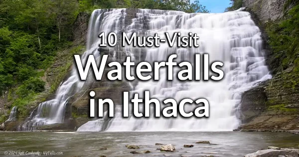 |
Bell Station Preserve | See Cayuga Shores WMA |
Bob Cameron Loop Falls | A very small waterfall on this beautiful natural trail in the Connecticut Hill State Game Management Area. Dries up quick without rain. 1 small waterfall – Map |
Brooktondale Falls | A cascade on Sixmile Creek southeast of Ithaca. It’s possible it’s accessible from the north, but this has not been confirmed. 1 waterfall – Map |
Business Man’s Lunch Falls | See Wells Falls |
Buttermilk Falls State Park | 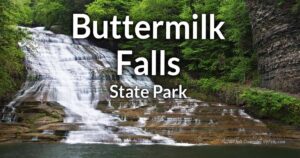 Buttermilk Falls State Park features a steep, rocky gorge where a series of cascades pour into a broad, frothy pool that’s perfect for hiking and swimming. Its Gorge Trail winds past ten waterfalls, natural swimming holes, and scenic overlooks framed by lush woodlands. Buttermilk Falls is 165 ft tall and one of the most beautiful falls in the Finger Lakes Region. Buttermilk Falls State Park features a steep, rocky gorge where a series of cascades pour into a broad, frothy pool that’s perfect for hiking and swimming. Its Gorge Trail winds past ten waterfalls, natural swimming holes, and scenic overlooks framed by lush woodlands. Buttermilk Falls is 165 ft tall and one of the most beautiful falls in the Finger Lakes Region.10 waterfalls – Map |
–Owl Creek Falls | A bit removed from Buttermilk Falls Park gorge trail is this 70 ft high cascade in a narrow tributary gorge. The Owl Creek Trail gets you there. 1 additional waterfall in Buttermilk Falls State Park – Map |
Cascadilla Falls | 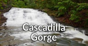 Adjacent to the Cornell campus in Ithaca, and often used by students as a shortcut into College Town, this small city natural area features one spectacular waterfall after another. Adjacent to the Cornell campus in Ithaca, and often used by students as a shortcut into College Town, this small city natural area features one spectacular waterfall after another.9 waterfalls – Map |
Cayuga Shores WMA | 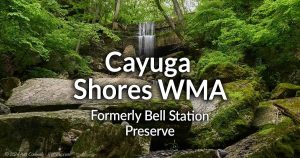 Formerly Bell Station Preserve. 287-acres along the eastern shoreline of Cayuga Lake in Lansing. Seasonal streams form waterfalls along strong layers of Tully Limestone. There are three small streams and 3 large waterfalls. Formerly Bell Station Preserve. 287-acres along the eastern shoreline of Cayuga Lake in Lansing. Seasonal streams form waterfalls along strong layers of Tully Limestone. There are three small streams and 3 large waterfalls.Multiple waterfalls – Map |
Class of ’48 Falls | See Forest Home Falls. |
Coy Glen | This Critical Environmental Area is an important tributary ecosystem near the City of Ithaca. Access is restricted and because of the fragility of the system it is important that access remain limited. Property Access Restricted. Unknown number of waterfalls – Map |
Denison Falls | 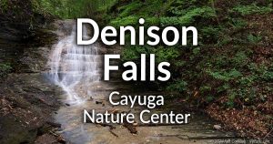 A 20 ft tall cascade on within the Cayuga Nature Center property. An easy hike down a gravel path to the Treetops Treehouse gets you the a great view, but a short creek walk up is the best. A 20 ft tall cascade on within the Cayuga Nature Center property. An easy hike down a gravel path to the Treetops Treehouse gets you the a great view, but a short creek walk up is the best.1 waterfall – Map |
Edward Lake Cliffs | See Pocket Falls. |
Emilie Jonas Falls Nature Preserve |  A short, but steep trail into Gulf Creek leads to a large waterfall of 61 ft in height (55 and 6 ft drops) on Gulf Creek. A seasonal waterfall may also be seen after heavy rain. A short, but steep trail into Gulf Creek leads to a large waterfall of 61 ft in height (55 and 6 ft drops) on Gulf Creek. A seasonal waterfall may also be seen after heavy rain.2 waterfalls – Map |
Fall Creek Gorge | 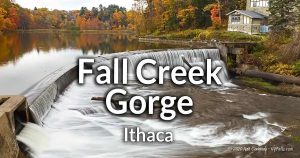 Fall Creek runs through Ithaca, bordering the Cornell campus and slicing through the Portage Escarpment. Ithaca Falls is the first of several large waterfalls along this large waterway. A hike on the Fall Creek section of the Cayuga Trail will give you excellent views of the other 5 waterfalls. The hike will end in a flooded section of the gorge called Beebe Lake. Fall Creek runs through Ithaca, bordering the Cornell campus and slicing through the Portage Escarpment. Ithaca Falls is the first of several large waterfalls along this large waterway. A hike on the Fall Creek section of the Cayuga Trail will give you excellent views of the other 5 waterfalls. The hike will end in a flooded section of the gorge called Beebe Lake.5 waterfalls (4 are covered in the Fall Creek Gorge page. Ithaca Falls has its own page) |
| The Waterfalls of Fall Creek: | |
–Ithaca Falls | 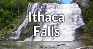 On the north End of Ithaca, west of the Cornell University campus sits this majestic and iconic 150 ft tall cascade. Easily seen from the roadside or a quick walk from the parking area. On the north End of Ithaca, west of the Cornell University campus sits this majestic and iconic 150 ft tall cascade. Easily seen from the roadside or a quick walk from the parking area.1 waterfall – Map |
–Forest Falls | A 20 ft picturesque cascade. 1 waterfall – Map |
–Foaming Falls (Horseshoe Falls) | A 15 ft cascade with a sharply concave crest. 1 waterfall – Map |
–Rocky Falls | A 25 ft cascade in a bend in the creek. 1 waterfall – Map |
–Triphammer Falls | An 80 ft cascade dropping into a bend in the gorge. It’s topped with a man-made dam that forms Beebe Lake. 1 waterfall – Map |
Fischer Old-growth Forest | A few seasonal streams run through this fantastic old-growth preserve outside of Ithaca. At least one sizable waterfall can be seen along the red blaze trail. 1 waterfall (possible more) – Map |
Flat Rock | A stretch of Fall Creek that has an arboretum on one side and wooded trails on the other. The creek is very flat here, but there is a few feet high dam near the parking area, and a very small ledge downstream. People tend to lay on the rocks in summer and wade in the shallow water. Park off of Forest Home Drive. 1 small drop, one man-made dam – Map |
Forest Home Falls | 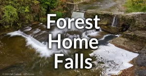 A small decaying mill dam on top of a natural waterfall. Viewable from a historic steel bridge in the Forest Home neighborhood. An additional waterfall can be seen in the distance upstream. A small decaying mill dam on top of a natural waterfall. Viewable from a historic steel bridge in the Forest Home neighborhood. An additional waterfall can be seen in the distance upstream.2 waterfalls – Map |
Frost Ravine Natural Area | A small ravine and creek winds through this nature preserve. While there are no significant falls here, there are several small ledges and low gradients. Several very small drops – Map |
Green Tree Falls | See Potter’s Falls |
Gulf Creek | A long and large gully with 8 waterfalls, including a 100 ft falls. Reported by trusted sources that the lower portion is on Private Property and inaccessible. Two of the upper falls, Rainbow Falls and Emilie Jonas Falls are open to the public. See Emilie Jonas Falls Nature Preserve. 8 waterfalls (2 are viewable) – Map |
Glenwood Creek Falls | An abandoned railroad is a 7 mile stretch from Cass Park in Ithaca and ends with this 20+ ft falls. There is a parking lot for the Yacht Club next to the falls and the restaurant above it, but don’t use those private lots. Current property status is unknown. 1 waterfall – Map |
Indian Chimney Falls | A gully on the Yoga Farm Ithaca is reported to have a 60 ft waterfall Yoga Farm Ithaca is private property, but it looks like from photos on review sites that customers are able to catch a few of at least one other smaller waterfall. Unknown number of waterfalls – Map |
Judd Falls | 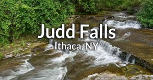 A 12 ft high roadside (Pine Tree Rd) cascade on Cascadilla Creek; upstream from Cascadilla Gorge. Walk to it from the East Ithaca Recreation Way. A 12 ft high roadside (Pine Tree Rd) cascade on Cascadilla Creek; upstream from Cascadilla Gorge. Walk to it from the East Ithaca Recreation Way.1 waterfall – Map |
Lovers Falls | 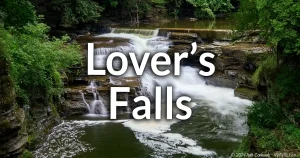 Just upstream from Beebe Lake is a 20 ft tall cascade just a short walk from Cornell’s North Campus. Just upstream from Beebe Lake is a 20 ft tall cascade just a short walk from Cornell’s North Campus.1 waterfall – Map |
Lick Brook Falls | 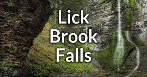 The Finger Lakes Land Trust protects the 128 acres surrounding Lick Brook Gorge in Sweedler Preserve, which contains several small cascades and 3 major falls (approx 25, 50, and 100 ft high). The Finger Lakes Land Trust protects the 128 acres surrounding Lick Brook Gorge in Sweedler Preserve, which contains several small cascades and 3 major falls (approx 25, 50, and 100 ft high).3 large waterfalls and a few small ones – Map |
Little Ludlowville Falls | A 12 ft cascade on a tributary that empties into Salmon Creek downstream from Ludlowville Falls. While this is in a residential area, public fishing access granted by the DEC enables anglers to get to and see this one. Note the access applies to anglers, not photography or hiking. You may get caught for trespassing if you are just sightseeing the falls. Park at the fishing access lot at the end of Mill St. 1 Waterfall – Map |
Lucifer Falls | See Robert H. Treman State Park |
Ludlowville Falls |  A beautiful falls (with a cave) in a park in the middle of a small town southeast of Ithaca. A beautiful falls (with a cave) in a park in the middle of a small town southeast of Ithaca.1 waterfall – Map |
Pleasant Groove Falls | A trail leads downhill through the Renwick Slope Natural Area in east Ithaca. From Renwick Dr to W Remington St, you follow Pleasant Brook, which has low flow, but at least a few decently sized cascade in early spring or after periods of rain. Multiple waterfalls – Map |
Pocket Falls |  Access to the top of of this 35-ft tall falls within Shurger Glen (a part of Gulf Creek), through the Edwards Lake Cliffs Preserve in the town of Lansing. Access to the top of of this 35-ft tall falls within Shurger Glen (a part of Gulf Creek), through the Edwards Lake Cliffs Preserve in the town of Lansing.Multiple waterfalls – Map |
Potter’s Falls | 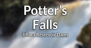 A 25 ft natural waterfall on Six Mile Creek. Along the way, there is an 8ft dam, a 30ft dam, and you may seem some seasonal waterfalls along the gorge. A 25 ft natural waterfall on Six Mile Creek. Along the way, there is an 8ft dam, a 30ft dam, and you may seem some seasonal waterfalls along the gorge.Multiple waterfalls – Map |
Renwick Brook Waterfalls | While surrounded by private property, cascades can be seen from NY-13, and the crest of one from above on Cayuga Heights Rd. Several waterfalls – Map |
Robert H. Treman State Park | 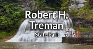 A spectacular gorge containing 11 cascades, including the 115 ft tall Lucifer Falls in the Enfield Glen. This park also offers a natural swimming pool, campgrounds and an historic mill site. Located south of Ithaca. A spectacular gorge containing 11 cascades, including the 115 ft tall Lucifer Falls in the Enfield Glen. This park also offers a natural swimming pool, campgrounds and an historic mill site. Located south of Ithaca.11 waterfalls – Map |
Shindagin Hollow State Forest | This forest located outside of Brooktondale has 4 waterfalls along the trail that stems from the trail head/parking area. The falls are tall and thin and you may want to save this one for after periods of rain. 4 waterfalls – Map |
Shurger Glen | See Pocket Falls |
Sweedler Preserve | See Lick Brook Falls |
Taughannock Falls | 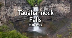 Taughannock Falls plunges 215 feet in a single drop into a narrow gorge, making it one of the tallest waterfalls east of the Rockies. The park’s Gorge Trail offers rim-to-river views through shaded woodlands and a spectacular views. Be sure to explore the upper gorge rim for a view of the upper falls. Taughannock Falls plunges 215 feet in a single drop into a narrow gorge, making it one of the tallest waterfalls east of the Rockies. The park’s Gorge Trail offers rim-to-river views through shaded woodlands and a spectacular views. Be sure to explore the upper gorge rim for a view of the upper falls.Multiple waterfalls – Map |
Twin Glens | Two steep gullies running parallel right next to each other. When water is flowing they are over 100 ft of white water. While on Private property, you can catch a quick glimpse of them from NY-34 on the east end of Cayuga Lake, or by boat. Multiple waterfalls – Map |
Vanbuskirk Gulf | 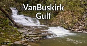 A 25 ft high falls and a 20 ft high falls that I know of. Several smaller waterfalls in this sizeable glen south of Ithaca. Private property. Access to the preserves are via permit only. A 25 ft high falls and a 20 ft high falls that I know of. Several smaller waterfalls in this sizeable glen south of Ithaca. Private property. Access to the preserves are via permit only.Multiple waterfalls – Map |
Van Nattas Cascade | See Wells Falls |
Wells Falls | 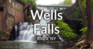 A 65 ft twisting and turning cascade stemming from a man-made dam (20 ft) and falling down 3 drops (totaling 45 ft) on Six Mile Creek. A 65 ft twisting and turning cascade stemming from a man-made dam (20 ft) and falling down 3 drops (totaling 45 ft) on Six Mile Creek.3 waterfalls – Map |
Williams Brook Falls (Lower) | This waterfall emerges from the culvert under Black Diamond Trail near Cass Park in Ithaca. The brook continues under NY-89 towards the Park. 1 waterfall – Map |
Willow Creek Falls | Adjacent to NY-89 in Willow Creek and the crest is possibly visible from the road. It seems to be on Private Property and inaccessible. 1 waterfall – Map |
Awosting Falls | 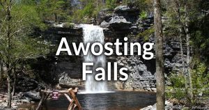 A 65-ft tall plunge down Peters Kill Creek in Minnewaska State Park. Another small waterfall just upstream. A 65-ft tall plunge down Peters Kill Creek in Minnewaska State Park. Another small waterfall just upstream.2 waterfalls – Map |
Blue Hole Falls (Plattekill Clove) | A 8-10 ft waterfall over a solid, but worn, slab of rock with a deep pool below it. In direct sunlight the pool takes on a blue color. It’s found downstream from Red Falls in Plattekill Clove. 1 waterfall – Map |
Buttermilk Falls (at the Buttermilk Falls Inn) | A 30 ft+ high frothy cascade on an unnamed tributary in the hamlet of Milton. The falls is accessible to guests of the Buttermilk Falls Inn & Spa and just just west of the Hudson and Poughkeepsie. 1 waterfall – Map |
Buttermilk Falls (Denning) | 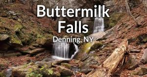 A 40 ft high slender falls in a narrow gorge on Buttermilk Falls Brook, which is a tributary to Rondout Creek (Peekamoose Gorge). A small trail leads from a parking area to the base of the falls. Above the falls are several more drops in a narrow gorge. A 40 ft high slender falls in a narrow gorge on Buttermilk Falls Brook, which is a tributary to Rondout Creek (Peekamoose Gorge). A small trail leads from a parking area to the base of the falls. Above the falls are several more drops in a narrow gorge.Multiple waterfalls – Map |
Glenerie Falls | Multiple small ledges line the wide expanse of the Eposus Creek here. Multiple waterfalls – Map |
Hanging Rock Falls | Nothing is known about this multi-tiered falls on the Beer Kill. Unknown number of waterfalls – Map |
Hidden Falls (Plattekill Clove) | A 4 ft single drop within Plattekill Clove, downstream from Lemon Squeeze Falls. 1 waterfall – Map |
Horseshoe Mine Falls | 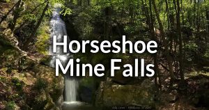 A 60 ft tall sliding cascade that ends with a plunge over an entrance to an old mining exploratory tunnel. The tunnel is quite deep. Parking is roadside just a few hundred feet away on Lewis Rd. A 60 ft tall sliding cascade that ends with a plunge over an entrance to an old mining exploratory tunnel. The tunnel is quite deep. Parking is roadside just a few hundred feet away on Lewis Rd.1 waterfall – Map |
Lemon Squeeze Falls (Plattekill Clove) | A small 3-4 ft drop along Plattekill Clove, downstream from Blue Hole Falls. 1 waterfall – Map |
Marlboro Falls | 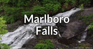 A segmented cascade of about 100-135 ft in total height located next to the Falcon music venue. A segmented cascade of about 100-135 ft in total height located next to the Falcon music venue.1 waterfall consisting of 3 distinct segments (2 of which are visible) – Map |
Millstream Swimming Hole (Woodstock) | A once-popular swimming hole on Saw Kill in Woodstock, has several 1-2 ft drops and sizable pools for wading. Disrespectful social-media driven crowds has driven the owners to close the spot to the public. Now only guests of the The Woodstock Inn on the Millstream are allowed access. Multiple small drops and pools – Map |
Nevele Falls | A 50 ft. drop on the grounds of Nevele Grande Resort and Country Club. A visitor to the CC may be able to gain access to view the falls. (Private Property). 1 waterfall – Map |
Plattekill Clove | Often erroneously called “Platte Clove” (which is the name of the old settlement on the west end) Plattekill Clove is a very steep ravine mostly in the town of Hunter, Greene County, but ends in Saugerties, Ulster County. This is also where hikes up the gorge tend to start. The Clove, which was carved out by Kaaterskill Creek, features several large waterfalls, some of which are in the top 10 largest in the state. Unfortunately, getting to the majority of involves a dangerous hike, with climbing, risk of flash floods, and no maintained trails. I have listed the known waterfalls in the clove separately in their respective counties. |
Shawangunk Ridge Forest (Waterfall on the Yellow Trail) | A cascade of about 50-ft over on a small unnamed brook. The waterfall is over rocks arranged almost like shingles. 1 waterfall – Map |
Stony Kill Falls | A 90 ft plunge down Stony Kill in Minnewaska State Park. 1 waterfall – Map |
Unnamed Cascades of Lower Plattekill Clove | Downstream from Hidden Falls, Plattekill Clove has several smaller falls where the land begins to level off as Kaaterskill Creek reaches West Saugerties at Becker Rd. These range from 3-10 ft high. 4 waterfalls – Map (approximate) |
Verkeerder Kill Falls | An estimated 70 ft falls in Sam’s Point Preserve. 1 waterfall – Map |
Vernooy Falls | A 20-30 ft staircase falls on Vernooy Kill, just outside of Kerhonkson. 1 waterfall – Map |
Bakers Falls | A dam on the Hudson in Glens Falls, NY emphasizes this irregular 60 ft drop. 1 waterfall – Map |
Bear Slide | Buttermilk Brook slides 50 ft down a massive slab of bedrock then plunges into a shallow pool. Yes, people do slide down this. 1 waterfall – Map |
Buttermilk Falls | See Bear Slide |
Clay Meadow Falls | A 20 ft seasonal falls near the Clay Meadow trailhead near Northwest Bay Brook. 1 waterfall – Map |
Crane Mountain Falls | A moderately sloping cascade stemming from Crane Mountain Pond at the top of Crane Mountain. 1 waterfall – Map |
Curtis Falls | Visible from Saratoga County. |
Dunkley Falls | A 10 ft fall with a large bolder at the base. Picnic facilities are on the premises and the Black Hole swimming area is nearby. 1 waterfall – Map |
Glens Falls | A large, irregular falls with many potholes and an undefined crest. In the center of the city of Glens Falls on the Hudson River. 1 waterfall – Map |
Jessup’s Great Falls | See Palmer Falls |
Great Falls | See Glens Falls |
Mill Park Falls | A few small cascades in a Lake Luzerne village park. 2 waterfalls – Map |
Northwest Bay Brook Falls | A 25 ft and an 8 ft high falls on Northwest Brook, North of Lake George. 2 waterfalls – Map |
Oregon Trail Falls | See Stewart Creek Falls. |
Palmer Falls |  A 70 ft high man-made dam and cascade at the site of a historic paper mill on the Hudson in Corinth, NY. Visible from the hillside on the Warren County side of the river. A 70 ft high man-made dam and cascade at the site of a historic paper mill on the Hudson in Corinth, NY. Visible from the hillside on the Warren County side of the river.1 waterfall – Map |
Rockwell Falls |  A 10-12 ft high horseshoe falls on the Hudson, just before it meets with the Sacandaga in Hadley and Lake Luzerne, NY. A 10-12 ft high horseshoe falls on the Hudson, just before it meets with the Sacandaga in Hadley and Lake Luzerne, NY.1 waterfall – Map |
Shanty Brook Falls | A hike of less than an hour will lead to this beautiful 12 ft plunge into the Shanty Gorge, a tributary to east branch of the Sacandaga River. 1 waterfall – Map |
Square Falls | A 7 ft falls on the east branch of the Sacandaga River, Southwest of Baker’s Mill. 1 waterfall – Map |
Stewart Creek Falls | A snowmobile trail leads you to this pleasant scene with a small cascade, wooden bridge, gorge, and marshland near Cod Pond. 1 waterfall – Map |
Wing Falls | See Glens Falls |
Kane Falls | Nothing is known about these falls on Halfway Creek. (Private Property) Unknown number of waterfalls – Map |
Shelving Rock Falls | A 70 ft waterfall at the base of Shelving Rock Mtn. near Lake George. A pothole halfway down makes for a great swimming spot. 1 waterfall – Map |
Westchester County and the City of Peekskill
There are no waterfalls listed for this county at this time.
Alasa Farms (Second Creek Falls) | The Genesee Land Trust and Cracker Box Palace manage this property which is part animal rescue and part preserve. Nature trails are by appointment. The trails feature one man-made falls under Red Mill Road on Second Creek. There are more falls upstream (natural ones) but they seem off-trail. Hiking is by appointment. Multiple falls? – Map |
Martensia Falls | Two small set of cascades on Mud Creek in the southwest corner of the town of Farmington, west of the hamlet of Martensia. Both sets appear to be bordered on all sides by Private Property. The set upstream can be seen from the CR-21 bridge. Multiple Waterfalls – Map |
Maxwell Creek Falls | 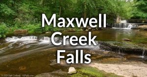 A 15 ft high falls consisting of 3 steps Salmon Creek, at an old mill site. Located just south of Camp Beechwood State Park in the town of Sodus. A 15 ft high falls consisting of 3 steps Salmon Creek, at an old mill site. Located just south of Camp Beechwood State Park in the town of Sodus.1 waterfall – Map |
Palmyra-Macedon Aqueduct Falls |  This Erie Canal-side park has one beautiful man-made falls. This 15 ft high stone crafted falls varies in flow as the nearby Lock 29 is utilized. This Erie Canal-side park has one beautiful man-made falls. This 15 ft high stone crafted falls varies in flow as the nearby Lock 29 is utilized.1 waterfall – Map |
Wolcott Falls | 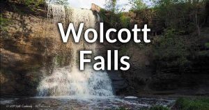 A 34 ft tall falls located in a public park within the village of Wolcott. A 34 ft tall falls located in a public park within the village of Wolcott.1 waterfall – Map |
Angel Falls | Angel Falls may be on private property. See Java Falls. |
Cascades of Attica |  A creek walk up Crow Creek through the Attica town watershed. A tough hike, but short and rewarding. (Private Property, but accessible). A creek walk up Crow Creek through the Attica town watershed. A tough hike, but short and rewarding. (Private Property, but accessible).3 waterfalls – Map |
Cascade Falls | I’m lacking information about this waterfall on Cascade Brook near the village of Wyoming. Unknown number of waterfalls – Map |
Crow Creek Dam and Falls |  A 10 ft tall man-made dam and a 4 ft tall natural waterfall on Crow Creek, south of Attica. Easily seen from the roadside. A 10 ft tall man-made dam and a 4 ft tall natural waterfall on Crow Creek, south of Attica. Easily seen from the roadside.1 man-made dam, 1 natural waterfall – Map |
Crystal Brook Falls | See Warsaw Falls |
Glade Creek Falls |  A 16 ft high cascade in two segments on the north end of Strykersville. Private Property, but easily seen from Dutch Hollow Drive. A 16 ft high cascade in two segments on the north end of Strykersville. Private Property, but easily seen from Dutch Hollow Drive.1 waterfall – Map |
Java Falls |  There are 3 waterfalls on Beaver Meadow Creek in Java Village. Java Falls is the one visible by the roadside. Two are further upstream, one of which is commonly known as ‘Angel Falls’, but access to these upstream falls is not confirmed. There are 3 waterfalls on Beaver Meadow Creek in Java Village. Java Falls is the one visible by the roadside. Two are further upstream, one of which is commonly known as ‘Angel Falls’, but access to these upstream falls is not confirmed.3 waterfall – Map |
Johnson Falls | On Johnson Creek near Attica. Approximately 30 ft high. 1 waterfall – Map |
Johnson Falls | A 70 ft high steep cascade with smaller falls along Sheldon Creek. (Private Property) 3 waterfalls – Map |
Letchworth State Park | Letchworth State Park—nicknamed the “Grand Canyon of the East”—spans a 20-mile gorge carved by the Genesee River, with towering sandstone cliffs rising up to 600 feet and three dramatic waterfalls (Upper, Middle, and Lower Falls) plunging into the canyon below. Visitors can hike over 66 miles of trails, explore historic stonework and bridges built by the Civilian Conservation Corps, picnic at scenic overlooks, raft Class III rapids, or camp in wooded sites, all while enjoying panoramic views and lush forests. Over 20 waterfalls – Map |
Rock Glen | Several falls ranging from 10-15 ft in height in the village of Rock Glen near Silver Lake. (Private Property) Multiple waterfalls – Map |
Warsaw Falls |  Several falls, including an 80 ft cascade tumbling down from a railroad culvert. (Accessible, but possibly private- obey signs) Several falls, including an 80 ft cascade tumbling down from a railroad culvert. (Accessible, but possibly private- obey signs)Multiple waterfalls – Map |
Bruce’s Gully | Several falls lie in this gully which is a tributary to the Keuka Outlet. (Private Property). Multiple waterfalls – Map |
Cascade Mills Falls | 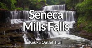 A 20 ft cascade on the “Friends of the Outlet” trail in Penn Yan. See also Seneca Mills Falls. A 20 ft cascade on the “Friends of the Outlet” trail in Penn Yan. See also Seneca Mills Falls.1 waterfall – Map |
Deep Run Gully | Multi-branching gully on the east shore of Canandaigua Lake. (Private Property) Multiple waterfalls – Map |
Clark Gully (Upper) | 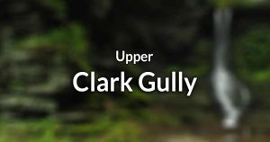 A steep and difficult climb down this series of large cascades in a far less accessible section of the gorge. The Lower gully is a far easier hike. It’s located in the beautiful High Tor WMA area in the town of Middlesex. A steep and difficult climb down this series of large cascades in a far less accessible section of the gorge. The Lower gully is a far easier hike. It’s located in the beautiful High Tor WMA area in the town of Middlesex.Multiple waterfalls – Map |
Clark Gully (Lower) | 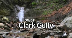 A steep creek-walk leads to the bottom half of this gully and to the base of an 18 ft cascade with a 7 ft one just above it. It’s located in the beautiful High Tor WMA area in the town of Naples. A steep creek-walk leads to the bottom half of this gully and to the base of an 18 ft cascade with a 7 ft one just above it. It’s located in the beautiful High Tor WMA area in the town of Naples.Multiple waterfalls – Map |
Conklin Gully | 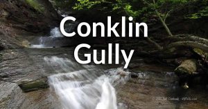 Multiple cascades along this undeveloped gully in the Hi Tor Wildlife Management Area in Naples. Some climbing will be needed to see them all. Multiple cascades along this undeveloped gully in the Hi Tor Wildlife Management Area in Naples. Some climbing will be needed to see them all.Multiple waterfalls – Map |
Eggleston Glen | A steep 100 ft cascade in this tributary to Keuka Lake on the East Branch. (Private Property) 1 waterfall – Map |
Glenora Falls |  A 90 ft cascade at the end of Big Stream on the west side of Seneca Lake. It’s on Private Property, but you can see it from the road or book an event on the property. A 90 ft cascade at the end of Big Stream on the west side of Seneca Lake. It’s on Private Property, but you can see it from the road or book an event on the property.1 waterfall – Map |
Kashong Glen | A large tributary to Seneca Lake containing numerous large waterfalls. (Private property) Multiple waterfalls – Map |
Mays Mills Falls | See Cascade Mills Falls |
Parrish Glen | See Conklin Gully |
Rock Stream Falls | An estimated 90 ft cascade at the end of Rock Stream on the west side of Seneca Lake. (Private Property) 1 waterfall – Map |
School No. 7 Gully | Not much is known about this gully. It is believed to hold several small falls as well as one in excess of 60 ft. (Private Property). Multiple waterfalls – Map |
Seneca Mills Falls | A 41 ft cascade on the “Friends of the Outlet” trail in Penn Yan. See also Cascade Mills Falls. 1 waterfall – Map |
Triphammer Falls | On Conesus Creek, south of Avon. (Accessibility Unknown) 1 waterfall – Map |
West Italy Hill Falls |  A steep climb along the Bristol Hill Branch of the FLT, gets you a glimpse of this 30 ft waterfall. Climbing up this super-challenging ravine yields a better view and more falls, but is not advised. A steep climb along the Bristol Hill Branch of the FLT, gets you a glimpse of this 30 ft waterfall. Climbing up this super-challenging ravine yields a better view and more falls, but is not advised.Multiple waterfalls (1 viewable from the trail) – Map |
Special thanks…
Thanks to Kelly Lucero, Chris Babcock., Matt Champlin., Kyle Hobart, Loren, George, and our community members for help building and updating this list.
Some resources
These books and websites are what I find to be helpful when fact-checking and researching:
- nnywaterfalls.com : great research on history and colloquial names. While I haven’t gotten to visit many of the falls this site focuses on, this would be my go-to resource. I need to order those books at some point.
- cnyhiking.com : I don’t use it much for finding waterfalls, I just love it for general hiking. Lots of interesting stuff
- bobbieswaterfalls.net : amazing how many falls Bobbie has visited. Information is lacking and some names/locations are wrong.
- natualhighs.net : the original waterfall site for NY, but long since it’s been updated.
- falzguy.com : an old site that still gets updates. Lots of very unique images of waterfalls in western NY. He also has a scientific approach that I enjoy.
- digthefalls : they have a lot of waterfalls listed but many are inaccurate, with pretty much anything of any height listed as a waterfall. Some are even dangerous places to visit (such as Brownfield sites). Seems like quantity over quality. Hard to find good info because a lot of pages are just empty.
- Rich and Sue Freeman: Some of the best guide books ever.
- Russell Dunn : His series of books don’t really cover my region, which is a shame. He does extensive research and his books are great for local history fans. He inspired me to collect old postcards. All his books are worth owning.
- world-of-waterfalls.com : Quantity over quality. I find it no better than a USGS map. It has improved recently.
- worldwaterfalldatabase.com : It’s basically a database of falls from official maps, expanded with anything anyone reports. It’s a little messy with duplicates and ancient names, but it’s comprehensiveness is why it’s an essential resource.
- Facebook group : Sometimes I reference pics with people in them from Facebook to estimate heights of falls. Other than that, Facebook is is just a mess.
- Wikipedia: eh. If there’s information there it’s just “borrowed” from the references and often simplified. Find the references and look there.
- Instagram: not a great resource at all unless you want to see what that waterfall looks like with someone doing yoga in front of it.
* Best guess location.
