Royalton Falls (Gasport)


Location: Within Royalton Ravine County Park; hamlet of Gasport; town of Royalton; Niagara County; New York.
Maps: Google Map; Topographic; Interactive map.
GPS Coordinates:
- Park entrance: N 43.18636 / W 78.57523
- Falls in the East Branch of Eighteenmile Creek: N 43.18155 / W 78.58617
- Falls on the southern tributary: N 43.18234 / W 78.58195
Directions: From the west, take NY-31 (Rochester Rd) east, through Lockport, and into the hamlet of Gasport. Turn right onto Gasport Rd (CR-10) and head south for a half mile. You will pass some houses on your right and shortly after you will see a brown sign for the park and a gravel parking area. Turn right.
From the east, NY-31A west will take you to NY-31 and into Gasport. Turn left onto Gasport Rd. (CR-10) and head south for a half mile to the park, which will be on your right.
Or use Google Maps.
Parking: Right at the entrance off of Gasport Rd, the park has 1.5 lots available to visitors (the northern lot is shared with the park maintenance). There’s room for over 20 cars. The park may get packed on summer holidays.
Weather
Information / Accessibility / Accommodations
Number of falls: 2
Size/Types: The main falls on the East Branch of Eighteenmile Creek (often referred to as Nortons Falls) is a sloping cascade of roughly 15 ft high, over thin layers of shale. A larger, nearly 25 ft high waterfall can be found in a southern tributary. It is of similar construct.
(Several sources seem to have the sizes of these falls swapped).
Best time to visit: Spring.
Flow: Low. Tends to dry out by summer.
Waterway: The East Branch of Eighteenmile Creek, which starts out to the southeast at Gilberts Corner. From there it heads west about 4.5 miles and then turns northeast at Terrys Corners. At the park, it’s cutting through the Niagara Escarpment, the very same that formed Niagara Falls, and led to the massive set of canal locks being constructed at the Lockport Flight of Five. It flows under the Erie Canal at Gasport and continues north. Here the waters are considered a Great Lakes AOC (Area of Concern) due to high levels of PCBs, DDT, mercury, and other contaminants. In 2006 Eighteenmile Creek was included in the NYS List of Impaired Waters. That said, you should probably avoid spending time in the water and certainly avoid eating any fish you may catch here. North of Gasport, the creek turns left, joining (the main branch of) Eighteenmile Creek, just north of Lockport. It then passes through Newfane, eventually emptying into Lake Ontario near Olcott Beach.
Time: About an hour.
Seasons/Hours: 7am to 9pm. Memorial Day weekend through September.
Admission: Free.
Handicap Accessibility: These trails are dirt paths with varying levels of incline.
Pets: Allowed on a leash.
Accommodations: Trails; pavilion; restrooms; baseball diamond; fishing pond.
Description
AKA: Royalton Ravine; Victor A. Fitchlee Park; Nortons Falls
Royalton Ravine Park is a family picnic park at the south end of Gasport, a hamlet along the Erie Canal. With open fields, a fishing pond, and a few miles of wooded trails, the park hugs an ancient glacial ravine over the Niagara Escarpment and is home to two waterfalls.
Norton Falls, on the East Branch of Eighteenmile Creek, is what most visitors hike to. It is a 15 ft cascade in a heavily wooded area. Views from the trail are limited to above, but a creek walk to the base of the falls is possible for better views. A tributary from the south creates a taller cascade, which very few are aware of, let alone trek to visit. The problem with these falls is that the flow can be pretty low at times. Come in the wet season and it tends to be very muddy. So if you don’t mind getting dirty on a short hike, and love a little exploration to find the hidden falls, this may just be the waterfall hike for you.
History
The ravine here is carved out of the Niagara Escarpment, the same rock ledge that created Niagara Falls. The falls here are quite a bit smaller, mostly due to the scale of the escarpment in the east, which is much smaller than it is at Niagara. 10,000 years ago, the pre-historic Lake Tonawanda sat above the Niagara Escarpment stretching from Buffalo to Medina. Overflow from Lake Erie would fill Lake Tonawanda, which would in turn, spill over the escarpment into Lake Iroquois (a prehistoric Lake Ontario). One of the largest outlets of Lake Tonawanda was this ravine.
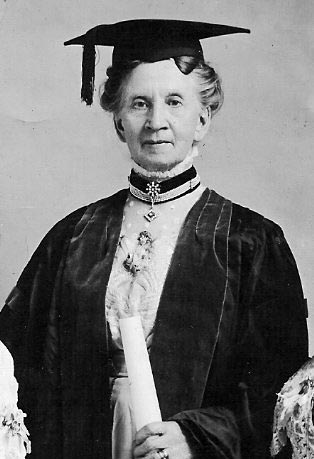
Belva Ann Bennett Lockwood (October 24, 1830 – May 19, 1917) was a Royalton native, who become one of the first female attorneys in the United States and the first woman to argue a case before the US Supreme Court. A woman’s rights activist and suffragist, Lockwood ran for US President on the 1884 and 1888 ticket under the National Equal Rights Party. I could go on about all the positions she held, careers she held, and ceilings she shattered. She was an amazing person and political pioneer. You should definitely give this a read.
Belva Lockwood’s husband, Uriah McNall, owned a sawmill on Eighteenmile Creek. After passing away following a mill accident, Belva ran the mill for a number of years after his passing. The home/mill ruins in the park (near the falls) are typically known as the Belva Lockwood Homestead, although it is unconfirmed if she actually lived and worked here. An 1875 map has the property under the ownership of F. C. Odell. 1908 map shows this home and mill under the ownership of Mrs. A. L. Clark. The closest McNall-owned residence in the area is south of Gasport in a place called McNalls (formerly McNalls Corner).
Hiking / Walking Trails
Difficulty: Moderate. Some steps and inclines. Some areas may be muddy. There are many exposed roots. Wear appropriate footwear and keep an eye on where you are stepping.
Markings: Color-blazed trail. Note that the park may have changed some of the trail colors over the years. I have also heard the trail-map in the park is pretty inaccurate. Older sources have the red and blue trails leading to Royalton Falls. Most recent online sources have the red trail leading all the way, which makes a lot more sense. The park sign and blazes tell a different story. Many trails are not marked, and the trail to the falls is orange. The description below should help make sense of it all.
Distance: About a mile one way.
Description:
The easiest access: There is a trailhead just west of Royalton Falls off of Kayner Rd. Parking would be roadside, and there’s not much space. But you can enter the orange trail and take that to the top of the falls. Not very immersive, but quick.
Through the park: From the parking lot, head west on the gravel path towards the fishing pond. Pass the pond on your left and head for the tree line.
At the tree line, enter the orange blazed trail. It’s a wide, well-groomed dirt trail. Keep on this, ignoring any of the smaller spur trails that branch from it. Very shortly you will hit a T. Going left brings you back to where you came from. Take a right here.
Just before a quarter mile, you will hit a T in the trail. The right goes north to a viewing area at the creek (and no waterfalls). Go left and pass a junction with a blue blazed trail on your left. Keep on the orange trail, which will descend wooden stairs and head south as it reaches the creek.
At about a third of a mile, you will reach a wood plank and cable bridge crossing the creek. You have a choice:
A: Cross it and continue along the orange trail to the top of Royalton Falls.
B: Walk the creek for a half-mile to get to the base of Royalton Falls AND take a side trip up the tributary gorge to the second falls.
Option A (the trail): Cross the bridge and continue on the orange trail, which widens up and will get muddy. You will pass a yellow trail that heads north. Stay on the orange trail as it heads south with the creek on your left.
Just before the falls, you will pass the ruins of the Belva Lockwood Homestead.
The falls will be at about 4/5 mile in. You will only have access to the top of the falls via this route.
Option B (creekwalk): From the bridge, head upstream. The creek winds back and forth through the ravine, often leaving some larger fords for easier navigation without walking wet the whole time.
At about 600ft in there will be a Y in the gorge. To the left is an unnamed tributary. If flow is high enough, it may be worth the 400 ft hike up this tributary to check out the waterfall at the end. When done, backtrack to this junction.
Continue along Eighteenmile creek for another 1/5 of a mile to reach the base of Royalton Falls.
Go back the way you came.
Map: Interactive.
Royalton Ravine Park Interactive Map
Royalton Falls Media
Videos

Contributor Photos & Art
At this time I have not been able to get out to this site and photograph yet. In the meantime, those with suitable photos or original works of art, that would like to be featured here, please contact me. Photos, paintings, and illustrations would be subject to quality review, and not all will be accepted. Your work can be accompanied by a link to your site/store/insta.
Interesting Stuff
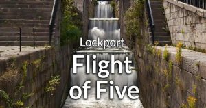
Lockport Flight of Five
The Niagara Escarpment also passes through Lockport in the west, which made it a challenge to raise barges all the way up. How did they do it? Read more here.

Who to Contact
Niagara County Parks & Golf Courses
Royalton Ravine Park
Gasport Road, Gasport, NY 14067
716-772-2016
[email protected]