Snook Kill Falls


Access note: In August of 2024, I received updated information that the falls, including pathways leading to it are on private property and that the owner does not allow access. You should not seek out to violate the rights of property owners, as you could put your safety and their privacy and peace at risk. Enjoy the photos and information left here for archival purposes and seek out other beautiful waterfalls in Saratoga County. Do Not Trespass.
Location: About 4 miles north of Saratoga Springs; hamlet of Kings Station; town of Wilton; Saratoga County; New York
Maps: Google Map; Topographic; Interactive map.
GPS Coordinates: Waterfall: N 43.15267 / W 73.77260
Trailhead: N 43.15258 / W 73.77334
Directions: From Saratoga Springs, take US-9 (Saratoga Rd) north for about 4 miles to Kings Station. Turn left onto Parkhurst Rd and follow that northwest for 1/3 mile. Turn left onto Greenfield Rd. Continue on Greenfield Rd until you reach a bend. There will be an intersection with Strakos Rd at the apex of this bend. Find roadside parking near this intersection. Or use Google Maps.
Parking: Only roadside parking for a few cars is available. Be mindful of traffic coming around this bend.
Weather
Information / Accessibility / Accommodations
Note: These falls are on private property and no longer accessible.
Number of falls: 1
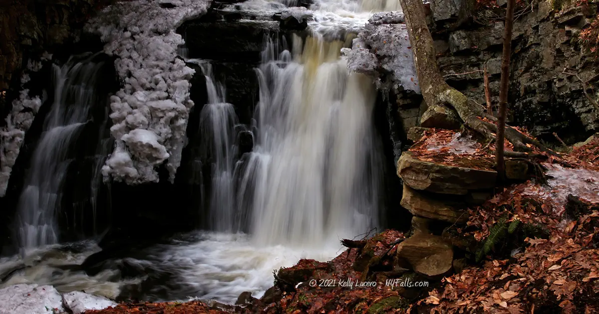
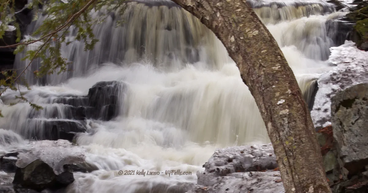
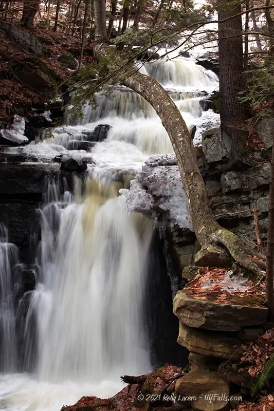
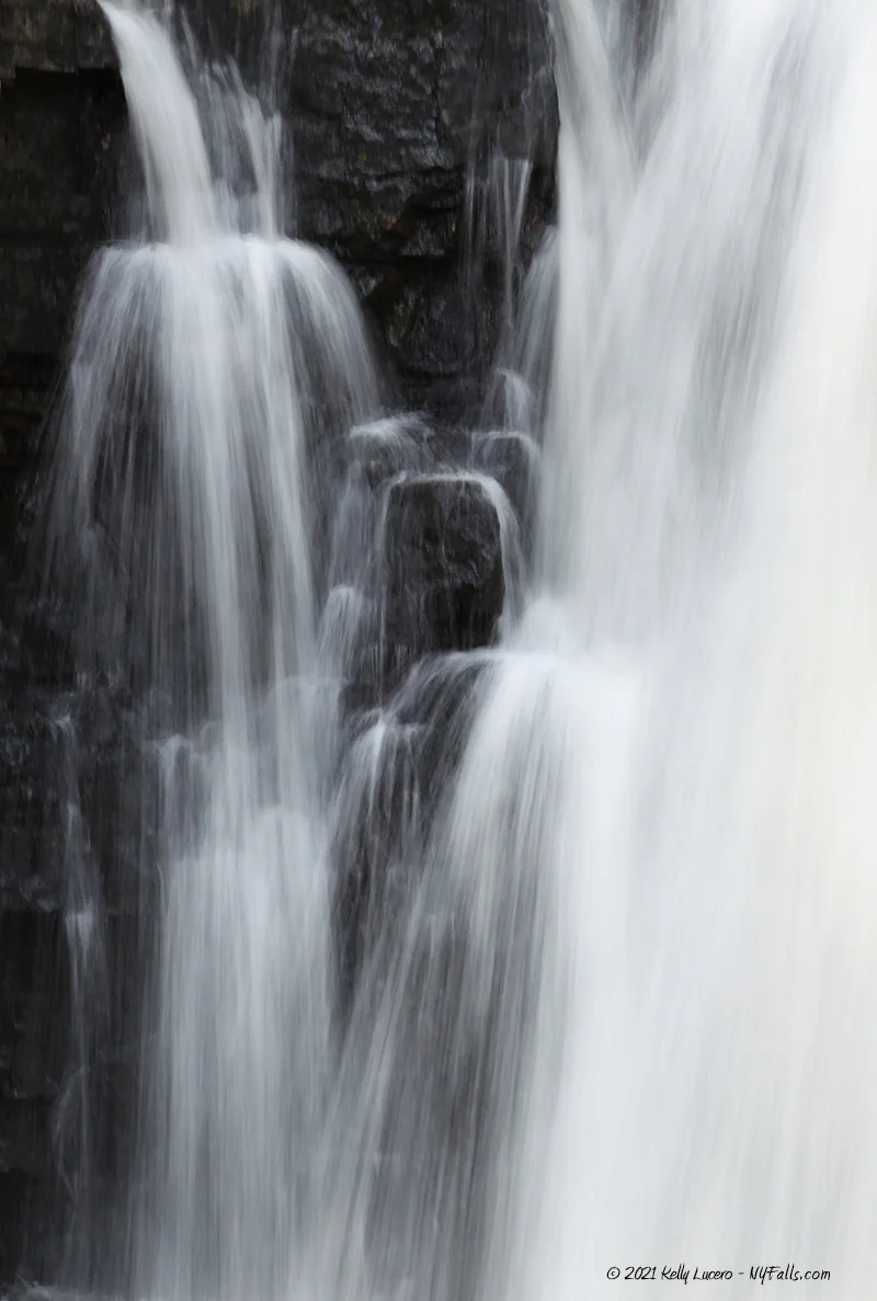
Size/Types: A 50-60 ft cascade that starts out with a series of steps for the first half and then a very steep cascade the second half. Below the falls are several small drops and rapids.
Best time to visit: Spring, Fall, and Winter (with caution). It may dry up by mid-summer.
Flow: Low to moderate.
Waterway: Snook Kill, which starts out about 2 miles west of here in marshlands in the town of Greenfield. Once over the falls, it heads northeast about 10 miles and empties into the Hudson River just south of Fort Edward.
Time: About 30 minutes in and out.
Seasons/Hours: No hours set.
Admission: Free.
Handicap Accessibility: None. Some of the falls may be visible from the roadside.
Pets: No rules are posted, but it is not advised to bring your pet due to unsafe conditions.
Accommodations: None.
Description
Snook Kill Falls is an alluring cascade tucked within a small wooded pocket gorge that can be found just 4 miles north of Saratoga Springs. While there are no markings, barely signs of a trail, and the short journey from the road to the falls could be dangerous for some, enthusiasts taking up the the quick challenge will most likely love it. It’s easy to get to if you are in the area, secluded, and not heavily trafficked.
The falls itself is unique with its variable steps and steepness, topped by the Greenfield Road bridge. In high flow a ribbon or two of wispy water tends to shoot out from the left side. Framed by gray jagged limestone, when composed right, the falls can be highly photogenic.
Downstream Snook Kill continues to tumble over small ledges and wind around fallen stone from the high cliffs above.
History
Battle of Wilton
Just a short distance east of here, near Gailor and Parkhurst Road, the Battle of Wilton took place on Feb 17, 1693. A part of the Nine Years War (1688-1697) an expedition of 625 men (including Canadians of various native tribes) led by the French, travelled from Quebec to the Mohawk Valley with the intent of disabling the Mohawk Native American forces in New York. They rampaged 3 Mohawk towns and took hundreds of prisoners.
The French forces began the journey back north to Quebec, prisoners in tow, stopping here along the way. The Albany County Militia, commanded by Major Pieter Schuyler, joined up with the Mohawk survivors and neighboring Oneida survivors (totaling about 500 men) and began pursuit. They constructed a fort, amidst a cold winter, near the French.
After 3 attacks, the French were unable to overcome the Albany Militia. Supplies were running out and there are some reports of individuals resorting to cannibalism. The French eventually retreated leaving 33 casualties, while the local forces lost only 4. While this battle was considered a victory for the colonists and their allies, it is far outweighed by the total destruction of the French campaign.
Orra Phelps
Orra Almira Phelps (10 September 1895-26 August 1986) was a veteran physician, botanist, naturalist, mountaineer, and educator in Saratoga Springs. While mostly known for her work documenting the High Peaks Region, including the first trail guide, she often explored the natural areas around Saratoga. A wildlife preserve just north of here, where she used to explore and enjoy birding, is named in her honor.
Hiking / Walking Trails
Access note: In August of 2024, I received updated information that the falls, including pathways leading to it are on private property and that the owner does not allow access. I have yet to verify this information, but you should not seek out to violate the rights of property owners, as you could put your safety and their peace at risk. Enjoy the photos and information here and seek out other beautiful waterfalls in Saratoga County.
Difficulty: The steep scramble downhill and lack of maintained trails, while short, make this a difficult one.
Map: Interactive.
Snook Kill Falls Interactive Map
Snook Kill Falls Media
Videos


Who to Contact
No contact information available