Churchville Dam


Location: in the village of Churchville; Town of Riga; Monroe County; New York.
Maps: Google Map; Topographic; Interactive map.
GPS Coordinates: Churchville Dam: N 43.10479 / W 77.88266
Parking area and ramp to observation deck: N 43.10467 / W 77.88316
Directions: From Rochester:
- Take I-490 west to Exit 3 Churchville.
- Make a right (North) onto S Main St (NY-36) and follow for 0.7 miles into the village.
- Turn Right onto East Buffalo St.
- Within a few hundred feet you will see the bridge. Just before the bridge, turn into the parking area on the left.
From Batavia and points west:
- Take NY-33 east all the way to the dam in Churchville.
Use Google Directions.
Parking: The parking lot at the dam has room for 9 cars and it’s rarely full. Overflow parking can be found across the street at the village offices.

Weather
Information / Accessibility / Accommodations
Number of falls: 1
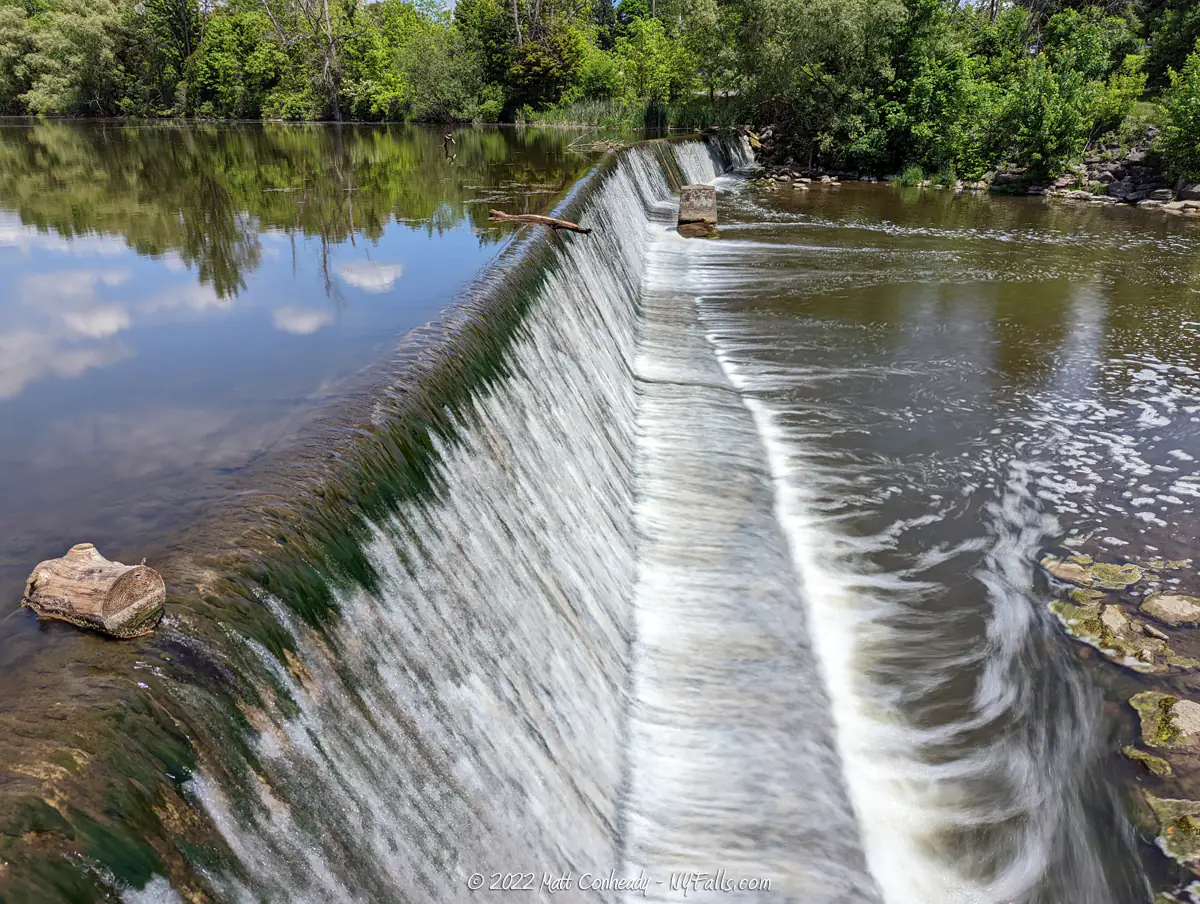
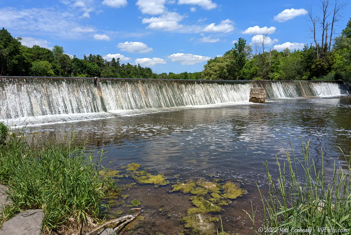
Size/Types: A man-made dam that is about 6 ft high and 180 ft across. It is illuminated at night, taking on festive colors during the holidays.
Best time to visit: Year-round and at night to see it illuminated. By late July the flow dips and the algae rises to unpleasant levels.
Flow: Moderate. It can be a trickle by late summer.
Waterway: Black Creek, a major tributary to the Genesee River. Black Creek originates quite a ways southwest of here in the town of Middlebury in Wyoming County. From there, it flows north between Batavia and Leroy and then swings east through the Byron Swamp towards Churchville. It continues meandering eastward through the town of Chili towards Rochester, emptying into the Genesee River in the town of Henrietta. The Genesee flows north to Lake Ontario.
Time: A few minutes to park and walk around, or just drive by slowly to see it from the road.
Seasons/Hours: Day and night, year-round.
Admission: Free.
Handicap Accessibility: Viewable from the sidewalk. The observation platform has a ramp.
Pets: Leashed pets are allowed.
Accommodations: Fishing is allowed here. Kayaks can be launched here. A few restaurants and shops are located within walking distance in the village. No public restrooms.

Description
The Churchville Dam is a relatively modern concrete dam of early 20th century design built to replace older dams that powered mills. It’s not large compared to others in the area, and it has no intrinsic design that separates it from the other rural/suburban creek dams in the region. It is now surrounded by a small park and has a viewing platform approximately where an historic mill once stood. The pond it holds back is a popular spot for casual fisherman and the area is quite peaceful despite its proximity to NY-33. What does make this otherwise common dam a worthy sight is that it is illuminated at night, taking on festive colors for each season.
History
In 1807, the town of Northampton was formed from a part of the Pulteney territory. A year later the towns of East and West Pulteney were formed. They eventually became the towns of Riga and Chili. In 1808, Samuel Church, of Massachusetts, built the first saw mill in the town, to the north of the village. In 1811, he constructed a flour mill on the site where the dam is now, the first west of the Genesee River. At this time, the “Buffalo Road” was constructed, facilitating east-west traffic from Rochester and bringing in travelers from east-west, bolstering the new settlement’s economy, but only for a short time. The war of 1812 broke out and Samuel Church fought as a captain until 1815. In 1818 he constructed a third mill about three miles to the south of the village. Sometime after that a distillery was constructed by John Crocker on the west bank of the creek, adjacent to the mill. A second distillery was built by Erastus Sprague next to the first one a few years later.
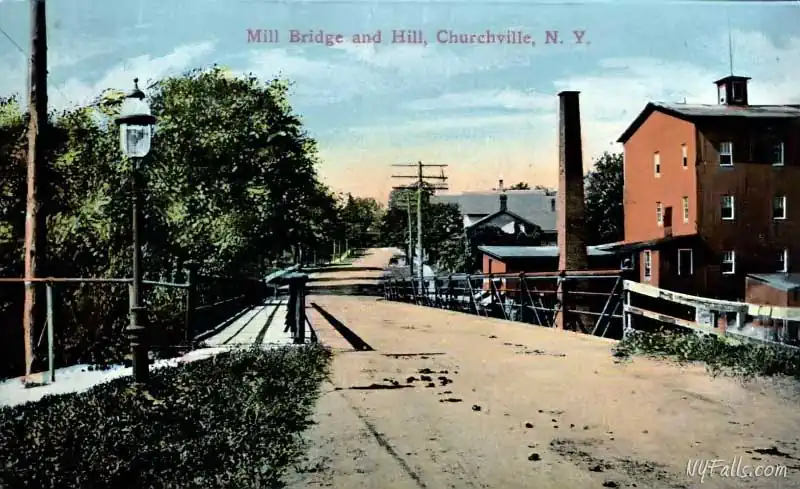
The Tonawanda railroad reached the village in 1837, bolstering Churchville’s growing flour industry. The village of Churchville was incorporated on September 21st, 1852, although a few sources claim it was official on its first election of March 7, 1855. In 1884, George Harmon purchased Samuel Church’s village four mill and converted it to operate it off of steam power. The mill was sold again in 1887, this time to Charles Sage and Frank Potter. It burned to the ground the following year. In 1888, Sage and Potter rebuilt bigger, with a new mill that could produce up to 15,000 pounds of flour per day. In the early 1900s they purchased a plot of land south along Main St, closer to the rail line, and by 1914 launched a new gas-generator-powered, modern facility.
The Main Street mill changed hands several times and was once operated by Agway. Agway sold the mill to Star of the West Milling Company (out of Frankenmuth, MI) in May of 2000. They have since added 4 towering modern grain silos to the site. It runs 24 hours a day, 7 days a week. Where does this flour go? A majority of it goes to large baking franchises on the east coast, such as Dunkin’ and Freihofer’s.
The old mill site along the creek was eventually replaced with a modern dam and small hydro-power facility which was located where the observation platform now stands. I could not find a date for when this plant was removed or when this small park replaced it.
Hiking / Walking Trails
Difficulty: Quick and easy.
Markings: Sidewalk and historic marker.
Distance: A few seconds of walking or just drive by.
Description: Either drive by or park and walk along the walkway to get a good view. There’s not much more to it.
Map: Interactive.
Churchville Dam Interactive Map
Churchville Dam Media
Videos
More coming soon…
Interesting Stuff
Country Junktion
Country Junktion, located on Main St, just around the corner from the dam, specializes in Antiques, Primitives, and Folk Art. Founded in 2004 in Caledonia, NY, it pulled up roots and relocated to Churchville in 2022. NYFalls’ editor and special photo contributor, Kelly Lucero’s work, including her popular photo greeting cards, can be found here.
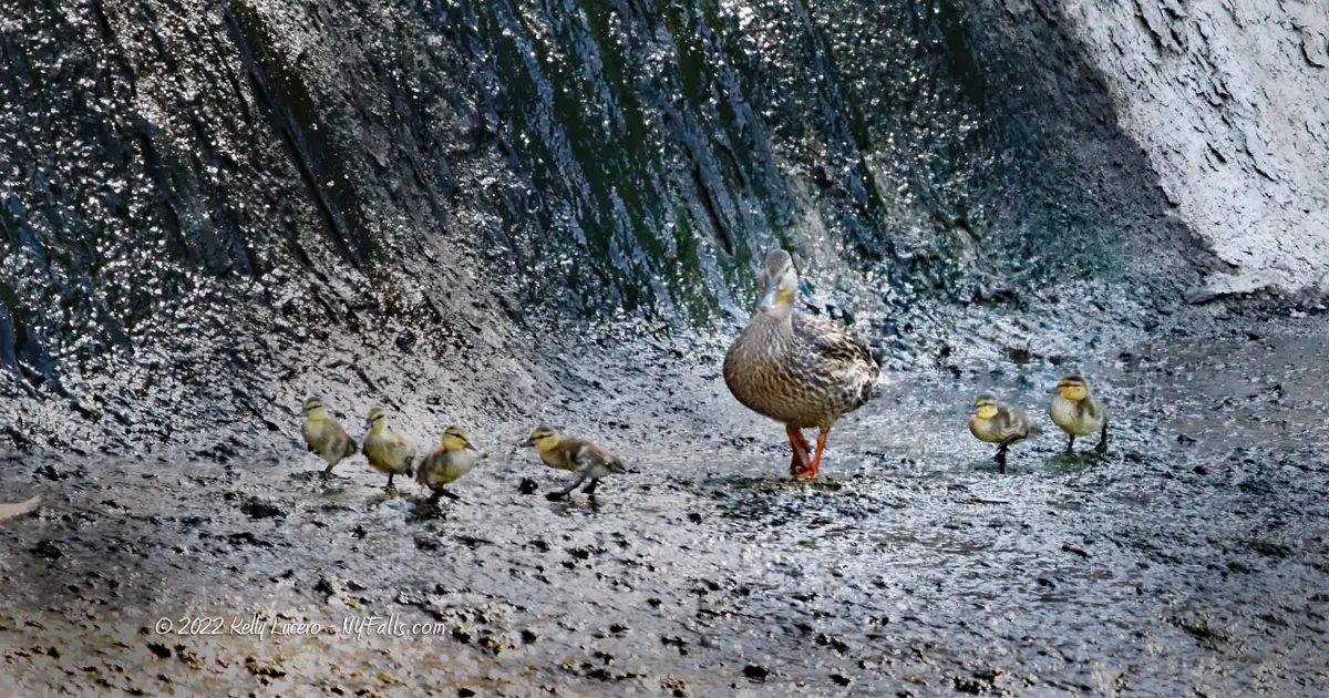
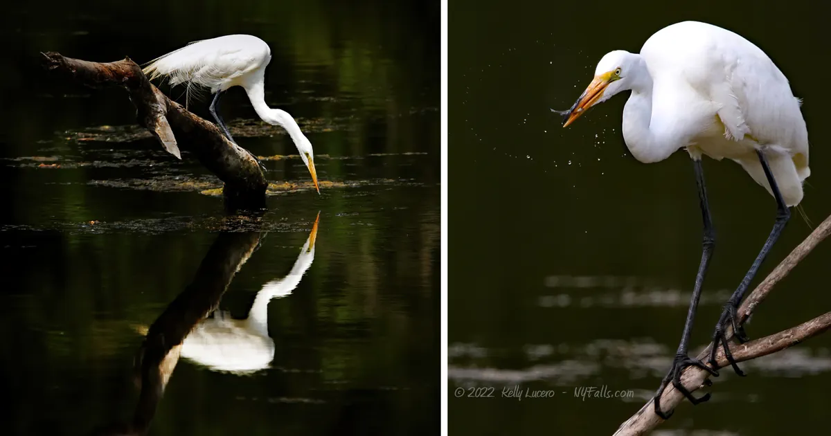
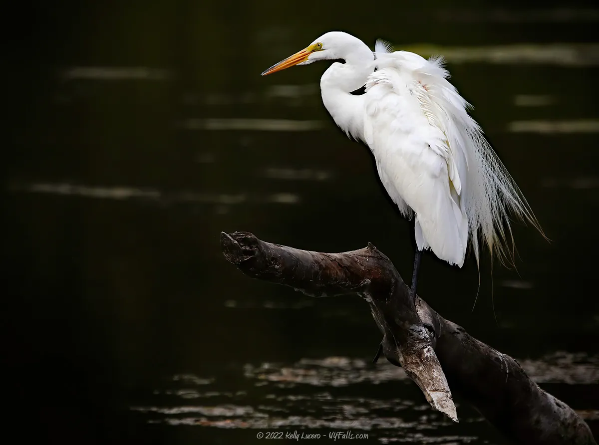
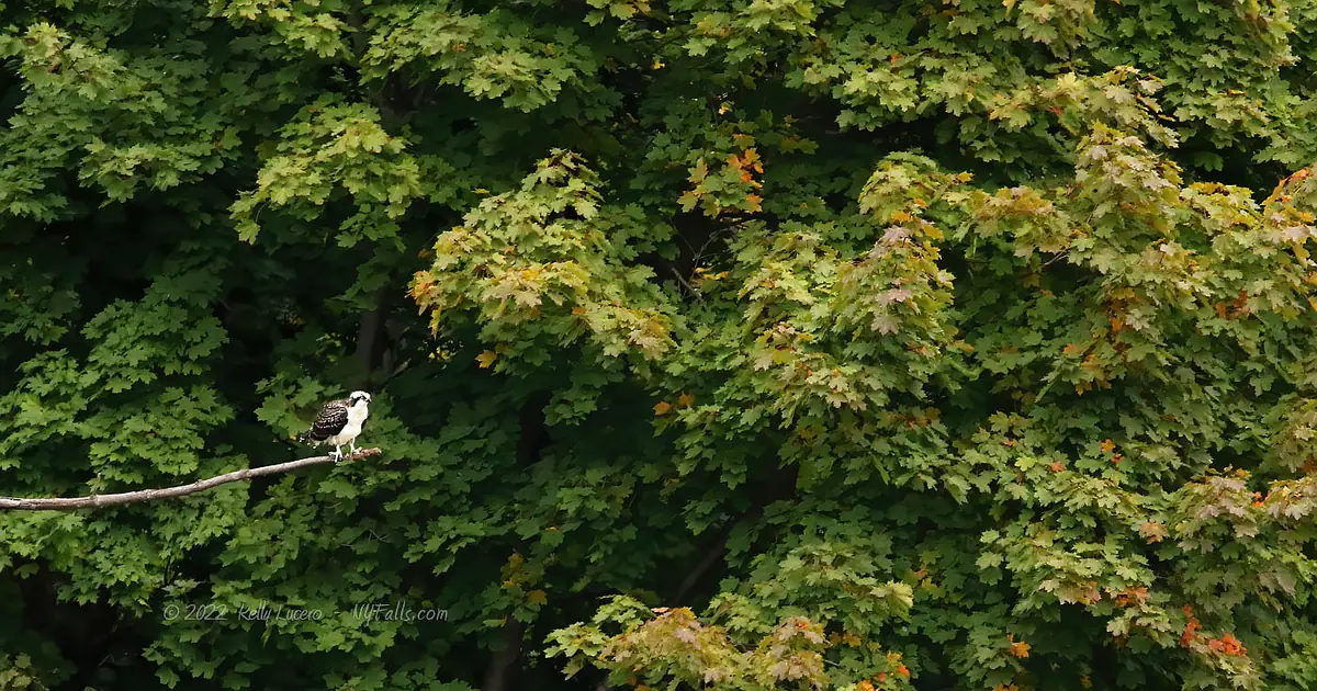
Birds
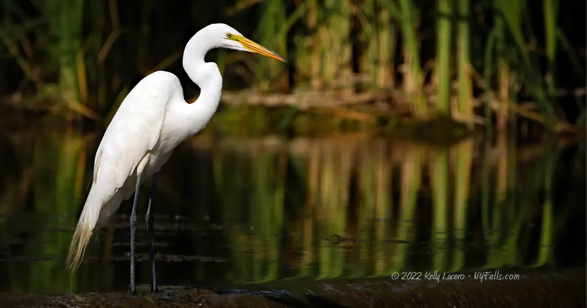
Yes, it’s a popular fishing spot for humans, but local birds rate it 5/5 stars! The water around the dam is a fantastic place to spot birds one may not regularly see in their daily travels. We have consistently observed many species hunting for their meals here. Bring binoculars and watch for these species and more: great egret, green heron, spotted sandpiper, great blue heron, belted kingfisher, and osprey. Bald eagles have been spotted nearby, as well. Bring a long lens and bit of patience – and you’ll go home with images of some really interesting species!


Photography Tips
Silky Water Effect
- To get that smooth cotton-candy look to the falls, you need to use a Neutral Density (ND) filter on your lens. The ND filter will block some of the light from entering the lens without altering the color, and thus allows your shutter to stay open longer. This blurs the water and creates a soft white gloss to the foamy areas of the falls. Check out the article for all of the details.
More tips
- See the Articles for more photography tips.


Who to Contact
Village of Churchville
585-293-3720