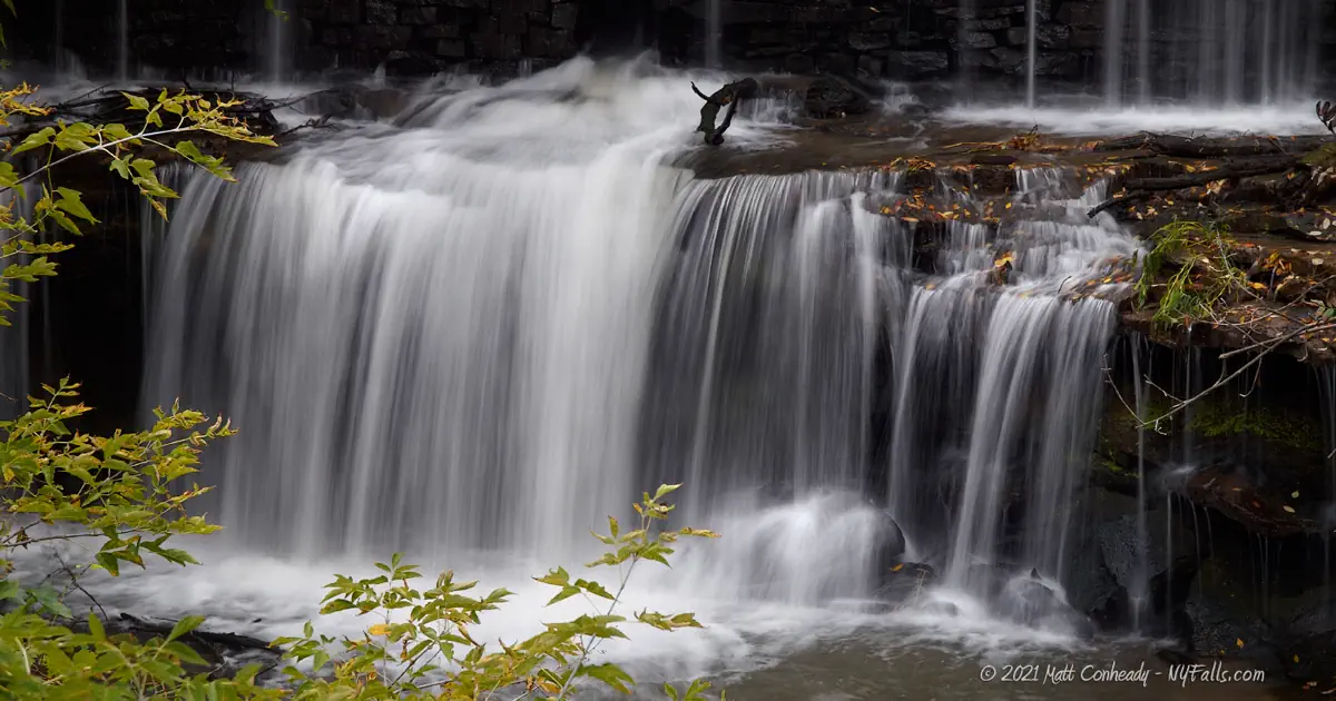
Mill Pond Falls (Gasport)


Location: On the north side of the hamlet of Gasport; Town of Royalton; Niagara County; New York.
Maps: Google Map; Topographic; Interactive map.
GPS Coordinates:
- Lower Mill Pond Dam:(N 43.20815 / W 78.56495
- Royalton Mill ruins: N 43.20886 / W 78.56564
Directions: From the east: Take NY-31A west to NY-31 west. Just past Middleport, turn right onto Telegraph Rd. Make a right onto Root Rd at the canal and cross over the single lane steel bridge. After the bridge, make an immediate left onto Slayton Settlement Rd (CR-7). You will pass a farm on your right and then some houses. Look for Quaker Rd on your right. Park on the side of Quaker Rd.
From the west: Take NY-31 east to Gasport. Make a left onto State St (before the gas station) and follow State St into the hamlet. When you reach Main St, make a left onto the bridge over the canal. Once over the canal, this becomes Hartland Rd. Continue down this road to Slayton Settlement Rd (CR-7) and make a right. After a half-mile, look for Quaker Rd on your left. Park on the side of Quaker Rd.
Parking: There’s room on the shoulder at the intersection of Quaker Rd and Slayton Settlement Rd for a car or two, but be mindful of traffic. The shoulder is enlarged at the mill ruins, north of the intersection.
Weather
Information / Accessibility / Accommodations
Number of falls: 1 that you can visit.
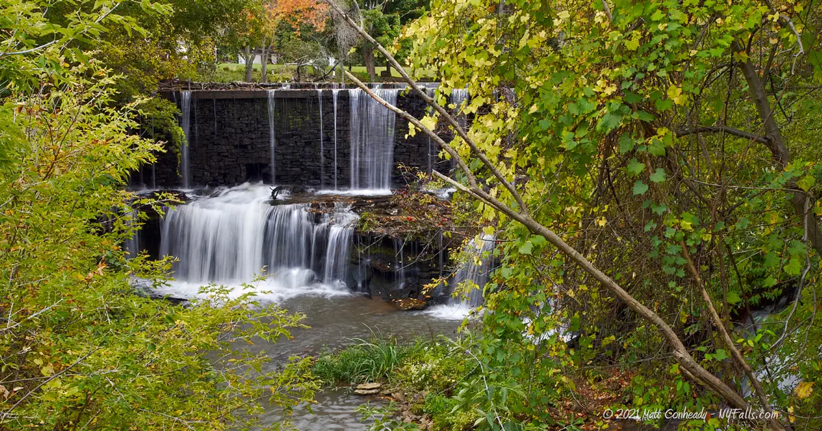
Size/Types: An 18 ft high man-made dam. The dam itself is 250 ft long, but most of that is hidden by overgrowth. Water only flows over the northernmost 5-15 ft of it. Downstream from here is another dam and mill pond, but it is on private property and not accessible.
Best time to visit: Early spring; fall when the leaves are off the trees.
Flow: Low to moderate.
Waterway: The East Branch of Eighteenmile Creek, which starts out to the southeast at Gilberts Corner. From there it heads west about 4.5 miles and then turns northeast at Terrys Corners. At Royalton Ravine at Gasport it cuts through the Niagara Escarpment, the very same that formed Niagara Falls, and led to the massive set of canal locks being constructed at the Lockport Flight of Five. It flows under the Erie Canal at Gasport and continues north to the two mill ponds here. Here the waters are considered a Great Lakes AOC (Area of Concern) due to high levels of PCBs, DDT, mercury, and other contaminants. In 2006 Eighteenmile Creek was included in the NYS List of Impaired Waters. That said, you should probably avoid spending time in the water and certainly avoid eating any fish you may catch here. North of Gasport, the creek turns left, joining (the main branch of) Eighteenmile Creek, just north of Lockport. It then passes through Newfane, eventually emptying into Lake Ontario near Olcott Beach.
Time: A few minutes.
Seasons/Hours: Year-round.
Admission: Free.
Handicap Accessibility: You can view the dam from the roadside.
Pets: Pets should be on a leash.
Accommodations: None. There are shops and eateries nearby in Gasport.
Description
AKA: Otto Dam and Falls
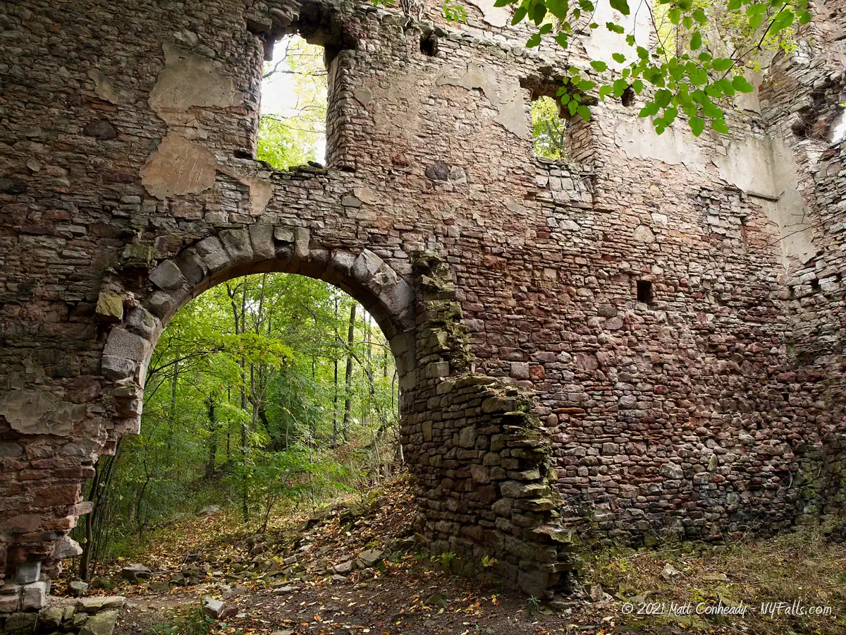
The waterfall here is nothing much. It’s a mill dam north of Gasport, built in the first half of the 19th century, and restored in the 1990s. Most of it is covered in overgrowth, and what you can see of it is minimal if there are leaves on the trees. A second dam and falls is just downstream, but not accessible. What does make this worth a stop is the history. Just to the north is a beautiful set of ruins from one of the mills that graced the creek over 100 years ago and drew power from a mill fed by the pond. If you are in the area to check out Royalton Ravine, it’s definitely worth the 10 minute trip north to check out the ruins and spot the falls.
History
The two mill ponds constructed just north of Gasport on Eighteenmile Creek formed a reliable waterway to power several mills for over a century. One of the first mills built here was a grist mill, by Col. Jonathan Mabee, around 1812. He then built a sawmill nearby. The Mabee family continued to open mills along this creek (4 total), including the large stone “Mabee Mills,” a gristmill built in 1872 (to replace the former, which they had sold). This four-story mill lasted until 1880, when it was destroyed by fire. The remains of the brick exterior are what you will see on the site today.

Hiking / Walking Trails
Difficulty: Easy. It’s roadside, but I recommend, parking and walking closer to get a good look. You can also visit the Mabee Mills ruins that are across the road.
Markings: None.
Distance: Roadside. A walk from where you can park would only be 30 ft or so.
Description: From the intersection at Quaker Rd, take a moment to walk to the adjacent Mabee Mills ruins which is just along the tree line north of the intersection. There’s a historical marker near the intersection.
Facing Slayton Settlement Rd (south), cross it and move a bit right. You’ll see the dam to the south, although it tends to be a bit obstructed by trees in the summer.
Some people will climb down from the road to the metal culvert or into the creek bed. I do not recommend this. The culvert is slippery and the creek is polluted.
Map: Interactive.
Mill Pond Falls Interactive Map
Mill Pond Falls Media
Coming soon…
Interesting Stuff
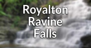
Royalton Falls
It’s probably why you are here in the first place. Royalton Ravine Park has hiking trails along the Niagara Escarpment and two waterfalls.
Becker Farms
Becker Farms and the Vizcarra Vineyards & Becker Brewing Company is just north of here on Quaker Rd. It offers a farm market, apple picking, cider, wine, a brewpub, playground, animal exhibit, and more. Map.
Photography Tips
Long Lens
- You can’t get too close to this one. Bring a longer lens to fill the frame.
Avoid Late Spring and Summer
- The trees have taken over most of the dam. You can see more of it from late fall into early spring.
Silky Water Effect
- To get that smooth cotton-candy look to the falls, you need to use a Neutral Density (ND) filter on your lens. The ND filter will block some of the light from entering the lens without altering the color, and thus allows your shutter to stay open longer. This blurs the water and creates a soft white gloss to the foamy areas of the falls. Check out the article for all of the details.
More tips
- See the Articles for more photography tips.
Who to Contact
Town of Royalton
585-567-2666
townofroyalton.org