Franklin Gulf County Park


Location: Northeast of the village of North Collins; towns of North Collins and Eden; Erie County; New York.
Maps: Google Map; Topographic; Interactive map.
GPS Coordinates:
- Largest waterfall: N 42.60626 / W 78.90648
- Waterfall on north branch: N 42.60967 / W 78.91247
- East side parking lot: N 42.60876 / W 78.90172
Directions: From Buffalo: Take NY-5W for 7.8 miles to NY-75S.
In Athol Springs, keep left to NY-75S. Follow NY-75S for 5 miles.
In Hamburg, at the intersection with Main and Pierce Ave/US-62, turn right onto US-62 and follow for 6 miles.
Just past Eden, turn left onto Sandrock Rd.
About 1.7 miles down Sandrock, make a left onto Larkin Rd.
At about 0.8 miles down Larkin Rd, look for a gravel/dirt parking area on your right.
Use Google Maps.
Parking: There’s a parking area for about a dozen cars on Larkin Rd.
Weather
Information / Accessibility / Accommodations
Number of falls: 5 (more if you count the tiny ones).
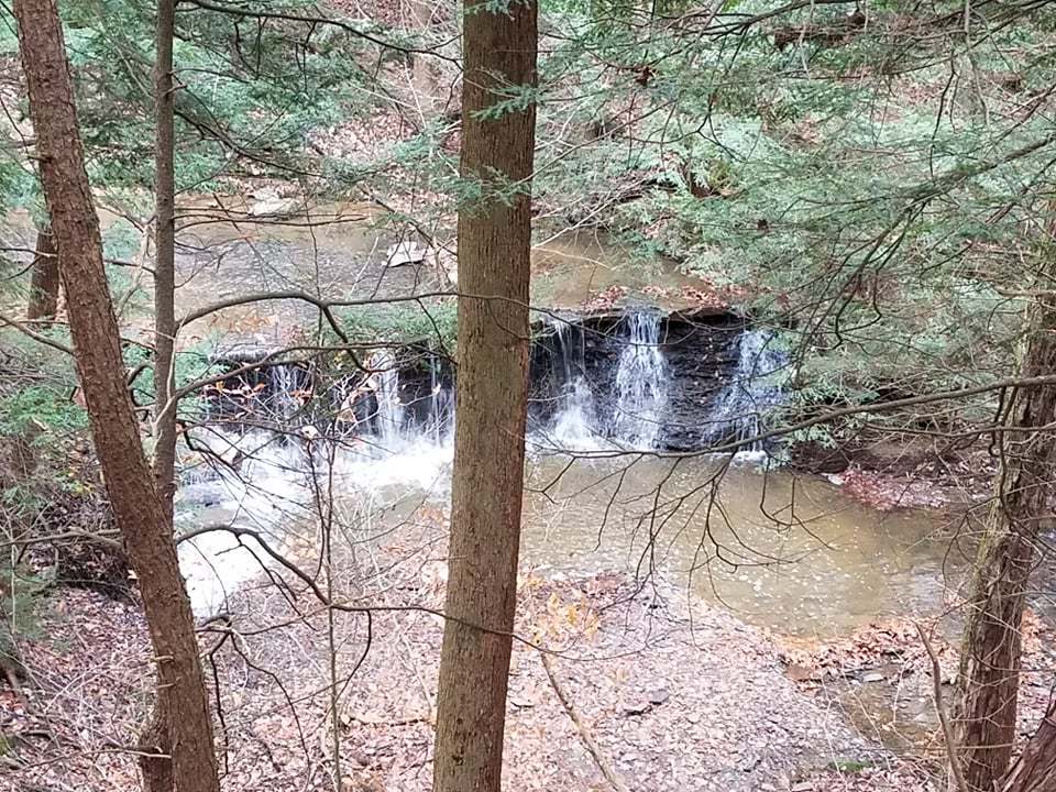
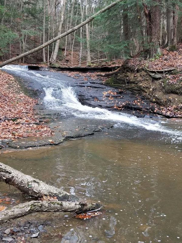
Size/Types: Cascades down shale. 4 of the falls are under 10 ft tall (ranging from 5-9 ft). The largest is a 25 footer, in 3 segments.
Best time to visit: Spring and fall (after rain)
Flow: Low to moderate.
Waterway: Franklin Gulf starts on the east side of the gorge, in the town of Eden. The majority of the falls are on an unnamed tributary glen that comes from the south. Just west of the park, the Franklin Gulf converges with Big Sister Creek, which flows northwest, through the village of Angola, and into Lake Erie at Bennet Beach.
Time: About an hour to hike the loop.
Seasons/Hours: Daily, 7am – dusk (winter hours) or 9pm (summer hours).
Admission: Free.
Handicap Accessibility: None.
Pets: Must be on a leash.
Accommodations: Trails. If you need anything, head to nearby North Collins or Angola.
Description
AKA: Franklin Gulf Park; Franklin Gulf Conservation Park
Franklin Gulf is an undeveloped Erie County park. You won’t find a playground or pavilions. There is no large parking lot, but what you will find are 631 acres of pristine woodlands, a beautiful ravine with 4 decent-sized waterfalls, as well as many small drops in the creek. If you are in the Buffalo area and need to get out into nature for the day, this may be a closest spot for you to help get that feeling of being far away.

History
North Collins separated from the town of Collins in 1852. At the time it went by Shirley, but changed to North Collins in 1853.
The name “Franklin” is likely derived from the village of North Collins’ resident, U. Franklin.
A 1866 map shows a sawmill and residence, owned by A. Segrist, located just west of the branches of the gulf confluence. Tice Rd once bisected the land, and the mill would have been along that road. The ruins of a stone chimney can now be found there.
Much of the land here was owned by C. H. Larkin in the early 20th century.
Hiking / Walking Trails
Difficulty: Easy. Some gradients. More difficult if you want to climb down to the base of some waterfalls.
Markings: Dirt trail. Some blazes. I recommend following the streams.
Distance: 1.8 miles if you do a complete loop.
Description: The map below is approximate. I colored the trail red, which is the color of the initial trail, but this park has many colored blazed trails and some without. Don’t go completely by color.
From the parking area, enter the red blazed trail and keep going straight. About 700 feet into the woods, veer off to the trail on the right to head north to Franklin Gulf. You will reach the gulf 1/4 mile later. Now follow the gulf downstream. At about 0.8 miles you will reach the first waterfall (5 ft tall).
Keep going downstream until you reach the confluence of the two ravines. Just downstream from here is a bridge and small waterfall. Up the second ravine are 3 more waterfalls, including the 25 footer.
Head up the second ravine. At about 1/2 mile from the confluence you will hit the 25 ft falls. Beyond that is a 7 and then an 9 footer. Keep on the trail and it will loop back north to the parking area.
Map: Interactive.
Franklin Gulf Park Interactive Map
Franklin Gulf Park Media
Videos

Contributor Photos & Art
Karra Schultz is the admin of the NY Hikes & Waterfalls on Facebook (highly recommended). She captured these beautiful fall photos of Franklin Gulf and its waterfalls.


Who to Contact
Erie County Parks, Recreation & Forestry
716-858-8355
[email protected]