Channing H. Philbrick Park


Location: Southeast of Rochester; In the Village of Penfield, Town of Penfield, Monroe County, New York
Maps/Locations: Google Map; Topographic; Park map; Interactive map.
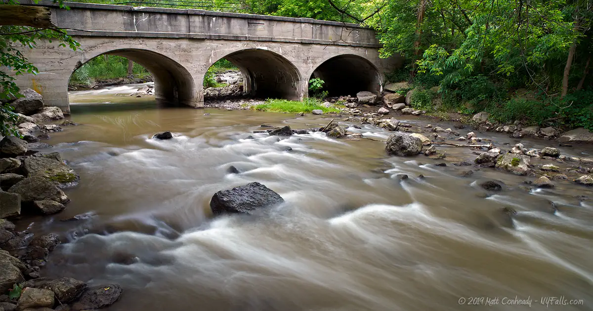
GPS/Locations: Bridge: (N 43.12720 / W 77.48457)
Lower Falls: (N 43.12728 / W 77.48436)
Upper Falls: (N 43.12731 / W 77.48296)
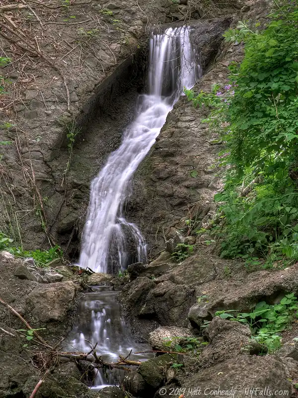
Falls on Honey Creek: (N 43.12767 / W 77.48246)
Directions: Take I490 to exit 23 and head east on Linden Avenue. Follow Linden as it becomes Penfield Rd. past the Panorama Trail exit. As the highway reaches the town and the speed limit drops and the route becomes less like a highway, slow down and look for the park sign on the right. Make a right onto Linear Park Drive. Follow this road into the parking area.
Or use Google Directions.
An alternate entrance and parking is located on the other side of the bridge and can be accessed from N Washington St.
Use Google Directions.
Parking: There are three lots, two off of the Rt 441 entrance (north), and one off of the N Washington St entrance (south). Parking for roughly 20 cars.

Weather
Information / Accessibility / Accommodations
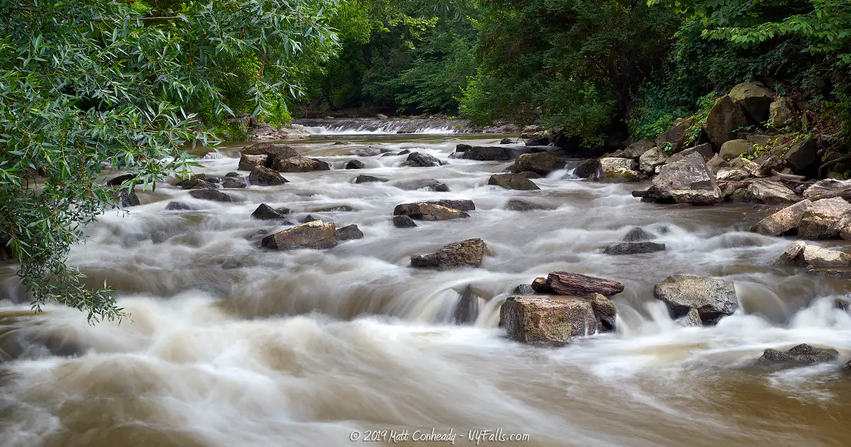
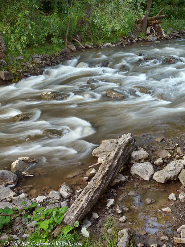
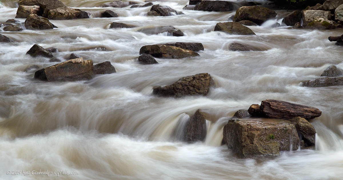
Number of falls: More like a series of rapids, but if you really need a number, 2 ledges along Irondequoit Creek and 1 seasonal waterfall on Honey Creek (a tributary).
Size/Types: Upper and Lower Falls are less like waterfalls and more like gradual cascades and rapids. They are no more than a series of 2 ft high drops. The seasonal waterfall on Honey Creek, although usually dried to a trickle, is roughly 30 ft tall. It starts out as a 3 ft cascade, then a 14 ft gradual slope, then another cascade to the bottom.
Best time to visit: Year round, but best after heavy rain.
Flow: Moderate to high for Irondequoit Creek. Seasonal for Honey Creek.
Waterway: Irondequoit Creek, which flows north into Irondequoit Bay and Lake Ontario. Honey Creek is a small seasonal tributary into Irondequoit Creek.
Time: At least 15 minutes, but hiking the park trails can easily take 1 or more hours.
Seasons/Hours: Open year-round, daily, from 6 am to 10 pm.
Admission: Free.
Handicap accessibility: Yes, from the parking area to the observation/fishing platform on the south bank of the creek near the Lower Falls/Rapids.
Pets: Allowed if on leash. Leash policy strictly enforced. Please clean up after. Be careful with your pet in some steep areas.
Accommodations: Restrooms; signage; historical markers; trails; fishing; playground; pavilion.
Description
AKA: Linear Park; The Falls; The Hollow; Sgoh-Sa-Is-Thah; Irondequoit Falls; Irondequoit Rapids
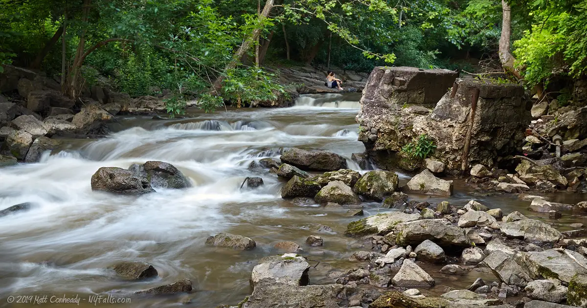
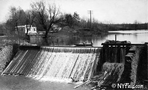
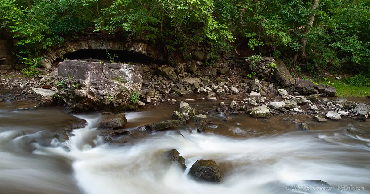
The Town of Penfield hosts this 19 acre community park along an exciting stretch of Irondequoit Creek, where it drops over 90 feet in the course of one mile. The relatively steep drop in an otherwise flat region leads to some interesting rapids along its path towards Irondequoit Bay and eventually Lake Ontario. The community of Penfield has always had a use for this stretch of the creek. The power presented by the creek created a large community of mills that fueled the earliest industries in the valley. Although the course of the creek has changed over time, and all of the mills that once utilized it have been razed, evidence of this period can still be found in the crumbling foundations of a few of these remaining structures.
Named after former Town Supervisor, Channing H. Philbrick, the park serves a variety of purposes. The open field, picnic shelter and playground are a frequent host to parties and family gatherings throughout the summer months. Year-round, the creek is host to hikers, photographers, and fisherman who come to enjoy the sights, sounds, and the sense of peace and isolation this small sliver of nature offers in an otherwise highly-developed suburb.
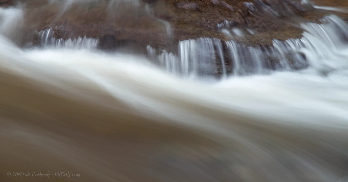
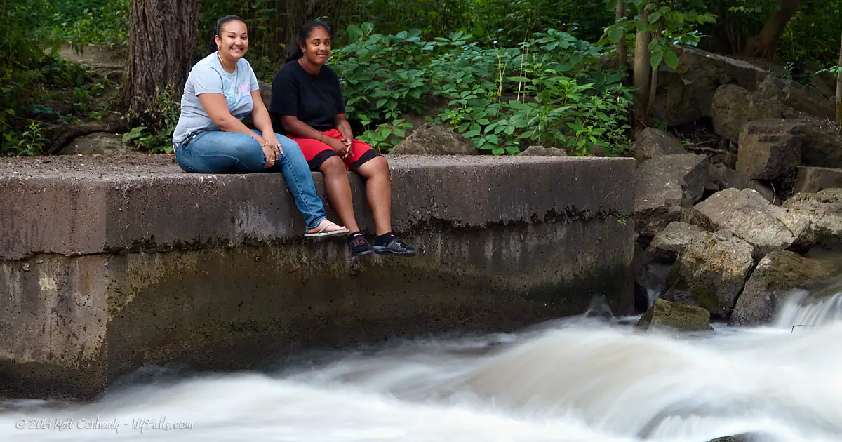
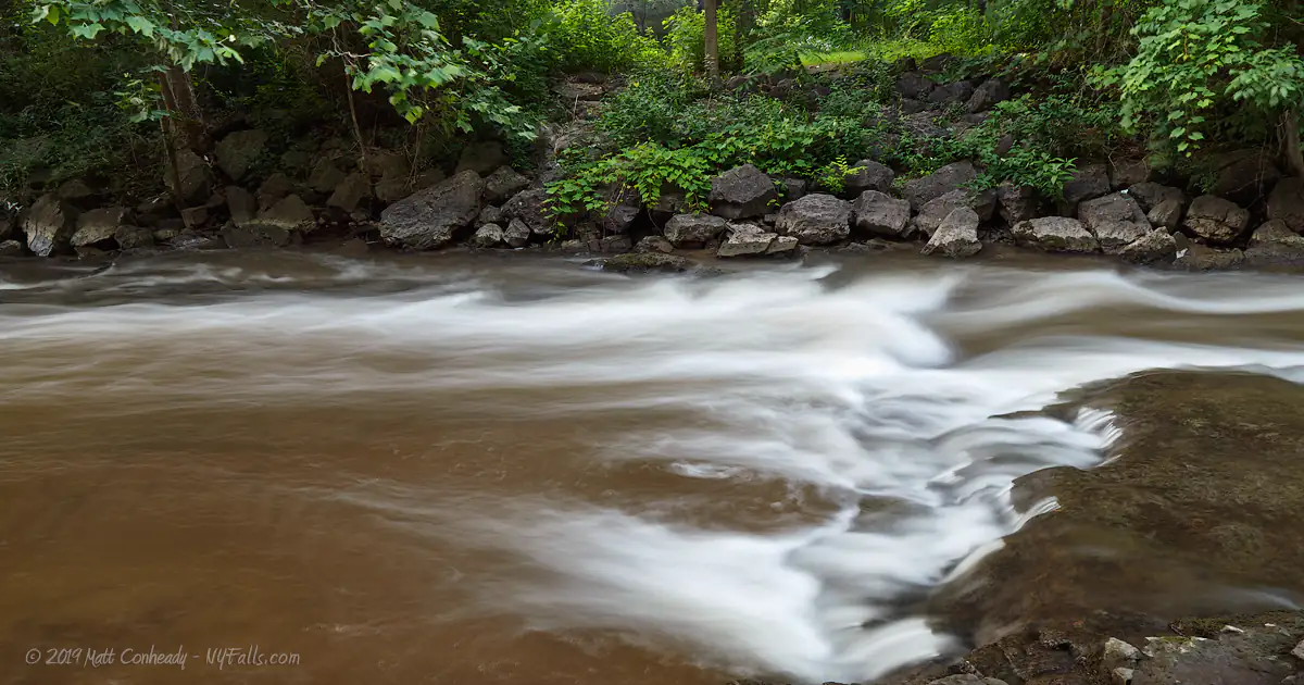
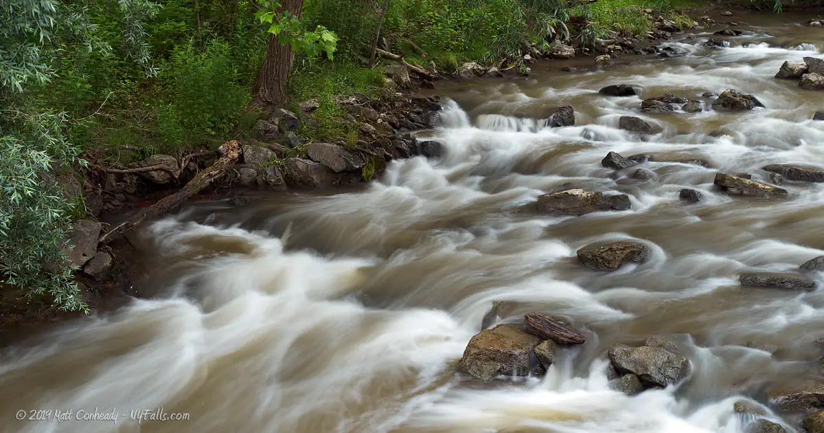
The big draw here is the class III whitewater. Twisting, bouncing and spraying around the limestone mottled creek bed, Irondequoit Creek displays tremendous power for such a small waterway. The porous nature of the rock layers here acts as an amplifier as the water drums upon it, creating a thumping roar of water that fills the glen. It’s both relaxing and exhilarating at the same time, and well worth at least a quick stop.
History
 When walking the shady trails along this section of Irondequoit Creek, it is tough to imagine its banks lined with dozens of mills and factories. Although the course of the creek has changed drastically since then, some traces of these mills can still be found along its shores.
Irondequoit Creek’s origins can be traced to a pre-glacial Genesee River, that carved out the valley that Irondequoit Creek now flows through. Irondequoit Bay was once the delta where this ancient Genesee emptied into the pre-glacial Lake Ontario. Sediment deposits from the last ice age pushed the Genesee to its current location to the west, while small tributaries still contributed to its former valley, forming Irondequoit Creek.
Prior to pioneer settlement, the Iroquois inhabited this region and named this section of the creek SGOH-SA-IS-THAH (smashing water against rock) hailing to the drumming sound made by rapids pummeling the limestone layers beneath.
Penfield was first owned by Jonathan Fassett, Sr of Vermont. The heavily wooded, hilly and swampy terrain was not of much use and it was sold, and sold, and sold again until Daniel Penfield, a wealthy land owner and merchant from down state, came to the area in 1795 and saw the potential of this stretch of Irondequoit Creek for the powering of mills. He bought the entire township that same year, but did not erect a sawmill until 1800. Soon after, several other mills were erected nearby. The principal industry here was flour, which was carried by land to Charlotte and then shipped north across Lake Ontario to Canada. The opening of the Erie Canal in the 1820s allowed for shipping to markets far to the east and the milling industry in Penfield thrived. The mills here included, but were not limited to grain, sawmills, triphammers, clothing mills, tanneries, clothing mills, distilleries. Other businesses sprung up to support the township and prosper from the power of the creek. Mr. Penfield maintained the water rights within the Township limits and thus had an interest in all of the businesses that utilized it.
Mr. Penfield encouraged settlement within his township by accepting produce and livestock in lieu of mortgage payments for new farmers as they settled on their land. As the milling business in nearby Rochester blossomed around the High Falls, milling on Irondequoit Creek diminished and agriculture took over as the principal industry in the town. Before becoming a town park, this area (specifically the open fields along the creek) was home to a sewage treatment plant that emptied right into the creek. It was removed and trails and park facilities were built. The park was called Linear Park until recently.
Hiking / Walking Trails
Difficulty: Easy to moderate.
Distance: Roughly 1.5 miles of trails within the park, and larger trail systems connecting connecting to this park.
Markings: The tails are easy to find and usually marked with trail-heads.
Description: Channing H Philbrick Park Trail runs along the northern shore of the creek east and west. It will get you the best look at the rapids and the bluffs. Pick it up near the pedestrian bridge or the wooded area near the pavilion. The trail is well maintained dirt or gravel, through the wooded terrain along the creek. At some points it reaches a wooden bridge or downed tree. After heavy rain, some areas can get quite muddy. You can follow this trail east past the boundaries of the park and all the way to Linden Ave if you don’t mind getting wet and dirty.
Follow it west along the twists and turns, past the bluffs and all the way to Rt 441 and the Irondequoit Creek – Panorama Plaza Trail.
The Old Mill Trail is a short loop that begins from the small parking lot on the southern end of the bridge, off of N Washington St. This 15 minute trail will take you to a depression in the ground that was once occupied by mill. A few remnants of the mill foundation can be found scattered along the site and in the creek below. Follow the trail back to the parking area.
The Honey Creek Trail, a recent addition to the trail system in the park, passes through a wooded hollow north of the creek and then scales the sandy glacial moraines and ends at 5 Mile Line Rd. Honey Creek Falls cannot be seen from this trail. It actually lies several hundred feet to the west where this small seasonal tributary pours over the scarp into the glen. It is accessible via a barely detectable trail that runs adjacent to Honey Creek.
The Irondequoit Creek – Panorama Plaza Trail is a multi-use trail that runs from the Town Buildings at Philbrick Park (near the pavilion), northwest along Irondequoit Creek and ends at the back of Panorama Plaza. The trail is approximately 3 quarters of a mile.
Maps: Park map; Irondequoit_Creek_Panorama_Plaza_trail map; See also the interactive map below.
Philbrick Park Interactive Map
Philbrick Park Falls Media
Irondequoit Creek at Philbrick Park Audio:
Irondequoit Creek at Philbrick Park Videos
More coming soon…
Interesting Stuff
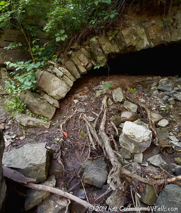
Mill foundation
Although the north side of the creek has been developed to prevent bank erosion, a lot of the old mill foundations are still present (although in ruin) along the southern bank. The era of the mills stem from cobblestone through concrete construction. You can even find the traces of the mill races and tunnels they ran through.
Photography Tips
Fishermen
- Include them in your photos of the creek for a sense of scale and to add a touch of human personality.
Macro
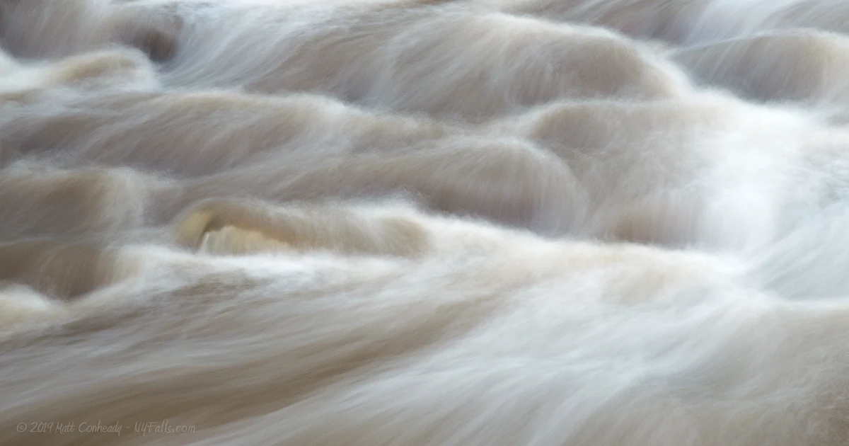
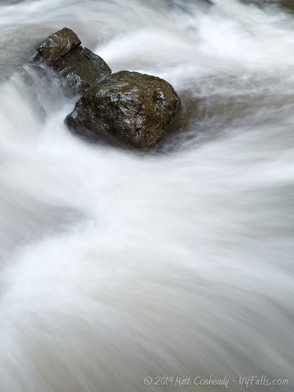
- Go in close and try to make abstract art from the swirls and flows of the frothy water.
Silky Water Effect
- To get that smooth cotton-candy look to the falls, you need to use a Neutral Density (ND) filter on your lens. The ND filter will block some of the light from entering the lens without altering the color, and thus allow your shutter to stay open longer. This blurs the water and creates a soft white gloss to the foamy areas of the falls. Check out the article for the all the details.
More tips
- See the Articles for more photography tips.
Who to Contact
Town of Penfield
Parks & Recreation
3100 Atlantic Avenue
Penfield, NY 14526-9798
(585) 340-8655
[email protected]