Cohoes Falls


Location: In the City of Cohoes, north of the City of Albany, Albany County, Capital Region, New York
Maps: Google Map; Topographic; Interactive map.
GPS Coordinates:
- Cohoes Falls: N 42.78746 / W 73.70861
- Falls View Park – viewing area: N 42.78584 / W 73.70970
- Falls View Park – Parking/entrance: N 42.78531 / W 73.71101
Directions: From the City of Albany, take US-787 north to Cohoes. Continue on N Mohawk St for 3 miles. Look for the Falls View Park on your right.
Parking: There’s parking for 30 or so cars across from the Falls View Park entrance. There’s roadside parking for a few cars on N Mohawk St just south of that entrance. Additional roadside parking can be found on School and Cataract Streets near Overlook Park.
Weather
Information / Accessibility / Accommodations
Number of falls: 1 waterfall
Size/Types: 65 ft tall and (usually) 600 ft wide cascade. Because of water power redirection in the river, the true width of the falls (over 800 ft) is only seen after heavy rain or flooding conditions.
Best time to visit: Year-round.
Flow: Moderate. It’ll be flowing year-round, but the falls will tend to have quite a bit more power and width to it in early spring.
Waterway: The Mohawk River, which starts at the confluence of the East Branch and West Branch in Oneida County. To the south, it joins up with the Hudson River in Waterford. The Hudson then empties into the Atlantic Ocean.
Time: About 15 min to an hour.
Seasons/Hours: The parks providing viewing access are privately owned and their opening is at the discretion of the owner: Brookfield Renewable. The two parks that provide access are open daylight hours from May through October. In the Fall of 2020, Falls View Park was closed for repairs, and a schedule of the repairs, and thus a re-opening has not been announced.
Admission: Free.
Handicap Accessibility: Both parks offer smoothly paved walkways. There is gentle sloping. The lower viewing areas in Falls View Park are accessible only by stairs, but you can get a good view of the falls from above.
Pets: No rules are posted, but pets need to be on a leash in public.
Accommodations: There are two parks that offer viewing opportunities. Overlook Park, off of Cataract St, offers a viewing platform and some signage. Falls View Park, off of N Mohawk St, is a bit larger, with a few more spots to view the falls from, a few picnic tables, as well as a footbridge over the river. There are no restrooms in either park
Description
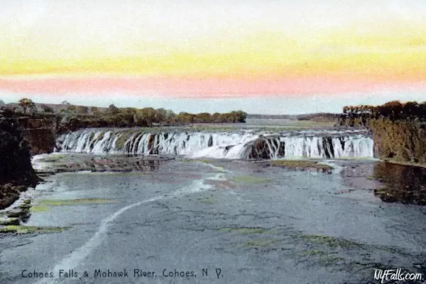
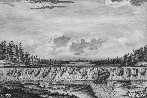
Located just northwest of its confluence with the Hudson River, Cohoes Falls is one of New York’s premier historic and grand waterfall attractions. Once a popular tourist attraction, visited by tens of thousands yearly (including a handful of daredevils) it was soon eclipsed by the huge success of the Niagara Falls tourism industry.
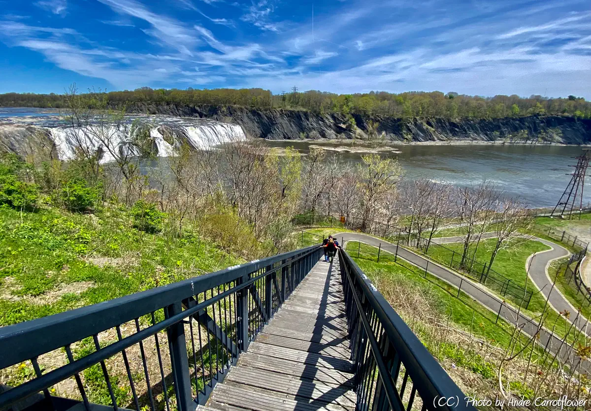
Today, the falls power the Brookfield Renewable School Street plant just downstream. Brookfield Renewable has built and maintains two parks that offer views of the falls from the western side of the river. Overlook Park was constructed first. Located off of Cataract Street, this tiny park has a viewing platform and several benches. It’s an easy way to see the falls in a jiffy. Falls View Park, off of N Mohawk St, was opened in 2008. It’s located north of Overlook Park and closer to the falls. It starts out with a footbridge that crosses a diversion channel of the Mohawk that leads to the hydro plant. The walking path continues to a beautifully landscaped viewing area. Those looking for more can continue closer to the river towards the School Street Hydro Plant. While the falls is considerably far and chain-link fences do obstruct some of the view, these parks are convenient and well-maintained. I recommend bringing a telephoto lens or binoculars to get a close-up look.
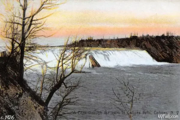
The falls itself is massive. It’s not even close to the highest in the state, but considering the amount of flow it has in the wet season, it can be a powerful sight. Usually, its water is diverted for power, reducing its width to about half. Depending on conditions when you visit, it may appear drastically different.
With the new park bringing in more tourists, as well as the falls’ proximity to commerce streets, Cohoes has a lot of potential to capitalize on these historic falls. There has been some talk by the city to illuminate the falls at night and host more events at the site, but nothing has materialized as of this writing.
History
The name “Cohoes” (pronounced Co-ho-ez) may stem from the Iroquois word “Coho” meaning “falling canoe” – which is spot on considering the history of being a navigation barrier along the Mohawk River. Legend has it that a daughter of a local chief was working alongside the river above the falls. She sat in a canoe tied to the riverbank and fell into a deep sleep. The canoe suddenly came loose and she was swept to the crest of the falls where the canoe became stuck. She screamed for hours, with the roar of the falls drowning her out. No one could hear her and no one came to her rescue. Exhausted she finally gave in and collapsed, which knocked the canoe free, and she tumbled to her death.
Iroquois oral history states that Hiawatha “The Great Peacemaker” convinced the Mohawk tribe to become the founders of the Iroquois Confederacy here. The site is considered to be a sacred one to the Iroquois, and because of this, Brookfield Renewable has opened part of their property to visitation.
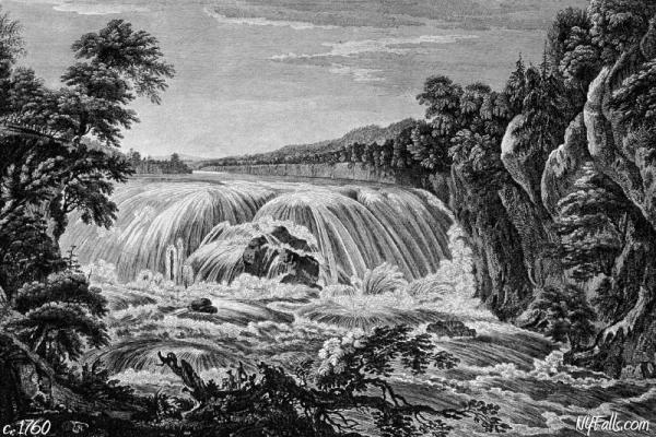
Early white explorers encountered the falls as the first major portage heading west from the Hudson. It garnered a name as “The Great Falls of the Mohawk,” bringing in travelers from around the fledgling country, inspiring poems, books, travel guides, and tourist rail stops. Inns and taverns flourished, private parks were constructed and even daredevils brought their barrels. But the tourist industry soon waned as industry took over.
Canvass White led the Cohoes Company to construct a dam above the falls in 1831. It powered textile mills along the gorge, including Harmony Mills, once the largest cotton mill in the world upon its opening in 1872.
When the Erie Canal was planned, the Mohawk was integrated into it as a major east-westward route. The Falls was a major barrier to this, so early versions of the canal were routed past the falls and up 10 Locks. In 1918, with the construction of the enlarged Barge Canal, Cohoes and its falls were avoided altogether.
The mill industry took a hit during the Great Depression. Most mills in Cohoes closed, but the Harmony Mills stammered on taking on a variety of tenants up until the 1980s. Former mill sites were then leased to power companies (Niagara Mohawk & Orion Power). The Harmony Mills Historic District, which includes the remaining mill building (now luxury lofts) and former worker residences, is listed on the National Register of Historic Places.
Hiking / Walking Trails
Difficulty: Easy to Moderate. Falls View Park has a lower observation platform past a large flight of stairs. This section of the trail is optional.
Markings: Paved walkways.
Distance: Overlook Park has the shortest pathway of just under 100 feet from the road to the overlook. Falls View Park’s pathway is about 1/3 of a mile one way.
Description: Overlook Park: From the corner of School and Cataract Roads, follow the pathway to the left of the apartment building. It will wind to the right to an open viewing area.
Falls View Park: From the entrance on N Mohawk, head north (left) and cross the footbridge. This will lead to several branches of the path. To the left, the trail leads to a viewing area that’s closest to the falls. To the right is an open viewing area with decorative bricks and pathways that wrap around it. Just south of this is a set of stairs leading down the gorge. After the stairs, the path will wind back and forth a bit and then lead to another viewing area. From here you can head further south to a viewing platform for the Brookfield Renewable Hydroelectric Plant.
Map: Interactive.
Cohoes Falls Interactive Map
Cohoes Falls Media
Cohoes Falls Videos


Contributor Photos & Artwork
At this time I have not been able to get out to this site and photograph yet. In the meantime, those with suitable photos or original works of art, that would like to be featured here, please contact me. Photos, paintings, and illustrations would be subject to quality review, and not all will be accepted. Your work can be accompanied by a link to your site/store/Instagram.
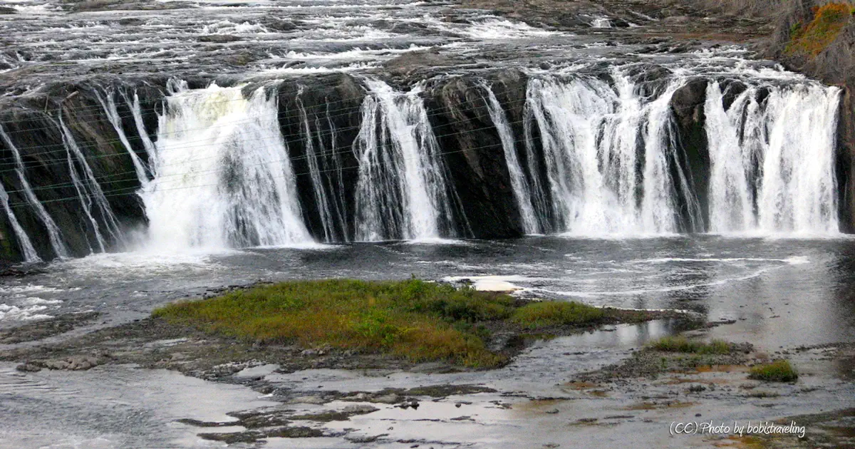
- Top photo by bobistraveling. This file is licensed under the Creative Commons Attribution 2.0 Generic license.
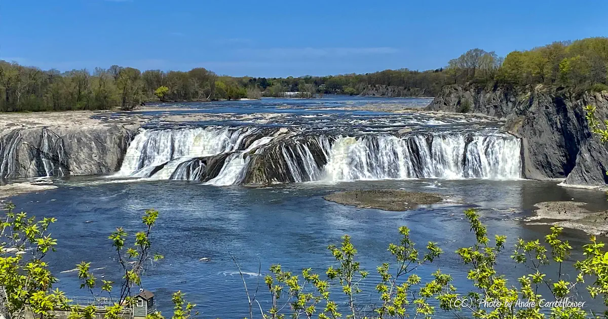
- Second photo by Andre Carrotflower. This file is licensed under the Creative Commons Attribution-Share Alike 4.0 International license.
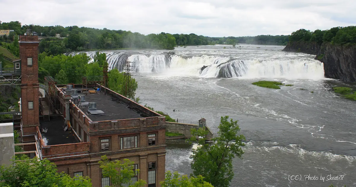
- Third photo by Skeat78. This file is licensed under the Creative Commons Attribution-Share Alike 3.0 Unported license.
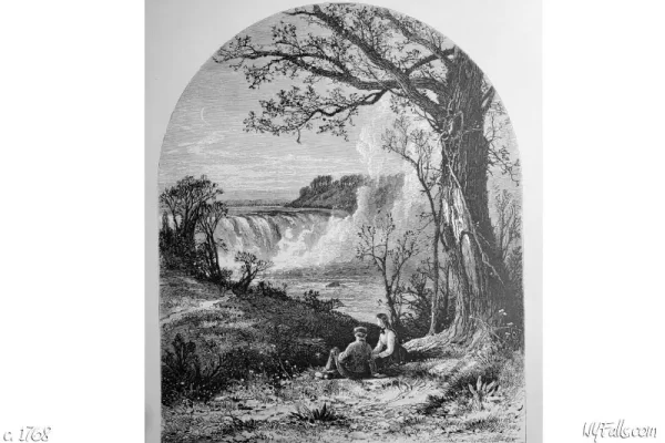
- Fourth photo by Andre Carrotflower. This file is licensed under the Creative Commons Attribution-Share Alike 4.0 International license.
Who to Contact
Brookfield Renewable
(518) 480-1494
[email protected]


