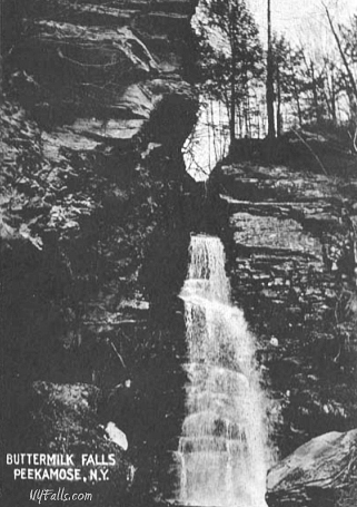
Buttermilk Falls (Denning)


Location: Within Peekamoose Valley; Town of Denning; Slide Mountain Wilderness; Ulster County; Catskill State Park; New York.
Maps: Google Map; Topographic; Sundown Wild Forest map; Interactive map.
GPS: Buttermilk Falls: (N 41.92415 / W 74.41362)
Parking area: (N 41.92371 / W 74.41278)
Directions: Located off of Peekamoose Rd about halfway between Sundown and West Shokan. Take NY-28 to Boiceville and then head west on NY-28A. NY28A will then head south into West Shokan. Turn right onto West Hollow Rd (CR-42) and follow it west. About 7 miles in it will become Peekamoose Rd as you enter the valley and pass Peekamoose Lake on the right (a long slim pond that parallels the road). About 2 miles later there will be a small gravel pullover on the right. Pull over and park.
Or use Google Maps.
Parking: It’s a small gravel roadside lot, with no clear signage and only room for up to 6 cars. The road has several waterfalls and pothole pools. Alternatively there’s a parking area for Peekamoose Mountain a mile west down the road.

Weather
Information / Accessibility / Accommodations
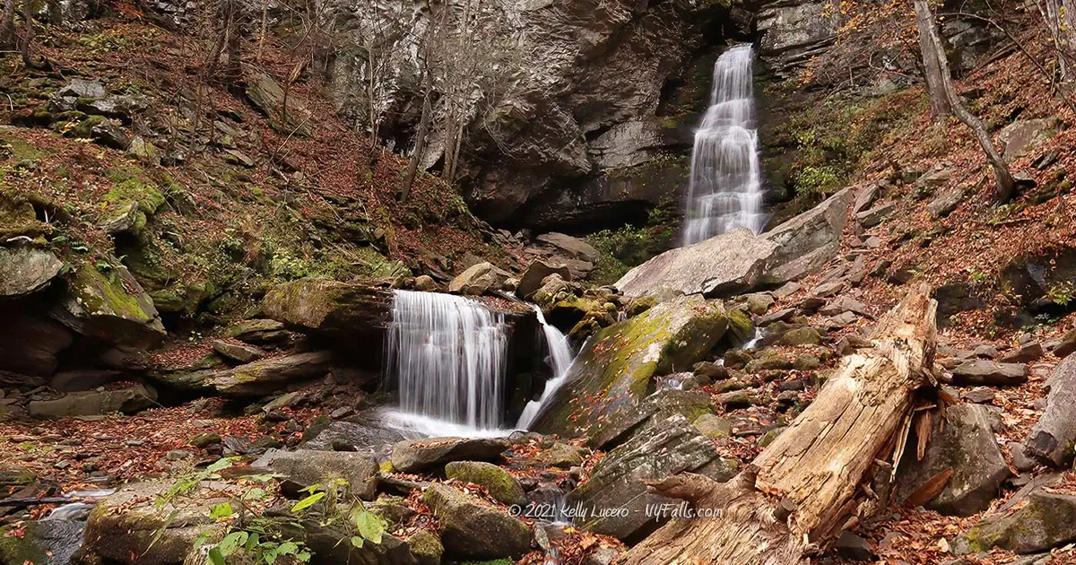
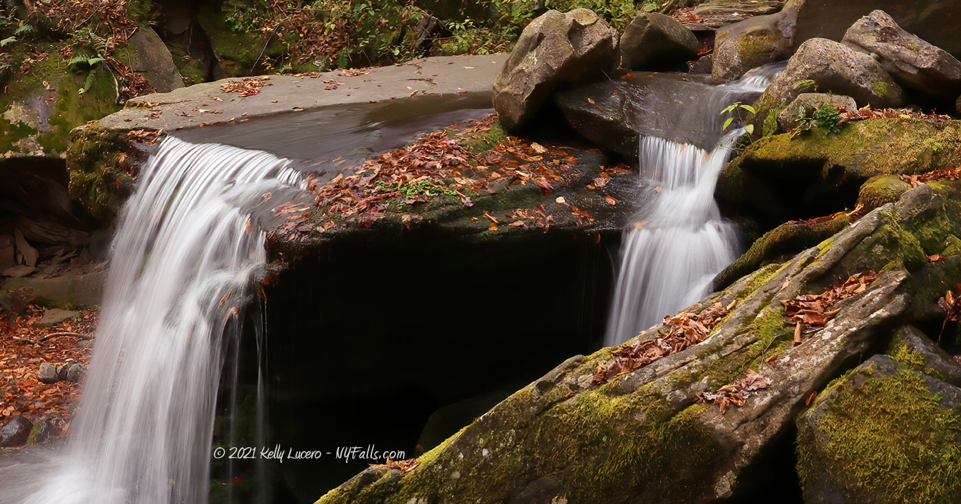
Number of falls: Buttermilk Falls is one waterfall, but Peekamoose Valley is home to at least 6 more waterfalls along this stretch of road. Russell Dunn’s Catskill Region Waterfall Guide mentions that there are 3 more drops directly above Buttermilk Falls (5, 10 and 15 ft high) although I am unsure of their accessibility.
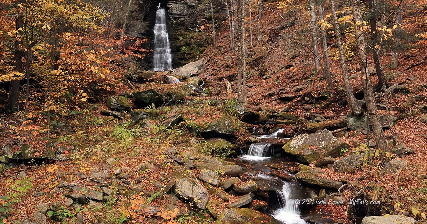
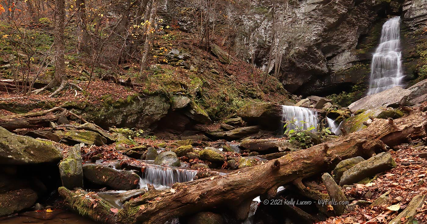
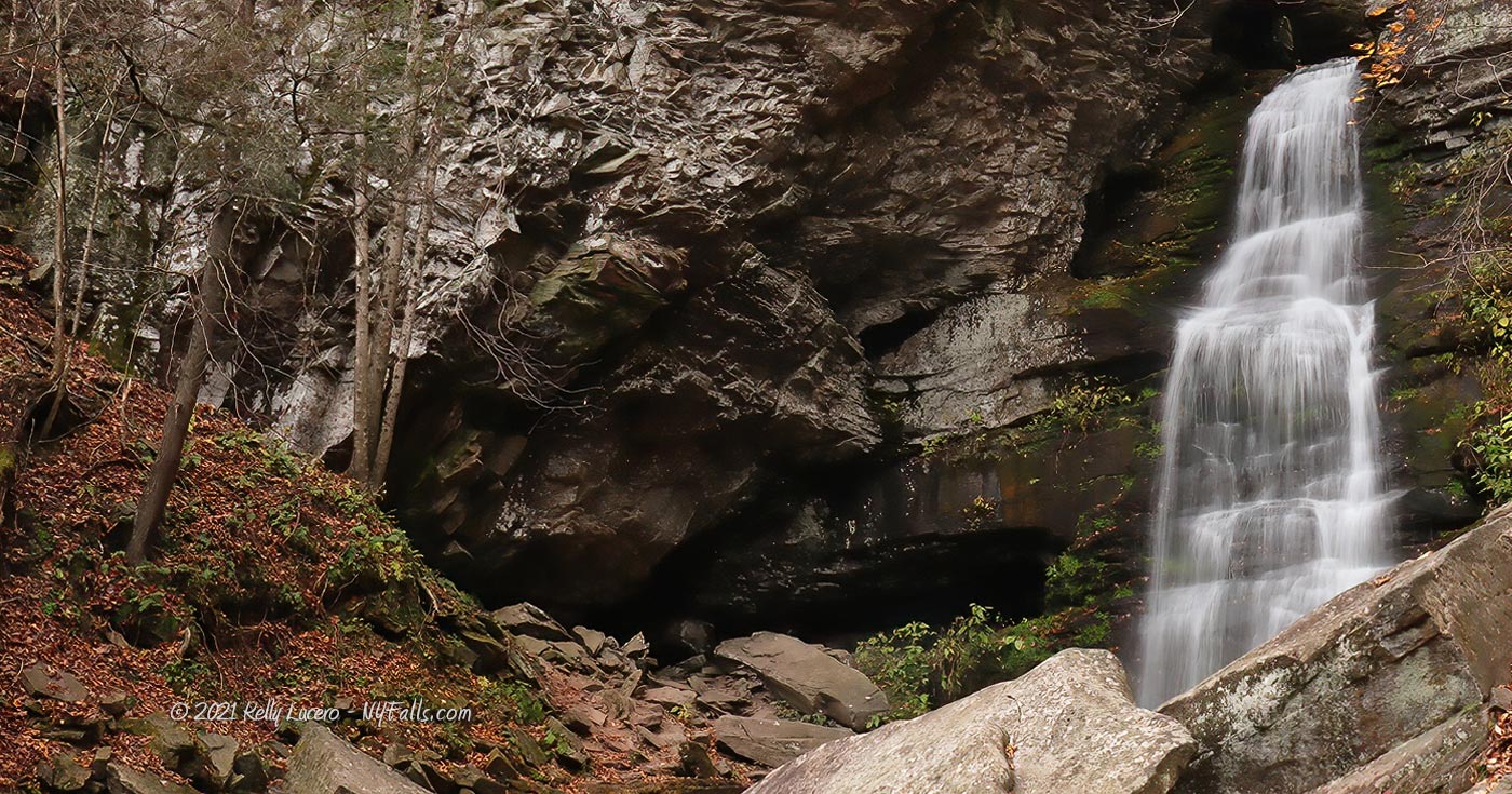
Size/Types: A steep and narrow cascade that emerges from a slim gorge and drops 36 ft in height down a mossy cliff. Just below, it runs through a small shallow pool and then tumbles over a 4 ft boulder-covered ledge.
Best time to visit: Spring and Fall.
Flow: Low to moderate. While many of the waterfalls emptying into the valley tend to dry up quickly, Buttermilk Falls tends to have more flow than the rest.
Waterway: Buttermilk Falls Brook, which joins Rondout Creek just south of the falls. Rondout Creek heads east and a small dam after 1.6 miles creates Peekamoose Lake, which is a small and shallow lake that parallels the road for 1,200 ft. Rondout exits the valley and heads northeast through West Showkan, where it empties into the Ashokan Reservoir.
Time: 30 minutes.
Seasons/Hours: Open all day/all year.
Admission: Free.
Handicap Accessibility: Not wheelchair accessible. The dirt trail has slight gradients.
Pets: Pets should be on a leash.
Accommodations: Only trails.
Description
There are several waterfalls across the state called Buttermilk Falls. While most of them share the white frothy mix of cascading water that most likely led to their names, most of the more popular ones are larger waterfalls carrying a high amount of flow. Buttermilk Falls, located in a tributary gorge to the Peekamoose Valley’s Rondout Creek, is a thin and slender cascade in comparison. But its beauty and accessibility make it a worthwhile visit. Peekamoose Valley is home to at least 6 more waterfalls visible along CR-42. Carved out from glacial meltwater, the area, with its plentiful hanging valleys from the mountains above, is spotted with pothole features from the last ice age. One of these is the nearby Blue Hole a deep swimming hole in Rondout Creek that was once a plunge pool for a glacial waterfall. Buttermilk Falls, while not even close in scale to Ithaca’s own, is reminiscent in geology to many Finger Lakes region waterfalls, and it’s certainly a worthy stop when passing through this area of the Catskills.
History
The name Peekamoose is most likely an anglicization of an Algonquin word meaning broken off smooth, referring to the round top of Peekamoose mountain. Early writings have the name with only one “O” — spelled as Peekamose.
The town of Denning is named after William H. Denning, one of the first grantees of the Hardenbergh Patent, a tract of 2 million acres of land across Ulster, Greene, Orange, Sullivan and Delaware Counties.
White settlements existed in the valley as early as 1849 when several log cabins and sawmills were built. All have relocated since the area became part of Catskill State Park in the early 1900s.
Hiking / Walking Trails
Difficulty: Easy.
Markings: Dirt trail.
Distance: Several hundred feet.
Description: From the parking area head on the trail to the west. It heads down and to the base of the falls within 100 feet.
If flow is low, you can then cross over the brook and loop back around to the road, or just head back the way you came.
Map: Interactive.

Buttermilk Falls (Peekamoose Valley) Interactive Map
Buttermilk Falls (Peekamoose Valley) Media
Videos

Interesting Stuff
Peekamoose Blue Hole
West of here is a swimming hole known simply as Blue Hole. Like much of the Peekamoose gorge, it was carved out by glacial meltwater, which poured from massive waterfalls and carved out potholes in the valley. Recently an overabundance of traffic to the Blue Hole has caused the state to limit access by permit.

Who to Contact
NYS DEC Region 3
New Paltz Office
(M-F, 8:30 AM – 4:45 PM)
(845) 256-3076
[email protected]
