
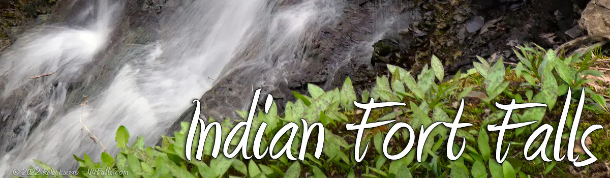
Indian Fort Falls


Location: South of the village of Geneseo; Town of Geneseo; Livingston County; New York.
Maps: Google Map; Topographic; Interactive map.
GPS Coordinates: North waterfall: (N 42.76454 / W 77.83298)
South waterfall: (N 42.76395 / W 77.83360)
Parking area: (N 42.76579 / W 77.83049)
Directions: The preserve is located south of the village of Geneseo, along NY-63/Mt Morris Rd. From Geneseo, just head south on NY-63 for 2 miles.
Turn right onto Jones Bridge Rd.
Parking: There’s a parking lot on the left, just after you turn onto Jones Bridge Rd. Easily room for 10 cars. If it happens to be full, park along Jones Bridge Rd.
Weather
Information / Accessibility / Accommodations
Number of falls: 2
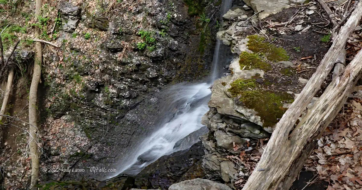
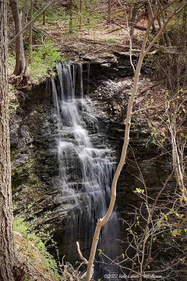
Size/Types: A steep 50 ft waterfall over shale. It has some protruding layers of stone that give it a mix of plunging and cascading. The second waterfall is more seasonal and may not be flowing much of the year. It starts out with a 4 ft plunge and then cascades about 10 or 12 more feet. Both are in heavily wooded areas.
Best time to visit: Spring and Fall (after rain) if you want a better chance of catching the smaller falls flowing. The insects can be brutal in mid-summer.
Flow: Low to moderate. The larger falls is typically flowing, but the smaller one will need the ground to be saturated.
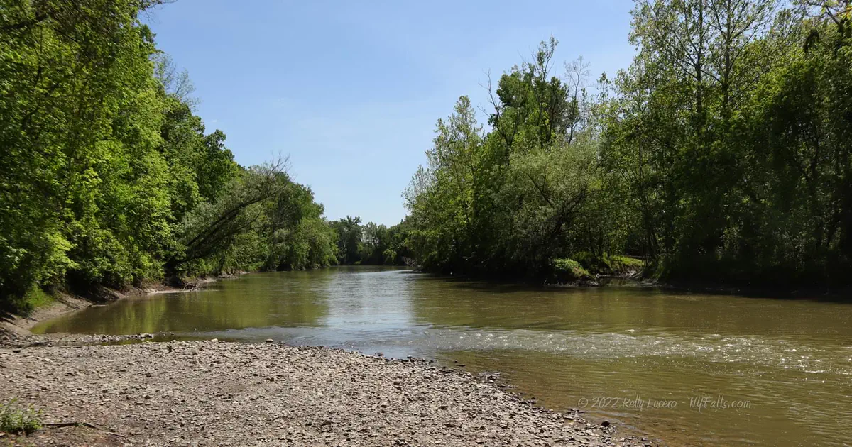
Waterway: Two unnamed tributaries to the Genesee River. The Genesee heads north, through the City of Rochester, over Lower and High Falls, and makes its way to Lake Ontario at Charlotte Beach, 35 miles north of here.
Time: 30 minutes to see the falls, hiking all the trails can take an hour.
Seasons/Hours: The preserve is open daylight hours, year-round.
Admission: Free.
Handicap Accessibility: Not accessible.
Pets: Allowed on a leash.
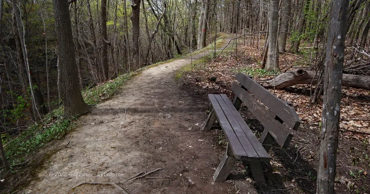
Accommodations: Trails, benches, hand craft launch, and an information kiosk. There are restaurants, restrooms, and shops in the village 2 miles to the north.

Description
Indian Fort Nature Preserve is a fairly new publicly accessible slice of land along the Genesee River, just south of Geneseo. Its two gullies each create beautiful falls along the exposed thin layers of shale and limestone in a very natural forest setting. Much of the preserve was farmed up until 1960, when it was left to grow naturally to forest, a process known as succession. What was originally 12 acres of woodland, has now become 60, all along the hillside leading into the Genesee Valley.
The Preserve has historical significance as well. A 15th century Seneca palisaded fort existed here, using the two gullies as natural “walls” of defense. The land was first owned by a Revolutionary War veteran with ties to the Seneca himself, and the road leading in once took travelers to the first bridge across the Genesee south of Avon.
The Preserve has 4 well-organized trails that take visitors to each of the waterfalls, across the site of the old fort and along the Genesee.
History
The native Iroquois and their ancestors built mounds and palisaded forts across the land to defend themselves from neighboring tribes. Usually these structures were built in strategically defensive locations, such as high and commanding sites along bluffs, or even in valleys, on top of small hills or constructed mounds with a bank or stream to offer a strong barrier from attack. Some have been constructed in isolated and elevated areas surrounded by swamp and in dense forests. Nearly all of them, that have been found, are near a source of fresh water and often near a hunting ground.
The forts were constructed by clearing a patch of woodland with fire and axes, collecting logs and using them to construct an encircling picket around a mound. The logs were held up by dirt embankments. Later on, the use of spade shovels, brought by European settlers, enabled the Iroquois to dig deeper trenches for the logs, resulting in a stronger barrier without dirt embankments.
Some of these forts were used for long periods of time. Digs have uncovered artwork, pipes, clay jars, tools, and remnants of underground food caches. The more permanent structures tended to be much larger than the temporary ones. They were generally used as protection for the elders, women, and children when a nearby village was under attack, or when warriors were on a campaign and the homestead was lacking protection.
As early as 1792, a large fort near Livonia was discovered along Conesus outlet, when John Bosley tilled his newly settled land atop a hill and uncovered numerous artifacts, including tomahawks, axes, iron tools and trinkets. So much was unearthed, that they were melted down in enough quantity, that they were able to craft parts to build Bosley’s Mill.
Several of these discoveries were made along the Genesee Valley, including this site, which is mentioned in the 1905 book “History of Livingston County”:
In the wood lot on Mr. Austen’s “Sweet Briar” farm, twenty rods to the west of the highway leading from Geneseo to Mt Morris, and about the same distance south of the road running to Jones bridge, is a small aboriginal inclosure embracing 2 acres. Its outlines are still defined. It was most likely used as a temporary abode by the ancient Builders while they were cultivating, from year to year, a favorable spot on the productive flats just below.
The site consisted of two rows of palisades supported by dirt mounds (indicating it was constructed prior to the mass-introduction of European spade shovels.) The palisade walls were on the east and west sides of the fort, both running north-south. Palisades covering the north and south sides of the stronghold were not needed as the two gullies served as natural barriers. The fort was constructed and used by the Seneca in the 15th century. The mounds that held up the palisades can still be seen today.
Jones Bridge (Jones Bridge Rd, being the dead end road that the parking lot is located on) was the first bridge over the Genesee River, south of Avon. Originally constructed in 1816, it was destroyed by flooding in 1831, and then rebuilt again in 1832-1833. The bridge was most likely named after Captain Horatio Jones (or his kin). Jones (from Pennsylvania) was a member of the Revolutionary War’s Bedford unit in 1779. He was captured by the Seneca and taken to Caneadea, NY. During his capture he became fluent in the Seneca language and familiar with their customs. After the war, he was appointed as an interpreter to the Six Nations by George Washington, and facilitated the Treaty of Canandaigua in 1794 and the Treaty of Big Tree in 1797. In 1970 he settled on the land here on a farmstead that came to be known as “Sweet Briar.”
The Genesee Land Trust acquired the land in 2011 and created this preserve.
Hiking / Walking Trails
Difficulty: Moderate. Sometimes the trails may be muddy.
Markings: Colored blazes. A trail map and informational signage can also be found near the parking area.
Red Trail: Falls Trail
Yellow Trail: Fort Trail
Blue Trail: Houston Trail
White Trail: Side Trail
Distance: About .4 mile to get to both falls. More if you’d like to explore the other trails.
Description: The preserve has 3 major trails: Red, Yellow, and Blue. The White side trails are mostly alternate woodland trails that don’t lead anywhere special with the notable exception of the North-South trail on the west end of the preserve. It parallels the Genesee River and offers access to the river itself (for views or for launching canoes/kayaks).
To get to Falls 1: Follow the leading trail into the woods from the parking area, to the junction of the Red and Yellow trails. Take the Red (Falls) trail keeping watch on your left for a second junction with the Yellow trail. It should be at about 1000 ft in. Turn left onto this trail, which leads to a bridge just upstream from the falls. Cross over the bridge (don’t go left on the Yellow trail, which leads you back to the parking area). Just over the bridge you get a decent view of the falls. This larger falls is referred to by some as the Indian Fort Falls. I’m not sure of the source, but I could only find one author mentioning it by that name.
To get to the second falls, continue across the bridge on the Yellow Trail and southward a bit to a junction with the Blue (Houston) Trail. This passes just above the falls before hitting a junction with the main artery of the Blue Trail and the White Trail. Take a left on the Blue Trail for another angle of the falls.
What about seeing the falls from below?
While it’s not a great hike for the smaller south falls because of mud and debris, to get to the base of the larger falls, follow any of the colored trails to the White Trail along the Genesee River. Work your way to the base of the gully between the Yellow and Red Trails. Hike carefully up the gully.
Map: Interactive.


Indian Fort Nature Preserve Map
Indian Fort Preserve Media
Videos

Who to Contact
Genesee Valley Conservancy
585-243-2190
[email protected]
