Peppermill Gulf


This location is currently OFF LIMITS. This information is preserved here for archival purposes. You should not visit this location without permission.
Location: 6 miles south/west of Syracuse. Just outside of South Onondaga, town of Onondaga, Onondaga County, New York.
Maps: Google Map; Topographic; Interactive map.
GPS Coordinates: Parking area: N 42.92682 / W 76.21978
Peppermill Falls: N 42.91892 / W 76.23233
Directions:
To get there from Syracuse and points east: travel US Route 20 westward until reaching the intersection of NY-80. Turn right heading north on NY-80.
From points west: Travel US Route 20 east until reaching the intersection of NY-80. Turn left heading north on NY-80.
Follow NY-80 for about a mile until reaching Hogsback Road on your left hand side. Less than a quarter a mile down, there is a bridge with a pull off on the right hand side.
Parking: Roadside along Hogsback Road directly past the bridge.
Weather
Information / Accessibility / Accommodations
Number of falls: 1.
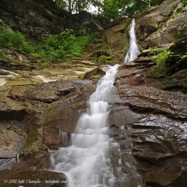
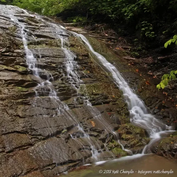
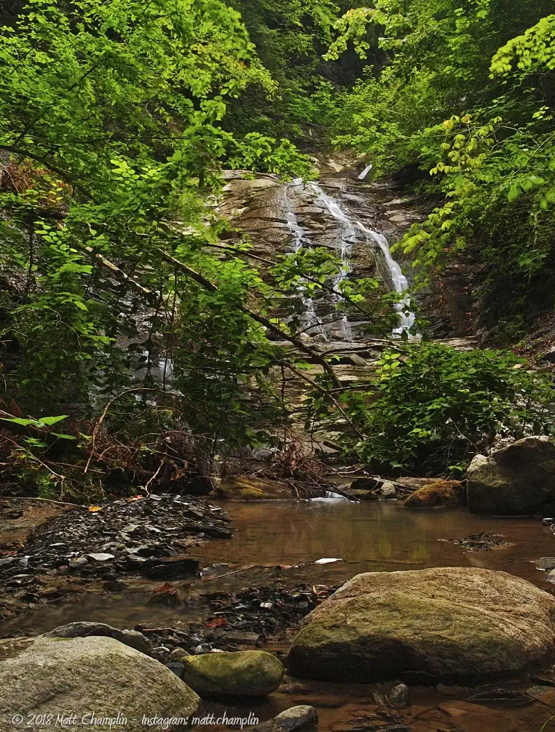
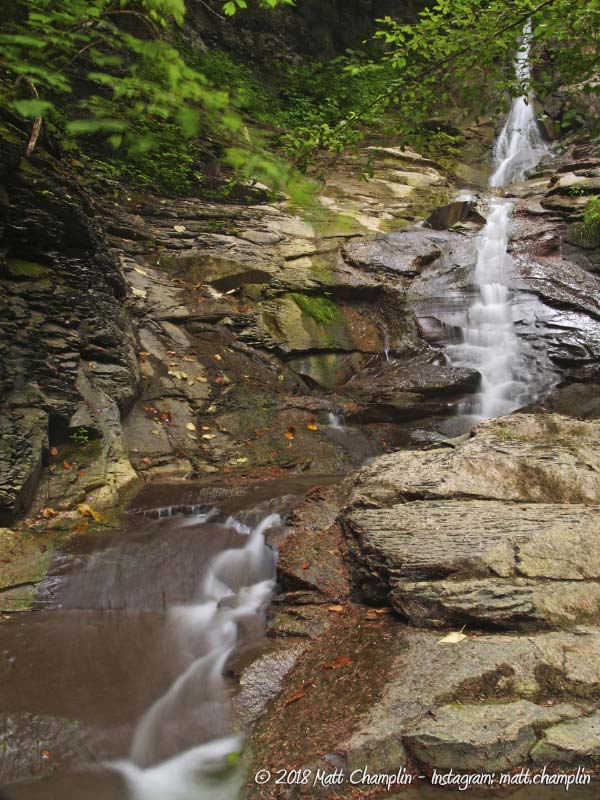
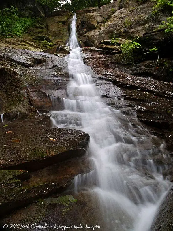
Size/Types: 90 ft multi-tiered cascade. There are three distinct drops on Peppermill Gulf Falls. The highest part of the waterfall drops steeply in a narrow channel down the limestone rock face. It briefly levels out before dropping steeply again, finally cascading and spreading widely down the rock at the base.
Best time to see: Spring, early summer, fall. Deer flies and horseflies can be a nuisance in mid-summer.
Flow: Somewhat consistent. Water flow can be low in mid-summer. High in spring.
Waterway: Peppermill Gulf is one of many creeks and brooks in the Tully Valley that flow into the West Branch of Onondaga Creek.
Time: 1.5 hours for the entire trip in and out. It’s about 2 miles round-trip.
Seasons/Hours: Off limits
Admission: Area is now POSTED. Do not trespass. (as of April, 2014)
Handicap accessibility: No.
Pets: No.
Accommodations: None.
Description
Peppermill Gulf Falls is just one in a series of ravines and glens that course down from the Tully hills, and enter the west branch of Onondaga Creek. The ravine itself is very secluded and wild, but contains ample evidence of past human activity. Unfortunately, years of dumping from careless landowners above the steep slopes of the gully have left the creek bed and surrounding flood plain awash in garbage, from cars to hundreds of tires that litter the forest.
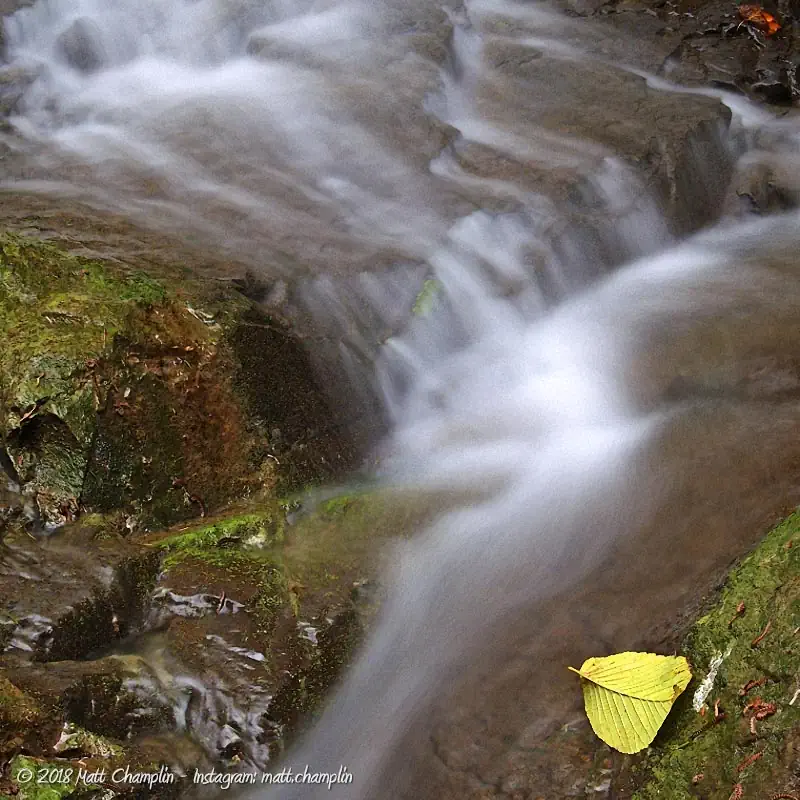
The waterfall is similar in structure to the nearby Fellows Falls in that it is made mostly of limestone that gives it a unique look similar to many western waterfalls. The lower part of the gulf contains larger boulders of granite while the middle portion of the gully is made of shale that is more common among Finger Lakes waterfalls. At nearly 90 ft high, Peppermill Gulf is quite a surprise to come upon in such a narrow ravine. Get here in spring for a challenging creek walk and a massive torrent of falls. Later on, the falls dries to a tall ribbon cascade. The sharp angles of limestone give this falls wonderful character and scaling can be a moderate challenge. You will most likely have the waterfall to yourself as the difficult walk and relatively unknown nature of this gem makes it unique in the area.


History
During the last ice age, the edge of a giant glacier stood at Tully Valley and had built up an enormous end moraine, about 600 feet high across the valley. As the torrents of melt water flowed south, they spread quantities of gravel and sand that now make up much of the valley floor. It is the most extensive area of glacial outwash in Central New York. The ravines above the floor of the valley have gradually eroded, forming steep gorges that make up the numerous waterfalls in the area, consisting of both Tully Limestone and shale. Just south of the moraine and Fellows Falls, lies the Tully Lakes, pothole and kettle lakes formed from enormous melt-waterfalls and chunks of ice from the receding glacier.
Peppermill Gulf is very distinct in its remnants – a large, prehistoric coral bed, unique to the Tully region, was found in the area dating from the middle Devonian period, nearly 300 million years ago. Certain fossil specimens were found only in this one area of New York State.
A map from 1874 shows a Saw and Grist Mill operated near the village of South Onondaga.

Hiking / Walking Trails
Again, this place is not off limits. Do not trespass. The information below is historical.
Difficulty: Difficult.
Markings: None.
Distance: Less than a mile creek-walk upstream.
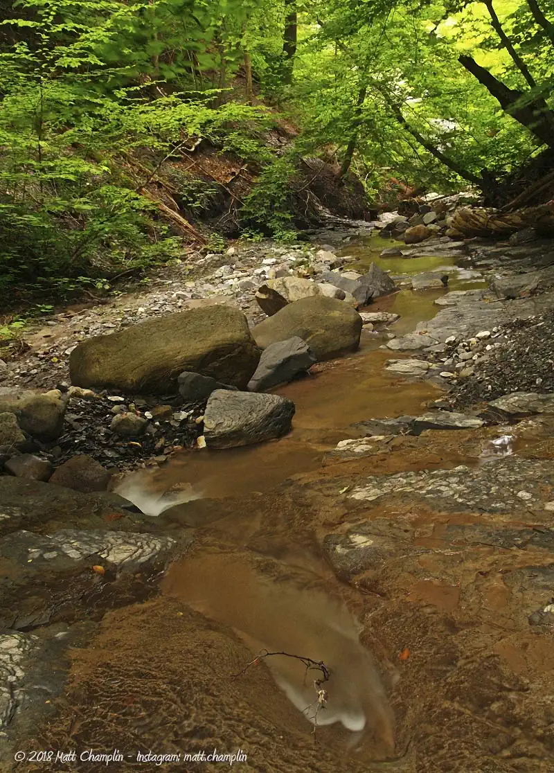
Description: The hike is a difficult one, consisting almost entirely of walking directly in the creek bed. From the bridge, walk upstream about 1.8 miles. Along the way, you will pass through various obstructions, from downed trees to the shells of old cars, snowmobiles, and a “tire forest.” Most of the junk along the way is a relic of days past when the farmers and landowners above the gully would toss their junk down the slopes into the ravine below. The forest has reclaimed the area, but the junk remains, making walking difficult, but interesting.
The lower part of the creek has larger granite rocks & boulders and it’s more open, making walking easier. About half-way in, there is a slight trail that dips into the forest for a short while. You will know you are getting close to the waterfall when the creek bed changes into a combination of shale & limestone and briefly narrows before opening up into the spectacular waterfall.
Map: Interactive.
Peppermill Gulf Falls Interactive Map
Peppermill Gulf Media
Coming soon.
Interesting Stuff
Peppermill Gulf Fossils
Keep an eye out for Devonian-era fossils in this layer of shale. There are many scientific publications touting the richness of this fossil bed.
Photography Tips
The Falls
- The gully is very narrow and heavily forested, making photography easier even in daylight. Due to various obstructions in front of the waterfall and in the gulf, getting a clear shot of it can be difficult.
- You can carefully climb up the side to get different elements of the plunges of the waterfall.
- Zoom in and get small drops and segments of the falls. Focus on the details, not the whole falls, which is difficult to get all in one shot.
Proper creek-walk footwear
- Wear the proper footwear for creek walking and climbing. Not only can a quality pair of water shoes prevent blisters and infection, they will help you stick better to the ground and reduce your risk of falling, hurting yourself, or your camera gear.
Silky Water Effect
- To get that smooth cotton-candy look to the falls, you need to use a Neutral Density (ND) filter on your lens. The ND filter will block some of the light from entering the lens without altering the color, and thus allow your shutter to stay open longer. This blurs the water and creates a soft white gloss to the foamy areas of the falls. Check out the article for the all the details.
More tips
- See the Articles for more photography tips.
Who to Contact
No contact information available.