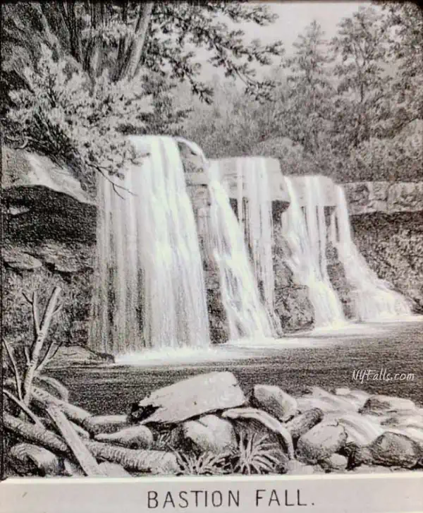
Bastion Falls


Location: Within Kaaterskill Wild Forest in Catskill Park (also known as the Catskill Forest Preserve); Town of Hunter; Greene County; New York.
Near the hamlet of Haines Falls.
Maps: Google Map; Topographic; Kaaterskill Wild Forest DEC Map; NYNJ Trail Conference Map; Interactive map.
GPS Coordinates:
- Upper drop: N 42.19182 / W 74.07038
- Lower drop: N 42.19145 / W 74.07051
Directions: The most common parking lot used to access this falls, off of CR-23A, is closed. There is no longer a direct and quick way to visit this waterfall on foot. You will have to hike down from Kaaterskill Falls. You can see these falls quite well as you drive past on the hairpin turn on NY-23A, but do so very slowly as the turn is rough and there can be an abundance of traffic. Don’t stop and don’t pull over in front of the falls.
Use this to get you there.
- Take CR-23A into Haines Falls and turn onto CR-18 (N Lake Rd). It will go north for a bit and then off to the right at the Twilight General Store.
- Follow it for 1.8 miles and then turn right onto Laurel House Rd.
- It will end at the Laurel House parking area for the trailhead to Kaaterskill Falls.
Use Google Maps to get you there.
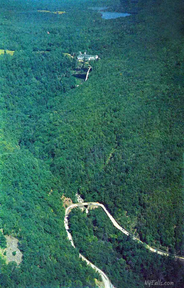
Parking: The parking area on Laurel House Road can accommodate over 20 cars and typically has a set of port-a-potties. At the south end of the lot is the trailhead that leads down to Kaaterskill Falls and eventually to Bastion Falls. On summer weekends this lot can fill up fast. Get there early to get a spot.
Parking is not allowed on NY-23A, as it is narrow and people never slow down. The Molly Smith parking area along that road is also closed, probably permanently. The town will tow you if you park along NY-23A.
Alternative parking can be had at the Escarpment Trailhead to the east.
Or the Scutt Rd Trailhead to the north.

Weather
Information / Accessibility / Accommodations
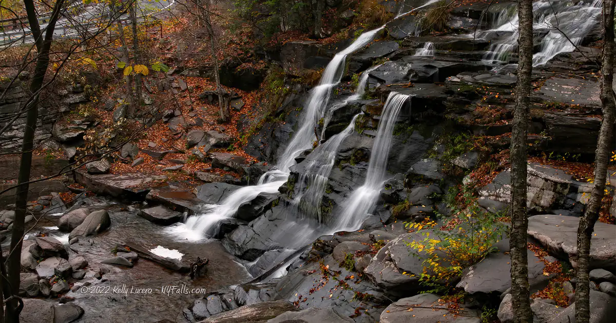
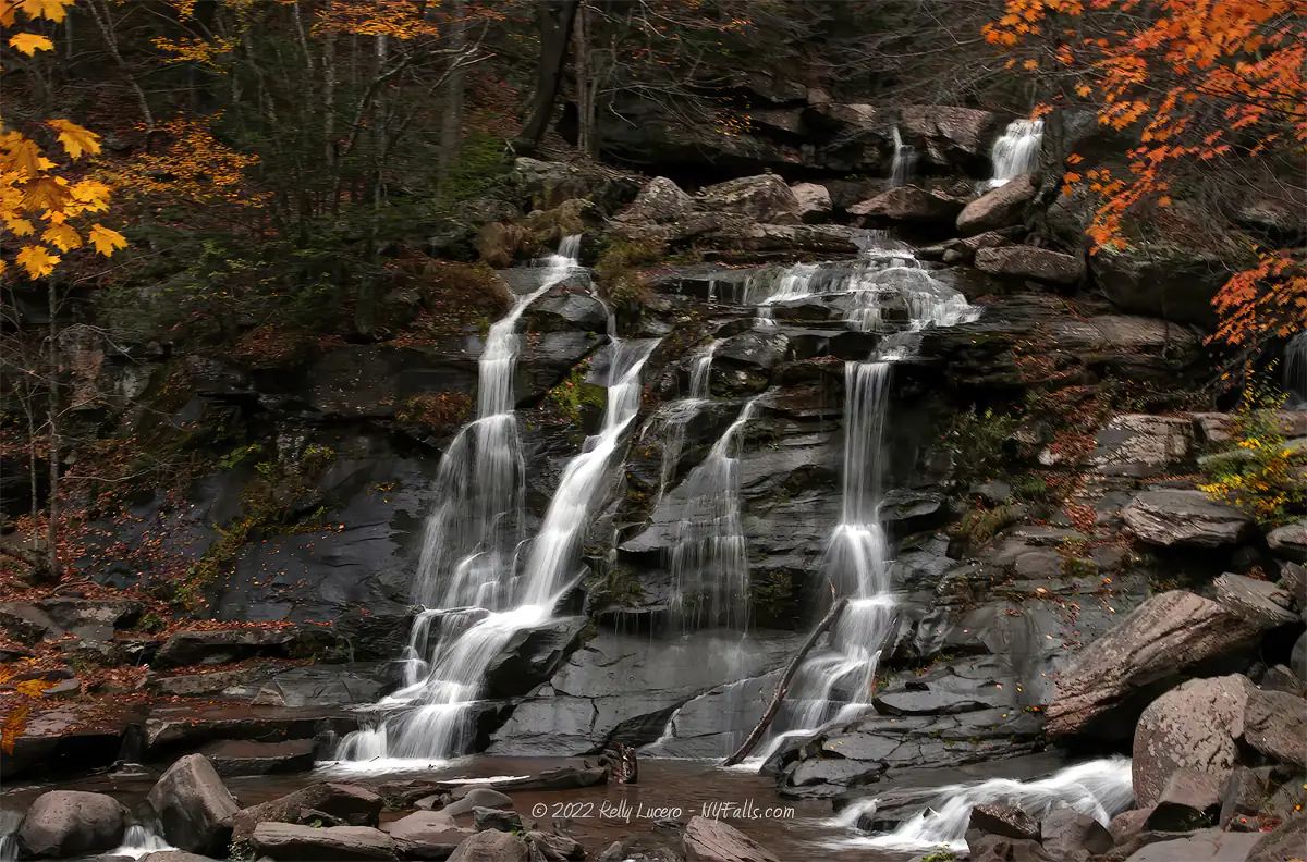
Number of falls: Bastion Falls is a single waterfall with 2 tiers. If you hike to this one, you’ll see Kaaterskill Falls on the way down. Drive-by and you will see just the one waterfall.
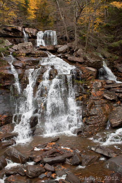
Size/Types: At about 70 ft tall, the falls starts out as a blocky and steep step cascade over thick layers of bedrock. About 20 ft downstream it tumbles down an irregular and taller cascade which widens and splits the creek into several ribbons. From there it travels under the NY-23A bridge.
Kaaterskill Falls is uphill and on the way down from the new trailhead.
Best time to visit: Spring through fall. The hike down in winter would require crampons.
Flow: Moderate. It has been known to dry up in late dry summers.
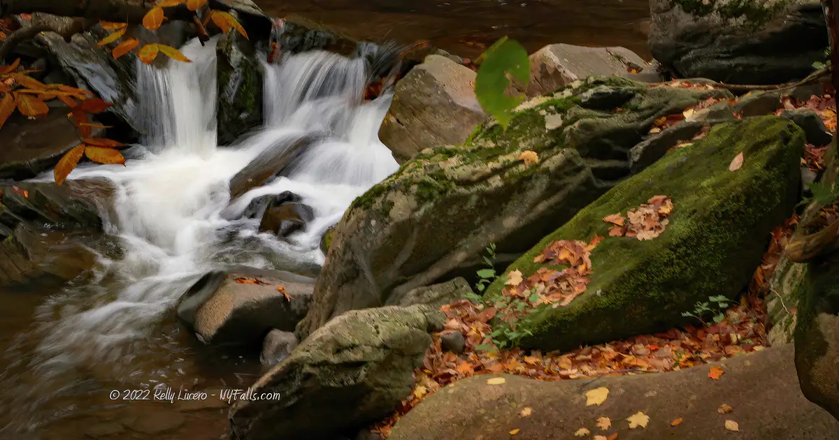
Waterway: Spruce Creek, which begins about a mile and a half to the north at North Mountain, flowing south and through North and South Lakes prior to reaching Kaaterskill Falls. It turns west just before the falls and then turns south again after Bastion Falls and joins Kaaterskill Creek shortly after. Kaaterskill Creek cuts a narrow gorge, known as Kaaterskill Clove, as it enters the Hudson Valley at Palenville. It does its own U-turns as it turns north after Palenville, back south just shy of Kiskatom, back north again at Asbury, and then finally to the east as it merges with Catskill Creek. Catskill Creek then runs through the village of Catskill and into the Hudson River. The Hudson flows south to New York City and the Atlantic Ocean.
Time: You can see the falls via car as you reach the apex of the hairpin turn in the gorge on NY-23A. It goes by quickly.
IF you want to hike down from the trailhead at the top near Kaaterskill Falls, allow for several hours. Try not to take the hike down late in the day as it may be dark and thus more dangerous on your way back. Most importantly check the hourly weather for the time you expect to be on this trail as it can get very muddy and slippery during rain.
Seasons/Hours: No hours are posted, but for safety: dawn to dusk, 7 days a week. The trail may be closed in winter or icy conditions, or if there are landslides. This place can get really packed on summer weekends. If you want to enjoy yourself without the crowds, plan on an early morning weekday trip.
Admission: Free.
Handicap Accessibility: You can see the falls from NY-23A as you pass by in your vehicle.
Pets: Leashed pets are allowed in the park, but because of the danger not only to your pet, but to other hikers along these narrow slippery trails, do not bring your pet on difficult hikes. Remember that you are liable for any injuries/damage caused by your pet, including rescue operations.
Accommodations: Trails, port-a-potties.


Description
AKA: Lower Kaaterskill Falls, Sebastian Falls, Rip Van Winkle Falls
Bastion Falls is often overshadowed by the great Kaaterskill Falls, which is just upstream in the preserve. From time-to-time I see a guide or photo posted that refers to Bastion as Lower Kaaterskill Falls, which I guess, to some degree, it is. It’s on the same creek and accessible via the same network of trails. It has a different character through. Much less defined in structure, but by no means any less unique.
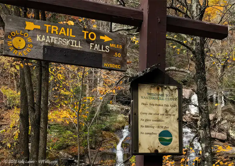
Bastion Falls is large at over 70 ft tall. It creeps out of the gorge as NY-23A winds in and out, making many drivers new to the area do a double-take. A popular parking lot just west of the falls would bring hikers sprinting across the road and then scrambling to dodge speeding traffic to make their way to the trailhead at Bastion Falls, one that leads all the way up to Kaaterskill Falls and the Laurel House parking lot at the top of the gorge. A series of way-too-close calls has resulted in the lot being closed and the trailhead roped off. Visitors are encouraged to start from the top and work their way down. Those who love Bastion don’t seem to mind. Limiting such quick, yet risky access, seems to have tamed the crowds, yet still allows the dedicated to make the full trek down and then back up in order to spend quality time wading in its pools.
History
Head on over to the Kaaterskill Falls guide to read up on the history behind the area.
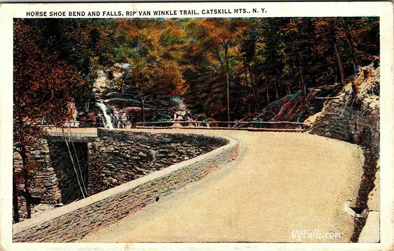
The Rip Van Winkle Trail is a scenic route along NY23A from Palenville to Haines Falls, following the footsteps of the legendary Rip Van Winkle and his faithful dog, Wolf. The stonework along the way was built largely by convict labor in the early 1900s.
The area of roadway where Bastion Falls is situated has been historically referred to as Horseshoe Curve (sometimes Horseshoe Bend) because of its abrupt about-face precisely at the spot where you need to look out your car window to see the falls. Enjoy some old postcard views of the area.

Hiking / Walking Trails
Difficulty: You can see this one easily by driving by on NY-23A. With the Molly Smith parking lot and trailhead at the falls now being closed, hiking to the falls requires a hike from above at Kaaterskill Falls, increasing the difficulty to moderate-to-difficult. It’s very difficult in icy conditions.
Markings: Blazed trails (Yellow and Blue)
Distance: About 1 mile one way.
Description: If driving by for a quick look…
- Head west on NY-23A for about 3.4 miles (6 minutes uphill).
- Slow down a bit, and keep an eye out on the right as you make the hairpin turn.
- Be mindful of traffic as many drivers just zip by here.
To hike down…
There currently is no parking area near the base of the falls. You’ll need to start all the way up at Laurel Hill Road, hike down to Kaaterskill Falls and then continue on the yellow trail all the way to the bottom at Bastion Falls. Check out the Kaaterskill Falls guide for more details on that hike.
Map: Interactive.


Bastion and Kaaterskill Falls Interactive Map
Bastion Falls Media
Videos

Contributor Photos & Art
Photos by community member Jim Weeks (aka backpacker):


Photo by community member and waterfall expert L_G_D:

Photo by community member Des219 (Salabsky):
Photos by community member ApprochingLight:


Who to Contact
DEC Region 4 Stamford Office
M-F, 8:30 AM – 4:30 PM
Phone: 607-652-7365
[email protected]
Enforcement Matters
518-408-5850 (24/7) or 911


