Mills Mills Falls


Location: Within the Town of Hume; Allegany County; South of Letchworth State Park; New York
Maps: Google Map; Topographic; Interactive map.
GPS Coordinates: Mills Mills Falls: (N 42.50170 / W 78.11951)
Mills Mills Dam: (N 42.50084 / W 78.11993)
Directions: Mills Mills Falls and Wiscoy Falls are in the same general area. The journey will take about an hour from Rochester.
From Rochester or the NYS Thruway, head south on I-390 to exit 7 and take NY-408 west towards Mt Morris/Letchworth State Park.
The directions get a little complex from there, so it’s best to leave it up to Google Maps.
Parking: There are no lots. This is a roadside falls only. If you want to get out for a better view, park on the side of the road at the intersection of Pond and Armison Rds.
Weather
Information / Accessibility / Accommodations
Number of falls: 1 natural waterfall and one man-made dam.
Size/Types: The dam is about 8-10 ft high. The waterfall below is a series of ledges creating a staircase cascade of about 20 ft in height.
Best time to visit: Year-round.
Flow: Reasonable flow throughout the year.
Waterway: Wiscoy Creek. The creek starts out as a pond about 20 miles west of here in the town of Eagle, Livingston County. It creates Mills Mills Falls and Wiscoy Falls in the town of Hume. Just a couple of miles east of the falls, it joins the Genesee River, which heads north through Letchworth State Park, the city of Rochester, and then empties into Lake Ontario.
Time: A few minutes.
Seasons/Hours: Daylight hours.
Admission: Free.
Handicap Accessibility: There is no sidewalk and the shoulder of the bridge is too narrow. A view from the car is best.
Pets: Keep them in your car.
Accommodations: None.
Description
Don’t take the journey out to just see Mills Mills Falls. It’s on private property, and as far as I know, the area below the falls is off limits. If you do happen to make it down to Letchworth State Park, then have time to swing down to nearby Wiscoy Falls, and still have time left, this is an easy stop in order to check one more waterfall off your list.
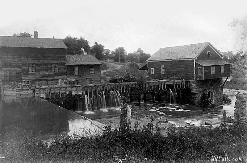
Armison Rd crosses Wiscoy Creek between the 10 ft dam and the 20 ft falls, and from the road you can easily see both. Unfortunately the view of the falls is from the top, and not that impressive. It’s the best you’ll get as the land around it is on private property.
History
The name “Wiscoy” comes from the Caneadean language, meaning “The Creek of 5 Falls.”
The Town of Hume, probably named after Scottish philosopher and historian David Hume, was first settled by Roger Mills in 1806. At the time, Hume was a part of the town of Angelica. Mr. Mills settled at the upper falls (Mills Mills Falls) at the intersection of Mills Mills Road and constructed a log cabin, dam, and saw mill. A gristmill was built the following year. A successful venture, the gristmill served farmers and families within a 40-mile radius, including the native Caneadea Native Americans who originally inhabited the region. The gristmill was also used as a makeshift inn for those traveling through, as well as the new settlement’s post office. This settlement was appropriately named “Mills Mills.”
At its peak, Mills Mills was thriving, with an added furniture factory, carding mill, distilleries, stage depot, schools and homes. Today it’s just a few family homes.
Hiking / Walking Trails
Difficulty: Easy (just see it from your car as you drive by).
Markings: None.
Distance: N/A
Description: If the drive by view isn’t satisfactory, find a wide shoulder nearby and walk back to the Armison Rd Bridge to get a better look. Be mindful of traffic because the shoulder is very narrow.
The land on the right side of the falls has POSTED signs. Do not trespass.
The narrow sliver of land to the left of the falls did not have any signs when I drove by in 2020. There didn’t seem to be a trail and I could not gauge the climb down. It may be a possible access point.
Map: Interactive.
Mills Mills Falls Interactive Map
Mills Mills Falls Media
Coming soon…
Contributor Photos & Art
At this time I have not been able to get out to this site and photograph yet. In the meantime, those with suitable photos or original works of art, who would like to be featured here, please contact me. Photos, paintings, and illustrations would be subject to quality review, and not all will be accepted. Your work can be accompanied by a link to your site/store/insta.
Explore More
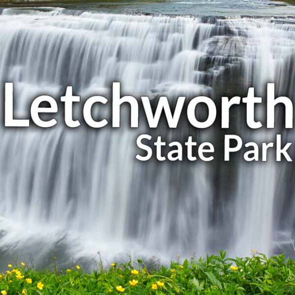
Letchworth State Park
Referred to as “The Grand Canyon of the East,” Letchworth is nowhere near as large or interesting as the National Park. But for the region, it is a beautiful giant park, with a dozen or so waterfalls, plenty of trails, and some of the best sights in the northeast. Think you’ve seen it all before? You most likely haven’t. Check out this guide to find all of the waterfalls in the park.

Wiscoy Falls
A beautiful and large roadside falls just east of Mills Mills Falls. Take the small trail up the north side of Wiscoy Creek to see even more falls.
Who to Contact
No contact information