Mine Kill Falls


Location: Within Mine Kill State Park; Town of Blenheim; Schoharie County; New York.
Maps: Google Map; Topographic; Interactive map.
GPS Coordinates:
- Upper Mine Kill Falls: N 42.42898 / W 74.47265
- Middle Mine Kill Falls: N 42.42921 / W 74.47194
- Lower Mine Kill Falls: N 42.42925 / W 74.47162
- Viewing Platform: N 42.42903 / W 74.47190
- Closest Parking Lot: N 42.42720 / W 74.47187
Directions: From Albany, take I-90 west past Schenectady. Take exit 52A to get onto I-88 West towards NY-7/Schenectady/Binghamton. Stay on I-88 for 16 miles. Take exit 23 for NY-30A toward NY-7/NY-30/Schoharie/Central Bridge. Head south on NY-30 for 25 miles. Pass over Mine Kill, and look for the entrance to the parking area on your left. Or use Google Maps.
Parking: The state park has 3 parking lots, but only one is on the west end where the waterfall is. It’s off of NY-30, south of the bridge over Mine Kill. There’s room for 20+ cars.
Weather
Information / Accessibility / Accommodations
Number of falls: 1 waterfall with multiple sections. In periods of high flow, a seasonal cascade can be found dropping just to the right of Lower Mine Kill Falls.
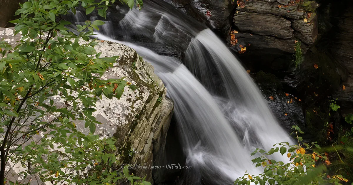
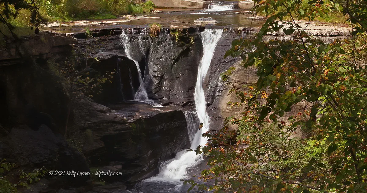
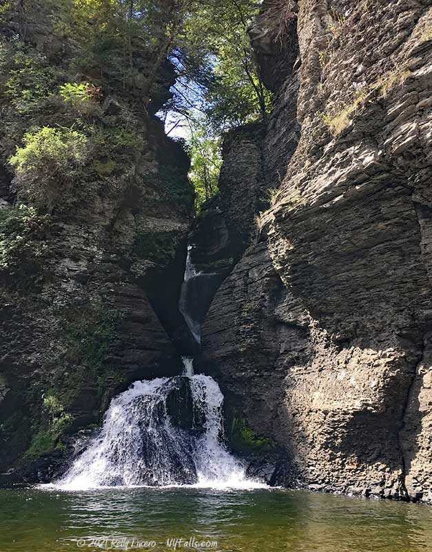
Size/Types: The upper falls is a 20 ft cascade just below the NY-30 bridge. The Middle Falls is a narrow 40 ft tall cascade that winds around a deep gorge. Mine Kill then spreads out as it falls about 20 ft over the Lower Falls into a sizable pool. It’s about 80 ft high in total, but not all sections can be seen at once.
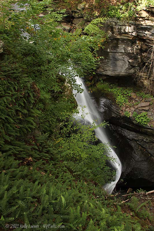
The seasonal waterfall that can sometimes be seen next to the Lower Falls, usually after heavy rain, is a 70 ft tall cascade off of a sheer cliff.
Best time to visit: Spring through fall.
Flow: Moderate. It can dry by late summer.
Waterway: Mine Kill, which starts out about 7 miles northwest in Jefferson County. After the falls, at the east end of the park, it empties into the Blenheim-Gilboa Reservoir, which was created by a hydro-electric power dam on Schoharie Creek. The Creek flows 25 miles north from here where it joins with the Mohawk River. From there the Mohawk travels east towards Albany. It has a confluence with the Hudson River at Cohoes. The Hudson then heads south over 150 miles to NYC and the Atlantic Ocean.
Time: About 30 minutes to an hour. The park offers several amenities beyond these falls and may be worth planning more time to explore the park and make it a full day.
Seasons/Hours: Year-round, dawn to dusk
Admission: Free.
Handicap Accessibility: There is a nice viewing platform made of flat lumber, but steps lead to it. The Lower Falls is a steep trail. Other areas of the park (near the swimming pool) offer more accessibility.
Pets: Allowed on a leash.
Accommodations: Biking, Boat launch, Concession stand; Disc golf (fee required); Fishing; Pavilions; Picnic tables; Soccer fields; Swimming pool (free); Ice Skating, Cross-country Skiing, and Sledding is available in winter months.
Description
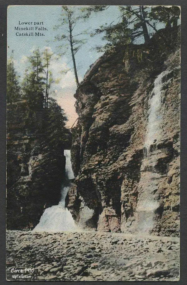
Mine Kill Falls is a beautiful and complex series of drops along Mine Kill in Schoharie County. The falls consists of three drops with the Upper Falls occurring in a relatively open section of the stream just outside the park, the Middle Falls go on winding through a virtually inaccessible tight gorge, with the Lower Falls emerging into an opening and filling a sizable pool. In the wet season, an additional waterfall, a sparkling 70ft drop can be seen right next to the Lower Falls.
The State Park, which is funded by the NY Power Authority, has constructed a wealth of day-use facilities, including trails to the Lower Falls, a viewing platform for the Upper and Middle falls, a swimming pool, athletic fields, museums, picnicking pavilions, disc golf course, boat launch, and more… all provided compliments of the Power Authority. The north end of the park houses the New York Power Authority Blenheim-Gilboa Visitor Center and the Lansing Manor House, both worth visiting, which provide opportunities to learn more about local history and the hydro-electric project that led to the creation of the adjacent reservoir. While the waterfall can be seen in a matter of minutes, the park can easily fill the rest of the day and is well worth visiting if you are in the area.
History
Pioneer settlers of the Capital Region were allowed to settle Dutch land as long as they paid taxes and rent. They had no option to purchase the land on which they lived, nor did they have mineral, hunting, or fishing rights. This Feudal-style system did not sit well with the new American settlers. From 1839 to 1845 the Anti-Rent War (also known as the Helderberg War) was a series of posse campaigns and riots by “anti-renters” to voice for change in this archaic system. Much of the anti-renter campaigns involved white settlers wearing “Calico Indian” disguises, taking to horseback, and then surrounding government employees. One posse ride of significant size took place just west of here near Blenheim Hill. The “war” drastically changed New York politics, which added renters’ rights to the lawbooks in 1846.
Construction began on the Blenheim-Gilboa Pumped Storage Power Project in 1969. The dam flooded the Schoharie Valley with 5 billion gallons of water. A few family estates were relocated to make way for the new reservoir. The Blenheim-Gilboa Visitor’s Center, which is just north of the park, is housed in a restored 18th century dairy barn. Also on the site is the Lansing Manor House, built in 1819 by John Lansing Jr., which now serves as a museum. The NY Power authority maintains the dam, reservoir, visitor’s center, and Mine Kill Park.
Hiking / Walking Trails
Difficulty: Easy to moderate. There are some steps. The most difficult part is getting down the sloping trail to the base of the falls. When dry, it’s not bad.
Markings: Signs and well marked trails
Distance: Less than a third of a mile to see the falls. There are miles of trails to explore other parts of the park.
Description: From the parking area off of NY-30, on the west end of the park, head north towards some picnic tables and where a grey-blazed trail runs past the parking lot. You want to head left on that trail (known as “Old Long Path”) towards the opening in the woods.
After about 500 ft you will come to a junction with a green-blazed trail called “Long Path.” Going right on this green trail will loop around a small seasonal tributary glen and get you to the bottom of the falls. Going left will take you to the bridge over the upper falls and loop around to the east side of the park.
To get to the viewing platform for the Upper Falls, keep straight at that junction. The path will lead you right to a wooden observation deck. From there you will see the Upper Falls to the left and Middle Falls directly below the right of the platform.
Head back to the junction with the green-blazed Old Path. Turn left. This path will wind around for about 1,000 ft with the last 200 ft or so getting steeper as it goes down to the pool at the base of the falls. Head back the same way you came to get to the parking area.
You can see the Upper Falls from the NY-30 bridge, but there’s not much room for pedestrians. Be mindful of traffic.
If you’d like to hike further into the park, seek out the Old Path Trail. See the interactive map for more detail.
Map: Interactive.

Mine Kill State Park Interactive Map
Mine Kill Falls Media
Videos
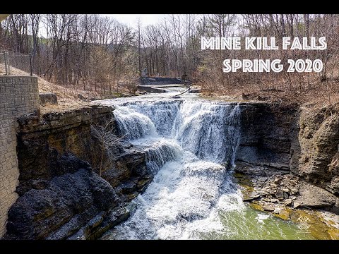
Video by Kelly Lucero
Video by Kelly Lucero
Interesting Stuff
Old Path
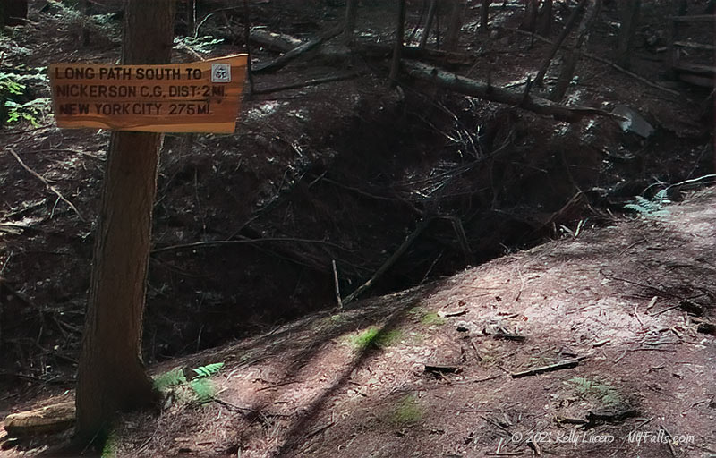
The Old Path that runs through the park is a part of a 358 mile network of trails connecting parks and preserves from John Boyd Thacher State Park near Albany all the way to 175th Street Subway Station, in New York City. Nonstop, it would take about 120 hours to hike all 358 miles of the trail.
Who to Contact
Mine Kill State Park
161 Minekill Road
North Blenheim, NY 12131
Phone: (518) 827-6111
