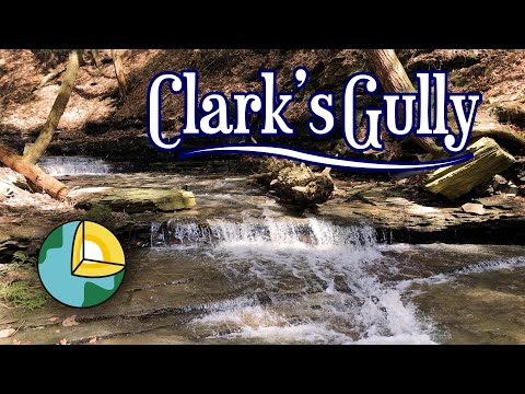
Clark Gully (Lower)


Location: On the south end of Canandaigua Lake; in the Hi-Tor Wildlife Management Area; Near Naples, in the Town of Italy; Yates County, New York.
Maps: Google Map; Topographic; Interactive Map.
GPS Coordinates: DEC Parking lot: (N 42.66386 / W 77.33473)
Trail-head and parking: (N 42.66185 / W 77.33371)
Waterfall at the end of this hike: (N 42.66489 / W 77.33545)
Directions: Take Rt. 245 to the south end of Canandaigua Lake and Sunnyside Rd, across from Niagara Vineyards. Sunnyside will split into West Ave, where a DEC parking area is located. The gully entrance is on the right on Sunnyside just after this split. Look for 2 dirt paths stemming from a dirt pull-off area.
Parking: Dirt parking area at the gully entrance (3 cars) or a DEC parking lot at the West Ave/Sunnyside junction (20 cars).
Weather
Information / Accessibility / Accommodations
Number of falls: 3
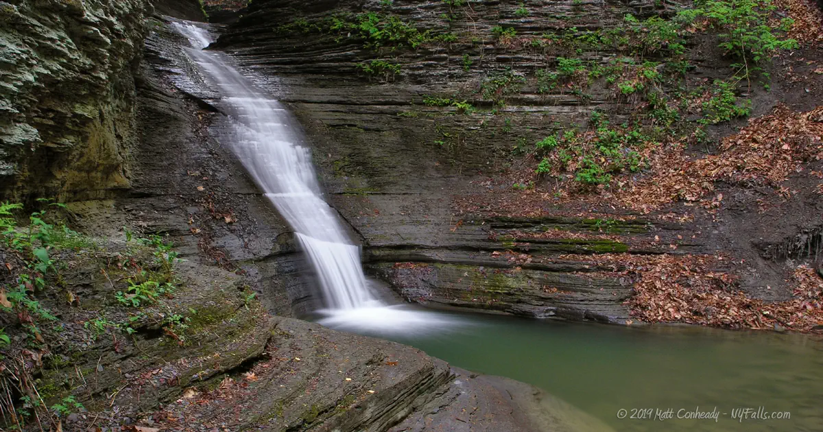
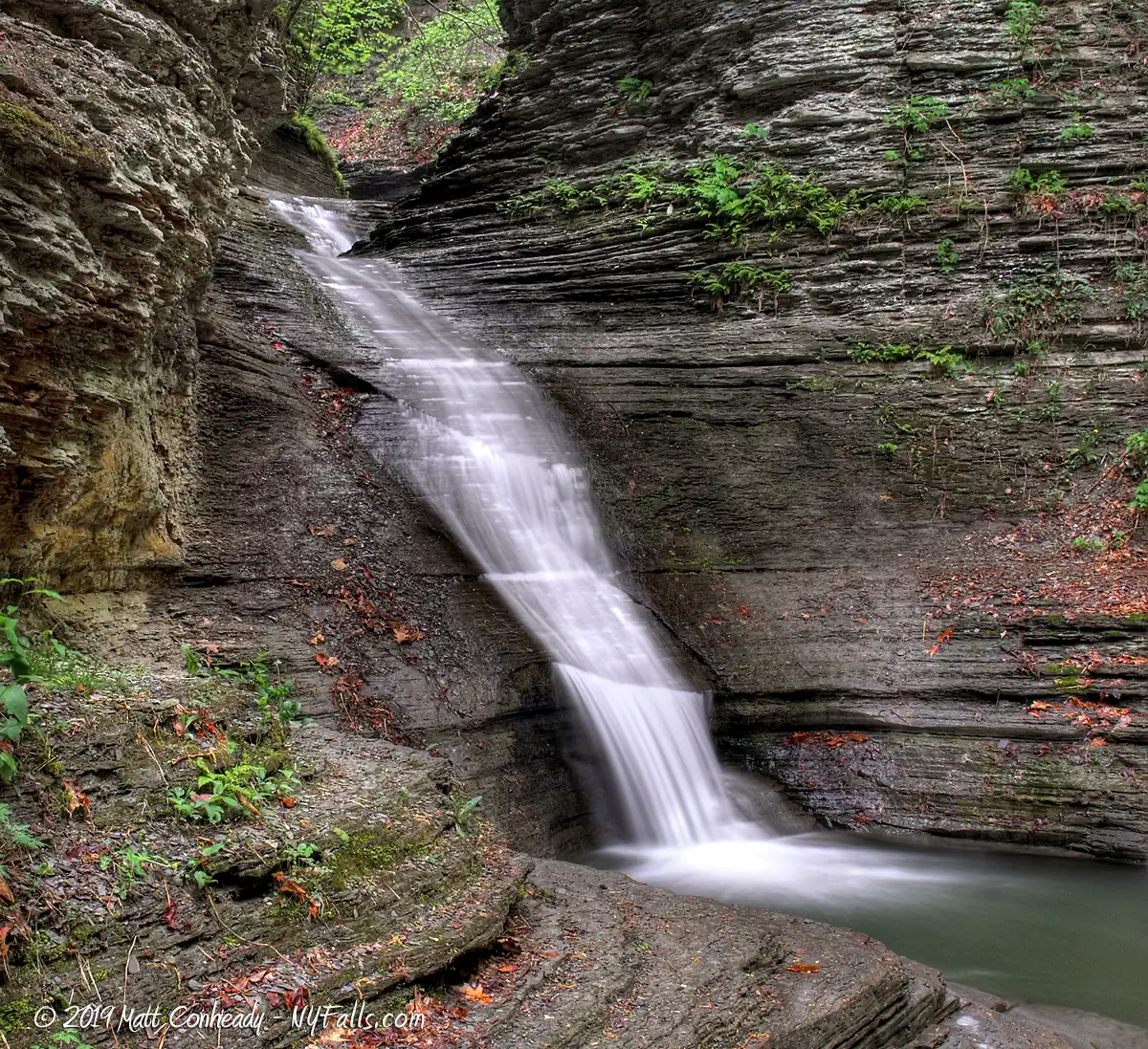
Size/Types: An 18 ft high cascade with a 7 ft cascade just above. A 3rd 18 ft cascade is above both of these, but due to the steep and narrow channel, it’s inaccessible.
Best time to visit: Spring and fall after rain.
Flow: Ranges from trickle to medium flow. Be careful as the gully is narrow and can flood easily after downpours.
Waterway: Clark Gully, a tributary to the West River, which flows southwest, then just a mile from Clark Gully hooks north and empties into Canandaigua Lake.
Time: 30 minutes to an hour.
Seasons/Hours: Open year-round. Be careful during hunting seasons.
Admission: Free.
Handicap accessibility: Not at all.
Pets: Allowed on a leash.
Accommodations: Hiking; Fishing (near the DEC parking area). Please do not leave trash at this site.

Description
AKA: Clark’s Gully (used in old maps and documents); South Hill Gully.
The Hi-Tor region was set aside to protect the wildlife present in the southern Canandaigua Lake watershed. The area, in the Naples Valley region, is rich with wildlife. Clark Gully has many waterfalls, but most of them are on the upper end of the Gully, not easily accessible from this hike, and best saved for the more advanced hikers and climbers. The lower portion is a short hike to an oddly-shaped shale waterfall. The two waterfalls directly above it are only accessible from a descent from above. The gully is peaceful and in a very natural state. The climb is steep, but it’s well worth the challenge if you want a more secluded creekwalk as other Naples gullies tend to get more and more traffic..
The upper gully can be accessed from a different location covered…(soon).

History
This was formerly the Seneca Nation homeland, where the “People of the Stone Hill” held their base for hundreds of years in a settlement called Tsonontowan, near what is now Naples, NY.
Clark Gully’s importance to the history of the Seneca may be sacred. Several theories suggest that the people who believe that the creator opened up a stone mountain to let the first Seneca out into the world, can be geographically aligned to this very spot. With the homeland of the Seneca being nearby, and South Hill being the most prominent stone feature, Clark Gully could very well be the crack in the stone that the Seneca people first walked out of. Does the archaeological evidence support this? I have found little in the way of any study done by credible sources. But we have found many people interested in “spiritual” and “sacred” places that have made their own conclusions. The area surrounding the gully, more frequent uphill, has numerous rock piles and formations. Unfortunately, because of the nature of wooded areas in New York, it’s silly to think that a circle of flat stones would be left uncovered for a thousand years, let alone 10. Massive rock piles require much more effort to create, but are the common result of pioneer settlers clearing land for plowing. If there is real archaeological evidence to be had, it’s buried deep. That being said, Frederick Houghton states in The Characteristics of Iroquoian Village Sites of Western New York (1916) that artifacts found at the site are most likely of “pre-Seneca origin.”
Despite there not being prominent proof that this site is the sacred origin site of the Seneca people, it should be treated with respect, not only for people’s beliefs, but because it is just downright beautiful, and we are lucky to have it.
The gully is named after Col. William Clark and family, who first settled in Italy Valley in 1790. William lived in the valley until his death in 1851, at the age of 81. The land passed through his family for several generations. The gully seems to be named in his honor, rather than because he owned the land it is on.
Hiking / Walking Trails
Difficulty: Moderate.
Markings: Markings define designated hunting areas.
Distance: Less than a quarter mile to the falls.
Description: Two trails lead from the pull-off area to the creek bed (the right one approaches the creek quicker). Follow the creek uphill, past multiple ledges and several downed trees. Since this gully is not a park and not maintained in any way, you will find plenty of debris. The waterfalls are around the bend after a quarter-mile.
The other waterfalls are above, but the climb is very steep and dangerous. I do not recommend climbing this waterfall at all, but some do. Additional falls can be approached from the north via Upper Clark Gully.
Map: Interactive.

Clark Gully Interactive Map
Clark Gully Media
Interesting Stuff
Benchmark
Want to test out that new V8 engine you bought to compensate for something? Drive up South Hill Road, which climbs about 900 feet to the top of South Hill.
Upper Clark Gully
Here’s where most of the waterfalls are located in the narrow section of the gorge. It will take a lot of climbing, skill, and caution. Advanced hikers only. Access it from South Hill Road.
Photography Tips
Shooting wide
- The gorge is narrow, and you may not have much space to back up to capture scenes. Bring your wide angle lens.
The creek
- This is one steep creek. Use that to your advantage by shooting upstream, filling more of the frame with the creek and flowing water. Keep close foreground elements sharp by shooting with a narrow aperture.
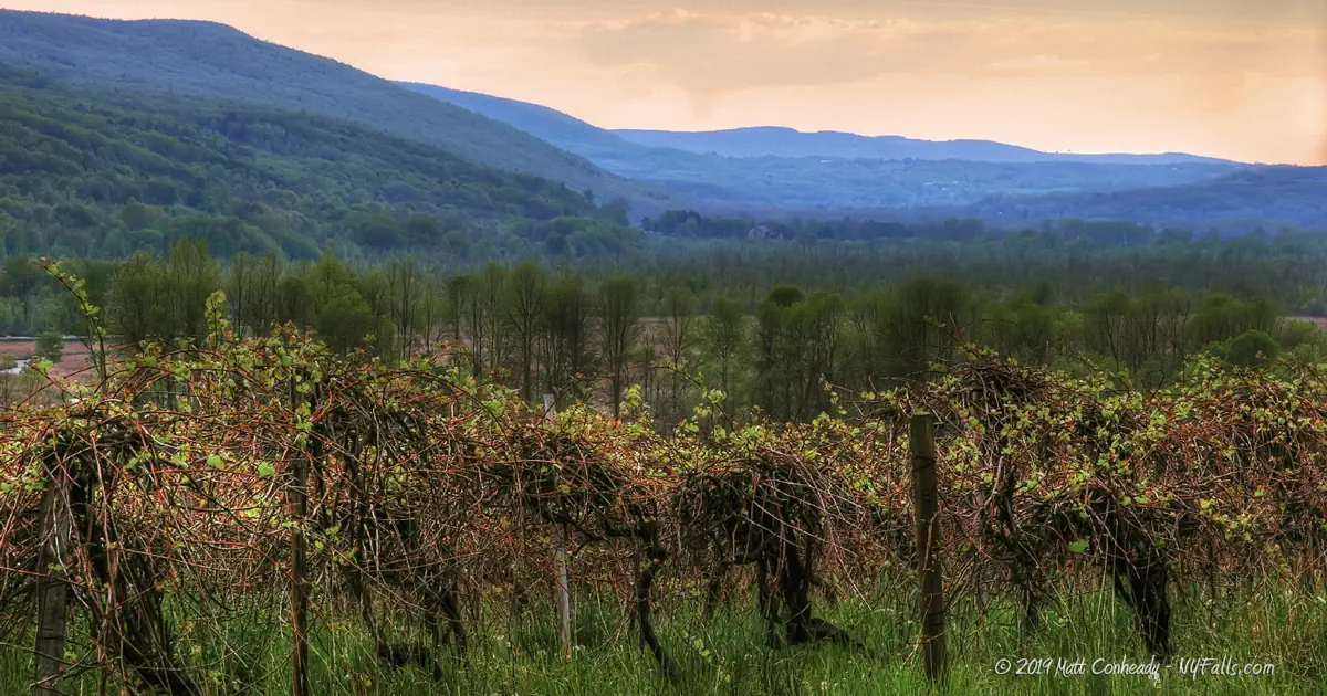
The vineyard
- The vineyard across the street, surrounded by the hills of Naples Valley, can’t be ignored. Get there at sunrise or sunset for some great landscapes, and keep those vines in the foreground.
Silky Water Effect
- To get that smooth cotton-candy look to the falls, you need to use a Neutral Density (ND) filter on your lens. The ND filter will block some of the light from entering the lens without altering the color, and thus allow your shutter to stay open longer. This blurs the water and creates a soft white gloss to the foamy areas of the falls. Check out the article for the all the details.
More tips
- See the Articles for more photography tips.
Who to Contact
NYS DEC Region 8
6274 E. Avon-Lima Rd.
Avon, NY 14414
Phone: (585) 226-2466
[email protected]