Lyndonville Dam Falls


Location: South of Lake Ontario; In the village of Lyndonville; town of Yates; Orleans County; New York
Maps: Google Map; topographic; Interactive map.
GPS Coordinates: Dam: N 43.32227 / W 78.38931
Parking: N 43.32252 / W 78.38885
Park: N 43.32198 / W 78.38907
Directions: Take NY-104 (Ridge Rd) to NY-63 (Lyndonville Rd) and head north for about 4 miles. Look for the dam on your left, just before the high school.
Or use Google Maps.
Parking: There is roadside parking along N. Main St. south of the bridge.

Weather
Information / Accessibility / Accommodations
Number of falls: 1.
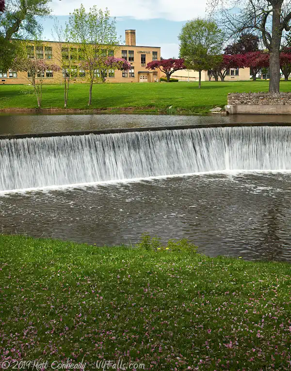
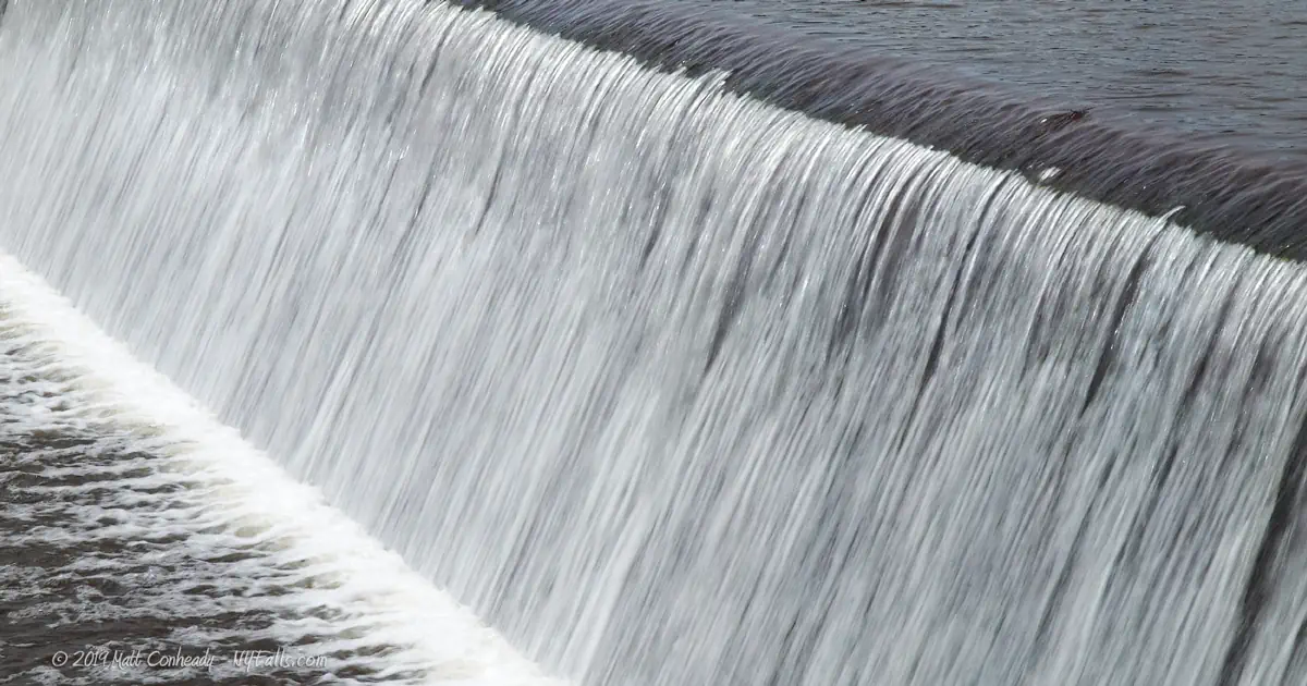
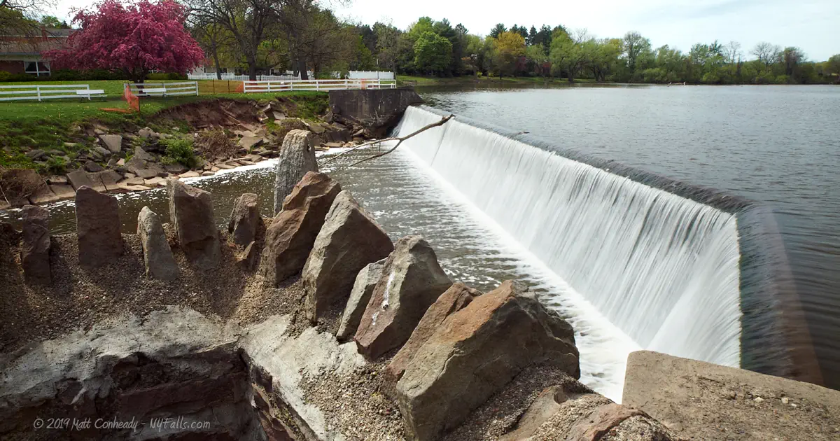
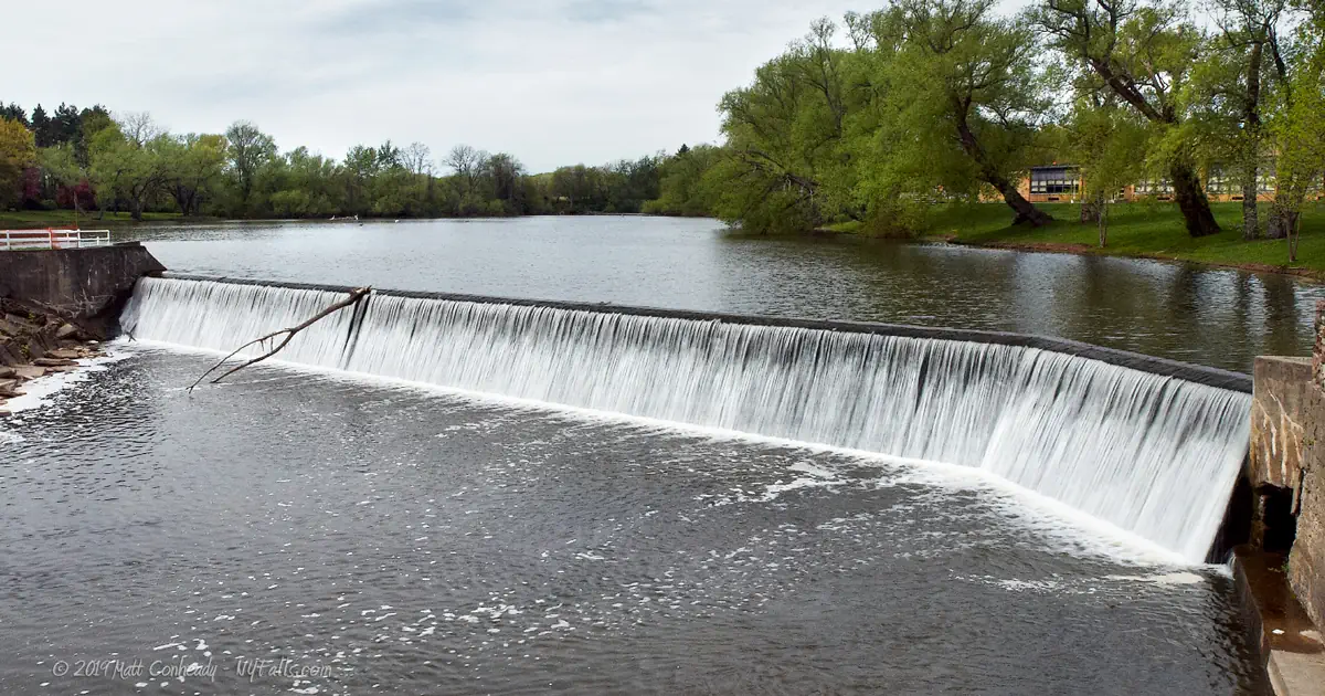
Size/Types: The Lyndonville Dam is 11 ft high and 275 ft across, creating an even cascade across its length.
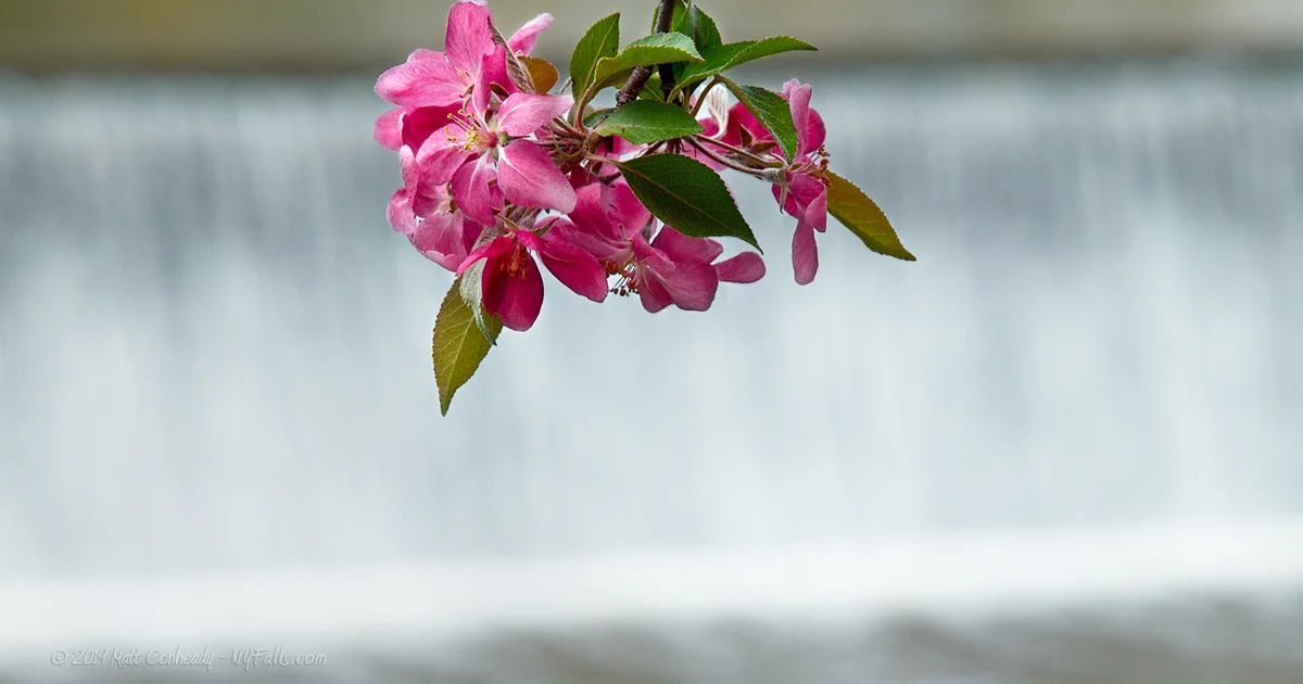
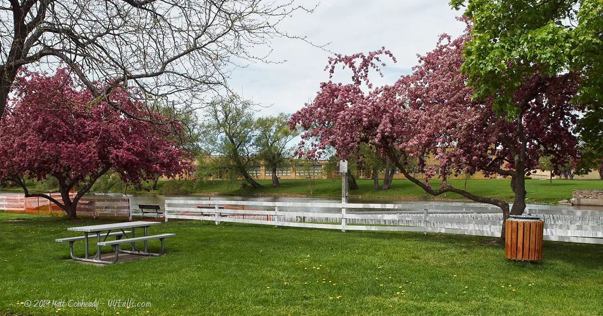
Best time to visit: Year-round. Spring is best for both a guaranteed flow and fruit blossoms on the park’s trees.
Flow: Moderate.
Waterway: Johnson Creek, which flows northeast and empties into Lake Ontario, west of Lakeside Beach State Park.
Time: Less than 10 minutes.
Seasons/Hours: Open year-round; all day, all night.
Admission: Free.
Handicap accessibility: Yes.
Pets: Allowed if on a leash. For your pet’s safety, and the safety of other hikers, keep your pet on the leash! It doesn’t matter if your dog is “friendly”; it’s the law. Please clean up after.
Swimming: No.
Accommodations: Drinking fountain; fishing access; WWII monument; historical markers; benches; trash can; hand boat launch. You may be able to use the restrooms in the library to the south.
Description
AKA: Lyndonville Falls; Village of Lyndonville Dam
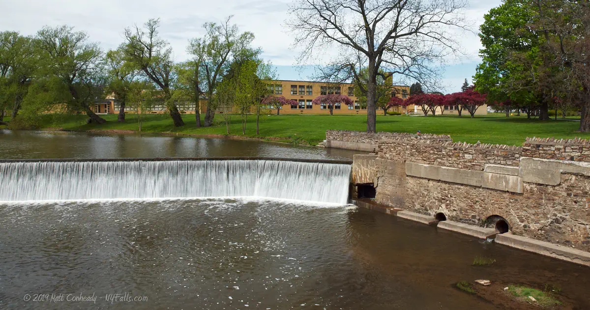
The Lyndonville Dam is an 11 ft high, 275 ft across concrete dam with a small bend at the northern end. The bend’s purpose was to channel water through an old mill race (the mills and the race have long since been razed). The property on the northern end borders a village school, while on the southern end lies a small park, complete with benches and a white wooden fence.
Water from Johnson Creek pools just above the dam, creating excellent fishing and canoeing opportunities along the 4 acre lake. The dam itself is wide and level and the flow over it is smooth and uneventful. The sheer quantity of water allows for a decent roar, helping to drown out the noisy traffic from the adjacent Rt 63. A large rocky pool lies below the dam and fish can be easily spotted within it. The creek continues under the Rt 63 bridge and heads northeast towards Lake Ontario.
Although there is not much to this waterfall, if you are in the area, it is a very nice spot to picnic or fish.
History
Pioneers from Lyndon, Vermont first settled here taking advantage of the fast and reliable waters of Johnson Creek to power their mills. The current site of Lyndonville dam is where a small waterfall existed, providing the geological gradient needed for easy waterpower. Several mills were built along the shores of the creek at this location, with many owners forming a conglomerate to dam the creek for more regulated flow and to share a common mill race.
One of the first settlers of the village was Jackson Blood, who arrived here in 1815 and built a cobblestone house on what is now Rt 63, just south of where it crosses over Johnson Creek. Mr. Blood farmed a large tract of land on Lake Ontario where he collected the glacially-rounded stones for the construction of the cobblestone home. The home is now listed on the National Register of Historic Places.
The combination of mills on Johnsonville Creek and the arrival of the Rome-Watertown-Ogdensburg Railroad allowed Lyndonville to grow as a business center. The village was incorporated in 1903; the last village to be formed in Orleans county. The Village Dam, in its current form, was constructed in 1948. The William Gray Foundry, which produced steel parts for horse collars, operated here since the early 1800s and was torn down in 1952 to make way for the creek-side park.
Hiking / Walking Trails
Difficulty: Easy.
Distance: A few feet.
Markings: None.
Description: Just head towards the dam – it’s right there. The park is located to the south.
Maps: Interactive.
Lyndonville Falls Interactive Map
Lyndonville Dam Falls Media
Lyndonville Falls Videos
More coming soon…
Interesting Stuff
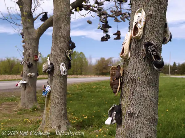
Shoe Trees
Northeast of Lyndonville, at the junction of Lakeshore and Foss Rds is a pair of trees, covered with hundreds of pairs of shoes. (map)
Cobblestone Homes
Cobblestone dwellings were popular among early settlers in this region due to the abundance of rounded stones of the Great Lakes. Many settlers used the massive amounts of pebbles unearthed as they plowed their surrounding farmland. Others would travel to the beach of Lake Ontario to gather them. Several surviving cobblestone buildings, including a schoolhouse, can be found along Rt 104. The Jackson Blood Greek revival home can be found just south of Lyndonville Dam, along Rt 63.
Photography Tips
Getting it all
- With a falls so short and wide, you have several options for filling the frame:
- Shoot a panoramic.
- Put the falls at the top of the frame and fill the bottom with the creek bed below it. This works great if the water flow is low and details in the creek bed are visible.
- Put the falls in the foreground and fill the top of the frame with the pond behind it and the sky. This works a lot better if you have a dramatic sky to work with.
Silky Water Effect
- To get that smooth cotton-candy look to the falls, you need to use a Neutral Density (ND) filter on your lens. The ND filter will block some of the light from entering the lens without altering the color, and thus allow your shutter to stay open longer. This blurs the water and creates a soft white gloss to the foamy areas of the falls. Check out the article for the all the details.
More tips
- See the Articles for more photography tips.
Who to Contact
Village of Lyndonville
2 South Main St.
Lyndonville, NY 14098-0273
Phone: (585) 765-9385