Aunt Sarah’s Falls


Location: Village of Montour Falls, Town of Montour, Schuyler County, New York.
Maps: Google Map; Topographic; Interactive.
GPS Coordinates:
- Aunt Sarah’s Falls: N 42.35185 / W 76.85597
- Parking: N 42.35243 / W 76.85549
Directions – Take Rt. 14 south towards Montour Falls and the waterfall will be visible on the right (west) just before hitting the village. Be mindful of traffic. Many vehicles slow down to see the falls. Many speed right through. Pull off into the parking area to the left (across from the falls).
Or use Google Directions.
Parking: There is a small, dedicated parking area across the street from the falls.
Weather
Information / Accessibility / Accommodations
Number of falls: 1.
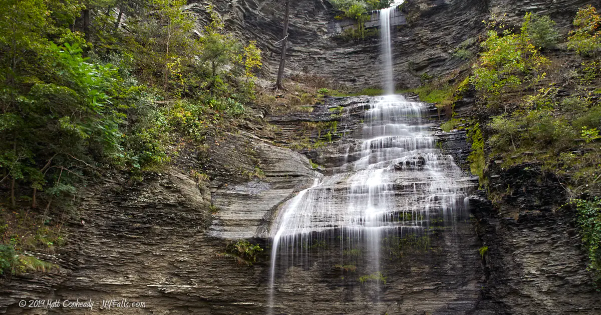
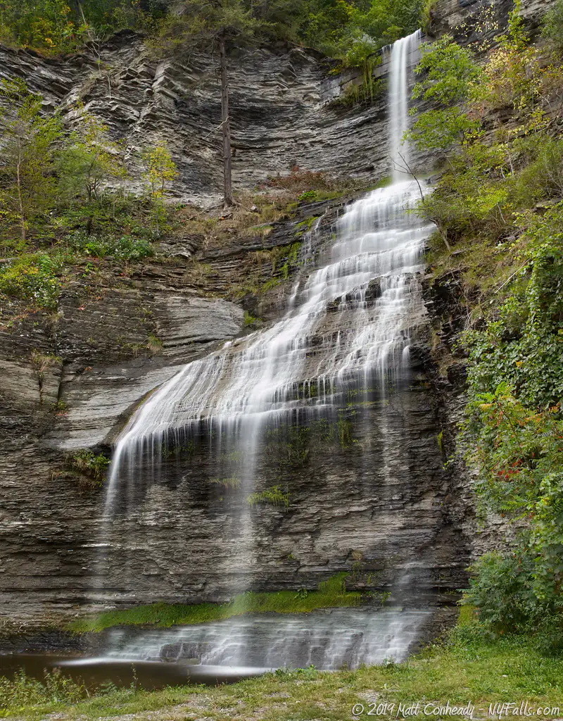
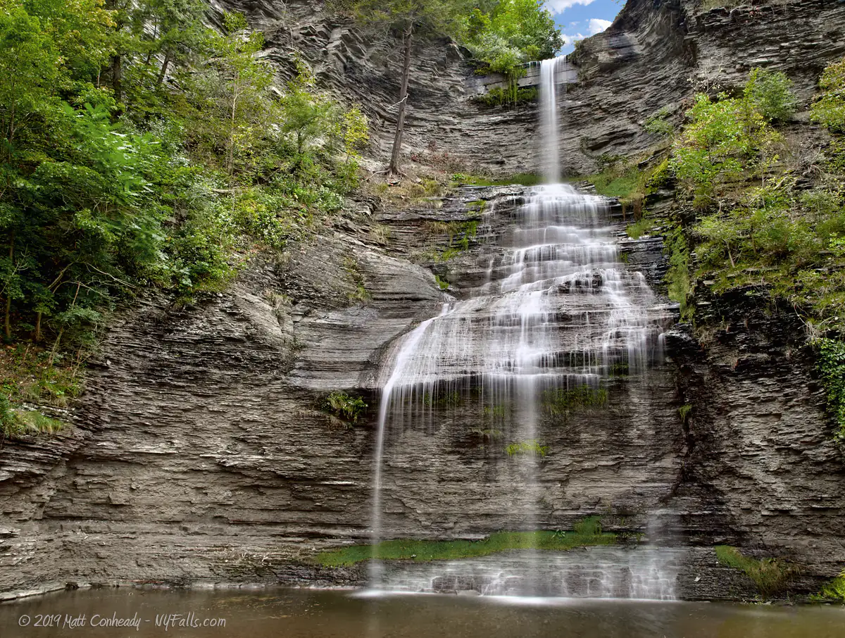
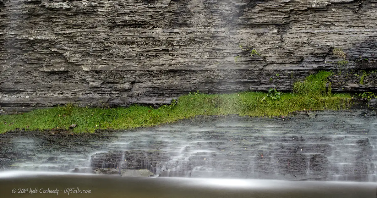
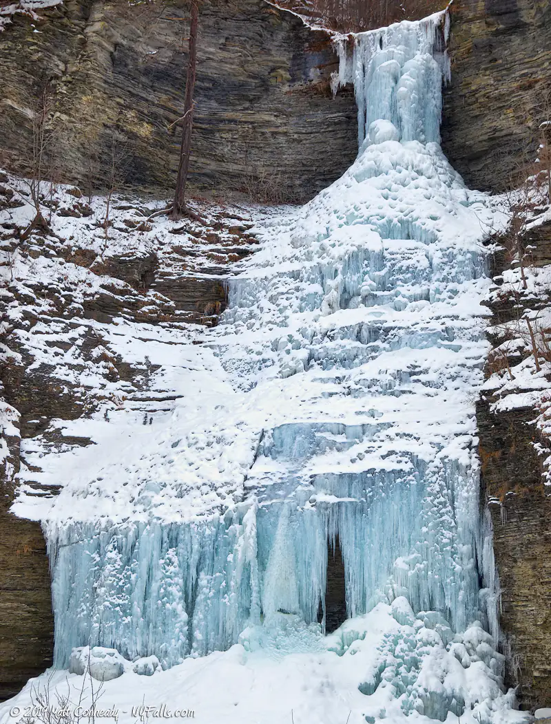
Size/Types: While Aunt Sarah’s Falls is well over several hundred feet tall from the top of the gorge, the top 2/3rds is not visible or accessible. Here we are concentrating on the bottom 90 ft, which is visible from the road.
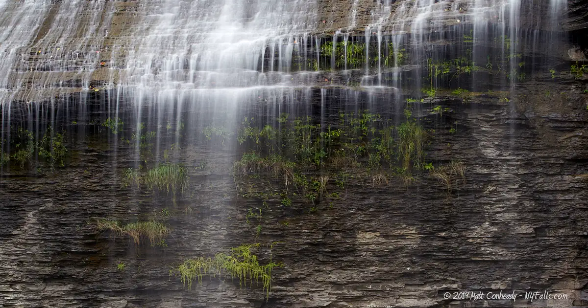
Aunt Sarah’s Falls first free-falls about a third of the way, then it fans out on a steep slope of shale for another third. It then free-falls again into a shallow plunge pool where it immediately crosses under Rt 14.
Best time to visit: Spring and after heavy rain.
Flow: Low.
Waterway: An unnamed tributary that joins with the Barge Canal and then empties into the southern end of Seneca Lake.
Time: A few minutes to view the falls from below.
Seasons/Hours: Year-round. Dawn to dusk.
Admission: Free.
Handicap accessibility: Yes.
Pets: Allowed on leash. Be careful of traffic.
Accommodations: Informational signage.
Description
It’s easy to miss Aunt Sarah’s Falls even despite its massive size. Rt 14 is the main road on the west side of Seneca Lake, and when you are driving down the road at 55 mph or more, you can blink and miss it. The key is to look for the parking area to the east first, then quickly turn your head to the west. The falls is the unofficial boundary for the Town of Montour (there’s actually a small granite stone near the falls marking the town border). If you reach the village within, you’ve gone too far.
With cars zooming down Rt 14, it is tough to enjoy this beautifully formed falls without road noise (or the fear of getting hit by a car), but it’s a quick and easy stop, and certainly one of the easier waterfalls to photograph. View the falls from the parking area, or cross the street to the small grassy area near the base of the falls.
One of the more uniquely-shaped waterfalls, Aunt Sarah’s Falls starts out with a thin ribbon free-fall. It then hits a slanted portion of the shallow gorge and fans out. It then finishes with a much wider free-fall, giving the cascade its unique and recognizable shape. The flow is often minuscule, but the large amount of activity gives this falls a great deal of noise. Upstream, far out of sight, are at least another 100 ft or so of cascades, but the land is not accessible.
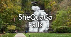
The Village of Montour Falls lies within a gorge carved out of the Portage Escarpment by glacial and water erosion. Aunt Sarah’s Falls, as well as SheQuaGa Falls, both tumble down it.
History
Although, the true origin of the falls’ name is not known, local legend states that it is named for the Seneca wife of a pioneer who jumped over the falls to her death.
Montour Falls, like Watkins Glen is nestled within the basin of Seneca Lake. Thousands of years ago, when the lake levels were much higher, this whole region would have been underwater.
Catharine Montour or Queen Catharine, was a matriarch of the Seneca tribe of the Iroquois during the late 1700’s. Known to be the daughter of a native Huron and a French official, she was well versed in both cultures. Since she could speak English in addition to native languages, she was influential in dealing with early white settlers in the area. Montour Falls was previously known as ‘Catharine’s Town’ or ‘Catherine’s Landing,’ but was destroyed during the Sullivan Expedition during the Revolutionary War. Rebuilt by non-native settlers, the town was then called Havana, and renamed Montour Falls in 1890. The village of Catharine and nearby Catharine Creek are also named after Queen Catharine.
Montour Falls was an important trade stop and travel hub in its early years. It played an important role on the Seneca Lake Inlet when the Chemung Canal was built in 1827. The Chemung Canal connected Seneca Lake with the Chemung River.
Hiking / Walking Trails
Difficulty: Easy.
Markings: None.
Distance: You can see it right from the road or parking area.
There’s nothing to it. The falls is visible from either the parking area, or you can cross the street and see it from below. Watch out for traffic.
Map: Interactive.
Aunt Sarah’s Falls Interactive Map
Aunt Sarah’s Falls Media


Interesting Stuff
The Catharine Valley Trail
When completed, the trail will extend 12 miles from Watkins Glen State Park to Mark Twain State Park in Horseheads, NY, passing through Montour Falls along the way. The trail follows the old Northern Central Railroad and the Chemung Canal towpaths with multiple historic sites along the way.
Photography Tips
Shoot wide
- This is a large waterfall with only a small area to shoot from (unless you are shooting from across the street). Bring a wide angle lens if you want to shoot from the base of the falls.
Traffic
- Busy Rt 14 is part of the character of these falls. Try to incorporate it into your shot.
Overcast skies
- Since the falls is so large and out in the open, getting a good exposure in bright sunlight would prove to be difficult. Early daylight will cast uneven shadows and the late sun will leave it in the shade. It is best to wait for an overcast sky for this one.
Silky Water Effect
- To get that smooth cotton-candy look to the falls, you need to use a Neutral Density (ND) filter on your lens. The ND filter will block some of the light from entering the lens without altering the color, and thus allow your shutter to stay open longer. This blurs the water and creates a soft white gloss to the foamy areas of the falls. Check out the article for the all the details.
More tips
- See the Articles for more photography tips.
Who to Contact
Village of Montour Falls
408 W. Main St.
Montour Falls, NY 14865
Phone: (607) 535-7367
villageofmontourfalls.com