Wolfe Park Waterfall, Chenango


Location: Just outside of Hinmans Corners and Chenango Bridge; North of Binghamton; Town of Chenango; Broome County; New York.
Maps: Google Map; Topographic; Trail Map; Interactive map.
GPS Coordinates: Waterfall: N 42.16183, W 75.91206
Park Entrance, Parking lot, Trailhead: N 42.16220, W 75.91422
Directions: From Binghamton, take US-11N for just over 2 miles into the hamlet of Hinmans Corners.
Turn left onto Fuller Rd.
Fuller Rd will turn slightly left and become Russell Rd. Keep going until it ends.
Make a right onto Dorman Rd.
Follow Dorman Rd for 0.7 miles.
Keep an eye on the left for the roadside parking and wooden kiosk for the park.
Use Google Maps to get you there.
Parking: A long roadside lot on the shoulder of Dorman Rd can handle about 15 cars.
Weather
Information / Accessibility / Accommodations
Number of falls: 1
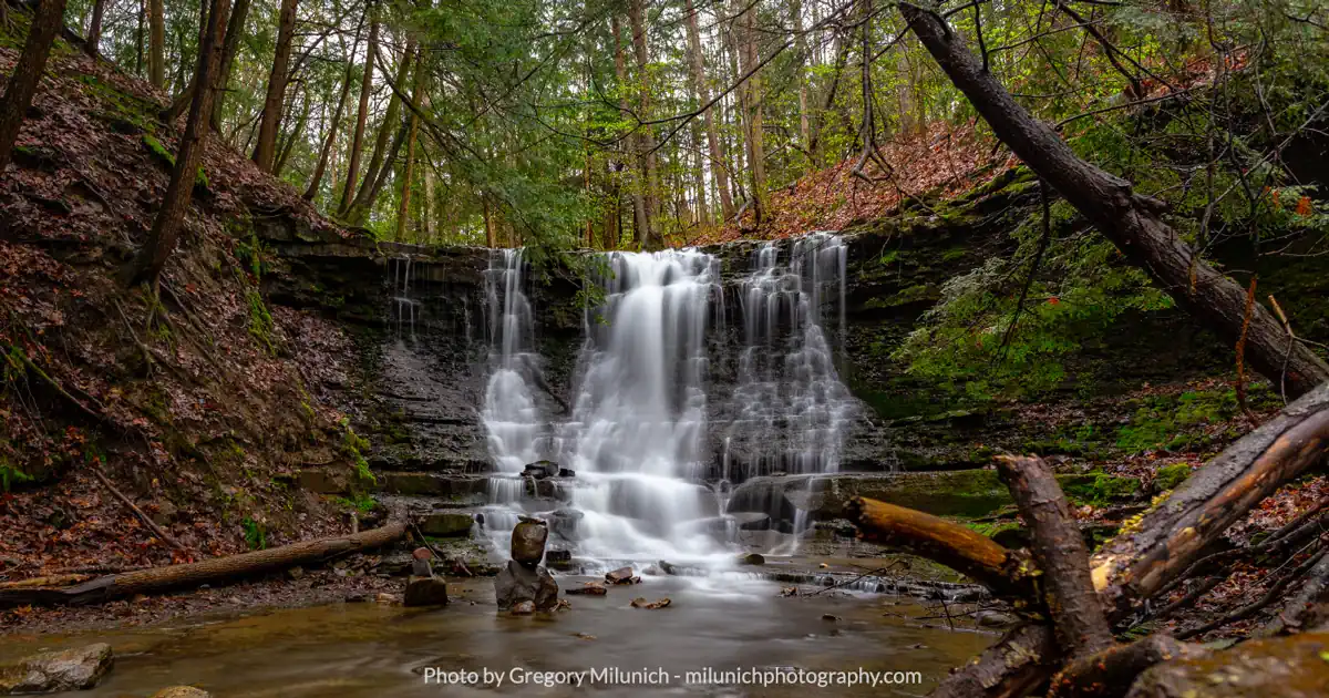
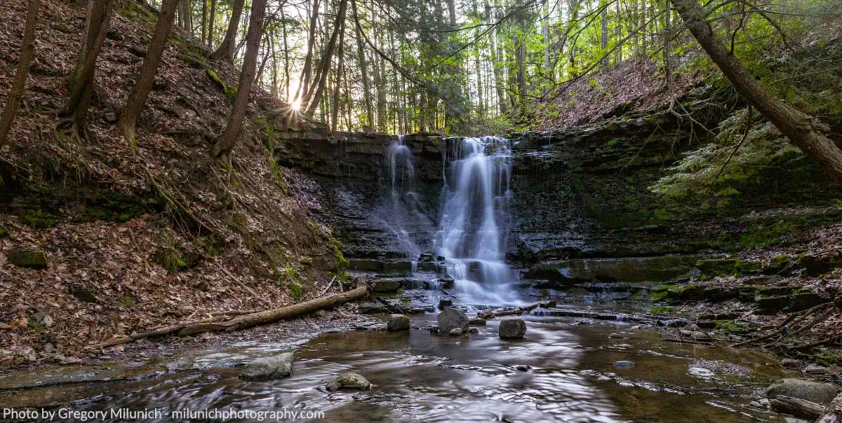
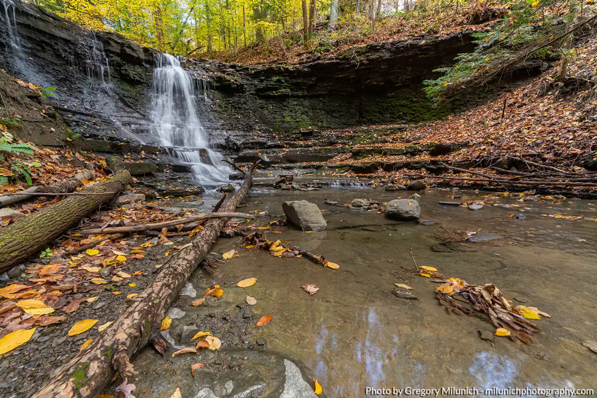
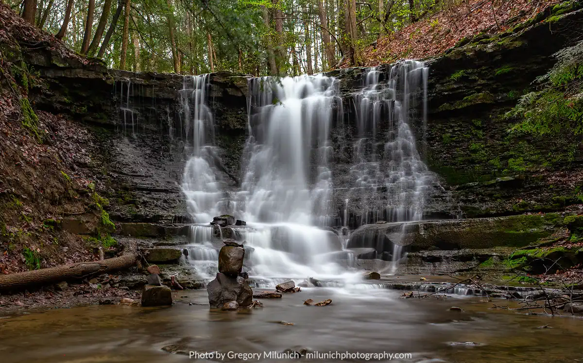
Size/Types: A 10-12 ft tall cascade over a mossy cliff in a shallow glen. After falling about 80% of its height, the water hits a ledge and fans out before falling the remaining few feet.
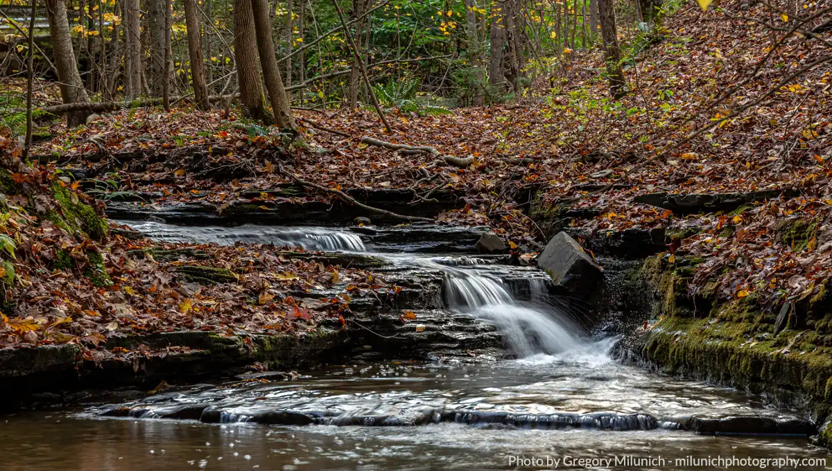
There are some smaller ledges along the creek, but nothing that would be considered a waterfall worth going out of your way to see.
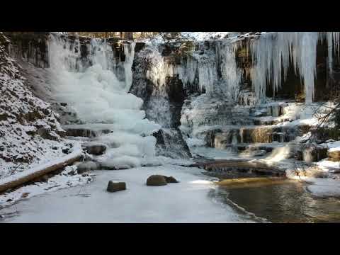
Some tall seasonal tributaries will form waterfalls along the gorge during periods of rain or melt.
Best time to visit: It’s best in spring or in fall after rain.
Flow: Low. It may dry up by mid-summer.
Waterway: The falls is located on an unnamed tributary to the Chenango River. The source is located less than a half a mile uphill to the west. It flows east past the park to the hamlet of Hinmans Corners and at US-11 the creek is diverted underground as it passes a shopping plaza, emerging just east of the plaza at Castle Creek. Castle Creek flows a few thousand feet and empties into the Chenango River. From there, the Chenango flows south through Binghamton where it meets the Susquehanna River.
Time: 10 minutes to see the falls and get back to your car. About an hour or two if you hike around the park.
Seasons/Hours: Open 7am to sundown.
Admission: Free.
Handicap Accessibility: The trail is not wheelchair accessible.
Pets: No rules are posted, but pets need to be on a leash in public.
Accommodations: Trails, benches, port-a-potty.

Description
Wolfe Park is a 182-acre undeveloped community park in the town of Chenango, just north of Binghamton. A part of the Chenango River Watershed, the hills in the surrounding area are striped with small tributaries, some of which have small waterfalls. There is one such waterfall at Wolfe Park. Near the entrance on the west side, there is a 10-12 ft cascade that runs down a mossy cliff. It’s just off the blue trail and quite easy to spot. While not the largest, it’s easy to see and quite photogenic. While you are there, the park offers about 3 miles of wooded trails to explore along the hillside.
History
This area was first settled around 1790 with the town being established in 1791.
The land around the falls does not seem to have ever been the site of a mill, probably because of the inconsistent, seasonal flow. In 1971, local businessman Richard W. Wolfe donated the land to the town to use as a public park. The first nature trail was built in 1981 by the Youth Conservation Corps.
Hiking / Walking Trails
Difficulty: Easy with a mild gradient. If you want to go off-trail and scramble down to the creek to see the falls from below, that ups the challenge a bit.
Markings: Blue blazes.
Distance: 0.1 mile from the trailhead to the falls. Making a complete loop on the blue trail is about 0.6 mile.
Description:
- From the parking lot on Dorman Rd follow the trail down to the gazebo and into the woods. This is the Blue trail.
- Just past the gazebo you will find yourself at the creek and a small wood bridge to help you cross it.
- After the bridge, you will reach a fork. This is a loop, so both ways will get you there, but it’s faster if you go left/straight rather than turning right.
- The path continues with the creek on your left. At about 0.1 mile, you should hear the falls. If the foliage is dense you may not get a great view.
- Scramble carefully down to the creek bed below the falls to get a closer look.
Map: Interactive; Trail Map.
Wolfe Park Interactive Map
Wolfe Park Waterfall Media
Videos
Contributor Photos & Art
Gregory Milunich of Milunich Photography made us aware of this falls and provided the photos above.
Take some time to check out Gregory’s gorgeous landscape shots.
Who to Contact
Town of Chenango
Parks and Recreation
Phone 607-648-4809
[email protected]