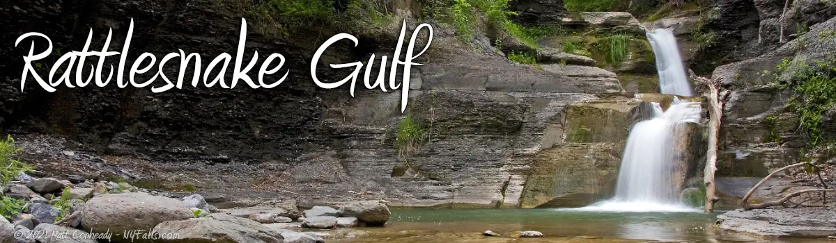
Rattlesnake Gulf and the Blue Hole


Note: This place seems to be off-limits since 2015. Folks used to access the place through the camp, but as of 2019, it does not appear as though the camp is open for business. Reports, including news articles, show the property owner is rightfully arresting trespassers. Assume it’s closed and you cannot visit.
Location: On privately-owned land; Tully Valley; Town of Lafayette; Onondaga County; New York
Maps: Google Map; Topographic; Interactive map.
GPS/Locations:
Gully Trail-head: (N 42.86561 / W 76.17315)
Directions: From Syracuse and points north: Take I-81 S. to US-20 West, Exit 15; Turn left onto US-20 for 4 miles; Turn left onto Case Hill Rd. for 2.3 miles; Turn left onto South Cook Rd. for 0.6 miles. End at 4812 S. Cook Rd.
From Cortland and points south: Take 1-81 to EXIT 14 toward Rt-80/Tully; Turn Left onto NY-281 for 0.1 miles; Turn LEFT onto NY-80 for 7.8 miles; Turn RIGHT onto Cook RD. for 2.4 miles. End at 4812 S. Cook Rd.
Parking: None.
Weather
Information / Accessibility / Accommodations
Description
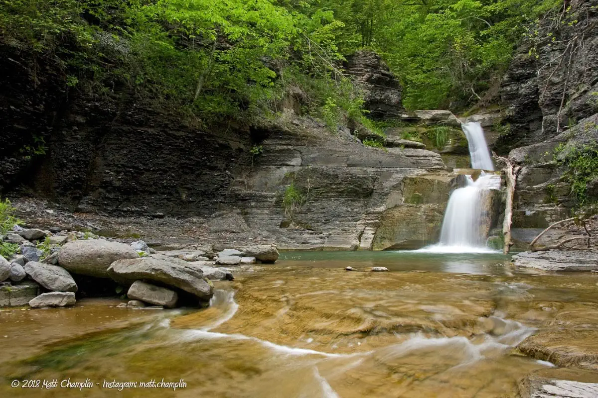
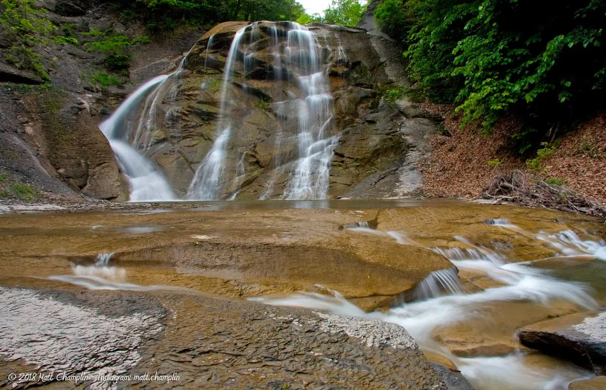
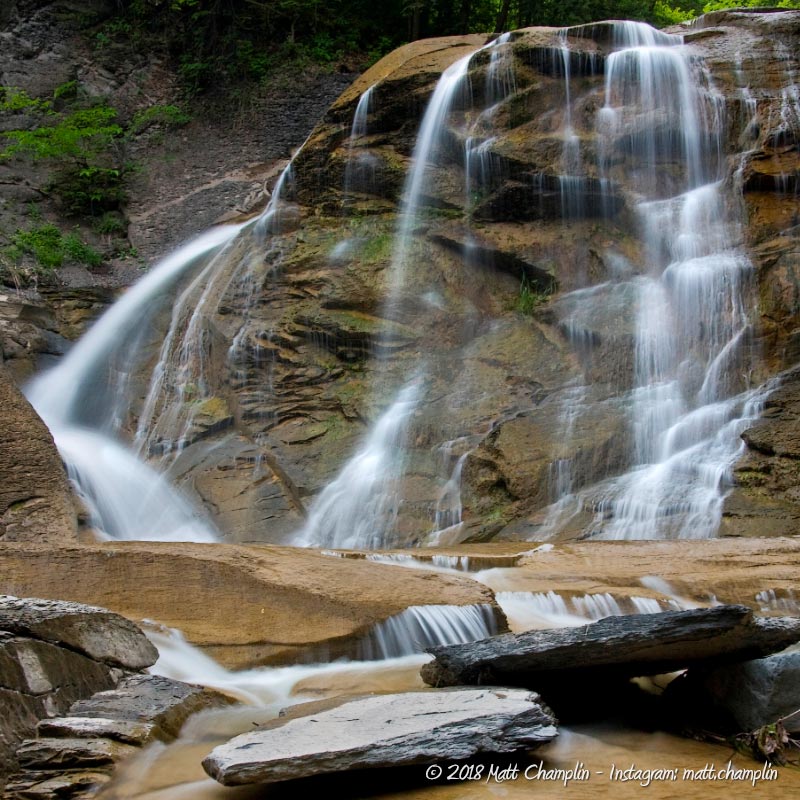
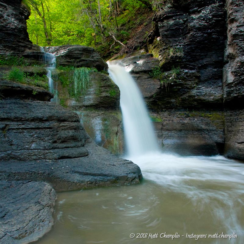
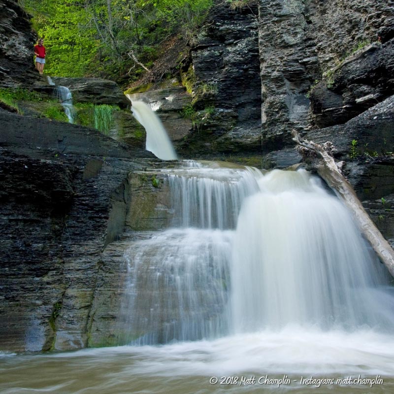
AKA: Rattlesnake Gulch; the Blue Hole; Wedding Falls; Great Falls
The private camp that owned the property in 2015 approached NYFalls.com about doing a profile on this amazing glen. For one, they were concerned about people trespassing on the land through other means and getting into trouble. The camp wanted to let people know that they can visit this place safely and legally. Walking from the “Blue Hole” down provides a safer, more enjoyable route than the unauthorized access, and the camp offers a host of activities to fill out the rest of your day. For a very reasonable rate per person for a day pass, I found this to be more than worth it. As of 2019, I have been unable to verify the existence of the camp or any official access. Any information I found was about there being no access and the camp being closed. So I am marking this place as Off-Limits, until I find out otherwise.
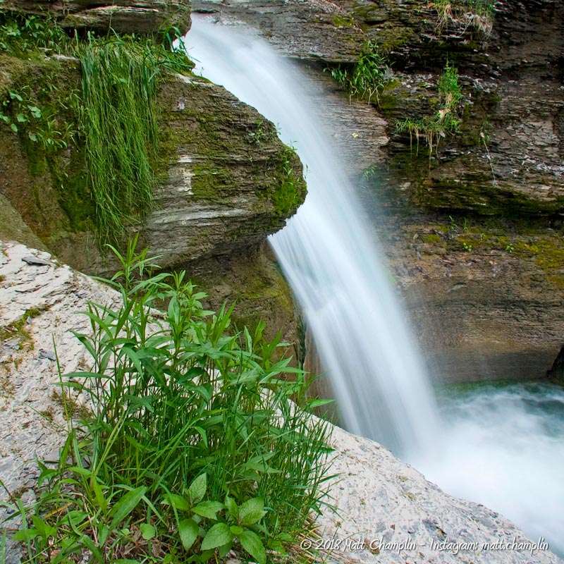
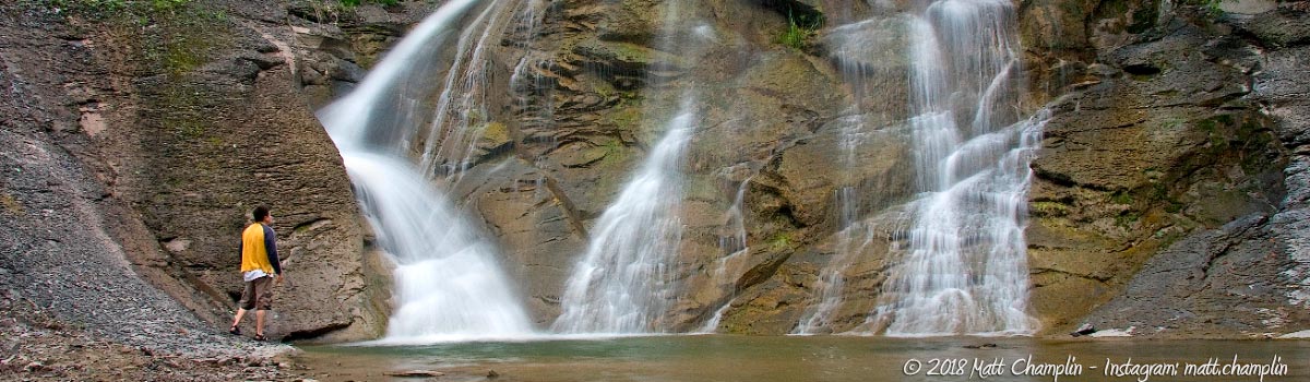
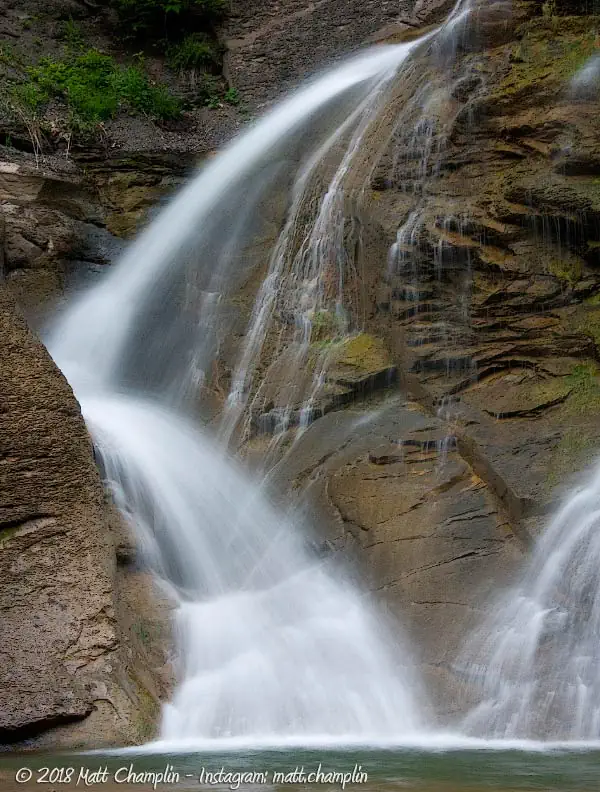
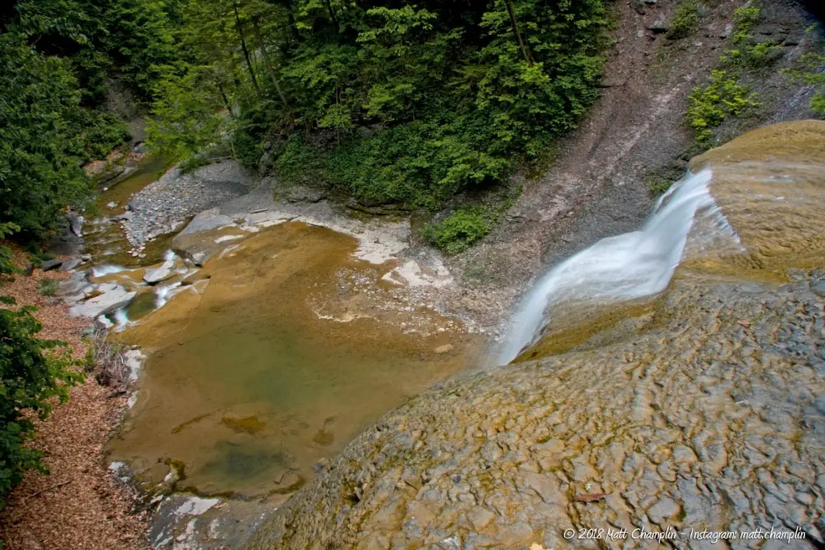
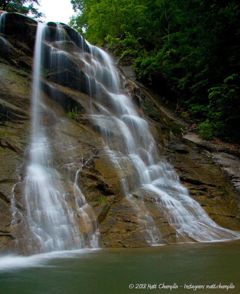
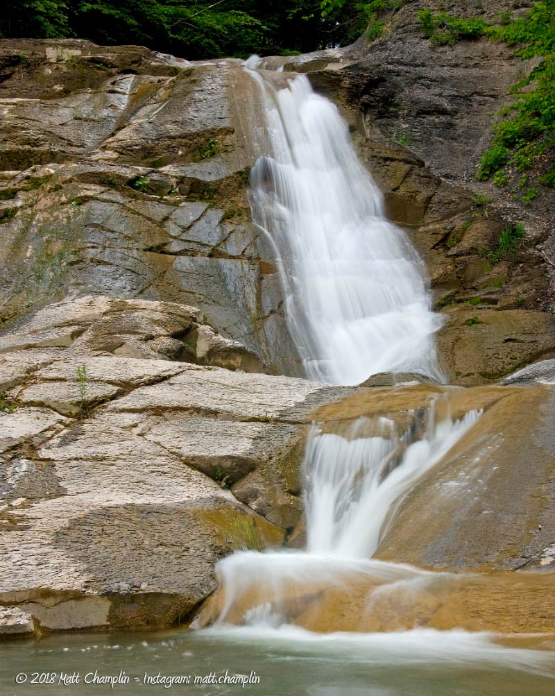
Rattlesnake Gulf is very typical of the type of glens and gorges in the Finger Lakes region. You will find towering shale stone walls sandwiched with limestone layers. However, Rattlesnake Gulf is unique in the breadth and scope of this characteristic. With a steep grade towards the Tully Valley, the creek speedily rushes downhill, and for centuries has cut a sharp ravine into the bedrock. During this time, when the water reached tougher rock layers, or extended periods of low flow, waterfalls stalled and cut deep potholes into the weaker, soluble rock below. Rattlesnake Gulf is full of these deep blue basins, colored by the minerals from the limestone that the creek passes through.
The gulf alternates between the shale and limestone layers, with the lower falls and plunge pools cutting through limestone, shaping them into multi-tiered cascades. Nearly all of the waterfalls have wonderfully deep pools below, many of which are smooth and moss-lined. The glen is well-shaded with mature forests which provide respite on hot summer days.
In the recent past, Rattlesnake Gulf has suffered from landslides, which are common in the Tully Valley. The glacial till (dirt, sand, stone and clay) make-up of the valley is highly unstable, especially during and shortly after periods of high rain. Landslides are a dangerous reality here. Be careful and check the weather prior to exploring this gully.
History
Rattlesnake Gulf is particularly rife with fossils from the middle Devonian era (380 million years ago). Just walking on the stream-bed you cannot help but step on a variety of types of horn coral, mollusks, and trilobites that are from an era when New York was a warm, tropical ocean. The seas that covered the area 300 million years ago vanished, leaving fossils for us to discover. There was another period of the area being inundated with a sea (or large inland freshwater lake) about 80 million years ago. Due to these seas being here, the area became known for its famous salt deposits that have been mined for years.
The more recent geological history of the area is typical of the surrounding Tully Valley. During the last ice age, the edge of a giant glacier stood at Tully Valley and had built up an enormous end moraine, about 600 feet high across the valley. As the torrents of melt water flowed south, they spread quantities of gravel and sand that now make up much of the valley floor. It is the most extensive area of glacial outwash in Central New York. The ravines above the floor of the valley have gradually eroded, forming steep gorges that make up the numerous waterfalls in the area, consisting of both Tully Limestone and shale. Just south of the moraine and Rattlesnake Gulf, lie the Tully Lakes, pothole and kettle lakes formed from enormous melt-waterfalls and chunks of ice from the receding glacier.
The area has recently been known for landslides that dropped portions of the clay-based hillsides down into the valley, the biggest being in 1993. This area, as well as the whole Onondaga Creek watershed, are often disturbed by farm run off, gravel mining, and denuding of the hillside for housing developments. Just a few years ago there was a large landslide in Rattlesnake Gulf that choked off portions of the creek and formed two small lakes. This activity will no doubt continue in the future, perhaps one day closing off the gully forever under rocks and sediment.
The history of the camp. . .
The camp was owned and operated by the Syracuse Rescue Mission from the late 1960’s to 2003. Previously known as Camp Id Ra Ha Je, which stood for I’d Rather Have Jesus, the camp was a ministry outreach to inner-city youth. The camp’s retreat center was known as the Moosewood Christian Camping Center. After 2003 the camp sat vacant for a few years and is now privately owned and is no longer connected with the Syracuse Rescue Mission. Currently, Paul and Linda Adams along with their children operate the camp which was called Adams Eden Camp as of 2014. Today we are not sure of what the current status of the camp is. It may be called Mt Mercy Camp. Information is scarce. You’d think that a public camp would want to have their name and details published everywhere possible.
Hiking / Walking Trails
This place is currently marked as Off-limits as the camp that allowed us in, seems to no longer exist, or changed ownership. I will update this page if the situation changes. Swimming in the “Blue Hole” is dangerous and several people have drowned here. Don’t be stupid.
Difficulty: Difficult.
Markings: None.
Distance: Less than a mile creek-walk upstream.
Description: The hike is a difficult one, consisting almost entirely of walking directly in the creek bed. From the bridge, walk upstream about 1.8 miles. Along the way, you will pass through various obstructions, from downed trees to the shells of old cars, snowmobiles, and a “tire forest.” Most of the junk along the way is a relic of days past when the farmers and landowners above the gully would toss their junk down the slopes into the ravine below. The forest has reclaimed the area, but the junk remains, making walking difficult, but interesting.
The lower part of the creek has larger granite rocks & boulders and it’s more open, making walking easier. About half-way in, there is a slight trail that dips into the forest for a short while. You will know you are getting close to the waterfall when the creek bed changes into a combination of shale & limestone and briefly narrows before opening up into the spectacular waterfall.
Map: Interactive.
Rattlesnake Gulf Falls Interactive Map
Note: this map is out of date. It still has the camp details. We are unsure of the status of the camp. The property is off-limits until stated otherwise.
Interesting Stuff
Bald Mountain
As the name states, the top of this hill has a few nice openings in the canopy, serving up beautiful views of the valley below. It’s well worth the hike up here. Hang gliders take off from a platform near the top.
Photography Tips
The Falls
- Great Falls and Wedding Falls are both in rather open areas so shots will have to be composed with this in mind. Bring polarizer and neutral density filters to block out some of the excess light. Try taking shots of the double bouncing cascade of Great Falls as well.
- On the way to the lower falls, the gully opens up quite spectacularly, affording opportunities to take pictures looking out into the valley from the crest of Wedding and Great Falls. Take a moment to snap some pictures from the tops of the waterfalls.
- The upper falls are heavily forested, which allows for long exposure photography nearly all the time.
Overcast skies
- Daylight will cast uneven shadows through the canopy and cause sunspots in your shots. It is best to wait for an overcast sky for this one.
Proper creek-walk footwear
- Wear the proper footwear for creek walking and climbing. Not only can a quality pair of water shoes prevent blisters and infection, they will help you stick better to the ground and reduce your risk of falling, hurting yourself, or your camera gear.
Silky Water Effect
- To get that smooth cotton-candy look to the falls, you need to use a Neutral Density (ND) filter on your lens. The ND filter will block some of the light from entering the lens without altering the color, and thus allow your shutter to stay open longer. This blurs the water and creates a soft white gloss to the foamy areas of the falls. Check out the article for the all the details.
More tips
- See the Articles for more photography tips.
Who to Contact
No contact information available.