Lick Brook Falls (Sweedler Preserve)
Location: On the south end of the city of Ithaca and north end of the town of Danby; Tompkins County; Finger Lakes Region; New York.
Maps: Google Map; Topographic; Interactive map.
GPS Coordinates:
- First waterfall on Lick Brook: N 42.39985 / W 76.53852
- Parking area and trailhead off of NY-34/96: N 42.39834 / W 76.54572
- Roadside parking on Townline Rd: N 42.39617 / W 76.53292
Directions: From the city of Ithaca, head south on NY-13A for 2 miles to NY-13. Make a right onto NY-13 which heads west. About 3.5 miles later things get a little complicated and dangerous. The parking area will be on the left as this road splits, but you cannot make a left here! Traffic is also going at high speeds, so learn ahead of time how to get into the parking area safely. At the split, you want to veer right onto NY-34. Shortly after, you will pass under a bridge. Right after this bridge, you want to make a U-turn. This will get you onto NY-34 heading back north. Within a few hundred feet, look for the parking area to your right. Put that turn signal on early to warn speedy drivers of your sudden turn.
Parking: The lot off of NY-34 has room for a dozen cars and is right on the trailhead that leads to the base of Lick Brook’s glen.
Alternatively you can start the hike from above by parking on the side of Townline Rd.

Weather
Information / Accessibility / Accommodations
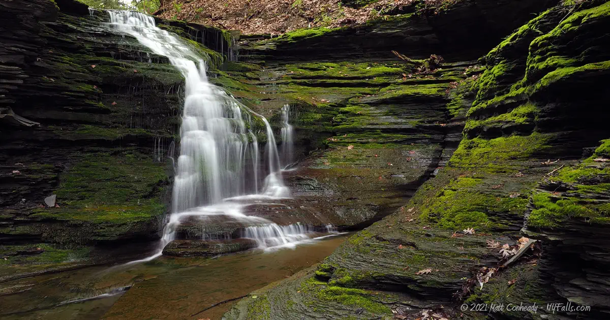
Number of falls: Numerous. There are 3 large waterfalls (over 30 ft high) on Lick Brook, as well as several smaller falls along the way. Spring Brook is home to several smaller waterfalls.
Size/Types: The smaller waterfalls range from a few feet high to 20 ft. The three larger waterfalls range from 25-90 ft tall, but heights are estimated, as they are in steep gorges and can only be viewed from above. The highest waterfall, by some accounts may even be upwards of 125 ft tall. Most are ribbon cascades of various widths.
Best time to visit: Spring.
Flow: Low.
Waterways: Lick Brook begins at Bruce Hill about 2.5 miles south. It runs through farmland picking up fertilizer runoff, leading to the heavy coating of algae typically seen on the falls here. A few hundred feet west of the glen, it empties into the Cayuga Inlet, which heads north, through the city of Ithaca and feeds Cayuga Lake.
Spring Brook is a seasonal tributary just north of Lick Brook. It begins just above the glen and also empties into the Cayuga Inlet. Because it’s a small watershed, it only flows in early spring or after long periods of rain. Spring Brook is not a name listed on official USGS maps—it’s just a local name.
Time: 2-3 hours for Lick Brook; an extra 2 hours to loop around Spring Brook or extend your hike up Lick Brook.
Seasons/Hours: Daylight hours, year-round.
Admission: Free.
Handicap Accessibility: This trail does not offer any accessible paths for those with disabilities.
Pets: Pets are allowed on a leash. Because of the steep cliffs and danger of this hike, keep your pet on a close leash for their safety and the safety of others.
Accommodations: Trails. For restrooms, food, and shopping, head north on NY-34 and then go right on NY-13 (Elmira Rd).

Description
The preserves that make up what is commonly known as Sweedler Preserve or Lick Brook Gorge are officially known as: William J. and Marjory L. Thayer Preserve, Howard Edward Babcock Preserve, and Lick Brook Natural Area.
Sweedler and Thayer Preserves, protected by the Finger Lakes Land Trust, and the adjacent Lick Brook Natural Area, owned by Cornell University, combine to create 177 acres of beautiful wooded hillside surrounding what is considered to be Ithaca’s least known gorge (or “Hidden Gorge” as some call it).
The 2 miles of trails that wind across the preserves, don’t sound like much, but they wind through beautiful hemlock and white pine, traverse brush that blooms with lush wildflowers in the spring, and takes you up a steep breathtaking gorge, much of which has been inaccessible for a millennium.
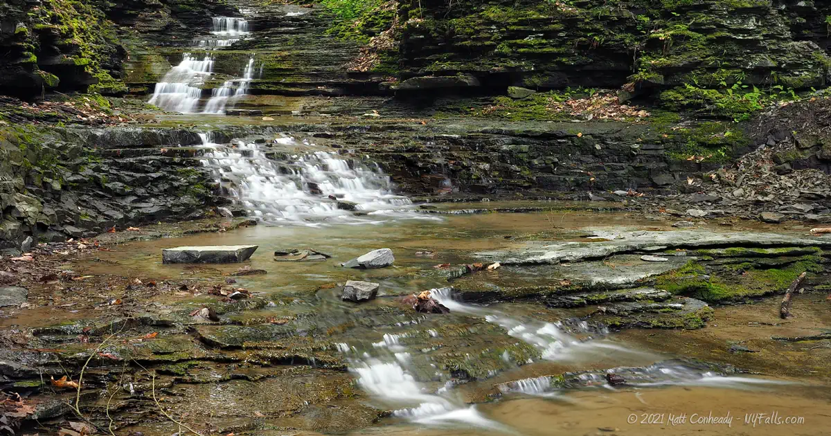
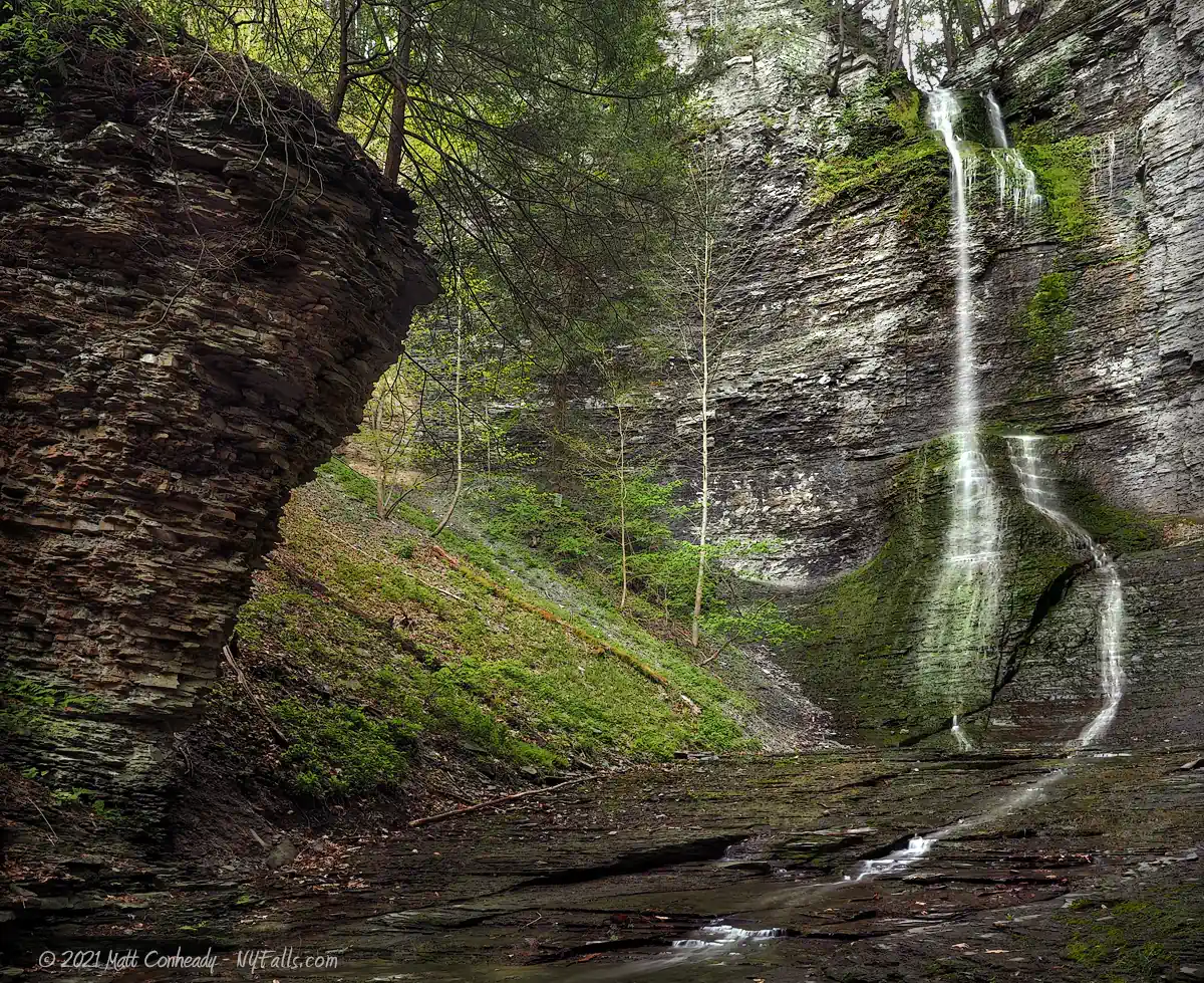
Lick Brook is home to three large waterfalls, one of which you have direct access to from the trails. The other two are buried deep in the gorge above and can only be seen in part from the trail that winds up the northern rim. The tallest of these falls is reported to be anywhere from 90-125 ft in height. Further up the gorge, the cathedral walls taper off, opening up some smaller cascades to those who make it to the top.
To the north is Spring Brook, a seasonal tributary that will surprise visitors with an additional cascade or two in times of high runoff.
While not the most accessible gorge, and with the more popular Enfield Glen (Robert H Treman State Park) just across the valley and Buttermilk Falls a short drive east, that may be the best reason to enjoy it. It’s lightly trafficked, little known, and often serene. No paved steps, no hordes of selfie-takers, and no screaming kids. This is a hike for the nature lover.
History
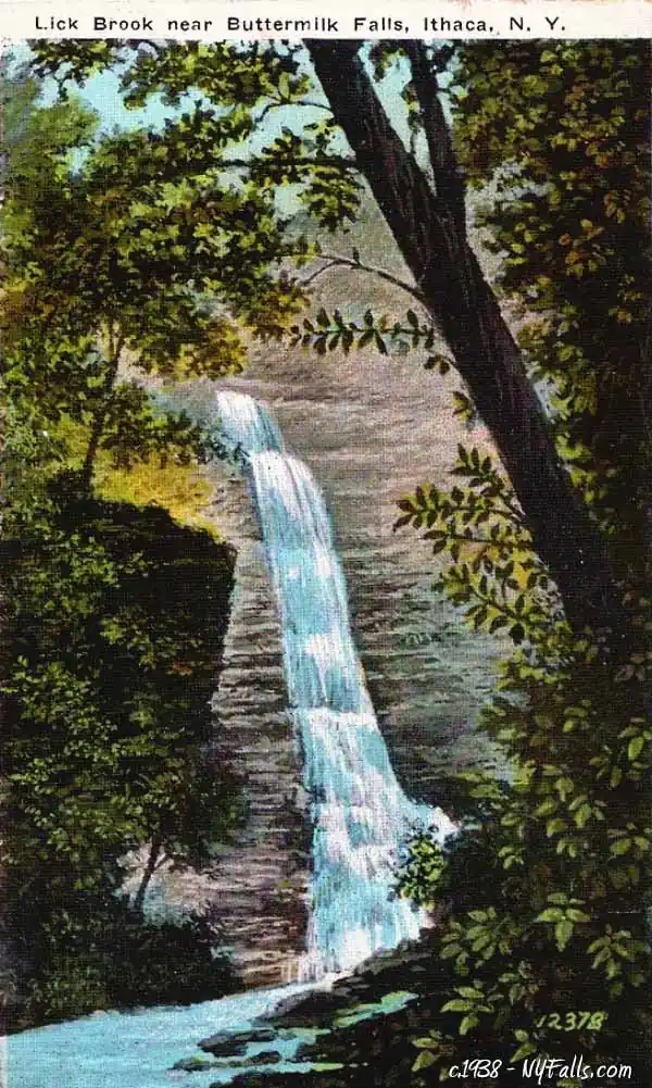
Several publications from the late 1800s mention Lick Brook as a forgotten gorge. Tales of early settlers enjoying the waters, and not passing the location on to their children, led to the further tales of its discovery. “Where is Lick Brook?” or so the saying goes, was often followed by varying directions and locations as people sought out the “Lost Glen.” Part of what led to it becoming “lost” was its inaccessibility. As nearby Buttermilk Falls and Enfield Glen offered developed trails and bridges, people flocked to them, leaving Lick Brook and its impassibly steep middle gorge as a memory. It doesn’t appear that any mills were constructed on Lick Brook, probably due to its low water flow and tendency to dry up in early summer. Most of the land making up the preserves today were used as farmland in the 19th and 20th centuries.
The land around the gorge was farmland. “Farmer Williams” and his white gothic cottage off of Newfield Rd are mentioned in some c.1880 writings as the trail heads toward the gorge. Farmer Williams was known to rent out horses from his stable to those venturing east to Lick Brook.
People aware of the gorge continued to visit for hikes and picnics throughout the years. In 1993, the Finger Lakes Land Trust purchased 128 acres from Moss and Kristin Sweedler, creating the preserve and opening it up, officially, to the public. Howard Edward Babcock, Chairman of Cornell Board of Trustees from 1940 to 1947, donated 27 acres of adjacent land to Cornell Botanical Gardens in 1997. In 2008 the FLLT purchased an additional 7 acres from William and Marjory Thayer. In 2011 the Thayers made a generous donation of an additional 20 acres of adjacent land (upstream from Sweedler Preserve) to the FLLT. While this slice of preserve is officially known as “Howard Edward Babcock Preserve,” it is commonly known as “Lick Brook Preserve. Today, the three preserves encompass 277 acres, all of which are open to the public.
Hiking / Walking Trails
Difficulty: Difficult. The hike up the side of Lick Brook involves a steep incline of over 400 ft. If you want an easier hike, you can walk from the parking area off of NY-34 to just the first waterfall on Lick Brook and it will be easier.
Markings: White and Blue blazes.
Distance: The recommended loop is about 1.5 miles.
Description: My recommended route is to start from below the gorge and work your way up Lick Brook. From the parking area off of NY-34, follow the white-blazed trail into the wooded area. It will loop back out to the the open brush with the tree line on your left. In summer, this area can get overgrown, so be sure to wear tick repellant.
After about 700 feet, the trail heads back into the woods and past an iron train trestle over Cayuga Outlet. Cross here.
The path will reach an area of open brush. Again, it can be quite full in summer. I can’t stress enough how important it is to tick-proof yourself for this hike. You will pass under some powerlines about 200 ft. later. At this point the trail will swing north along the tree line (on your right).
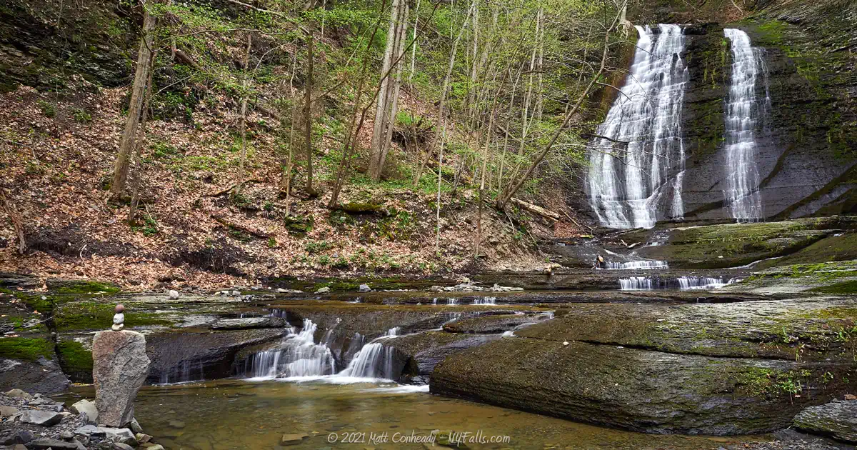
900 ft. later, you will enter the woods near Lick Brook at the base of the gorge. A few hundred ft. later, the gorge, and the first waterfall will be on your right. This is a massive 70 ft cascade where the top third is a steep drop, while the bottom glides over rounded rock. It runs pretty light most of the year.
Continue north past this falls on the white blaze trail. About 150 ft. later you will reach a junction with the blue blazed trail. This heads uphill. If you want the challenge, go for it. It can be difficult, but exhilarating when you make it to the top. Take the blue trail.
If you want to take it easier, continue north on the white blaze trail, which is the reverse of what I’m explaining here. It will lead to an easier incline, but you will still work your way down the blue trail to loop back, which I find to be much easier than going up.
The blue blazed trail hugs the north rim with varying switchbacks. Most of the time you can walk right up the gorge edge and look over. Listen for the 2 large waterfalls as you ascend. Use extreme caution. There are no railings, and the waterfalls below are straight down. Continue on the blue trail and it eventually straightens out and levels off as you reach 2/3rds of the way.
At about a third of a mile, you will reach a junction with the white blaze trail. Heading south (right) will lead to the parking area at Townline Rd. Head north (left) which will take you to Spring Brook.
About 1,000 ft. from the junction, you will reach Spring Brook, which may be totally dry. If you happen to visit in early spring, the trail will run along the seasonal brook and you will be able to spot at least one decent-sized cascade. Keep following the white blazes to work your way across this brook and to the base of the hill.
At 1,800 ft. from the junction, the trail has reached the bottom and will turn back south.
At 2,700 ft. is the junction with the start of the blue trail, and the first waterfall will be just south of there.
Keep on the white trail to go back to the parking area.
Map: Use the Interactive map.
Sweedler & Thayer Preserves Interactive Map
Sweedler & Thayer Preserves Media
Videos

10 Must-Visit Waterfalls Around Ithaca, NY
A selection of the most popular and accessible waterfalls around Ithaca in the Finger Lakes Region of New York.
Photography Tips
Low Flow
- The flow on Lick Brook is very low. Late May through November it’s going to be a trickle if flowing at all. The only time you’d want to visit during these months is right after a 2+ day rain streak.
Silky Water Effect
- To get that smooth cotton-candy look to the falls, you need to use a Neutral Density (ND) filter on your lens. The ND filter will block some of the light from entering the lens without altering the color, and thus allows your shutter to stay open longer. This blurs the water and creates a soft white gloss to the foamy areas of the falls. Check out the article for all of the details.
More tips
- See the Articles for more photography tips.
Who to Contact
Finger Lakes Land Trust
Phone: 607-275-9487
[email protected]
fllt.org/contact/


