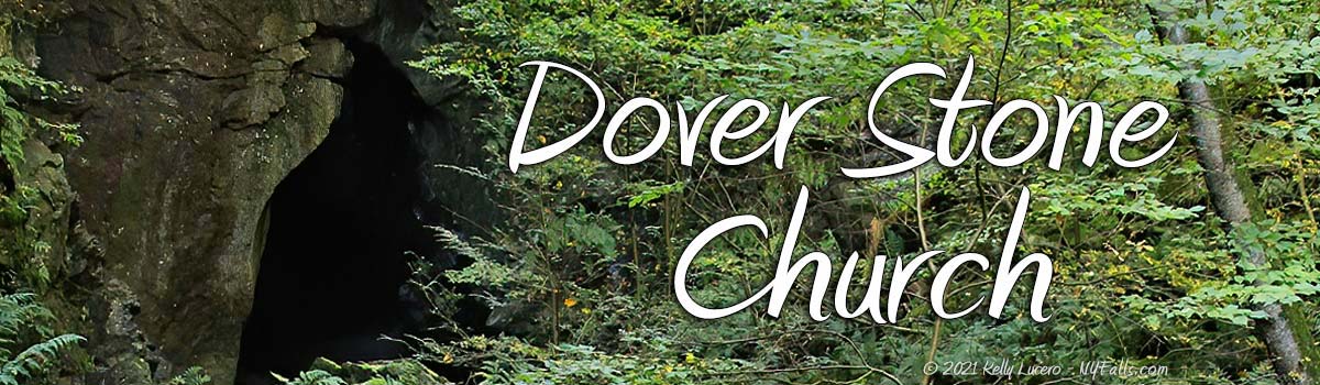
Dover Stone Church


Location: In the hamlet of Dover Plains; Town of Dover; Dutchess County; New York
Maps: Google Map; Topographic; Interactive map.
GPS Coordinates:
- Dover Stone Church: N 41.73809 / W 73.58894
- Trailhead: N 41.73971 / W 73.58066
Directions: The trailhead is located on a private drive right off of NY-22 in Dover Plains. From Poughkeepsie, you want to take US-44 E for 12 miles. It will then become NY-343 in Dover. Keep going for 9 miles into Dover Plains. Head south on NY-22 toward Dover Plains and then make a right onto NY-22. You will pass a sign and private driveway on your right after about 1/5 mile (across from Mill St). Do not turn into that driveway. Head a little bit further south and use the parking area for the elementary school on your left.
Or use Google Directions to get you to the parking area.
Parking: There are 3 shared lots that are okay for use. The Dover Elementary School lot at the corner of NY-22 and School St, The Freshco 22 Restaurant lot at NY-22 and Mill St., and the Four Brothers Pizza Inn north of the trailhead on NY-22.
Weather
Information / Accessibility / Accommodations
Number of falls: 1 or maybe two (one right after another) depending on your criteria.
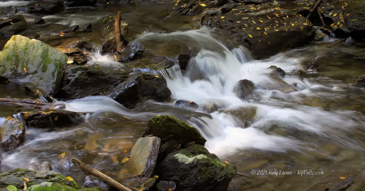
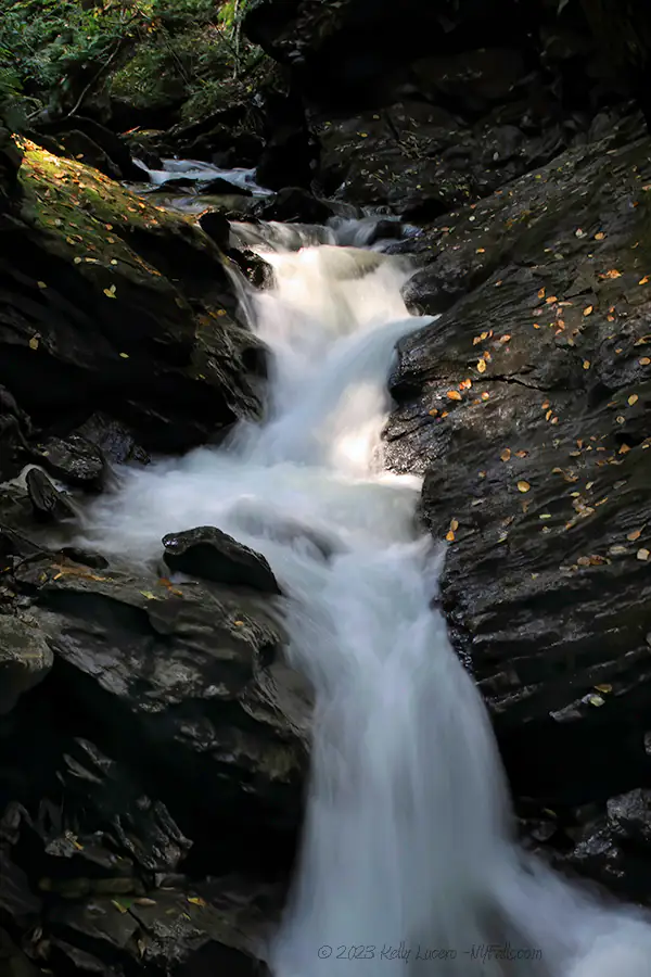
Size/Types: Within the cavern, a rock dam creates a 3 ft high cascade in high flow. In lower flow, water just tends to go around it. Just downstream and outside the cavern is a cascade comprised of several small steps, totaling 3-4 ft in height.
Best time to visit: Spring and Fall (after rain).
Flow: Low to moderate.
Waterway: Stone Church Brook, which starts a couple of miles northwest of here at Butts Hollow (lol) in the town of Washington. The brook turns east just upstream from the Dover Stone Church and then continues through the hamlet of Dover Plains, where it empties into the Tenmile River on the east side. The Tenmile River is a major tributary to the Housatonic River in Connecticut.
Time: A half hour. More if you want to explore the network of trails beyond the ones that lead to the falls.
Seasons/Hours: 7am to 7pm. Year-round.
Admission: Free.
Handicap Accessibility: The trail is a mix of gravel, paved steps, and natural stone. Not suitable for wheelchairs.
Pets: Dogs are allowed on a leash only.
Accommodations: Trails, signs, and historical markers are on the premises. The hamlet has a handful of restaurants and shops within walking distance.
Description
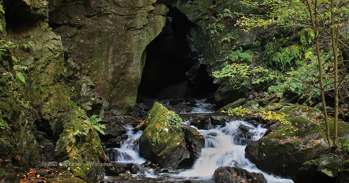
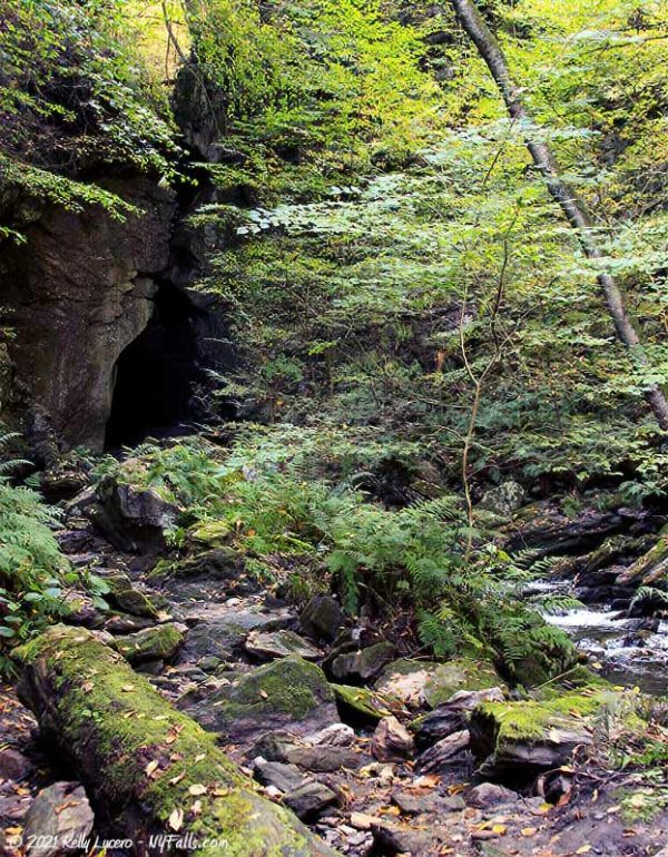
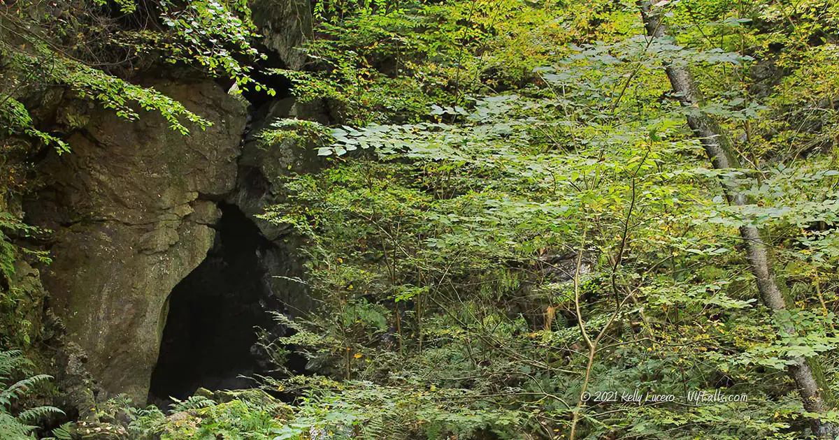
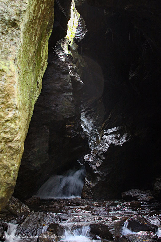
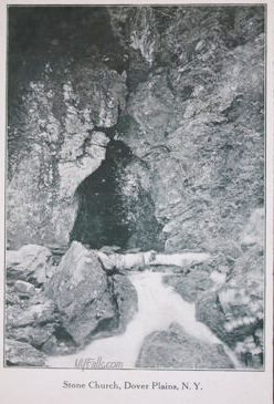
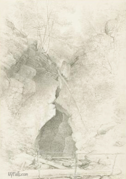
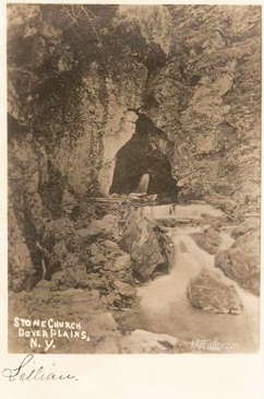
The Dover Stone Church is not a church. It is a very narrow section limestone gorge on Stone Church Brook on the west side of the hamlet of Dover Plains. The “Church” stems from the triangular cave-like entrance. It’s not a cave either, in the true sense of the word. The top is open like the narrow gorges of Watkins Glen and other Finger Lakes gorges.
Here, where thousands of years of erosion carved a thin chasm into bedrock, is a small set of cascades that emerge from the cave. Inside the cave, where rockfalls are frequent, a series of boulders has created a dam that, in high flow, creates a waterfall inside, making for an extremely beautiful and picturesque scene.
While many visitors head a bit beyond the official trail and enter the cave, it is not recommended due to the abundance of rock falls that happen here. Enjoy it from the trail, where honestly it is framed perfectly by the surrounding cliffs and foliage.
History
In the 1630s, Pequot tribes, led by Sassacus, raided several British Connecticut towns. Settlers raised a militia, and led by John Mason, set out to attack a Pequot settlement near Mystic, CT, only to be held in a stand off. Sassacus, using faulty intelligence, assumed Mason’s forces had left, so he moved his Pequot tribes to Hartford for another raid. Mason, who had not left, proceeded to attack the settlement, killing the 600-700 women, children and elderly residents of Mystic in what is known as the “Mystic Massacre.”
Sassacus and his forces fled west into New York territory, seeking assistance from the Mohawk. Instead, they only received hostility from them. Sassacus’ final camp, and last stand was in this “stone church.” He was caught, scalped, and his head offered to the British as an friendship offering.
The stone church had been privately owned for hundreds of years and in 2003, the town of Dover purchased the site along with 558.2 acres around it. The town, the Dutchess Land Conservancy, and the Friends of the Dover Stone Church worked together on the acquisition and further efforts to preserve it.
The right of way through private property that allows access to the stone church was secured in 2009 when the property owners donated easements of 50 acres. Another 63 acres of easement were added to the southern end of the preserve.
52 more acres were added to the preserve in 2014, allowing for the 3 miles of wooded trails to complement the hike along the brook.
Hiking / Walking Trails
Note that this route traverses private property for which there is an easement to allow access to visitors.
These property owners are within their rights to rescind this access at any time. Be respectful, quiet, and pick up any trash and take it with you.
Difficulty: Moderate. Some steps. Some narrow sections on potentially slippery natural stone at the creek.
Markings: Gravel trail with some signage.
Distance: About a half-mile one way.
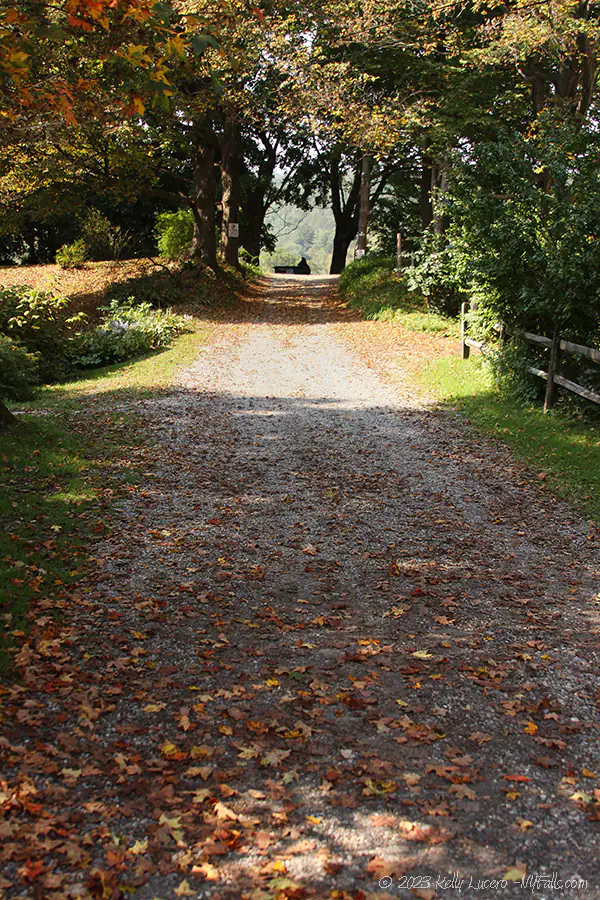
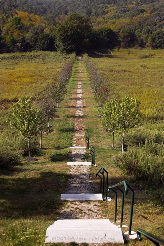
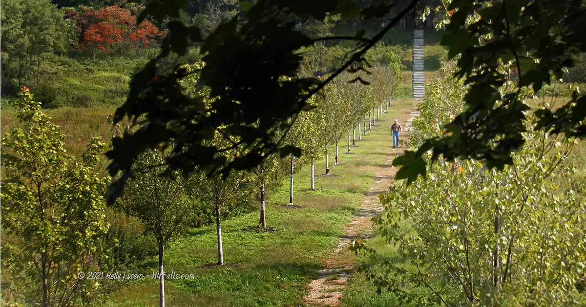
Description: From the trailhead off of NY-22, head west past the houses. Notice this is also a private driveway. Don’t go off the gravel trail. This stretch of the hike is a great photo opportunity.
Soon after the houses, you will have a downhill view of some fields with the trail cutting right through. Keep going down and straight about 1,000 ft toward the wooded area.
The path will pass by some taller trees and turn a little bit northward. 300 ft later you will find an informational sign.
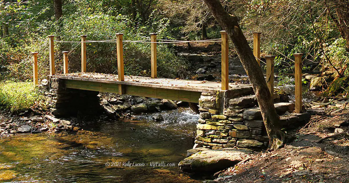
Keep going on the main gravel trail for another 300 ft to a footbridge that crosses the brook. You will now be on the south end of the brook with the water on your right. Here is a junction with the Red, Blue, and Yellow trails, which are off to the left. These trails loop around some tall wooded areas. Keep going straight.
The next 500 ft is close to the brook and can get pretty tight and slippery in places. Natural stone is laid out to traverse along the brook. I recommend a walking stick to help keep your balance.
The trail ends just downstream from the Stone Church. Since some rockfalls have happened in the “cave,” I highly recommend not going inside.
Turn around and go back the way you came, or explore the loops on the southern end of the preserve.
Dover Stone Church Interactive Map
Dover Stone Church Media
Video

Interesting Stuff
National Register
Dover Stone Church was placed on the National Register of Historic Places in December 2014.
Photography Tips
Silky Water Effect
- To get that smooth cotton-candy look to the falls, you need to use a Neutral Density (ND) filter on your lens. The ND filter will block some of the light from entering the lens without altering the color, and thus allows your shutter to stay open longer. This blurs the water and creates a soft white gloss to the foamy areas of the falls. Check out the article for all of the details.
Embrace the Shadows
- Don’t fear the lack of light within the cave. Use the shadows to enhance your composition and add mystery to your photo’s story.
More tips
- See the Articles for more photography tips.
Who to Contact
Town of Dover
126 East Duncan Hill Road
Dover Plains, New York 12522
Phone (845) 832-6111


