Cascades of Attica
Note: This gully is located on private property. Traditionally, the waterfalls have not been POSTED and people have enjoyed the falls for decades. This could change at any moment. If you encounter POSTED signs, turn back, as you may be prosecuted for trespassing. If it is open, respect the property. Do not leave trash, destroy any property, or risk your life and safety—any of which could result in the landowner closing access.
Location: South of the village of Attica; town of Attica; Wyoming County; New York.
Maps: Google Map; Topographic; Interactive map.
GPS: Parking pullover: (N 42.81588 / W 78.25356)
First waterfall: (N 42.81611 / W 78.25388)
Second waterfall: (N 42.81667 / W 78.25390)
Third waterfall: (N 42.81705 / W 78.25424)
Directions: From Batavia: Take NY-98 South for 9 miles.
As you approach Attica, make a left onto Stroh Rd and at the next intersection make a right onto Maplewood Rd. Follow it for 1.1 miles.
Turn left onto NY-238S (Halls Corners Rd) and follow it for 2.5 miles.
At the 2.5 mile mark the road will branch, go right onto Beck Rd.
1.2 miles later, make a right onto Cascade Rd (CR-39).
Cascade Rd will have a bend at 1/4 mile. The creek, and a pullover area will be just before this bend.
Parking: A pullover area existed east of the bend on Cascade Road. A few recent reports claim that it no longer exists due to road construction, or is posted. If no parking is available here, you may need to find an alternative spot to pull over along Cascade Rd and walk back to the creek.
Weather
Information / Accessibility / Accommodations
Number of falls: 3. If you make it further downstream, going toward the reservoir, you will find 2 small drops along the way, which is why some sources will claim there are 5 waterfalls. These are very small ledges of about 1 ft in height.
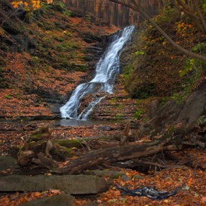
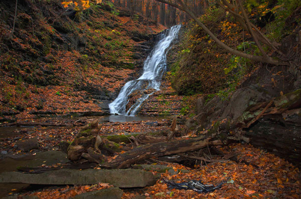
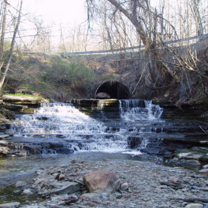
Size/Types: The first is a 10 ft high cascade over slabs of limestone. The road culvert is just upstream from it. Recent construction along the road may have changed the shape of the falls in recent years. The second falls is a nearly 60 ft high cascade over limestone and shale. The waters get pretty frothy as they tumble from thin layer to thin layer. The last waterfall is a gradually sloping 10 ft high cascade over slippery shale.
Best time to visit: Late spring through early summer.
Flow: Moderate.
Waterway: Crow Creek, which is fed by the Attica Reservoir, two miles southeast of here. The reservoir is primarily fed by Stony Creek. Crow Creek continues north, over these falls and into (another) Attica Reservoir about 0.8 miles downstream. Just before it reaches the state prison, it turns left and merges with Tonawanda Creek. Tonawanda passes through Attica and then reaches Batavia 13 miles to the north. At Batavia, it turns west through Indian Falls. Shortly after, it runs through Tonawanda Reservation and eventually to the city of Tonawanda, where it empties into the Niagara River near Tonawanda and Grand Islands.
Time: Take your time. The climb is tough and rushing can lead to injury. Set aside a half hour to view the 3 main falls. 2-3 hours if you want to make it to the reservoir and back.
Seasons/Hours: Daylight hours.
Admission: Free.
Handicap Accessibility: Not at all.
Pets: It’s private property and the creek is a public water source. Adding to that, the climb is dangerous. Do not bring your pet. Just don’t do it. You will. I know you will. You know you will. That’s the kind of person you are. You are exempt from common sense.
Accommodations: None. Bring a bag to pick up any trash you find. Help keep these special places clean!
Description
This private land has been traditionally open to respectful hikers for years. Located south of Attica on Crow Creek, there are 3 beautiful waterfalls within a few hundred yards of the road. Hiding in the ravine is a short but very challenging hike that should be saved for those experienced and prepared for slippery and risky “Finger Lakes Glen Hiking.”
The largest of the 3 main falls is a towering 60-ft cascade, worthy of the Buttermilk moniker more than most. To get down to the base, a descent down a slippery steep slope is required. Only the adventurous make it. For those looking to spend more than a half-hour of time here, a creekwalk a few miles north to the south end of the Attica Reservoir is possible, with a few small waterfall ledges along the way (as well as downed trees, slippery bedrock, and brush to whack through).
Because the landowners graciously allow visitors, it’s important not only to avoid leaving any trash, but you also need to be extremely cautious and not fall, have your pet slip and tumble down, or have a rope snap while you are carrying your baby strapped to your back (yes, a trail reviewer bragged about repelling down with her baby strapped to her back). One serious accident and this gully is gone to us. Stop, think, and appreciate the privilege we have to visit it.
History
The first settlers in Attica were Zerah Phelps (of Connecticut), Deacon Porter, Nathaniel Sprout, Isaac Townsend, and Major P. Adams, who settled here in 1802. Zerah purchased the plot of land, which was to become the town of Attica, from the Holland Land Company in Batavia. Stephen Crow, for whom the creek is named, arrived later in 1802, and settled in Attica Center, east of the creek.
A map from 1866 shows a sawmill at the site of the falls, owned by D. Hechler.
A 1902 map shows the land occupied by Philip and George Bey.
Hiking / Walking Trails
Note: This gully is located on private property. Traditionally, the waterfalls have not been POSTED and people have enjoyed the falls for decades. This could change at any moment. If you encounter POSTED signs, turn back, as you may be prosecuted for trespassing. If it is open, respect the property. Do not leave trash, destroy any property, or risk your life and safety—any of which could result in the landowner closing access.
Difficulty: Difficult due to unmarked trails, steep climbs, steep gradient, muddy conditions, slippery rock. Don’t bring small children and pets. Wear water shoes with a good grip, never go alone, and become familiar with these safety guidelines.
Markings: None. If you see POSTED signs, turn back.
Distance: 2/10 mile to see the 2 main falls and go back. About 3.3 miles to make it north to the reservoir and back.
Description: This trail has been made by visitors, is not officially maintained and may be dangerous.
While there is a trail that follows the rim of the ravine, offering views of the falls from above, it remains steep and often slippery.
Trails have been carved out on both the east and west sides. Most take the west, which is a more established trail. Many creek walk once below the 3rd falls.
West trail: from the road on the west side of the creek, enter the wide trail and follow it until you approach a slope to the right. The slope leads to the top of the large (middle falls). Descend to the creek bed and head upstream to the base of the first waterfall.
Head back up the slope and continue down the trail. At some point it will get pretty steep. People often leave ropes to help with this descent. Should you use them? Check their condition before you do. The surface here is very slippery. Use caution.
The descent will get you down to the creek below the 3rd falls. Time to head upstream. You will be able to see the large 60ft tall middle falls from the base of the 3rd falls. Pass the 3rd falls on the right side and continue to the base of the large middle falls. There’s usually a nice pool here.
Now you have a choice, head back, knowing you will have that steep climb back up, or if you have the energy for it, head downstream all the way to the reservoir. From the 3rd falls, this is about a 0.8 mile hike one way, in the creek—wet and muddy. You will need to hop downed trees and bushwhack a little along the way. It sometimes gets swampy near the reservoir, so wear some insect repellant.
East trail: Reports claim this trail is barely one. It may require some bushwhacking when it’s overgrown. It usually is without ropes leading down the steep ridge. I don’t recommend it.
Map: Interactive.
Cascades of Attica Interactive Map
Cascades of Attica Media
Videos

Contributor Photos & Art
The following photo was posted to the NYFalls Talk message board by waterfall expert Chris B. (cbobcat):
The following photo was posted to the NYFalls Talk message board by fellow photographer ApproachingLight:

Who to Contact
No contact information


