Beaver Cotton Mill (Beaver Mill Falls)
Location: In the village of Valatie; town of Kinderhook; Columbia County; New York.
Maps: Google Map; Topographic; Interactive map.
GPS: North Falls: N 42.41302 / W 73.67397
South Falls: N 42.41261 / W 73.67384
Parking area: N 42.41330 / W 73.67409
Directions: From Hudson:
Take NY-66 N/Union Turnpike northeast for 3.1 miles to the intersection with NY-9H.
Make a left onto NY-9H and head north for 8.8 miles.
At Kinderhook, exit NY-9H on the right and then make a left onto McCagg Rd, then an immediate left onto Novak Rd/Rod and Gun Club Rd.
Continue 1.4 miles north into the village of Valatie. You will pass the falls on your right just before coming up on Main St.
Make a right on Main Street and the parking area will be on your right, near the creek.
Parking: There is a public parking lot Google Maps has labeled as the “Beaver Cotton Mill Overlook.” It has room for about 10 cars and is right next to the falls.
Weather
Information / Accessibility / Accommodations
Number of falls: Technically 2 falls, considered to be 1.
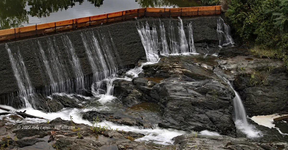
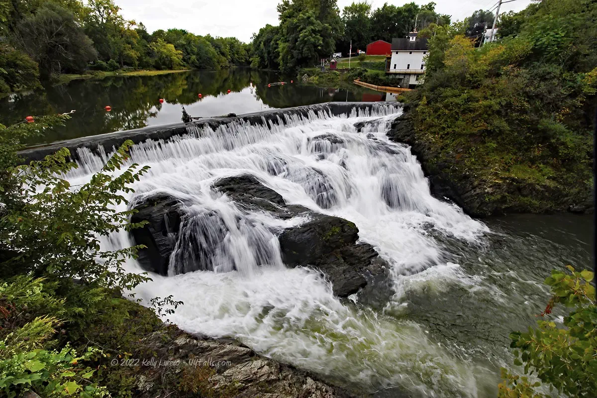
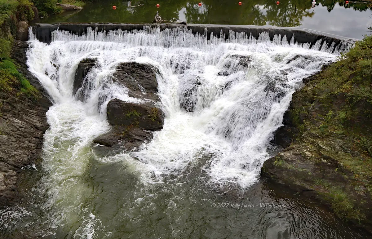
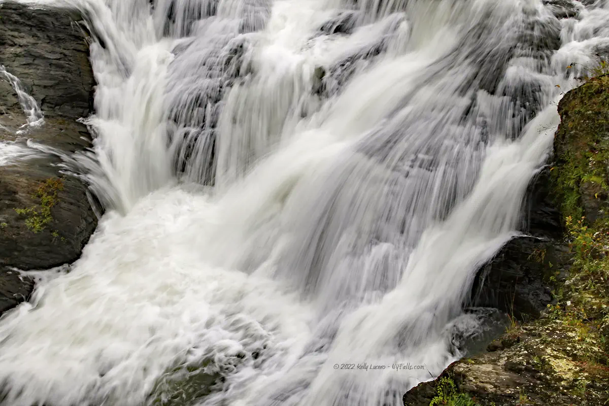
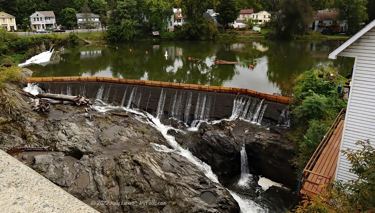
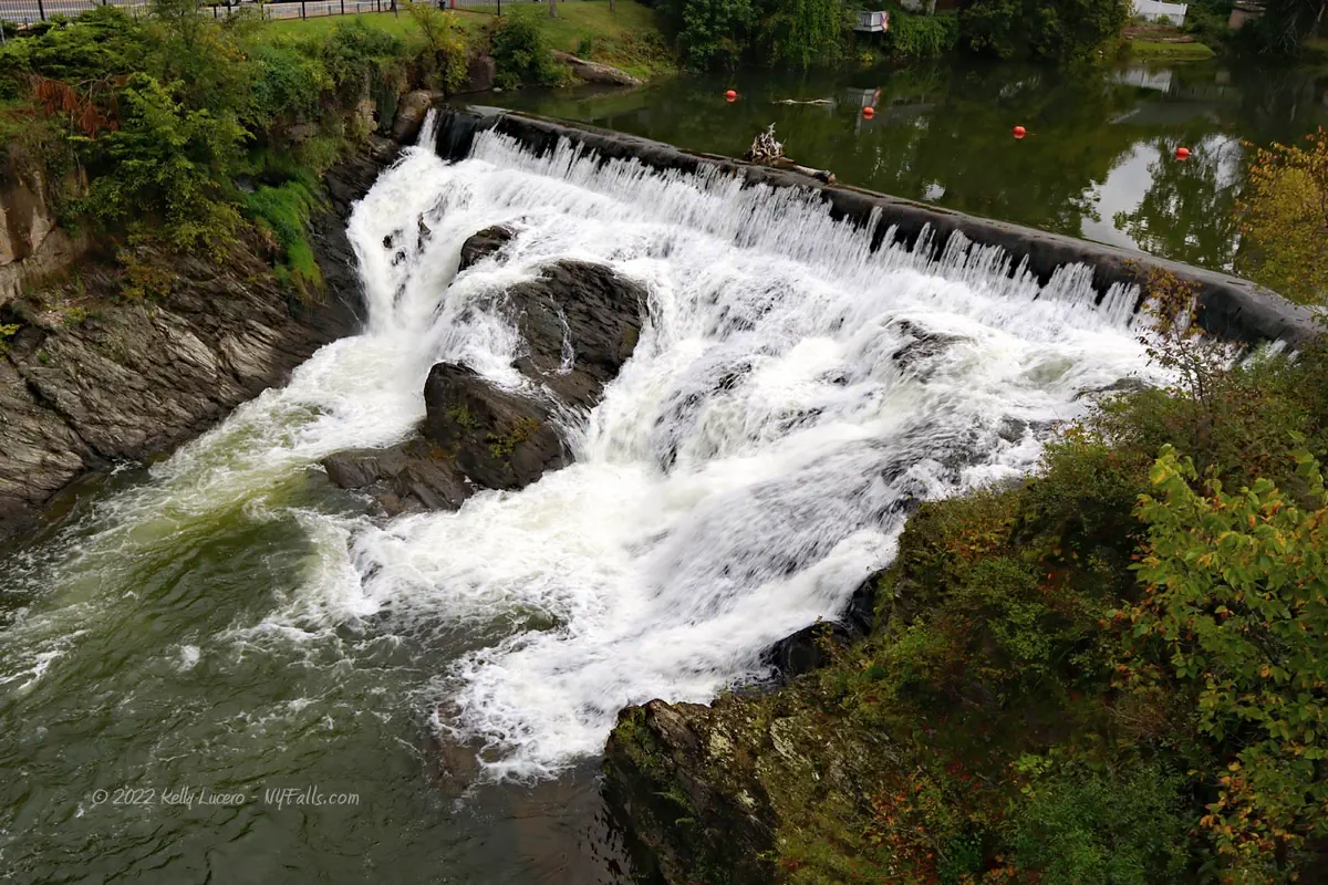
Size/Types: The falls is split into a north and south segment by a narrow island. Both are about 20 ft tall, with the top 6 ft being a concrete dam. The north segment is about 120 ft in width and the south is about 94 ft.
Best time to visit: Year-round.
Flow: Moderate.
Waterway: Kinderhook Creek, which has a total length of 49 miles. It starts 25 miles northeast in Hancock, Massachusetts in the Hancock State Wildlife Management Area. It meanders west into New York, passing through many small towns it helped power throughout the years. At Valatie it loops north into the village and then dramatically moves south to Stuyvesant Falls. From there it heads further south for 2.5 miles where it merges with Claverack Creek into Stockport Creek in Stockport, NY. Stockport Creek heads west for 1.5 miles, emptying into the Hudson River at the Stockport Flats Estuarine Sanctuary. The Hudson River flows south to the Atlantic Ocean at New York City.
Time: 10-15 minutes to see it from a few angles.
Seasons/Hours: Year-round, daylight hours.
Admission: Free.
Handicap Accessibility: The Beaver Cotton Mill overlook is paved and has a low grade ramp. The Chatham St bridge does not have a sidewalk and the shoulder is narrow.
Pets: No rules are posted, but pets need to be on a leash in public.
Accommodations: Some nearby restaurants and shops in the village. Pachaquack Preserve, on Elm St. has a hiking trail.
Description
AKA: Beaver Falls, Beaver Mill Falls, Valatie Falls
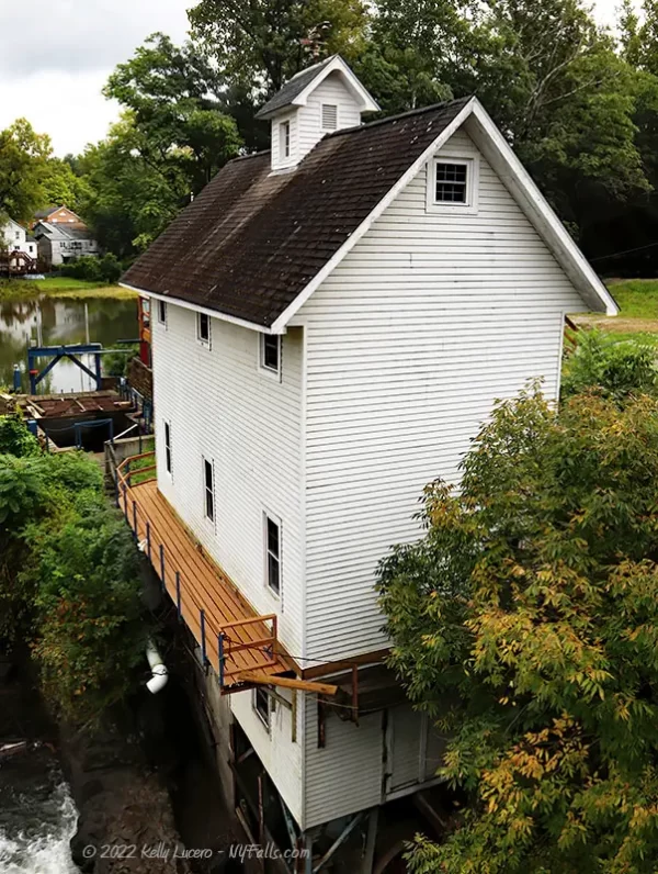
The Beaver Cotton Mill site is yet another historic mill settlement in the Hudson Valley, similar to nearby Stuyvesant Falls. The water power here was the basis for a booming paper and textile industry that was spread across the valley. Today, the majority of the mills and factories that flanked the two drops of these falls are completely gone. One structure that does remain is a small wood-framed hydro power facility that was recently rehabilitated.
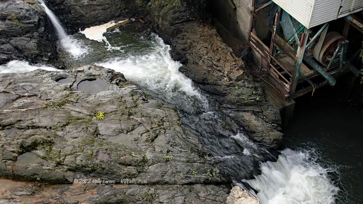
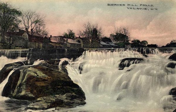
The falls, which are divided by a slender island in the middle are still topped by the concrete dam that controlled the flow and diverted the water to the numerous mills. Below the dam is the natural falls, still visible, yet scarred from nearly a century of industry. Sadly, there are no remnants of the Beaver Mill specifically. In fact, the parking lot and viewing platform is where the mill once stood (it burned down in 1888). While the falls are the main attraction and easy to see from a few vantage points, the village itself is dotted with historic markers and structures and it may be worth a stroll and further exploration after you visit the falls.
History
What is now the Pachaquack Preserve was home to a meeting place and settlement of the Mohicans and used up until the 17ths century. “Pachaquack” means “Meeting Place.”
The Kinderhook area saw its first white settlers as early as 1650, with the Dutch and Swedish beginning to settle “Little Falls” at this location around 1665. The first grist and saw mills arose around 1697, owned by Hans Hoes and Derick Hoes respectively. I could not find records on the location of these mills and if they were at the location of this falls, downstream or on Valatie Kill.
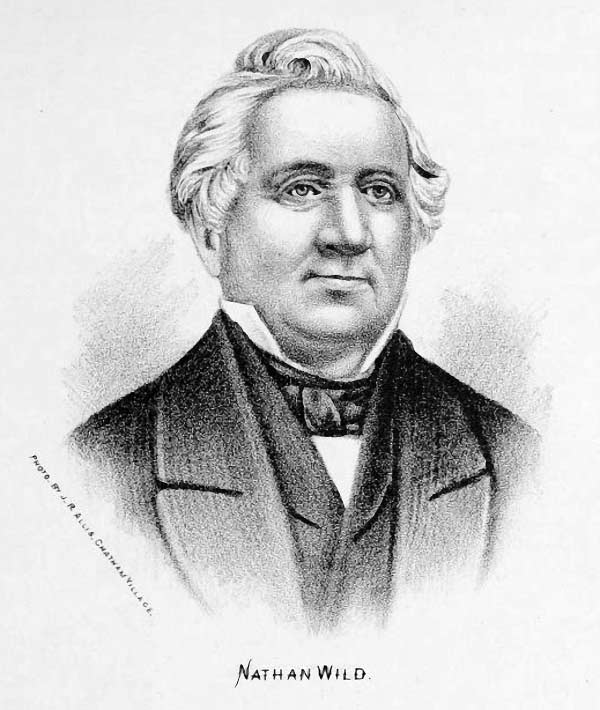
Nathan Wild (of Manchester, England) worked at Slater Mill In Rhode Island and took his knowledge of the first textile industry in the Americas and settled in Valatie in 1790. He formed (with associates) the Kinderhook Manufacturing Company in 1817. They constructed a cotton mill on Valatie Kill, kicking off the cotton manufacturing industry in the village, one that would lead to the nickname “Millville.”
Around 1820 a wood-frame mill was built at the small falls southeast of the village by the Kinderhook Manufacturing Company, making “wraps and other cotton goods.” The mill prospered and a hamlet arose around it. William P. Rathbone acquired the property and in 1855 converted it to a paper mill, building a cotton mill alongside it. Dr. Alexander Abbott acquired the property and sold the paper mill side of the business to C. F. Davis, who produced wrapping paper here. The paper mill lasted for some time and the dam still exists today.
Northern side
John Van Allen owned a small wood frame cotton mill at the falls (built around 1818). The Kinderhook Manufacturing Company also built a mill here, but it was soon destroyed by fire. Van Allen constructed a brick building in 1820 which became known as the Beaver Cotton Factory. It passed on to Jeremiah Carpenter in 1851 and he increased the size and output of the factory, including installing a larger dam (that records show as) 23 ft in height. At this time, it was known as the Canoe Mills and had 3,500 spindles and 24 looms. The name canoe is supposedly the brand of shirting equipment the mill used.
The factory passed on to George Copeland & Co., of New York a few years later. The company purchased several buildings around the falls, and at one point it had 9 buildings along the creek producing cotton products. Records show that in the 1860s the mill complex consisted of 5,600 spindles and 100 power looms. It was able to produce 180k yards of fabric per year.
Southern side
Records refer to these mills as Hanna Mills (formerly Baldwin Mills). The name Hanna may be from Samuel Hanna who constructed a foundry and machine shop in Valatie which ran until 1843. Baldwin may refer to a partner of Nathan Wild, who was involved in the Hudson mill business in various ways. The property eventually passed on to Alexander Abbott & Sons who manufactured satinet wraps and sheetings. The brick mill was accompanied by several machine shops. The mill passed on to William A. Harder (which operated under the name Valatie Cotton Mills) and produced yarn for a number of years.
Incorporated on March 25, 1865 as the Village of Valatie. Valatie is Dutch for “Little Falls” which was the original name of the falls and settlement, named to distinguish them from the “Great Falls” of Stuyvesant. The population grew to more than 2,000 inhabitants by the end of the 1800s due to the strong milling and manufacturing industry provided by Kinderhook Creek and Valatie Kill, and close proximity of the Hudson for shipping.
The Fire
Beaver Cotton Mill burned during a blizzard on the night of March 11 and into the 12th, 1888.
An account of the blaze was documented in A History of Old Kinderhook from Aboriginal Days to the Present Time by Edward Augustus Collier (1914):
The sky was filled with snowflakes as thickly, and driving as fast and furiously as could be. Only near the doomed building could the fire be definitely located through the blinding snow which so diffused the light of the flames that (with apologies to Shakespeare) it did,
The multitudinous flakes incarnadine,
Making the heavens one red.
The separate flakes were of a glowing pink as they fell about our homes two miles away. So vivid was the fiery glow that some, fearing the roofs of their own homes were aflame, rushed out into the storm to see. And there were those who thought that the end of the world was at hand. The burning of that large mill was a greater loss to Valatie than was the burning of our own to us.
Of the blizzard we need say but briefly, that while much less severe here than to the south of us, none then living had ever seen its like before. We remember seeing the snowdrifts concealing the top of the doorframe of the house opposite. We recall crawling as best we could along the top of the fence east of us, and wading far afield when obliged to venture out. We recollect the tunnel over the sidewalk near Jacob Cook’s house, through which men passed for several days. How all travel was suspended and we without mails and every other communication with the outside world for three or four days; how the supplies of milk and food began to grow scanty and would have failed except for the resource of canned goods, none who passed through those scenes will ever forget. We do not recall however that there was much if any actual suffering here. In due time the storm abated and by slow degrees paths and roads were opened up and mails and travel facilities restored. And when Thursday afternoon we had papers to read we found that compared with many other places, Kinderhook had fared very well through an experience not wholly unwelcome once in a lifetime for its impressiveness not without high moral teaching.
Wild’s Mills on Valatie Kill were sold to William Harding in 1904 and run under this textile empire, Rensselaer and Valatie Mills. It closed during the Great Depression. The Beaver/Copeland Mills at the falls also saw a decline around that time, closing down completely after the Second World War and the rise of synthetic fibers.
Harry Houdini
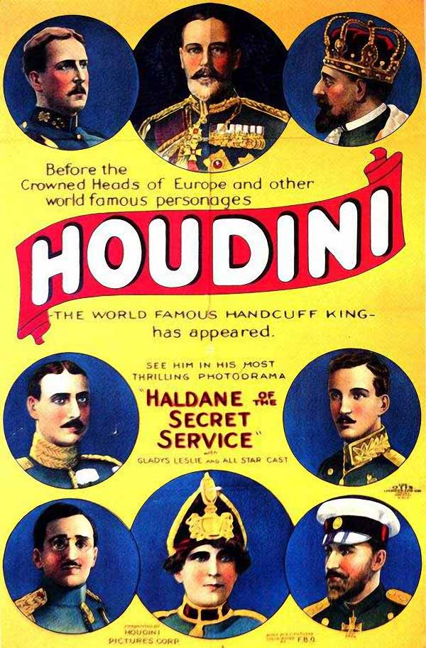
A stunt scene from Haldane of the Secret Service (1923) starring Harry Houdini was filmed at the falls, specifically the northernmost falls. In the film, Heath Saldan (Harry Houdini) is caught by the bad guys and tied to a water wheel at the falls. He spins as water rushes over the wheel and then suddenly it becomes unhinged and collapses with Houdini still attached. Does he make it out alive? Yes, he’s Houdini. The scene was shot in 1921.
Hiking / Walking Trails
Difficulty: Easy.
Markings: Road and historical signs.
Distance: A few feet to a few hundred feet, depending on how many angles you want to see it from.
Description: From the parking area off of Main St, walk down the ramp to the overlook platform in the southwest corner to see a close view of the northern part of the falls.
Head back to Main St and head left (west). Be mindful of traffic and make a left (south) on Chatham St. See the northernmost falls from the bridge and continue south to see the southern segment.
That’s all there is to it. Head back to the parking lot.
Map: Interactive.
Beaver Cotton Mill Interactive Map
Beaver Cotton Mill Media

Video by Kelly Lucero
Who to Contact
Village of Valatie
518-758-9806


