Akron Falls County Park


Location: Within Akron Falls County Park; village of Akron, town of Newstead, Erie County, New York.
Maps: Google map; Topographic; Interactive Map.
GPS Coordinates:
- Upper Akron Falls: N 43.01445 / W 78.48273
- Lower Akron Falls: N 43.01529 / W 78.48367
- Dam drop: N 43.01612 / W 78.49518
Directions: From the east:
- Take the Thruway (I-90) west to exit 48A (Pembroke/Medina) and head south on NY-77.
- Turn right (west) on NY-5 (Main Rd.) and follow it for about 4 miles.
- Turn right (north) onto Crittenden Rd and follow it for about a mile.
- Turn left (west) onto Skyline Dr and look for the park entrance on the right.
- Park near shelter #4.
From the west:
- Take the Thruway (I-90) east to exit 49 (Depew/Lockport) and head north on NY-78 for a mile.
- Make a right and head east on NY-5 for 10 miles.
- Turn left (north) onto Crittenden Rd and follow it for about a mile.
- Turn left (west) onto Skyline Dr and look for the park entrance on the right.
- Park near shelter #4.
Or use Google Maps.
Parking: Plenty. The first lot on the right will hold about 5 cars. The second, near the trail-head and shelter #4, holds about 20 cars. Additional parking can be found near each pavilion, and a large lot is on the western end of the park by the tennis courts.


Weather
Information / Accessibility / Accommodations
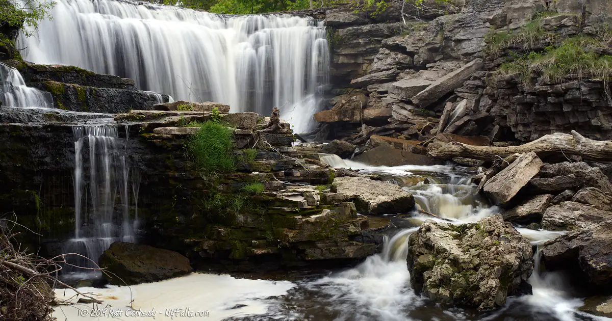
Number of falls: Number of falls: 2 natural falls, one small drop over a man-made dam.
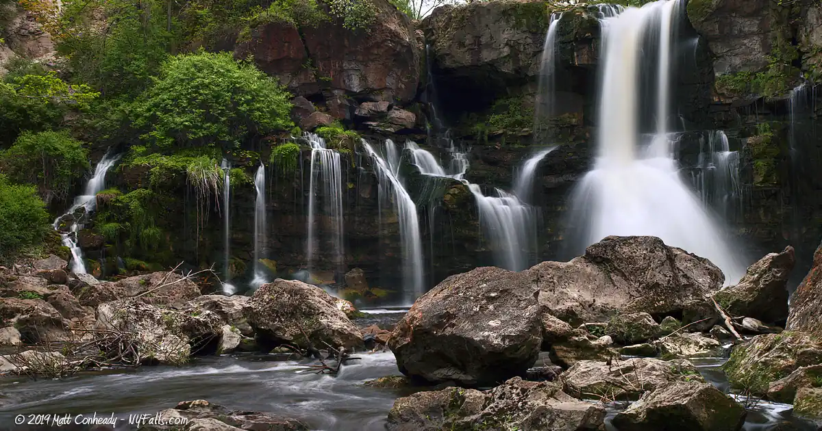
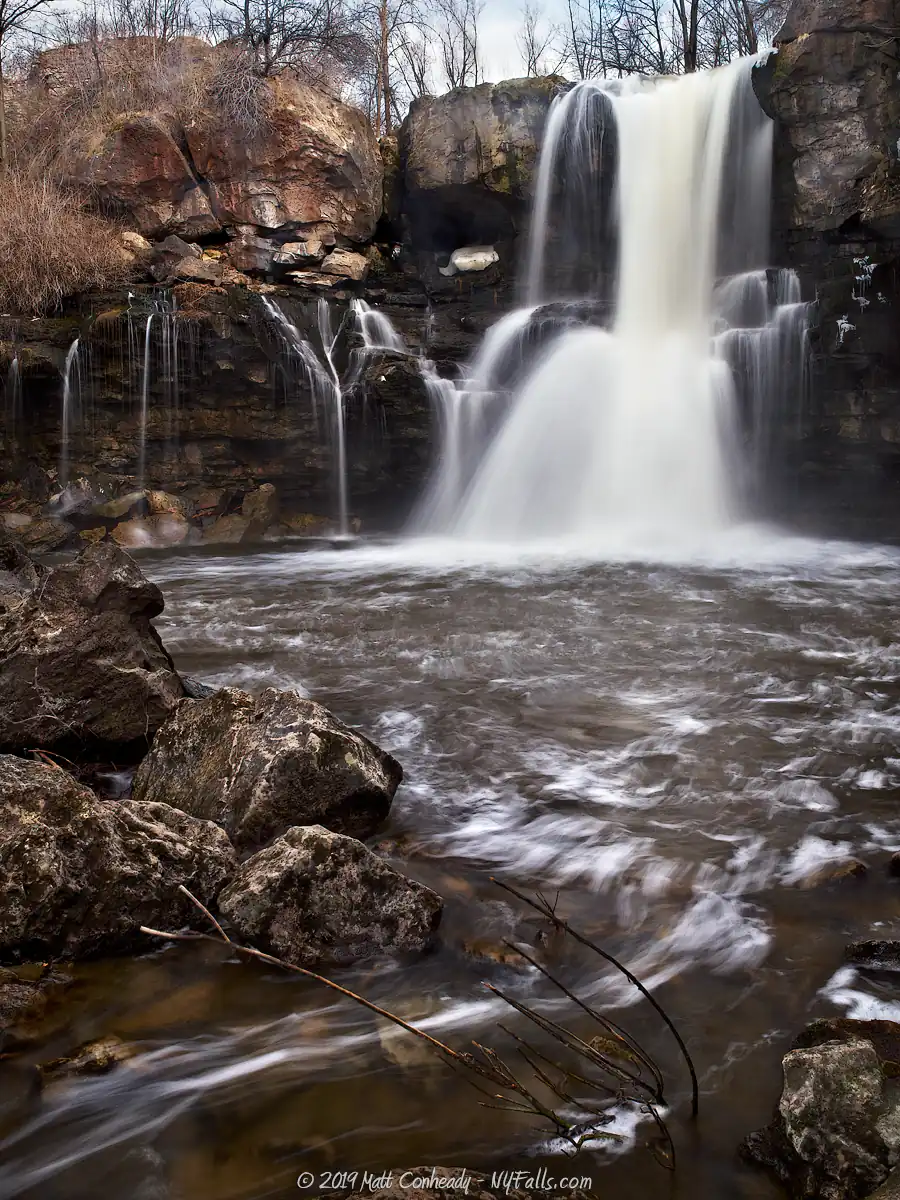
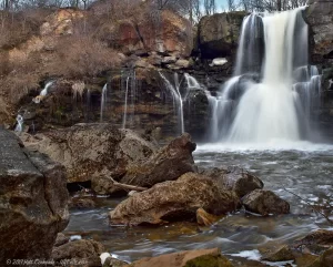
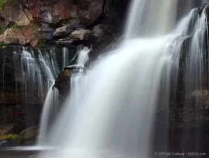
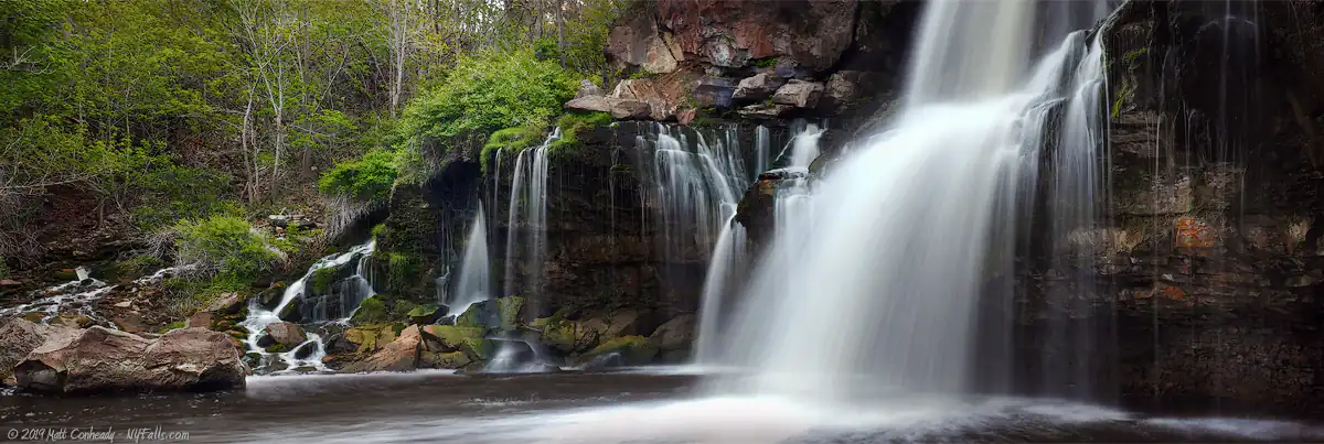
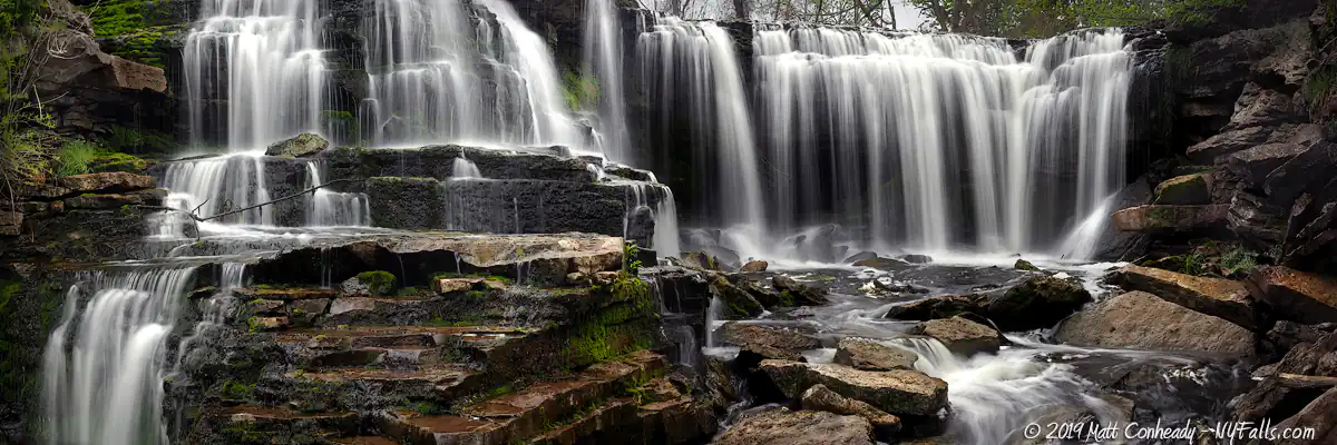
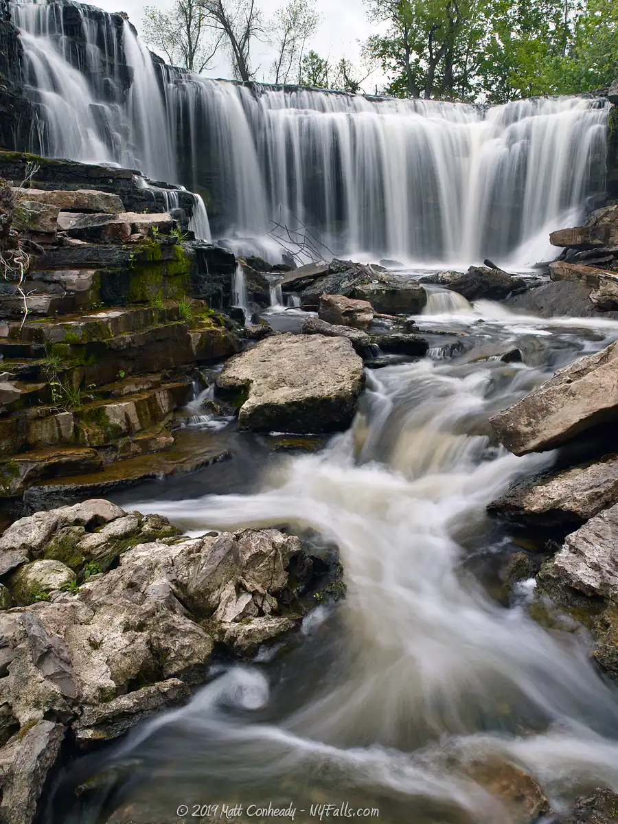
Size/Types: Lower Falls is roughly 44 ft and Upper Falls seems to be less than 20 ft tall. Both are irregular in shape with many drops, including some cave formations. Upper falls is often divided in two side-by side drops by a rock outcropping in the face. The dam, which maintains the pond at the western end of the park, is a uniform 2 ft drop over a u-shaped crest.
Best time to visit: Spring thaw and after heavy rain.
Flow: Low. Mostly dry in summer.
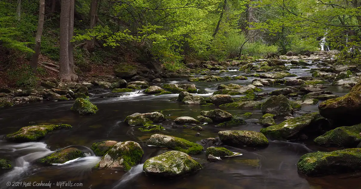
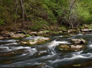
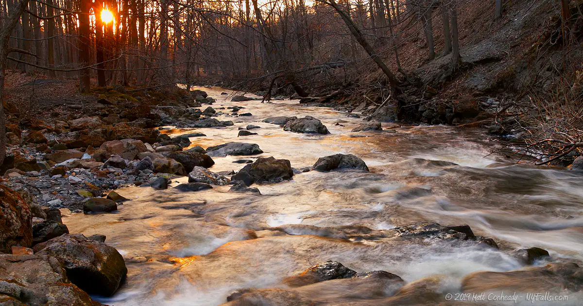
Waterway: Murder Creek, a tributary to Tonawanda Creek, which empties into the Niagara River.
Time: From 5 minutes to see the crest of Lower Falls to 30 minutes to walk to the viewing platform and back.
Seasons/Hours: Year-round; 7 am to 9 pm.
Admission: Park admission is free.
Handicap accessibility: Not for the trail leading to the viewing area in the gorge. It is also difficult to see from the paved area above. I would say… you can see a small part of it from a decently accessible vantage point.
Pets: Pets allowed when on leash. Carry proof of inoculation. Not allowed in the water.
Accommodations: Restrooms; picnic tables; grills; pavilions (16); indoor lodge with kitchen; playgrounds (3); ball fields (soccer, baseball); tennis courts; basketball court; fishing; hiking trails; ice skating. No swimming (especially below the falls).
Description
Akron Falls County Park is probably most often used for picnicking, parties and sports more than anything else. The northern half of the park is crammed with tables, grills and shelters (over sixteen of them); with restrooms and playgrounds scattered about. Walking trails stem from the roads and lead down into the gorge and across the creek, with a few areas for viewing Lower Akron Falls. The southern tail of the park, often referred to as the Akron Sports Complex, is filled with numerous well-groomed playing fields and wooded nature trails. The park is an exceptional family destination, despite cradling a waterway called Murder Creek. For those who come just for the waterfalls, the park delivers with some of the more unique cascades in the state.
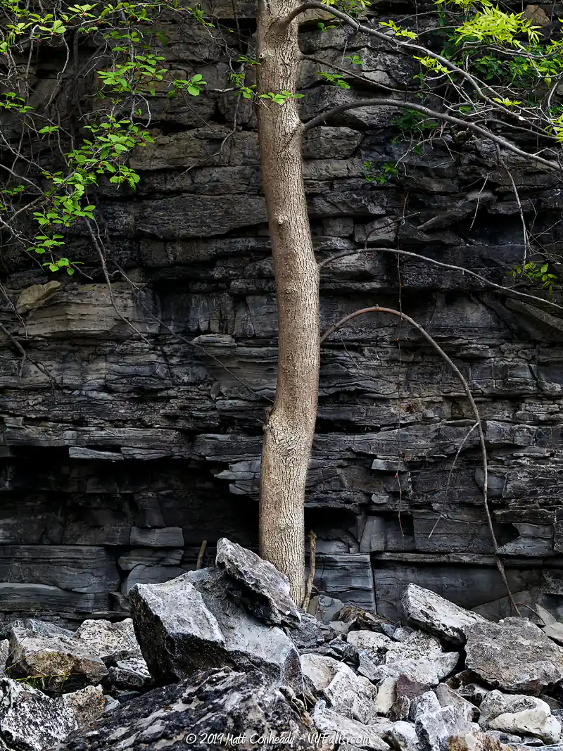
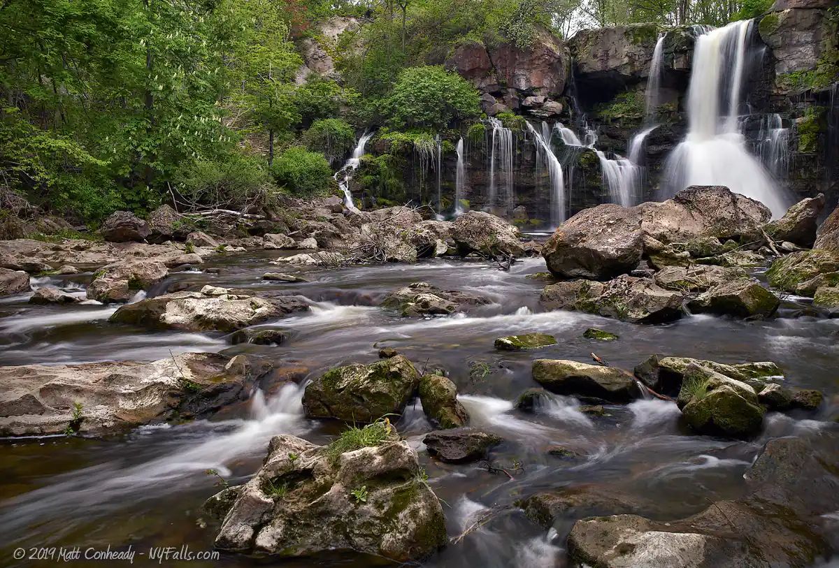
Carved out of the Onondaga escarpment, Upper and Lower Akron Falls are formed out of irregular, cracked layers of thick limestone, a typical representation of karst topography. Water and ice erosion have expanded natural cracks in the limestone, allowing the creek to flow between and under the resulting large blocks of the bedrock. As a result, water seems to flow out of the cliff face from random nooks and crannies.
Upper Akron Falls, which is generally inaccessible, consists of two side-by-side, U-shaped overhangs, separated by a pillar of higher bedrock. The northern section drops nearly 20 feet over a large cave formation. Years ago this cave was blocked off by steel bars, but erosion destroyed the barrier and now only rusty remnants of it can be found about the creek bed. The section to the south, also an overhanging drop, only flows at times of heavy rain. Click here to see an aerial view of the Upper Falls. Lower Akron Falls is easily visible from the viewing area half-way down the trail that leads to the creek. Lower Falls drops straight down through a channel and disperses as it hits the cliff face nearly halfway down.
Complemented by the many other drips and drops from the cracked cliff-face, it can take on many diverse shapes and sizes depending on the flow of Murder Creek. At times of high flow the entire crest of the cliff carries water, but this will only happen during a quick winter thaw or extended heavy rain.
History
The Akron area was once inhabited by the Huron, Erie, Wenro and (predominantly) the Seneca tribes of the Iroquois Nation. The land that is now the Village of Akron was settled quickly in the late 1700s by Europeans, who took advantage of the Iroquois’ Great Central Trail (which extended from the Albany region through Western NY) and used it as a wagon gateway to the west. What was once called Buffalo Road, still is in many parts of the state. Rt 33 and the NY Central Railroad now run the length of this Native trail turned pioneer road.
The Village of Akron was founded in 1829 and incorporated in 1849. The abundance of limestone and gypsum found in the Onondaga escarpment, and water power from Murder Creek, provided the village with a thriving cement industry. In 1918 Morton Perry purchased a small dairy in Akron and began producing ice cream (read about the history of Perry’s Ice Cream).
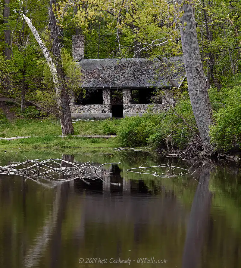
As with many of New York State’s great parks, it was the Great Depression and Roosevelt’s resulting New Deal plan that brought upon intensive development to Akron Falls Park. In an effort to provide jobs to young, unemployed men in the country, the Civil Works Administration (CWA) led the development and rehabilitation of public properties around the country. Akron Falls Park was the result of a 90-man operation over several years; during which they carved out trails and roads, built bridges, fences and pavilions, as well as dammed the creek at the western end of the lake to create a fishing pond. Most of the stonework seen today is a result of that effort. Those familiar with The Civilian Conservation Corp‘s similar work at other State Parks (such as Letchworth or Watkins Glen) will notice a different style to the construction here. This is due to both the natural resources available in the different regions, and the fact that the CCC and CWA were different agencies under different management. Erie County acquired the Park in 1947, expanded the park to 248 acres, and added playing fields and additional picnic facilities.
Hiking / Walking Trails
Difficulty: Moderate to Lower Falls; Difficult to Upper Falls.
Markings: Trees along the trail are marked with paint. The official park trail is lined with stonework.
Distance: Less than 1000 ft to the Lower Falls viewing area. Less than a half mile to get a good glimpse of the Upper Falls.
Trail Guide: To reach Lower Akron Falls…
- Start at the trail-head near the parking lot at Shelter #9. Follow it to the right to reach the falls viewing platform.
- If you go to the left, you can reach the creek and walk to the right and up the creek to get a better look.
- You can also get a view of the crest of the falls from the small parking area above it.
To reach Upper Akron Falls (at your own risk)…
- Start at the parking area above Lower Falls and follow the fence to the east (towards State St).
- Cross Murder Creek on the State St bridge and immediately turn left to follow the creek to the west. You may have to hack your way through the brush, but in early spring we were able to follow a narrow trail. Be extremely careful here: it is very difficult to tell where the cliff is. The rocks here are not stable and may collapse. Proceed with caution.
- You may be able to catch a glimpse of the crest of the Falls from the trail, but there is a way to scramble down to the cliff to the creek bed if you proceed a bit further and are very safe about it. It’s a bad idea to enter that cave under the falls. Those limestone blocks are loose and ready to fall.
Map: Interactive.

Akron Falls Interactive Map
Akron Falls Media


Murder at Murder Creek
The Legend of Murder Creek
In the early 1800s, John Dolph and his business partner built a cabin near Murder Creek with hopes of building a sawmill and starting an enterprise in this early settlement. The planning of their mill was abruptly interrupted by the desperate cries of a young native woman outside of their dwelling. They brought her inside and she told them about her family that had just been murdered by a crazy white officer named Sanders. She escaped from him just minutes before coming to the cabin. The men and their families were horror-struck at the event that had just taken place nearby. Sanders was now after the woman, intent on taking her as his bride.
Sanders showed up minutes later looking for the woman, who was hiding in a nearby cave. Suspecting that the settlers were covering something, he staked out the cabin and found her when Dolph’s wife brought her food and water. When Dolph and the others were away, Sanders went to retake his prisoner.
Gray Wolf, a young native warrior from a nearby camp, and the young woman’s husband-to-be, had come across the carnage at the native family’s home. Hearing the cries of his loved one, he rushed to her aid. With tomahawk in hand he fought a gruesome battle with the sword-wielding Sanders at the edge of the creek gorge. Bloody and battered, Sanders fell dead. Before Gray Wolf could be reunited with the woman, he too succumbed to his wounds.
This legend is told as the source of the name Murder Creek. Many variations of this legend exist. Some say that Gray Wolf lives, some say that the woman dies. In some cases the deaths occur via fall into the creek gorge. We couldn’t verify anything here as fact.
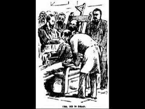
Sadie McMullen
During the night of November 1, 1890, 19-year old village resident Sarah (Sadie) McMullin lured Delia Brown (age 6) and Nellie May Connors (age 8) on to the New York Central Railroad Bridge over the Murder Creek gorge. Sadie pushed the two children into the rocky gully 50 ft below. Connors was killed instantly. Brown was permanently injured. Sadie then jumped into the creek herself, but was rescued and arrested. She was put on trial for murder on March 5, 1891 and the case made national headlines.
Evidence presented at the trial showed that Sadie had premeditated the murders; preparing for her arrest or death by writing letters and visiting her priest the day before to say goodbye. It was also shown that Sadie most likely did not jump from the railroad trestle, but climbed down closer to the creek to jump in, possibly to fake the drowning. The most controversial argument made by the prosecution was that Sadie was possibly romantically infatuated with Delia Brown’s father, a widower whom she helped around the house.
She was acquitted 2 days into the trial on grounds of insanity and was institutionalized in 1891. She was released in August of 1893 and declared “perfectly sane.”

Interesting Stuff
Rich-Twinn Octagon House
The Rich-Twinn Octagon House, at 145 Main Street in the village, is a late Greek Revival style 8-sided house, now serving as a museum. Octagonal homes were relatively common in the Upstate NY region in the 19th century as they were thought to provide many benefits over traditionally shaped homes. Map, More info.
Limestone caves
Akron is home to several limestone caves, both natural and left over from the cement industry that once mined here. Some are on private land and even being used (for mushroom farming). Others are explorable and probably dangerous. Use caution. More info.
Onondaga Escarpment
The Akron Escarpment Natural Area, is located along a run of the Onondaga escarpment near the Akron airport. You can park off of Scotland Rd to reach a trail-head (map) or at the ball field on John St (map).
Photography Tips
When to shoot
- Early Spring, after rain, and when the sky is still overcast, head to this park.
- Summer weekends will pack the park with hundreds. Get there early to beat the crowds.
Shoot wide and long
- Bring a wide angle lens. Lower Falls is big and spread out.
- Don’t leave that telephoto at home. If you can’t creek-walk to the falls, count on your zoom to focus in on segments of it, rather than just shooting the whole thing. The possibilities are limitless.
- A creek walk up to the basin just downstream from the falls may yield a better angle. This is probably against the park rules.
Downstream
- Don’t forget the pond at the western end of the park. It provides excellent reflections for the nearby Parkview Dr bridge.
Park infrastructure
- The CWA stonework makes an excellent subject. Photograph it now before it goes away forever.
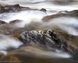
Silky Water Effect
- To get that smooth cotton-candy look to the falls, you need to use a Neutral Density (ND) filter on your lens. The ND filter will block some of the light from entering the lens without altering the color, and thus allow your shutter to stay open longer. This blurs the water and creates a soft white gloss to the foamy areas of the falls. Check out the article for the all the details.
More tips
- See the Articles for more photography tips.
Who to Contact
Eire County Parks & Recreation
95 Franklin St. – 13th Floor
Buffalo, NY 14202
Phone: (716) 858-8355
eerie.gov


