Whistlewood Park / Lakeshore Marshes WMA


Location: On Lake Ontario; In the central Lake Shore Marshes Wildlife Management Area; West of Port Bay; within the town of Huron; Wayne County; New York
Maps: Google Map; Topographic; WMA Map; Interactive map
GPS Coordinates:
- Beachside entrance: N 43.29797 / W 76.85494
- West bluff trailhead parking: N 43.29677 / W 76.85549
- East beach boundary: N 43.30175 / W 76.84715
- Bluff trailhead: N 43.29800 / W 76.85474
Directions: From NY-104, take Lasher Road (which is just west of the Village of Wolcott) north. Continue north as it becomes Dutch Street Road when it passes Ridge Road. After several miles, you will hit an intersection. Making a right (east) will continue on Dutch Street Road which will soon again head north. The road terminates at the beach and a small parking area. Or use Google Maps.
Parking: For quick access to the beach, park at the very end of Dutch Street Road. Here space is limited to about 5 or 6 cars and the lot can fill up quickly on hot summer days. Alternative parking is just 1000 ft south of here on Dutch Street Road. This lot is more often used for the hiking trails, but it’s within a reasonable walking distance to the beach.

Weather
Information / Accessibility / Accommodations
Typical Seasons/Hours: The state wildlife management area, of which this land is a part, is open year-round, 24-7. There are no artificial lights anywhere near here, and cellular reception is very spotty, so it’s not recommended to be exploring the area at night. Hunting is allowed here, so use caution in hunting season.
Admission: Free.
Best time to visit: Summer weekdays.
Time: Easily a few hours to half a day to explore the beach and trails. Pack a picnic (there are no trash cans, so be prepared to carry it out).
Handicap accessibility: Not much at all. The end of Dutch Street Road, while paved, is uneven and covered in gravel. One could see the lake from here. Everything else is pebble beach and steep dirt trails.
Pets: Allowed on a leash (which is a county law).
Swimming: Officially swimming is not allowed here. There are no lifeguards and the beach is not monitored for bacterial contamination. Folks do swim here. Obviously, use caution if you make that choice.
Boat launch: Hand launch for kayaks and canoes from the beach near the parking area at the end of Dutch Street Road.
Camping: Not allowed. No facilities.
Accommodations: Lake Shore Marshes Wildlife Management Area is a pretty natural place. All you will find here: Beach access, hiking trails, fishing, hunting/trapping, a place to launch hand watercraft, and wildlife viewing.
Description
This former Girl Scout camp has been wholly reclaimed by nature and incorporated into the state’s Lake Shore Marshes Wildlife Management Area. While labeled on some maps as Whistlewood Park, it doesn’t seem to be a park in any official capacity. The DEC and other organizations just refer to it simply as “Whistlewood”. Adding to that, the boundaries of the “park” don’t seem to be defined within the larger WMA. The Wildlife Management Area itself is large, spanning from Sodus Bay to Black Creek near Sterling and partitioned into 7 sections, most of which surround important wetland habitats. Of the many accessible areas of the WMA, Whistlewood is easily one of the more park-like, and maybe a touch more development could make it a great alternative to neighboring Chimney Bluffs State Park, which tends to get packed on summer weekends.
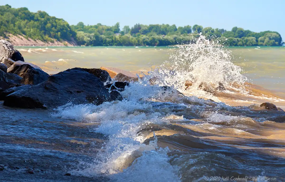
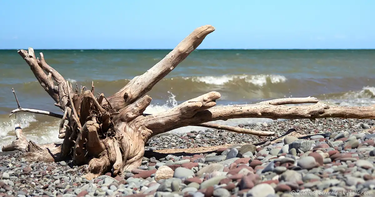
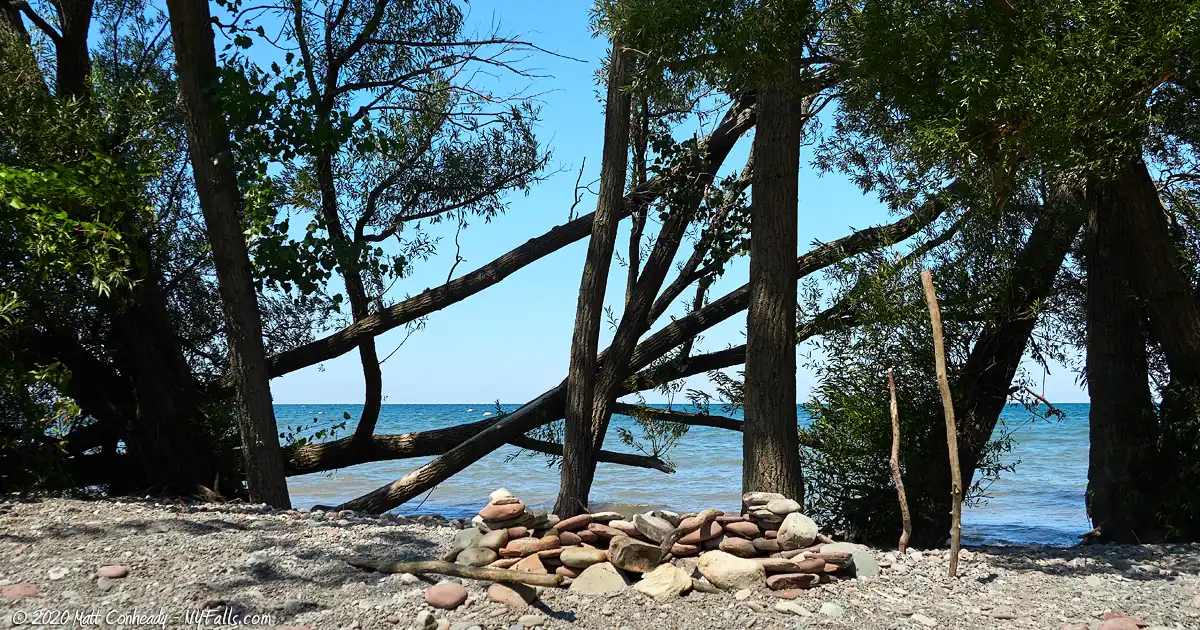
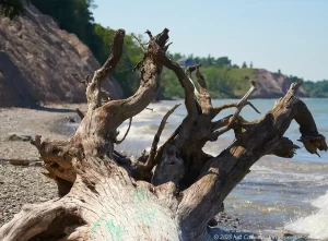
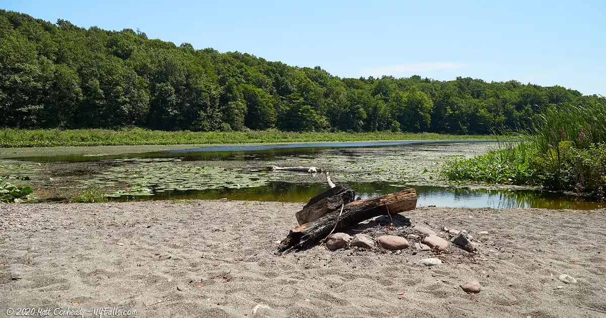
While it has almost no facilities, including a lack of restrooms, one could easily spend a great deal of time exploring the beach and network of trails that surround Beaver Creek. Perhaps because of Whistlewood’s isolated location and lack of amenities, it also sees fewer crowds. At the times I have visited, I’ve seen no more than a couple of cars, and a few families on the half-mile stretch of beach. Maybe it’s this peaceful setting that’s needed for those who want to enjoy lakeside nature but have been turned off by the boost in popularity the Chimney Bluffs have had in recent years. Another thing Whistlewood has going for it is shade. While the pebble beach here is very similar to neighboring parks, Whistlewood has smaller, but steeper wall-like bluffs as well as trees firmly planted in some areas of the beach, providing some cooler areas to enjoy than the sun-soaked beach. I visited on one of the hottest days in July and was relieved to be able to sit on a bleached log resting on the hot stones under a thick canopy of trees, enjoying the view.
Whistlewood is a great spot for bird-watchers and there is activity from endangered (black tern), threatened (pied-billed grebe, least bittern, northern harrier, and upland sandpiper) as well as special concern classified species (American bittern, osprey, and common loon).
History
The area of the Town of Huron was first settled in 1796, but the town wasn’t established until it spun off from the Town of Wolcott on Feb 25, 1826. Then it was called the Town of Port Bay. It was renamed Huron in March of 1834.
Captain William Helms of Fauquier County, Virginia first settled in the area in 1796 with about 70 slaves, who he forced to run his 100-acre farm. The Helms family and their slaves were pretty much the only inhabitants of the area until about 1807. William Helm’s brother Thomas ran the farm and was known for his cruel treatment of the slaves who lived and worked for him. Upon his death, they were freed and it seems as though they mostly moved elsewhere, although I cannot find any information on who they were and what became of them.
The beach and surrounding woodland was once Camp Whistlewood, a former Girl Scout summer camp. Information on the camp is scarce, but it seems to have opened for the first time in the summer of 1961, and was used by senior scouts to train more primitive camping skills. Special camping skills were offered as training, including fire building, hiking, outdoor cooking, swimming, and boating. Primitive camping was also offered to entire families of scouts. I do not have a date for when the camp was closed. At some point, the land fell into the hands of the DEC and was incorporated into the Wildlife Management Area.
Huron’s history is mostly that of farming and shipping, the latter of which waned when the Erie Canal was built and shifted business from the lake ports to the canal. The land encompassing the Wildlife Management Area was mostly left unsettled due to its marshes and steep hills.
Today orchards and fruit processing are the predominant industries, with tourism being somewhat of a boom around Sodus Bay and the Chimney Bluffs.
Hiking / Walking Trails
The Wildlife Management Area has a vast network of trails, many of which are not clearly documented, with several in the Whistlewood vicinity. For this guide, I have simplified the major trails that are adjacent to the lake, as well as the larger, more popular trail that extends south through the woodland. These are the trails I recommend.
Beach Trail
Difficulty: Moderate, mostly because of uneven ground (sand and stones), dwindling beach due to erosion, and some downed trees that may take some agility to cross.
Distance: About a half-mile from one side to the other.
Markings: None. Just stick to the beach.
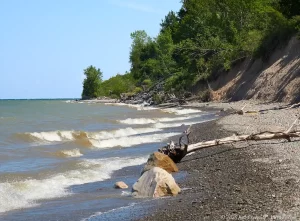
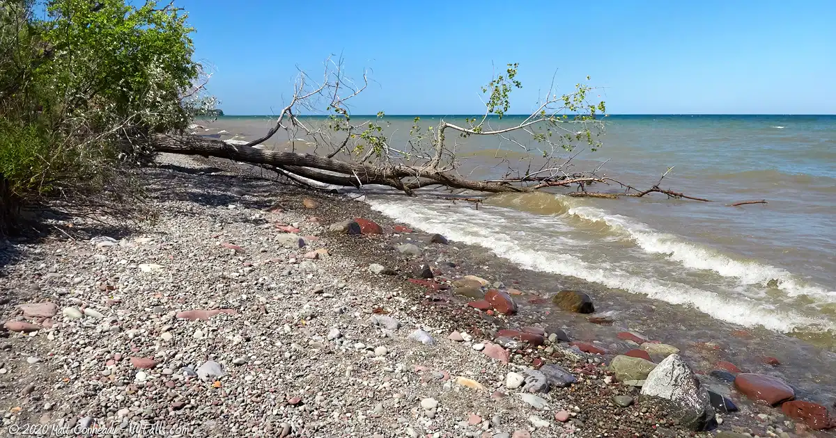
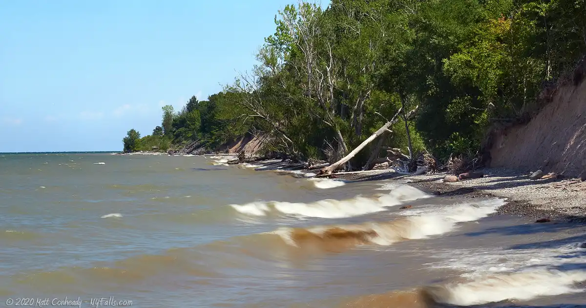
Description: This is the ideal walk if beach conditions allow for it. From the end of Dutch St Rd head east along the beach. You will first pass a set of small steep clay bluffs, which will then open up to a section of beach with sparse trees. This is a great spot to stop to enjoy the water or picnic. On the other side of the stone/sand bar is the Beaver Creek Marsh. Check for turtles and waterfowl here. Keep heading east along the Lake Ontario beach and you will soon come across a larger set of bluffs that extend about a quarter-mile. At the east end of these bluffs are private cottages. When you reach this point, turn around and come back.
Maps: See the interactive map below.
Bluffview Trail
Difficulty: Moderate, mostly because of uneven ground (sand and stones), dwindling beach due to erosion, and moderate changes in gradient.
Distance: Just over a mile one way.
Markings: Blazes in the wooded area.
Description: The trail begins at the park road and parking area near the maintenance station (map). Follow the service road north through the woods for about 0.7 mile. It will reach a stony beach at the lake. Continue on the beach for about 1/3 mile and you will reach the bluffs. The trail cuts back into the woods on the other side of the bluffs. This wooded section loops around the bluff hill and back to the beach at the beginning of the bluffs. Head back the way you came.
Maps: See the interactive map below.
Whistlewood Park State Park Interactive Map
Fishing
Fishing is allowed at Whistlewood Park and across the Lakeshore Marshes WMA. You can cast at the shore of Lake Ontario from the park’s beach, but most people fish just east of here at Port Bay at the south off of W Port Bay Rd or the north end, also off of W Port Bay Rd, by the Lake.
Interesting Stuff
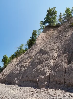
Glacial Drumlins
Drumlins are egg-shaped mounds of clay, silt, gravel, and boulders left by glacial movement and the erosion of the bedrock those glaciers move across. They typically are elongated in the direction of flow and are found in groups or “fields”. Western NY and the Finger Lakes are so full of them, we just think of them as normal hills in these parts.
The bluffs here at Whistlewood, those at Fair Haven, and the much larger bluffs at Chimney Bluffs State Park are drumlin hills that have been cut into by erosion (primarily by the lake’s waters). Take a look at this terrain map of all the drumlins from the Chimney Bluffs to Stiffs Bluff at Fair Haven. Then zoom out and see how many stretch across Finger Lakes and Western New York. Are there any drumlin fields where you live?
Sodus Point
The village has been a neat little lakeside vacation spot in Upstate New York for over a century. With a big and beautiful sandy beach, and a handful of great bars and eateries, it’s a great place to stop by or rent a weekend cottage.
Lake Shore Marshes Wildlife Management Area
Whistlewood is just a small sliver in this grand preserve. Composed of seven patches of preserves and park land along Lake Ontario, Sodus Bay, East Bay, Port Bay, and their tributaries, it is a 6,179 acre management area for wildlife and its wetland habitats as well as for wild-life related recreational activities. Until I get a chance to explore it all and create more guides, check out this overview by the NY DEC.
Thorpe Vineyard
One of the few Lake Ontario wineries in the region, it’s located near the Chimney Bluffs and has an outstanding local selection.
Photography Tips
Sunsets
- The angle of the shore (towards the west) gives this park a nice vantage point for Lake Ontario sunsets.
Exposing for Beaches
- Digital camera sensors tend to see flecks of glare from water and sand and turns down the automatic exposure to compensate. This usually results in an overly dark scene. Keep an eye on this and be prepared to use exposure compensation to keep the beach looking bright and hot. Phone photographers can try tapping dark spots in the scene to get the camera to adjust exposure correctly.
The Bluffs
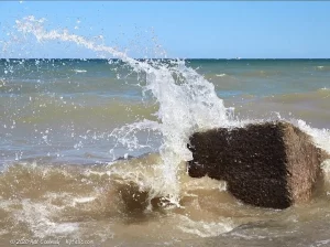
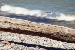
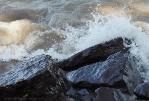
- When photographing the bluffs, try to use layering in your scene to convey depth. Stones and driftwood in the foreground and people standing next to the bluffs in the background work really well.
- Get your feet wet and (safely) step out into the water a little to get a wider shot. Use the shoreline as a foreground element.
- If shooting from the beach, the sky will end up being a great background element. Dramatic clouds will make for some amazing shots.
Don’t forget the wetlands
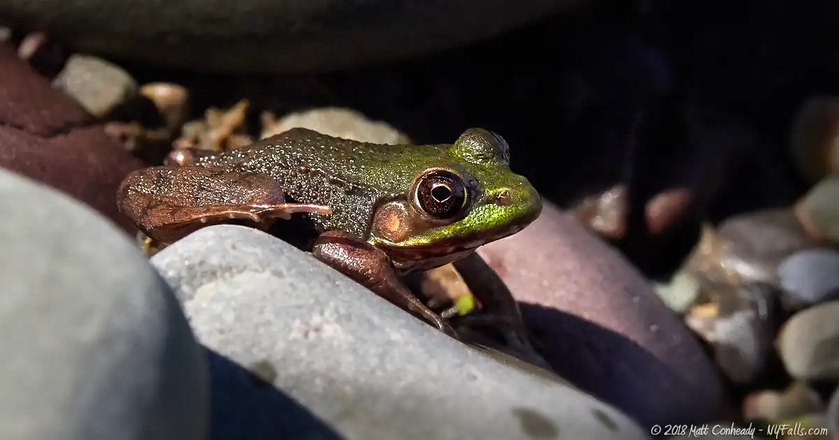
- Beaver Creek is surrounded by a marsh that is packed with lily pads, frogs, waterfowl, salamanders, and more critters. Several times I found little frogs on the Ontario Beach rocks across from the marsh.
Birds
- The park is an important habitat for marshland species and a stopover for migrating birds.
- Bring a long lens.
More tips
- See the Articles and Message Board sections for more photography tips.
Nearby Waterfalls

More Lake Ontario Parks & Beaches
Find a new summer hangout spot or place to swim in our comprehensive guide to Lake Ontario Parks and Beaches in New York State.
Who to Contact
DEC Region 8
6274 E. Avon-Lima Rd.
Avon, NY 14414-9519
(585) 226-2466
[email protected]
