Sodus Point Beach Park & Sodus Bay Lighthouse


Location: On Lake Ontario; Village of Sodus Point; Town of Sodus; Wayne County; New York.
Maps: Google Map; Topographic; Interactive map
GPS Coordinates:
- Lighthouse: N 43.26497 / W 77.02628
- Beach parking lot: N 43.27377 / W 76.98625
Directions: To get to the village of Sodus Point, take NY-14 north to Lake Rd/Bay St. To get to the Lighthouse, from Bay St, make a left onto N Ontario St and follow it to the Lake. The Lighthouse will be on your right. To get to the Beach Park, from Bay St, turn left onto N Ontario St and then make a right onto Wickham Blvd. Follow Wickham to the beach parking lot. Or use Google Maps to get to the Beach or Lighthouse.
Parking: Beach Park: Parking is located off of Wickham Blvd at the beach park; alternative parking can be found to the south along Greig St. or Bay St (near the ball fields).
Lighthouse Museum: Parking is available along N Ontario St.
Weather
Information / Accessibility / Accommodations
Seasons/Hours: Beach Park: June 26 – Sept. 3; 7 days a week 11am-7pm
Lighthouse Museum: May through October; Tuesday through Sunday (Closed Mondays except holidays); 10am-5pm.
Admission: Beach Park: Free.
Lighthouse Museum: Parking and walking the grounds and visiting the gift shop are all free.
Adult: $4; Children: $2; Under 8 years: free; Sunday concerts: Adults: $3
Best time to visit: Late spring through summer.
Time: A half-day to walk the beach and museum grounds and tour the museum. Make a day of it by swimming, fishing at the beach and visiting the local eateries.
Handicap accessibility: Beach Park: Yes, up the pier.
Lighthouse Museum: Not really.
Pets: Allowed at Beach Park if on a leash, but not in the swimming area. Not allowed on the grounds of the lighthouse museum. For your pet’s safety, and the safety of other hikers, keep your pet on the leash! It doesn’t matter if your dog is “friendly,” it’s the law. Please clean up after.
Swimming: Beach Park: There is a guarded swimming area along the lake and also on the other side of the parking lot at the bay. Poor water quality may close the beach to swimming. Call (315) 946-5624 (Mon – Fri only) for beach conditions.
Lighthouse Museum: No swimming.
Boat launch: Beach Park: There is a small boat ramp near the Coast guard station. It is closed during the summer months.
Lighthouse Museum: No.
A public boat launch can be found to the south on Rt 14 near Margaretta Rd.
Accommodations: Beach Park: Fishing, guarded swimming, restrooms, bathhouse, playground, hand boat launch, pavilion, grills.
Lighthouse Museum: Restrooms, gift shop, guided tours, historical signs, picnic tables, summer concerts, benches.
Description
The village of Sodus Point’s population booms in the summer months as visitors from all over the state populate the many cottages that surround the Great Sodus Bay and line the shores of Lake Ontario. Sodus Bay, since the latter half of the 1800s, has predominantly played the role of a summer destination for vacationing Rochester and Syracuse inhabitants rather than a site for residency. This has changed in recent years as more and more cottages have been converted to homes and modern utilities and permanent roads span out from the village. The village’s charm as a lakeside vacation spot has not diminished.
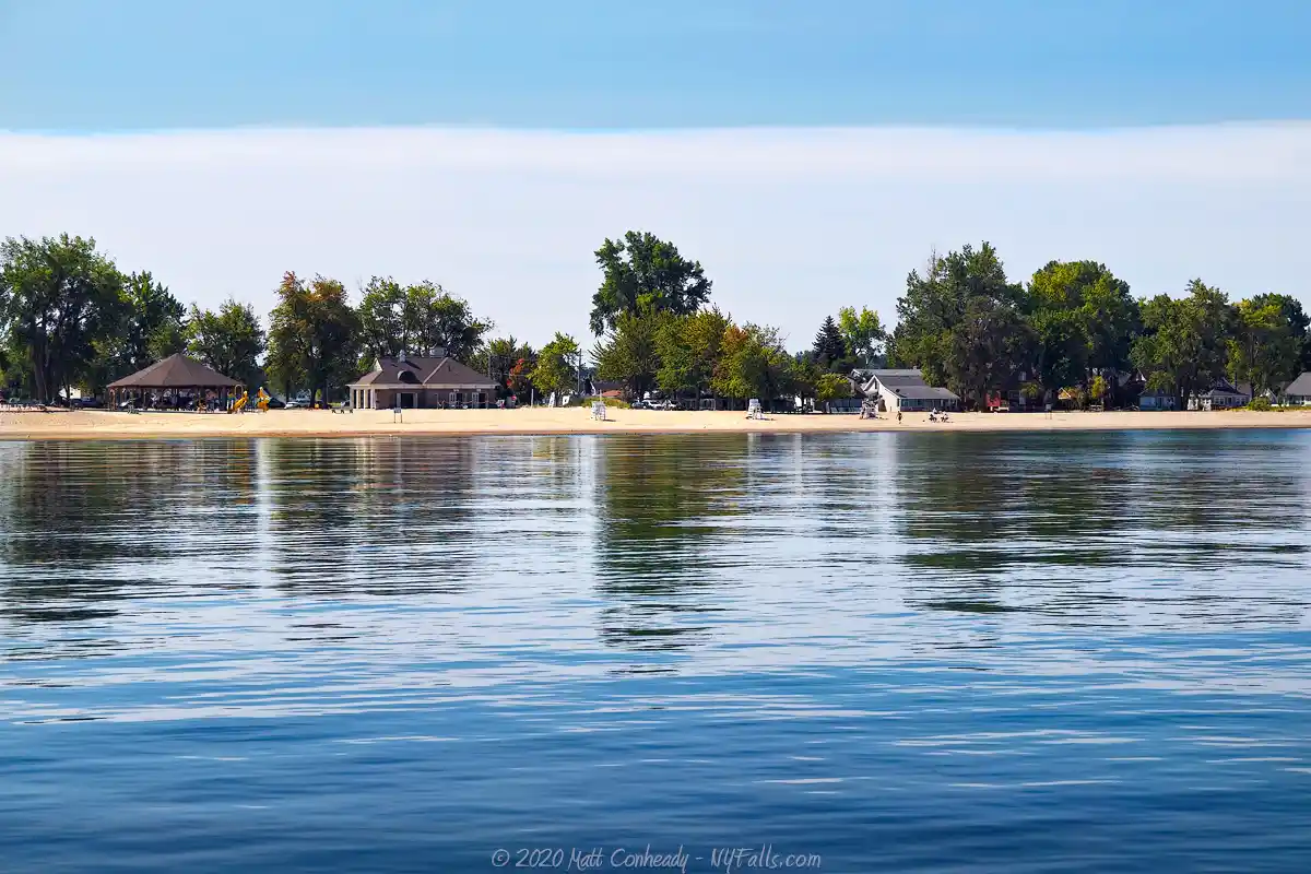
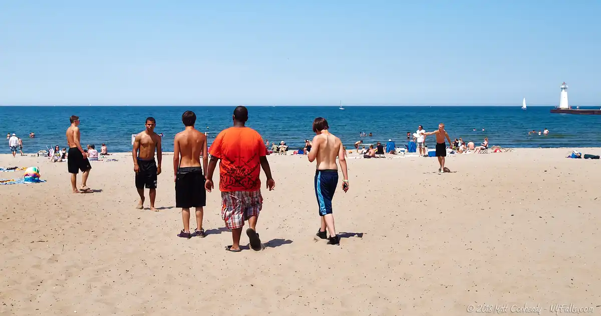
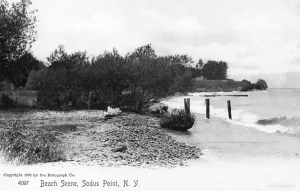
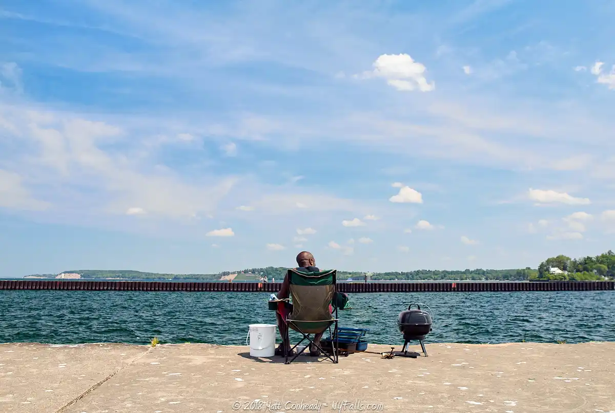
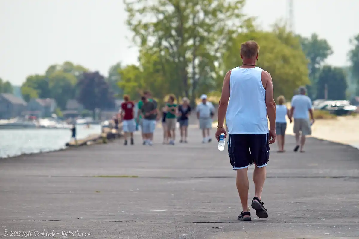
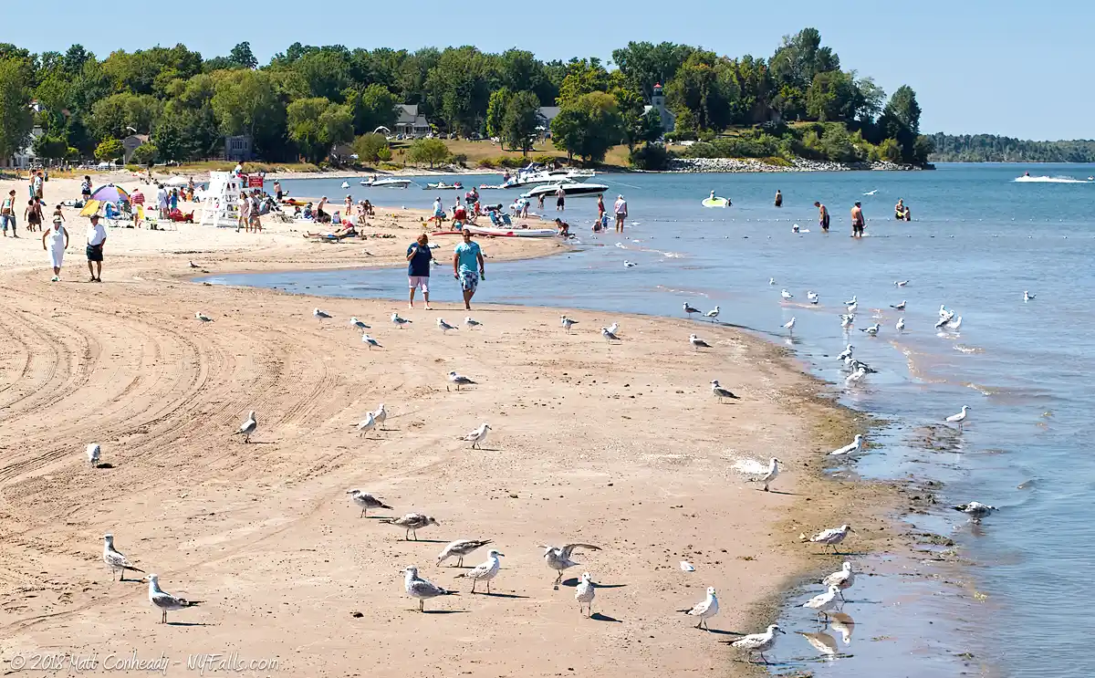
Sodus Point’s draw has always been the water. The village is nestled on a peninsula created where the peaceful waters of Sodus Bay meet the erratic coast of Lake Ontario. At this point lies Sandy Beach Park, one of the more popular swimming beaches on the southern shoreline. Although small, the park features an open pavilion, bathhouse, and a pier for fishing and sightseeing. When the lake’s waters are too rough for swimming, or as in recent years, closed due to water quality concerns, a small beach on the bay is usually available. Families can also walk out from the park and visit many of the quaint local establishments that offer excellent meals and gifts.
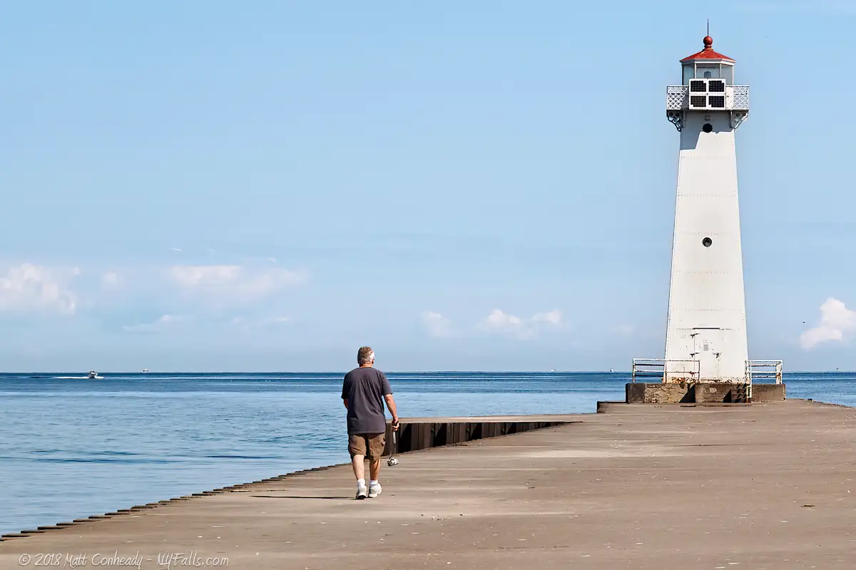
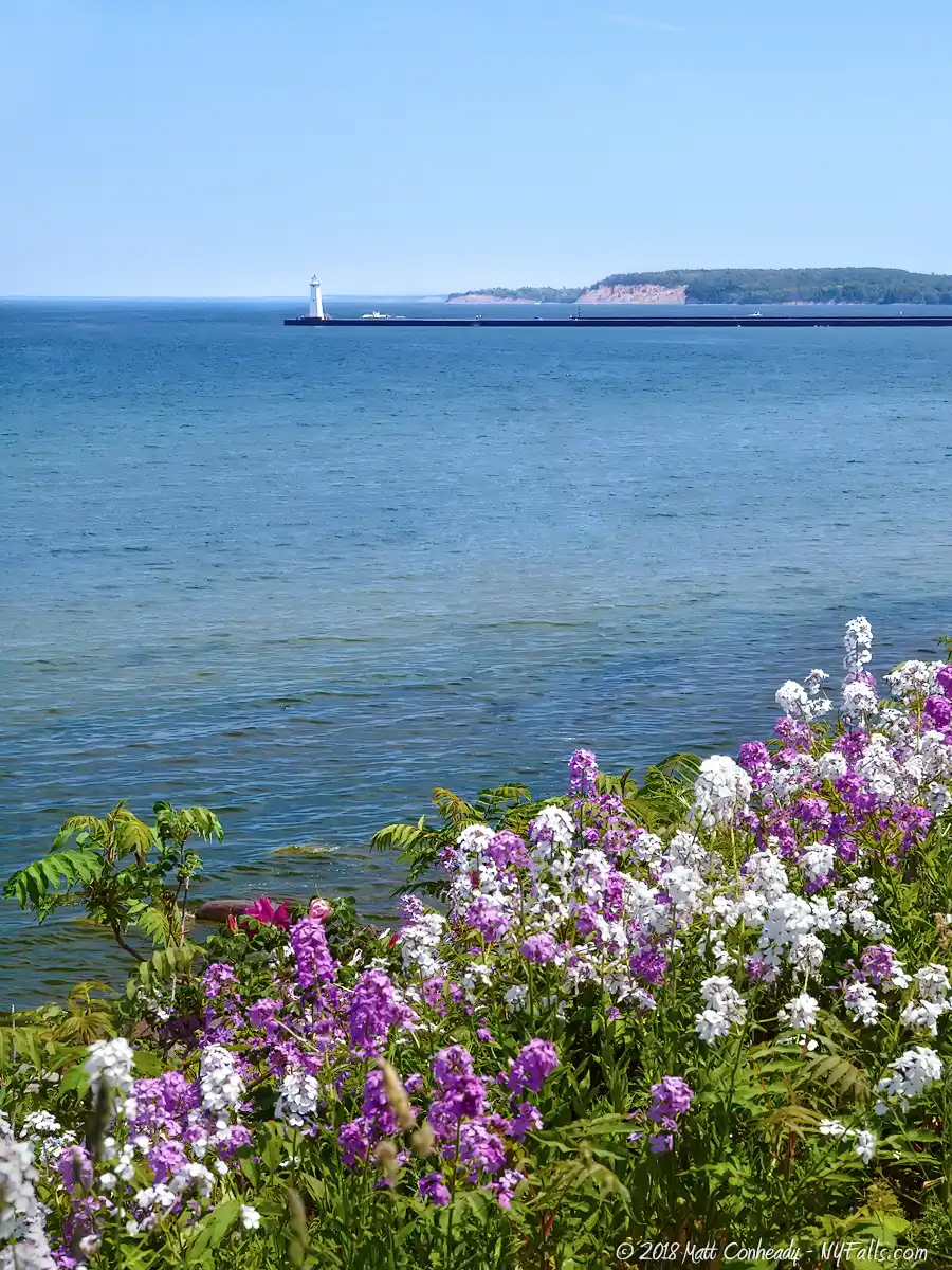
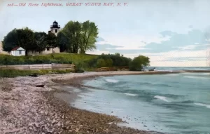
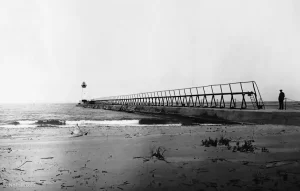
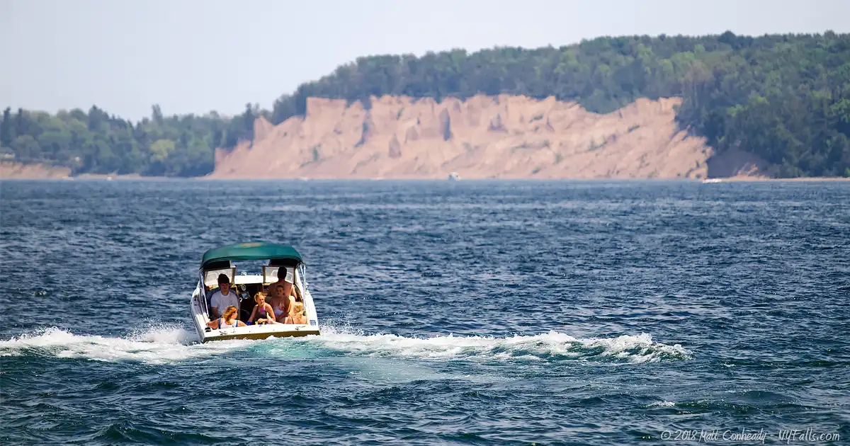
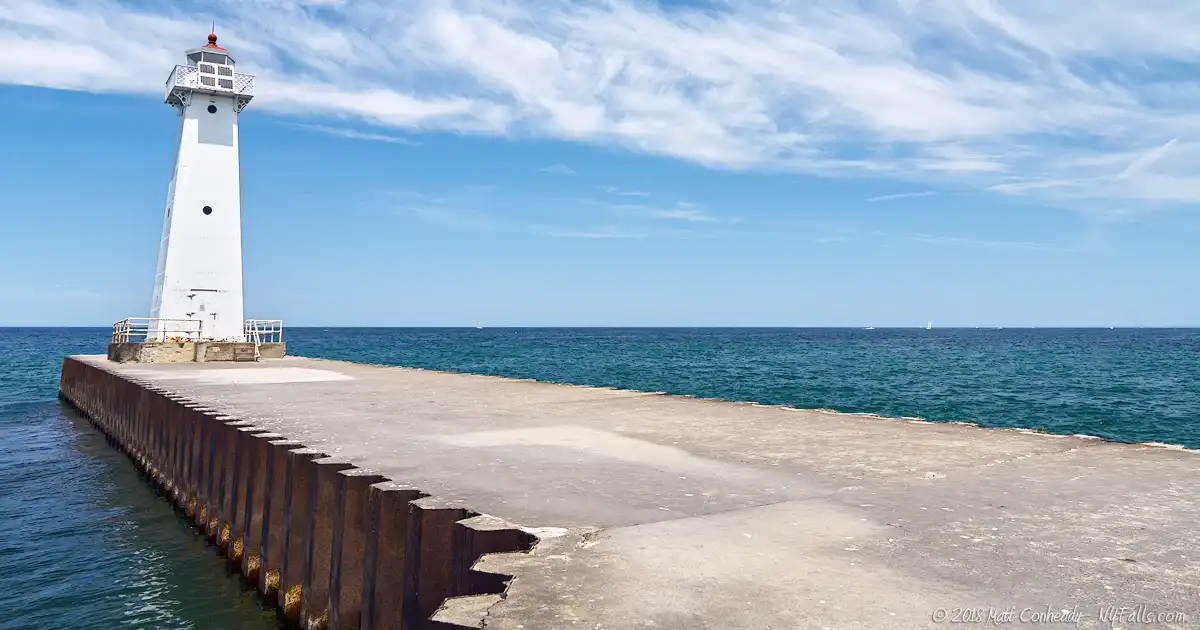
From the 1150 ft long pier at Sandy Beach Park, one can see the Chimney Bluffs 3 miles to the east, and the Sodus Bay Lighthouse Museum to the west. Although the pier at Sandy Beach is capped with a light, this is merely a modern beacon (not a house) constructed in 1938 and used for navigating the entrance to the bay. The actual Sodus Bay Lighthouse sits atop a 20 ft bluff less than a mile to the west, where it has stood for the last 140 years. The beautifully landscaped property offers spectacular vistas of the lake as well as historical markers describing the existing lighthouse and one marking the ground were its predecessor stood. The lighthouse itself is now a museum, exhibiting the maritime history and tourism legacy of the Great Sodus Bay.


History
Sodus Bay was once a great river delta formed from the emptying of a watershed system that ran from the hills of present-day Pennsylvania and into the precursor to Lake Ontario, the Ontarian River Valley. The last ice age brought massive glaciers that drastically altered the land and its many watersheds, gouging out Lake Ontario and the Finger Lakes. Most likely the same river valley that created Sodus Bay was also deepened to create Cayuga Lake.
Prior to white settlers, the Onondaga and Cayuga Indians settled along the “Assoh-doh-rass,” or “silver waters” of Sodus Bay, the largest natural bay along Lake Ontario.
Sodus Point was first occupied in 1794 by Captain Charles Williamson, an agent for Colonial land investors, Pulteney Estates, with the intention of creating a port settlement. Roads were built from southern settlements in Palmyra and Phelps and the Village of Sodus Point was founded shortly after. “The Point” became the sight of a battle in the War of 1812, when British forces besieged and burned the village to the ground on June 19, 1813. The village was quickly rebuilt and continued to prosper as the war ended and the shipping industry began to blossom.
The Lighthouse
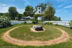
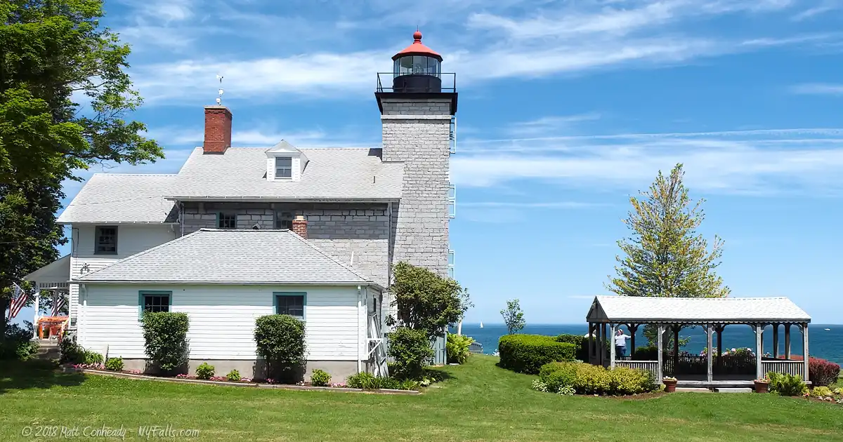
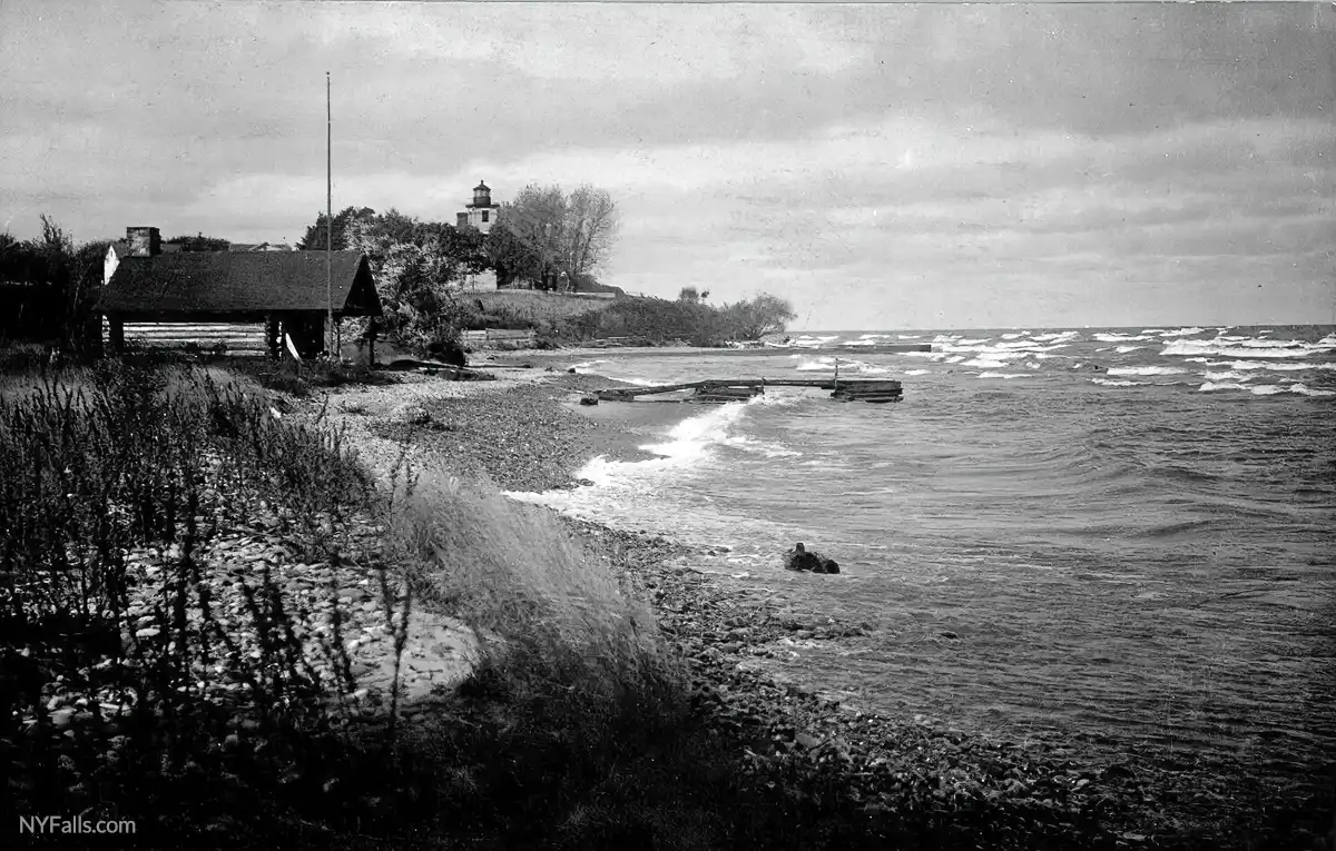
A new lighthouse was completed in June of 1871, next to the former tower, and featured a two and a half story dwelling and 45 ft high light. The $14,000 lighthouse was constructed of limestone brought 70 miles across the lake from Kingston, Ontario. The light from the oil lamps was projected using a fourth-order Fresnel lens, taken from the old tower which was soon after demolished and the old lighthouse stones were used to construct a jetty below the bluff to thwart erosion. Today, the old tower’s position is marked by a ring of bricks and a plaque set in stone, while the position of the old keeper’s dwelling is marked by large stones recovered from the sight of the old jetty.
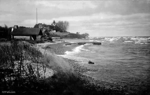
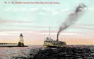
In 1835, cement piers were constructed at the entrance to the bay and the west pier was topped with a simple stone beacon to be used as a nighttime navigational aid for boats entering and exiting the harbor. In 1872, the original beacon was replaced by a larger wooden tower with a sixth-order Fresnel lens (the least powerful of the Fresnels) and the piers were extended further out into the lake and reinforced with steel. The higher tower and stronger lamp made the pier a better navigational beacon for ships far out on the lake and in foul weather to spot and enter the harbor, and thus diminishing the need for the actual lighthouse to the west. The lighthouse still served as the primary navigation beacon until 1901, when it was decommissioned and its fourth-order Fresnel lens was transferred to the pier tower. The keeper was now responsible for maintaining the lamp in the pier tower rather than the lighthouse, though he still resided in the lighthouse quarters. The pier tower was replaced again in 1938 with a larger, steel tower and electric lamp.
The lighthouse was fully abandoned in 1953 and remained that way until the early 1980s when local residents and lawmakers, recognizing the appeal a lighthouse would have for the local tourism industry, ran a campaign to take control of the property from the US government. In 1984, the property was granted to the Town of Sodus, and under lease of the Sodus Bay Historical Society, was repaired and converted into a maritime museum commemorating the 200+ year history of the bay.
Fun and Coal
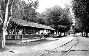
Looking for destinations to entice passengers in the late 1800s, early 1900s, rail companies sought out small lakeside villages to build resorts in. The Rochester Railway Company formed a Sodus Bay division and began extending its trolley line out to Sodus along Ridge Rd in 1901. The clear and calm water of the bay with rolling hills and orchard-covered plains, combined with the clean vast expanse of the Lake and an abundance of fish, made this a prime location for budget vacationers. With an influx of weekend passengers from the booming city of Rochester, several resorts, campgrounds and at least one amusement park sprung up in the point. The 30 mile track from the outskirts of Rochester to the Point also allowed people to take day trips to the beach for a swim, see band shows, fish and eat. The Chimney Bluffs, a natural dirt formation along the lake three miles to the east, became such a popular attraction for vacationers, it was eventually acquired by the state and run as a nature park.
Sands Point Amusement Park, which was located at the site of the present day Beach Park, began as a small resort with snack vendors and a sandy beach, and by the 1950s grew to a 6 acre park with a restaurant, grandstand, bingo hall, and 7 rides. In the mid-50s it attracted upwards of 15,000 visitors a week in the summer.
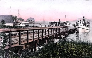
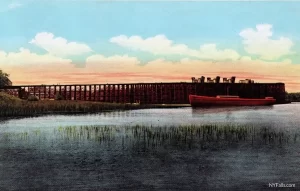
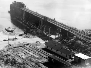
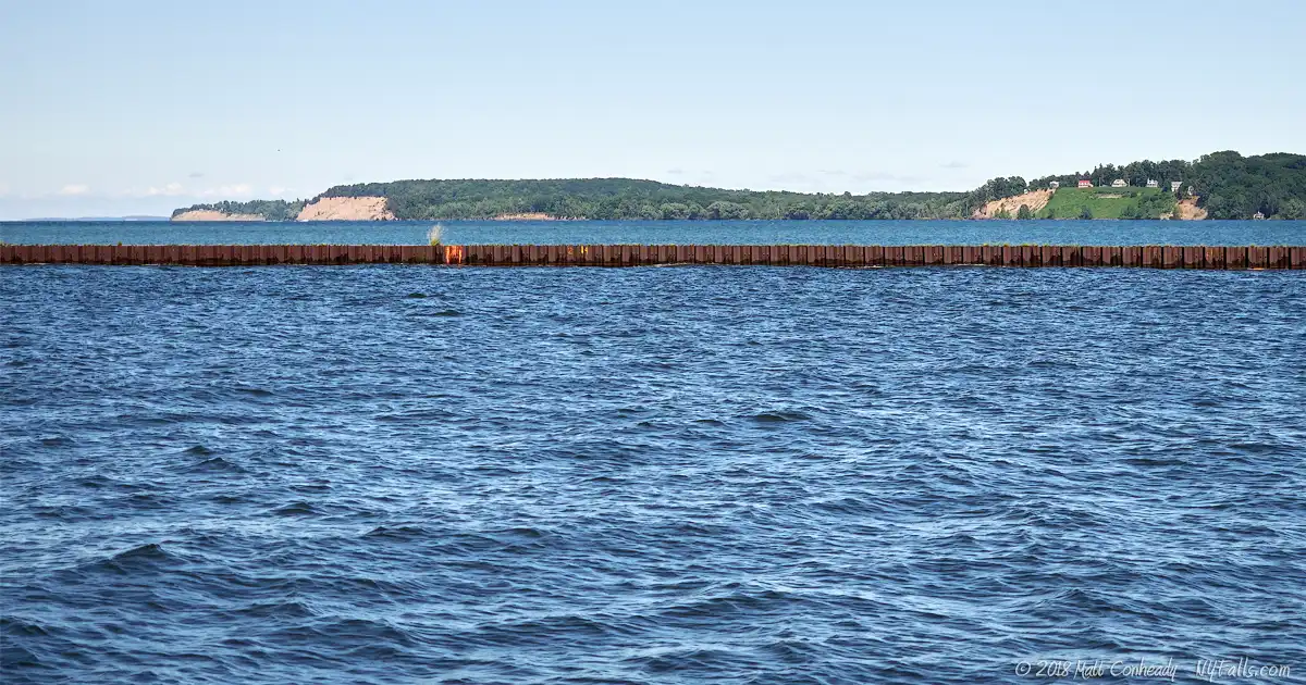
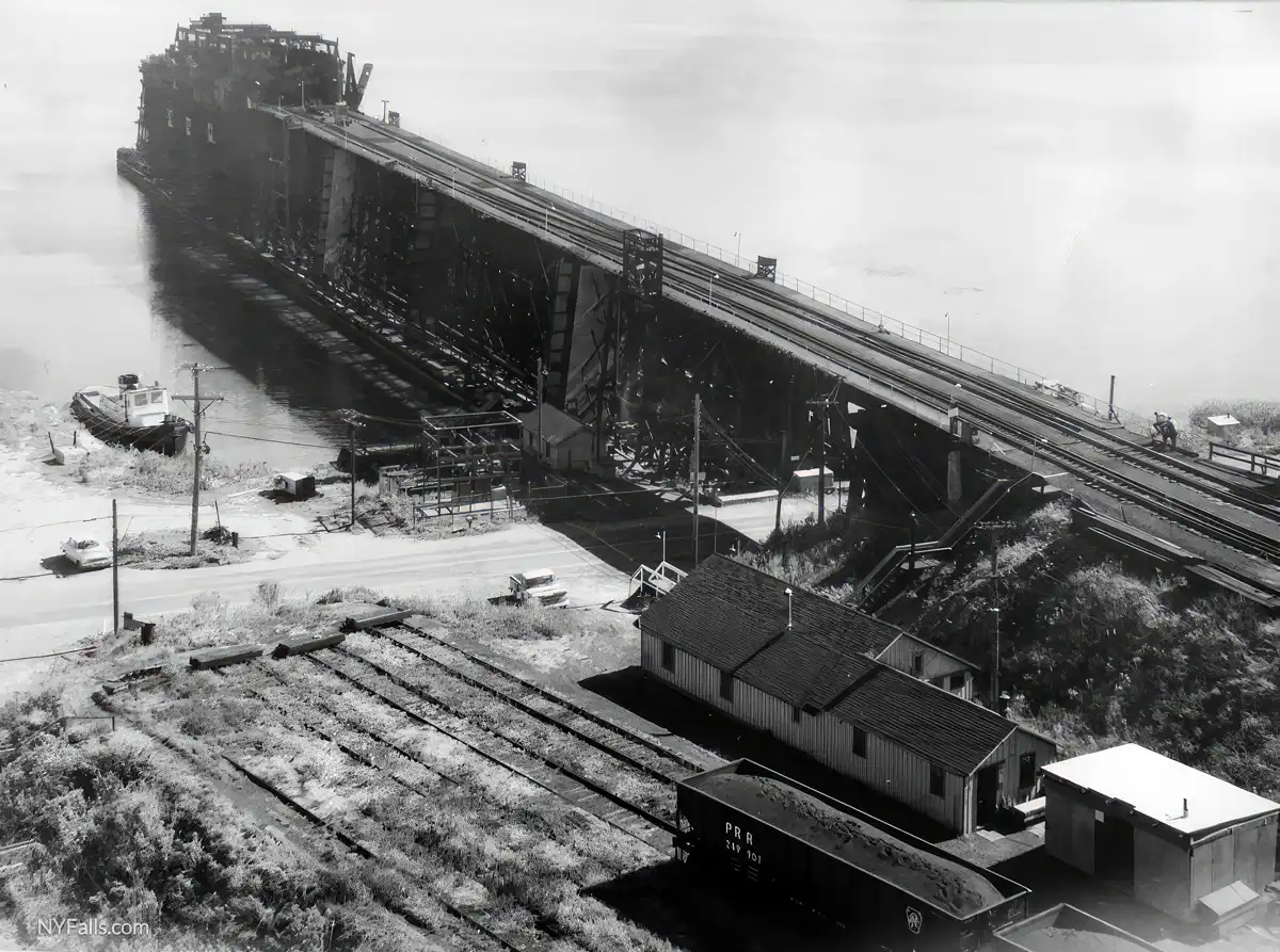
As the country went to war and families spent less time vacationing, the tourism industry at the point dipped and the economy focused more on shipping. Coal was the primary commodity that exited the bay. Originating from the Appalachian mines of Pennsylvania, and brought up the Pennsylvania Rail Road Sodus Line (part of which is now the Ontario Pathways trail) coal was loaded onto steamships from a 500 ft wood and steel rail dock on the west shore of the bay, south of the Point. From there, ships would carry it to various cities along the Great Lakes. The dock dominated the landscape and the loading of the huge transport ships was a sight many locals and vacationers easily remember. Coal demand diminished over the years and when the dock was being dismantled in 1971, a welder’s torch set it ablaze and a large portion of it burned. The remaining pilings were used in the foundation of the marina that now occupies the location of the old dock.

Hiking / Walking Trails
Difficulty: Easy.
Markings: No markings; no defined trails.
Description: There are no trails to follow here. The Beach Park is completely visible from the parking lot. You can walk up and down the pier, and if you want a bit of exercise, walk west along Wickham Blvd and make a right onto N Ontario St. Follow it North to the Lighthouse Museum.
Map: See the interactive map below.
Sodus Point Interactive Map
Fishing
Fishing is allowed from the west pier and along the bay outlet. You can also fish the bay from the south end of the park off of Wickham Blvd. Fishing is not allowed on Lighthouse property.
Interesting Stuff
Islands
Sodus Bay has three islands (Le Roy, Newark and Eagle). Each one has private cottages on its shores, but only one (Le Roy) is accessible by road.
Crescent Beach
The 1.4 mile long sandbar that separates the bay from Lake Ontario is home to roughly 50 summer cottages. Rising lake waters are slowly eating away at the sandbar, bringing the width down to 50 ft at some locations. Some cottages are pounded by the rough lake waters during storms.
Photography Tips
Sand
- Tiny reflections on the sand tend to trick digital camera light meters into thinking the scene is very bright. Review the photo you just captured (and if you can check out the histogram, do so) and make sure it is not being underexposed by the camera.
Clouds
- Dramatic skies make for more interesting lake landscapes.
More tips
- See the Articles and Message Board sections for more photography tips.
Nearby Waterfalls


More Lake Ontario Parks & Beaches
Find a new summer hangout spot or place to swim in our comprehensive guide to Lake Ontario Parks and Beaches in New York State.
Who to Contact
Sodus Bay Lighthouse Museum
7606 N. Ontario St.
P.O. Box 94
Sodus Point, New York 14555
Office: (315) 483-4936
Gift Shop: (315) 483-0775
Fax: (315) 483-1396
E-mail: [email protected]
Web: soduspointlighthouse.org
Wayne County Buildings and Grounds/Parks
7312 Rt 31
Lyons, NY 14489
Phone: (315) 946-5836
