Outer Harbor & Greenway Nature Trail


Location: On the northeast end of Lake Erie; within the Buffalo Outer Harbor; City of Buffalo; Erie County; New York.
Maps: Google map; Topographic; Interactive map
GPS Coordinates:
- Trail parking area: N 42.86095 / W 78.87237
- South end of the trail: N 42.85689 / W 78.87501
- North end of the trail: N 42.86755 / W 78.88237
Directions: From Buffalo (north): Take the Buffalo Skyway (NY-5) south to Outer Harbor Drive/Fuhrmann Blvd. The trail is right across from the exit.
From Erie/Dunkirk (south): You can follow Lakeshore Rd. (NY-5) north into Buffalo and straight to the Outer Harbor.
Use Google Maps.
Parking: Roadside parking is available up and down Fuhrmann Blvd, and just south of the Skyway exit/roundabout is a dedicated parking lot for the trail. There’s also a small lot under the Skyway just north of the exit. Parking may be a problem when there is a concert going on although the concert venue has its own lot on the north end. Roadside parking is either blocked off or full during these events. Check the concert schedule and avoid going here on concert days.
Weather
Information / Accessibility / Accommodations
Seasons/Hours: Open year-round. Day and night, although access may be restricted during concert events.
Admission: Free.
Best time to visit: Year-round.
Time: A walk from one side of the trail to the other will take about 40 minutes.
Handicap accessibility: Yes, the trail is paved.
Pets: Allowed if kept on a leash, which is the law in Buffalo. Bring bags to clean up after.
Swimming: Not allowed.
Boat launch: None. Use the boat launch at the Erie Basin Marina.
Accommodations: Summer concerts (pay), bird watching, skate park, paved trails (walking or cycling), map and historic signs. Restrooms can be found to the north in Wilkeson Pointe Park.
Description
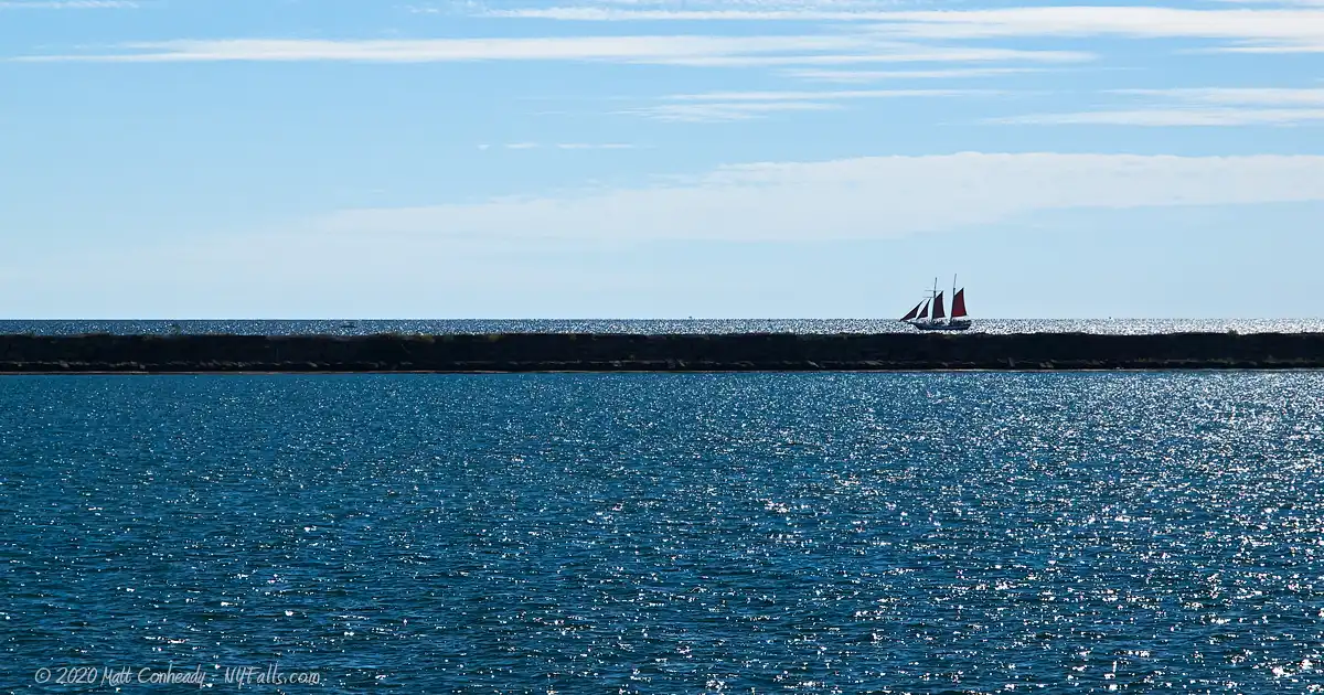
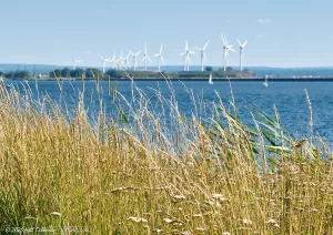
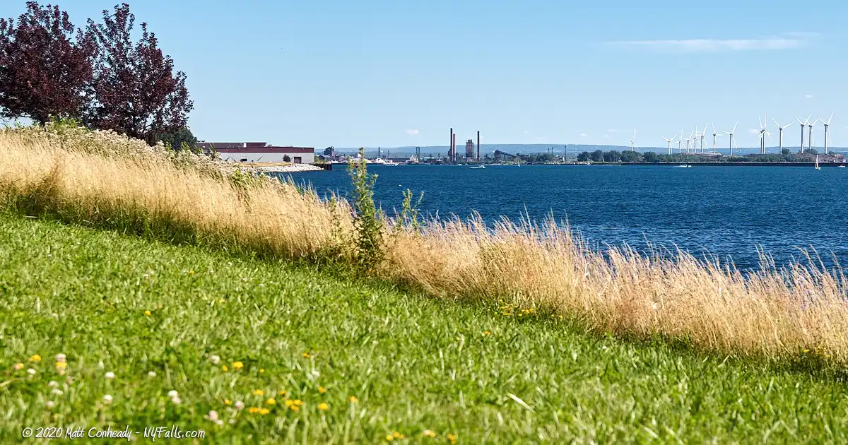
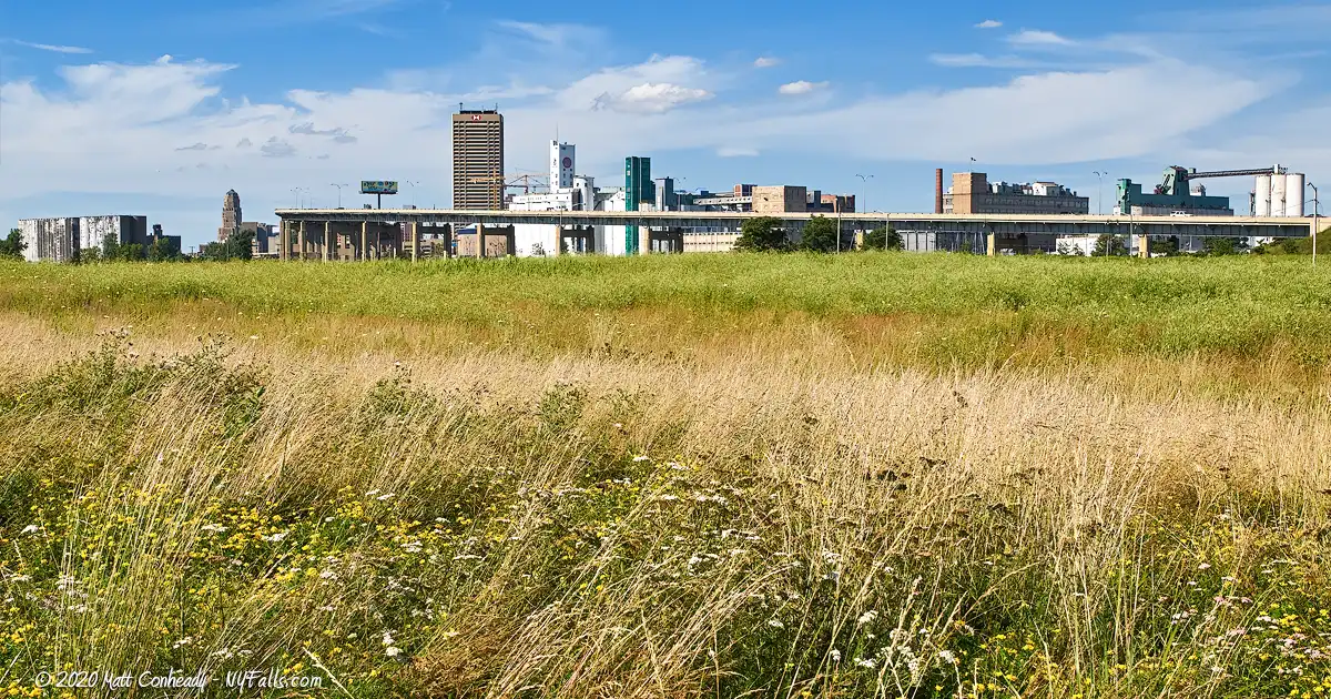
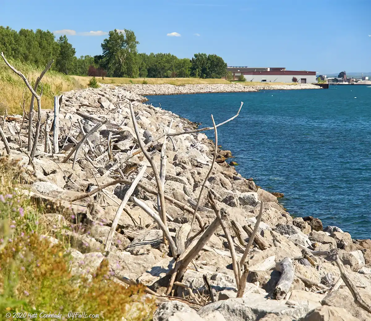
Along a large 120 acre strip of Niagara Frontier Transportation Authority (NFTA) land at the Buffalo waterfront, the newly constructed Greenway Nature Trail runs a mile along the lakefront at what is commonly called the “Outer Harbor.” From the old industrial “Bell Slip” to the south to the summer concert venue in the corner to the north towards Wilkeson Pointe Park, this former dredging dumping ground turned industrial complex is on its way to being reclaimed as a natural area, one of the primary strategies of the waterfront revitalization effort at Buffalo.
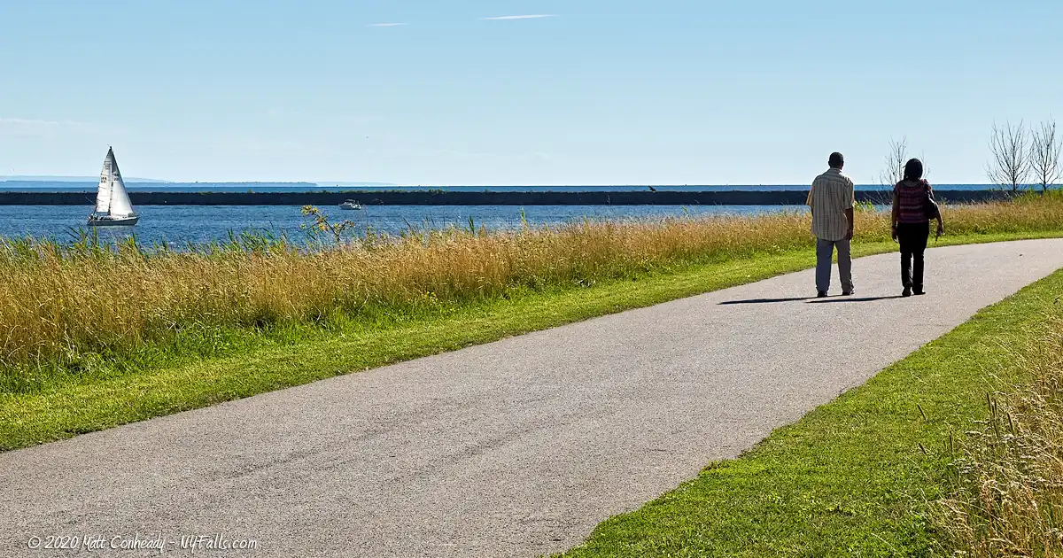
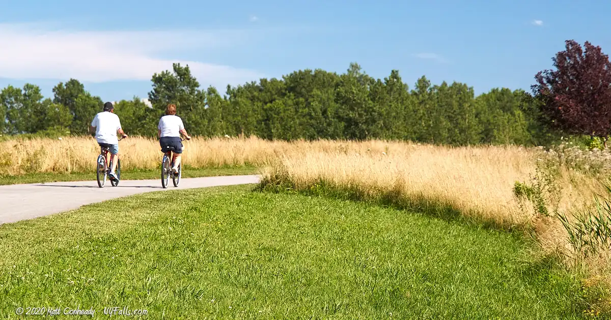
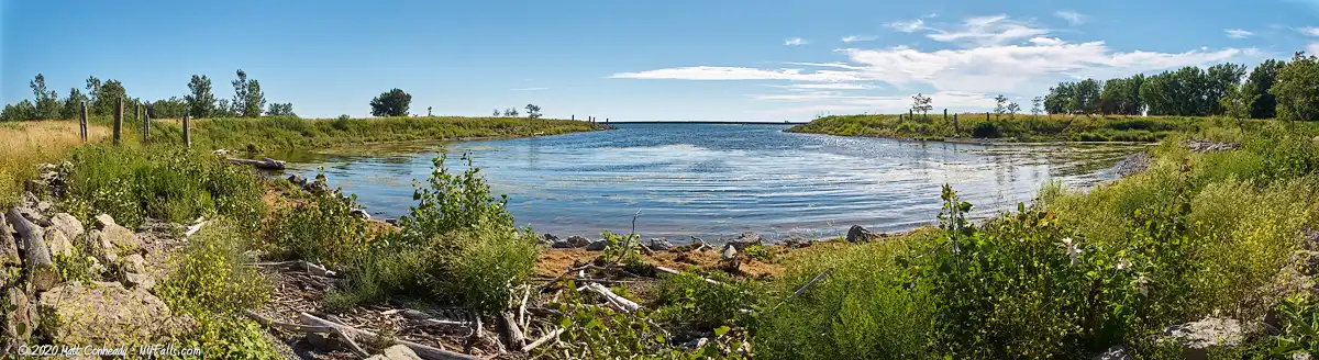
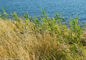
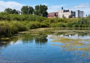
The trail itself is beautifully wide and paved; perfect for walking in groups, or cycling, and most of it is adjacent to the waterfront, with unobstructed views of Lake Erie and the Bell Slip. The slip, formerly catering to large commercial vessels, loading and unloading grains and other cargo, has been transformed into a shallow estuary habitat to promote fish spawning. Aquatic and shore plants have been installed and the areas surrounding it have been landscaped, not only making it a beautiful slice of the trail’s surrounding green space, but also a contributor to the overall natural health of the waterfront. A full 18 acres of land around the trail have been transformed to make the experience more pleasant, while promoting natural function as well. Native trees and wildflowers have been planted, catering to shoreline birds and insects.
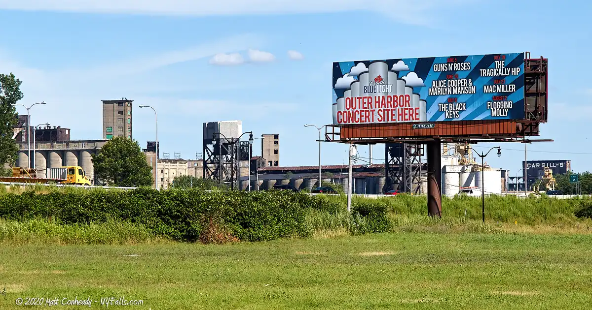
Outside of the trail, most of the remaining land has been left to grow wild, and it is undecided what role that land will play in the future. In recent years, the northern end has been used as a summer concert venue. A stage is set up at the north end of the trail with Lake Erie as a beautiful backdrop, and a parking area for concerts fills the rest of the northern end of the land. Concertgoers can purchase a ticket and enjoy the show from the lawn on the harbor, or pull a boat up and listen from the lake for free. In 2013, acts such as Guns N’ Roses, Marilyn Manson, and The Black Keys played to large crowds.
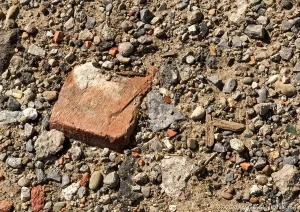
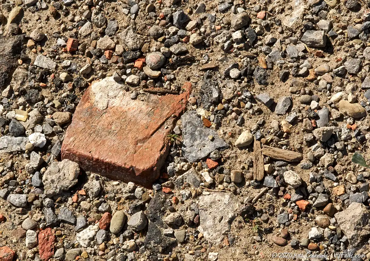
Our afternoon experience at the Outer Harbor in the summer of 2013 was very pleasant. We chatted with other trail users (who also brought their cameras) and a city police officer stopped to chat about where the good spots are to see passing deer. We went off trail and into the dirt paths that run up the center of the harbor land. Brick, coal, chunks of cement, glass, and metal waste make up a large part of the ground for much of the outer harbor—evidence of its industrial past, but few areas remain that have not yet been overcome by new plant growth. If this keeps up, in several years, those traces of the industrial outer harbor will be no more.

History
The first inhabitants of the eastern Erie shoreline were Native Americans, with the Seneca tribe of the Iroquois Confederacy controlling this “western door” of their territory. In 1797 the Holland Land Company purchased much of Western New York from the Seneca, and that block of land was divided and resold, with plans for the Village of Buffalo as a port city beginning as early as 1801. An 1805 act of Congress created the port at Buffalo, which initiated a long history of development along the Erie and Niagara shoreline. Little of what exists today is an original feature of the lake, but one thing we do know, is that much of this shoreline was originally a wetland and a critical stopover for migratory birds as they journeyed across the Great Lakes.
Buffalo’s Outer Harbor changed drastically while improvements to the Inner Harbor were made as the Erie Canal became the centerpiece of eastward shipping. The Buffalo River often filled with sediments making navigation in and out of it difficult. The river outlet was dredged and the south seawall was built in 1867. It prevented sand and mud from building up in the river, and instead it built up along the seawall, creating a beach. This new strip of land became a shanty-town known as “Seawall Beach”, inhabited by Irish and other immigrant port workers and their families. Records show it was a rowdy and nearly lawless neighborhood, with harsh living conditions and high death rates due to storm surges. The city was eager to get rid of it. With the Outer Harbor developing along with Buffalo’s growing shipping and grain industries, the shanty-town was dismantled and the space utilized for industry. A rail line was built along the sandbar in the 1920s to service grain elevators and docked ships along the seawall.
As Buffalo’s shipping industry began to wane during the Great Depression, industry and traffic along the Outer Harbor diminished and much of it went unused. In the 1970s the Army Corps of Engineers began using it to dump soil dredged from the Inner Harbor, Buffalo River, Black Rock Canal, and other nearby waterways. The site became contaminated and went unused.
Seeing the wasteland that the Outer Harbor has become, and realizing it was a barrier between city residents and enjoyment of Lake Erie, a strategy was formed to begin turning the Outer Harbor into public space, with green space being an important step toward environmental rehabilitation. The NFTA, who owns the land, applied for DEC Brownfield grants for environmental rehabilitation of contaminated lands and was awarded one in 2002, covering about 75% of the $3 million cost. The rest was made up from local sources. Within three years, construction was completed and the trail opened to the public.
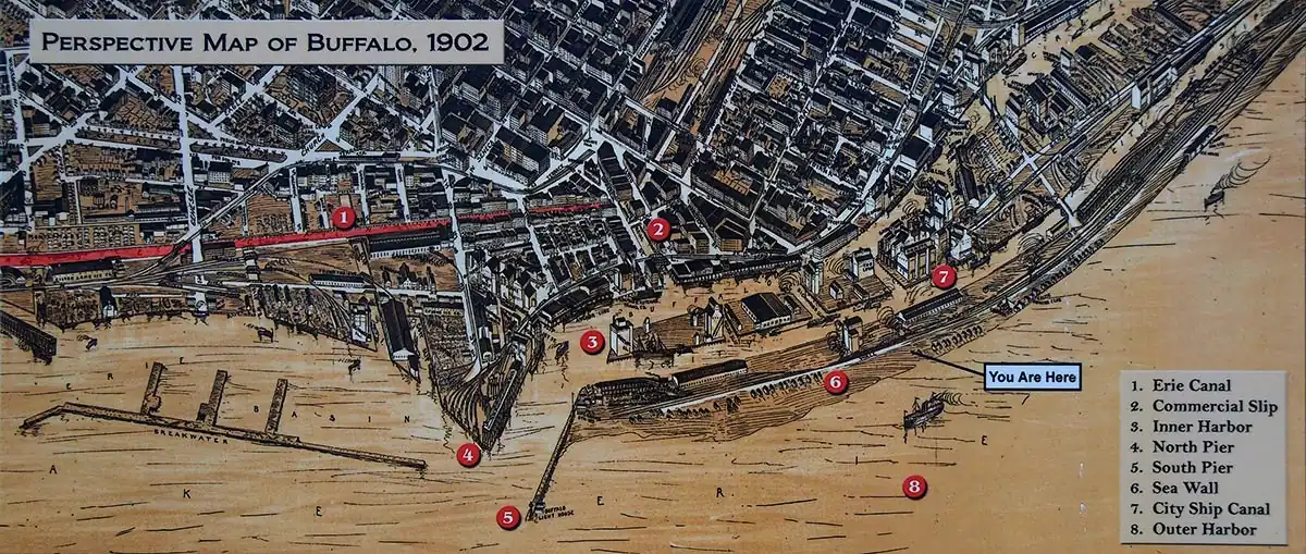
Hiking / Walking Trails
The Greenway Trail loop
Difficulty: Easy
Distance: The Greenway Trail portion is just over a mile total. Combined with the Outer Harbor Trail, that runs along Fuhrmann Blvd, it makes an easy and scenic 1.5 mile loop.
Markings: A map near the parking area. Follow the paved trails.
Description: Starting at the parking lot off of Fuhrmann Blvd (south of the traffic circle) head west towards the Bell Slip. Make a right at the Bell Slip and follow the winding paved path towards the shoreline. Walk along the shore heading north for about 3/4 of a mile until you get to the concert venue area at the north end. If the venue area is accessible (sometimes it’s closed off in preparation for an event) head right (east) across that section towards Fuhrmann Blvd.
Just before Fuhrmann is the Outer Harbor Trail. Turn right and head south down this trail and back to the parking area.
Map: Follow the Green, Blue and Brown trails on the interactive map.
Greenway Trail and Industrial Heritage extension
Difficulty: Easy, but parts are not handicap accessible.
Distance: The Greenway trail portion is just over a mile total. Combined with a small trail that extends to the other side of the Buffalo Skyway, you can maximize the walk and see a few historic sites in this formerly heavy industrial zone. The full walk is about 2 miles.
Markings: Follow the paved trails, and the dirt extension of the industrial trail.
Description: Starting at the parking lot off of Fuhrmann Blvd (south of the traffic circle) head west towards the Bell Slip. Make a right at the Bell Slip and follow the winding paved path towards the shoreline. Walk along the shore heading north for about 3/4 of a mile until you get to the concert venue area at the north end. If the venue area is accessible (sometimes it’s closed off in preparation for an event) head right (east) across that section towards Fuhrmann Blvd.

Just before Fuhrmann is the Outer Harbor Trail. Turn left and head north about 300 feet to a crosswalk that will get you to the other side of Fuhrmann and under the Buffalo Skyway. Follow this paved path right and continue past the parking area. Eventually the paved path will end and you can continue further on the dirt path. The dirt path will end at Outer Harbor Drive. Turn right and cross Fuhrmann at the traffic circle and make your way to the paved Outer Harbor Trail alongside the road. Follow this about 400 ft to the parking area.
Map: Follow the Green, Blue, and Rust trails on the interactive map.
Outer Harbor Greenway Trail Interactive Map
Fishing
Fishing is allowed in this area. You can fish from the platform in the north corner. Another good spot is at the bell slip by the skatepark.
Interesting Stuff
Outer Harbor Events
Check out the latest concerts, activities, and other events happening at the Buffalo Outer Harbor here: https://outerharborbuffalo.com
The Outer Harbor Trail
This trail, that parallels Fuhrmann Blvd, runs over 4 miles along the Outer Harbor from Lighthouse Point Park at the Coast Guard Station to the Union Canal at Stony Point, Lackawana. Along the way are six parks, preserves, or green spaces you can visit.
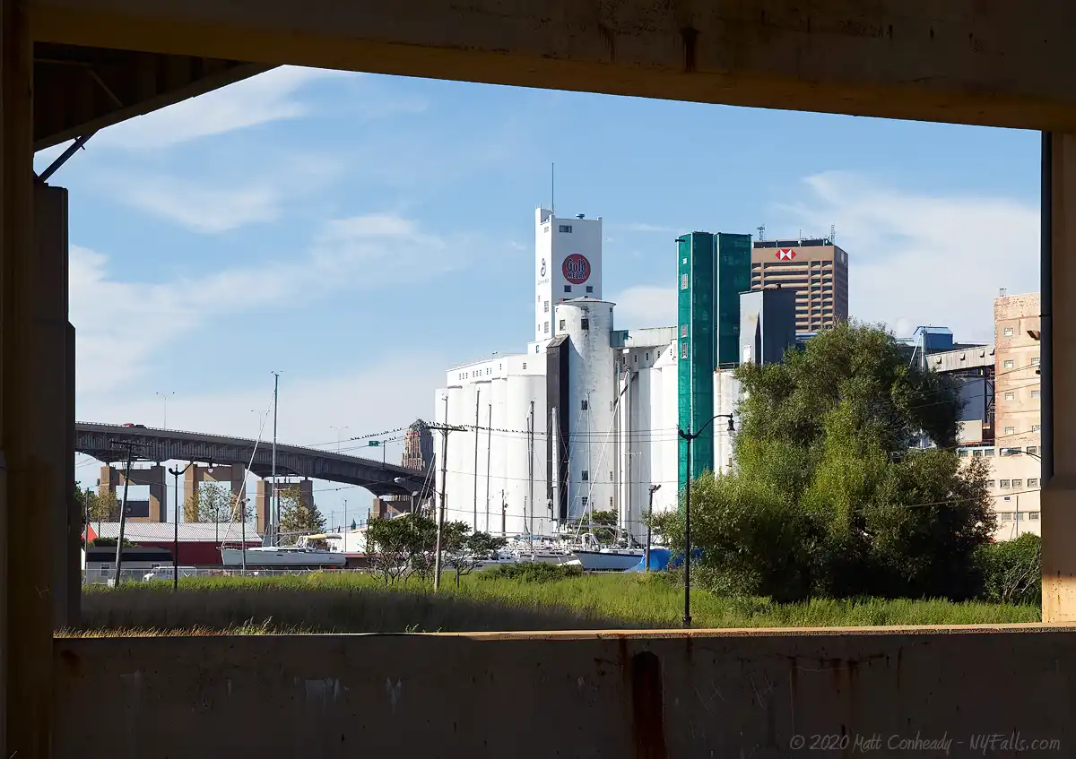
The Great Northern Grain Elevators
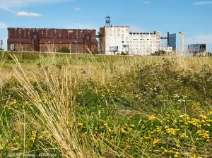
Across Fuhrmann Blvd, and past the Buffalo Skyway, are two large historic grain elevators. To the north east, the large white structure, is the General Mills Grain Elevator. It was originally constructed beginning in 1903 by the Washburn Crosby Company, when the storage bins and the first elevator were built. A major addition of another grain elevator was made in 1909. The original elevator was replaced in 1866, and the second elevator was dismantled in the 1960s. General Mills also built a large warehouse in 1922. They continue to operate the elevator, producing cereals and flours.
The rusted brick and steel building to the south is the Great Northern Grain Elevator. Constructed in 1897, it was the first elevator of its kind to run on electric power alone, and it was the largest, capable of holding 2.5 million bushels. It was the last of the working house grain elevators built in the US, one that operates totally within one box-like structure. More modern elevators have distinct sections built specifically for their function. The building was once owned by the Pillsbury company. In the 1980s it was set for demolition, but an effort to conserve this historic landmark prevented its destruction. The elevator, now owned by Archer Daniels Midland, is largely used for storage.
Photography Tips
Sunsets
- The eastern shore of Lake Erie is ideal for sunsets. The Buffalo waterfront is a great place to catch boats, birds and the interesting seawalls in the frame to keep those sunset photos interesting.
Shoot towards the city
- The contrast between the emerging woodland in the center of the green space and the rusty buildings along the canal make for a great story. Shoot away from the lake and towards the city.
Birding
- Don’t forget that long lens. This is a prime spot for birding.
- During the spring and fall migrations, get here early for more bird traffic and less people traffic.
More tips
- See the Articles and Message Board sections for more photography tips.
Nearby Waterfalls

More Lake Erie Parks & Beaches
Find a new summer hangout spot or place to swim in our comprehensive guide to Lake Erie Parks and Beaches in New York State.
Who to Contact
NYS DEC – Region 9
Phone: (716) 851-7000
dec.ny.gov
NFTA
Phone: (716) 855-7300
[email protected]
nfta.com
