Tinker Falls in Labrador Hollow


Location: 20 miles south/east of Syracuse. Within the Labrador Hollow State preserve; Between Fabius and Truxton; Cortland County, New York.
Maps: Google Map; Topographic; Interactive map.
GPS Coordinates: Tinker Falls: 42.78277 / W 76.03299
Trail-head: N 42.78008 / W 76.03577
Directions: Take I-81 to Exit 14 and proceed east on US-11 through Tully. Make a right onto NY-91 heading south.You will pass Labrador Pond on your right. Tinker Falls will be shortly after on your left.
Parking: There are two gravel roadside lots across from the trail-head to the falls. One lot up the road, one lot down the road. Each lot can handle about 10 cars
Weather
Information / Accessibility / Accommodations
Number of falls: 1.
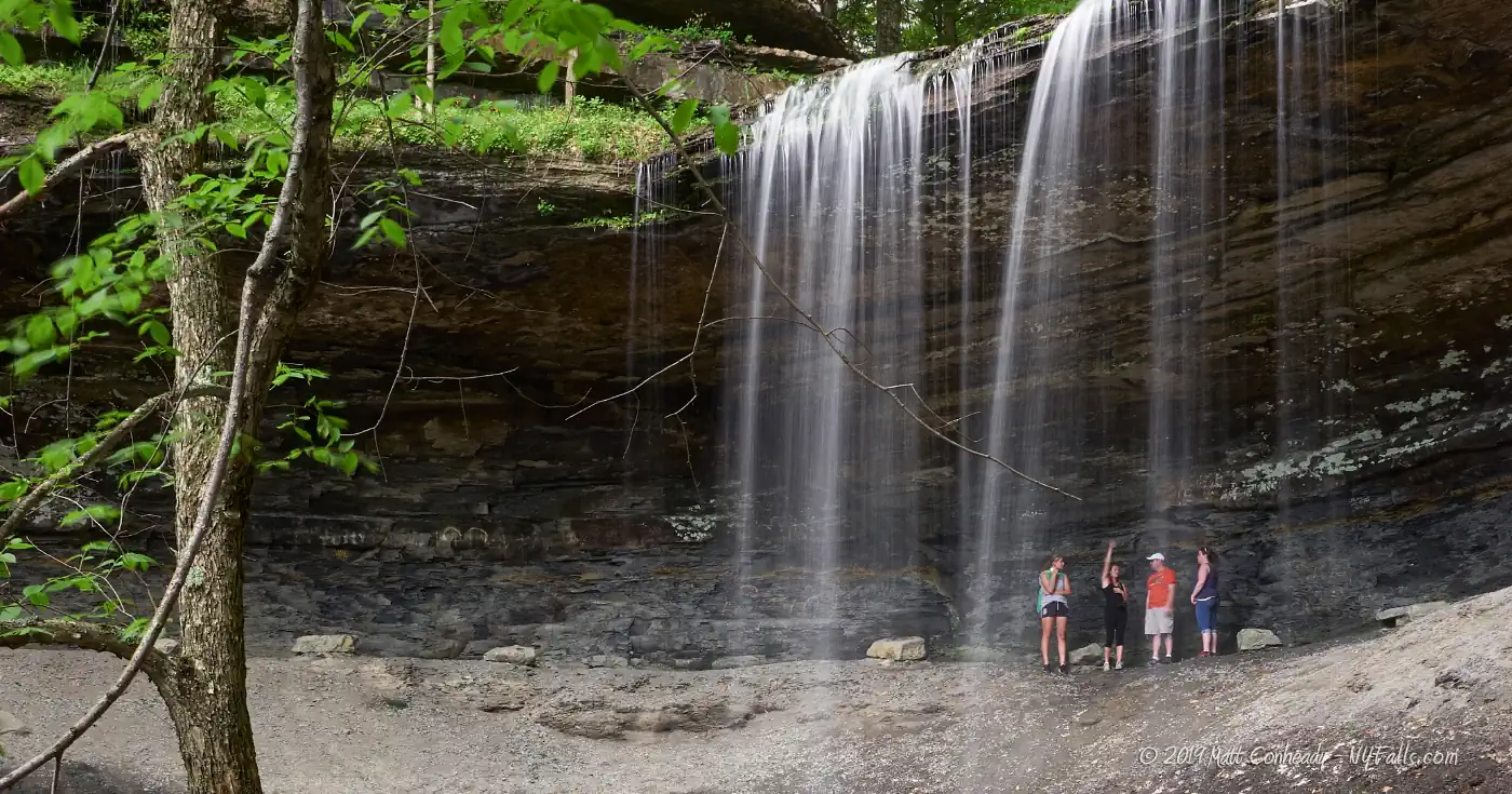
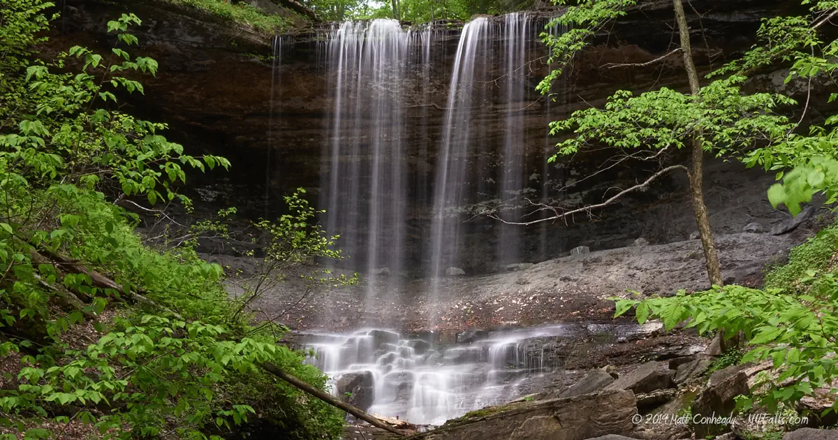
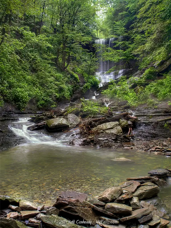
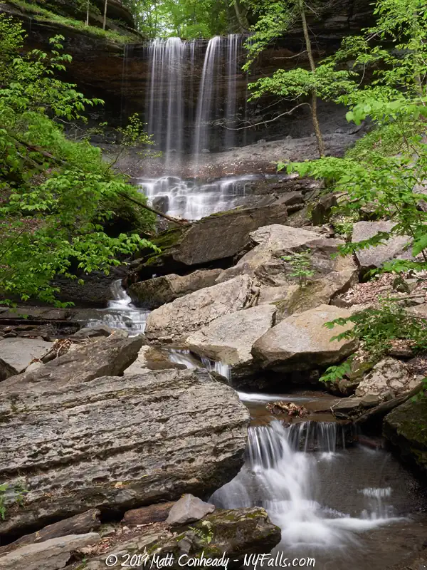
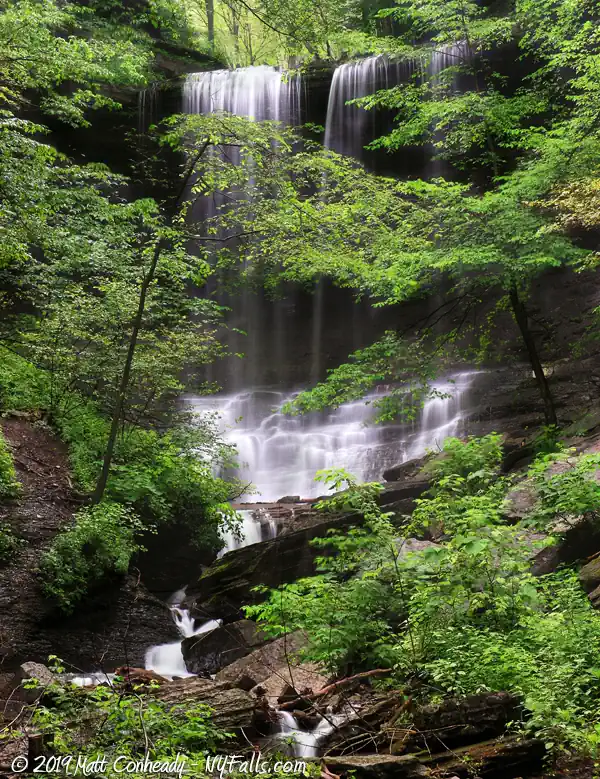
Size/Types: 80 ft tall. Overhanging falls (50 ft) over a rocky cascade (30 ft). Heavily wooded.
Best time to visit: All year. Maybe not in summer when things get dry. One of the best winter falls.
Flow: Medium / low. It can dry to a trickle in summer.
Waterway: Tinker’s Creek, a tributary into Labrador Creek, which heads south and less than a mile away empties into the east branch of the Tioughnioga River. It empties into the Chenango River to the south at Chenango Forks in Broome County. The Chenango flows further south to Binghamton where it joins the Susquehanna. The Susquehanna flow south, through Pennsylvania, and crosses into Maryland before emptying into Chesapeake Bay northeast of Baltimore.
Time: 20 minutes.
Seasons/Hours: Year round. All day, all night.
Admission: Free.
Handicap accessibility: No
Pets: Allowed on leash.
Accommodations: Hiking trail; benches. Fishing and hand boat launch to the north at Labrador Pond.
Description
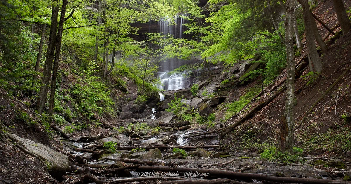
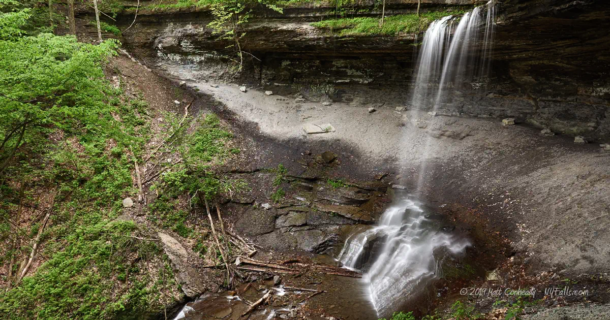
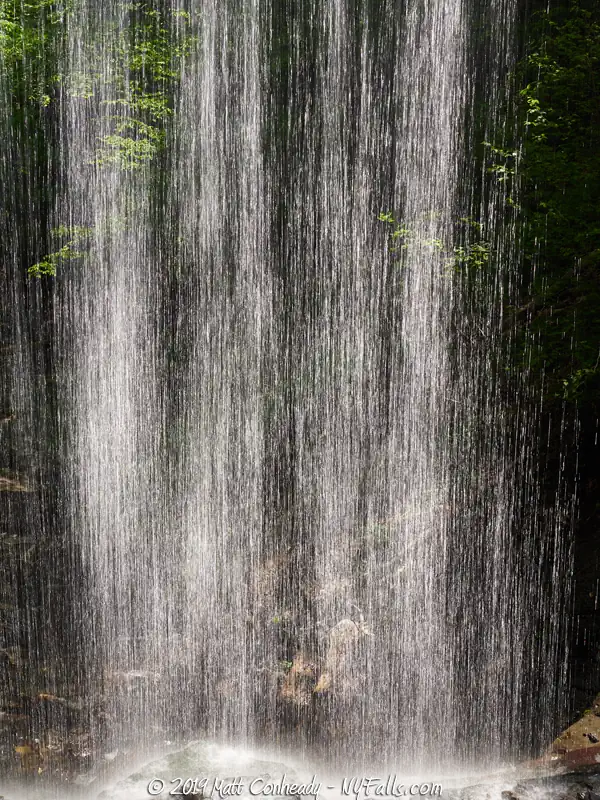
Amid the undeveloped land of the Labrador Hollow State Preserve, this location offers a peaceful and wondrous environment worthy of becoming a state park and tourist destination. The 80 ft waterfall is divided into a series of drops, the most dramatic being the 50 ft overhanging free-fall. From there, the water divides, winding around large boulders as it makes its way to the bottom. The gorge is deep and well enclosed by the surrounding trees, giving the location a cool and wet environment. After periods of high-rainfall, the drop can be a powerful and muddy torrent. When I first covered these falls, it was a pretty undeveloped preserve, relatively unknown. Since 2014, it has seen trail and signage improvements, for better or worse. From the road, one can hike upstream up and behind the falls, and off into the woods to the top of the hill for an amazing view. It’s impressive, indeed, but the last 2 times I visited, the place was packed and there were lines forming behind those stopping to take selfies.
It is common for rocks and trees to fall in this location, so be careful.

History
Truxton was founded in April of 1808 and named in honor of Commodore Thomas Truxton of the Revolutionary War. Labrador Hollow was the first property in New York State to be designated as a “Unique Area.”
Hiking / Walking Trails
The Gorge Trail
Difficulty: Easy or difficult, depending on how close you want to get to the falls.
Distance: About 1500 ft to the falls.
Markings: The trail-head is clearly marked. The trail is mostly dirt and gravel.
Description: Take the trail from the roadside up the creek to the falls. There are a few points along the way that may get slippery after rain, but for the most part the gravel trail is well-constructed. The trail leading up the right side of the falls can get very slippery, so caution is recommended. Despite this being, clearly the most dangerous point of the hike, this is where everyone stops and takes selfies. Don’t be one of those idiots. The trail now goes behind the falls (selfies) and then up and around the left side to get to the top (more selfies).
To the Hang Glider Launch
Difficulty: Moderate (steadily uphill)
Distance: About a mile and a half.
Markings: A dirt trail extending from the left of the trail leading to the top of the falls.
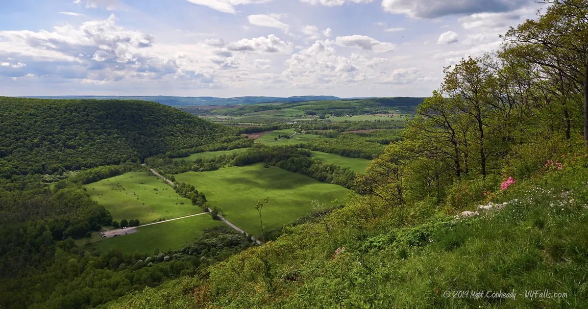
Description: There are no other waterfalls on this trail, but you came all this way, why not treat yourself to a peaceful wooded hike and one of the best views in the county? From the top of the falls, head left and uphill. This trail hugs the rim of the hill, taking you steadily upward to a large open area, often used for hang glider launching.
Map: Interactive.
Tinker Falls Interactive Map
Tinker Falls Media
Tinker Falls Videos


Interesting Stuff
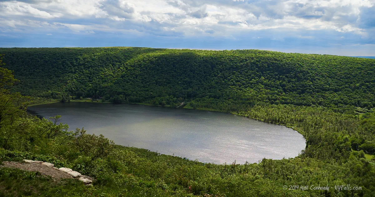
Labrador Pond
This tranquil pond, located to the north, up the road from here, is a wonderful spot for canoeing and fishing. A small road off of Rt-91 will get you to a nice trail and a fishing area near the pond.
Launch area
What is the bald spot on top of Jones Hill to the north? It’s a launch area for hang gliders.
Photography Tips
Photographing Tinker Falls
- This is a very natural area with little in the way of a viewing platform. Don’t concentrate on a clear shot of the falls. Show the falls hidden behind the trees.
- Try to climb up behind the falls (at your own risk) and shoot through it.
Silky Water Effect
- To get that smooth cotton-candy look to the falls, you need to use a Neutral Density (ND) filter on your lens. The ND filter will block some of the light from entering the lens without altering the color, and thus allow your shutter to stay open longer. This blurs the water and creates a soft white gloss to the foamy areas of the falls. Check out the article for the all the details.
More tips
- See the Articles for more photography tips.
Who to Contact
Department of Environmental Conservation
Region 7
1285 Fisher Ave.
Cortland, NY 13045
Phone: (607) 753-3095