

Waterfall | Best seen from… | Height/Type/Flow | Location/Map |
|---|---|---|---|
Abutment Falls | On the west side: From the St. Helena Picnic Area, take the Gorge Trail (Trail 1) down to the river bank. You can also take the St. Helena Trail (13) to where it meets with 1. 4 ribbon falls (the St. Helena Falls) are visible across the gorge. Check the map for the locations of each of the falls. | 50 ft high ribbon cascade / Very low flow – Visit after heavy rain, but not in spring when the dam backs up water flooding the valley and the trail. | N 42.62215 / W 77.98237 |
Bubbling Tiers Falls | On the east side: From the Genesee Greenway (Trail 7) about 1.8 miles in from the entrance to the trail at the Parade Grounds. South of the Upper Falls near Portageville. | 40 ft high ribbon in 3 drops / Low flow | N 42.56922 / W 78.04493 |
Canoe Shower Falls | On the west side: From the St. Helena Picnic Area, take the Gorge Trail (Trail 1) down to the river bank. You can also take the St. Helena Trail (13) to where it meets with 1. 4 ribbon falls (the St. Helena Falls) are visible across the gorge. Check the map for the locations of each of the falls. | 40 ft high ribbon cascade / Very low flow – Visit after heavy rain, but not in spring when the dam backs up water flooding the valley and the trail. | N 42.61315 / W 77.98795 |
Cinderella Cascade | On the west side: from the Big Bend overlook to the Archery Field overlook on The Gorge Trail (1). The 4th of 5 cascades as you head south. | 500 ft high cascade / Low flow | N 42.60279 / W 78.03074 |
Craspey Clay Falls | On the east side: From the Highbanks recreation area on the Highbanks trail (2) looking across the Hog’s Back Curve on the same side of the gorge. | 500 ft high plunge and cascade / Very low flow, visit after heavy rain. | N 42.72498 / W 77.92650 |
Crucifix Cascade | On the west side: From the St. Helena Picnic Area, take the Gorge Trail (Trail 1) down to the river bank. You can also take the St. Helena Trail (13) to where it meets with 1. 4 ribbon falls (the St. Helena Falls) are visible across the gorge. Check the map for the locations of each of the falls. | 70 ft high ribbon cascade / Very low flow – Visit after heavy rain, but not in spring when the dam backs up water flooding the valley and the trail. | N 42.61650 / W 77.98435 |
Deh-ga-wa-nus Falls | On the east side: From the Genesee Greenway (Trail 7) about 1 mile in from the entrance to the trail at the Parade Grounds. This falls meets the Upper Falls on the west side. On the west side: Adjacent to the Upper Falls on the viewing path south of the Glen Iris Inn (Trail 1). You will walk over the creek on the way towards the railroad bridge. This falls is on the side of the trail towards the river. Shadow Cascade in on the opposite side of the trail. | 15 ft high cascade / Low flow | N 42.57909 / W 78.04945 |
Deh-ga-ya-soh Falls
| On the east side: From the Genesee Greenway (Trail 7) about a half mile from the trail entrance at the Parade Grounds. Walking south on trail 7 towards Middle Falls, this falls is seen after Inspiration Falls/point and is easily identifiable by the bridge above its crest. | 150 ft in a series of plunges and cascades / Consistent high flow | N 42.58566 / W 78.04015 |
Denton Brook Cascade | On the east side: from the Big Bend overlook to the Archery Field overlook on The Gorge Trail (1). The last of 5 cascades as you head south. | 500 ft high cascade / Low flow | N 42.60045 / W 78.03010 |
Detour Cliff Cascade | On the east side: Follow Smokey Hollow Trail (15) as it loops down into the gorge. Any trailhead on 15 will do. As it loops lower into the gorge (1.5 miles), it offers a great view of this and Horse Tail Falls which are across the gorge. Big Flats Trail (17) will also lead to 15. Also visible in spring from Smokey Hollow Overlook (located at the southern trailhead to 15) , when the leaves are not crowding the trees. | 100 ft high cascade / Very low flow – Visit after heavy rain, but not in spring when the dam backs up water flooding the valley and the trail. | N 42.66429 / W 77.95757 |
Dish Creek Falls | See Canoe Shower Falls | ||
Eldest Stepsister Cascade | On the west side: from the Big Bend overlook to the Archery Field overlook on The Gorge Trail (1). The second of 5 cascades as you head south. | 500 ft high cascade / Low flow | N 42.60393 / W 78.03044 |
Horsetail Falls | On the east side: Follow Smokey Hollow Trail (15) as it loops down into the gorge. Any trailhead on 15 will do. As it loops lower into the gorge (1.5 miles), it offers a great view of this and Detour Cliff Cascade which are across the gorge. Big Flats Trail (17) will also lead to 15. Also visible in spring from Smokey Hollow Overlook (located at the southern trailhead to 15) , when the leaves are not crowding the trees. | 130 ft high horsetail falls / Very low flow – Visit after heavy rain, but not in spring when the dam backs up water flooding the valley and the trail. | N 42.67376 / W 77.94920 |
Inspiration Falls | On the east side: From the Genesee Greenway (Trail 7) about a quarter mile from the trail entrance at the Parade Grounds. Across the gorge from Inspiration Point. | 350 ft horsetail cascade / Flows only during/after heavy rain. | N 42.58789 W 78.03477 |
Lower Genesee Falls
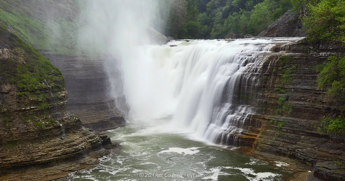
| On the west side: Take the Parade Grounds Entrance to the Portage trail (6) to 6A, which is the footbridge that crosses the river just downstream from the falls. 6A leads to the Gorge Trail on the other side, which also offers excellent views. On the east side: The Gorge Trail (1) leading to 6A (foot bridge). | 70 ft cascade / Consistent high flow | N 42.58551 / W 78.02001 |
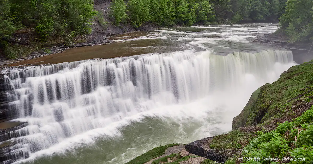
Middle Genesee Falls | On the west side: From Inspiration Point (Trail 1); adjacent to the falls on the viewing path near the Glen Iris Inn (Trail 1) On the east side: From the Genesee Greenway (Trail 7) upon approaching the falls (about a half mile from the trail entrance at the Parade Grounds). | 107 ft cascade / Consistent flow | N 42.58301 / W 78.04241 |
Paddler’s Falls | See Wolf Creek Falls | ||
Papermill Falls | On the west side: Follow the Gibsonville Trail (19) until you hear the waterfall. | 45 ft high with three drops. | N 42.70440 / W 77.93372 |
Paul Rock Cascade | On the east side: From the Parade Grounds Entrance, proceed to the Footbridge Trail (trail 6A). Within a few minutes of walking downhill you will cross Bogs Brook and reach the crest of the falls. Viewing is from the crest only. | 35 ft high segmented cascade in 3 drops (12, 10 and 6 ft) / Consistent low- medium flow | N 42.58567 / W 78.01259 |
Shadow Cascade
| On the west side: On the Gorge Trail (1), just past Upper Falls, look to the right as you pass over De-ge-wa-nus Creek. The upper and wooded portion of De-ge-wa-nus Falls | 15 ft high cascade / Low flow | N 42.57958 / W 78.05127 |
Stepmother Cascade | On the west side: from the Big Bend overlook to the Archery Field overlook on The Gorge Trail (1). The first of 5 cascades as you head south. | 470 ft high cascade / Low-Medium flow | N 42.60503 / W 78.02979 |
Timber Tunnel | On the east side: Just past the upper falls on the Genesee Greenway (Trail 7). | 90 ft high cascade / Low-Medium flow | N 42.57486 / W 78.05155 |
Upper Genesee Falls
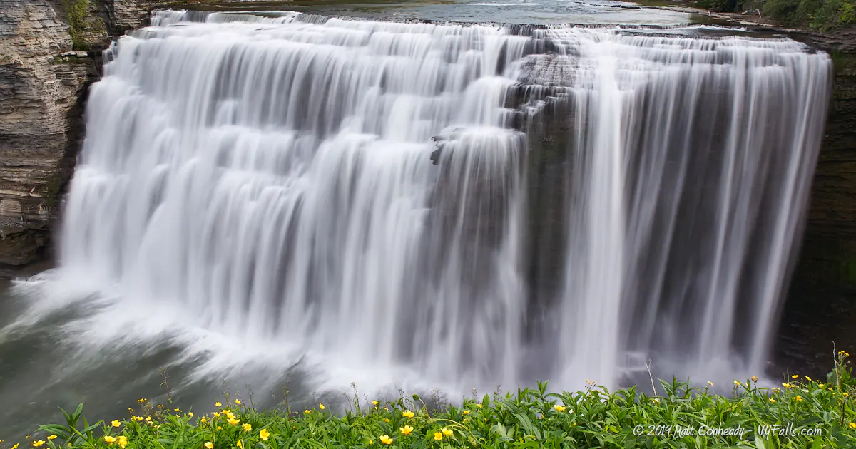
| On the west side: from Inspiration Point (Trail 1); adjacent to the falls near the picnic area south of the Glen Iris Inn (Trail 1).On the east side: Just above the falls on the Genesee Greenway (Trail 7). | 70 ft horseshoe cascade / Consistent high flow | N 42.57849 / W 78.04880 |
Wee Water Willy
| On the west side: At the Middle Falls viewing platform (below the Glen Iris Inn) at the crest of middle falls. (Trail 1) look towards the cliffs on the same side, just below the trail that winds below the Inn. | 115 ft high horsetail | N 42.58364 / W 78.04311 |
Wolf Creek Falls | On the west side: From the Tea Table Picnic Area overlook (look to the right to see the lower portion; From the Wolf Creek Picnic Area and the Gorge Trail (trail 1) surrounding it. The whole falls cannot be seen from the trails or viewing areas. Alternative views can be obtained by rafting the river. The bottom portion is known as Paddler’s Falls as it can be seen from the river. On the east side: Another possible viewing location is from an outcropping on the Big Bend (10) and Trillium (10A) trails on the east side. | 225 ft high segmented cascade in 4 parts / high flow in spring, consistent medium flow rest of the year. | N 42.61453 / W 78.01159 |
Wriggling Waters | On the west side: From the St. Helena Picnic Area, take the Gorge Trail (Trail 1) down to the river bank. You can also take the St. Helena Trail (13) to where it meets with 1. 4 ribbon falls (the St. Helena Falls) are visible across the gorge. Check the map for the locations of each of the falls. | 60 ft high ribbon cascade / Very low flow – Visit after heavy rain, but not in spring when the dam backs up water flooding the valley and the trail. | N 42.61931 / W 77.98293 |
Youngest Stepsister Cascade | On the west side: from the Big Bend overlook to the Archery Field overlook on The Gorge Trail (1). The third of 5 cascades as you head south. | 500 ft high cascade / Low flow | N 42.60340 W 78.03073 |
Letchworth Waterfall List


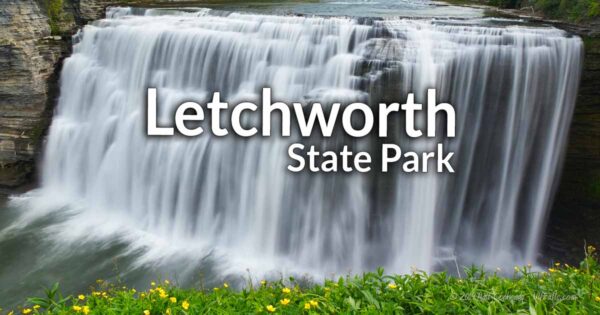
Complete Guide to Letchworth State Park
Our guide covers more of the waterfalls, trails, history, and don’t-miss sights of this amazing park. Check it out.
