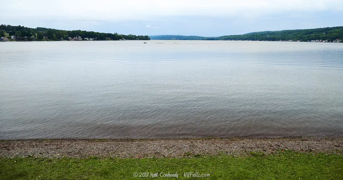
Keuka Lake


Location: Steuben and Yates Counties, New York.
Surrounding Communities: Jerusalem; Penn Yan; Hammondsport
Maps: Google Map; Topographic; Contour map; State Park Camping Map; State Park Trail Map
GPS Coordinates:
- Northeast outlet: Keuka Outlet: N 42.65164 / W 77.06394
- Northwest inlet: Sugar Creek: N 42.59682 / W 77.14737
- Southern inlet: Keuka Inlet or Cold Brook N 42.40609 / W 77.21724
Size:
- Area: 11,584 acres
- Length: 19.6 miles
- Max width: 1.9 miles
Max depth: 183 feet.
Volume: 390 billion gallons.
Water Quality: High
Water supply for Hammondsport, Branchport, Penn Yan, Keuka Park
Elevation: 715 feet
Directions: East Lake Rd. (Rt. 54) runs along the east side of the lake, while Rt. 54A runs along the western shore and bridges the gap between the two northern branches. Skyline Dr will take you from 54A along the top of the bluff between the two branches, while East and West Bluff Dr. will take you along the shores of the bluff.
Weather
Description
Pronunciation: “kyoo-kah”
From the Iroquois name meaning “Canoe Landing”
Also known as: Crooked Lake; Lady of the Lakes
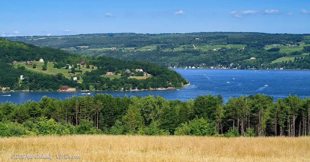
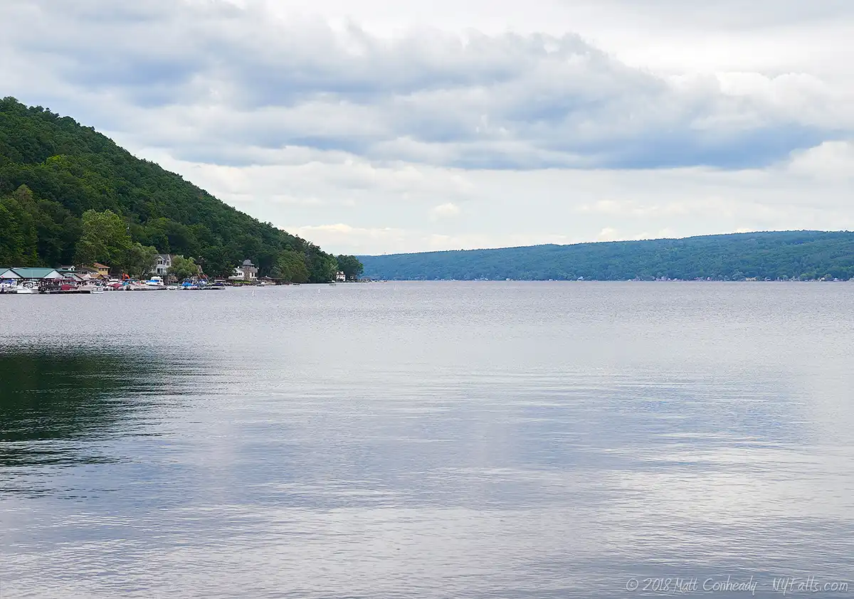
Keuka Lake is most easily recognizable by its unique Y-shape. But how did this lake come to sprout an extra branch while the other lakes remained linear, like fingers? Although grouped with the eastern Finger Lakes, Keuka is geologically a western Finger Lake due to its pre-glacial history. Prior to glaciers carving the region’s existing river valleys into the deep chasms that now hold the Finger Lakes, the western and southern branches of Keuka were a single, north-to-south flowing watershed. This north-to-south flow is a characteristic of the western Finger Lakes’ pre-glacial drainage. At that time the current east branch of the lake was a major tributary to the main river. The actions of the glaciers gouged the tributary, creating the lake’s eastern branch and reversed the flow of the drainage, which now effectively flows south-to-north. Although, the western branch of Keuka Lake still flows north-to-south, it joins the northerly flow of the rest of the lake—making it the only lake in the country, and one of the few lakes in the world, to flow both north and south. Out of the eastern branch, Keuka Lake drains into Seneca Lake, making it the only Finger Lake to drain into another.
Similar branching patterns exist with other Finger Lakes, but the branches remained as tributaries or became separate lakes. Examples are the West River in Naples that travels south and then turns north as it empties into Canandaigua Lake. Canadice Lake nearly forms a branch with the much larger Hemlock Lake. In these particular instances the actions of glacial erosion simply did not gouge existing valleys deep enough to form connected bodies of water.
Once dubbed “Crooked Lake” by early settlers, its natural beauty quickly gave it the nickname “Lady of the Lakes.” In 1887, with the wine industry booming, the lake was given the more appealing and marketable name: “Keuka,” the original Iroquois name. Once overlooked by pioneers heading westward, many of whom didn’t even know the lake existed, the lake soon became an important transportation short-cut. Ferries and schooners carried travelers and cargo (mostly grain) up and down the lake, where it was unloaded and transported further by wagon.
Once dubbed “Crooked Lake” by early settlers, its natural beauty quickly gave it the nickname “Lady of the Lakes.” In 1887, with the wine industry booming, the lake was given the more appealing and marketable name: “Keuka,” the original Iroquois name. Once overlooked by pioneers heading westward, many of whom didn’t even know the lake existed, the lake soon became an important transportation short-cut. Ferries and schooners carried travelers and cargo (mostly grain) up and down the lake, where it was unloaded and transported further by wagon.
With the opening of the Erie Canal, Keuka’s shipping business dwindled. The Crooked Lake Canal was built along Keuka’s outlet to link the lake with its eastern neighbor, Seneca Lake, in 1830. Although it brought a short revival in Keuka’s shipping industry, it proved unprofitable and was replaced by railroad 50 years later.
Wineries followed and subsequently flourished along the lake’s fertile shores. Prohibition threatened to destroy Keuka’s thriving wine industry, but clever vineyards instead sold grape juice with fermenting instructions printed right on the bottle. Soon, the opening of public beaches and tourist-centered steamboat rides drew in a wide variety of tourists from across the state. Today it continues to thrive as a tourism and agricultural hot spot, all while maintaining the beautiful scenery it grew famous for.
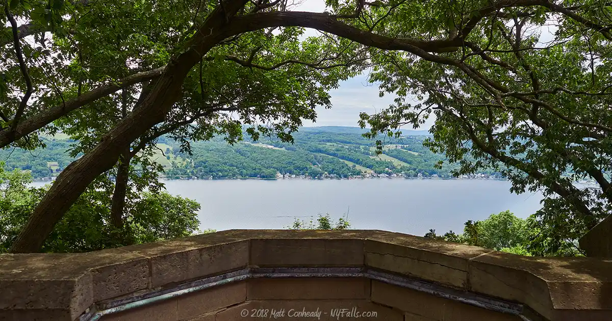
Driving the north-south shore of either side is a highly recommended experience. Route 54A is regarded as one of the most scenic drives in the world, and Rt. 54 on the eastern shore is arguably just as enjoyable. One must also take a trip down Skyline Drive, which runs down the middle of the 700 ft high Bluff Point, which will get you a breathtaking 360 degree view of the land surrounding the northern end of the lake.

On the eastern branch lies Penn Yan, the largest of the lake’s towns. It was formed in the early 1800’s by residents from New England and Pennsylvania who didn’t quite get along. Among many other things, they disputed over the name of the settlement, which at the time was (ironically) called “Union.” After a few years a compromise was made: Penn (for the Pennsylvanians) and Yan (for the Yankees). Along with numerous wineries, the village is packed with historic landmarks from the days when steamboats, mills, and the Crooked Lake Canal ran the local economy. To the south of Penn Yan, Keuka College rests on a beautiful lakeside bluff.
The Keuka Lake Outlet drains from Penn Yan to Dresden at Seneca Lake. The outlet gorge features an outstanding nature trail that runs along the towpath of the former Crooked Lake Canal. You can hike or bike between Keuka and Seneca Lakes and spot a few waterfalls and historic landmarks along the way.
The southern branch is home to Hammondsport; New York’s “Wine Capital.” Home to several popular wineries (including Bully Hill and Pleasant Valley), the village still manages to stay small and quiet. A quaint town square features shops and cafes that attract passers by, and a small park at the southern tip of the lake is a worth stop for its excellent view. Hammondsport is also known as the “cradle of aviation.” Village native Glenn Curtiss, who manufactured high-performance motorcycles, became the first person to fly an aircraft over 1 km. Curtiss did this in Hammondsport in a craft he designed called “June Bug.” Curtiss went on to design, build and fly the first sea planes, many of which were tested on Keuka Lake at Hammondsport.
Just south of Hammondsport, where the Keuka Valley and the Cohocton River Valley meet, is Bath, NY. The Bath National Cemetery is a memorable stop, but for those looking for a little fun, the local drive-in shows popular flicks on weekends.
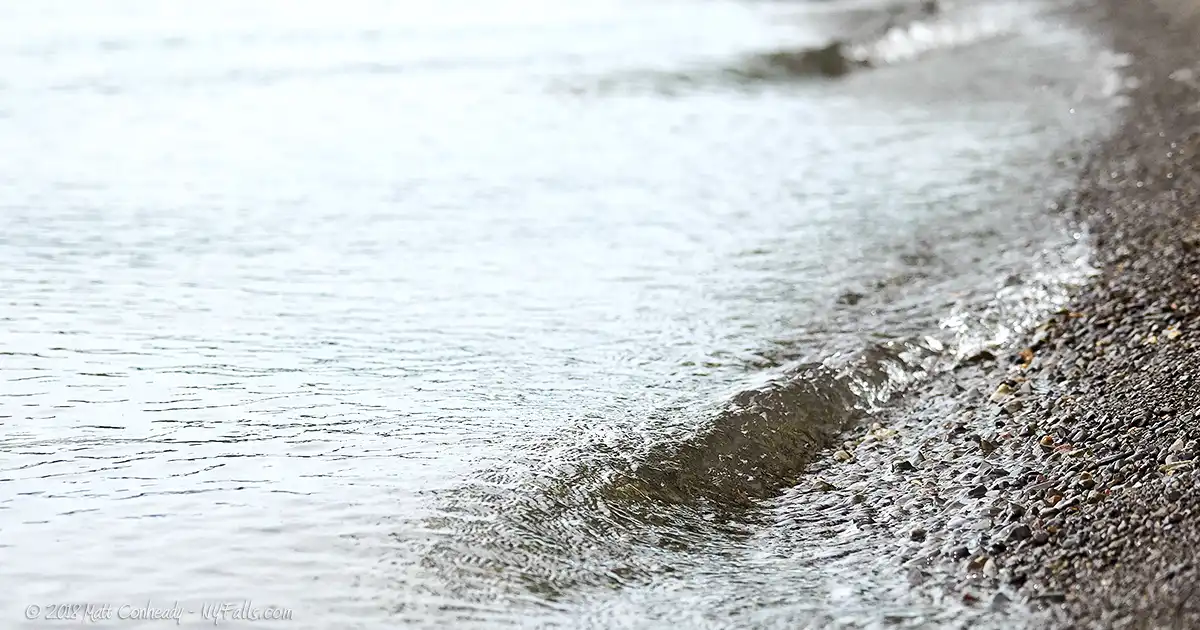
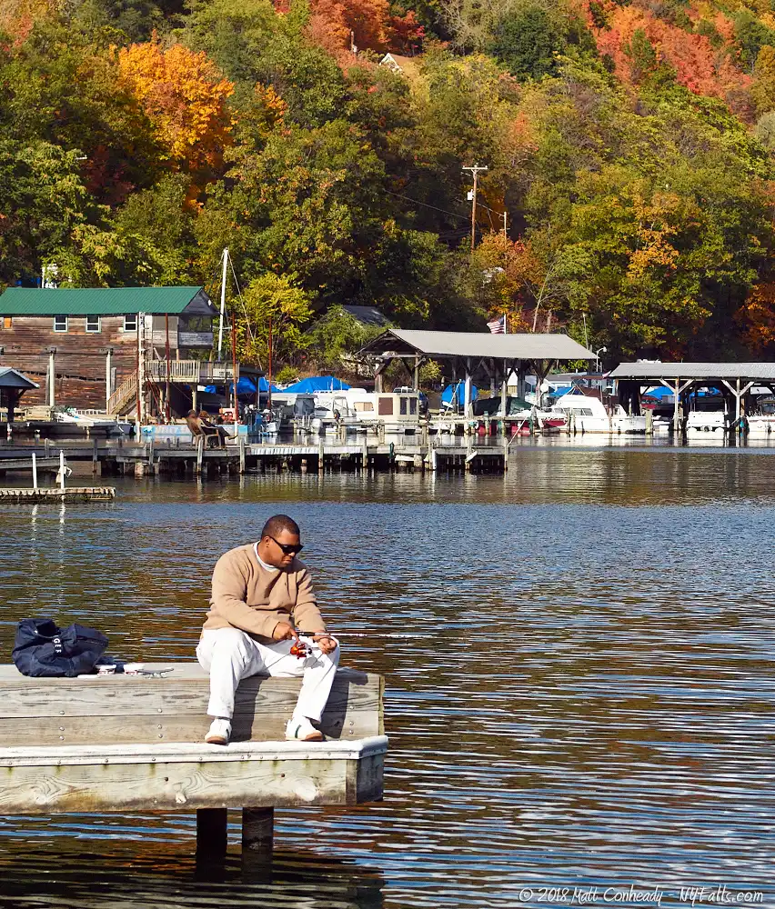
Although third in size, Keuka is relatively shallow, allowing it to warm up faster in the sun. Having a temperature slightly higher than the surrounding Finger Lakes, the Crooked Lake is one favored most by swimmers. Anglers also flock to the lake for its legendary trout and smallmouth bass stocks. There are plenty of fishing spots as well as charters available for fishermen. Keuka is also popular with boaters, evident from the numerous marinas, launch sites, and homes and cottages that have docks. Keuka also sports the most lakeside restaurants; most of which have facilities that cater to boaters. The best views of the lake are from the lake itself.
Keuka Lake Parks / Beaches / Access Points
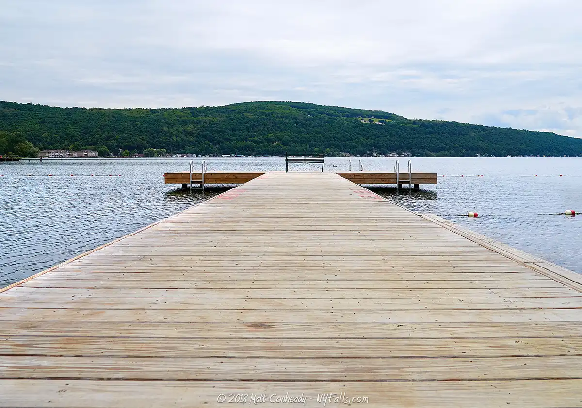
Keuka Lake State Park
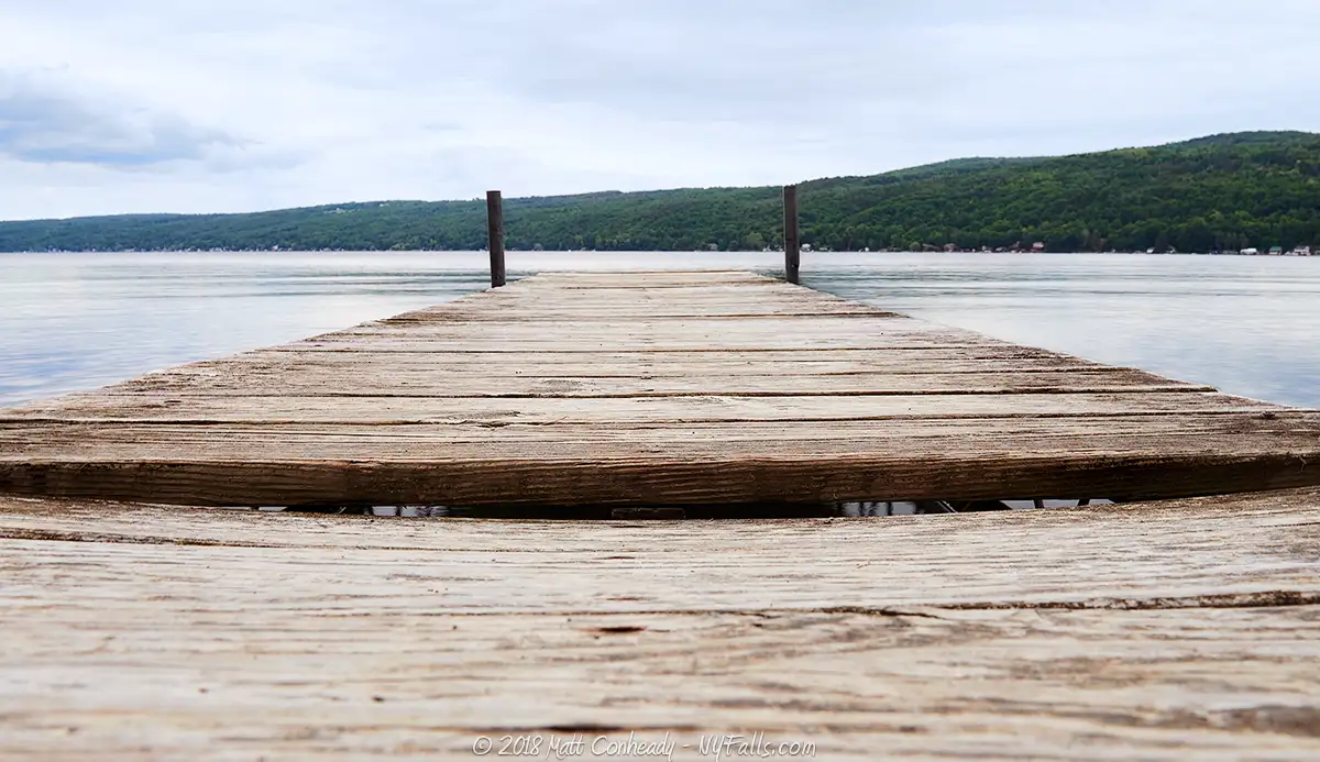
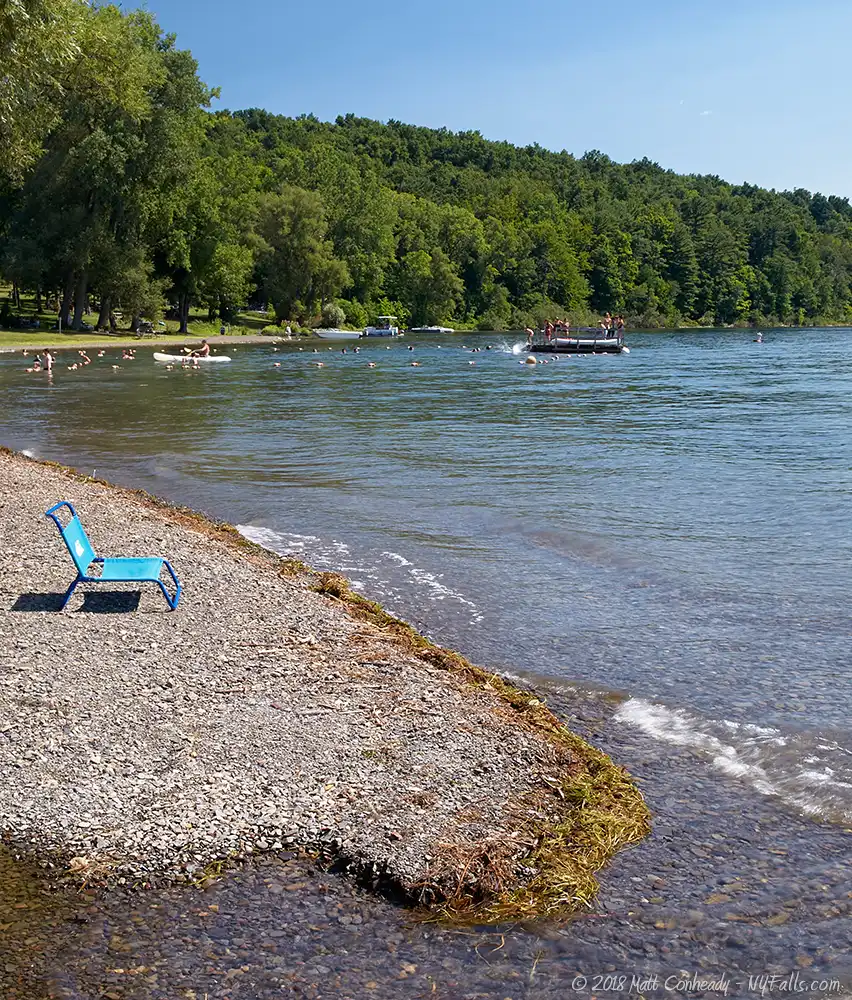
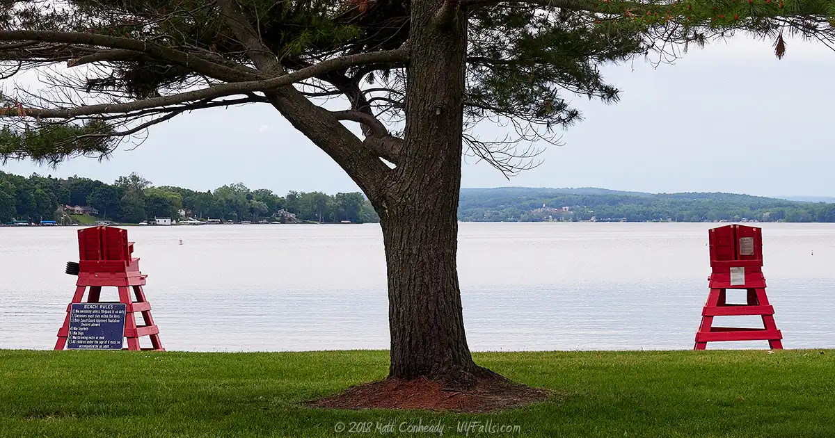
Description: This beautiful park is spread across 621 acres of Bluff Point hillside. A large portion of the park is wooded and a small strip runs along the shore of the west branch of the lake. Taking advantage of Keuka Lake’s warm temperatures, the park has a beach for swimming, with lifeguards and a modern bathhouse. There are plenty of picnic facilities, including a fully enclosed pavilion for larger parties. A few trails wind in and out of the woods and are spotted with breathtaking views of the lake from the bluff. Camping is an option with 150 tent/trailer sites available on the eastern side of the park. The view from Bluff Drive heading down towards the boat launch is one of the best to be had.
Seasons/Hours: Trails open year-round. Camping from May to mid October. Swimming from Memorial Day weekend through Labor Day.
Directions: West branch of the lake. From 54A to Pepper Rd. Google Maps.
Parking: Plenty in the park’s several lots.
Best time to visit: Summer.
Pets: Allowed, on leash. Not allowed in the swimming area.
Admission: $7 Vehicle entry fee collected 8am-6pm weekends and holidays; May 8-June 18 and September 7-October 11; From 8am-6pm daily June 19-September 6.
Handicap accessibility: Yes, to the restrooms, bathhouse, marina.
Swimming: Swimming is allowed in the designated area when lifeguards are on duty.
Boat Launch: Hand and trailer boat launch. Overnight slips available at the marina.
Camping: 150 tent and trailer sites; 53 with electric hook-ups. Rates vary. Book a campsite.
Accommodations: Fishing; swimming; bathhouse; docks; hiking trails; pavilion (2 sections); camping; playground; restrooms; hiking trails; x-country skiing.
Contact: NYS Parks: (315) 536-3666
Penn Yan Boat Launch and Park
Description: The village of Penn Yan hosts these docks and concrete boat launches on the lake outlet. A small park is adjacent to the launch site. This is also a great starting point to hike the Keuka Lake Outlet Trail.
Seasons/Hours: Unknown.
Directions: Water St. off of Rt 54 (Liberty St.) in the Village of Penn Yan. Google Maps.
Parking: Lot for 70 cars.
Best time to visit: Summer.
Pets: Allowed (on a leash).
Admission: Free.
Handicap accessibility: Yes.
Swimming: Not allowed.
Boat Launch: 3 concrete boat launches. Hand launch available too.
Accommodations: Fishing; docks; pavilions; tennis courts; skate park; hiking trail (trail-head to the Keuka Outlet Trail).
Contact: Penn Yan Recreation: 315-531-1567
Indian Pines Park
Description: A small village park on the northern tip of the east branch in Penn Yan; this park offers visitors a great place to picnic, fish, or swim.
Season/Hours: Year-round, dawn to dusk.
Directions: Old Pines Trail, off of Rt 54 in the Village of Penn Yan. Google Maps.
Parking: A lot for 40 cars.
Best time to visit: Summer.
Pets: Unknown.
Admission: Free.
Handicap accessibility: Somewhat.
Swimming: In designated swimming area when lifeguards are on duty.
Boat Launch: You may be able to hand-launch a craft from the beach.
Accommodations: Fishing, picnic tables, swimming, playing field, pavilion, restrooms.
Contact: Penn Yan Recreation: 315-531-1567
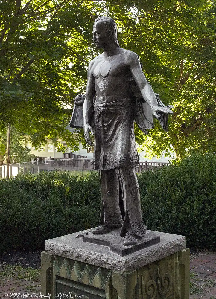
Red Jacket Park
Description: Named after the famous Seneca Red Jacket, this small lakefront park in Penn Yan features a statue in his honor.
Season/Hours: Year-round, dawn to dusk.
Directions: Off of 54, just south of Penn Yan. Google Maps.
Parking: Roadside parking along Rt 54 in the designated area.
Best time to visit: Summer.
Pets: Allowed, on a leash, but not in the swimming area.
Admission: Free.
Season/Hours: unknown.
Handicap accessibility: No.
Swimming: In designated swimming area when lifeguards are on duty.
Boat Launch: You may be able to hand-launch a craft from the beach.
Accommodations: Fishing, picnic tables, swimming, restrooms. There are restaurants in close proximity.
Contact: Penn Yan Recreation: 315-531-1567
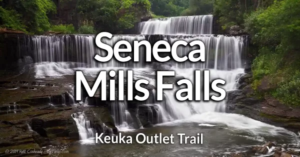
Keuka Lake Outlet Trail
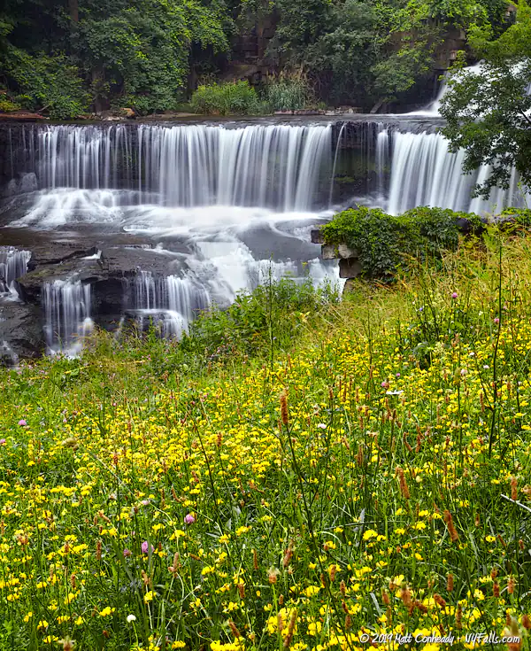
Description: Although the trail does not meet with either Keuka or Seneca Lake, it does run across most of the Keuka Lake Outlet. Owned and managed by Friends of the Outlet, Inc., the trail is a well maintained pathway shared by bikers and hikers alike. Built upon the towpath of the historic Crooked Lake Canal, the trail will bring you past numerous historic landmarks and a few notable waterfalls as you work your way towards Seneca Lake. Kayaking the outlet is also a popular activity.
Season/Hours: Year-round. Trail closes at dark.
Directions: There are several trail access points. One place to start is from the Penn Yan Boat Launch and Park. Check out the guide for more information.
Parking: Various parking spaces near the trail access points. Start at the park in Penn Yan for the most ample parking.
Best time to visit: Year-round.
Pets: Allowed (must be leashed). Horseback riding allowed.
Admission: Free.
Handicap accessibility: Not recommended.
Swimming: No.
Boat Launch: No.
Accommodations: picnic areas, restrooms, pavilion, bike rentals, places to eat in Penn Yan or Dresden.
Contact: Friends of the Trail
Guyanoga Creek
Description: The DEC runs this public boat launch in the hamlet of Branchport on the west branch. The launch is on Sugar Creek, just north of the lake.
Season/Hours: Unknown.
Directions: North west branch of the lake of of Rt. 54A. Google Maps.
Parking: 6 cars and trailers
Best time to visit: Summer.
Pets: Allowed, on leash.
Admission: Free.
Handicap accessibility: Yes
Swimming: No.
Boat Launch: Yes. Ramp for trailers.
Accommodations: Hand and trailer boat launch; fishing.
Contact: DEC: 518-402-8920
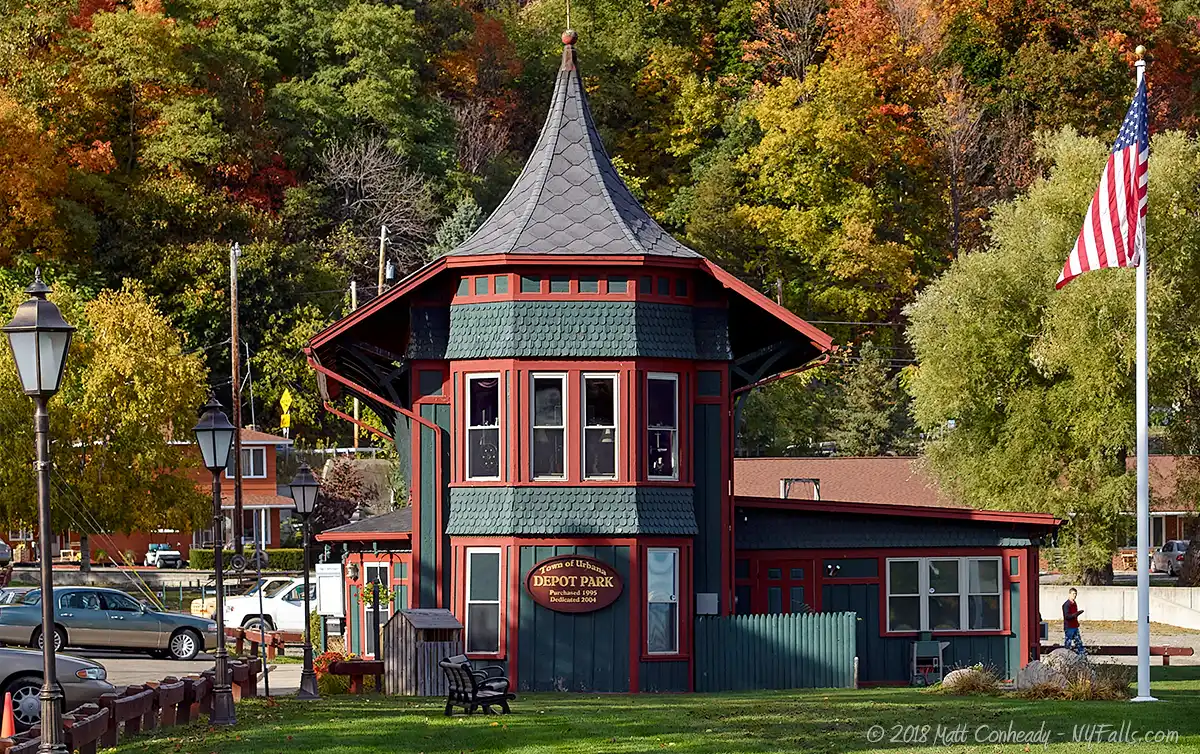
Depot Park
Description: The Town of Urbana and Village of Hammondsport maintain this small park on the southern tip of the lake. It has several docks, picnicking opportunities, and a large ramp for boat launching.
Season/Hours: Year-round, dawn to dusk.
Directions: In the village of Hammonsport. Google Maps.
Parking: Park along Water Street. Space for 20 cars.
Best time to visit: Spring through fall.
Pets: Allowed, on leash.
Admission: Free.
Handicap accessibility: Yes, possible to reach the lakefront easily.
Accommodations: Hand and trailer boat launch; fishing; scenic views; picnic tables; benches.
Contact: Town of Urbana: (607) 569-3743
Champlin Beach
Description: Situated on the southern end of the lake, this small village park is easily identified by the replica Curtiss seaplane mounted several hundred feet offshore (although, when we visited in the spring of 2018, the plane was missing). Warm weather brings crowds who come to take a refreshing dip in the public swimming area.
Season/Hours: Year-round. 11am to 8pm.
Directions: Located on the sound end of the lake off of Rt 54. Google Directions.
Best time to visit: Summer.
Pets: Allowed, on leash, but not in the swimming area.
Admission: Free.
Parking: Plenty of parking in the lot off of Rt 54
Handicap accessibility: Yes.
Swimming: In designated swimming area when lifeguards are on duty.
Boat Launch: None.
Accommodations: Picnic areas; swimming; restrooms; pavilion; fishing; docks; playing fields; places to eat in Hammondsport.
Contact: Town of Urbana: (607) 569-3743

Glenn Curtiss Park
Description: Located right on the Keuka Inlet on the lake in the village of Hammondsport, this small nature park is dedicated to Hammondsport native and innovator, Glenn Curtiss. The park offers little in the way of amenities, as it’s in the early stages of grassroots developement, but is a nice slice of nature to visit for short walks or fishing.
Season/Hours: Year-round. Dawn until dusk.
Directions: Located on the sound end of the lake off of Liberty Street in Hammondsport. Google Directions.
Best time to visit: Summer, fall.
Pets: Allowed, on leash, but not in the swimming area.
Admission: Free.
Parking: plenty of parking in the lot off of Rt 54
Handicap accessibility: Yes.
Swimming: None.
Boat Launch: None.
Accommodations: Fishing; walking.
Contact: Town of Urbana: (607) 569-3743
More Finger Lakes Guides
Explore more of New York’s Finger Lakes parks, beaches, nature trails, waterfalls and more in our handy guides.
Fishing Information
Common species
Rainbow Trout; Lake Trout; Brown Trout; Atlantic Salmon; Smallmouth Bass; Northern Pike; Chain Pickerel; Yellow Perch; Smelt; Bluegills; Pumpkinseed; Rock Bass; Black Crappie.
Best fishing spot
From the shaded shores of Curtiss Memorial Park on the southern end of the lake in Hammondsport.
Fishing conditions
For current fishing information a fishing hotline is available at Central New York Fishing Hotline or by calling (607) 753- 1551.
Nearby Waterfalls

Interesting Stuff
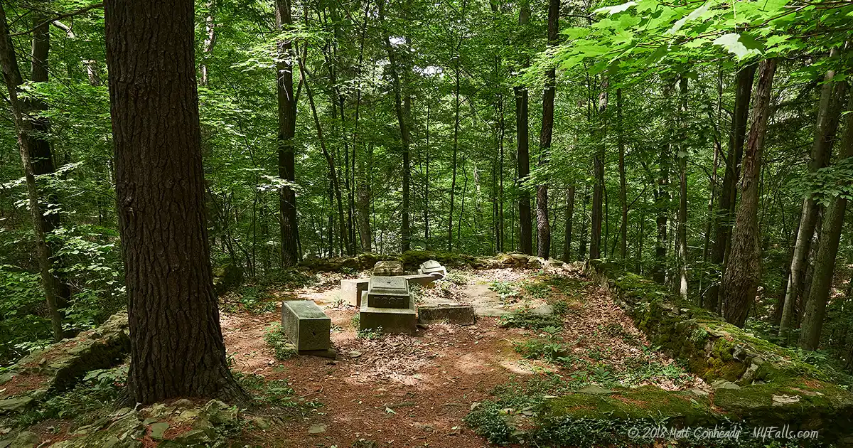
Beddoe-Rose Cemetery
Tucked away on a peaceful wooded slope within Keuka Lake State Park, this small interment of 14 pioneers and settlers of the Town of Jerusalem is on the National Register of Historic Places. The earliest burial is from 1815 and the latest is 1908.
Ring of Lights
The Ring of Lights happens on the Saturday evening of Labor Day weekend when residents along the shore light a fire, torch, and fireworks; tiny lights sparkle around the lake.
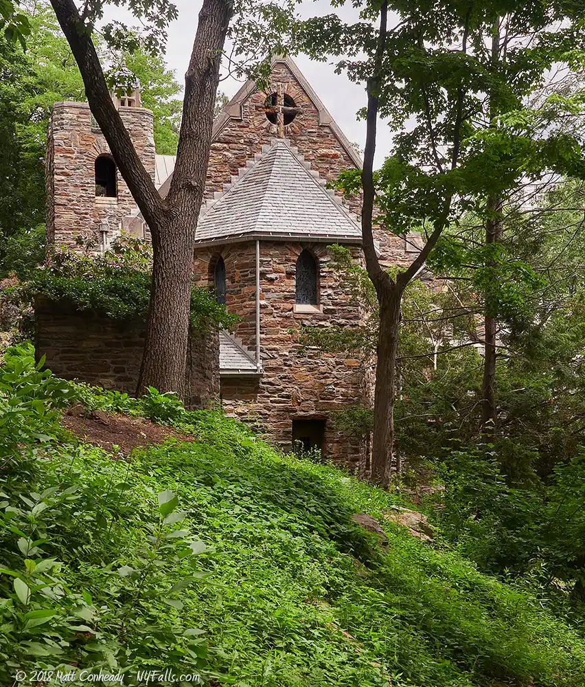
Little Chapel on the Mount
The Garrett Memorial Chapel commemorates the life of Charles Garrett. The Garrett family owned one of the most successful wine companies in the world, with vineyards lining this very bluff. Two years after Charles’ death from tuberculosis in 1929, his parents (Paul and Evelyn) built this 6th century, Norman Gothic-style chapel on the eastern slopes of Bluff Point. This was a location Charles loved all his life and he wished to be buried there. Materials for its construction were brought in from all over the world, including Algeria, Holland, and many regions of the Americas. The chapel is ornamented with symbols of motherhood, growth, and family love. Today this masterpiece of architecture is on the National Register of Historic Places and carries on seasonal worship services.
Esperanza Mansion
The Esperanza mansion was built in 1838 by Virginian plantation family heir John Nicholas Rose, who farmed the surrounding hillsides to become one of the wealthiest people in the region. This 20-room Greek Revival mansion, situated on the western hillside of the west branch, was his home until his death in 1837. Since then it has passed through several owners, once becoming a stop along the Underground Railroad, the county poorhouse, and a barn. Today it is listed on the National Register of Historic Places and is owned by the Wegman family, who runs it as a inn and restaurant.
Hammondsport
Hammondsport’s Village Square features cafes and various shops around a pleasant park and gazebo; a worthy stop for tourists. Summer nights will bring small concerts to the square.
Finger Lakes “Stonehenge”
Unfortunately you won’t be able to see Bluff Point Stone Ruins: a Stonehenge-like formation of rocks that once capped Bluff Point. Said to spread across nearly 14 acres of land, the ruins were discovered in the late 1800s by farmers who settled on the bluffs, but they were never formally surveyed by archaeologists At the time of discovery they consisted of a maze of depressions, lined with 1-foot high slabs of stone, and spotted with mounds. It is speculated that this may have once been an extensive complex with several rooms.
The ruins were destroyed by local farmers as they claimed the land. Some of the stones were used to build the foundations of nearby houses. Unfortunately almost no above-ground traces of the ruins exist today. Accounts from Native Americans say that the ruins existed prior to their people arriving in the region. Two unexcavated mounds led to speculation that the Mound Builders may have been responsible for this site. Read more.
Bike Keuka
Bluff Point Bike Trail will test your stamina as you ride 27 miles around Bluff Point’s steep inclines.
Who to Contact
General water concerns:
NYSDEC Bureau of Fisheries
625 Broadway Albany, NY 12233
Phone (518) 402-8920
E-mail: [email protected]
State boat launches/access
NYSDEC Region 8
6274 East Avon-Lima Road
Avon, NY 14414
Phone (585) 226-2466
E-mail: [email protected]