Norton’s Falls (Rochester)
Location: Within Seneca Park in the city of Rochester, Monroe County, New York
Maps: Google Map; Topographic; Interactive map.
GPS Coordinates:
- Norton’s Falls: N 43.19059 / W 77.62018
- Trailhead: N 43.18920 / W 77.62141
Directions: From the West: Follow Ridgeway Ave east to the St. Paul exit. Turn left onto St. Paul St. Turn right onto Seth Green Dr. Park at the public fishing access parking lot.
From the East: NY-104 west to the Clinton Ave N Exit. Go south and turn right on Norton Street. Take Norton St across St Paul St, where it becomes Seth Green Dr.
Or use Google Maps.
Parking: Park at the public fishing access parking lot off of Seth Green Dr. or along the road. Do not park in the apartment complex across the street.
Weather
Information / Accessibility / Accommodations
Number of falls: 1
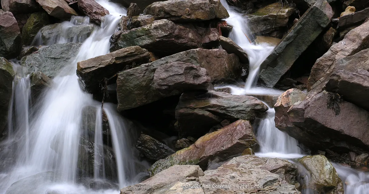
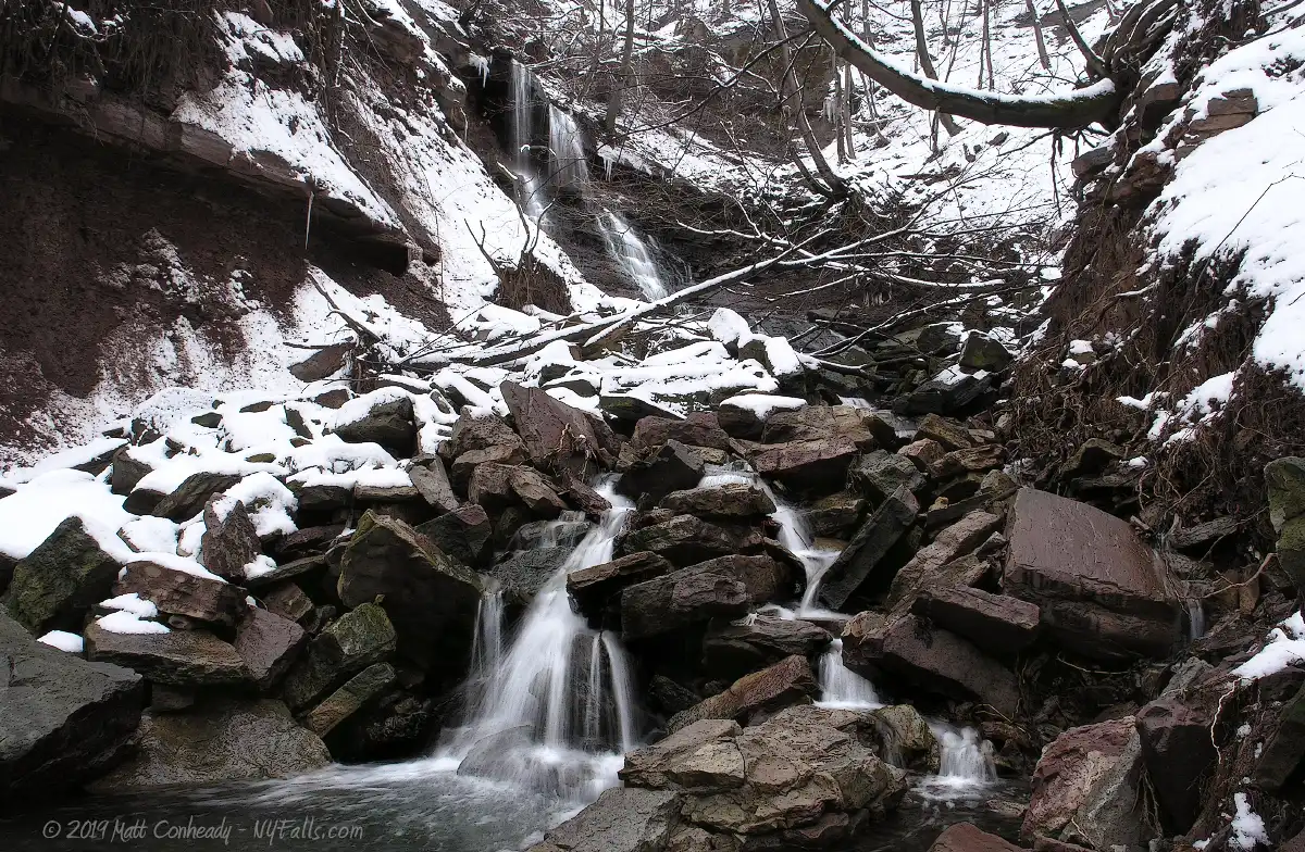
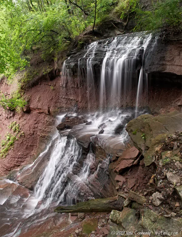
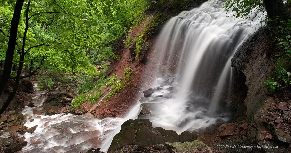
Size/Types: Roughly 50 ft tall. Starts out dropping 15 ft from a limestone tunnel then cascading another 15 ft over shale as it turns 45 degrees and tumbles the rest of the way over large limestone rocks into the Genesee River.
Best time to visit: Year round.
Flow: Low (can be spectacular in high rain).
Waterway: Norton’s Creek, a tributary to the Genesee River.
Time: 15 minutes.
Seasons/Hours: Open year-round, 24-hours/day.
Admission: Free.
Handicap accessibility: No.
Pets: Allowed (on leash).
Accommodations: Fishing; historical sign.
Description
Norton’s Falls is one of those hidden gems within the heart of Rochester, filled with myth and lore, and witness to the history of the city that mills built. Norton’s Falls is tucked away in a residential setting, sheltered by the steep Genesee Gorge into which it pours. The creek itself has long since been developed over, and now flows from some unknown location (although it is most likely integrated into the rain sewer). It emerges from a deep cave in the red sandstone gorge cliff and bounces over large rocks from the crumbling face. This area of the gorge seems to have a long history of landslides, which has decreased the slope, allowing people to descend to the river more easily.
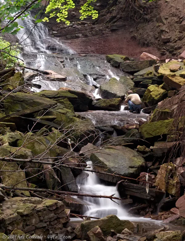
Norton’s Falls is at some times an ugly falls. It can suffer in dry weather. We have visited at times where rusty car parts, trashed bicycles, and hundreds of plastic containers littered the falls’ path. At one point a small community of homeless folk camped out in the woods nearby. They would fish the river for food during the day. The creek bed always has some sign of activity. Fishing line, lures, and old fire pits.
At other times, particularly in spring, when the water level is high, Norton’s Falls is a worthy stop. Taking only a few minutes to see the falls, there’s really no excuse not to. It’s simply one of the easiest and most beautiful to see in the region. The zig-zagging trail passes the falls half-way down and from there you hardly remember the busy streets and packed apartments just above it. It is just as isolated as any Finger Lakes gorge. With good flow and overcast skies, it is an excellent spot for local photographers to practice slow-shutter photography.
History
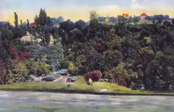
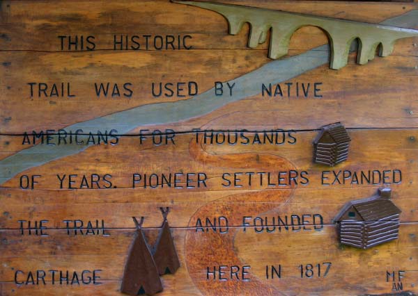
This winding trail was used thousands of years ago by native Americans as a means of accessing the river for fishing or portage. Above the gorge, approximately where the apartment building stands, was a Seneca camping ground. Pioneer settlers founded the village of Carthage just up on the ridge in 1817. They expanded the trail and built several mills on the site. Carthage extended as far north as present day Ridge Road, south as far as Clifford Rd, and east to Remington St. It encompassed Lower Falls, Ridge Road, and Norton’s Falls. The bank of the river here, commonly referred to as Carthage landing, then later Brewer’s Landing or Brewer’s Dock, was commonly used for passenger craft and light shipping vessels as it is most inland, natural landing north of the falls. Vessels often arrived from Canada and the west, with lumber to feed the fledgling tanning industry that arose on the riverbank. Village also constructed a bridge at lower falls to keep traffic within their district once Main St bridge threatened their importance as a portage. It was completed in 1819, and was the pride of the settlement.
By the late 1800’s Carthage was gone and the city of Rochester was developing rapidly around the gorge, and the Erie Canal took a large chuck of its shipping business away and a newly constructed landing on the west bank took the rest. In 1888, Seneca Park was commissioned to be built along the eastern gorge. Norton’s Creek was dammed at St. Paul Blvd, forming a pond (Emerson Ice Pond) that stretched all the way back to Hollenbeck St. In winter, ice was harvested in the pond and stored in a massive ice house at the dam. On hot summer days guests of Seneca Park were treated to free water and ice.
Seth Green was a famous fish conservationist known as “The Father of Fish Culture.” In this area he cataloged fish, studied their breeding habits and ran a successful fish market, known for its chowder. He founded the Caledonia Fish Hatchery, which now stocks the Genesee River with salmon. Seth Green Blvd, and the Island in the Genesee just south of here are named in his honor.
Hiking / Walking Trails
Difficulty: Easy to moderate.
Markings: A wood sign at the trail-head and red circles nailed on trees, labeled “Switchback Trail.”
Distance: Less than 300 feet to get to the bottom of the gorge.
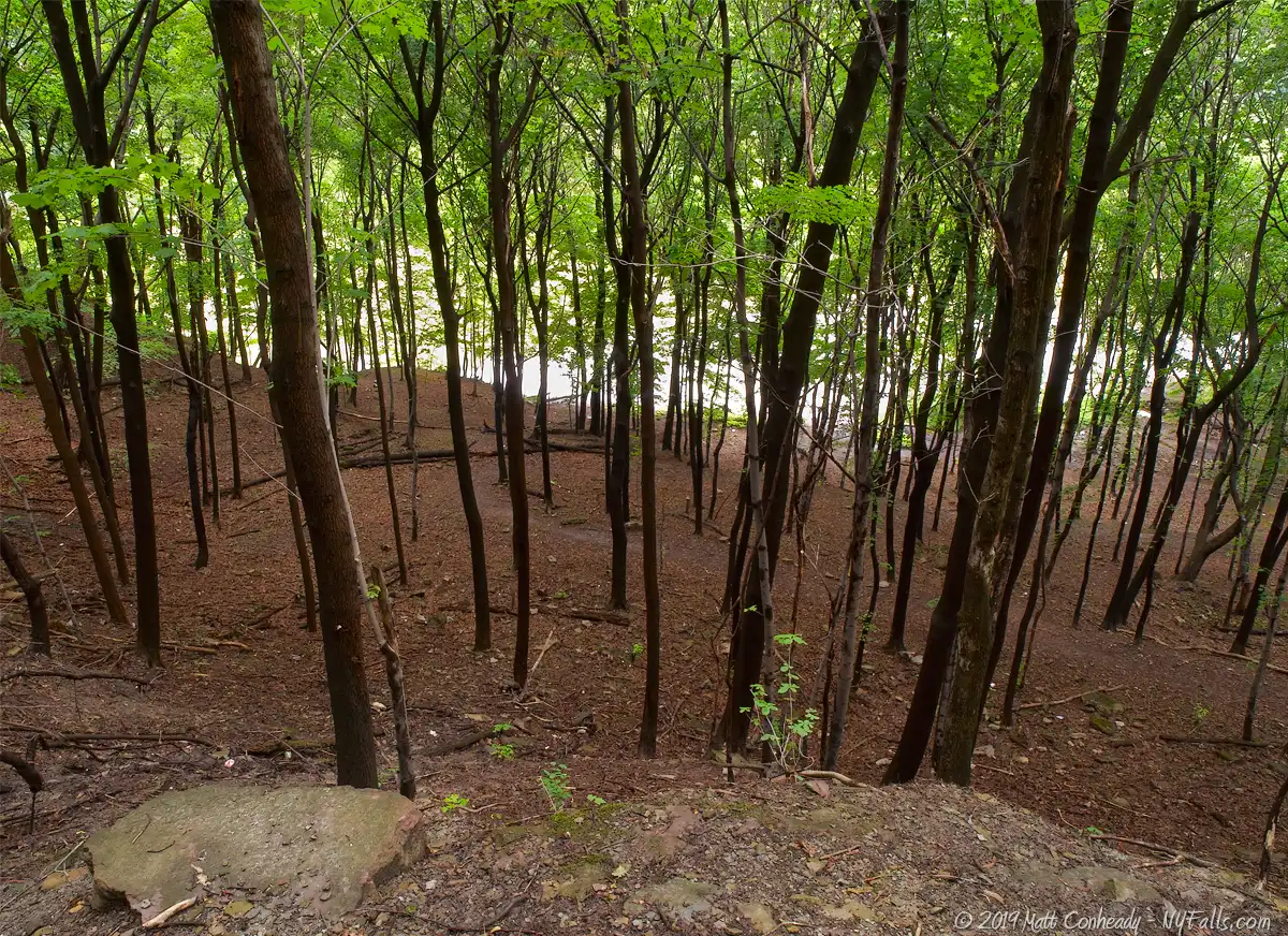
Description: This dirt trail winds down the side of the gorge and ends at the river. About a third of the way down the trail, there is a perfect view of the falls. The trail and the falls are littered with debris, both natural and man-made. At the tail end of the trail, you may have to scramble over rocks. The trail ends at the Genesee River.
Map: Interactive.
Norton’s Falls Interactive Map
Norton’s Falls Media
Norton’s Falls Audio
Norton’s Falls in high flow
Norton’s Falls Video

Interesting Stuff
Lower Falls
Take the DEC fishing access path nearby down to see Lower Falls. Along the way see all the layers to the Genesee Gorge as well.
Land slide
The more gradual slope present in the gorge here is due in part to Norton’s Creek, which eroded away the gorge cliff over thousands of years. Although small, it made enough impact and left enough debris to allow people to use this area to get to the bank of the Genesee for fishing or boating.
Photography Tips
Silky Water Effect
- To get that smooth cotton-candy look to the falls, you need to use a Neutral Density (ND) filter on your lens. The ND filter will block some of the light from entering the lens without altering the color, and thus allow your shutter to stay open longer. This blurs the water and creates a soft white gloss to the foamy areas of the falls. Check out the article for the all the details.
More tips
- See the Articles for more photography tips.
Who to Contact
Monroe County Parks Department
171 Reservoir Avenue
Rochester, New York 14620
Telephone: (585) 256-4950
monroecounty.gov


