Guppy Falls (Skaneateles Conservation Area)

Location: Located in the Skaneateles Conservation Area; town of Skaneateles; Onondaga County
Maps: Google Map; Topographic; Skaneateles Conservation Area map; Interactive.
GPS Coordinates:
- Falls: N 42.9673 / W 76.3921
- Parking: N 42.96814 / W 76.39002
Directions: From Marcellus, follow CR-133, the Old Seneca Turnpike, to the intersection of Gully Road. Turn down Gully Road and follow for ¾ of a mile until you see a turn-out on the right for Guppy Falls.
From Skaneateles, follow New Seneca Turnpike, CR-41, for 1.5 miles until the intersection of Gully Road. Take a left on Gully Road and follow for 1 mile until you see the turn-out on the left.
Parking: The gravel/dirt parking area is just north of the creek on the west side of Gully Road. Room for several cars.
Weather
Information / Accessibility / Accommodations
Description
Guppy Falls is located in the Skaneateles Conservation Area, a unique habitat protected by the town of Skaneateles who purchased land around this crucial tributary from owners and farmers in order to preserve the unique ecosystem.The area contains two ponds, numerous acres of wetland habitat and stream access.
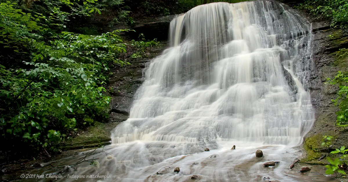
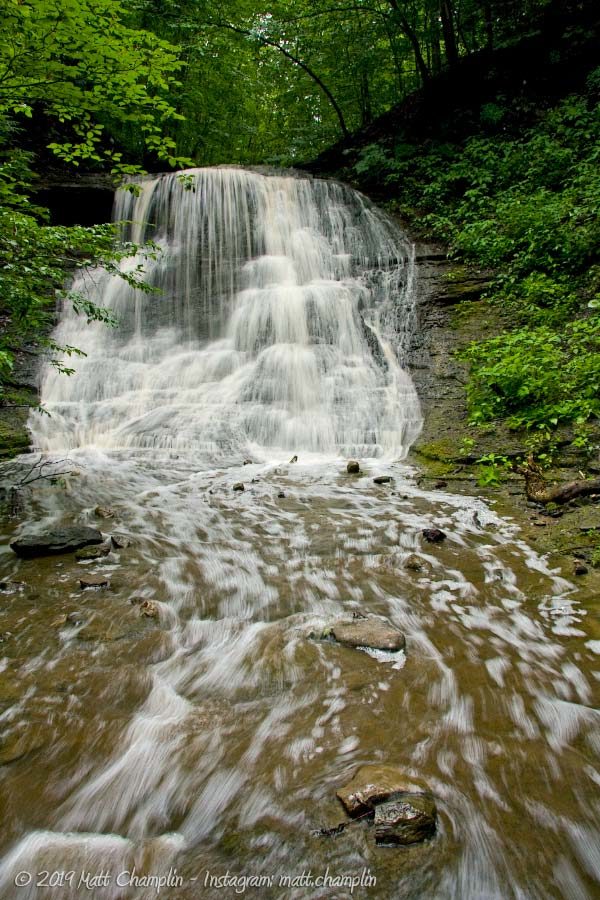
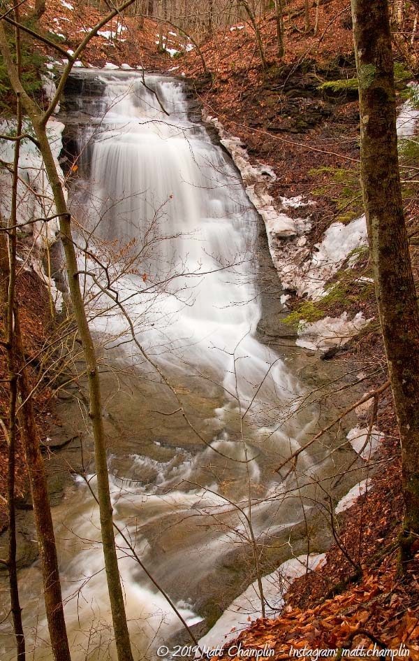
Guppy Falls is typical of many of the small feeder streams in the Finger Lakes area. The bedrock is shale, and the stream flow is very dependent upon rainfall. The falls itself is roughly 20 ft high, sloping over slippery shale, with a slightly overhanging segment at the top. There are many small flumes and cascades along the way to the Guppy Falls that make good photo opportunities as well.
Protecting these small tributaries is crucial to the overall health of New York’s system of watersheds. Although this small scree, and the muddy wetland it meets up with below is minute, it flows into Ninemile Creek, a major tributary to the troubled Onondaga Lake. Cleaning up Onondaga begins with ensuring that clean water fills it.

History
The Skaneateles Conservation Area has a very unique history. On a few maps the area is still pegged as a “US Military Reservation.”
According to local records, the land was purchased by the military so that soldiers stationed at the local bases and armory, such as Hancock Field, would have a place for recreation, camping, and even partying. When the military stopped using the area, it became known as a popular place for high-schoolers to hang out on weekend nights.
Having issues with late night underage activities, the town of Skaneateles purchased the land, as well as some surrounding acreage, and created the Skaneateles Conservation Area. Over the years, trails have been created, picnic benches put in, and a nice pavilion and parking area were constructed near the northern end of the park. Families come to picnic here or fish in one of the many small ponds in the area.
The former Guppy Farm, which surrounded the land of the gully, began in the 1850s as a dairy farm operated by William Guppy and family. After William’s death the farm fell into disarray and was eventually abandoned. The property was purchased by the town from the Evans family in 2001 and the nature trail, which was partially created by nature enthusiasts to explore above the falls, was established as an official trail.
Hiking / Walking Trails
Difficulty: Moderate.
Markings: None.
Distance: About a mile and a half to the upper falls and back.
Description: The lower falls has a very defined trail leading to it from the parking area only 200 yards from Rt 90. To reach the rest of the ravine, creek-walking is required, but there are some areas with defined trails along the shore of the creek. Another swimming hole can be found 1/3 mile from the Lower Falls. Further up the creek about another 1/3 mile you will reach the Upper Falls. It is possible to scramble up the side of the ravine to get a view of the waterfall from above, but it is not recommended without proper climbing gear and experience. The rock on Great Gully Creek is smooth, hard limestone with numerous cracks and holes. Walking in the creek bed can be slippery, so use caution.
Guppy Falls Interactive Map
Guppy Falls Media

Interesting Stuff
The rest of the Skaneateles Conservation Area
From Guppy Falls you can hike along the road north where you will find a trail head on the right side of the road that will lead you to the rest of the park and the ponds. You can also travel north on Gully Road until you reach the turnpike. Head east on the turnpike until you see a sign for the upper part of the Conservation Area. There are tens of miles of trails, hunting, fishing, camping, cross-country skiing opportunities, and more. Check out the full map to see the extent of the conservation area.
Photography Tips
Better view
- Visit in early spring, or late fall when the folliage isn’t as full in order to get a less obstructed view from the overlook.
Getting wet
- The stones in the creek are very slippery, especially in the lower glen. Be careful, use footwear with a good grip, and take advantage of your tripod or monopod as a walking stick. It’s best to pack that camera away as you move across the water.
Silky Water Effect
- To get that smooth cotton-candy look to the falls, you need to use a Neutral Density (ND) filter on your lens. The ND filter will block some of the light from entering the lens without altering the color, and thus allow your shutter to stay open longer. This blurs the water and creates a soft white gloss to the foamy areas of the falls. Check out the article for the all the details.
More tips
- See the Articles for more photography tips.
Who to Contact
The Town of Skaneateles
24 Jordan Street
Skaneateles, NY 13152
Phone: 315-685-5607
townofskaneateles.com
Contact form


