Delphi Falls
Location: 12 miles southeast of Syracuse; town of Cazenovia; Madison County; New York
Maps: Google Map; Topographic; Interactive map.
GPS: Lower Falls: (N 42.86392 / W 75.89926)
Upper Falls: (N 42.86314 / W 75.89831)
Park entrance: (N 42.86618 / W 75.90204)
Directions: From US-20: West of Cazenovia, turn south onto Oran Delphi Rd and follow that for 2.5 miles. Pass through the hamlet of Delphi Falls and then make a left onto Delphi Falls Rd. After 2/3 mi, make a right onto Cardner Rd. The park will be on your left after 1/3 mi.
From I-690 in Syracuse: Follow I-690 E and then merge onto I-481 S toward Dewitt. Take exit 3E for NY-5 E/NY-92 E toward Fayetteville. Take a slight right onto NY-5 E/NY-92 E and continue on NY-5 E for about 5 mi. In Manlius, turn left onto E Seneca St, then a few hundred ft later turn right onto NY-92 E/Washington St. Follow that for about 3 mi. Turn right onto Oran Delphi Rd and follow that for 7 mi. Pass through the hamlet of Delphi Falls and then make a left onto Delphi Falls Rd. After 2/3 mi, make a right onto Cardner Rd. The park will be on your left after 1/3 mi.
Use Google Maps.
Parking: The entrance to the park leads directly to the parking lot, which has room for about 20 cars.

Weather
Information / Accessibility / Accommodations
Number of falls: 2 waterfalls, with one (the lower falls) currently visible from the park. Trails are planned to allow access to the upper falls in the near future.
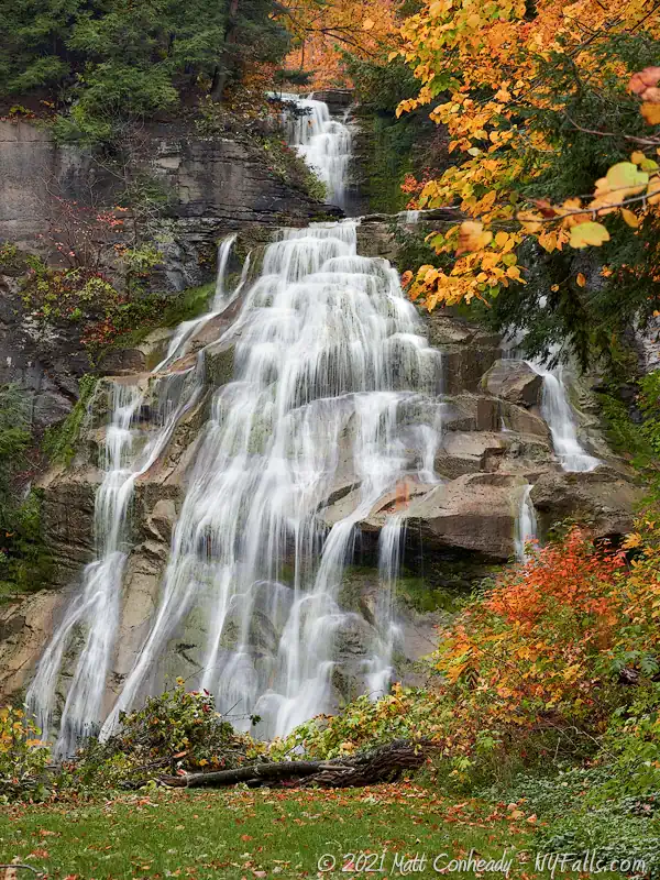
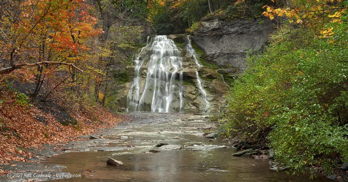
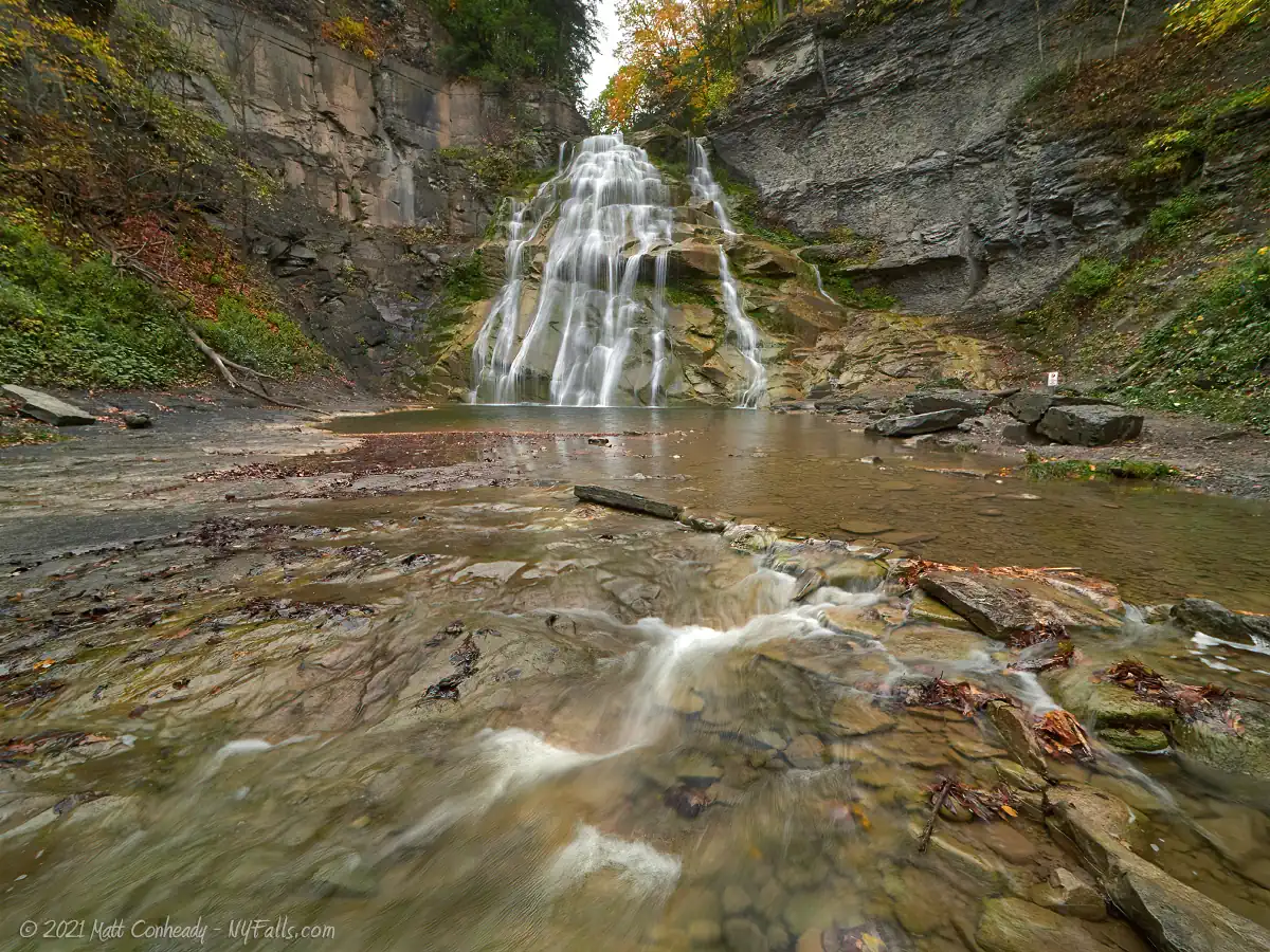
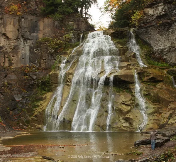
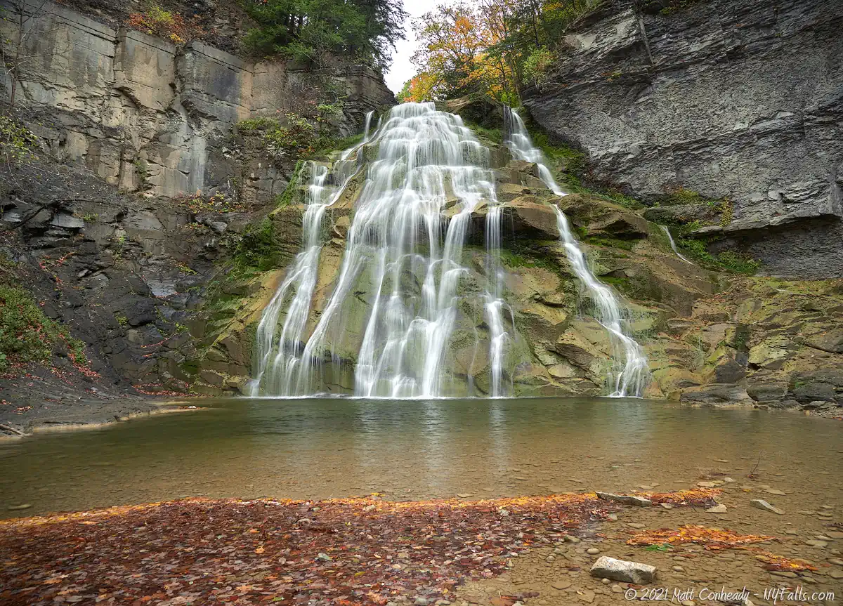
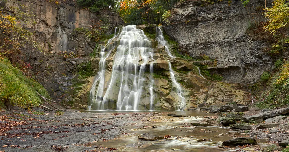
Size/Types: The lower falls is a 65 ft tall cascade that fans out as it drops. The upper falls is 52 ft tall rectangular-shaped cascade with a plunge mid-way down.
Best time to visit: Year-round.
Flow: Moderate. In mid-summer it tends to dry to a trickle.
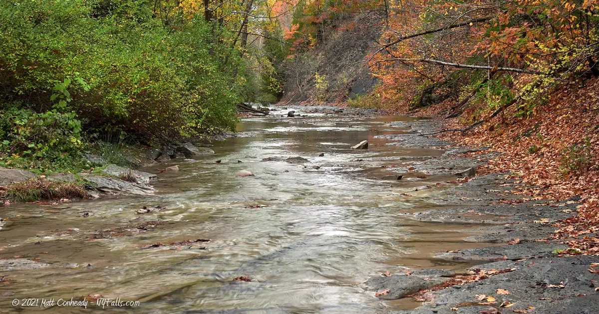
Waterway: East Branch of Limestone Creek, which forms about 6 miles east in the Tioughnioga Wildlife Management Area. It joins with Limestone Creek just west of the Falls. Limestone Creek heads north, passing through Manlius and crosses the Erie Canal at Fayetteville. In Cicero, it empties into Chittenango Creek. About 4 miles north Chittenango Creek empties into Oneida Lake.
Time: 15 minutes.
Seasons/Hours: Year-round, from sunrise to sunset.
Admission: Free.
Handicap Accessibility: There are two ADA parking spaces near the barn. The pathway to the lower falls follows ADA guidelines.
Pets: Allowed on leash only.
Accommodations: As of 2020, parking, a handful of picnic tables, and the one trail to the lower falls are the only offerings. Future plans include restrooms and a lodge, but the ETA for these is TBD.
Description
After being closed to the public for over a half-century, this beautiful set of large falls on the East Branch of Limestone Creek is finally open to the public—well, at least half is.
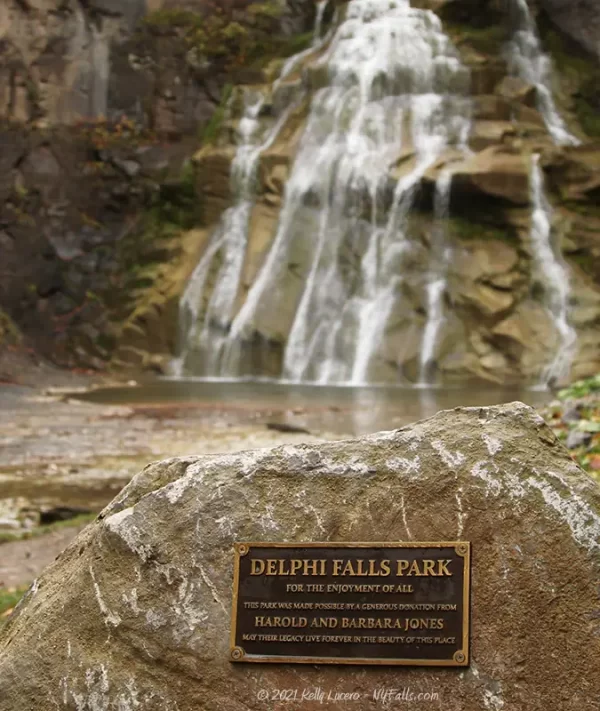
Thanks to a generous donation by Harold Jones, this once-private homestead has become a Madison County park. While the conversion to a full-fledged park is still underway, it is open and visitors can still come and enjoy parts of it.
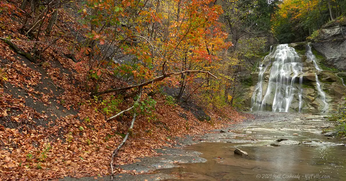
Delphi Falls consists of two large cascades within a deeply wooded hanging valley. The lower one, which cascades 65 feet down a rocky cliffside, fans out as it reaches the bottom, making the falls easily recognizable. Nutrient-rich run-off from the farmland upstream causes the cliff face under the falls to grow a bright green and orange algae, which contrasts with the surrounding grey stone and leafy surroundings, making the falls quite bold in appearance.
The upper falls has a more boxy form, with its 52-foot cascade nearly straight down. While the upper falls is just 360 feet upstream from the lower falls, there are currently no public trails granting access to it. That’s going to change in the next few years. The county has unveiled plans to build out a network of trails leading to overlooks of the upper falls. When this will be complete is still to be determined, as well as what plans they have for the existing barn and home.
With the acquisition of the beautiful property and the county enthusiastic about future plans for the park, Delphi Falls could easily go from being a relatively unknown glen to a top regional attraction in a matter of years. In its unfinished state, the park is already breathtaking. I’m eagerly awaiting what is to come.
History
The hamlet of Delphi Falls, which is just west of the falls in Onondaga County, was originally named “Delphi.” It was changed in the 1920s to Delphi Falls to avoid confusion with the town of Delhi. The name Delhi most likely came from the allocation of land to soldiers of the Revolutionary War as payment for their service. Many parcels were named after Greek places and legends by Simeon DeWitt, a fan of classical literature, who divided and distributed this “military tract.”
The land was owned by farmers and at least one grist mill operator until the 20th century, when it operated as a private park. The old home was once a park pavilion and dance hall.
It was sold to Michael Antil Sr. (of Cortland) in 1939 for $3,500 (about $65,000 today). Mr. Antil was a bakery operator, and at one time, VP of Hostess Cakes. The Antil Family occupied the home from 1948 into the 1960s. During his time there, Mr. Antil established the Duncan Hines brand.
The property was then in the hands of the Allen Family for a number of years.
In 2018, retired Syracuse University professor Dr. Harold Jones arranged to purchase the property from the Allens, with the purpose of turning it over to Madison County to be used as a new public park. He funded $750,000 of the $800,000 price tag, with the county picking up the rest.
The park opened to the public on August 26, 2018.
Hiking / Walking Trails
Difficulty: Easy level walk from the parking area to the lower falls.
Markings: Gravel walkway.
Distance: About 700 feet from the parking area to the viewing area for the lower falls.
Description: Note that more advanced trails are in the works and could open between 2021-2023, including a trail to the upper falls. As of this posting in 2021, there’s only one public trail to the lower falls.
From the parking area, follow the paved driveway southwest towards the buildings. Pass a barn and handicap parking area on the left. At about 300 ft you will reach the old private homestead. As of 2020, this building is closed to the public.
Pass the home using the gravel trail on the left. The falls should be coming into view at this point. Follow the gravel trail right to the falls. That’s all there is to it.
While many wade in the creek and climb the falls, note that in summer of 2020, the county was forced to close the park due to an overabundance of visitors walking off the trail. Don’t contribute to the next closure and keep to the trails. This is not a park meant for waterfall climbing.
Map: Interactive.
Delphi Falls Interactive Map
Delphi Falls Media
Delphi Falls Videos

Interesting Stuff
Limestone Creek
Aptly named, the area from Delphi Falls to Chittenango, through which Limestone Creek flows, has been home to multiple limestone quarries.
More Harold Jones Contributions
Delphi Falls is just one of many contributions Dr. Jones has made to the conservation community. He has generously donated 18 original John James Audubon prints to the Manlius Village Library, purchased and donated 80 acres in Three Falls Woods and 40 acres near Brickyard Falls in Manlius for the Central New York Land Trust.
Photography Tips
Shoot through the trees
- A few locations, including from near the old homestead, put the falls behind tall trees, providing a natural frame for the upper portion of the falls.
Mornings are best
- The sun will dip behind the falls in late afternoon and evening making exposure difficult. Get there in the morning to have the sun on your side.
Use people for scale
- The high cliffs on each side of the lower falls tend to make the falls appear smaller in photos than it really is. Include someone in the shot to help bring back the sense of scale to your photograph.
Silky Water Effect
- To get that smooth cotton-candy look to the falls, you need to use a Neutral Density (ND) filter on your lens. The ND filter will block some of the light from entering the lens without altering the color, and thus allows your shutter to stay open longer. This blurs the water and creates a soft white gloss to the foamy areas of the falls. Check out the article for all of the details.
More tips
- See the Articles for more photography tips.
Who to Contact
Madison County Planning Department
P.O. Box 606
Wampsville, NY 13163
Phone: (315) 366-2376


