Burdett Falls
Location: In the village of Burdett; town of Hector; Schuyler County; Finger Lakes Region; New York.
Maps: Google Map; Topographic; Interactive map.
GPS: Waterfall under Willow St Bridge: (N 42.41931 / W 76.84942)
Waterfall 2: (N 42.41900 / W 76.85054)
Waterfall 3: (N 42.41889 / W 76.85051)
Waterfall 4: (N 42.41847 / W 76.85073)
Directions: The village of Burdett is on the southeast side of Seneca Lake. NY-79 runs right through it.
From Watkins Glen: Take NY-414 N/E for 1.5 miles.
Keep right as it branches left (and uphill).
Arrive in Burdett in 1.8 miles.
From the north: Take NY-414 S to the southern end of Seneca Lake. You will be getting close when you pass Finger Lakes Distilling and Silver Springs Winery.
With caution, make a left onto CR-5. Follow it for 1 mile.
When you arrive in the village, turn left onto Lake Ave.
Turn right onto Willow St.
From the east: Take NY-79 all the way to Burdett.
Use Google Maps for precise directions.
Parking: You can park at the dead end by the old Main St bridge crossing the creek. The southern end of it is more vacant. If you can’t park there, check around for a suitable vacant business, or dine at the nearby BBQ joint and stop and see the falls afterwards.
Weather
Information / Accessibility / Accommodations
Number of falls: 4
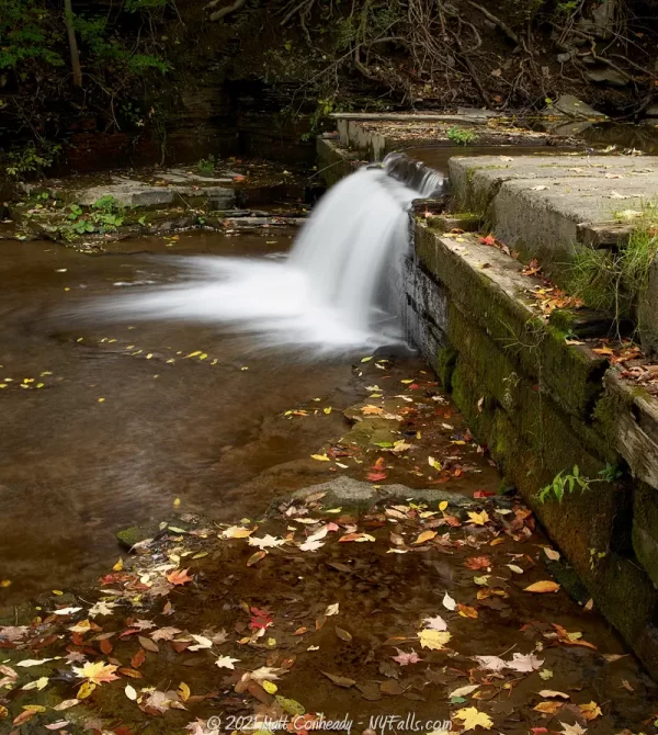
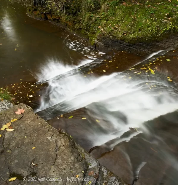
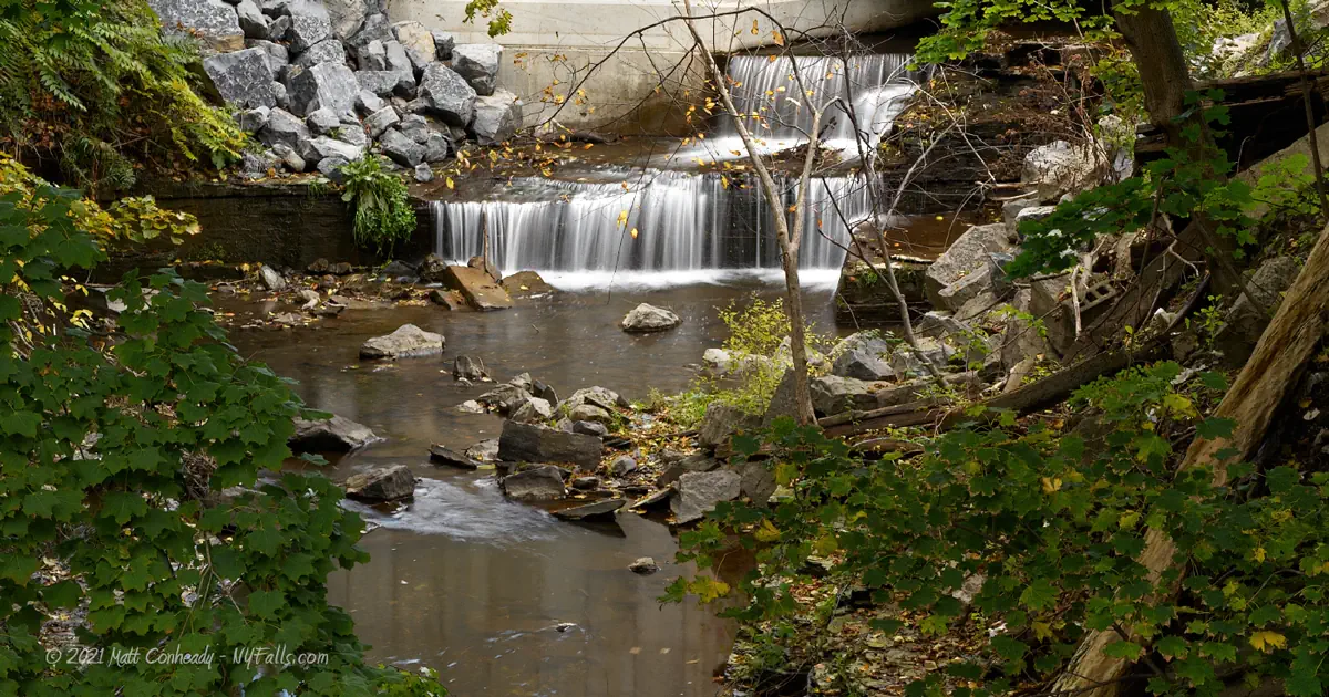
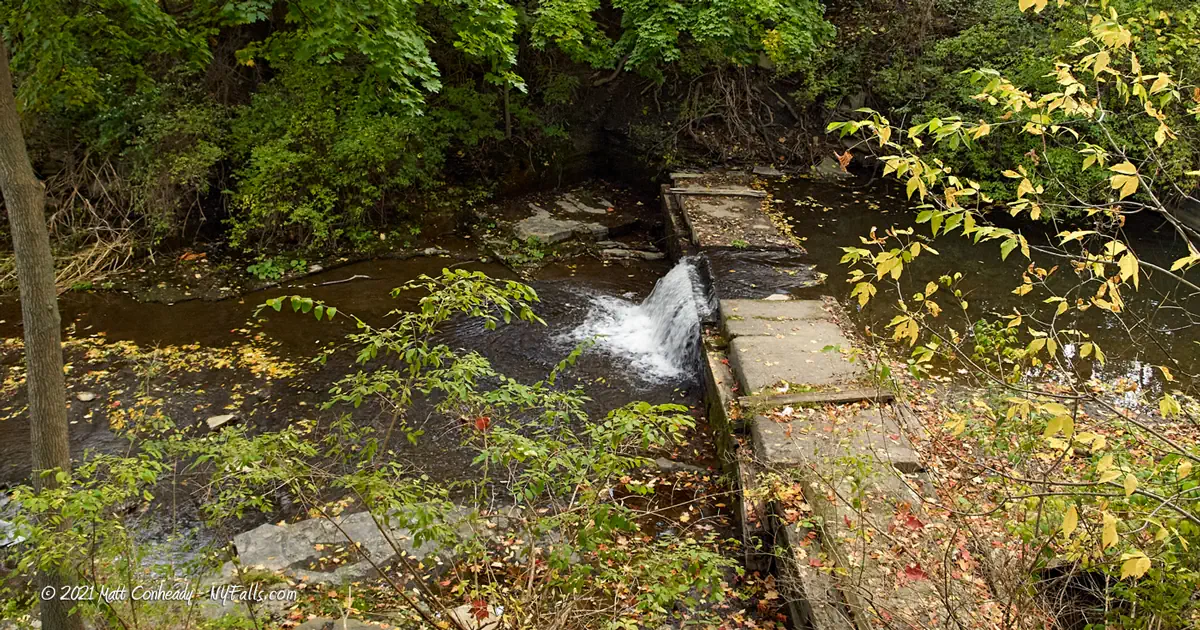
Size/Types: Under the Willow St bridge is a 4ft tall cascade with 2 steps. The next waterfall is downstream from the Main St bridge. It’s about a 2 ft drop over a straight edge – the remnant of an old dam. Just downstream from there is a natural cascade of about 15 ft in height. The final waterfall is about 250 ft downstream and around the bend. I’m estimating it at only a few ft high as I couldn’t get a clear look at it.
Best time to visit: Year-round.
Flow: Moderate. This creek is flowing most of the year.
Waterway: Hector Falls Creek, which creates the massive Hector Falls just west of here before it empties into Seneca Lake. The creek has a pretty large watershed, with a source 6.5 miles northeast in Reynoldsville, giving the falls a pretty consistent flow throughout the year.
Time: 15 minutes.
Seasons/Hours: Daylight hours, year-round.
Admission: Free.
Handicap Accessibility: While the falls are close to roads, I don’t think those confined to a chair can spot them easily. I’m gonna say no.
Pets: Leash laws in effect here.
Accommodations: There’s a BBQ restaurant nearby.
Description
While Hector Falls gets all the attention around here, the creek creates several waterfalls along its 6+ mile run down toward Seneca Lake. There are 4 waterfalls in the village of Burdett that are close to roads and easy to spot if you are hunting for them. There’s no massive gorge with towering cliffs here. But the shallow glen with its mossy striated rock is well isolated from the development of the small village.
Despite NY-78 running through the center of Burdett, carrying thousands of tourists into the southern Finger Lakes region annually, the small village of Burdett is not living up to its potential. Frankly, it’s a bit run down. I feel it’s a shame, with waterfalls being such a low-maintenance attraction, that the village has not put in the resources to uncover these gems, develop small parks around (which the residents can enjoy as well), and begin to give passers-by a reason to stop and spend time here. Smok’n Bones BBQ, and Barry Family Cellars are both within a short walk of the falls, are well rated establishments, and deserve a boost in tourism traffic.
History
The Sullivan Campaign passed through Burdett in 1799 as they slaughtered native Seneca and burned villages across the state, driving survivors west to Fort Niagara and Canada.
European settlers first arrived in Burdett around 1790. There are no records of the name, and all is known is that it was a lone man and he didn’t stay long. More settlers arrived in1799 (by some accounts) which included William Martin, Joseph Carson and Mowbray Owen. Joseph Gillespie is also credited as being the first permanent settler in 1799. The village was originally called Hamburg and once carried the nickname “Tod’s Pole” after a political totem that once stood at a local tavern. It was named Burdett after British political reformist Sir Francis Burdett or possibly the Burdett family. Hector Falls Creek was originally called Cranberry Creek, a name now given to a waterway just south of here.
The creek here was dammed in the 1800s, creating a mill pond, and supplied power to several sawmills.
Hiking / Walking Trails
Difficulty: Easy to get some views from a distance. Some folks have gone down into the the creekbed, which is not very difficult, but you could get wet in high flow.
Markings: None.
Distance: Walking up and down some small streets.
Description: The best spot to view the first falls is from the Main St Bridge, which is for pedestrians only. From there, you can see the 4ft waterfall under the Willow St bridge.
You can scramble down the right side of the bridge and down the creek behind the old white and grey brick building. There’s a bunch of junk behind here and because of the small dam downstream, the creek is rarely dry at this point.
Cross the small grassy park next to the parking spots near the bridge, to the tree line. There’s usually a small trail leading down to the two falls there. It doesn’t get a lot of traffic at all, so you may have to bushwhack your way in.
The 4th falls is parallel to Mill St. The white house south of the bridge used to be Berta’s Cafe. Mill St is on the other side of it. Walk down Mill St and keep an eye on your right to spot the falls through an opening. The land doesn’t seem to be posted here, so scrambling down may be an option.
Map: Interactive.
Burdett Falls Interactive Map
Burdett Falls Media
Videos
Coming soon…
Who to Contact
Village of Burdett
607-546-2266
[email protected]


