Oneida Lake


Location: Northeast of the city of Syracuse; Oswego and Oneida Counties; New York.
Surrounding Communities: Brewerton; Constantia, Sylvan Beach; Lakeport; Bridgeport.
Maps: Google Map, Topographic, Contour (Lake)
Size:
- Area: 50,894 acres (206 km²)
- Length: 21 miles (37.8 km)
- Max width: 5.5 miles (8.9 km)
Max depth: 22 ft (6.7 m)
Volume: Approximately 364 billion gallons. (1.379 trillion liters).
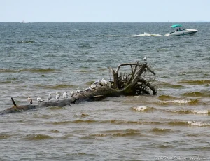
Water Quality: Moderate. Oneida Lake’s water quality has improved due to reductions in phosphorus levels from upgraded sewage treatment and agricultural best management practices, yet challenges persist. Sedimentation from watershed erosion, exacerbated by storm runoff, continues to impact water clarity and habitat quality. Harmful algal blooms (HABs), particularly cyanobacteria, remain a concern, influenced by nutrient runoff and rising water temperatures. In 2024, Oneida beaches closed down a total of 31 times due to HABs and elevated E.coli levels.
Elevation: 340 ft (104 m).
Directions: From Syracuse, take I-81 north to Brewerton.

Weather
Description
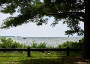
Oneida Lake, located about ten miles north of Syracuse in central New York, is the largest lake entirely within the state, spanning approximately 79.8 square miles. It stretches 21 miles long and about 5 miles wide, with an average depth of 22 feet. While not as deep as the Finger Lakes, its shallow nature makes it a warm, inviting lake for recreation.
Oneida Lake is part of a vast watershed, draining portions of 69 municipalities and covering a massive 872,722 acres. It receives water from several inlets, the largest being Chittenango Creek, Fish Creek, and Scriba Creek. The primary outlet is the Oneida River at Brewerton, which connects to the Oswego River system and eventually flows into Lake Ontario.
A Name Rooted in Haudenosaunee Tradition
The lake is named after the Oneida Nation, one of the six Haudenosaunee (Iroquois) Nations who inhabited about 6 million acres from the St. Lawrence River to the Susquehanna. Oneida villages thrived in the land surrounding the lake, particularly to the southeast, centering around Oneida Castle. The Oneida people referred to the lake as “Tsioqui,” meaning “white water,” likely a nod to the lake’s frequent wind-driven waves.
Recreation and Parks: A Year-Round Destination
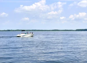
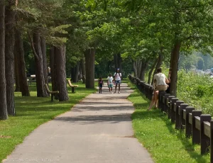
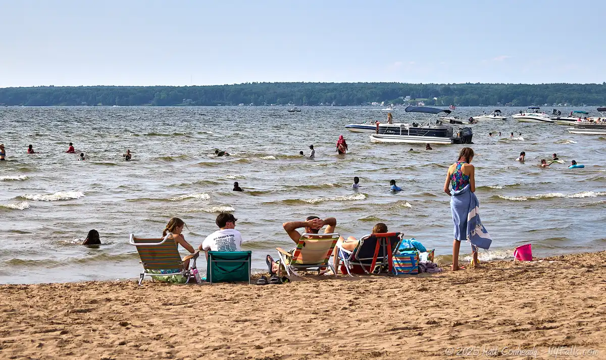
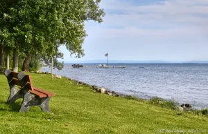
Oneida Lake is a hub for outdoor adventure, offering boating, fishing, swimming, camping, and hiking. Its location close to Syracuse makes it a popular getaway for enjoying a slice of nature and plenty of leisure, without straying too far from urban amenities. While summer brings the largest crowds to the beaches, even winter has its charm with ice fishing, beautiful views along the icy shoreline, as well as 540 miles of snowmobile trails across greater Oneida County. Several events around the year, including Sylvan Beach’s “Pirate Weekend” in July and the Central Square Apple Fest in September, keep things interesting and provide excellent reasons to visit.
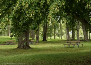
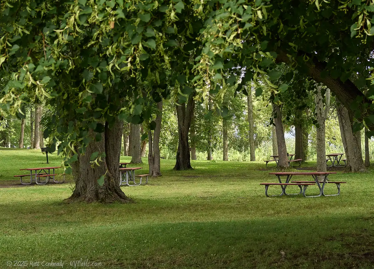
On the southeastern shore, Verona Beach State Park provides a peaceful retreat with 1,735 acres of woodlands, wetlands, and beaches. Families flock here for its sandy shoreline, picnic areas, and nature trails. The park also features a campground and snowmobiling trails in winter, making it a year-round escape. It gets completely packed on hot summer days and despite the density and heat, the entire park echoes with the sounds of people having a blast.
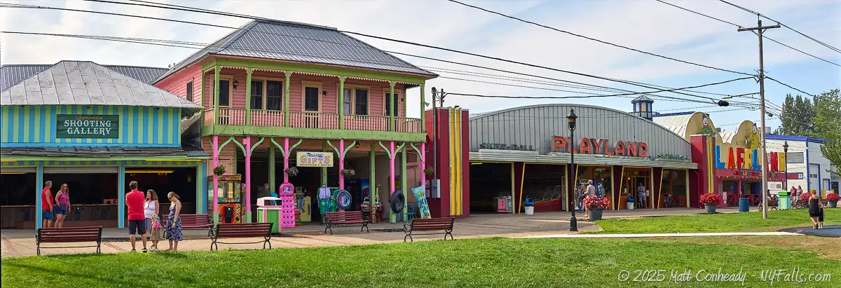
North of Verona Beach, on the eastern shore, Sylvan Beach is the heart of Oneida Lake’s summer activity. This small resort village has an old-fashioned charm, reminiscent of an early 20th-century lakeside retreat. The Sylvan Beach Amusement Park dates back to the 1870s, originally featuring carnival-style rides and classic arcade games. Today, it still operates with a mix of vintage rides and new attractions, giving visitors a nostalgic boardwalk feel. The village is packed with ice cream stands, waterfront restaurants, and shops, making it a perfect stop for families. The area comes alive in summer with classic car shows, outdoor concerts, and lively nightlife. Sylvan Beach is a popular sunset photography spot, offering golden-hour views over the lake that are perfect for capturing and ending your day at the lake.
Other Lake Communities: Small-Town Charm
Other, smaller communities around Oneida Lake offer their own unique experiences:
- Brewerton (west end): A boating hub with several marinas, waterfront restaurants, and easy access to the Oneida River. It’s a prime spot for both recreational and sport fishing. It’s not too far from the city of Syracuse and is often considered a suburb. Several well-reviewed eateries and taverns can be found here, making it a good spot to plan for a meal.
- Bridgeport (south shore): A quieter town known for its fishing charters and access to Chittenango Creek. There’s a small casino here, as well as a few places to eat.
- Cleveland (north shore): A charming village with a historic lakeside vibe, often overlooked, because there’s not much here, except a small lakeside park, fishing access site, and The Cleveland House, a five star casual bar and grill that also features live music.
- Constantia (north shore): Home to the Oneida Fish Hatchery, which offers tours from April 1 to September 30.
Plenty to Enjoy for Families and Photographers
Oneida Lake offers a perfect mix of natural beauty, recreation, and nostalgia. Whether you’re boating to an island, casting a line for walleye, or capturing a sunset at Sylvan Beach, this lake delivers an unforgettable experience. We spent a day driving around the lake and exploring and always had a new site to stop at and photograph, easily eating up all the sunlight and encouraging a return trip to capture more. The surrounding parks and communities provided the perfect mix of busy beaches, peaceful nooks, curiosities, and top-notch eateries amidst decaying signs of this once thriving resort lake in the rust belt. Definitely one of the more interesting lakes to explore with the family–don’t forget the camera.
History
Oneida Lake is a remnant of Glacial Lake Iroquois, formed nearly 12,000 years ago when retreating glaciers blocked the St. Lawrence River, creating a vast body of water that inundated much of central New York. As the glaciers receded and the St. Lawrence River reopened, Lake Iroquois drained, leaving behind Oneida Lake (as well as Onondaga Lake, Lake Ontario, and Cayuga Lake) in a deeper depression of the former lakebed. Evidence of this glacial past is visible today, with large boulders deposited by the glaciers scattered throughout the region and a ridge that runs across the state that defines much of the shoreline of the ancient lake, of which NY-104 (or Ridge Rd) runs along.
Before European exploration, the Oneida and Onondaga tribes of the Iroquois Confederacy inhabited the region. The Oneidas, who called the lake “Tsioqui,” meaning “white water” due to its impressive wave action, established fishing villages near the mouth of Oneida Creek and along Fish Creek, near present-day Sylvan Beach. Their annual harvests of Atlantic salmon were substantial, providing a vital food source. The Onondagas also valued the lake’s fishery, establishing camps at the Oneida River outlet and near Chittenango Creek’s mouth, where they netted and speared eels, salmon, catfish, and pike. Archaeological discoveries at sites like Brewerton and Shackelton Point have unearthed numerous artifacts, attesting to the rich indigenous history of the area.
Fort Brewerton
Fort Brewerton, constructed in 1759 during the French and Indian War, was strategically located at the western end of Oneida Lake in present-day Brewerton (at the corner of CR-37 and US-11). Designed as an eight-pointed star fortification, it featured sixteen 30-foot faces surrounded by a 10-foot moat, with earth walls and log palisades forming a 480-foot parapet. Inside, the fort housed four log blockhouses, storage buildings, and wells. Its primary purpose was to defend the vital passage from Albany to the port of Oswego, ensuring control over key transportation and communication routes in the region.
Following the war, the fort’s strategic significance diminished, leading to its abandonment. In 1790, a blacksmith named Dexter became the first white settler in the area, establishing himself opposite the fort’s remains. Shortly after, Oliver Stevens, one of the region’s earliest settlers, resided on the north side of the Oneida River before relocating to the south side near the fort. In 1794, amid concerns of potential conflicts with Native Americans, Stevens was commissioned by Governor George Clinton to construct a blockhouse, which later served as his residence.
Today, the Fort Brewerton Historical Society operates the Oliver Stevens Blockhouse Museum, a reconstructed late 18th-century log blockhouse situated near the original fort site. The museum showcases artifacts spanning 10,000 years of local history, including Native American materials, military relics, and exhibits depicting 18th-century life. The fort’s remains were listed on the National Register of Historic Places in 1973.
Settlement and Development
In the late 18th century, European settlers began developing lands around the lake. The Scriba Patent, founded by George Scriba in the 1790s, marketed significant acreage stretching from the lake’s north shore to Lake Ontario. The Military Tract, encompassing the lake’s western end, was reserved for American Revolution veterans, with unsold parcels eventually offered to the public. The early 1800s saw an influx of New Englanders seeking fertile land, leading to the establishment of communities such as Constantia and Brewerton in the 1790s, Bridgeport around 1802, and Lakeport by 1811. These villages served as commercial centers for a burgeoning lake fishing industry, as well as surrounding farms and as summer retreats.
The completion of the Erie Canal in 1825, which bypassed Oneida Lake, spurred the construction of connecting waterways to join Oneida communities and industry to this new superhighway. The first, known as the “Side Cut Canal,” built in the 1830s, linked the Erie Canal with Fish Creek near Sylvan Beach, facilitating logging and sand businesses. A second canal, constructed in the 1870s, connected Upper South Bay with the Erie Canal at Durhamville, but proved economically unsuccessful. The enlargement of the Erie Canal into the Erie-Barge Canal in 1918 incorporated Oneida Lake into its course, connecting it with the Great Lakes and the Hudson River, and turning Brewerton, Cleveland, and Sylvan Beach into bustling canal ports.
Cleveland Glass
In 1840, German immigrant Anthony Landgraff established the first glass manufacturing operation on the north side of the lake in Cleveland, NY. Landgraff, who had previously worked in Vernon, Oneida County, relocated to Cleveland due to its abundant hemlock forests, which provided the necessary fuel for glass furnaces. Initially, sand for glass production was transported from Vernon, but by 1841, high-quality silica was discovered locally, streamlining the manufacturing process. The factory primarily produced window glass, with artisans occasionally crafting “off-hand” pieces such as canes, pitchers, and bowls during their free time. Years later, former employees founded the Union Glass Factory, which also produced window glass. The glass industry in Cleveland died out before 1920.
Sylvan Beach Resort Era
The late 19th and early 20th centuries marked the transformation of Sylvan and Verona Beaches into the “Coney Island of Central New York.” This era saw the emergence of numerous hotels, two amusement parks, and a boardwalk, attracting thousands of vacationers. Railroads and steamboats facilitated this tourism boom, with grand vessels like the Sagamore and the Manhattan navigating the lake. Cottage and camp construction along the lakeshore accelerated during the post-World War I prosperity of the “Roaring 20s,” altering the landscape significantly. While the depression was tough on the resort industry, it did not completely destroy it like it did for most lakeside amusement in the state. It continued to sustain, and while not as grand as it once was, exists to this day.
Commercial fishing thrived on Oneida Lake, with species like Atlantic salmon and whitefish being abundant. However, overfishing led to the decline of these populations, prompting the state to ban netting practices to protect the dwindling stocks. Still, for a time after its banning lake “pirates” would go out at night and scoop up what they could. Today, the lake supports a diverse fish community, including walleye, yellow perch, and bass, (although many of these species are stocked from state fisheries) and remains a popular destination for anglers.

Oneida Lake Beaches / Parks / Access Points
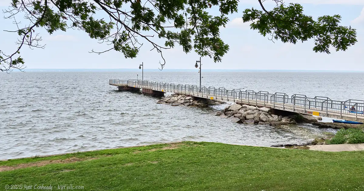
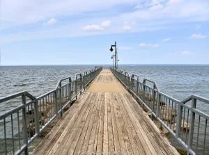
Swamp Road Crossing Fishing Area (Near I-81)
Description: A state-run fishing access site on the west side of the lake at the Oneida River in Brewerton. It’s not well documented and hidden under the I-90 bridge.
Seasons/Hours: Year-round.
Directions: Located on the north side of the Oneida River inlet in Brewerton, just east of I-90. The entrance is off of CR-37 near Weber Rd. Google Map.
Parking: A paved lot just beyond the entrance with room for 30+ cars.
Best time to visit: Spring through fall.
Pets: Allowed on a leash.
Admission: Free.
Handicap accessibility: Somewhat. There’s a paved trail, but it’s not in the best of shape and does have a slight gradient.
Swimming: No swimming.
Boat Launch: No boat launch.
Accommodations: Fishing; Port-a-potties (sometimes in summer); deck with lumber railings.
Contact: DEC Region 7 Fisheries: (607) 753-3095; [email protected]
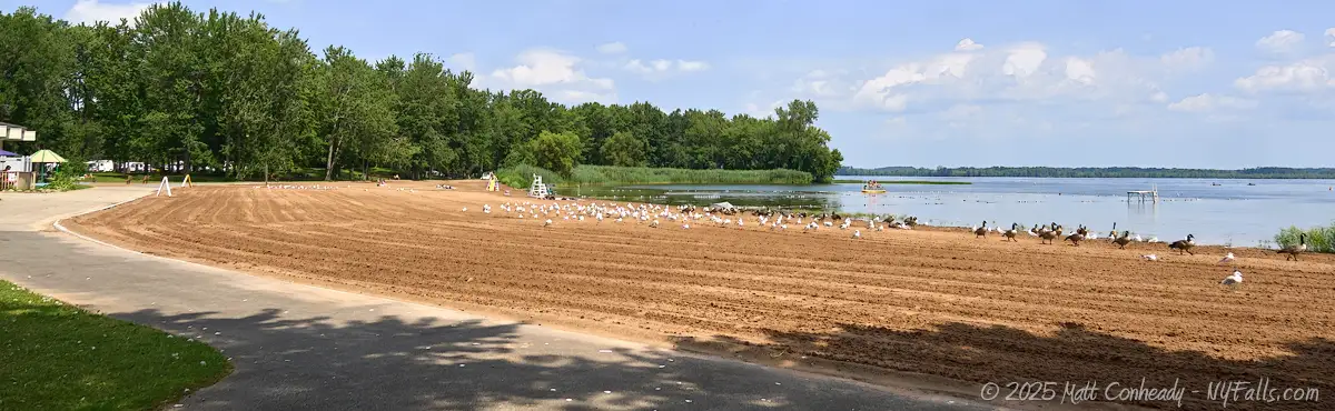
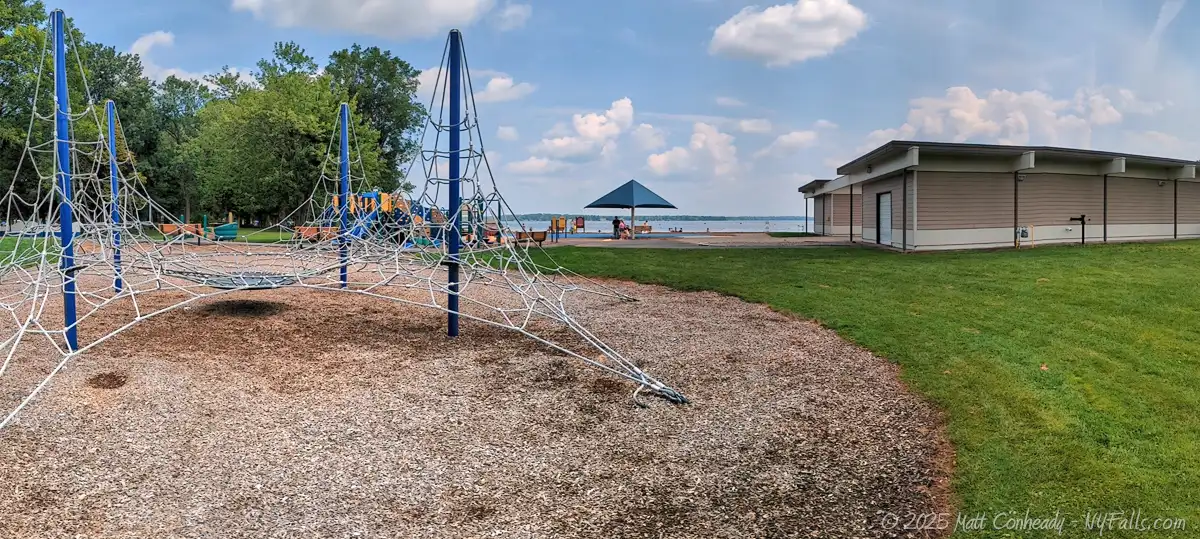
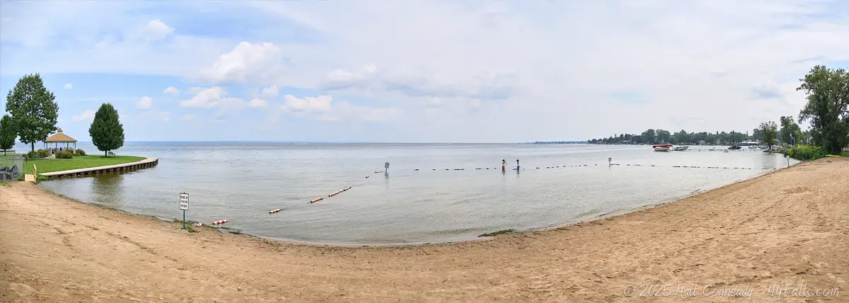
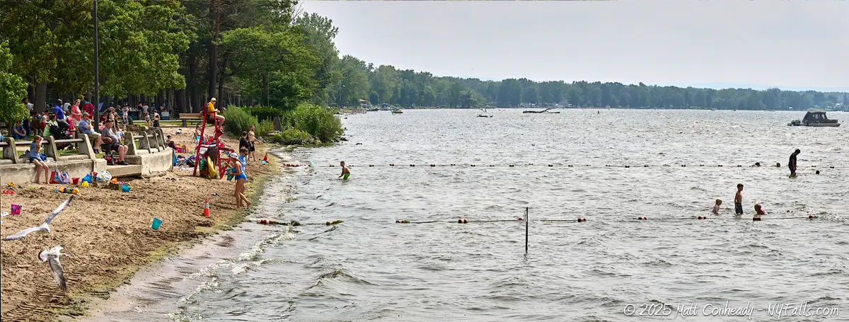
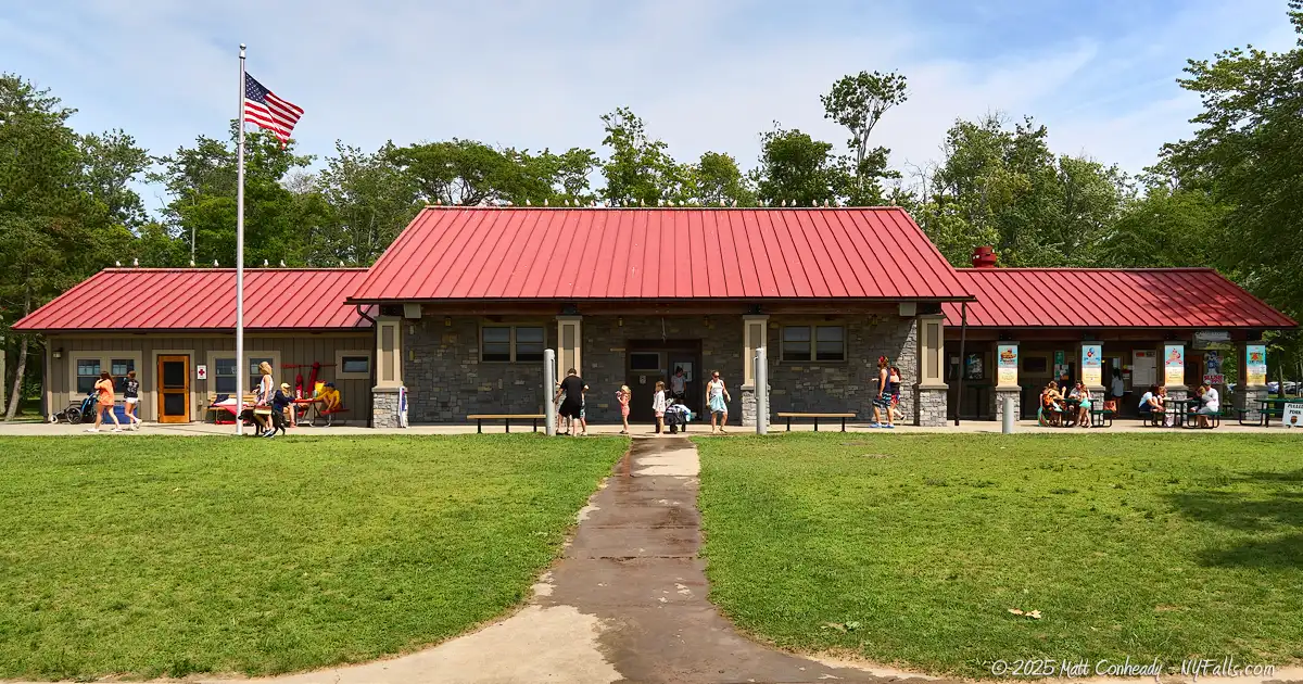
Oneida Shores County Park
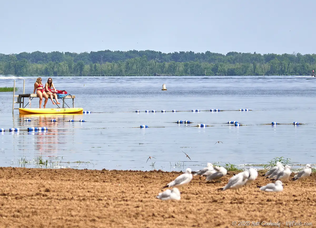
Description: A beautiful and well-maintained lakeside park in Brewerton. It spans 340 acres with 3,000 feet of frontage on Oneida Lake, 1,000 ft of which is a beautiful sandy crescent beach. The park offers a variety of recreational activities, including swimming, boating, fishing, camping, and picnicking. A large playground is situated near the modern bathhouse and the beautiful Arrowhead Lodge can be reserved for special events.
Map: Park Map (PDF).
History Tidbit: Established in 1964 after Onondaga County acquired the land in three parcels, Oneida Shores Park has developed over the years to enhance visitor experiences. Key milestones include the opening of the beach in 1970, the McKinley Ridge reserved section in 1979, the campground in 1994, and expansions to the boat launch in 2005.
Seasons/Hours: The park is open year-round. From Mother’s Day Weekend through Columbus Day: 6am – 8:30pm. Outside of that, it’s open from sunrise to sunset.
Directions: Located just east of the village of Brewerton, on the west side of the lake. 9400 Bartel Road, Brewerton, NY 13029. It is easily accessible from Interstate 81, less than a mile from the Brewerton exit. Directions.
Parking: Ample parking is available throughout the park, including areas near the beach, boat launch, and picnic facilities. In fact, most of the land comprising the park is parking lot, sadly.
Best time to visit: The park is most popular during the summer months when swimming, boating, and camping are in full swing. However, year-round activities like fishing and picnicking can be enjoyed depending on weather conditions.
Pets: Pets are allowed in certain areas of the park but must be leashed and under control at all times. They are not permitted in swimming areas or playgrounds. Every dog owner must have a dog license tag attached to their dog’s collar.
Admission: $7 admission fee per vehicle. $2 for seniors. Free with military ID.
Handicap accessibility: The park offers accessible facilities, including restrooms and picnic areas. While the beach itself may present challenges due to natural terrain, a paved pathway with plenty of space runs along the length of the beach.
Swimming: A sandy beach area is available for swimming, with lifeguards on duty during designated hours in the summer months (typically Memorial Day weekend through Labor Day weekend). Swimming is only permitted in designated areas when lifeguards are present.
Boat Launch: The park features a paved boat launch with multiple ramps, accommodating boats of various sizes. The launch is considered one of the most accessible routes to Oneida Lake. A $10 fee applies.
Camping: The campground offers over 50 shaded lake-view campsites, with options for basic sites as well as those with electric and water hookups. Reservations are recommended, especially during peak seasons.
Accommodations: Restrooms; guarded swimming; pavilions; picnic tables; grills; event lodge; boat launch; bathhouse with showers; campground; playground; archery field; fishing; volleyball court.
Contact: Oneida Shores County Park at (315) 676-7366 or visit the official website.
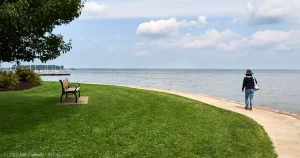
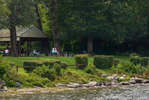
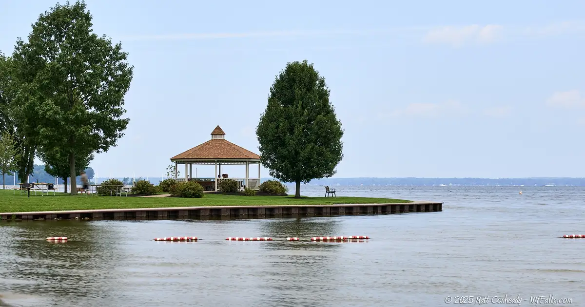
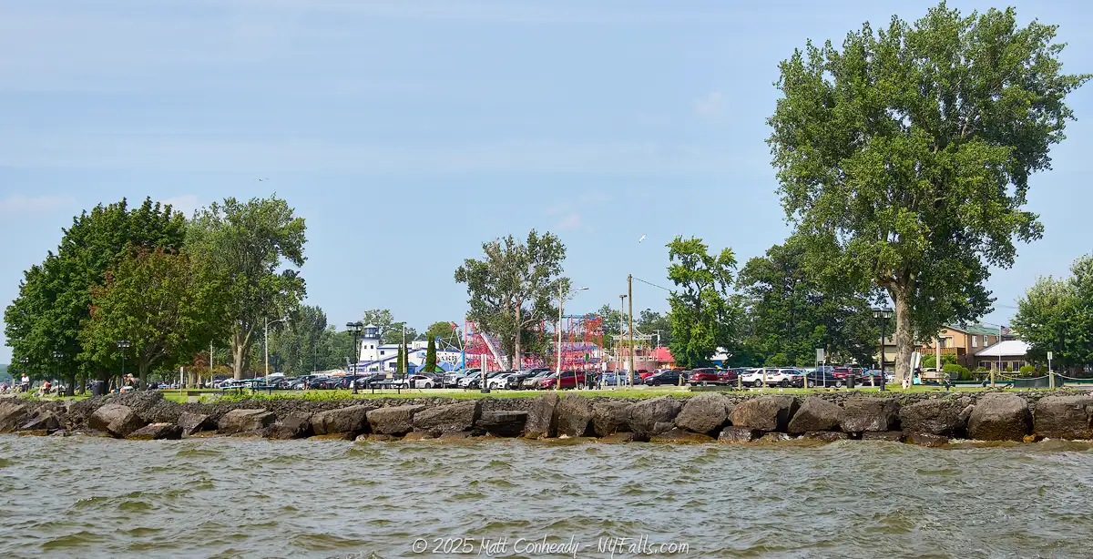
Joseph F. William Memorial Park
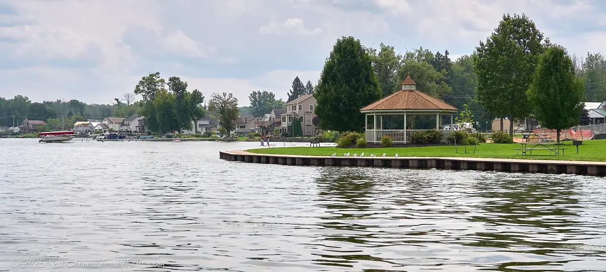
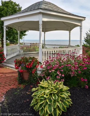
Description: A small, but beautiful town park in Cicero features a newly constructed splash pad and playground, three pavilions available for reservation, a picturesque gazebo often used for weddings and formal photographs, and a floating dock for fishing enthusiasts. Visitors can also launch non-motorized watercraft, such as canoes and kayaks, from the designated boat launch area. During the summer months, swimming at the sandy beach is the primary attraction, but families also gather to enjoy picnics, grilling, shuffleboard, and live concerts, all while taking in the beautiful sunset views. Despite its small size, the park’s design handles the traffic very well.
History Tidbit: Formerly known as Valentine’s Beach, after Captain Valentine Dunham, who settled offshore here at Dunham Island in the 1850s.
Seasons/Hours: Year-round, from 30 minutes before sunrise to 30 minutes following sunset.
Directions: Southeast side of the lake at 7033 Lakeshore Rd, Cicero, NY. Just east of Brewerton. Google Maps.
Parking: The park entrance leads to a small lot of 12 spots and a handful reserved for accessibility. Across Lakeshore Rd is a much larger lot with room for about 50 more cars.
Best time to visit: Summer.
Pets: Allowed, on a leash. Please clean up after.
Admission: Free.
Handicap accessibility: Paved pathways lead to most facilities. Beach and playground access is through sand.
Swimming: The guarded swimming beach is open Memorial Day weekend through Labor Day weekend.
Boat Launch: You can launch a canoe or kayak from the beach. The nearest trailer launch is at Oneida Shores County Park.
Accommodations: Restrooms; guarded swimming beach; bathhouse; picnic pavilions; gazebo; benches; picnic tables; grills; playground; splash pad; fishing dock.
Contact: Town of Cicero Parks and Recreation: 315-699-5233 ext. 345; [email protected]
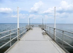
Oneida Lake South Shore Fishing Access Site
Description: The Oneida Lake South Shore Fishing Access Site is a state facility located off NY-31, approximately one mile east of the hamlet of Bridgeport and just west of Chapman Park. It has 4 concrete boat ramps and docks for fishing.
Seasons/Hours: Year-round.
Directions: South side of the lake on Bush Road. Take NY-31 (Lake Rd) and head north on Bush Rd to the end. Google Maps.
Parking: Parking for 100 cars and trailers.
Best time to visit: Summer. Also a good access point for ice fishing.
Pets: Allowed, on a leash. Please clean up after.
Admission: Free.
Handicap accessibility: Accessible.
Swimming: No swimming.
Boat Launch: 4 concrete ramps for trailer launching. No charge for use.
Accommodations: Boat launch; Fishing; port-a-potties (in summer).
Contact: DEC Region 7 Fisheries: (607) 753-3095; [email protected]
Chapman Park
Description: A 25 acre park in the town of Sullivan features ball fields, a large playground, picnic pavilions, and 500 feet of lakeshore. There’s no guarded beach for swimming here, but there is a concrete hand-craft launch and fishing pier, as well as beautiful views of the lake. While the park has 3 sizable picnic pavilions available for reservation, we didn’t see more than a few stray picnic tables or grills for anyone else when we visited in August, so it may not be an ideal spot to stop for a picnic. Town events are occasionally held here, including live music on summer Mondays.
Seasons/Hours: Daily, from dawn to dusk.
Directions: Located on the south side of the lake between Bridgeport and Lakeport at 1463 NY-31, Bridgeport, NY. The entrance may be easy to miss. Look for the green road sign for Chapman St.
Parking: There’s plenty of parking. For lake access, pass the first parking lot near the soccer fields and head past the pickleball courts to the main lot.
Admission: Free.
Handicap accessibility: Yes. Paved walkways link the parking lot with major facilities.
Swimming: Swimming is not permitted at this park, but when we visited in late summer some people were in the water. There is no lifeguard stationed in this park.
Accommodations: Restrooms; picnic pavilions with grills; playground; pickleball courts; soccer fields; baseball diamonds; volleyball court; basketball court; a few stray picnic tables; benches with views of the lake; concrete hand craft launch; walking path; fishing pier; lakeside music.
Contact: Town of Sullivan: 315-687-3471; [email protected]
Verona Beach State Park
Description: Verona Beach State Park, located on the eastern shore of Oneida Lake spans 1,735 acres and offers a diverse array of recreational activities. The park features a beautiful 450 ft long sandy beach, shaded picnic areas, and a 45-site campground adjacent to the water. Along its 3,000 ft of shoreline there are 5 picnic pavilions, plenty of tables and grills in the shade and wonderful views of the lake. In summer, the place is packed. Music is playing, families are grilling, and everyone else is splashing in the water.
While the entrance and parking lot leads to the busy beach section, most of the park is actually away from the shoreline spread out to the east. 13 miles of hiking trails wind through this area allowing people to escape the crowds. Its varied habitats, including the lake, Black Creek, cattail marshes, and bottomland hardwood swamps, make it one of the most ecologically diverse areas in Central New York.
Maps: Park and Trail Map (PDF); Campsite Map (PDF);
History Tidbit: Prior to its establishment as a state park, the area was known as Nabor’s Grove, a privately owned tract that preserved many large trees, contributing to the mature forest present today. In 1944, the New York State Council of Parks approved the initial acquisition of land for the park. By 1962, the park had expanded to 1,355 acres through multiple land purchases, and further acquisitions in 1969–70 increased its size to the current 1,735 acres.
Seasons/Hours: The park is open year-round, usually daylight hours, with specific facilities such as the beach and campground typically available from late May through early September.
Directions: On the east side of the lake in the village of Verona Beach, just south of Sylvan Beach. 6541 Lakeshore Road South, Verona Beach, NY 13162. Google Maps.
Parking: Plenty of parking in the main lot off of Lakeshore Rd S. Room for a few hundred cars.
Best time to visit: Summer weekends or fall season for the trails (be cautious in hunting season).
Admission: $7.00 vehicle entry fee.
Pets: Allowed on the grounds, on leash, with proof of inoculation.
Handicap accessibility: Restrooms and picnic facilities are accessible. Paved walkways span the shoreline and offer excellent views of the beach. The hiking trails are not accessible.
Swimming: Yes, in guarded areas only.
Boat Launch: You can hand launch small craft from the shoreline north of the swimming beach in the camping area. The nearest trailer launch is the Cove Road State Boat Launch north of here on Fish Creek.
Accommodations: Guarded swimming beach; Bathhouse with showers; Camping with 45 sites (with electric); hand boat launch; picnic pavilions; picnic tables; grills; snack bar (fast food and beverages); trails with interpretive signs; birdwatching; hunting; X-country skiing.
Contact: New York State Parks: (315) 762-4463; Reserve a pavilion or campsite.
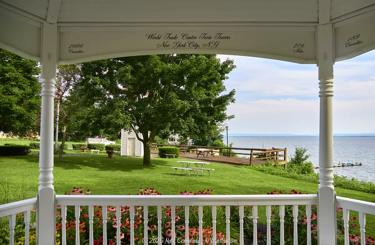
Verona Beach Lighthouse
Description: Standing at 85 feet tall, the “lighthouse” is an active navigational aid located on the eastern shore of the lake in Verona Beach, just north of the state park. It’s not a true lighthouse as there is no residence attached, and is typically referred to as a beacon. Constructed in 1917, it is one of three beacons built to assist navigation following the opening of the Barge Canal and is technically a part of that system. The light is very easy to miss. It’s buried in a residential area near the shoreline, and honestly, I missed it entirely. It sits within a small park area with stone benches and historical signage. There is a little sliver of beach that appears to be a part of this park, bordered on each side by private property.
History Tidbits: Designed in 1915 by Lupfer & Remick, Engineers & Contractors of Buffalo, NY, the lighthouse was completed in 1917 to aid vessels navigating the newly expanded Barge Canal system which connected with Oneida Lake in Verona Beach. Over time, the structure faced deterioration until the Verona Beach Lighthouse Association undertook significant restoration efforts beginning in 2002. The lighthouse now serves as a beacon for mariners and a historical landmark for the community.
Seasons/Hours: Year-round, 24 hours a day. The beacon light at the top and the exterior of the structure is illuminated at night.
Directions: North of Verona Beach State Park on 4th Ave. From Route 13, turn west onto Oneida Street, then south (left onto Forrest Ave). Look for the blue sign. Google Maps.
Parking: There is a paved lot adjacent to the lighthouse off of 4th Ave. Room for only a few cars.
Best time to visit: Year-round.
Admission: Free.
Pets: Allowed, on leash.
Handicap accessibility: Paved walkway surrounding the lighthouse.
Swimming: No.
Boat Launch: None.
Camping: No.
Accommodations: Benches; Historical signage; Lake views; The interior of the light is off limits.
Contact: Verona Beach Lighthouse Association: [email protected]
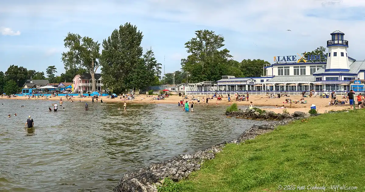
Sylvan Beach Waterfront
Description: Located on the eastern shore of Oneida Lake, Sylvan Beach is a vibrant waterfront community renowned for its summer resorts and cottages, sandy beaches, amusement park, and recreational opportunities. The area offers a blend of family-friendly attractions, dining, and entertainment, making it a popular destination for visitors seeking both relaxation and adventure.
Sunset Park sits across Fish Creek from the community of Verona Beach. From here a paved walkway runs through a grassy strip of land between the lake and Sylvan Beach Amusement Park. The park offers a few horseshoe courts, picnic tables, benches and arguably the best sunset views. At the north end of the park is the bathhouse that serves the 5,000 foot long beach to the north. The beach, which gets more crowded the hotter the weather, runs along a series of resorts, eateries and cottages. East of those are Main St Park, which has a bandstand and summer concerts, and Memorial Park which extends it with additional greenspace and a playground. Between those parks and back at Sunset Park is the historic Sylvan Beach Amusement Park, with roots dating back to the 1870s. The small, but packed amusement park features a variety of classic rides that cater to thrill-seekers and families alike. The Galaxi Roller Coaster offers an exhilarating experience with its twists and turns, while Laffland, a traditional dark ride, delivers a spooky yet fun adventure. Family-friendly attractions like Bumper Cars and Bumper Boats provide interactive fun, and classic spinning rides such as the Tilt-A-Whirl and Scrambler add to the excitement. For younger visitors, Kiddieland features ten classic rides kids will want to continuously get back in line for. The whole place smells like popcorn, cotton candy, and funnel cakes, which is a good thing.
History Tidbits: Established as a resort area in the late 19th and early 20th centuries, Sylvan Beach has long been a favored getaway for residents of Syracuse and Central New York. The amusement park was originally a gathering spot for steamboat passengers and vacationers, and it evolved with the rise of amusement attractions in the early 20th century. By the 1920s and 1930s, it featured a variety of classic rides, games, and arcades, becoming a cherished lakeside retreat. Over the decades, the park maintained its nostalgic charm, preserving vintage rides and traditional midway games and attractions. Though it has seen periods of decline and restoration, Sylvan Beach Amusement Park remains one of the few vintage amusement parks in operation today.
Seasons/Hours: The Sylvan Beach waterfront is accessible year-round; however, peak season typically runs from Memorial Day through Labor Day. During this time, the beach, amusement park, and most attractions operate daily, with varying hours. Off-season, some facilities may have reduced hours or be closed, so it’s advisable to check specific venues for current schedules.
Directions: North of Verona Beach State Park and Fish Creek. Take NY-13 and exit where the signs say “Amusement Park” and “Beach.” Google Maps.
Parking: The primary lot for visitors is off of Sunset Ave near Sunset Park by the Lake. Alternative parking can be found on Canal Ave along Fish Creek or Spencer Ave by NY-13. If those lots are full, you may need to drive north to find street parking. Parking in the official lots will incur an hourly charge or $10 for a full weekday, $12 on weekends. Charging stations are available on Spencer Ave.
Best time to visit: Early or late summer (still summer but fewer crowds).
Admission: Walking the village, parks, and using the beach is free. The amusement park is free to walk, but rides and games have various prices.
Pets: Allowed, on leash in the village, but not allowed on the beach, picnic area, or in buildings.
Handicap accessibility: Paved walkways throughout the village and parks. Some facilities are not accessible, especially the historic buildings in the amusement park. The beach is not accessible, but can be seen from various paved walkways and the decks of adjacent restaurants and bars.
Swimming: Yes. From Memorial Day weekend through Labor Day weekend.
Boat Launch: None. The closest launch is the Cove Rd State Boat launch on Fish Creek west of here.
Camping: There are several hotels, motels, inns, and cottages in the village. The closest campgrounds are at Verona Beach State Park (south on NY-13) and Lone Pine Campgrounds on 16th Ave.
Accommodations: The village has: massive guarded swimming beach; picnic tables; grills; benches; bathhouse; public restrooms (at Sunset Park and Carello’s Corner); Amusement park with adult and kids rides, arcade machines, midway games and carnival food; playgrounds; lodging; restaurants; bars; live music; summer events.
Contact: Sylvan Beach Tourism: [email protected]


Godfrey Point DEC Boat Launch
Description: The Godfrey Point DEC Boat Launch is a well-maintained facility located on the north shore of Oneida Lake in Vienna. It’s small with a single concrete ramp (with space for 2) and not much else.
Seasons/Hours: Open year-round, but the launch may close in the winter months when launching is not possible.
Directions: North side of the lake, east of Cleveland. Take NY-49 to Drive 9 and follow it south to the lake. Google Maps.
Parking: The lot has room for 56 cars and trailers.
Best time to visit: Early morning.
Admission: Free.
Pets: Allowed, on leash.
Handicap accessibility: Accessible.
Swimming: No.
Accommodations: Just the boat launch.
Contact: DEC Region 7 Fisheries: (607) 753-3095; [email protected]
Cleveland Dock Fishing Access Site
Description: A small state fishing access and picnic site at the mouth of Black Creek in the village of Cleveland. It has an illuminated fishing area with paved sidewalk, timber guide rails and benches. It provides access to the lake year-round.
History Tidbits: The village of Cleveland is named for James Cleveland, who settled here from Peterboro, Conn. in 1826. He built the first hotel and store. This site used to be the shipping center for village industry, which included glass, sashes and blinds, and leather goods. Its use grew when the state acquired it in 1917 as a part of the integration of the lake into the Barge Canal system. Large wood storehouses once stood here. For the last 100 years the site has been a popular fishing spot on the lake and it was restored and modernized in 2020.
Seasons/Hours: Year-round, day and night. Lamps illuminate the fishing area at night.
Directions: North side of the lake in the village of Cleveland, east of Constantia. Turn south onto Apps Landing, which is unmarked (look for the pink and grey bait shop shack). Google Maps.
Parking: The parking lot has room for 17 cars. If the lot is full, you are out of luck as street parking in the vicinity is not possible.
Best time to visit: Year round. A good place to access the lake in winter for ice fishing.
Admission: Free.
Pets: Allowed, on leash.
Handicap accessibility: Accessible. There are reserved parking spaces, an even paved fishing area, and accessible railings.
Swimming: No.
Boat Launch: Hand launch only. The closest trailer launch is at the Godfrey Point DEC Boat Launch 2 miles to the east.
Camping: Nearby camping sites include: Stone Barn State Forest to the north for primitive camping or Whispering Woods Campground to the northeast for more amenities.
Accommodations: Fishing; Ice Fishing; Port-a-potty (warm seasons); Benches; Picnic table; Bait shop; the village has a few restaurants.
Contact: DEC Region 7 Fisheries: (607) 753-3095; [email protected]
Lakeview Park
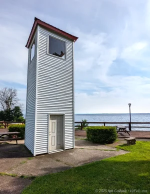
Description: A small lakefront park in the village of Cleveland has beautiful views of the lake, a white gazebo, benches, and a 2-story white wooden tower (I have no idea what it is). There’s not much to this 1-acre park, but it is a peaceful spot for a picnic.
History Tidbits: Beginning in the late 1800s, the waterfront here was filled with shops and inns supporting the village’s burgeoning industry. A wheelwright shop stood here around 1867.
Seasons/Hours: Year-round. Hours are not posted.
Directions: North side of the lake in the village of Cleveland, east of Constantia. 100-126 Lake St, Cleveland, NY 13042 Google Maps.
Parking: There’s parking for 20+ cars in the lot that parallels the park.
Best time to visit: Spring through Fall.
Admission: Free.
Pets: Allowed, on leash.
Handicap accessibility: There are no accessibility features.
Swimming: No.
Boat Launch: None.
Accommodations: Picnic tables (no grills); Gazebo; Benches; Lake views; The Cleveland House bar and grill is located right across the street.
Contact: Village of Cleveland: (315) 675-8611; [email protected]

David C. Webb Memorial Park at Taft Bay
Description: Commonly known as Taft Bay Park, this 15-acre town park is located on the northern shore of Oneida Lake in the hamlet of Bernhards Bay. The park features a small 100 ft sandy beach, picnicking facilities, ball fields, and playground. We found the park to be very clean and well-maintained. Several activities and events are held in the park throughout the year, including live music, fireworks, and a fall tractor show that brings in a variety of antiques, toys, and modern marvels. In winter, the park is an excellent lake access point for ice fishing.
History Tidbits: The park is named for David C. Webb, former Highway Superintendent and volunteer fighter fighter in the town of Constantia. “Taft’s Bay” is named for the Taft Family who were early settlers in the town.
Seasons/Hours: Year-round, daylight hours.
Directions: North side of the lake in the hamlet of Bernhards Bay, town of Constantia. Just off of NY-49. Google Maps.
Parking: The park road leads to a paved parking lot with room for 50+ cars.
Best time to visit: Year round. A good place to access the lake in winter for ice fishing.
Admission: Free. Note that some recreation programs that happen in the park, such as swimming lessons, trunk-or-treat, and food programs are for the local community only.
Pets: Allowed, on leash. Not allowed on the beach.
Handicap accessibility: Some. The parking lot leads to a paved path that encircles the ball fields, leads to the bathhouse, and a pavilion. The beach and playground are not accessible.
Swimming: Yes, in the guarded swimming area. The beach is generally open from Memorial Day weekend through Labor Day Weekend.
Boat Launch: Hand launch only. The closest trailer launch is at the Godfrey Point DEC Boat Launch to the east.
Accommodations: Guarded swimming beach; Bathhouse; Veteran’s memorial; Walking path; Picnic tables; Grills; Playground; Benches; Basketball courts; Tennis court; Volleyball court; Softball diamond; Pickleball court.
Contact: Town of Constantia: (315) 623-9206; [email protected]

Three Mile Bay Wildlife Management Area
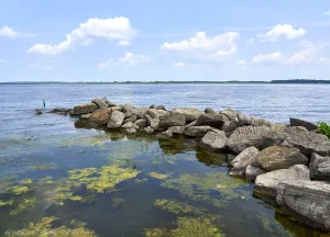
Description: Formerly known as Toad Harbor Swamp, Three Mile Bay WMA encompasses approximately 3,966 acres adjacent to Three Mile Bay on the northwestern shore of Oneida Lake in the towns of Constantia and West Monroe. This diverse habitat includes swamps, marshes, and upland ridges, providing a sanctuary for a wide array of wildlife, including several migratory waterfowl. The land is mostly swamp, but there are trails that go as far in as they can in little islands of land, each stemming from the parking areas. Phillips Point is a popular fishing and birding area and accessible via a dirt road.
Bordering the north end of the WMA is the town of West Monroe’s Memorial Park (often referred to as Depot Rd Park) which has restrooms, a pavilion, ballfields, a playground, and some trails that lead into the WMA land.
The Toad Harbor Fishing Access Site, located on the south side off of Shaw Rd., is a small dirt parking area with access to a secluded and open area in the wetland that offers excellent fishing opportunities.
Map: Map and Information (PDF).
History Tidbits: In the 1920s, some of the wetlands were cleared for muck farming, which were subsequently abandoned in the 1930s. The state of NY acquired the land in the 1950s through Pittman-Robertson Funds, with additional acreage added under the 1962 Recreational Bond Act. The primary purpose of Three Mile Bay WMA’s establishment was originally the development and preservation of waterfowl habitat. Over the decades, management efforts have focused on maintaining and enhancing habitats to support more diverse wildlife populations, particularly waterfowl species.
Seasons/Hours: Year-round.
Directions: Northwest side of the lake, near Brewerton. Toad Harbor Rd is the primary avenue to access it.
Parking: There are a few parking areas that provide access. On the northwest, a grassy pullover off of Toad Harbor Rd (map) accesses an “island” surrounded by swamp. Further south on this road has a small gravel lot (map) on another “island.” Near the south end of the road, there are two lots. The first is by a large open field (map) and the most southern (which may be closed off by a gate at times) is at Phillips Point (map) for fishing, hand craft launching, and birdwatching is typically done. There’s another parking area on the northeast side at the intersection of Wheeler and W roads (map) that lead to another “island.”
Toad Harbor Fishing Access is located at the west end of Shaw Rd (map). The dirt parking lot is just past the entrance.
Best time to visit: Year round. Some roads and trails may be inaccessible in winter or the wet season when dirt roads become muddy. For hunting and fishing, appropriate seasons as defined by state regulations.
Admission: Free.
Pets: Allowed, on leash. Not allowed in Memorial Park.
Handicap accessibility: None.
Swimming: No. Definitely don’t swim here.
Boat Launch: Hand launch only at Phillips Point at the south end of McLoud Rd.
Accommodations: Hunting; Fishing; Bird Watching; Hand boat launch; There are trails, but not enough for satisfying hikes. Memorial Park to the north has typical “Park” amenities.
Contact: Wildlife Manager, NYSDE Bureau of Wildlife: (607) 753-3095 ext. 247
Fishing Information
Common species
Walleye: One of the most sought-after species, known for their elusive nature and delectable taste.
Largemouth and Smallmouth Bass: Popular among sport fishers for their fighting spirit.
Yellow Perch: Abundant and favored for their flavorful fillets.
Northern Pike and Chain Pickerel: Predatory fish that offer a thrilling catch.
Panfish: Including bluegill, pumpkinseed sunfish, and black crappie, ideal for anglers of all ages.
Others: Such as freshwater drum, bowfin, longnose gar, and the occasional lake sturgeon (note: lake sturgeon are a threatened species in New York and must be released immediately if caught).
Popular fishing spots
Oneida Shores Park: Located on the south shore, this park provides shore fishing opportunities and a boat launch.
Godfrey Point Boat Launch: Situated on the north shore, offering access to deeper waters favored by walleye and bass.
South Shore Fishing Access Site: Provides access to central parts of the lake, popular among anglers targeting a variety of species.
Chapman Park: Located on the south shore, has a nice pier for fishing.
- Cleveland Dock: Recently renovated fishing access site.
Fishing conditions
The Oneida Lake Anglers Facebook Group is a great resource for conditions.
Nearby Waterfalls


Interesting Stuff
Three Sisters of Oneida Lake
The “Three Sisters” of Oneida Lake refer to three identical lighthouses constructed around 1917 to aid navigation along this 22-mile-long waterway as it became a critical part of the Barge Canal system. These lighthouses are strategically positioned at Verona Beach, Frenchman Island, and Brewerton, serving as crucial beacons for vessels traversing the lake and connecting to the canal. Despite lacking keeper’s quarters (so they aren’t true lighthouses) and their position on very small properties, these structures have remained operational since their inception and are now kept operational for historic and navigational purposes.
In recent years, efforts have been made to preserve and restore these historic lighthouses. The Verona Beach Lighthouse has seen significant improvements, including landscaping, the installation of granite benches, and the addition of informative kiosks. Unfortunately none of the lighthouse interiors are open to the public officially. The Frenchman’s Island light is relatively abandoned and at times the lock is pried off and visitors take the risk of climbing the stairs inside. See their locations on a map.
Field of Screams
A highly-rated haunted walk in Vienna on the northeast side of the lake, near Sylvan beach. Located on NY-49, it’s open on weekends through October and one special night in December for a Krampus event. More info.
Fort Brewerton
A small historic site houses a reconstruction of an Oliver Stevens Blockhouse that serves as a museum packed with artifacts and information about the fort (which no longer exists, but the foundation is visible.) as well as the early settlement of Brewerton. Map.
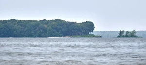
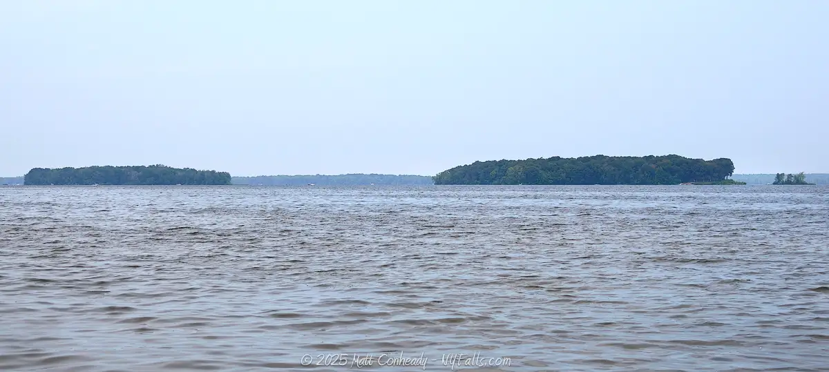
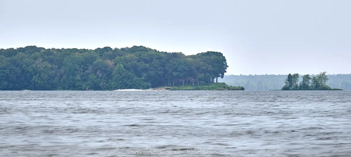
Oneida Lake Islands
There are two distinct islands on Oneida Lake. The two most prominent are Frenchman’s and Dunham Islands on the west end of the lake and easily visible from Joseph F. William Memorial Park. Frenchman’s Island is about 26-acres in size and was historically known as “Seven Mile Island” during the American Revolution and called Kah-wha-nah-kee by the Onondaga people before that. The island’s current name originates from a legend about an elite French couple who, from 1791-1793, sought refuge on the island after eloping from France (although some sources say it was to escape “The Great Terror.”) They established a home and lived there for several years before eventually returning to their homeland (upon the wife’s father’s forgiveness). While I’m sure a lot of the name’s origin has been twisted over the years, an account of a French woman living on the island was documented in the journal of Francis Andrian Vanderkemp, a Dutch pioneer who carried about an expedition in this area in 1792. His journal states:
Our path, gradually increasing in breadth, did lead us circumference of a cleared circle surrounded with lime-trees; at both sides of the path was planted Indian corn, already grown from four to five feet, while a few plants towards the middle of this patch were six feet long, and this in the middle of June. A small cottage of a few feet stood nearly in the centre of this spot. It had a bark covering and, to the left of it, a similar one three-fourths uncovered, and appropriated for a kitchen. Here was the residence of Mr and Madame des Wattines the Hollander’s rendering of French name with their three children. They lived without servants without neighbors without a cow lived as it were separated from the world.
Des Wattines sallied forward and gave us a cordial welcome in his demesnes. The well-educated man was easily recognized through his sloven dress. Ragged as he appeared without a coat or hat his manners were those of a gentleman; his address that of one who had seen the higher circles of civilized life. A female, from whose remaining beauties might be conjectured how many had been tarnished by adversity, was sitting in the entrance of this cottage. She was dressed in white, in a short gown and petticoat garnished with the same stuff, her chestnut brown hair flung back in ringlets over her shoulders, her eyes fixed on her darling Camille, a native of this isle, at her breast; while two children, standing at each side of her, played in her lap. Her appearance was amiable indeed; a wild imagination might have lost herself, and have considered the wearied, toiling Des Wat tines as the magician who kept this beautiful woman in slavery, but ere soon the charm dwindled away. Esteem for the man filled our bosom, and when you considered how indefatigably he must have exerted himself, what sacrifices he must have made, what hardships endured to render her situation comfortable, and rear roses for her on this island, so deep in the western wilderness then, notwithstanding all the foibles which a fastidious, cool observer might discover at his fireside, in a character and conduct as that of Des Wattines, he becomes an object of admiration. I at least gazed at him in wonder. Des Wattines introduced us to his spouse. She received us with that easy politeness, which well-educated people seldom lose entirely, and urged, with so much grace, to sit down, that we could not refuse it with out incivility. This couple was now in the second year on this island, and all the improvements which we had seen were the work of Des Wattines hands exclusively.
In the late 19th and early 20th centuries, Frenchman Island became a popular resort destination, featuring a two-story inn and recreational facilities. Visitors would arrive by steamboat to enjoy activities such as boating, fishing, and even bowling. Today, the island is uninhabited, with remnants of its past, including an abandoned lighthouse constructed in 1917 as part of the New York State Barge Canal system. The island is open to the public for recreational use and is managed as part of the Three Mile Bay Wildlife Management Area. It’s only accessible by boat.
East of Frenchman’s Island is Dunham Island. While less documented, Dunham Island has been a point of interest for local residents and visitors, despite being privately-owned, often used for picnicking and as a scenic stop for boaters. It’s named for a previous land-owner, Captain Valentine Dunham (for which Valentine’s Beach, now Joseph F. Williams Memorial Park, was also named.)
Who to Contact
General water concerns:
Region 7 Bureau of Fisheries
Phone: 607-753-3095
E-mail: [email protected]
