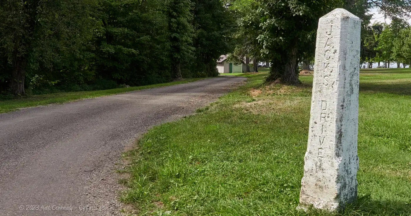
Ottaway Park


Location: On the east end of Lake Erie; north of the village of Westfield; town of Westfield; Chautauqua County; New York.
Maps: Google map; Topographic; Interactive map
GPS Coordinates:
- Park entrance: N 42.34409 / W 79.58025
- Waterfall on Doty Creek: N 42.34377 / W 79.58130
Directions: From east and west:
- Take I-90 to exit 60 for NY-394 toward Westfield/Mayville.
- Turn right (west) onto NY-394 W into Barcelona and follow for 0.3 miles.
- Turn right onto NY-5 and at 1 mile the entrance will be on your left. Turn into the entrance.
- The park road leads straight in and there will be one fork. Left goes to the pavilions and lower park. Straight goes closer to the lake and loops back.
Use Google Directions.
Parking: There are no lots. Park along the park road only. Do not block pavilion access.
Weather
Information / Accessibility / Accommodations
Seasons/Hours: Daily. Sunrise to sunset.
Admission: Free.
Best time to visit: Year-round.
Time: It’s a small park with not much going on. Lake views, some exploring, maybe a picnic. Plan on no more than an hour or two.
Handicap accessibility: There were no accommodations for wheelchairs when I visited in 2022.
Pets: Allowed on a leash.
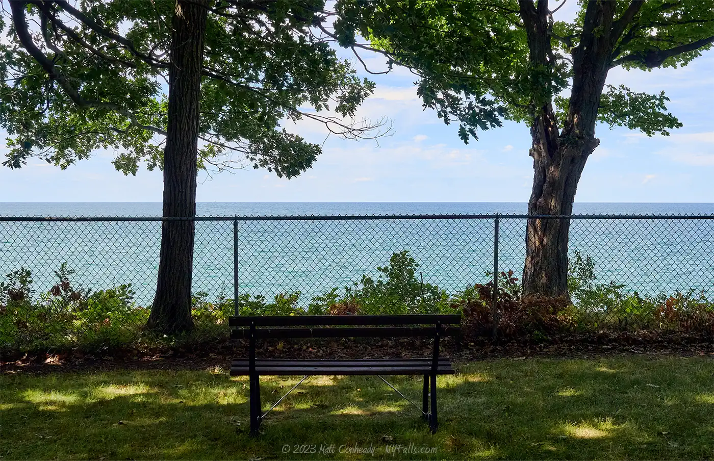
Swimming: No. The beach here is fenced off because it’s below a sheer cliff. There are a few ways to get around that fence, but considering waves tend to slam up against the cliffs, you would be risking injury or death swimming here on some days.
Boat launch: No boat launching here. If you need to launch, head a mile west to Barcelona Harbor.
Accommodations: Aside from views of the lake, there are:
- Open fields
- Pavilions
- Restrooms
- Shaded picnic areas with grills
- Small hiking loop
- Waterfall
Across the road is the Westfield/Lake Erie KOA for camping. Shops and restaurants can be found to the south in the village of Westfield.


Description
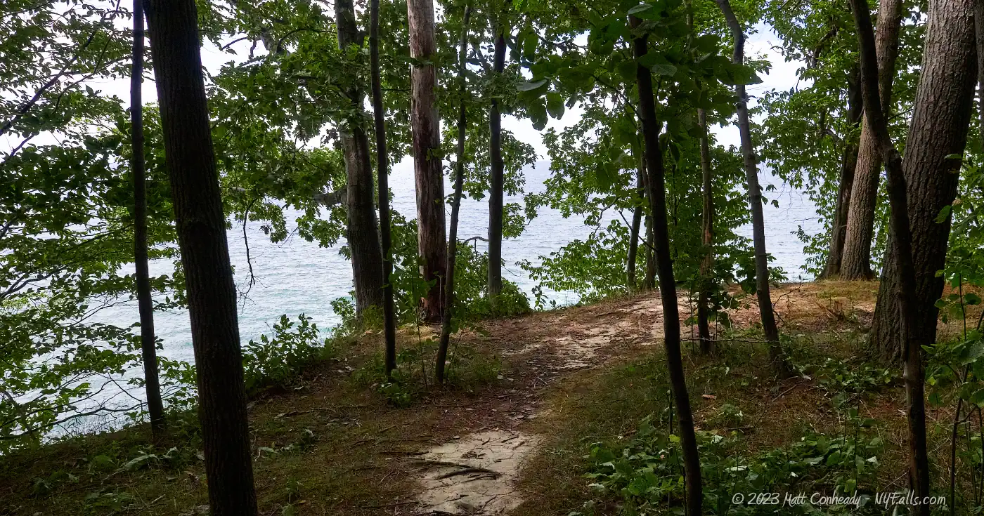
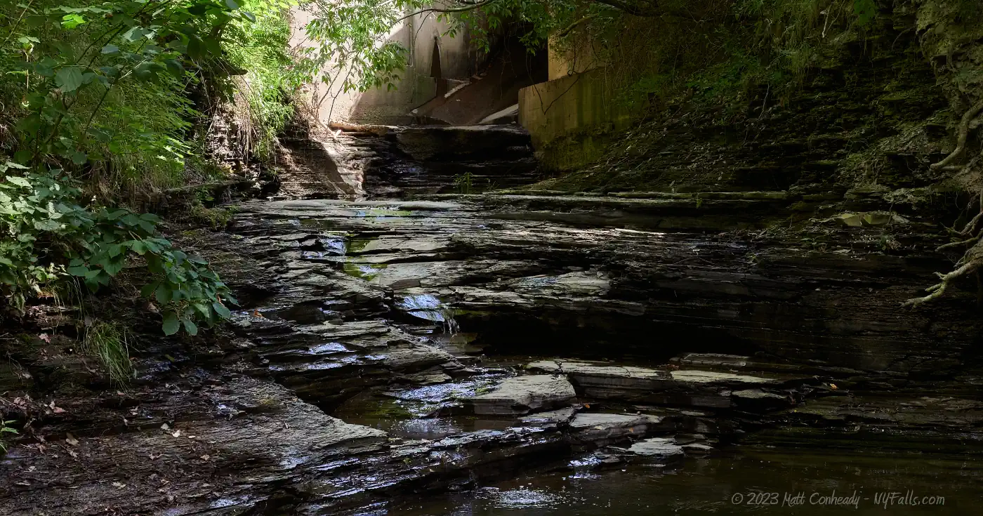
Ottaway Park is a 17-acre community-use park on the shore of Lake Erie, just east of Barcelona Harbor. The park sits above 20-ft tall cliffs over the lake, and for safety reasons access to the lake is fenced off, but views can be easily had. When we visited in 2022, the north-eastern end of the park had a small wooded area with a short trail that led right to the cliffs. The west side of the park is bordered by Doty Creek, with the park’s land ending in the middle of the creek (crossing to the other side would be trespassing). Where the creek emerges from the culvert under NY-5, there is a 2-tiered waterfall of about 6 ft in height just above a large plunge pool. The creek is relatively level the remainder of its journey to the lake. When lake levels are low, the creek will drop off of a small shelf of rock as it meets the lake, creating another waterfall. When high, waves often move up the mouth of the creek. A few paths lead down from the picnic area to the creek, providing access.
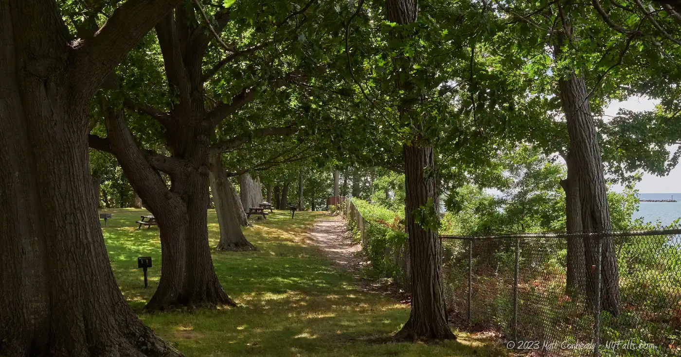
The park features two pavilions, one for very large gatherings, restrooms and several picnic tables and grills. There is a large grass field, but no ballfields. Across the street is the KOA Westfield/Lake Erie Journey campground, and while that popular campground is full of amenities, campers often cross over to enjoy the views and peace Ottaway Park provides.

History
Arthur Boorman Ottaway
The Ottaway family (from Kent County England) was one of the first to settle in Chautauqua County. Descendant Arthur B. Ottaway (May 8, 1854) attended Sherman Academy in Westfield. Intending to move on to college, he abandoned that idea for a time as the family farm needed help. Studying while balancing farm work, he moved on to teaching once he graduated. During his years teaching he studied law on his own, taking up an interest in the profession. He obtained a preceptorship under William Russell, Esq., refining his law skills, and eventually passed the bar in 1879. He worked his way up from junior to senior at Russell, Deckerman & Ottaway and then moved on to create the Ottaway & Munson firm.
Elected Chautauqua County District Attorney in 1884, he served in this position for 3 years while maintaining his private practice. After that, he served on the board of supervisors for the practice, being called upon for important cases. In January of 1906, he was appointed County Judge, by the Governor, and officially elected to the position later in the year. He was known for being extremely knowledgeable about the law, as well as being very accommodating, patient, and insightful to all parties of the court. He is noted as being one of the first critics of mass incarceration and formed a parole system of sorts, long before this was a practice in the state. Chautauqua County was the first of rural counties in the state to create a children’s court, for which Ottaway presided. He was a member of the Board of Education in Westfield for 2 decades and gained a reputation of working with the county’s youth, either by including them in politics and law, or helping them establish local business.
After he retired from the bench, he continued to work in private practice up until his death on Jan 10, 1927. His will designated his lakefront property, known as “Gas Springs” to the county to be used as a community park. Development of the property into the park took place over a decade. Two sets of stairs were built to take people down into the creek, and two wooden bridges took them to the other side. It had 71 picnic tables, lakeview benches, and a large playground.
Ottaway or Ottoway
The park signs, municipal websites, and modern news articles say “Ottaway,” while USGS and other maps have it listed as “Ottoway.” Which is it?
The Ottaway burial plot in Westfield Cemetery is marked Ottaway for all family members. His obituaries spell it with an A.
The Ottoway and Ottaway names are both used in Kent, England, where his family immigrated from.
Historic court documents, including those of State of New York Supreme Court, have not only Arthur’s name spelled as “Ottoway,” but also spelled the same way for his various firms. I could not find one filing with his name spelled with an A. This includes or references papers by his firms, and some documents of his court.
It very well could be both and that the family, at least Arthur, was pretty forgiving about the spelling. It could also be that the misspelling occurred perhaps on his law license and he just went with that. Or maybe it was misspelled upon immigrating and when he worked for the law, he felt obliged to use the proper spelling? Or that some people just got it wrong. I couldn’t find a true answer. If you know, please share.
Hiking / Walking Trails
Difficulty: Easy if you loop around the park. Moderate (and getting your feet wet) if you walk up the creek.
Distance: Our recommended walking loop is 0.4 miles. Walking up the creek is not a part of that loop.
Markings: Some dirt trails, some paved paths. Not labeled.
Description: From the end of the park road at the loop, head towards the fence and lake view.
- Head west/left along the fence and into the wooded, lower area of the park where there is another road loop.
- Continue west and you should see the creek.
- You can find a place to work your way down into the creek, walking downstream to the lake or upstream to the waterfall. Going in either direction, you will need to backtrack to get to the main walking loop.
- Stick to the park side of the creek. The other side is private property.
- Follow the lower park road north up the incline and you’ll be at the restrooms. Continue right/south until you link back up with the main park road.
- Turn left/north on the main park road and follow that back to the loop where you started.
Map: Check out the interactive map.

Ottaway Park Interactive Map
Fishing
Unfortunately, there are no suitable spots to fish from at this park. Head on over to Barcelona Harbor to fish.
Nearby Waterfalls


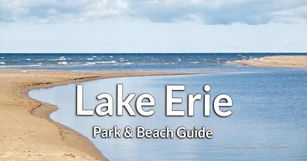
More Lake Erie Parks & Beaches
Find a new summer hangout spot or place to swim in our comprehensive guide to Lake Erie Parks and Beaches in New York State.
Who to Contact
Village of Westfield
716-326-4961
