Turning Point Falls (Rochester)


Location: Within Turning Point Park; city of Rochester; Monroe County; New York.
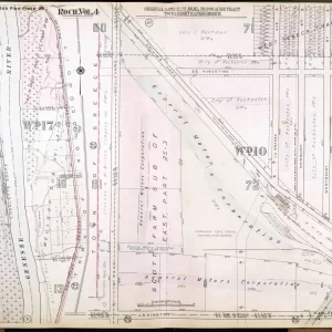
Maps: Google Map, Topographic; Interactive map; Genesee Riverway Trail Map.
GPS Coordinates:
- Parking: (N 43.22776 / W 77.61792)
- Red Falls: (N 43.23089 / W 77.62230)
- Brown Falls: (N 43.22385 / W 77.61762)
Directions:
- From NY-104/Ridge Rd, in the city of Rochester, take Lake Ave north for 2.25 miles.
- Make a right onto Boxart Street, and then make another right (still Boxart street).
- Head straight until you reach the parking lot for the park.
Or use Google Maps.
Parking: Park at the end of Boxart Street. Room for 30 cars.
Weather
Information / Accessibility / Accommodations
Number of falls: 2.
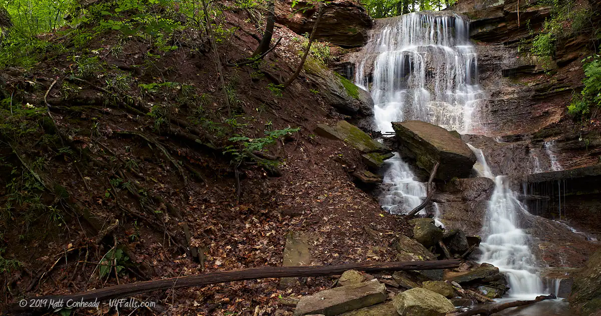
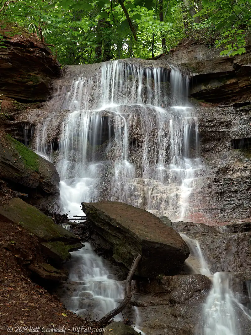
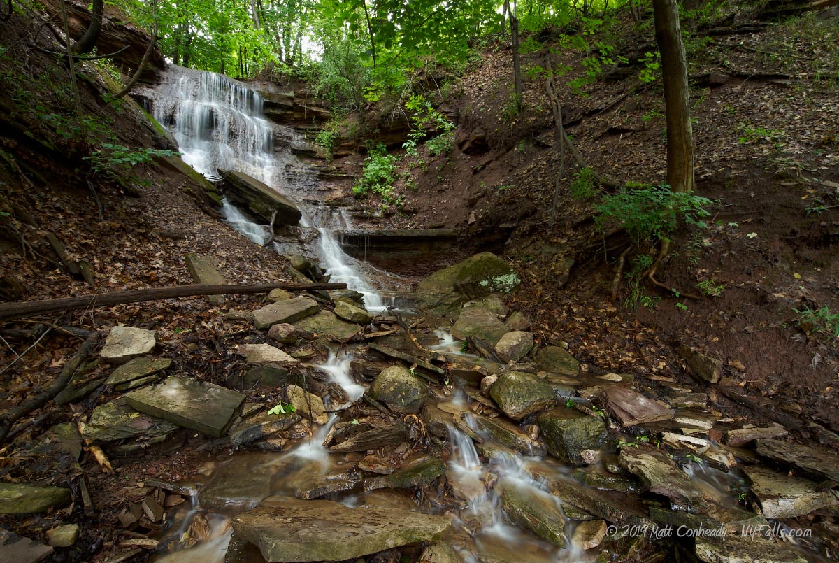
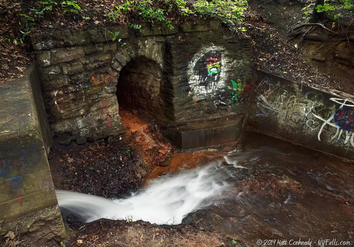
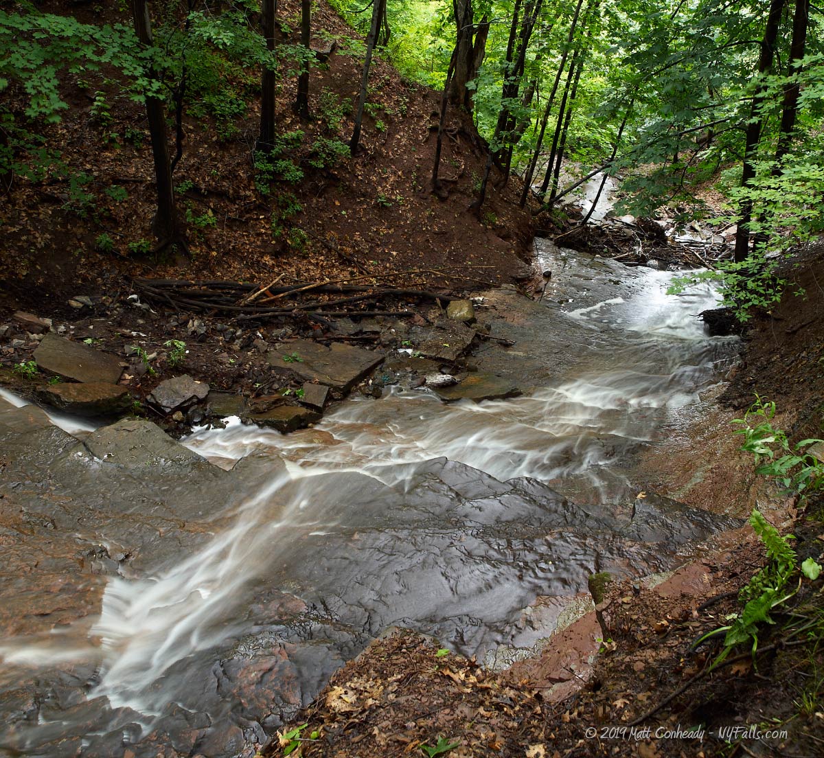
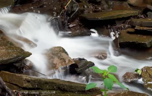
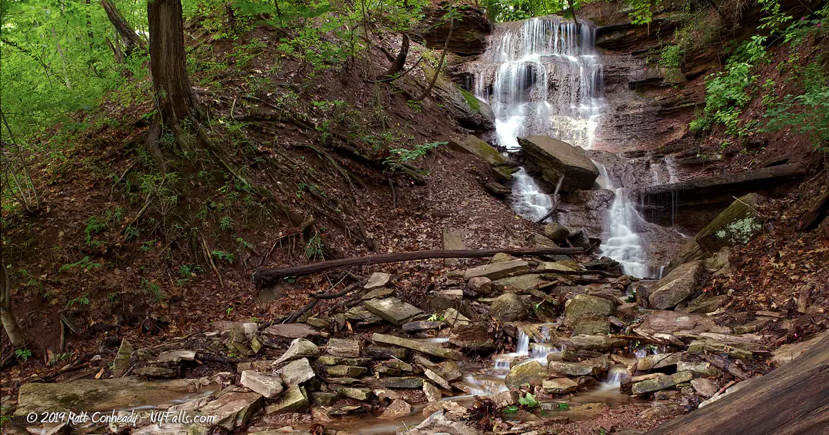
Size/Types: Red Falls is a seasonal cascade riddled with large rocks and downed trees (as well as some garbage). It starts its 60 ft journey from a culvert under the railroad tracks and flows down a layer of red sandstone part of the way.
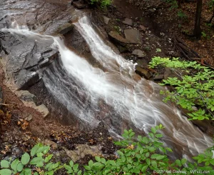
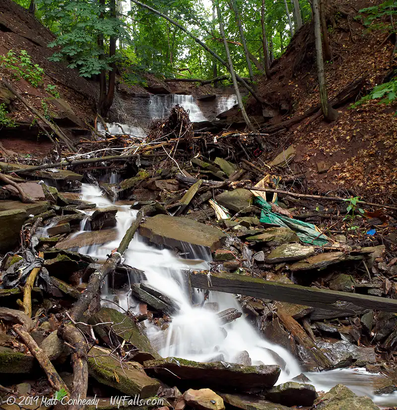
Brown Falls, is in a heavily wooded area in the southern end of the park, about halfway down into the gorge. It is a 35 ft high seasonal cascade.
Best time to visit: In winter or spring; after heavy rain or snow-melt.
Flow: Low.
Waterway: Unnamed seasonal tributaries into the Genesee River, which empties into Lake Ontario 2 miles to the north.
Time: Thirty minutes to an hour. Carefully scrambling to the bottom of each waterfall will take quite some time.
Seasons/Hours: Open year-round, from dawn until dusk.
Admission: Free.
Handicap accessibility: The paved portions of the Riverway Trail and from the parking lot to a lovely view of the gorge are accessible. Beyond that are steep gradients and irregular dirt trails.
Pets: Allowed in the park if on a leash. For your pet’s safety, and the safety of other hikers, keep your pet on the leash, and it’s recommended not to scale the cliffs with them.
Accommodations: Trails; informational signage; fishing access from the wooden docks.
Description
AKA: Bullock’s Woods Falls; Red Falls; Brown Falls
Rochester’s Turning Point Park is a wonderful slice of nature along the Genesee River in the highly developed Charlotte neighborhood. Just two miles south of where it empties into Lake Ontario, this stretch of the Genesee is wide and slow-moving as the steep gorge begins to taper off as it reaches the Port of Rochester. Turning Point Park serves as a family nature park and offers wonderful hiking, bird-watching and cross-country skiing opportunities.
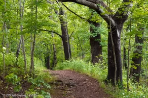
The park’s isolation and simplicity are its charm. Comprised of 275 acres of wooded hills, the slopes of the western river gorge, and marshland, it offers little in the way of typical city park attractions, other than hiking trails. The Genesee River Walkway, the pride of the city of Rochester’s trail system, winds through here, crossing the river’s large turning basin on a winding boardwalk, then continuing down a path laid over a century ago by the city’s trolley system that carried passengers to the bustling beaches at Charlotte.
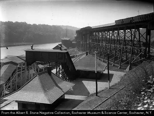
For bird-watching, the modern boardwalk and gorge overlooks are a combination that’s hard to beat so close to the city. Egrets, herons, swans, among others frequent the marsh along the shores. For history buffs, remnants of the old Genesee Docks, which helped make Rochester a major shipping hub on the Great Lakes, can be seen south of the turning basin along the western shore.
There are two seasonal waterfalls within the park. Red Falls, named for the iron-rich sandstone over which it flows, emerges from a culvert under a railbed, and tumbles down a debris-filled gorge about 60 ft and into to the river. Although not spectacular by any means, it can become considerably powerful during times of heavy rain, and is a worthy distraction if you are hiking the Riverway Trail. Brown Falls, which gets its name from the brown sandstone it flows over, is more classical in appearance and certainly less free from trash. It’s difficult to approach from below and often dry throughout the year.
If you can get to the park after a few days of rain, both waterfalls are easy to check out from the trails above, but getting to their bases becomes increasingly difficult as the muddy slopes of the Genesee Gorge are prohibitive to most hikers. Aside from the waterfalls, the Genesee Riverway Trail is a phenomenal trail system for all types of hikers, taking them across the Rochester stretch of the river to Lake Ontario, offering historical, geological, and biological facts along the way.
History
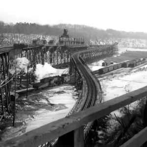
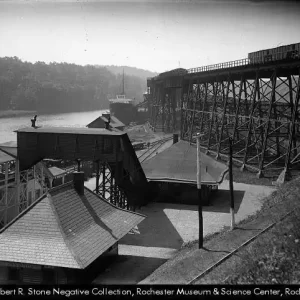
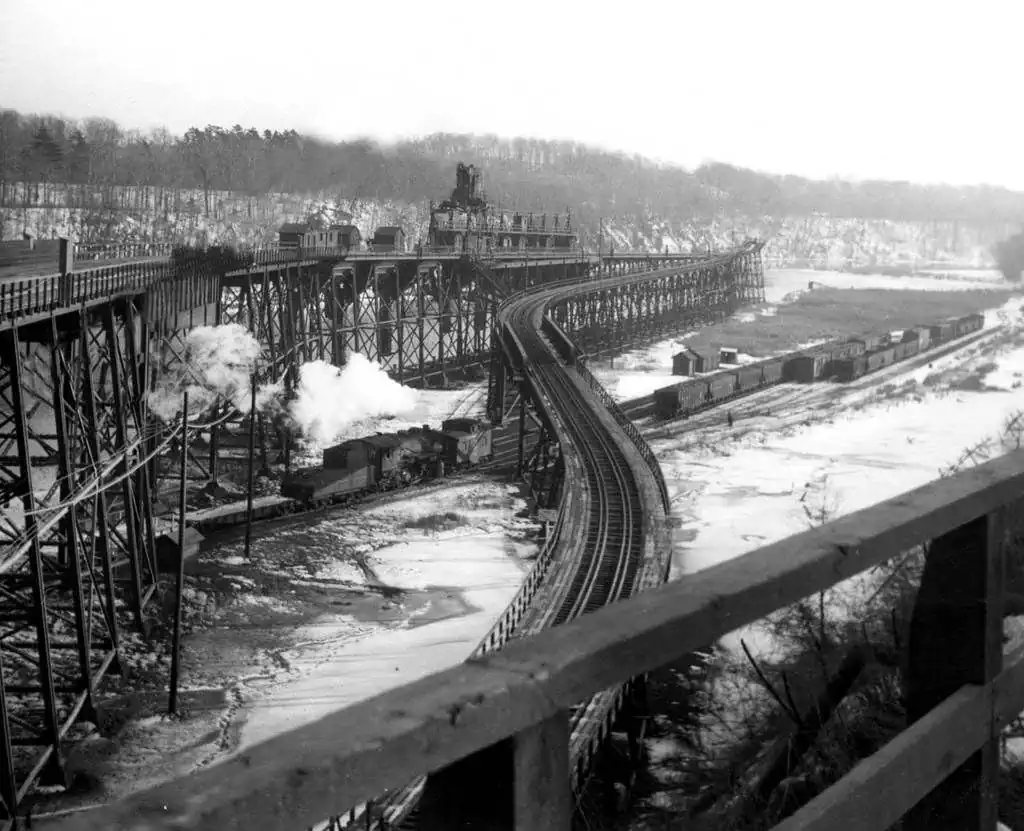
As Rochester grew as an industrious city, famous for its fine baking flour and manufactured goods, it started to become a major port along the Great Lakes. Rochester’s lakeside resorts, including one at nearby Ontario Beach also became a large draw for tourists, who arrived by ferry or trolley. Harbored docks along the Genesee accepted ships, dropping off and receiving goods that were carried on land by wagon or train. These large ships needed room to turn around in the river, and the wide breadth of the Genesee at this location served that purpose well.
The Buffalo, Rochester & Pittsburg Railroad (then bought out by the B&O RR) operated a major line that ran through what is now Turning Point Park. The majority of traffic through this turning basin was industrial raw materials (such as coal), while a smaller turning point almost 2 miles north (near Ontario Beach and the Port of Rochester) was primarily used for tourists. The BR&P RR’s facility along the Genesee was known as the Genesee Docks, and operated from 1889 until the 1970s.
In the 1970s the City of Rochester was entertaining the thought of constructing an oil receiving and storage facility along the shore south of the turning basin. A local environmental preservation movement pushed to stop the plans and preserve the area for community enjoyment. The city purchased the land and opened it as a municipal park in 1997.
In 2008, the 3,572 ft long, winding boardwalk over the turning basin and connecting trails won the American Public Works Associations’ “Transportation Project of the Year” Award.
Hiking / Walking Trails
Difficulty: Easy to get to the top of each waterfall. Difficult to approach the bottom.
Markings: Some paved trails within the park. Dirt trails leading tot he falls.
Distance: Two miles total to see each falls and then back to the parking lot.
Trail Guide:
- From the parking lot, head straight east to the gorge overlook for a beautiful view of the Genesee Docks below.
- Head north along the paved trail to Red Falls. This paved path is the former BR&P railway.
- Bear left when the trail splits (with the right path leading down into the gorge and to the boardwalk). You will enter a wooded area about a quarter mile in.
- Just before the waterfall, the path becomes dirt and gravel. You should be able to see the culvert and the falls below. If you’d like, carefully climb down the steep embankment to get to the base of the falls. Climb back up and retrace your steps to get back to the parking lot.
- To get to Brown Falls, head south past the parking lot along the paved trail.
- After about a quarter mile you should be able to hear the falls to your left. There is a parallel trail that runs to the left, and many shortcuts through the woods to reach it. If you can hear the falls, cut through to get to it. If not, keep heading south and eventually you will reach a switchback that will get you to the parallel trail. Follow it and listen for the falls within the woods to your right. It’s just over a tenth of a mile from the junction. Climbing down to the base of this falls is very difficult. Use caution.
- Go back the way you came.
Map: Interactive.
Turning Point Falls Interactive Map
Turning Point Falls Media

Interesting Stuff
Old Docks
Although much of the old port that existed here has been removed, remnants of some of the old docks (both wood and steel) exist along the marshy shore in ruins. The only modern dock is owned and operated by the Essroc Cement Corporation.
Rain garden
A special mix of plants lines a slope between the parking lot and the gorge. These plants help filter runoff from the parking lot, reducing the amount of pollutants that drain into the river. More information (PDF).
Photography Tips
Photographing the Falls
- If you will be climbing down to the base of these waterfalls, bring rope and pack your gear well. It makes it a lot easier.
- These waterfalls are seasonal and usually dry. Visit after long periods of rain.
Proper creek-walk footwear
- Wear the proper footwear for creek walking and climbing. Not only can a quality pair of water shoes prevent blisters and infection, they will help you stick better to the ground and reduce your risk of falling, hurting your self, or your camera gear.
Overcast skies
- Daylight will cast uneven shadows through the canopy and cause sunspots in your shots. It is best to wait for an overcast sky for this one.
Silky Water Effect
- To get that smooth cotton-candy look to the falls, you need to use a Neutral Density (ND) filter on your lens. The ND filter will block some of the light from entering the lens without altering the color, and thus allow your shutter to stay open longer. This blurs the water and creates a soft white gloss to the foamy areas of the falls. Check out the article for the all the details.
More tips
- See the Articles for more photography tips.
Who to Contact
City of Rochester
Operations Center
945 Mt. Read Blvd
Rochester, NY 14606
Phone: (585) 428-5990
cityofrochester.gov/des


