Buttermilk Falls State Park


Location: On the south end of Cayuga Lake; City of Ithaca; Tompkins County; New York.
Maps: Google map; Topographic; State Park Map (PDF); Trail Map (PDF); Campground Map (PDF); Interactive map
GPS Locations:
- Lower Park Entrance: (N 42.41761 / W 76.52318)
- Buttermilk Falls: (N 42.41501 / W 76.51930)
- Lake Treman: (N 42.39941 / W 76.51126)
Directions: To the lower parking area: Once in Ithaca, go Route 13 South for one and a half miles. Buttermilk Falls State Park will be on your left. Google Directions.
To reach the upper parking area, take NY 96B south of Ithaca, past Ithaca College, to King Road. Here, turn right, and follow the signs to the upper entrance, which is right before the bridge over Buttermilk Creek on your left. Google Directions.
Parking: Multiple parking lots throughout the park can hold more than 100 cars.
Weather
Information / Accessibility / Accommodations
Number of falls: 10.
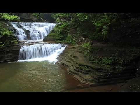
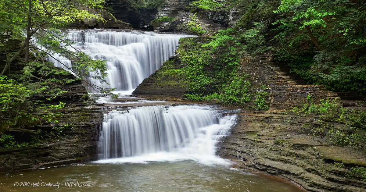
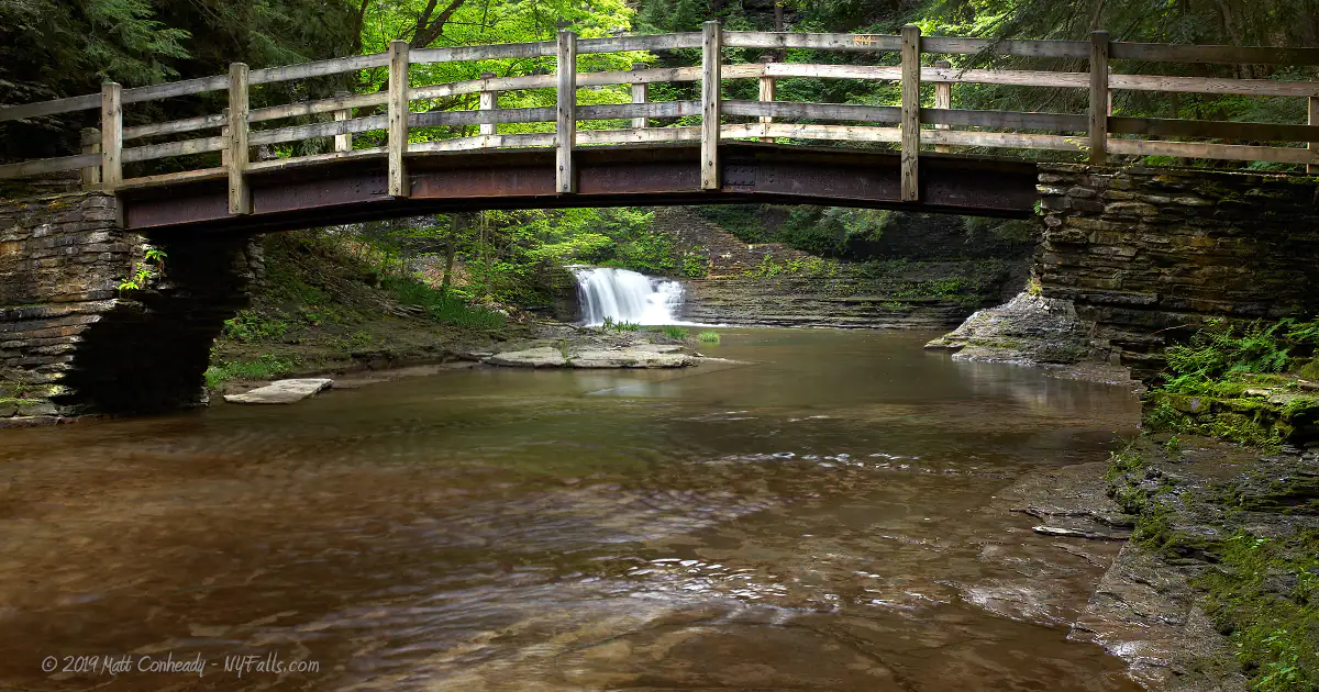
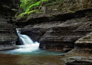
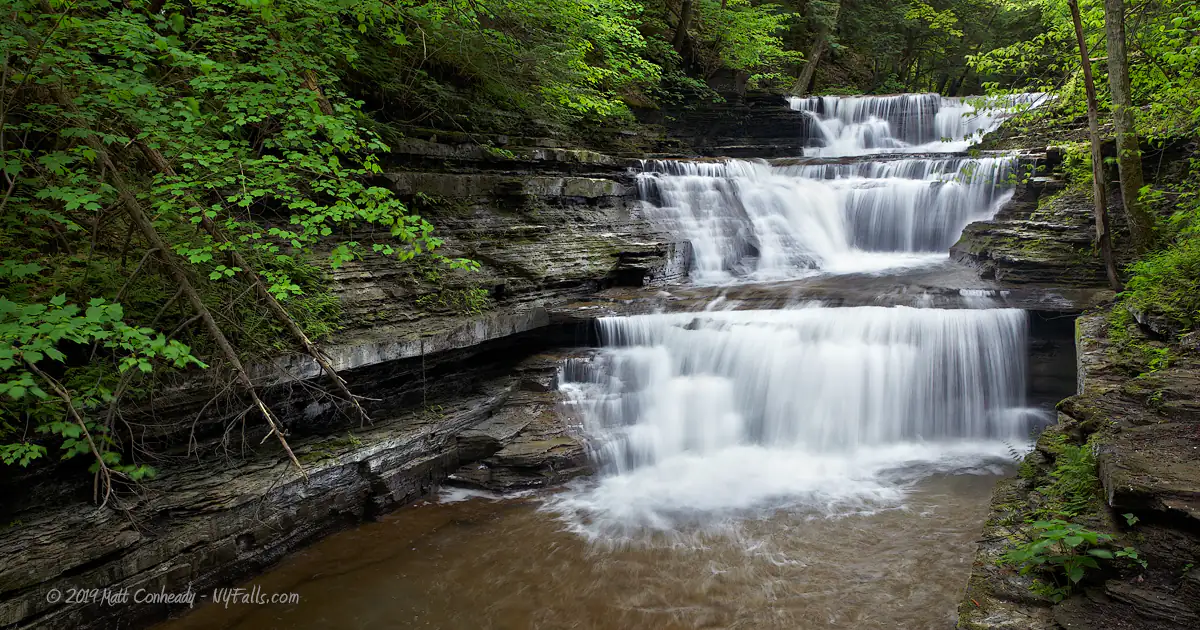
Buttermilk Falls, the main attraction, is directly accessible and visible from the parking lot in the lower area. Additionally, there are 9 or so other waterfalls, accessible by hiking the gorge trail, which you’ll find by crossing the bridge over the creek near the main parking area. Not all of the waterfalls are accessible to photography as the steepness and available angles in the gorge make it difficult.
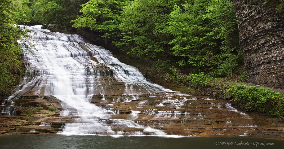
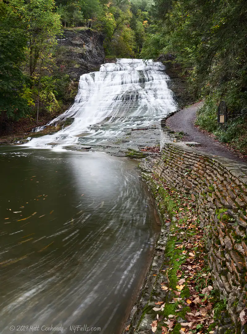
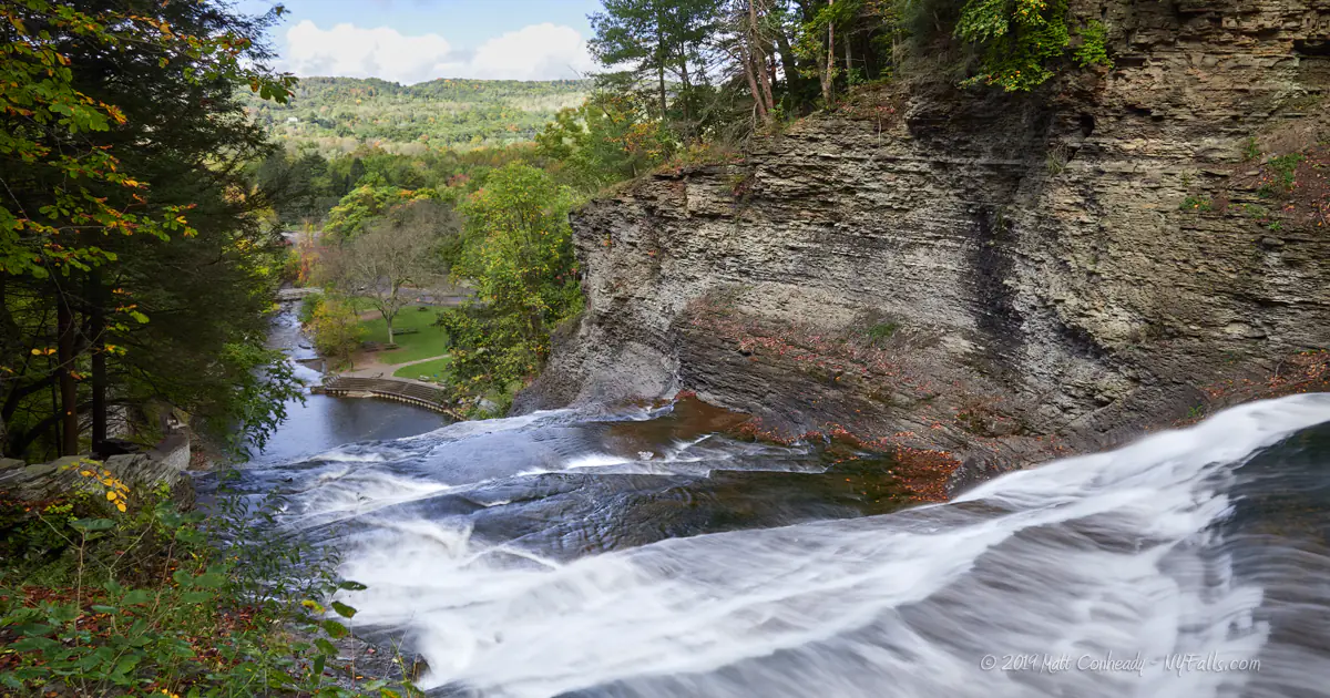
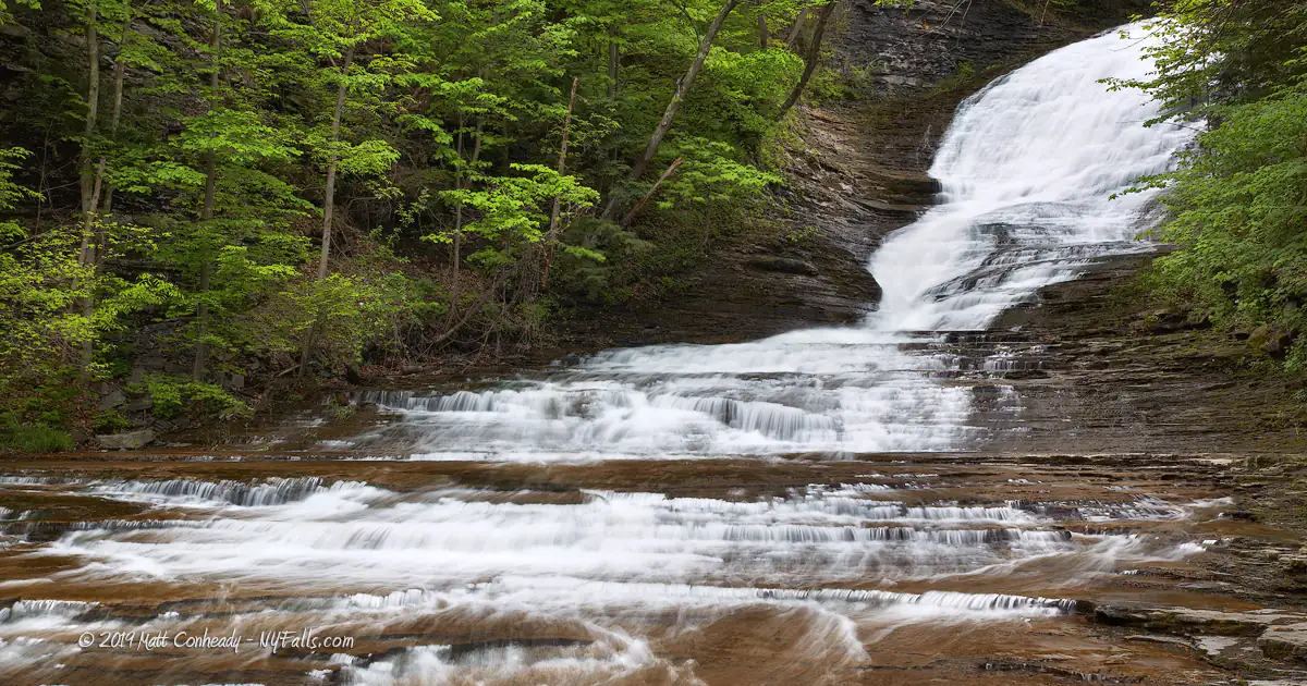
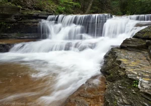
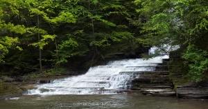
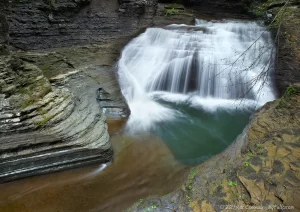
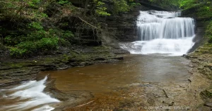
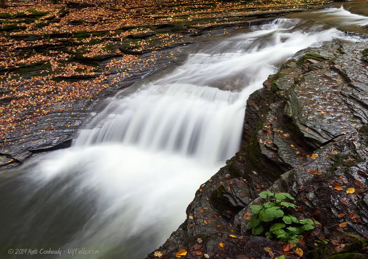
Size/Types: Cascades, staircases, segmented falls, and plunges. The main falls, or Buttermilk Falls, is 165 ft high, tumbling in a wide, frothy cascade. It is divided into two equally high segments (the ‘first’ and ‘second’ fall), with a twist around the gorge in-between. There are numerous cascades and plunges along the rest of the trail, varying from 5 to 35 ft in height.
Best time to visit: Spring, early summer, fall. The park’s trails are closed after November, but Buttermilk Falls is still accessible from the lower parking lot area.
Flow: Variable, depending on rainfall. May be a trickle in mid-summer.
Waterway: Buttermilk Creek, which begins in the Danby State Forest 3 miles south, runs north through the park, and then empties into the Cayuga Inlet, which leads to Cayuga Lake.
Time: 10 minutes for Buttermilk Falls and the swimming area. 1 hour for the gorge trail. 2-3 hours for the gorge and rim trails.
Seasons/Hours: Park open all year. All trails close November 10.
Parking: Multiple parking lots can handle up to 100 cars.
Admission: Vehicle entry fee of $9 collected 4/20 – 10/20 from 8:30am to 6pm daily
Handicap accessibility: Yes (for the parking area, swimming pool, and adjacent facilities. The trails are not).
Pets: Allowed on leash with proof of inoculation. Not allowed in the swimming area or on the gorge trail. For their safety and the safety of others, we recommend you do not take your pet on the gorge trail. Many pups have taken a tumble – don’t risk yours!
Swimming: Swimming in the natural pool below the falls is open from the last weekend in June through Labor Day weekend. Call (607) 273-5761 for a more precise swimming schedule.
Camping: 45 electric campsites and 6 cabins are available from May to October. Book a campsite.
Accommodations: Snack bar; nature trails; picnic tables; grills; vending machines (drinks); playing fields; pavilions; playground; restrooms; showers; fishing; hunting.
Description
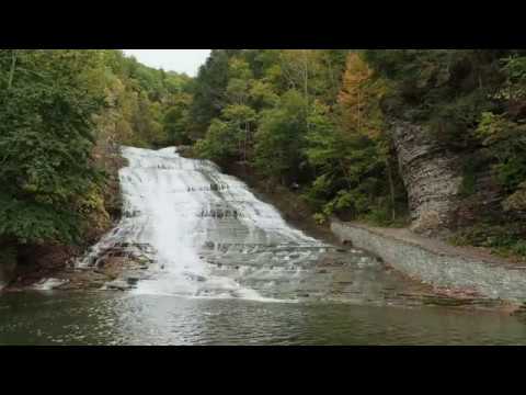
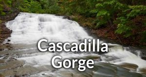
Buttermilk Falls State Park takes its name from its centerpiece, the classical 165 ft foaming cascade, enjoyed by thousands of visitors each year. The water mixes, twists and turns over the rock, looking indeed like creamy buttermilk as it reaches the bottom. Buttermilk Creek drops a total of over 650 feet through this valley toward Cayuga Lake, tumbling over ten distinct waterfalls along the way.
Buttermilk Falls State Park could easily be divided into two sections, upper and lower, each offering the visitor a uniquely beautiful experience. The lower park offers superb waterfall viewing and a great chance to swim in the wake of the colossal falls for which the park is named. A downstream dam deepens the plunge basin below the Falls, giving visitors this exceptionally cool and refreshing pool to relax and play in. This is the main draw of the park and it can get quite crowded on hot summer days.
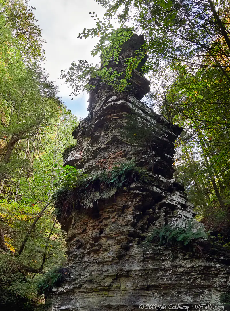
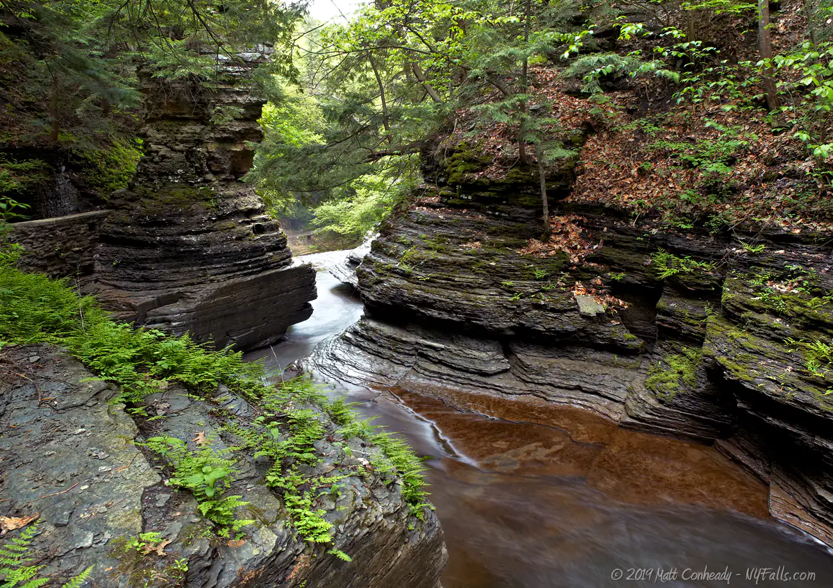
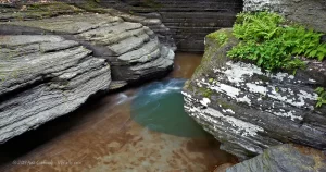
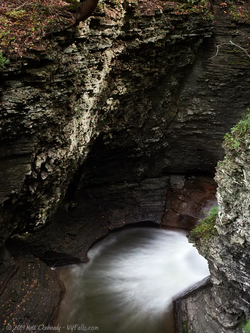
The lower portion of the gorge is reminiscent of intimate and saturated Finger Lakes gorges like Watkins Glen State Park. The waterfalls of Buttermilk Creek are typical of the area – multiple layers of loose shale and porous limestone, which has been cut by the erosive powers of the creek, sculpting a spectrum of cliffs and leaving numerous waterfalls of various shapes and sizes along the way. Here you will see pillars protruding from the glen, made of stone formed in the late Devonian age. Pulpit Rock, one of the more striking formations, oversees the roaring Pulpit Falls. Upstream Pinnacle Rock hogs all the attention. This 42 foot high spire, created by erosion and the expansion of a massive fault in the rock wall of the gorge, stands mysteriously alone in the creek bed. Potholes, carved by sand and pebbles caught in circulating creek currents can be found throughout Buttermilk Creek, giving the glen more character and color, with their deep bluish tint.
The upper park levels off as you reach Lake Treman. Numerous meadows provide for excellent vistas and plenty of opportunities for viewing wildlife. A campground gives visitors a chance for an extended stay. The 60 campsites present in the park offer no utilities, but are comfortably close to the park’s happenings while providing privacy and tranquility in the wooded and hilly setting of the upper park. There are also 7 cabins available for rent in the camping area.
History
During the early 1700s, Tutelo and Saponi Indians lived in the village of Coreorgonel near Ithaca. They were remnants of a large nation in the Virginia/North Carolina region. Driven from their homeland by colonists, they settled with the Cayugas as part of the Iroquois Confederacy and established a home near Buttermilk Falls. There were over twenty log cabins, with farm fields and orchards, which were abandoned and then burned to the ground by Continental soldiers during the Revolutionary War. The remaining tribe members fled towards Canada and have since been scattered.
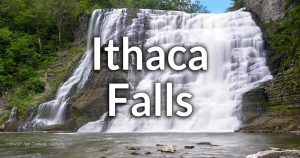
Numerous mills existed along the creek during the 1850s. A dam was built above Buttermilk Falls and supplied water to the city of Ithaca until the early 1900s. A large grist mill operated in the upper section of the park. Like nearby Robert Treman State Park, the initial grant of land for the park came from Robert and Laura Treman. Since 1924, the original 154 acres have grown to the present size of 751 acres.

Hiking / Walking Trails
Difficulty: The Gorge Trail is moderate to difficult (all uphill). The Rim trail is longer and equally as challenging.
Markings: Standard brown and yellow state park markings, some colored blazes. The trails are clearly defined.
Distance: Our recommended walk covers about 1.5 miles, mostly uphill.
The lower (and biggest) waterfall is located directly adjacent to the North parking lot. It has paved trails and can be accessed by anyone.
To access the Gorge Trail, enter the lower entrance to the park and cross the bridge to the steep gorge trail on the right-hand side of the Buttermilk Falls.
The gorge trail has numerous stairs and quickly rises in elevation from the parking area. It winds around the numerous waterfalls and passes the Pinnacle Rock, eventually reaching the upper park entrance ¾ of a mile down the trail.
From there, the gorge trail either continues across the road to the Bear Trail, which follows Buttermilk Creek and eventually leads to Lake Treman (¾ mile from the junction with the road) or crosses the creek onto the Rim Trail which loops around the top of the gorge and leads back to the lower parking area (this is recommended).
The Larch Meadow Trail is a self-guided loop of about one mile. It begins near the ball fields at the lower park. A detailed trail guide is available at the park office.
A Finger Lakes spur trail also ties into the upper reaches of the Lake Treman trail in the north of the park.
Buttermilk Falls State Park Interactive Map
Buttermilk Falls State Park Media
Interesting Stuff
Larch Meadows
This wetland is a great location for watching wildlife, birds in particular. It is hidden in the lower park, behind the ball fields. A nature trail will take you through it. Get a trail guide at the park office.
Potholes
These deep impressions in the creek bed indicate locations of past waterfalls. This is where plunge pools used to be. Water from past waterfalls swirled rocks and sand in the creek bed and carved pits into the bedrock. Since then, the rock behind those waterfalls eroded, pushing the drops further upstream and leaving the potholes behind. Currents continue to mix trapped sand and rocks to continually deepen these holes.
Owl Creek Gorge
Northeast of Buttermilk Creek, past the camping area, is this second gorge. It drops nearly 500 feet in less than a mile. The flow is highly variable and the opportunities for waterfalls may be slim. It is unknown to us at this time the accessibility of this area of the park.

Photography Tips
Buttermilk Falls
- The largest and most accessible waterfalls are often times very crowded during nice weather. So photographing them in their natural state can be rather difficult. There are often buoys at the bottom of Buttermilk Falls that will get in the way of photography. Often times, the water flow will be very low and difficult to see. For a better photo opportunity, hike partially up the gorge trail and take pictures of the second tier of Buttermilk Falls (it is usually hidden from the point of view of the parking lot).
Upper ravine
- The further reaches of the gorge are forested, damp and well-shaded, making photography a bit easier. You’ll find that less people venture this far up the gorge trail, and that means more unobstructed natural scenery for you. Some waterfalls are so far down in the ravine that photography is not possible.
Silky Water Effect
- To get that smooth cotton-candy look to the falls, you need to use a Neutral Density (ND) filter on your lens. The ND filter will block some of the light from entering the lens without altering the color, and thus allow your shutter to stay open longer. This blurs the water and creates a soft white gloss to the foamy areas of the falls. Check out the article for the all the details.
More tips
- See the Articles for more photography tips.
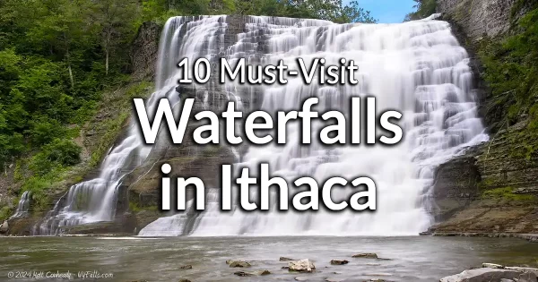
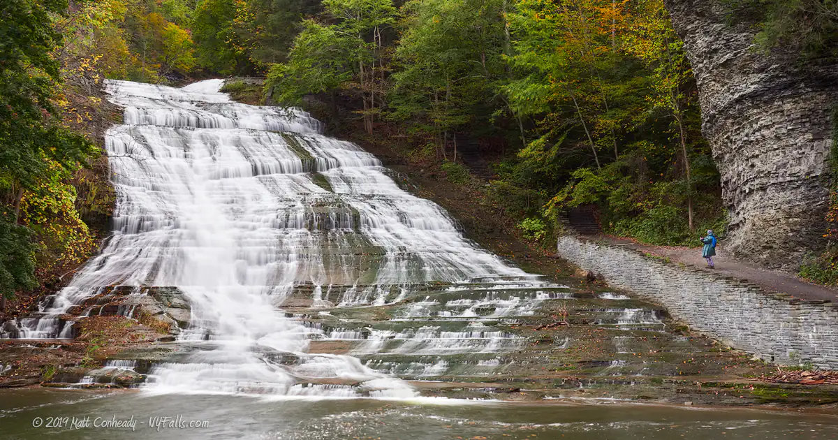
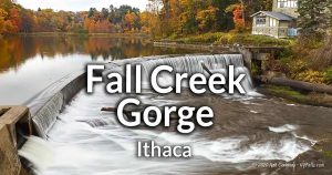
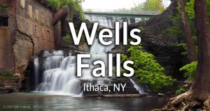
10 Must-Visit Waterfalls Around Ithaca, NY
A selection of the most popular and accessible waterfalls around Ithaca in the Finger Lakes Region of New York.
Who to Contact
Buttermilk Falls State Park
112 E. Buttermilk Falls Rd.
(Off Rt. 13 S)
Ithaca, NY 14850
Phone: (607) 273-5761
Secondary Phone: (607) 273-3440

