Niagara Falls Visitors Guide
This Devil’s Hole State Park guide is a part of our Niagara Falls Guide, a comprehensive look at The Falls, top attractions, and awesome parks in the region, with a focus on photography and nature.
This Devil’s Hole State Park guide is a part of our Niagara Falls Guide, a comprehensive look at The Falls, top attractions, and awesome parks in the region, with a focus on photography and nature.
Location: Devil’s Hole State Park is located on the American side of the Niagara River, next to Whirlpool State Park, just few miles north of Niagara Falls near Lewiston in Niagara County, New York.
Maps: Google maps; Topographic; Interactive map
GPS coordinates:
Directions from the south (Niagara Falls): Take the Robert Moses State Parkway north to the State Park.
Directions from the east: It is best to use Google Maps.
Parking: Parking is available in two lots near the park entrance on the Robert Moses State Parkway. There are both northbound and southbound lots. If one is full, pass it, turn around and try the lot for the opposite direction. For the northbound lot, there is a pedestrian bridge allowing pedestrians to easily cross the parkway. There is parking for nearly 80 cars.
Note: Devil’s Hole State Park is adjacent to Whirlpool State Park, and shares many of the same trails and views. Review both locations before visiting.
Seasons/Hours: Devil’s Hole State Park is open year-round. Sections of the gorge trail may not be accessible (or safe) during times of heavy rain or snow. Dawn to dusk. The park and trails are not lit by artificial light. The gorge trail is very hazardous at night.
Admission: Devil’s Hole and Whirlpool State Parks are free to all visitors.
Best time to visit: Autumn for the foliage and fishing. Winter for fishing. Summer to get away from the tourist crowds at the Falls.
Time: few hours.
Handicap accessibility: Just a few views from the top of the gorge.
Pets: Household pets are allowed. They must be caged or on a leash not more than 6 feet. They are not allowed in the restroom and it is best not to let them swim in the water. There have been several cases of dogs slipping on the gorge trail and falling to their deaths. We highly recommend against bringing your pet on the trail.
Boat launch: This park is not equipped with a boat launch. For launching, visit Fort Niagara State Park or the public marina in Lewiston.
Accommodations: Restrooms are located at the top of the gorge at both the Whirlpool park and Devil’s Hole entrances. A playground is near the pavilion at Whirlpool State Park. Historic and Natural History signage can be found throughout both parks.
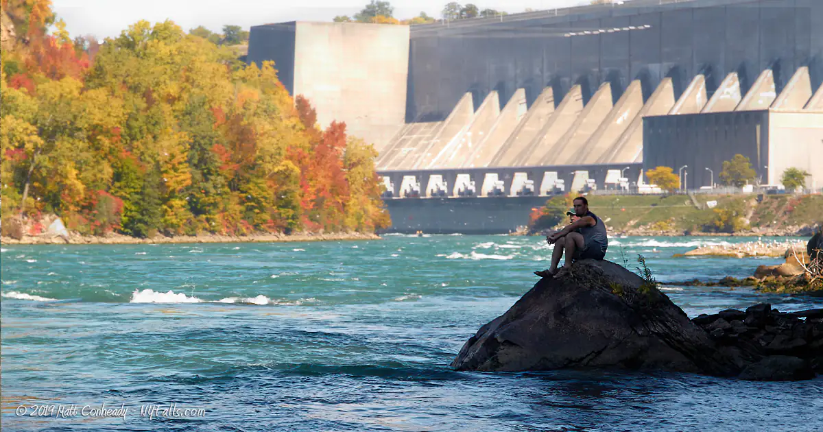
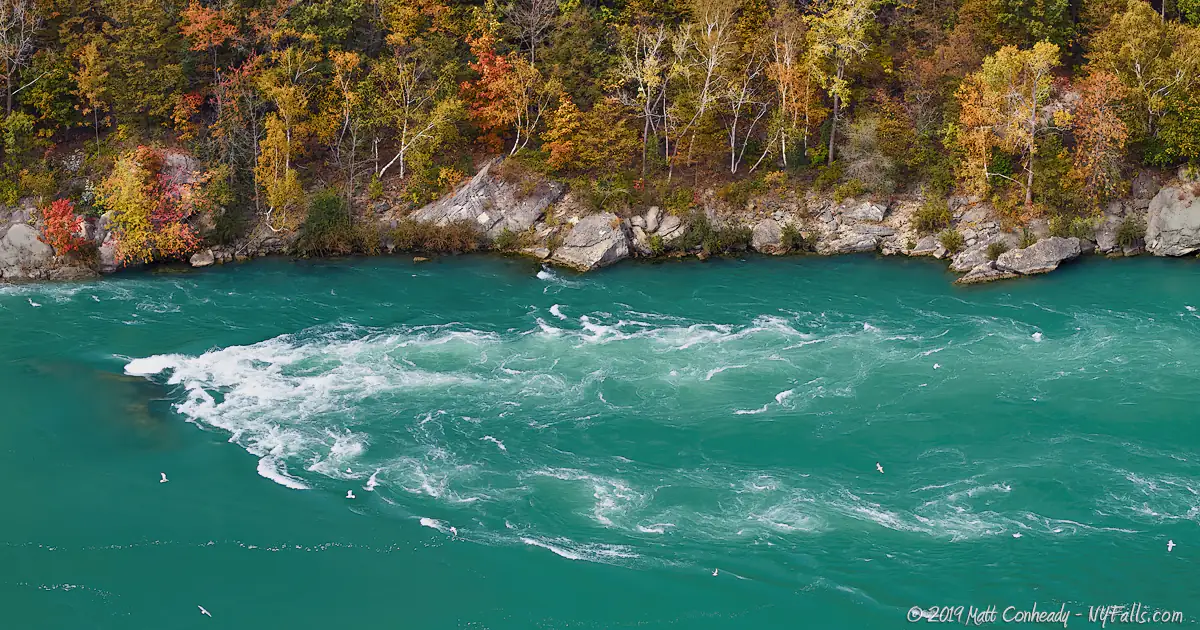
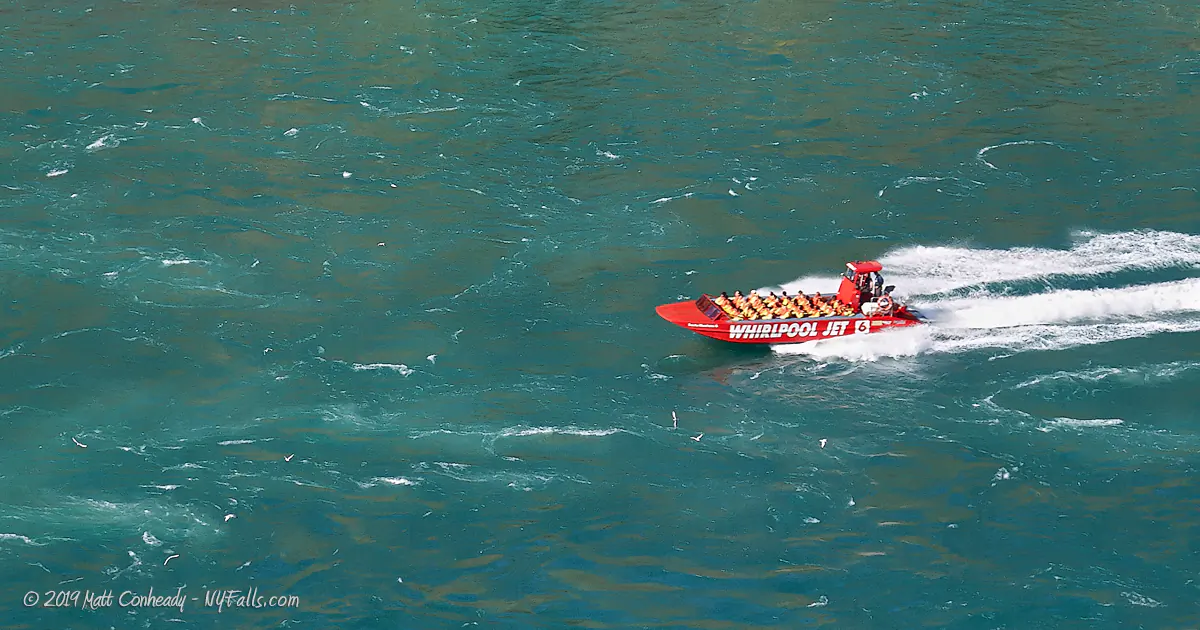
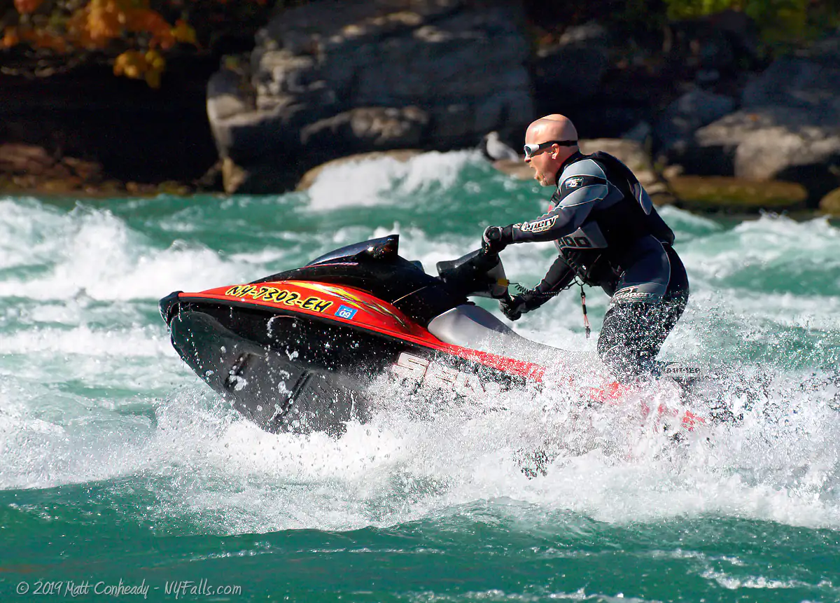
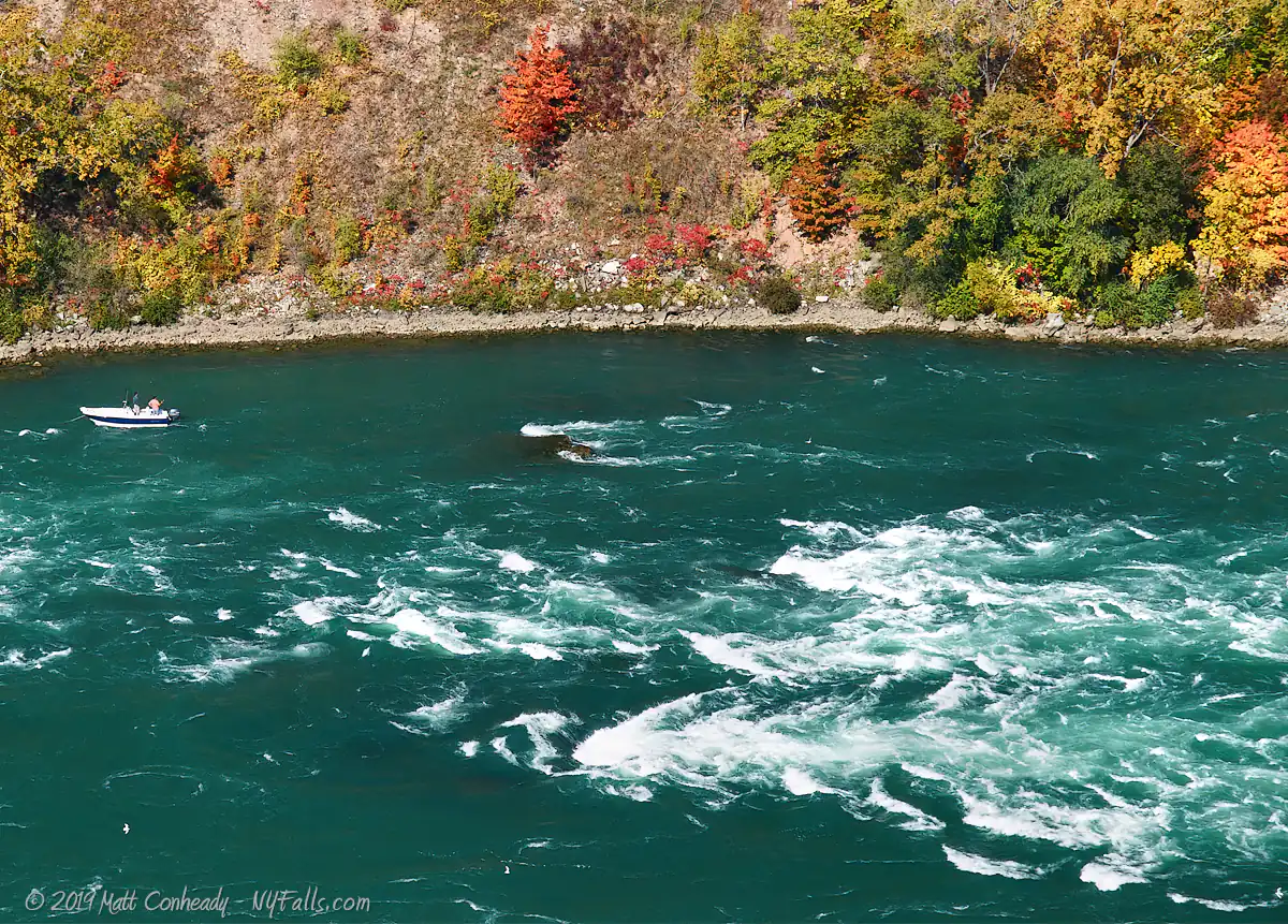
Devil’s Hole State Park encompasses 42 acres of cleared and wooded land along the Niagara Gorge just north of the Whirlpool. The park is located along the lower reaches of the Whirlpool Rapids, a dangerously turbulent stretch of the Niagara River downstream from Niagara Falls. Here the water starts to calm from the notorious Class V whitewater upstream, creating exhilarating waves for jet-skis and highly oxygenated water for large sport fish. In fact the fishing here, especially for trout and salmon, is so spectacular, major fishing journals and television shows have called this one of the premiere freshwater fishing locations in the country.
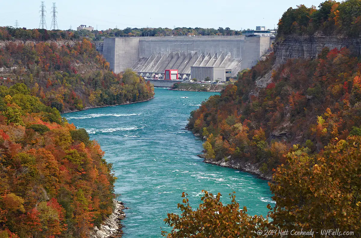
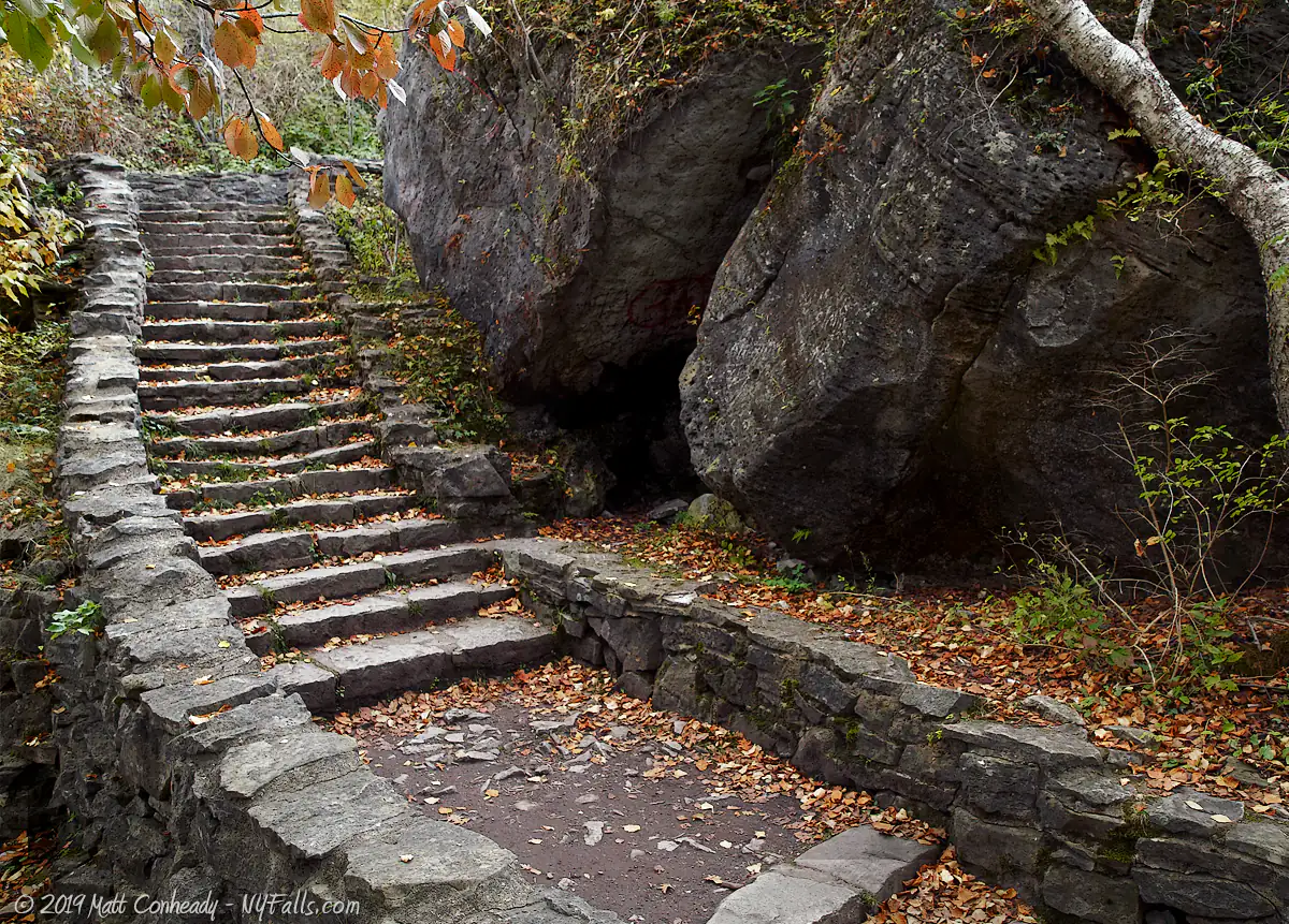
From the entrance off of the Robert Moses State Parkway the level lawns and scattered picnic tables overlook the tree-covered gorge, white water, and the massive power plant below. A single stone stairway, in dreadful condition, leads 300 feet down into Devil’s Hole. Intimidating? Only if you are out of shape. Take the journey. Devil’s Hole is filled with beautiful sights all the way down.
Devil’s Hole refers to an interesting, but certainly not unique geological formation. After the last ice age a large creek once poured over the gorge here joining the Niagara River. For the geologically brief time this happened not only did it create a large waterfall, separate from the great Niagara Falls, it also began to erode a semicircular notch perpendicular to the gorge. Since then the creek (named Bloody Run for a horrifying battle that once took place here) has diminished to a seasonal trickle. In recent years almost all of the flow has been blocked by masonry upstream from the park. During the wet season, the small tributary seeps through the bedrock, and even emerges halfway down the gorge. Catch it right after heavy rain and you’ll even see a small waterfall if it had rained recently.
Not only left are the clues to this ancient tributary, but the mighty Niagara Falls, which are now several miles to the south, once resided here roughly 12,000 years ago. Here they left geological footprints of their passage within the gorge. Numerous pothole formations, gouged out by stones in the swirling waters below the Falls, can be found within the bedrock at the river bed. Other evidence can be found in the water-eroded stones seen high up on the gorge. Walking along the Niagara River and seeing these clues help us to imagine what this section of the Gorge looked like when the Falls were cutting their way through here.
The porous limestone rock layers that make up a great portion of the cliff wall here have also formed caves as seeping water froze, expanded, and split rocks from the inside. One such cave, the Cave of Evil Spirits, is a 4 ft tall, 30 ft deep fissure in a large block of dolostone just to the north of Devil’s Hole. Although many legends claim that the cave will bring misfortune to all who enter it, it is most often used as a hangout and drinking spot for locals and students at the nearby Niagara University.
The moisture that Bloody Run saturates Devil’s Hole with, along with the shaded cliff-sides and limited development within the Niagara Gorge, have created a haven for a variety of plants and animals. Rare mosses and ferns adorn the forest floors of the gorge, while trees and their inhabitants flourish from the adjacent and plentiful water and earth. Although many of the plant species that inhabit the cove can be spotted from the 410 crumbling steps that wind down it, those that are out to see more can explore the cliff sides as long as they are careful not to trample what they find.
The rock outcroppings, slower water, and abundance of fish in the Niagara at Devil’s Hole make this a frequented spot for birds, especially gulls, who constantly shuffle for the best rocks in the river. Waterfowl and other migratory species also make a stop here to take advantage of the food and warmer waters below the dam, making this an excellent bird-watching location. The best seasons are in spring for large raptors and waterfowl and in autumn for more migratory species. Gulls seem to be around all-year.
An old rail-bed, that seems dangerously close to the rapids, now serves as a trail that connects the Devil’s Hole steps to Whirlpool State Park to the south, and creates an excellent looping trail. When hiking this trail, imagine the renaissance of Niagara tourism in the 1920’s when passengers would brave the dangers of the rock slides and deadly water, as they paid less than a dollar to ride this close on a steel trolley. (Not only did rock slides kill passengers and some crew on this line, but the resulting damage led to its demise).
Despite the intimidating name, and proximity to certain death, the park is harmless for those that play safe, and certainly should not be avoided. The small sense of danger, coupled with the tragic history that occurred here, add a little more adventure to the typical Niagara attraction. Bring a picnic, take your time enjoying the sights and sounds of the river, and you can easily make a day of it.
12,000 – 11,000 | – | Niagara Falls carves out the Niagara Gorge as it recedes south. Around this time the Falls was located in the Devil’s Hole area. For more History of the Falls itself, see the Niagara Falls Historical Timeline. |
11,000 – 10,000 | – | The ancient glacial Lake Tonawanda covers a large portion of western New York. One of its many outlets is Bloody Run, which carried water over the Niagara Gorge at Devil’s Hole, creating a massive waterfall, and carving out the namesake notch in the gorge. The ancient lake was fed by the waters of Lake Erie whose water level, as the climate warmed from the last ice age, began dropping. The Niagara River quickly became the dominant outlet between Lake Erie and Lake Iroquois (now Lake Ontario), rather than feeding Tonawanda and the lake eventually dried up. Bloody Run, which carved out the small notch, diminished greatly before it had a chance to carve a large gorge perpendicular to the Niagara. |
Iroquois Nation | – | Seneca Indians used the Devil’s Hole as a passage to get to the Niagara River. This is one of the few natural paths down into the gorge. |
Colonial America | – | By the 1760s the French and British were well settled in the region, and although their war continued in Europe, their properties in the American colonies were fairly at ease. The British controlled the Niagara Portage on the American side, which allowed supplies to be passed north and south across land and up/down the Niagara escarpment where the river’s rapids and falls prevented ships’ passage. Initially local Seneca did the grunt work for the colonies–escorting and carrying the supplies along the Portage by hand. With better mapping of the region, as well as expansion and development of the trail systems and roads, the British began replacing Indian couriers with horse-drawn covered wagons, leaving hundreds of young men unemployed and jaded. Indian sentiments in the Great Lakes Region were souring at this time, and unemployment was a major catalyst in a crusade to rid the land of the white man. Uprisings against British settlements and forts were becoming more common, and the safe transportation of supplies to them became all the more crucial to their ability to withstand these attacks. The Portage became the link between many forts in the Niagara region and was subject to many assaults. |
Devil’s Hole Massacre | – | The man in charge of the Niagara Portage was “Master of the Portage” John Stedman. His governance over the trail led to many improvements and changes in employment of local Seneca. Not only was he in charge of the Portage maintenance, but also the safe and secure transportation of important shipments. One such shipment was led by Stedman on September 14, 1763 from Fort Schlosser in Niagara Falls en route north to Fort Niagara. As the convoy traveled along the gorge rim near the Devil’s Hole cove they were ambushed by an estimated force of 300 to 500 Seneca Indians. Stedman escaped quickly, heading back south to Fort Schlosser to obtain reinforcements, but most of the convoy personnel were either killed by arrow fire or driven, along with the wagons and animals, into the gorge at Devil’s Hole. The sounds of the battle were heard in nearby Fort Grey in Lewiston, and the British 80th Regiment was dispatched as reinforcements. Reinforcements made it about a mile from Devil’s Hole when they themselves where ambushed and quickly decimated. Although reports about survivors vary, general consensus is that there were three survivors of the massacre at Devil’s Hole: Stedman, a civilian worker, and a young boy who was thrown from a supply wagon before it was run off the cliff, who then hid in bushes until it was over. Less than 10 soldiers of the reinforcements survived. An estimated 134 of the British force were killed, with only one Seneca injured. Soldiers from Fort Schlosser arrived shortly after the second ambush, but quickly retreated to the fort after seeing the aftermath. Days later they returned to Devil’s Hole only to find the wagons, animals and most of the bodies in the cove below, many of which had been scalped. Descriptions of the scene were told of the small tributary at Devil’s Hole and were said to have been saturated red with blood. This is how the creek at Devil’s Hole got the name “Bloody Run. “The Devil’s Hole Massacre was indeed a horrifying event to happen to the colonies, but it had the opposite effect the Seneca were hoping for. Instead of driving the white man from the region, the British quickly reinforced their presence and took a hard-line attitude towards future Indian relations. |
1887 | – | Municipal park architects Frederick Law Olmsted and Calvert Vaux devise a plan to establish several parks along the Niagara River, including Devil’s Hole. |
1895 | – | The Niagara Gorge Belt Line Railroad opened The Great Gorge Route, carrying passengers along the Niagara River from Niagara Falls, NY to Lewiston, passing right by Devils Hole. It quickly becomes one of the most popular tourist attractions at Niagara. |
1927 | – | Devil’s Hole State Park opens. It included more acreage than it does today. |
September 13, 1935 | – | A major rock slide, one of many that plagued the line, closes the Niagara Gorge Belt Line Railroad permanently. |
1962 | – | The north end of the park is cut off by an access road, which eventually leads to the newly built Robert Moses Power Plant. Stone from the excavation of the plant, its tunnels, and the road is dumped onto the gorge in and around Devil’s Hole. |
2001 | – | Two of the four lanes of the Robert Moses State Parkway are closed (on a trial basis) and designated as multi-use trails. Diminishing tourism in the Niagara region and decreased use of this scenic byway allow for the closure. |
Difficulty: Difficult due to the unevenness of the trail and the climb back up the gorge.
Markings: Trails are well established, but not labeled.
Distance: A 300 ft winding stone stairway down into the gorge, which connects with the several mile long gorge trail. A loop from Devil’s Hole Parking area, down into the gorge, back up at Whirlpool State Park and back to Devil’s Hole is roughly 2.5 miles.
Description: The Ongiara Trail is an excellent opportunity to experience Devil’s Hole and neighboring Whirlpool State Parks and get a good workout at the same time. For a longer hike through these two parks, view the trail guide on the Whirlpool State Park page.
Map: Interactive.
Audio of the rapids on the Niagara River at Devil’s Hole.
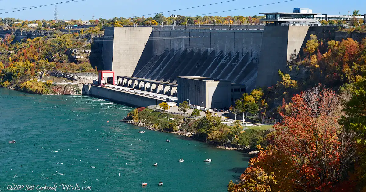
The Niagara Power Project, just north of Devil’s Hole State Park, harnesses the power of the Niagara river as it tumbles over the gorge wall and through the plant’s massive turbines. The “Project” is a combination of underground canals that usher water from the Niagara River upstream and stores it in a 1,900-acre reservoir. Water from the reservoir is then sent through the Lewiston Pump-Generating Plant’s 12 pump-turbines.
After the Lewiston Plant, water is held in a 740-gallon bay where it awaits the massive Robert Moses Power Plant’s 13 turbines as it takes water down to the river below.
When it first opened in 1961, it was the largest hydropower plant in the western world. It currently has a generating capacity of 2.4 million Kilowatts.
Devil’s Hole State Park
c/o Niagara Frontier Region
PO Box 1132,
Niagara Falls, NY 14303
Phone: (716) 284-5778
nysparks.state.ny.us
Niagara Power Vista
Phone: (716) 286-6661
[email protected]
nypa.gov