George Borrello Park

Location: On the east end of Lake Erie; in the village of Silver Creek; Town of Hanover; Chautauqua County; New York.
Maps: Google map; Topographic; Interactive map
GPS Coordinates:
- Parking area: N 42.54859 / W 79.17275
Directions: Take NY-5/I=20 into the village of Silver Creek. From downtown in the village head west on Central Ave towards the lake. Turn north (right) on Jackson St, just before the Tops Market. Follow Jackson to the Fireman’s Club building (white) and then turn left into the parking area on Front Street.
Use Google Directions.
Parking: A paved lot right at the beach. There’s parking for a dozen cars. Be sure to park in the beach lot and not the parking lot for the Fireman’s Club.

Weather

Information / Accessibility / Accommodations
Seasons/Hours: Open year-round. May 1 through October 31: DAILY 5am through 9pm; November 1 through April 30 – DAILY 5am through 5pm.
Admission: Free.
Best time to visit: Summer.
Time: A few minutes to check out the lake.
Handicap accessibility: The beach is sandy. A view of the lake can be had from the paved parking area.
Pets: Allowed if kept on a leash, which is the county law. Bring bags to clean up after. Pet waste is a significant contributor to lake bacteria levels.
Swimming: Not allowed. No guarded swimming area.
Boat launch: Hand launch only from the beach. Use the full-size boat launch on Silver Creek, off of Jackson St, for trailers.
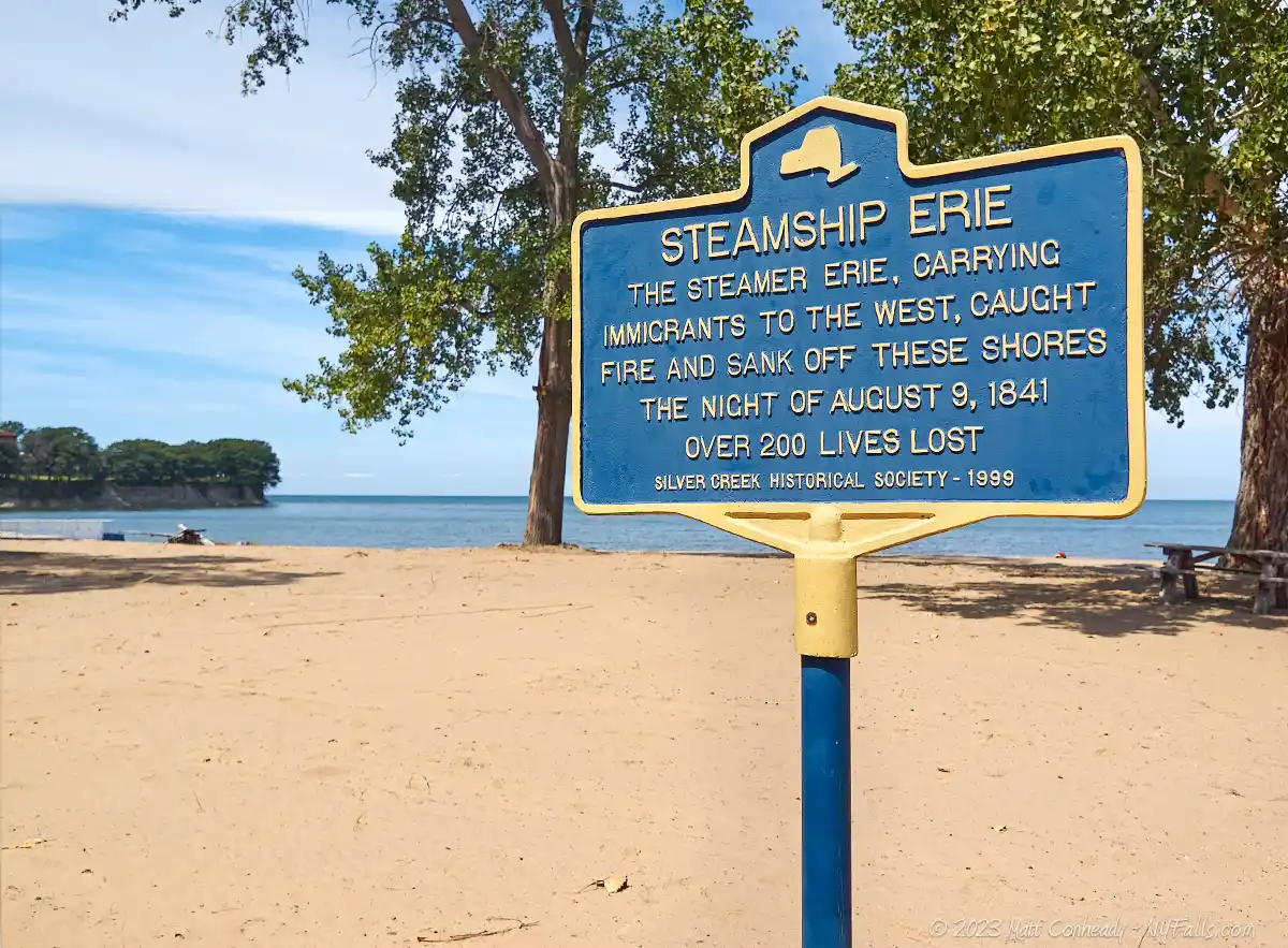
Accommodations: Benches, picnic tables, grills, fishing, picnicking, historic sign. Within walking distance, there is a supermarket and a deli.

Description
George Borrello Park is the perfect example of a small community beach, little known to the general public, barely on any maps, and yet it’s a worthy stop for those exploring the lakeshore and its small communities. The village takes pride in this small park, which is battling the never-ending erosion from Lake Erie. With just two picnic tables and a few signs, there’s really not much to it. Does there need to be more? When I visited, the beach was pristine, the water was cool and clear, and the people of Silver Creek were super friendly.
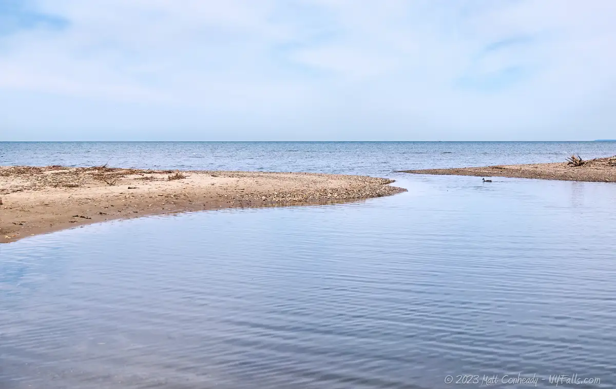
Often missed by the casual visitor is the Silver Creek outlet, which can be found just past the white building next to the beach. The sandbars are often large enough to walk on and it almost looks like one could sometimes jump over to the other side. I really liked the views from here.
In recent years there has been increasing erosion robbing land from the beach and the sandbars. In the past, sand was hauled in to extend the beach, but those measures were temporary. There are talks now of adding a series of boulders to the shoreline to encourage natural sand build-up, as well as constructing a playground.

History
The village of Silver Creek was first settled around 1803 by David Dickinson, Abel Cleveland and John E. Howard from Massachusetts. Dickinson and Cleveland constructed a mill on Silver Creek and it was used by them to grind corn and by Howard to cut lumber from the numerous hemlock trees. In 1805 Howard opened an inn and tavern. After the War of 1812, there was an influx of inhabitants, ballooning the population. A schoolhouse was opened in 1823 and the village was incorporated in 1848.
On August 9, 1841 the passenger vessel “Steamship Erie” was traveling from Buffalo to Chicago when it caught fire about 8 miles off-shore from Silver Creek. Citizens of Silver Creek and Dunkirk hopped in their boats to help survivors. Lives lost totaled 254, which was most of the passengers. They were buried in unmarked graves in Dunkirk, Sheridan, and Silver Creek. Many onboard were Swiss and German immigrants. 13 years later a salvage expedition recovered a great deal of machinery (in working condition) and $80,000 from the wreck.
In 1851, the Buffalo and State Line Railroad was brought to the village with a massive wooden trestle spanning the creek and defining the landscape for decades. Tragedy struck on September 14, 1886, when a passenger train full of Niagara Tourists collided head-on with a freight train at Silver Creek, killing 21.
In 1869 the rail infrastructure was upgraded to stone bridges, including the historic Skew Arch Bridge on Jackson St just south of the park. The bridge over the Creek was also rebuilt in stone, and this can be seen from the east end of the park.
The land that the park was once on was at one time filled with hemlock trees and would flood regularly. A map from 1881 shows the land was planned for residences, but yet to be occupied.
The park is named for former Mayor of Silver Creek George S. Borrello who was the mayor from 1984 to 1987. It appears as though the park was established long before the name change that took place in 1988. During his service, Borrello sought funding and support for fixing up the park and reconstructing the beach. His grandson, George M. Borrello is currently a State Senator.

Hiking / Walking Trails
Difficulty: Easy
Distance: It’s just a hundred feet from the parking area to the beach. Another few hundred feet to walk along the shore to Silver Creek.
Markings: None.
Description: Technically the Fireman’s clubhouse is on the park land, which extends east to Silver Creek, and includes the boat ramp off of Jackson St. From the parking area, walk north to the shoreline. Follow the shoreline east to the Silver Creek outlet. That’s all there is to it.
Map: Check out the interactive map.

George Borrello Park Interactive Map
Interesting Stuff
Arch Bridges
Silver Creek has two historic rail overpasses. The “Skew Arch” on Jackson Street was one of the first of its kind in the United States. Built in 1869, what made it unique is that it passed over the road at an angle offset from 90 degrees, making the tunnel skew. A double-arched stone bridge runs over Silver Creek and can be seen from the park.
Festival of Grapes
In mid-September the village celebrates the region’s wine and grape industry with a small festival featuring food, drink, and live music. Information can be found on their Facebook page.
New York State Route 5
Beginning at the Pennsylvania state line in the town of Ripley, State Route 5 spans 370 miles west to east across New York, passing through Buffalo, Syracuse, Utica, and Schenectady, ending up in Albany. Along the way it overlaps with State Route 20, leading to the common name of both routes as simply “5 & 20.” Several small towns and cities, as well as countless curiosities, eateries, and historic sites can be experienced along its path.
Photography Tips
Sunsets
- Sunsets happen well to the west. The best vantage point is from the beach on the east near the creek.
More tips
- See the Articles and Message Board sections for more photography tips.


