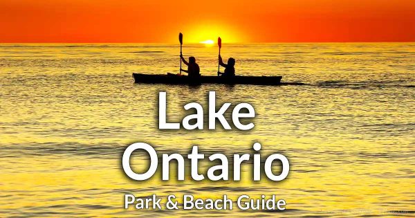
Camp Beechwood State Park


Location: On Lake Ontario; Town of Sodus; Wayne County; New York.
Maps: Google Map; Topographic; Interactive map
GPS Coordinates:
- Parking: N 43.26497 / W 77.02628
- Swimming pool: N 43.26782 / W 77.02977
- Beach: N 43.27035 / W 77.03023
Directions: From Rt 104/Ridge Rd, head north on NY-14 to the village of Sodus Point. Turn left/west onto CR-101/Lake Rd and follow it for 2 miles. The park entrance will be shortly after you pass Halcus Rd (on the left). Or use Google Maps.
Parking: There are two parking lots off of Lake Rd. One tot he north at the park entrance and one just south. Alternative parking can be found off of Gates Drive on the west end of the park.
Weather
Information / Accessibility / Accommodations
Seasons/Hours: Open year-round, from dawn until dusk.
Admission: Free.
Best time to visit: Spring through fall.
Time: Half a day to explore.
Handicap accessibility: None.
Pets: Allowed if on a leash.
Swimming: Not allowed.
Boat launch: Hand boat launch is possible from the southwest shore of Maxwell Bay not far from the east parking area. Another launch can be found on the other side of the bay from the State fishing access site. Maxwell Bay is open to Lake Ontario.
Accommodations: Trails; fishing; hand boat launch; restrooms near the east entrance; camping. No swimming.
Description
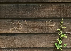
Camp Beechwood State Park, formerly known as the Girl Scouts of America’s Camp Beechwood is a hidden gem within New York’s vast park system. Although it remains relatively unknown to many, those who have visited can vouch for its unique blend of nature and history.
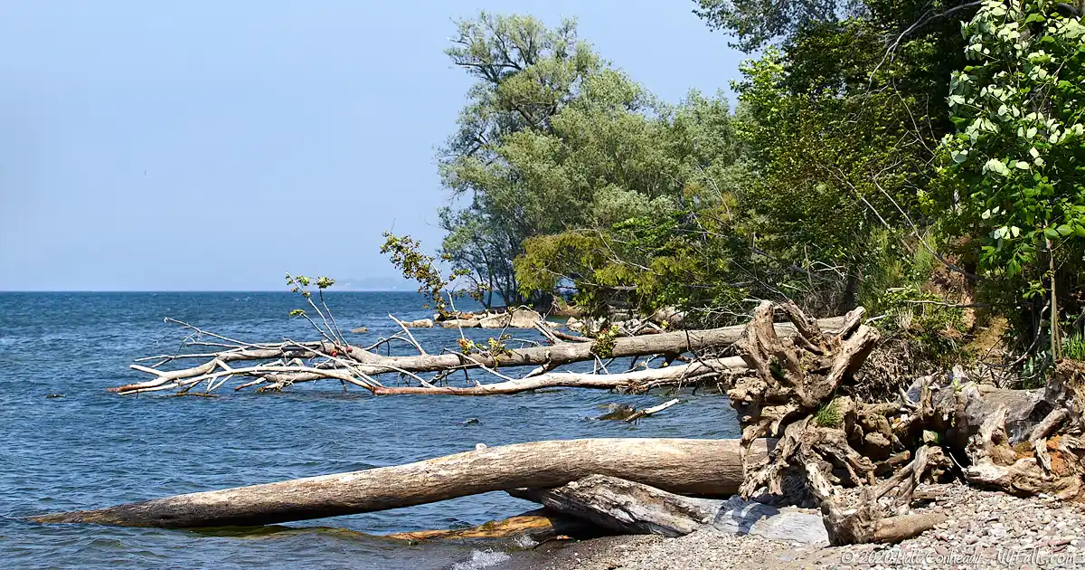
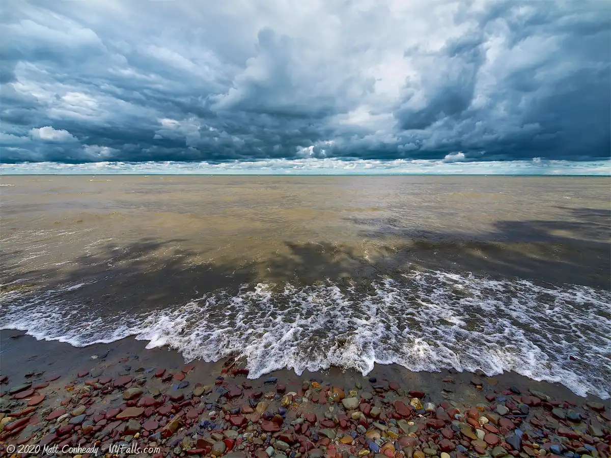
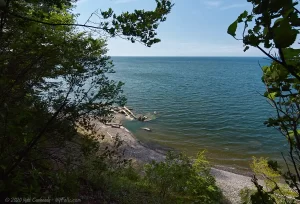
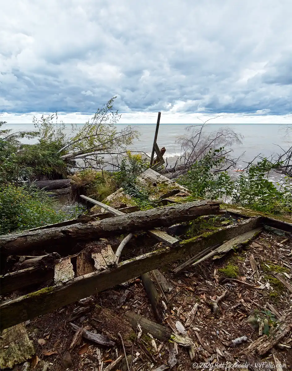
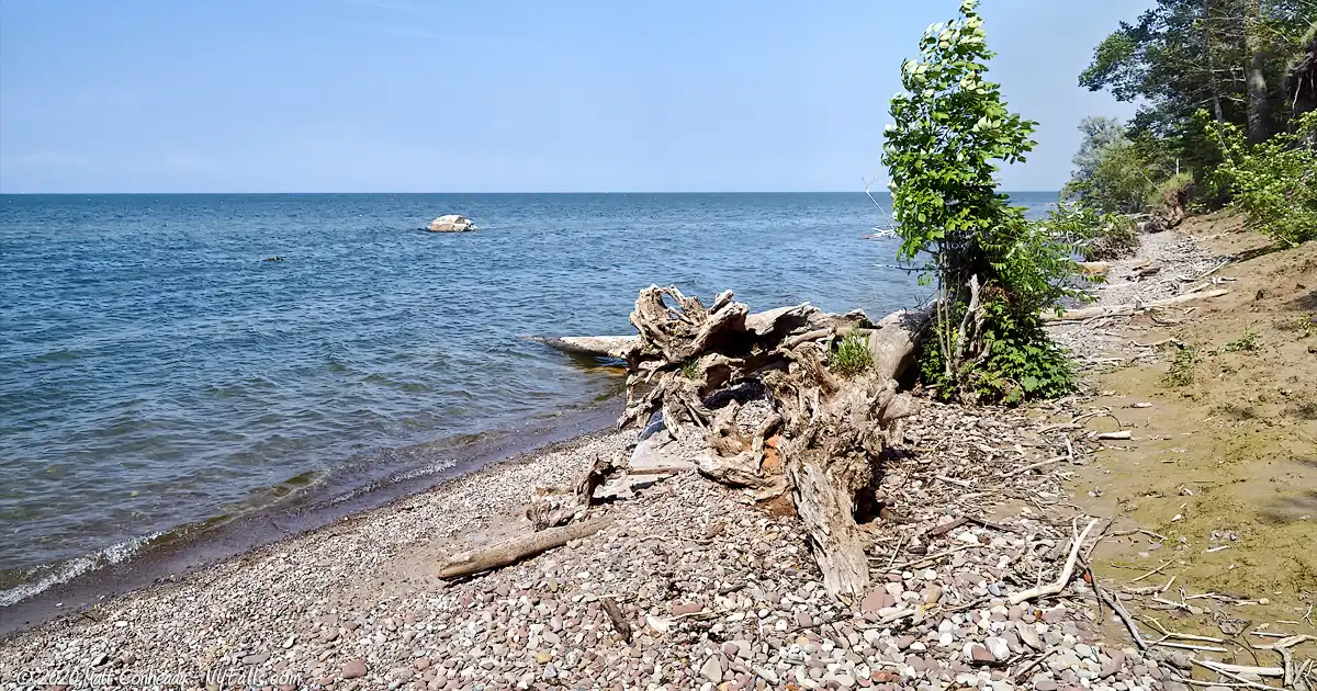
Sprawling over 250 acres along the serene shores of Lake Ontario, the park’s geography ranges from dense pine and hemlock groves to rolling wooded hills, marshy ravines, and even a stunning pebble beach. The latter, bordered by a striking two-story bluff, used to be the focal point of many Girl Scout activities. Today, however, the effects of rising waters, landslides, and fallen trees are evident, marking the ever-changing landscape.
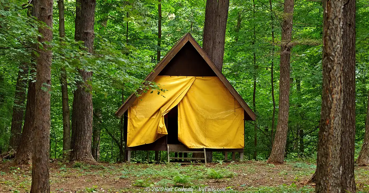
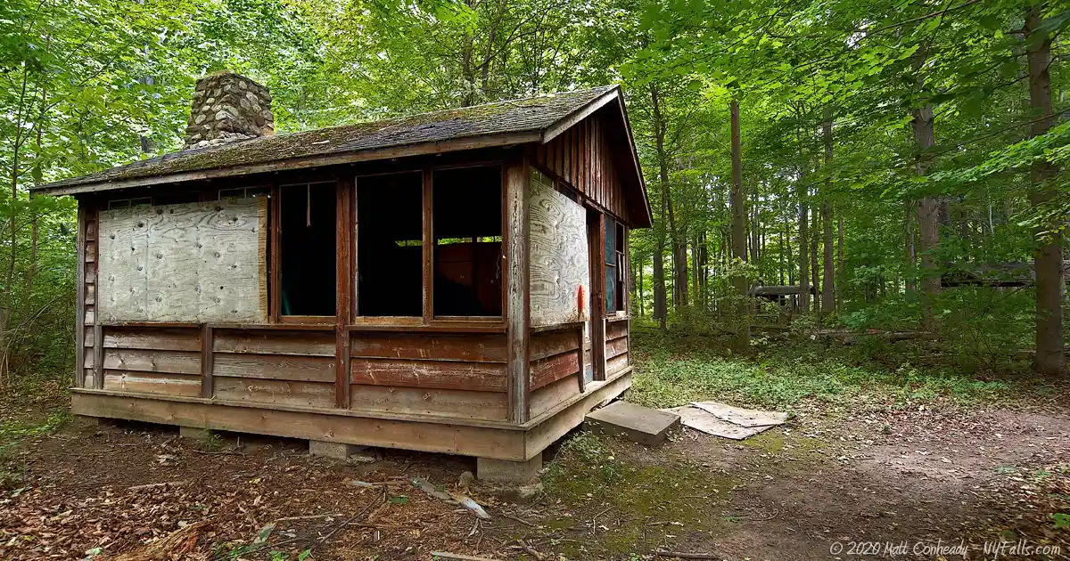
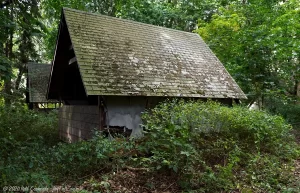
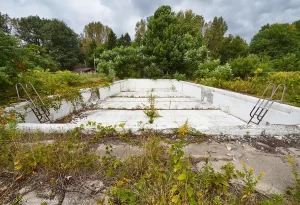
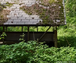
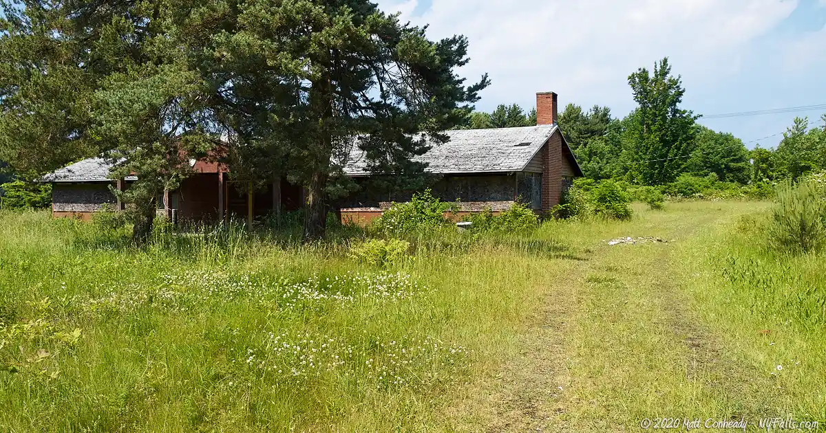
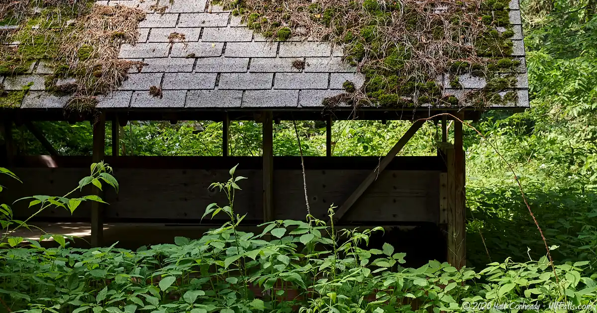
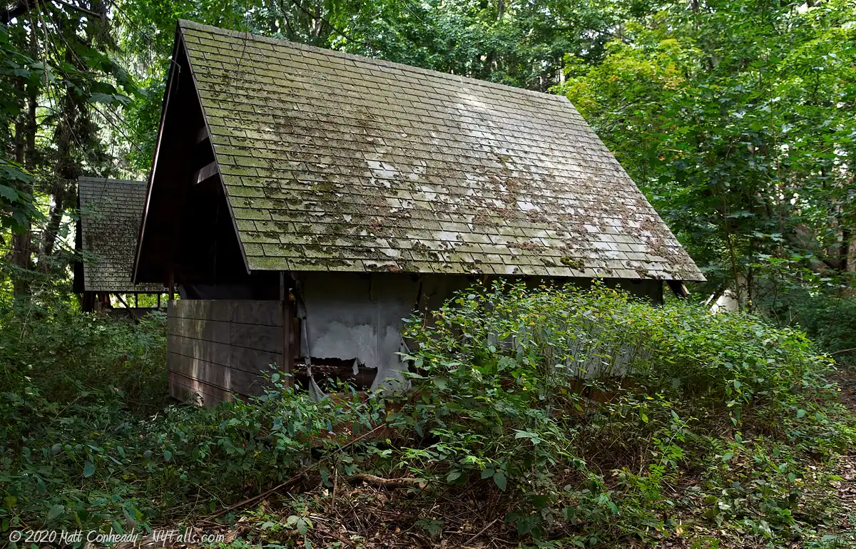
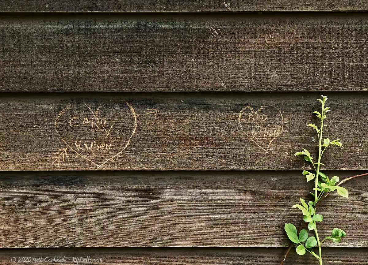
Once a vibrant summer camp, the property was abandoned in 1996, and the footprints of its past remain evident. The Olympic-sized pool, a once-popular spot for campers, now lies in ruins, a testament to nature’s reclaiming prowess. The large wooden dock, which must have seen countless sunrises and sunsets, is now a collection of broken planks scattered along the shoreline. The park’s campgrounds paint a contrasting picture. While some are completely swallowed by nature, with shelters covered in thick vines, others stand almost untouched by time, the lean-tos seemingly waiting for their next campers.
But beyond these decaying structures, there’s more to Beechwood. Maxwell Bay, on the west side, serves as a sheltered spot perfect for fishing and paddling. However, it currently faces challenges with road contaminants and agricultural run-off, a pressing issue for environmentalists and park officials. As a significant ecological zone within the Lake Ontario watershed, Beechwood has a role to play in preserving the region’s biodiversity.
Wildlife enthusiasts have much to look forward to as the park is teeming with ground squirrels, deer, and a variety of migratory birds. Their calls and movements add to the park’s charm, making it a nature lover’s paradise.
Photographers, both amateur and professional, find Beechwood a haven. The juxtaposition of decaying human-made structures with thriving nature provides countless opportunities for evocative imagery. The remnants of the old camp, peeping from the undergrowth, often serve as a poignant reminder of a time gone by.
In recent years, there has been a growing interest in Beechwood’s past, especially among those fascinated by abandoned sites and Girl Scout history. Efforts are being made to document and preserve its stories, ensuring that while nature might reclaim the land, the memories remain intact.
Visiting Beechwood State Park is more than just a typical day in nature; it’s a journey through time, a contemplation of man’s transient presence, and an ode to nature’s enduring spirit. Whether you’re an avid hiker, a history buff, or someone seeking tranquility, Beechwood promises an unforgettable experience.
History
Prior to white settlers, the Onondaga and Cayuga Indians settled along the “Assoh-doh-rass,” or “silver waters” of nearby Sodus Bay, the largest natural bay along Lake Ontario.
Sodus Point was first settled in 1794 by Captain Charles Williamson, an agent for Colonial land investors, Pulteney Estates, with the intention of creating a port settlement. The Village of Sodus Point flourished and even became the sight of a battle in the War of 1812, when British forces besieged and burned the village to the ground (on June 19, 1813).
The Girl Scouts of America purchased a parcel of land along the west side of Maxwell Bay and the Rochester division then built and operated Camp Beechwood here starting in 1929. Beechwood was named for the American beech trees (Fagus grandifolia fagaceae) that grew along the lakeside bluff. The camp was successful for many decades, but several factors led to its decline in the 1990s. For one, taxes on lakefront property in NY State increased dramatically over the years. Secondly, Scout membership was on the decline nationally, as girls of that age gravitated less towards outdoor camping and more towards media entertainment. Camp maintenance demands grew out of control as rising waters and storms caused uncontrollable erosion, landslides and fallen trees along the shore. The lake waters were filled with downed trees just below the surface, making for a creepy and somewhat dangerous swimming environment for the campers. The bay, which pulled agricultural runoff into the two mile stretch of Maxwell Creek (then called Salmon Creek) suffered from algal blooms and poor water quality.
As problems compounded, the operating costs became just too much for the Scouts and they decided to put the land up for sale in 1995. Recognizing the importance of the Maxwell Creek watershed to Lake Ontario‘s health, and fearing commercial development or agricultural use of this important property, the State become interested in its acquisition. With the land already connected to utilities, and the existence of modern cabins, lodges, and recreation facilities, the state looked at the acquisition and conversion to a family park as an easy task. There was some resistance to the purchase using taxpayer funds, but with the help of the Clean Water/ Clean Air Bond Act the state was able to buy the land in 1996 for $600,000.
Unfortunately, before the State could upgrade and open the newly acquired park, a budget crisis got in the way and no money was allocated for improvements. The park’s purpose was then shifted more towards a manageable “preserve” and it opened with no improvements in 1999. Since, the buildings have fallen into decay and only the occasional mowing is done down the access road and around the main lot containing the mess hall and swimming pool.
Recently, the Town of Sodus has been given permission by the state for use of the park as they see fit. An effort by the Boy Scouts of America is underway to help recondition some structures within the park, while the Trail Works organization has spent some time mapping the existing trails. The SUNY School of Environmental Science and Forestry has taken some interest in the property as of 2010, walking the grounds to take inventory for a recommended management plan. In recent years some removal of dangerous crumbling structures, newly constructed facilities, and new campground has enabled the town to open up the land for camping once again.
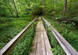
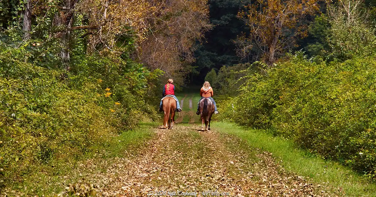
Hiking / Walking Trails
Difficulty: Easy, but because of the multiple branching trails, it’s easy to get lost and wander a bit. Use a map.
Distance: Up to 3 miles of trails.
Markings: Park trails are not distinctly marked. Some trails may have red flags tied to trees. An old access road leads from Lake Rd to the Lake.
Description: The trails in this park are all about exploration. The old access road (often labeled as Gates Dr on some maps) runs from Lake Road (west of the parking area) across the length of the park and to the shore of Lake Ontario. Use this road as a way to get back if you find yourself disoriented.
A recommended hike is to start out from the parking area and head north through the first campground and towards the bay.
Backtrack to the campground and follow a trail through the woods that leads to a large opening and a large structure. This is the mess hall. North of it is an abandoned swimming pool and administrative buildings.
Follow the old access road north and just past the clearing will be another abandoned campground on your left.
Continue north along the road and it will branch. Straight ahead leads down to the lake.
To the right are some cabins on top of the bluff, and to the left is a large campground and a lake-side lodge.
Map: See the Interactive Map below.
Camp Beechwood Interactive Map
Fishing
Fish at the DEC Maxwell Creek Fishing Access Site just east of the park on the other side of the bay. You can also fish on the south side of Lake Rd, along the creek. Follow the dirt trail from the south parking area.
Interesting Stuff
Sodus Point Beach and Lighthouse
Marking the largest natural harbor on Lake Ontario, this 1871 tower and keeper’s quarters is now a museum. It’s free to walk the grounds and guided tours are inexpensive. Only a few miles to the east in the village of Sodus Point.
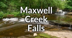
Maxwell Creek Falls
Just upstream from the park, on state-owned fishing access land, is a small waterfall. You can get to it by following the trail along-side Maxwell Creek that starts at the parking lot across from Camp Beechwood.

Photography Tips
Sunsets
- Because of the angle of the beach, sunsets are best (positioned more over the water) in mid-summer.
Layers
- When photographing the lake, include the foreground elements of Memorial Point to add depth and color contrast.
More tips
- See the Articles and Message Board sections for more photography tips.
Nearby Waterfalls
More Lake Ontario Parks & Beaches
Find a new summer hangout spot or place to swim in our comprehensive guide to Lake Ontario Parks and Beaches in New York State.
Who to Contact
Town of Sodus
14-16 Mill Street
Sodus, NY 14551
Phone: (315) 483-6934
Web: sodusny.org
DEC Region 8
6274 Avon-Lima Rd
Avon, NY 14414-9516
Phone: (585) 226-2466
Web: dec.ny.gov/about/558.html
