
Taughannock Falls State Park


Location: On the southwest end of Cayuga Lake; East of the village of Trumansburg, town of Ulysses, Tompkins County, New York.
Maps: Google Map; Topographic; Park Map (PDF); Campground Map (PDF); Trail Map (PDF); Interactive map.
GPS Coordinates:
- Taughannock Falls: N 42.53563 / W 76.61063
- Lower Falls: N 42.54477 / W 76.60136
- Upper Falls: N 42.53241 / W 76.61579
Directions: The park is on the south end of NY-89 along Cayuga Lake, 3/4 of the way from the Thruway to Ithaca. There are several entrances to the park. Heading south from the Thruway, the first entrance, Park Rd, leads to a spectacular overlook of Taughannock Falls. Follow the signs and park in the parking lot adjacent to the overlook. If you were to drive past this entrance and continue south on NY-89 you will find the main entrance to the park and the gorge trail. Rt-89 cuts through the park dividing the lakeside (northeast) section of the park and the gorge-side (southwest) section.
Parking: To hike the gorge, you want to park on the upland side of NY-89, which has a lot for about 40 cars. That entrance is right across the street from the lakeside entrance. Sometimes one entrance will have a toll-booth stationed, while the other won’t. There is plenty of parking on the lakeside section, and it’s not a far walk from there to the gorge trail-head.
Weather
Information / Accessibility / Accommodations
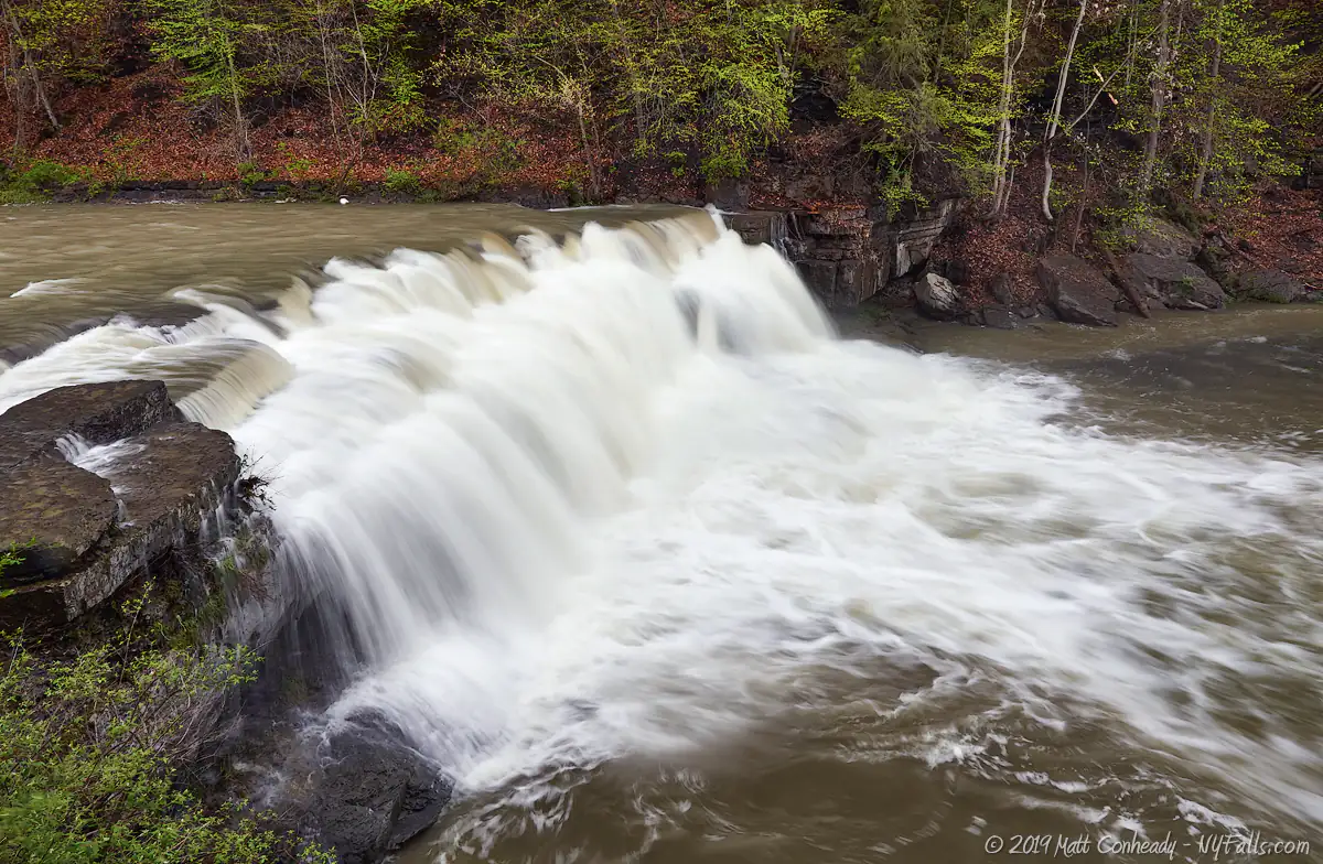
Number of falls: 3 major falls (Lower, Upper, and Taughannock) and several small drops along the length of the gorge. Several cascades by the roadside on the west end of the park.
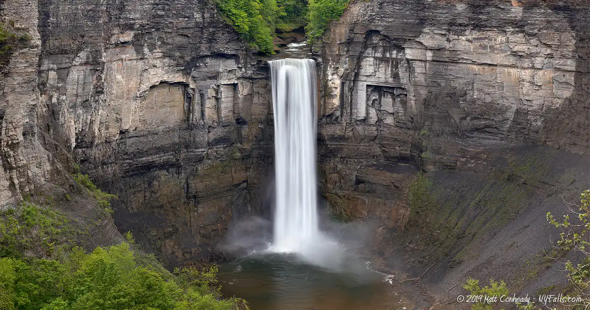
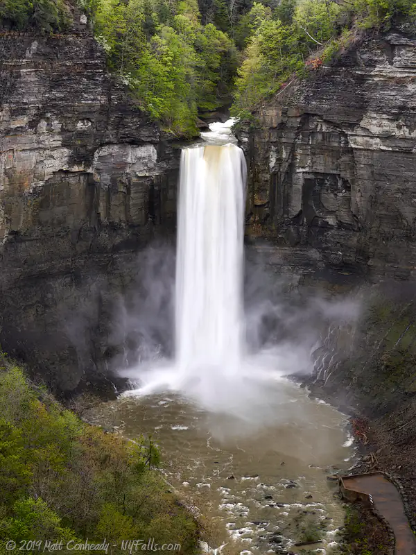
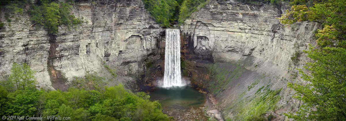
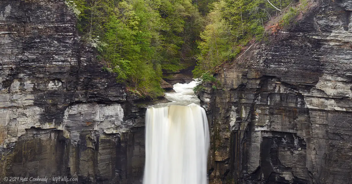
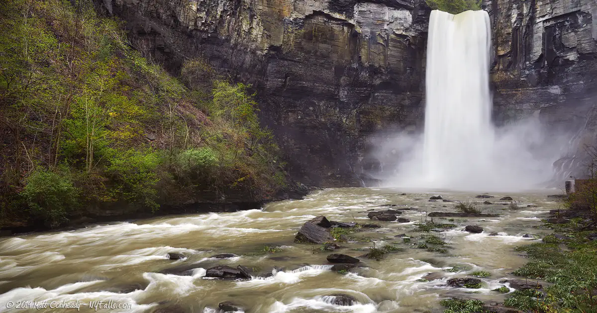
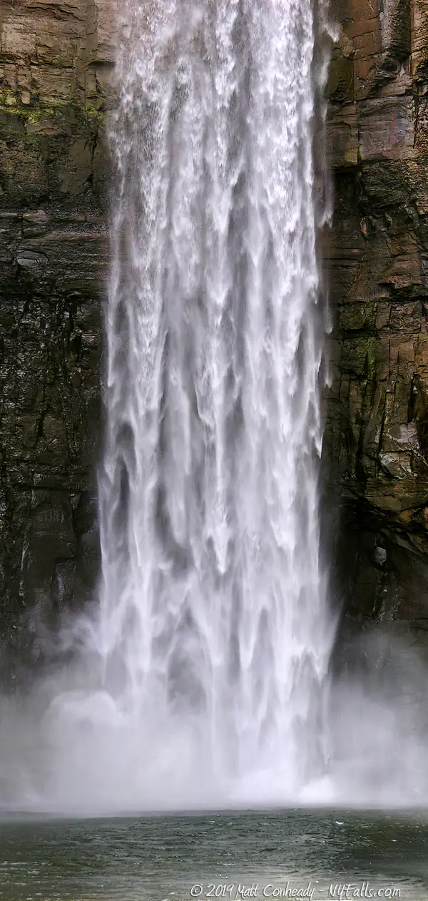
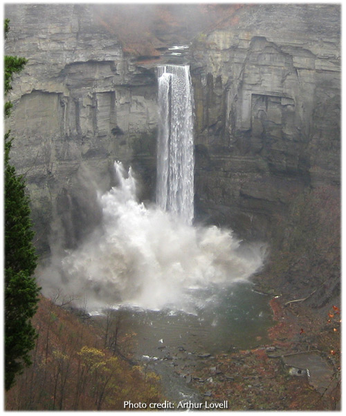
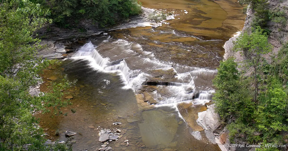
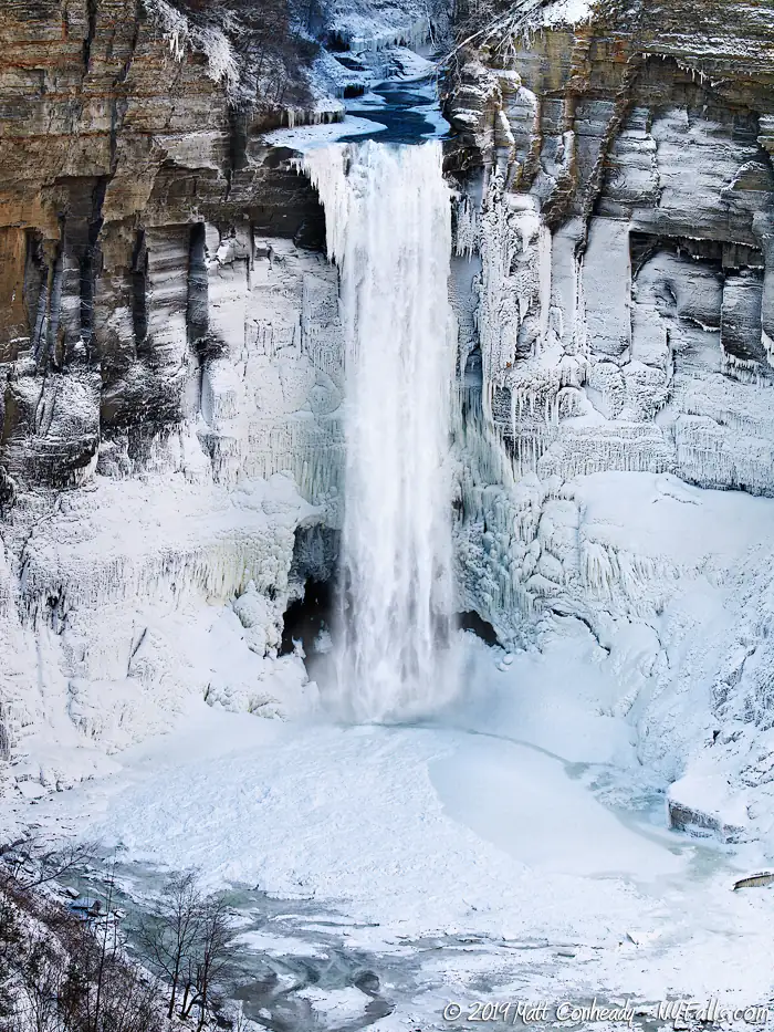
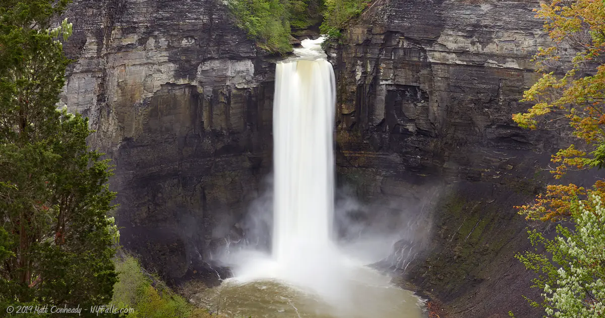
Size/Types: Taughannock Falls is a 215 ft tall plunge straight down into a massive amphitheater-like canyon. Lower Falls is a 15 ft high step cascade, which is easily seen near the parking area. Upper Falls starts as the creek joins the cascading tributary and steeply pours 100 ft while turning sharply at a twist in the narrow upper gorge.
Best time to visit: Spring, summer, fall. Gets crowded during summer weekends. Spectacular in fall.
Flow: Moderate, but will often dry to a trickle in summer.
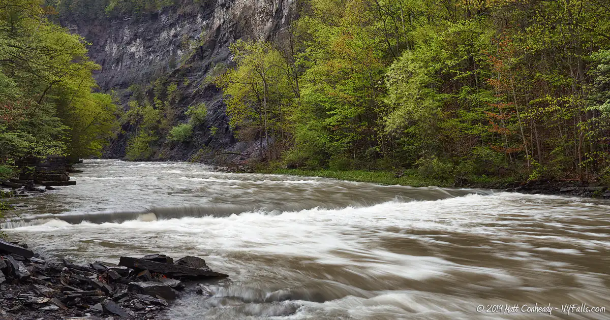
Waterway: Taughannock Creek, which begins over 12 miles southwest in the hills of Hector and empties into Cayuga Lake at the park.
Time: The falls overlook is a few minutes from the road. The gorge trail will take an hour. Add the rim trails and check out the lake to take up the better part of a day.
Seasons/Hours: Park open all year. Gorge trail open all year.
Admission: $7 vehicle fee for the entrances off of Rt-89. Free for the overlook via the park road. The rim trails are also accessible from this area of the park.
Handicap accessibility: Yes, the gorge trail and the falls overlook are accessible. The lakeside park is accessible. The rim trails are not.
Pets: Allowed on leash.
Swimming: No swimming in the creek or in the lake.
Boat launch: The park features a concrete ramp for trailer launch which is open year-round and a marina that operates from mid-spring through October.
Camping: The park features a fully-equipped campground with 68 camping sites and 16 cabins. Camping season runs from late March through mid-October. Book a campsite at this park.
Accommodations: Restrooms, beach, campsites, picnic tables, showers, changing rooms, playgrounds, cabins, pavilions, boat launch, trailer sites, drinking fountains, snack bar.
Description
A spectacular waterfall in a well maintained state park, Taughannock Falls is one of many sights within the park, yet it is easily the most popular not just within the boundaries, but in the entire region. Free-falling 215 feet from a hanging valley, this Taughannock roars during spring, drawing thousands of onlookers who hike the wide winding canyon to the viewing area at its base. In summer, it dries considerably, offering visitors a less wet experience walking up the creek bed. The pool at the base of the falls is deep and littered with gigantic boulders from rock falls. The sheer limestone cliffs that make up the massive amphitheater into which the falls empties, are jagged and worn with crackling and pops of falling debris often heard throughout the day and into night. In 2005, unfortunately a lady was killed, and three were injured, by a massive rock fall near the falls. In 2010, another significant rock fall was documented. This canyon is in constant flux, being one of the largest and most active as far as erosion. It is also one of the most beautiful, with the large twisting section of the gorge filled with waterfalls. Some are accessible and others far from reach. Most people go to enjoy just the grandeur of Taughannock Falls. We encourage you to explore the rest of the park, and specifically the rim trails to see the other falls.
Don’t limit your trip to summer. Visit in fall for some spectacular foliage and amazing photo opportunities. With the gorge trail open in winter, this is one of the better waterfalls to see in the cold of winter, as the mist builds up into huge sculptures of ice against the frosted cliffs.
When you have had enough of the waterfalls, Taughannock’s lake-side park has all the picnic and recreation opportunities needed to fill up the rest of your day.
History
The name Taughannock, as one would guess, comes from Native American culture, although not from a local tribe. It is actually partly from the region of Delaware and tribes east. It’s a name passed through cultures that eventually stuck here. Several origins of the modern name can be hypothesized, but the most similar is a combination of the Onondaga for Dehennach and Algonquin for Taakhan. Taughannock roughly means “the great falls of the woods.”
Early white settlers were documented as having recounted tales of unmistakable evidence that a Seneca settlement existed at what is now Taughannock Point (the lakeside part of the park). By the time white settlers arrived, the village had been abandoned, but their corn crops and orchards were still cultivated here. Orchard trees from these settlements survived up until the late 1800s, long after the Seneca were driven from the region. Abner Truman, a retired revolutionary soldier, is said to have transplanted apples from this old orchard to his farm nearby. The village of Trumansburg is named after him. George Goodwin, of Jacksonville, settled on the point and took over the old orchards. Remaining Seneca disputed his claim and would raid the orchards often. The point was then known as Goodwin’s Point.
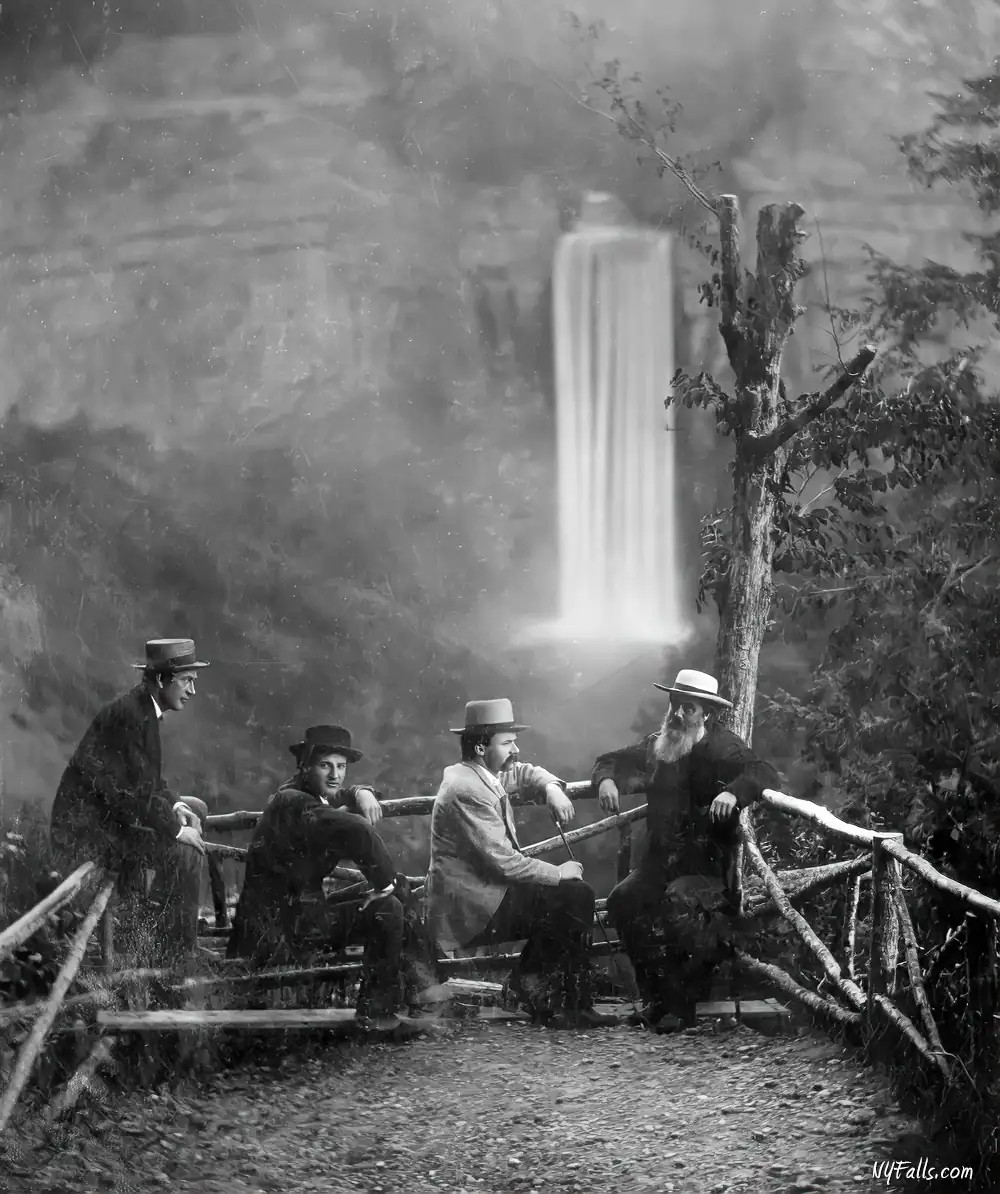
On July 2, 1879, workmen near the Taughannock House Hotel uncovered what seemed to be a seven-foot-tall petrified man while widening a carriage road, sparking significant public and media interest. Over 5,000 spectators paid to view this 800-pound “giant,” which was even examined by Cornell University scientists. However, it was soon exposed as a hoax by hotel owner John Thompson and his associates, inspired by the Cardiff Giant hoax of 1869. Although the original has been lost, a replica was created for the Tompkins Center for History & Culture in 2019. This wasn’t Thompson’s first stunt; in 1874, he hired acrobat “Professor Jenkins” to tightrope walk 350 feet above the creek, a feat he performed blindfolded in wooden shoes after having crossed Niagara Falls gorge.
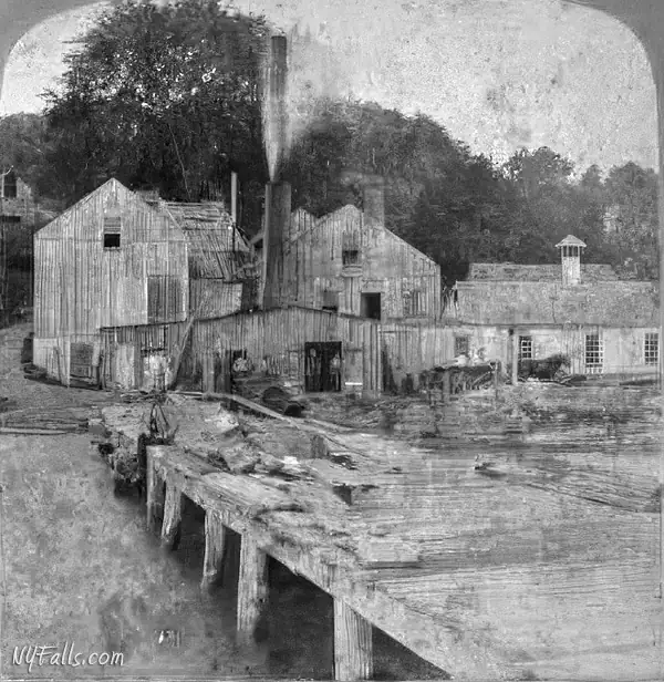
A gun factory was built around 1814 above the Upper Falls to make rifles under a government contract for the Civil War, but by the time their inventory was ready, the war had ended. After a period of abandonment, it served as an oil-mill, flax-mill, and then a tobacco house. By 1860, it was in ruins. Goodwins Point was the location of a large paper mill in the mid-19th century as the forests from around the area of the park were harvested for lumber and paper goods.
In September, 1922 New York State formed the Taughannock Development Corporation to oversee and promote the gorge as a tourist destination. At the time, people could buy shares in the Development Corporation for $10, and would yield an 8% dividend. Some development was done, such as hotels and shops, but the Great Depression stagnated the tourism industry. The state took over the property and developed it as a State Park in the 1930s.
Hiking / Walking Trails
The Gorge Trail
Difficulty: Easy.
Distance: Just over a mile to the falls and then back.
Markings: A well-defined stone, dirt and rock trail that starts at a trail-head near the gorge-side parking area. There are informational signs along the way. The trail-head has an information kiosk and park maps.
Description: The Gorge Trail runs from the main park entrance, past the Lower Falls, and along the gorge all the way to Taughannock Falls. If the water level is low, and it usually is, you can walk within the creek bed.
The trail offers many informational placards along the way, some about the history (natural and man), others about the geology . You’ll also pass a few small ledges and several magnificent cliff faces and overhangs. There are plenty of photo opportunities along the way.
The gorge trail ends about 300 ft from the falls, which is the perfect distance to take in the massive size of the falls and gorge. You may see many people crossing the boundary, and even swimming in the plunge pool, but be careful, people have been killed doing this.
Maps: You can pick up park maps at the information kiosk at the trail-head. Park Map (PDF); Trail Map (PDF); Interactive Map.
The Rim Trail Loop
Difficulty: Moderate (you have to climb stairs to reach the rim).
Distance: Just over 2.5 miles loop.
Markings: These trails are well-defined and marked.
Description: From the parking area at the gorge, climb the 2 sets of stairs up to the South Rim Trail. This trail parallels the Gorge Trail below, but goes further beyond Taughannock Falls and above the upper gorge.
There you will see several more falls, and near the end of the park, Upper Taughannock Falls from a bridge above the gorge.
Cross the bridge and head back on the North Rim Trail. About half-way back the trail opens up to the Falls Overlook area, from where you can see Taughannock Falls, the gorge, and all the little ants below. The trail heads back to Rt-89 on the other side of the creek from where you started.
Maps: Park Map (PDF); Trail Map (PDF); Interactive Map.
Taughannock Falls Interactive Map
Taughannock Falls Media
Taughannock Falls Videos


Interesting Stuff
Rock Falls
These are all too common. You have to be careful. In recent years a lot of people have been injured here, and some have died. You walk the gorge at your own risk, and if you cross a barrier, you really put yourself at risk.
Check out this awesome account of a massive rock slide.
Size
Taughannock Falls is 33 ft higher than Niagara Falls and is the highest free-fall waterfall in the northeastern United States. It falls with such force, the plunge pool carved out below is more than 30 ft deep. You’re not going to find a larger gorge in the Finger Lakes either. Erosion from water and ice has carved out 400 ft high cliffs over thousands of years. Rocks continue to crash down every day. Over the course of a several years, the gorge walls can change dramatically.
Joints
This gorge offers the greatest examples of joint rock fractures. Some of them are so straight and cut so consistently that they seem to be man-made. The joints are fractures in the rock caused by geological pressure. If the rock layer has consistency, fractures will be distributed evenly. Water can fill the fractures, freeze in the winter, expand, and either cause the joint to increase in size, or more dramatically, cleave off a portion of the rock layer.
The Ocean Floor?
See the ripple-like pattern in the creek bed? Some signage in other parks mislead people, telling them that this is the result of the layer of rock being deposited by an ancient ocean. While it is true that a rock layer was deposited by an ancient ocean, the ripple pattern is in fact the result of modern water erosion. Both acidic rain and sand are to blame. Acidic rain puddles in the creek bed dissolving the limestone, creating these ripples. In the creek’s current, particles of sand will swirl around in these dimples, further carving them out. Any ripples from ocean currents in sand back then would have been long flattened out over millions of years and hundreds of tons of rock, sand and soil piled on top.
Photography Tips
Taughannock Tips
- The viewing area at the end of the gorge trail is a great place for portraits with an awesome backdrop.
- This falls is huge, even from 500 ft away. Bring a wide angle lens. Shoot in portrait orientation.
- Tall waterfalls like this make for great falls either with a long or short exposure. Try both.
- The bridge below the falls vibrates when people walk on it. Use image stabilization or get to the park in the early hours.
- Because of the size of the gorge, the light is often uneven, with a shadow covering one side. Cloudy conditions are the best for lighting.
Proper creek-walk footwear
- Wear the proper footwear for creek walking and climbing. Not only can a quality pair of water shoes prevent blisters and infection, they will help you stick better to the ground and reduce your risk of falling, hurting your self, or your camera gear.
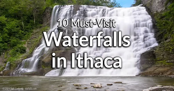
10 Must-Visit Waterfalls Around Ithaca, NY
A selection of the most popular and accessible waterfalls around Ithaca in the Finger Lakes Region of New York.
Who to Contact
Taughannock Falls State Park
2221 Taughannock Road
Trumansburg, NY 14886
Phone: (607) 387-6739
