
Excelsior Glen


Location: On the southeast end of Seneca Lake; Outside of the village of Watkins Glen; Town of Dix; Schuyler County; New York
Maps: Google Map, Topographic; Interactive map.
GPS Coordinates:
- Parking and Trailhead: N 42.39112 / W 76.85559
- Excelsior Falls (Empire Falls): N 42.39113 / W 76.84954
- Lower Falls: N 42.39075 / W 76.85492
Directions: From the village of Watkins Glen, head north on NY-414 past Clute Park, and uphill with Seneca Lake on your left. The glen opening and trail head will come up quickly on your right in about .1 mile uphill. If you reach the junction of NY-79, then you have gone too far.
Or use Google Maps.
Parking: Park near the trail-head alongside NY-414 (space for 3 cars) or downhill across from Cass Rd (space for more than 20 cars).

Weather
Information / Accessibility / Accommodations
Number of falls: 5.
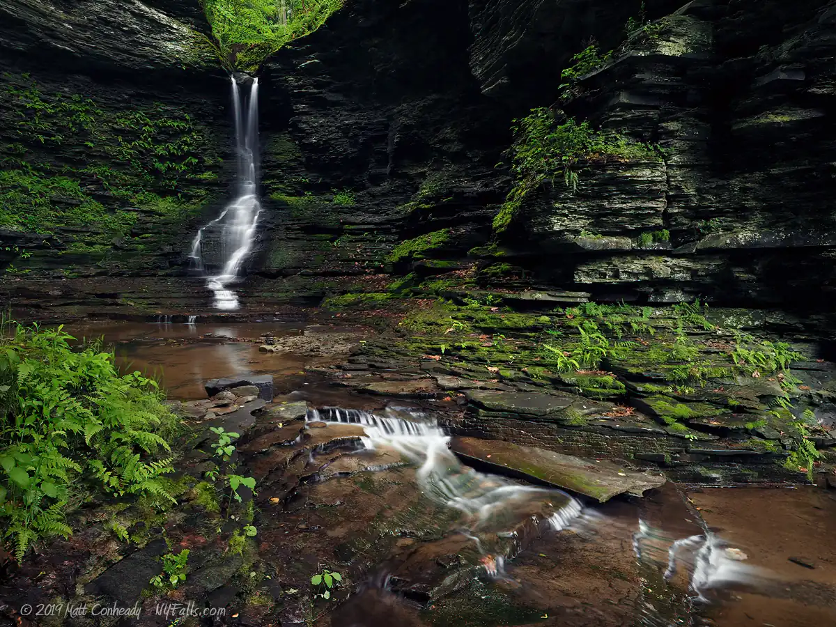
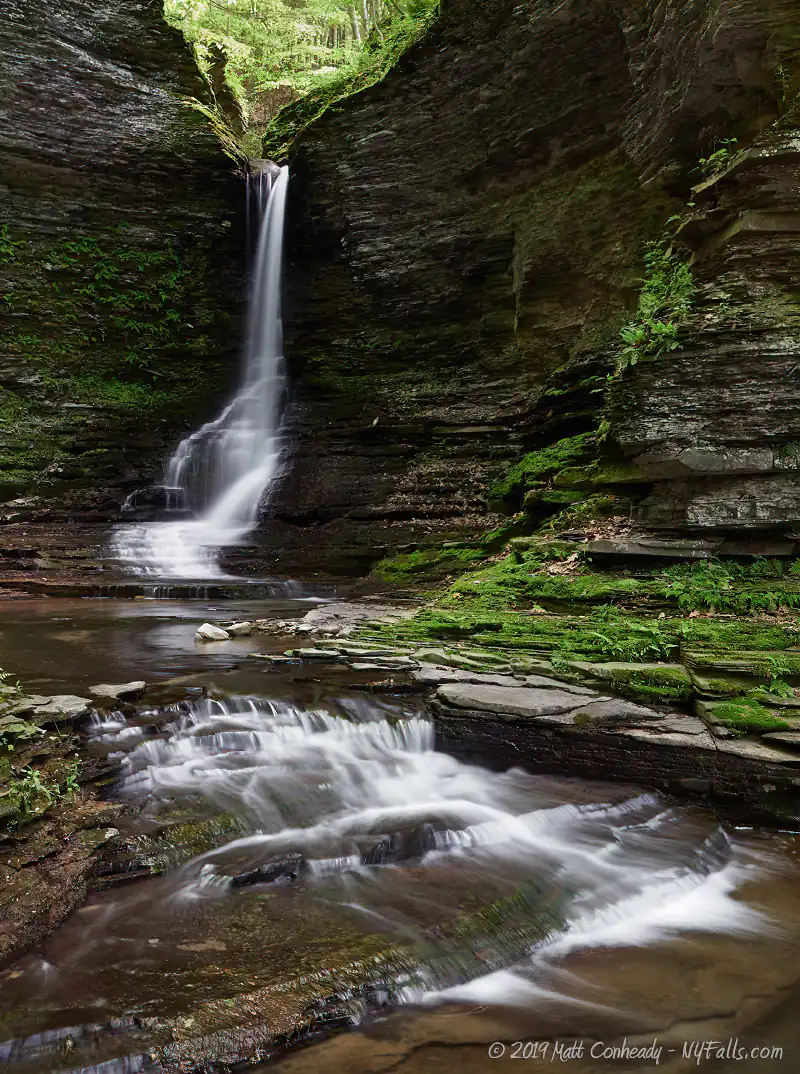
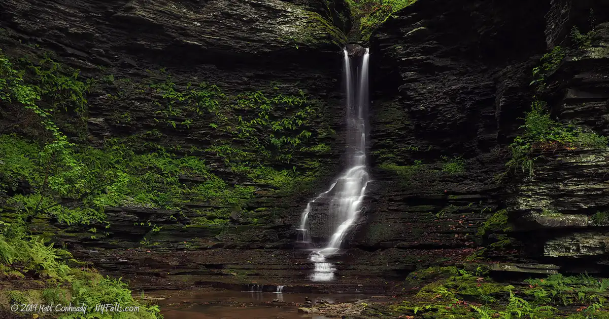
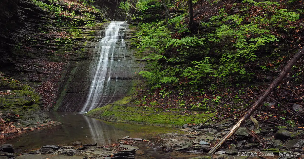
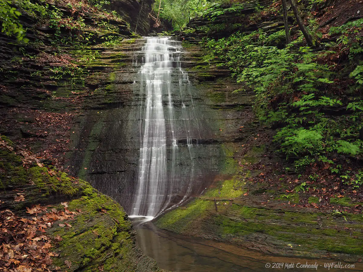
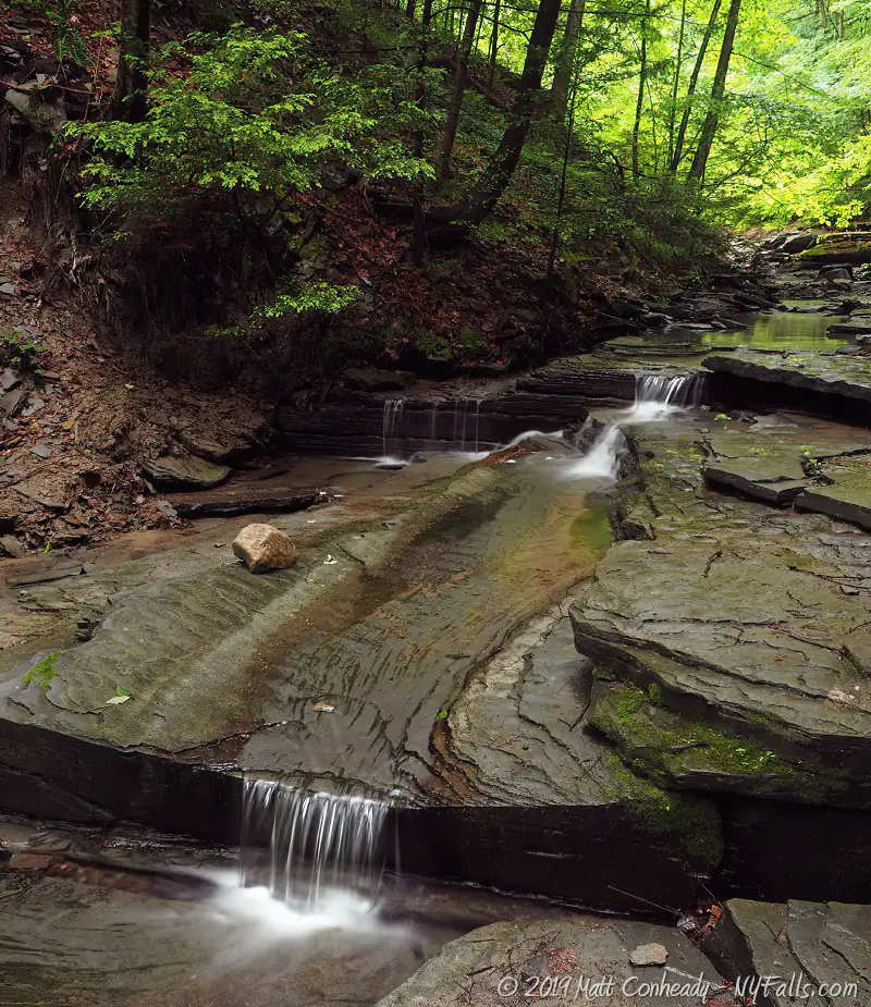
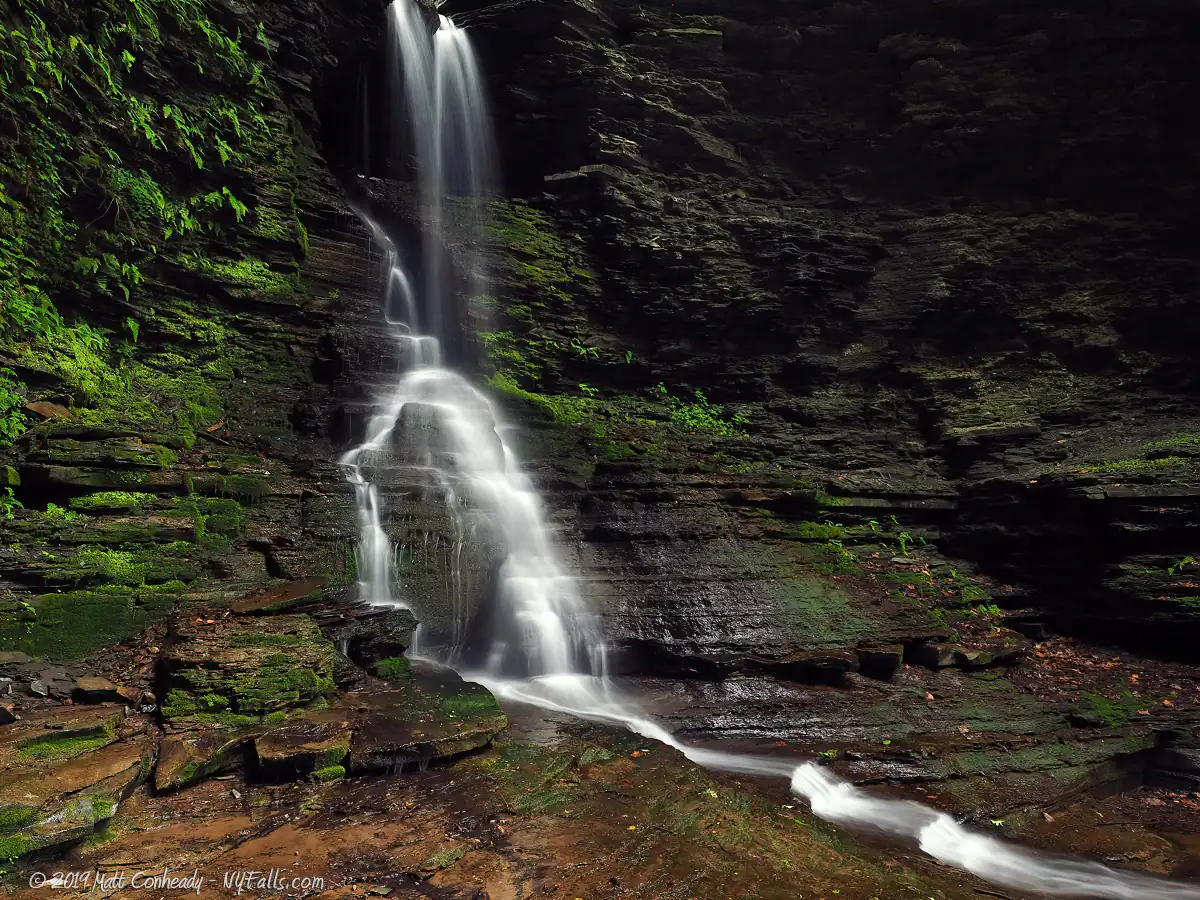
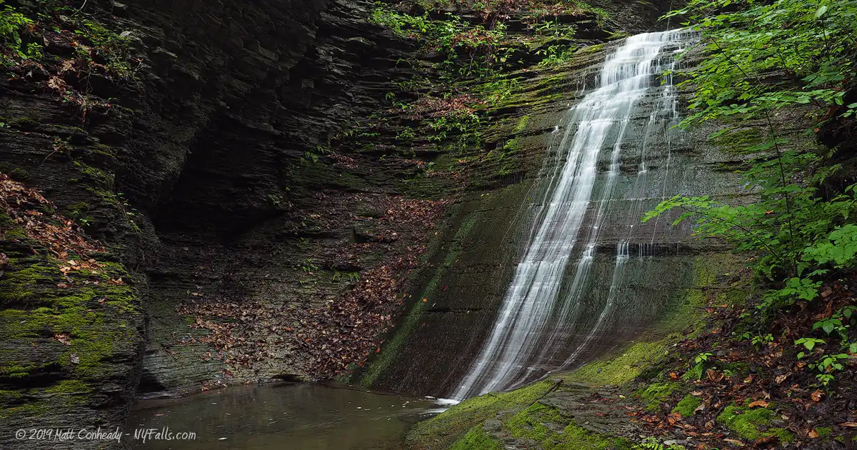
Size/Types: The glen has several waterfalls, all narrow cascades, ranging from 8 to over 100 ft. One in particular starts out as a narrow chute and spreads out as it cascades down. At its cap, a large limestone boulder is lodged within the slim gap in the glen walls. Excelsior Falls (Empire Falls) exceeds 100 ft in 3 tiers. Emerald Falls is a 32 ft high classic cascade in a green-covered section of the glen.
Best time to visit: Spring, fall. In winter Excelsior Falls (Empire Falls) is used for ice climbing.
Flow: Low to moderate. Usually dry in summer.
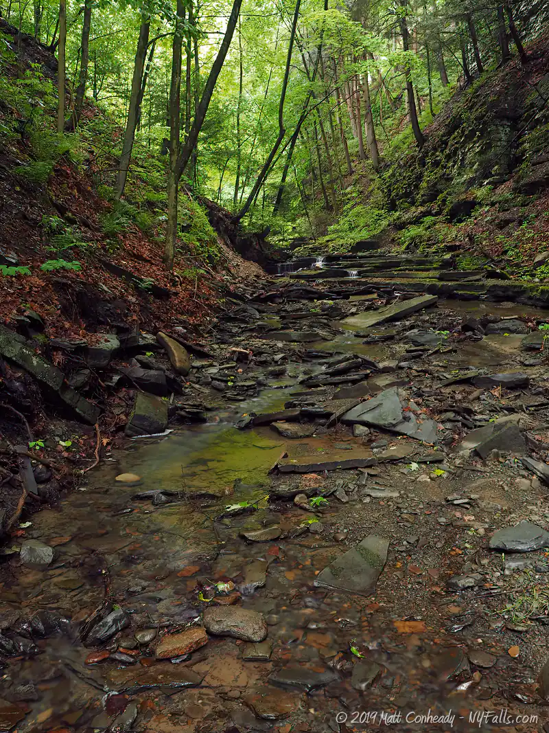
Waterway: Excelsior Glen, which starts in a small marsh, surrounded by farmland just over 1 mile east of Rt 414. The creek actually heads northwest for about a mile and cuts a small ravine into the hillside, dropping 150 ft before it turns 270 degrees and runs southwest towards the deep glen described here. When it reaches the ravine, it turns 90 degrees and heads west into Seneca Lake. The section of the glen described on this page drops nearly 450 feet in less than a half mile.
Time: 1 hour to hike up the Finger Lakes Trail and back. 2 hours to do some creek-walking and see all of the falls.
Seasons/Hours: Open year-round. All day, all night.
Admission: Free.
Handicap accessibility: No.
Pets: Due to the danger involved with this trail, we highly recommend not bringing your pets. This is not only for your pet’s safety, but for the safety of fellow hikers. On a recent hike we encountered an irresponsible owner forcing his scared pup up some questionable climbs. It was pretty sad. Don’t be that jerk.
Accommodations: Trails; trail register. Clute park is less than a mile south. It has a beach, restrooms, picnic facilities, trash bins.
Description
AKA: Excelsior Falls; Empire Falls; Emerald Falls; Sullivan Falls
Located less than two miles from Watkins Glen, Excelsior Glen has many of the same physical and historic characteristics as its more popular neighbor. Composed mostly of shale and limestone, Glen Excelsior (as it was called in the 19th century) has sparkling cascades, breathtaking chutes and refreshing plunge pools to explore in its relatively short length. Watkins Glen State Park has almost 20 waterfalls, Excelsior Glen has only 5. Although it lacks quantity, its massive secluded cascades, including the 100+ foot Excelsior Falls (AKA Empire Falls), offer a feeling of wonder and adventure one cannot get in the bustling park down the road.
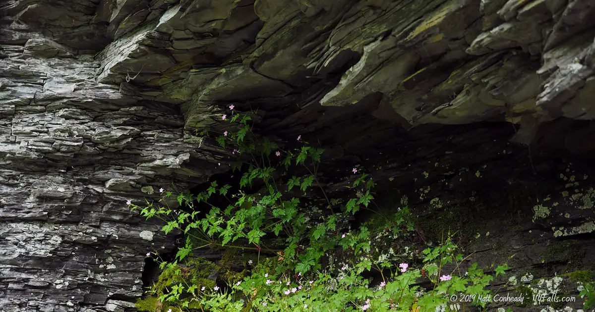
The first waterfall, which is a short distance from busy Rt 414, has cut a narrow plunge through the surrounding shale, dropping into a narrow “amphitheater” of towering rock. When standing in the creek bed, the massive stone cliffs seem to encapsulate you, blocking out nearly all signs of surrounding civilization. A large boulder is wedged in the narrow opening from which this falls pours, no doubt from a high water event in years past, is an oddity that may not last long. It makes for interesting photos and certainly adds character to the glen.
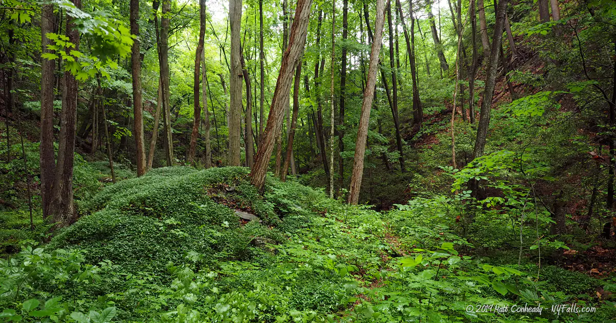
The trails along the creek bed are particularly lush and verdant, with wonderful ferns and columbines growing everywhere you walk. The glen is unique in that it has beautiful foaming cascades (similar to Buttermilk Falls in Ithaca) which seem to slide down a gradually inclined rock face, fanning out as they reach the bottom, making for beautiful photos as well as soothing sound.
What’s great about this glen is its wild and undeveloped state, a sharp contrast from nearby Watkins Glen, where the sounds of the crowds can literally drown out the rushing water. Excelsior Glen has always been a lesser known attraction along Seneca Lake, and its narrow corridor has long prevented the extensive development that made Watkins what it is today.
The Finger Lakes Trail that runs along the glen gives passage to visitors willing to take on a little excitement to get a glimpse of some of the waterfalls, while the more adventurous are welcome to hike upstream, scale the waterfalls and explore the nooks and crannies of the half-mile ravine. With barely any indication the creek exists to the casual visitor to the south end of Seneca Lake, Excelsior Glen is a tranquil alternative to Watkins Glen where in several hours of hiking you may not see another soul. Its solemn atmosphere, picturesque waterfalls, and openness to exploration make Excelsior Glen a favorite among many of our website’s visitors.
History
The geological history of the area was born with glaciers. At one point, the surrounding land was part of a shallow sea. At the end of the last ice age, when glaciers scoured out the Finger Lakes, tributaries to Seneca Lake had to cut through shale to make their way down to the lake — hence the numerous glens around the area were born.
In the latter half of the 1800s, Watkins Glen (now the state park) was a growing tourist attraction. Seemingly, each year the glen would open with a variety of trail improvements and accommodations for visitors. It was touted as a world-class attraction, and indeed attracted visitors from around the globe. Many others tried to imitate its success by purchasing nearby land containing glens, erecting ladders and constructing crude trails, and charging a small fee to see the waterfalls within. Havana Glen, Montour Falls, and Excelsior Glen were all privately owned attractions competing with Watkins Glen at that time. Of the four glens, Excelsior was the least developed, most likely due to its narrow ravine and seasonal flow, but historic accounts note it as a magical attraction, liked for its solemn qualities rather than its grandeur.
Thanks to the Finger Lakes Trail conference, the stretch of the waterway that has captivated the adventurous, is open to the public and still appeals to those looking for a more intimate and basic glen experience.
Hiking / Walking Trails
Difficulty: Moderate to Very Difficult. There is a combination of creek walking and moderately strenuous trail climbing along the outskirts of the gorge. Less strenuous if you take advantage of the trails. Very difficult if you creek-walk and climb the waterfalls all the way.
Distance: The Finger Lakes Trail is about a half-mile one-way. The trail to the lower falls is just a 10th of a mile one way. A hike/climb directly up the gorge all the way to the last falls is roughly a half-mile one way.
Markings: A Finger Lakes trail kiosk and trail register can be found at the first junction, just a tenth of a mile in. The trail is clearly marked with white blazes on the trees. The other trails are unmarked.
Description: The Finger Lakes Trail (green): Initially, the FLT heads north between the cliffs along Rt 414 and the guardrail until it hits the gully, where it makes a 90 right/east turn and heads into the glen. The trail is quite narrow through here, descending for a short way, then climbing back up a steep slope to a slightly leveled area. The FLT Trail Register box is on a tree to your right. As you look at that tree, you can see the white blazes to the right, leading further up the hill. The trail loops up the hill towards the road, then turns back and starts a long, steep ascent.
There are actually two routes through here. One is the old FLT (marked in yellow), and follows closer to the rim of the gorge. It is steeper, and footing is not as good, although it is shorter and more scenic. The white blazes have been removed from the trees, but a keen eye can spot the discolorations left behind and follow the trail.
The new FLT is a reroute that was done within the past couple years. It takes a more gradual (but still fairly steep) incline going south along another rock wall then turns almost 180° back around on itself, continuing the gentler incline east/northeast to merge with the original trail. From there, it gets a bit steeper as it follows the gorge rim up to Excelsior Falls. Near the top after it levels out, it does follow what may be an old farm road or herd path, and it takes an easily missed turn OFF that path to the left/northeast where it heads towards the glen for the crossing. Stay alert for this turn — you end up exiting the woods into a farmer’s field if you miss it. The trail slopes gently back down to the creek, and crosses at the crest of a nice waterfall. The adventurous can leave the trail early and get into the creek for a great view of this falls head on.
Follow downstream for the spectacular view from the top of Excelsior Falls (AKA Empire Falls). Go upstream for a few other, smaller cascades. Continue on the FLT to emerge on Jolly Rd. *NOTE* The majority of the FLT north of the creek crosses private property. Please respect the landowner who has graciously allowed the volunteers of the FLT Conference to build and maintain this trail for our use.
Lower Falls Creek-walk (blue): Moderate difficulty. Carefully climb down the side of the drainage culvert and into the creek, then head upstream a short distance for a spectacular view of the lower falls.
Creek Walk and Climb (red): Very difficult. Experienced hikers and climbers only. See our safety tips prior to taking this path. This part of the creek-walk starts at the base of Emerald Falls. The beginning and ending portions of this route are what makes it ‘advanced.’ It starts with the climb of Emerald Falls, advances on mostly level terrain through the creek-bed for rest of the way, then ends with climbing Excelsior Falls (Empire Falls) and intercepting the FLT.
Maps: Interactive map.
Thanks Andy, Kyle and Bret for help with this trail guide and map.
Excelsior Glen Interactive Map
Excelsior Glen Media
Interesting Stuff
The Finger Lakes Trail
Excited by this scenic hike? The FLT trail is only a small fraction of what the FLT has to offer. All the maps and information you need are available through their website: fltconference.org.
What’s that smell?
The high concentration of sulfur in the rock within the glen is picked up by the ground water, and carried out down the stream. Excelsior Glen has been known as a natural sulfur spring for hundreds of years.
Photography Tips
Shoot wide and get wet
- This gorge is very narrow and there isn’t much room to move back to fit the tall waterfalls in. Bring your wide angle lens.
- You will spend a lot of time in the creek bed for most shots—plan on getting your feet wet— and keep gear safe and dry.
In the gorge
- The 2nd and 4th falls have the foaming cascades on them, so be aware that during high water flows, this type of waterfall tends to over-expose, so check the histogram and keep exposure in check.
- The trails going through the lush understory are really beautiful. Keep that camera out and don’t concentrate on just the falls.
Silky Water Effect
- To get that smooth cotton-candy look to the falls, you need to use a Neutral Density (ND) filter on your lens. The ND filter will block some of the light from entering the lens without altering the color, and thus allow your shutter to stay open longer. This blurs the water and creates a soft white gloss to the foamy areas of the falls. Check out the article for the all the details.
More tips
- See the Articles for more photography tips.
Who to Contact
Finger Lakes Trail Conference
6111 Visitor Center Road
Mt. Morris, NY 14510
Phone: (585) 658-9320
[email protected]
fltconference.org
