
Corbett’s Glen Nature Park


Location: In the Greater Rochester Area; Brighton; Monroe County; New York.
Maps: Google Map; Topographic; Trail Map; Interactive.
GPS Coordinates:
- Falls 1 “Tunnel Falls”: N 43.12978 / W 77.52017
- Falls 2: N 43.12974 / W 77.51980
- Falls 3 “Postcard Falls”: N 43.13012 / W 77.51854
Directions: To the south park:
- Take I-490 to exit 23 and head east on Linden Avenue.
- Make the first left turn onto Glen Rd. Follow Glen Rd. You will see signs designating a section of Glen Rd. for Corbett’s Glen parking.
- Or use Google Maps.
To the north park:
- Take I-490 to exit 22 and head east on Penfield Rd.
- Cross the railroad tracks and Temple Sinai will be on your right.
- The parking lot is a few houses after the temple, across from Forest Hill Road.
- Or use Google Maps.
An alternate entrance can be found at the terminus of Park Ln, off of Penfield Rd. Park along the cul-de-sac. Use Google Maps.
Parking: Roadside parking in the designated parking area on Glen Rd (6 cars) or within the lot at the north end (opposite end from the waterfalls) off of Penfield Rd, across from Forest Hill Rd (room for 6-8 cars). Handicap parking for 1 or two cars is within the park. Drive through the tunnel to get there.

Weather
Information / Accessibility / Accommodations
Number of falls: 3
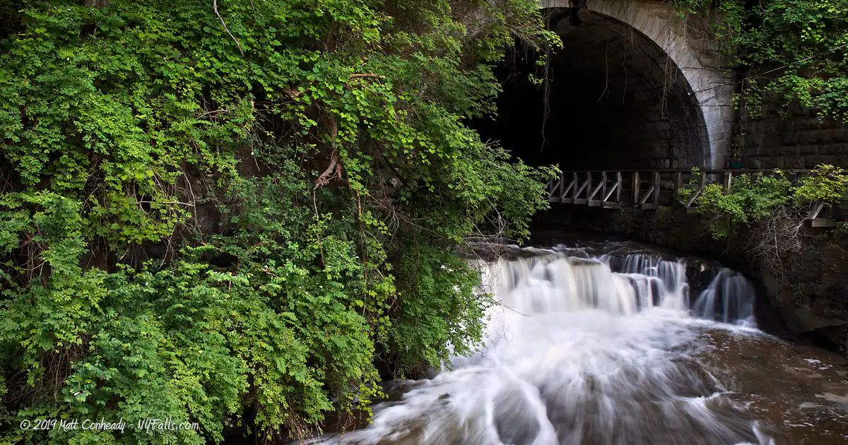
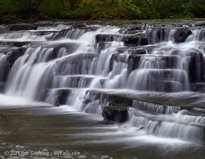
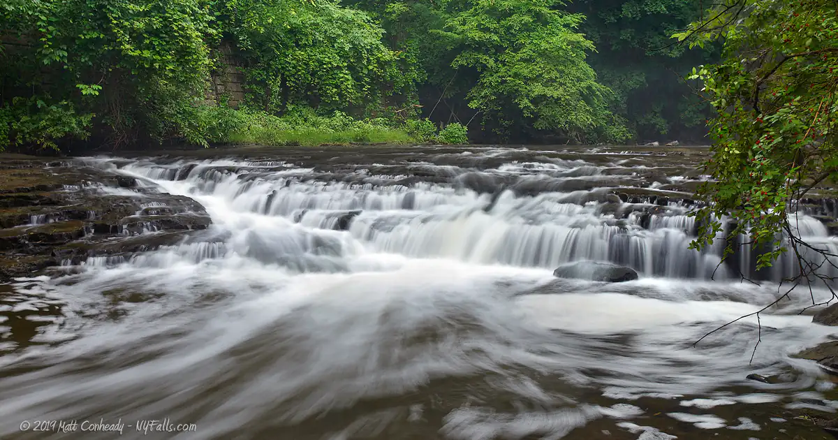
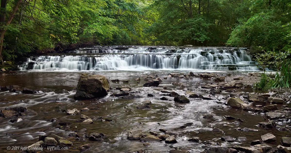
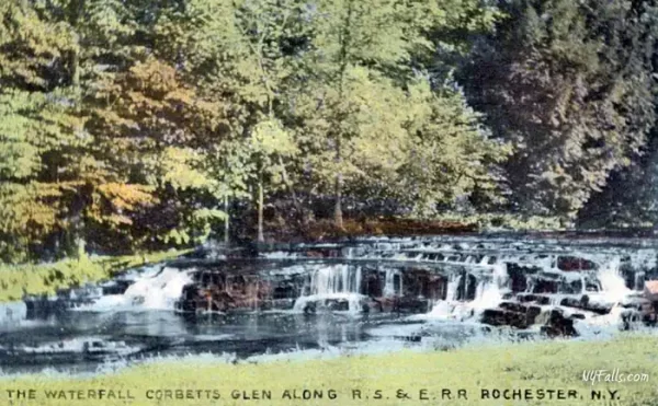
Size/Types: Tunnel Cascade is a small 4 ft drop framed by the railroad bridge tunnel. Another falls is a gentle sloping v-shaped cascade, barely 6 ft high. Postcard Falls is a limestone cascade less than 6 ft high.
Best time to visit: Year round.
Flow: Moderate.
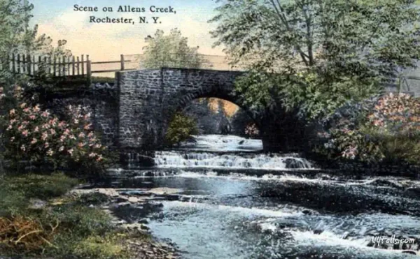
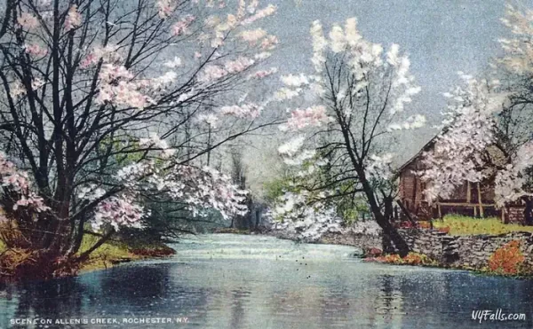
Waterway: Allens Creek, which is a tributary to Irondequoit Creek, which empties into Irondequoit Bay and Lake Ontario.
Time: At least 15 minutes.
Seasons/Hours: Open year-round, daily, from 7am to 10pm.
Admission: Free.
Handicap accessibility: Yes, to the first waterfall.
Pets: Allowed if on leash. Leash policy strictly enforced. Please clean up after.
Accommodations: Signage; historical markers; trails; fishing.
Description
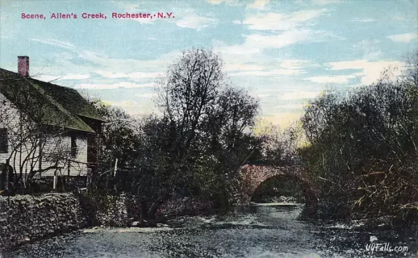
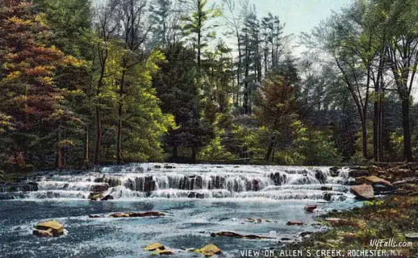
Once a privately-owned park, Corbett’s Glen was such a premier attraction for the Rochester area, its picturesque landscape is immortalized in postcards and the memories of the locals. Even when devastated by pollution and threatened by surrounding development, the Allens Creek Valley, in which the Glen lies, continued to be a draw for scenic walks, family picnics, and photography.
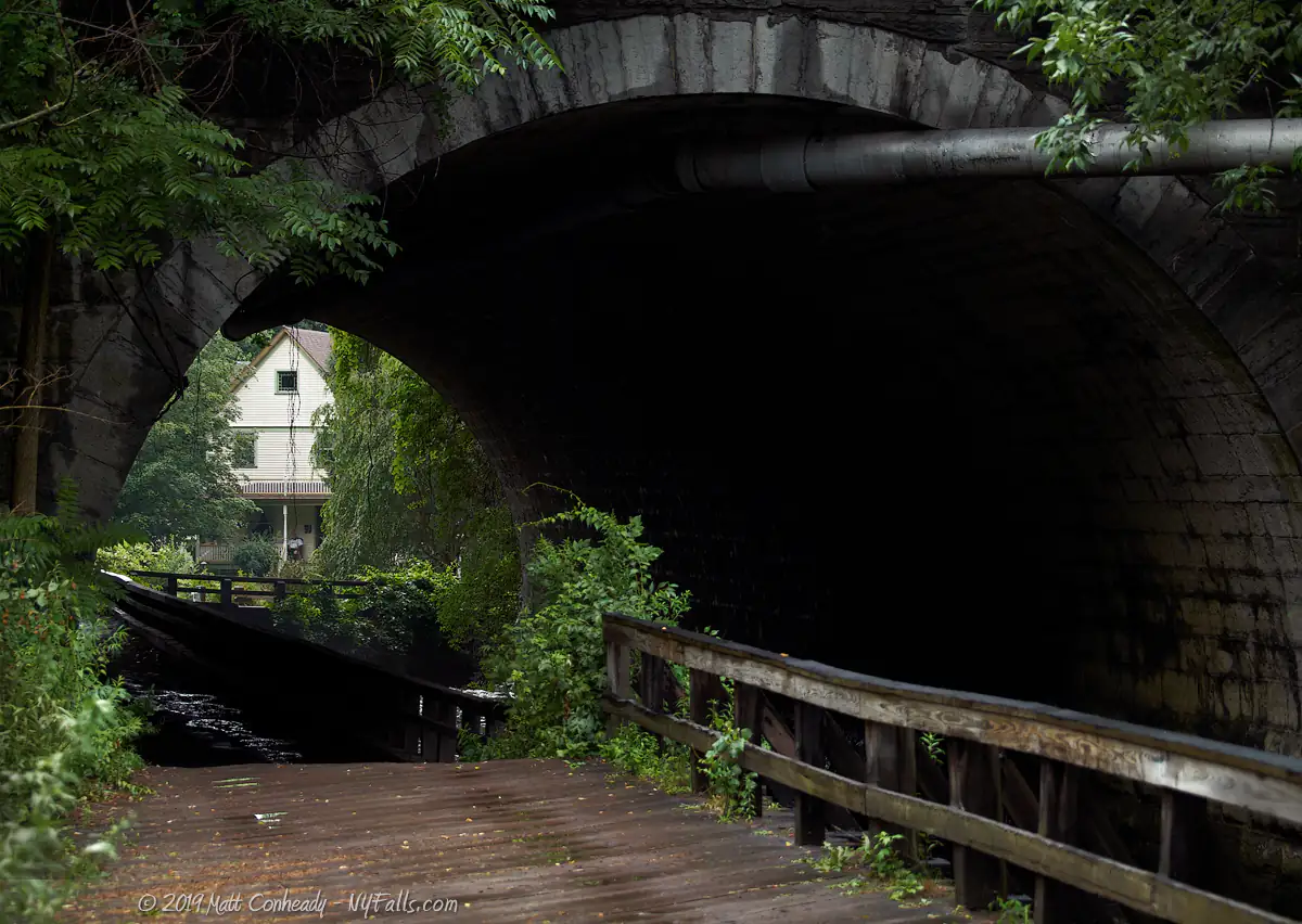
Hidden away in the development-packed Rochester suburb of Penfield, the Glen continues to serve as a small slice of nature for the community to enjoy. The pebble-lined Allens Creek enters the park as visitors do, through the vaulted stone arch of the railway bridge. It is this tunnel that gives visitors a feeling of entering another world; one that really shouldn’t be here, as they leave the busy expressways and business complexes above, and follow Allens Creek as it winds around glacial formations and drops over several small frothy cascades. Tunnel Falls, lying just as the creek emerges from beneath the vine-covered stone of the rail bridge, is the first of many lovely scenes that is remembered long after leaving. Two additional cascades, although small in size, shake up the creek and provide a little excitement in this otherwise serene landscape.
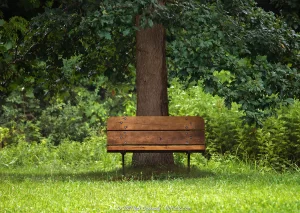
In addition to the three cascades, the southern part of the park carries hikers around rolling glacial moraines left from the last ice age, wetland marsh that is as saturated with wildlife as it is with water, and a wind-swept meadow in the heart of it all. A favorite pastime of mine is to sit on the lone bench in the middle of the meadow with a pair of binoculars and a field guide and try to identify the various resident and migrating birds that fly by. Being an oasis of green within an urban jungle, migrating birds often use the valley as a stop-over on their long journeys. Over 100 species have been spotted here. The northern end is perfect for an afternoon shaded walk through deciduous and mixed woodland. The trails here are well-maintained and spotting local wildlife is unavoidable.
The Corbett’s Glen neighborhood is friendly and very protective of the park. If it weren’t for the surrounding community, and support from the Genesee Valley Land Trust, we may not have Corbett’s Glen today. The town of Brighton’s plans for adjacent development are an immediate danger to the health of this isolated ecosystem.
History
Before pioneers reached the Allens Creek Valley, Seneca tribes utilized trails that ran across the Glen here and up to Irondequoit Creek. In the 1800s, evidence of an ancient burial ground was unearthed here, demonstrating the historical importance of this setting. As more pioneer traffic reached the valley, the trails became more crucial for traders traveling to nearby Indian Landing and Fort Schuyler, a major trading post in the region (now a part of Ellison Park).
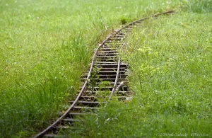
In the 1800’s, settlers built several mills and dams across Allen’s Creek, beginning an era of development that now threatens the health of the glen. A pre-civil war powder mill, owned by John Tyron, once supplied gunpowder to as far as Lockport, for use in the construction of the Erie Canal. In 1851 the Rochester and Syracuse Railway constructed a line that crossed the valley, but it wasn’t until 1882 that is was upgraded with a larger embankment and vaulted arch stone bridge, the largest in New York, which was constructed with stone quarried from the glen. It still stands at the southern entrance and the line is now operated by CSX.
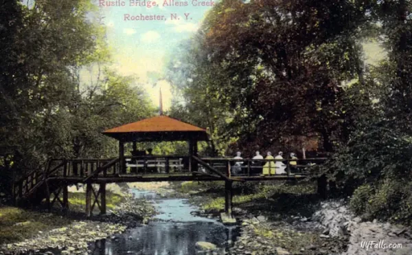
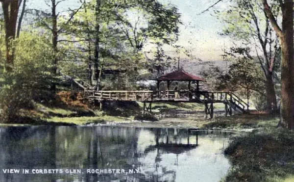
In 1883, Patrick Corbett moved to the Glen and in 1889 had purchased much of what is today’s park. His family operated a successful produce farm in the Glen utilizing the fertile soil and irrigated waters from the creek. Realizing the beauty of the glen beyond its agricultural potential, Mr. Corbett developed a private park, complete with dance and band pavilions, baseball diamonds, and food and drink stations. He operated the park for decades and visitors came in by trolley from as far as Syracuse to spend a day there. The expendable income and free time Americans had during the 1920s meant that parks near rail lines got a lot of traffic. Most traces of the Corbett-run park are gone now, with only the Corbett home, visible as you enter the Glen through the tunnel, left standing.
In 1956, Howard Meath purchased a section of the Glen and opened Camp Hideaway, offering summer recreation opportunities for local children. The facilities there catered to small concerts and gatherings for older crowds as well. The interesting and isolated land also became a local hang-out and was subject to a great deal of dumping and vandalism. The decline of the Glen began as early as the 1930s when upstream plants and factories began dumping waste into the creek. Post-war development saw a population boom in the Greater Rochester Region and the sewage-treatment facilities upstream could barely handle the load. The 490 expressway was built nearby in the 60s and this not only modified the flow of the creek, but contributed to runoff, and led to further development in Penfield. The toxicity of the water and poor state of the surrounding land meant an outdoor-centered business, like a park or camp could no longer survive here. By the 1970s Corbett’s Glen was nothing more than a dirty mess with lingering fond memories. It was split up and sold in 1976.In 1970, the town of Brighton’s Comprehensive Development Plan recognized the importance of the Glen as a natural setting, historic landmark and recreation spot. In 1974 the town began exploring the possibility of acquiring the land. In the 1980s, the passing of federal clean water legislation severely slowed dumping into the creek and made clean-up of the Glen a reality. During this time, although privately owned, the Glen was considered open spaces and seemingly open to visitors throughout the year. In 1999, with development of the property an increasing threat, the Town of Brighton and the Genesee Land Trust partnered and contracted to purchase the Glen from the Corbett and Meath families. After a fundraising campaign, the partnership celebrated the saving of the Glen on June 24, 1999 with the opening of Corbett’s Glen Nature Park.
Hiking / Walking Trails
Difficulty: Easy.
Markings: Markings define boundaries of the park and private property.
Distance: Nearly 2 miles of trails total within the park.
Corbett’s Glen South has a series of looping trails that reach around the perimeter of the park and cross the inland meadow. The Perimeter Trail runs around the southern park, from the Rail Tunnel and the first waterfall, past the observation deck and the second waterfall, along Allens Creek to Postcard Falls; all within the first 1/5 of a mile. Continue on the trail to make your way through to the beautifully isolated meadow, or stay on the perimeter to experience the hilly glacial formations on the fringes of the park and then pass through the Allens Valley Wetlands on a boardwalk. The full loop is about 2/3 of a mile.
The North-South Trail runs 3/4 of a mile, connecting the north and south ends of the park. You can pick up this trail near the railroad bridge tunnel.
Corbett’s Glen North features two looping trails and the majority of the North-South Trail. The Penfield Rd access point connects directly to the Stone Dust Loop Trail (1/3 mile), which is adjacent to the Woodchip Trail (just over 1/3 mile). Both trails are in wooded sections of the valley that border Glen Manor Creek.
Maps: Google Map; Topographic; Trail Map; Interactive.
Corbett’s Glen Interactive Map
Corbett’s Glen Media

Interesting Stuff
Old Growth
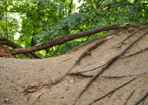
The bordering sandy hills are glacial moraines, left by towering glaciers from the last ice age. These moraines trace the perimeter of 3 sides of the southern end of the park and many are topped with old growth trees–over 150 years old!
Powder Mill Explosion
“The powder mill at Allen’s Creek, in the town of Brighton, about five miles from the city, was blown up at about half past nine o’clock yesterday morning. A man named ROSS, who was in the mill at the time of the explosion, was blown across the creek, and horribly mangled. We hear that he has since died. We have not learned the cause of the explosion. The mill was owned by Mansfield PARSONS. The glass in windows of houses in the neighborhood were all broken out. We have not learned the amount of Mr. PARSON’S loss.”
Source: Rochester Republican (April 5 1849)
Cherry Crush
The 2007, teen thriller, Cherry Crush, starring Nikki Reed and Jonathan Tucker, and directed by Nicholas DiBella, was filmed around Rochester, NY and Penfield. This drama follows a privileged 17-year-old as he pursues his talents with photography while his father has other ideas for his life. He gets kicked out of private school and attends public school, where he gets involved with a girl and wrapped up in a murder. Many scenes are recognizable for folks familiar with the area. The two fight scenes were filmed at Corbett’s Glen.
Walter Hagen
One of Golf’s earliest American stars, and 11 professional majors winner, was born at 66 Glen Rd and often fished at neighboring Corbett’s Glen.

Photography Tips
Away from the creek
- Where this park shines is in the meadows and wetlands where migrating birds will often stop for a rest. Bring a telephoto lens and some patience for some great wildlife shots.
Sudsy swirls
- Allens Creek isn’t the cleanest, and because of some of the contaminants, the water tends to get a bit foamy below the falls. Use this to your advantage by utilizing a neutral density filter to slow your shutter speed to 3 seconds or more. This will blur those rotating blobs of suds into beautiful swirls.
Silky Water Effect
- To get that smooth cotton-candy look to the falls, you need to use a Neutral Density (ND) filter on your lens. The ND filter will block some of the light from entering the lens without altering the color, and thus allow your shutter to stay open longer. This blurs the water and creates a soft white gloss to the foamy areas of the falls. Check out the article for the all the details.
More tips
- See the Articles for more photography tips.

Who to Contact
Brighton Parks and Recreation Department
Brighton Town Hall
2300 Elmwood Avenue
Rochester, NY 14618
Phone: (585) 784-5260
website
