
Chittenango Falls State Park


Location: South of the Village of Chittenango; in the Town of Cazenovia; Madison County; New York.
Maps: Google Map; Bing map; Topographic; Trail-Map (PDF); Interactive.
GPS: Falls: (N 42.97869 / W 75.84161)
Park entrance: (N 42.97776 / W 75.84440)
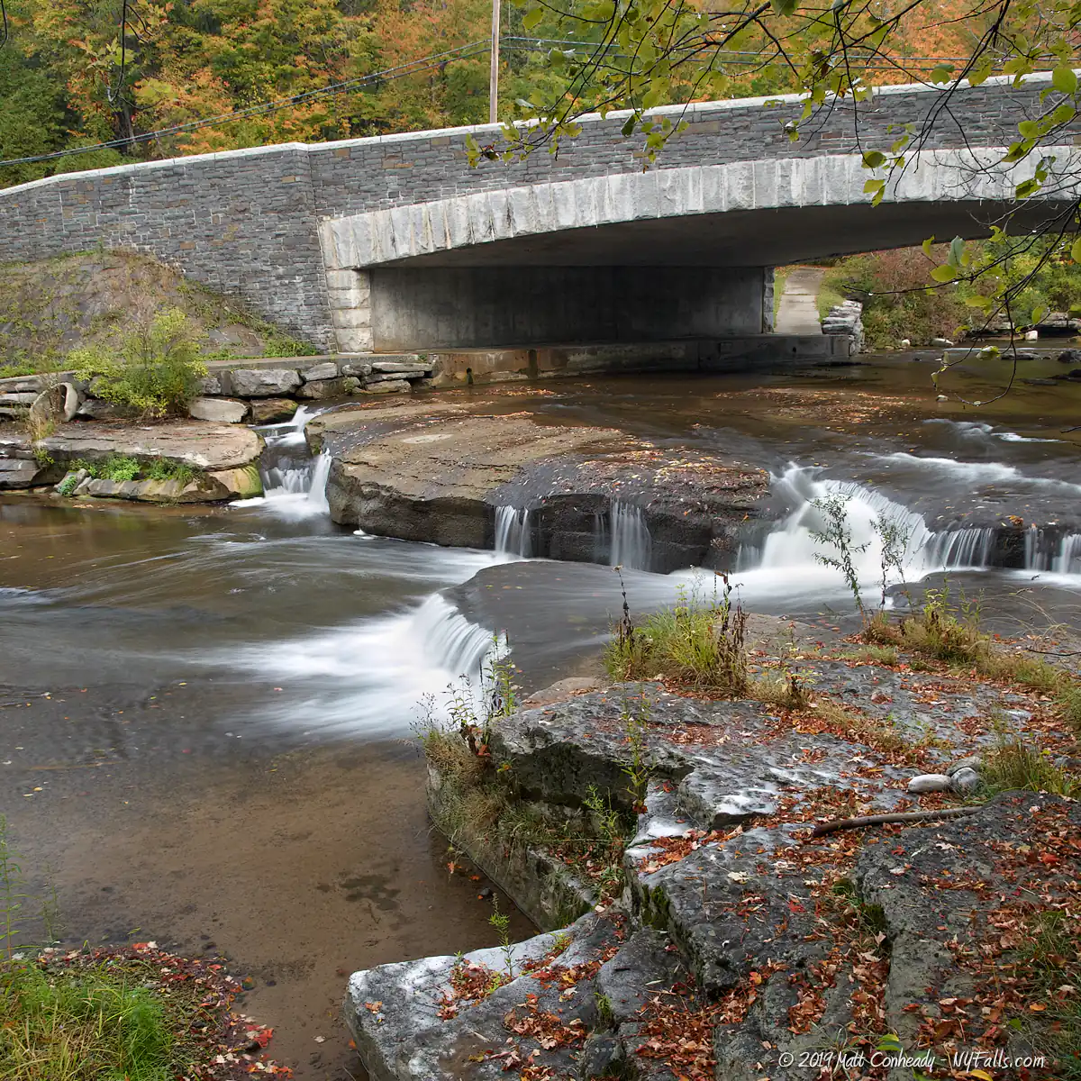
Bridge over the creek: (N 42.97955 / W 75.84219)
Directions: Take Rt. 13 (Falls Blvd./Gorge Rd.) south from the Thruway (I90) past the town of Chittenango towards Cazenovia. Gorge Rd. cuts through the park and leads to the parking area. Or use Google Directions.
Parking: State Park parking lot off of Gorge Rd. Space for up to 40 cars.

Weather
Information / Accessibility / Accommodations
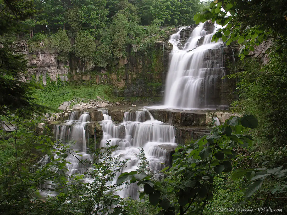
Number of falls: 1, and some small cascades upstream.
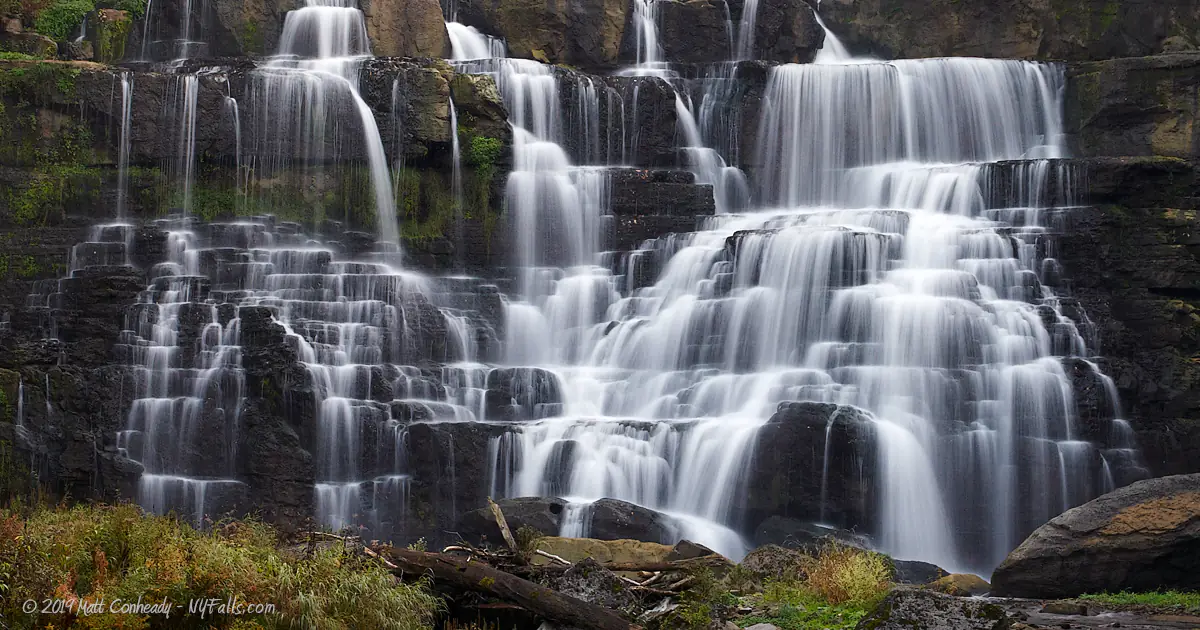
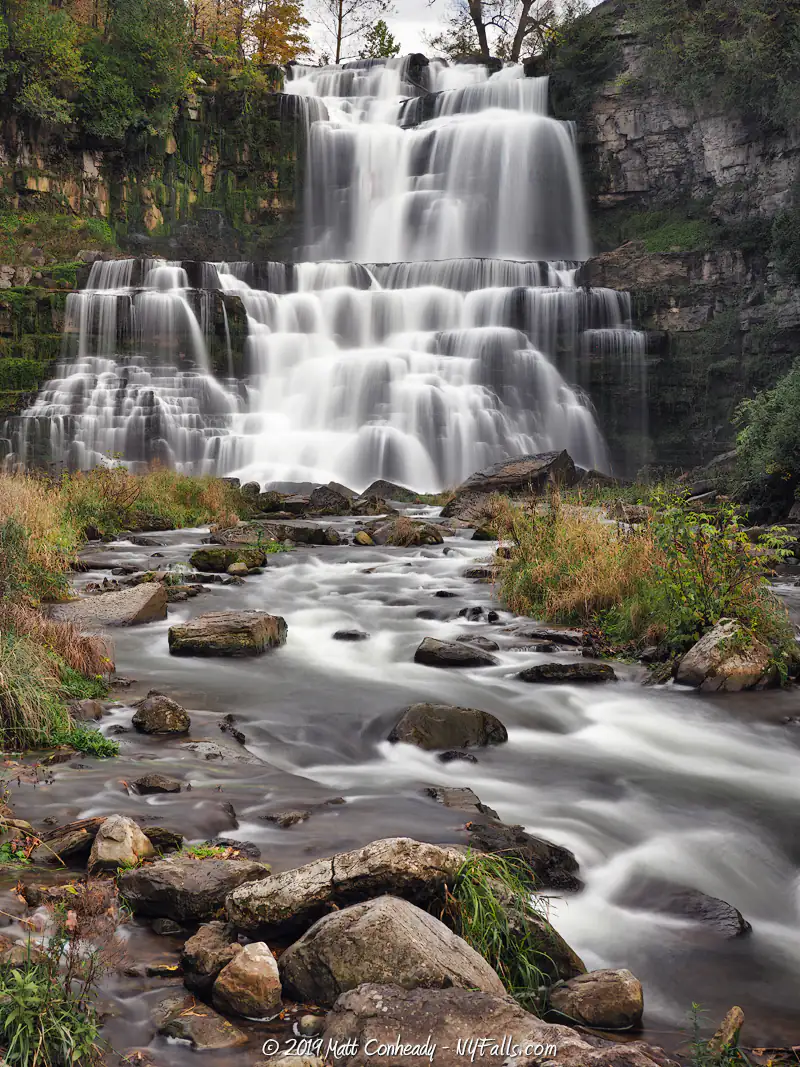
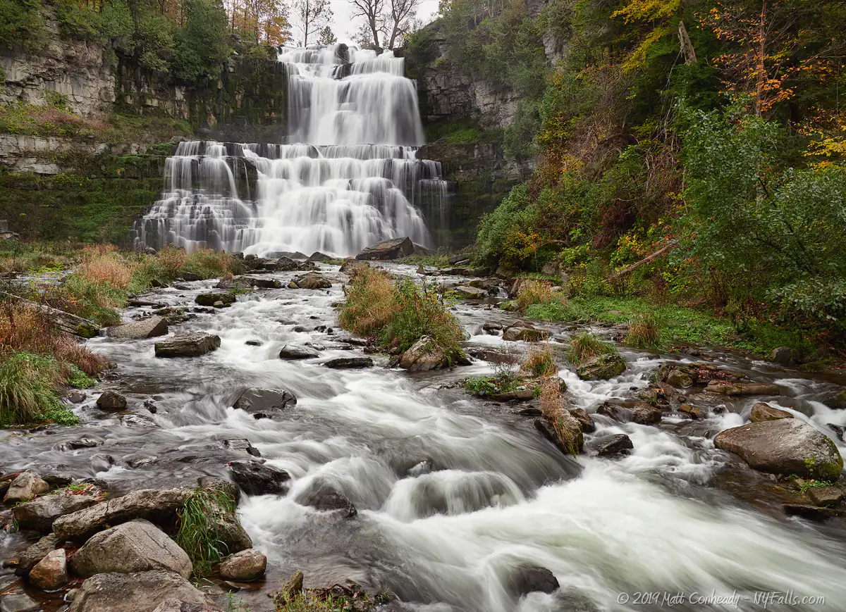
Size: 167 feet high.
Type: Staircase cascade.
Best time to visit: Year round. Spring for better flow. Fall for beautiful surrounding foliage.
Flow: Variable. It can be a trickle in summer.
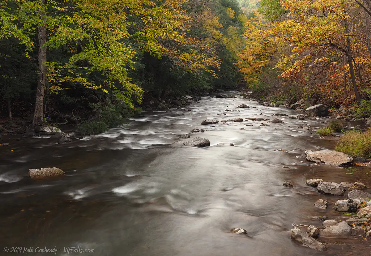
Waterway: Chittenango Creek, a tributary to Oneida Lake.
Time: 10 minutes to see it from the platform near the parking lot. 30 minutes or more to take the steps down into the gorge and see it from below.
Seasons/Hours: Open year-round; from 8:30 am to dark. The gorge trail is closed in winter.
Admission: Free for walk-ins; Vehicle fee: $3 for weekdays, $5 for holidays/weekends. Fee in the off season may not be collected.
Handicap accessibility: Yes, to see the falls from the platform near the parking lot. Steep trails and multiple steps make the walk to the base of the falls difficult.
Pets: On a leash not more than 6 feet. Do not bring your pet onto the gorge trail. The steps are slippery and this could lead to harm! Be responsible for your pet’s safety and the safety of others.
Swimming: Swimming/wading below the falls is prohibited. This is an endangered species conservation area.
Camping: This park no longer has a campground.
Accommodations: Pavilions; restrooms; benches; park office; playground; viewing platforms; hiking trails.
Description
The trip down to the Chittenango Falls gorge could be easily depicted as a damp adventurous journey into a tropical, yet familiar jungle. The massive falls, with its numerous drops, saturates the surrounding air with the waters of Chittenango Creek, which on a hot day can make the climb all the more difficult. The plants and animals that inhabit the limestone walls are adapted to these humid conditions, and ferns and other moisture-loving species dominate the landscape.
The park has unique plant and animal life including endangered species. The Ovate Amber Snail lives only under the rocks found in and around the falls. It is found nowhere else in the world. Also the very rare and environment-sensitive Hart’s Tongue Fern and the succulent Roseroot can be found growing on the gorge walls. Both species are very rare and are found only in damp, rocky environments like the areas immediately surrounding the falls. It’s very important not to remove any plants or animals from this park. It’s critical that you do not cross the barriers at the base of the falls to get closer to it. Since the endangered snails live underneath the rocks, simply stepping on the rocks can crush several of them.
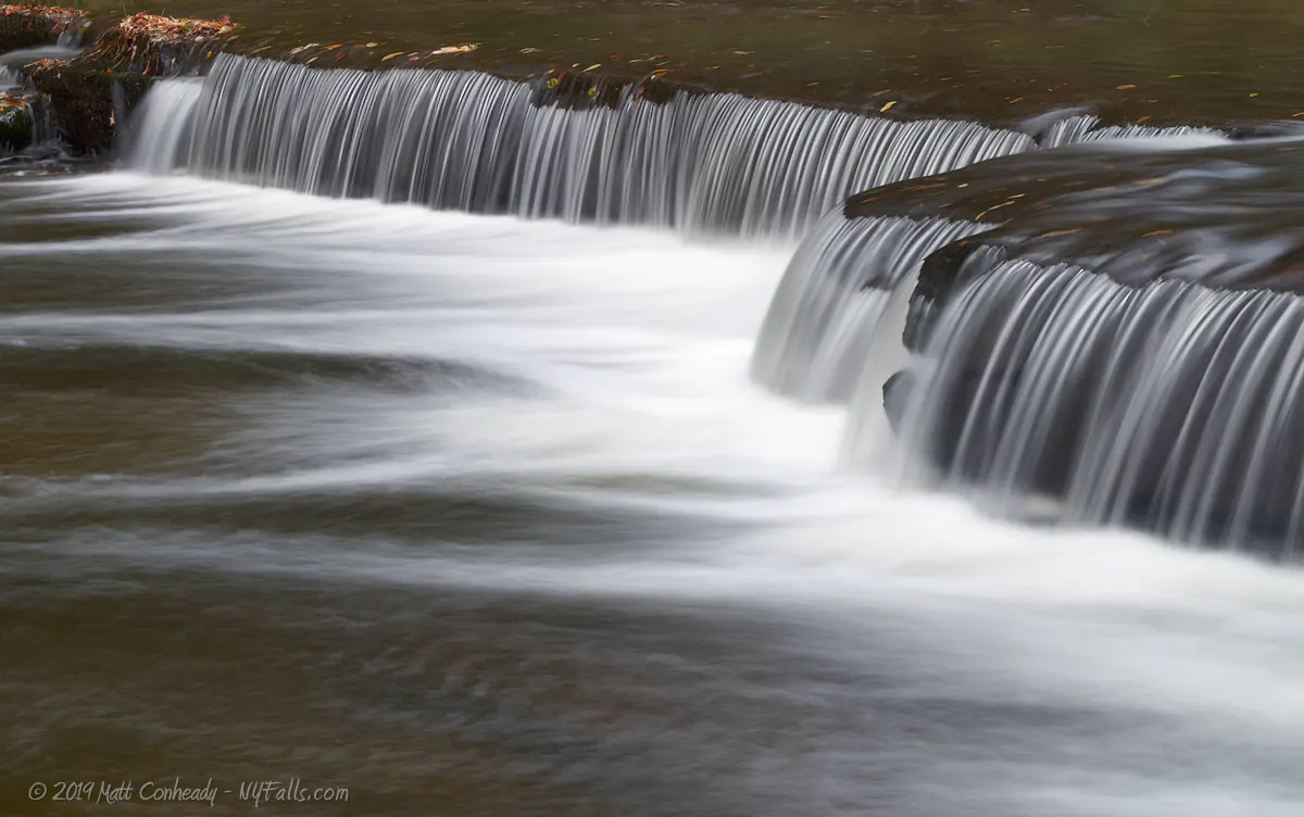
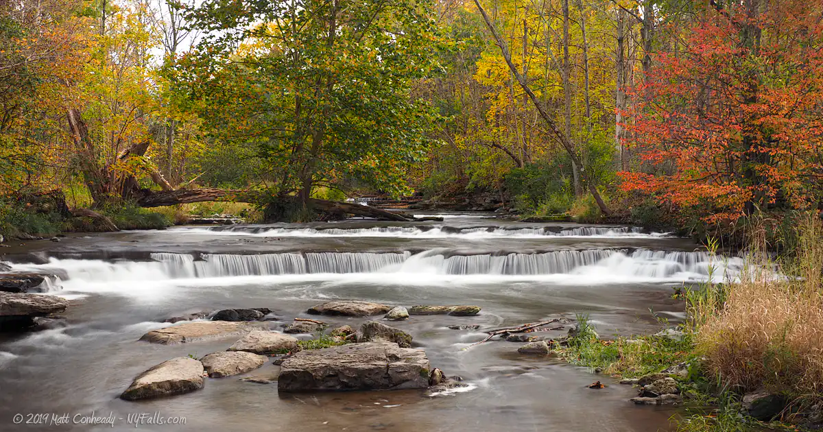
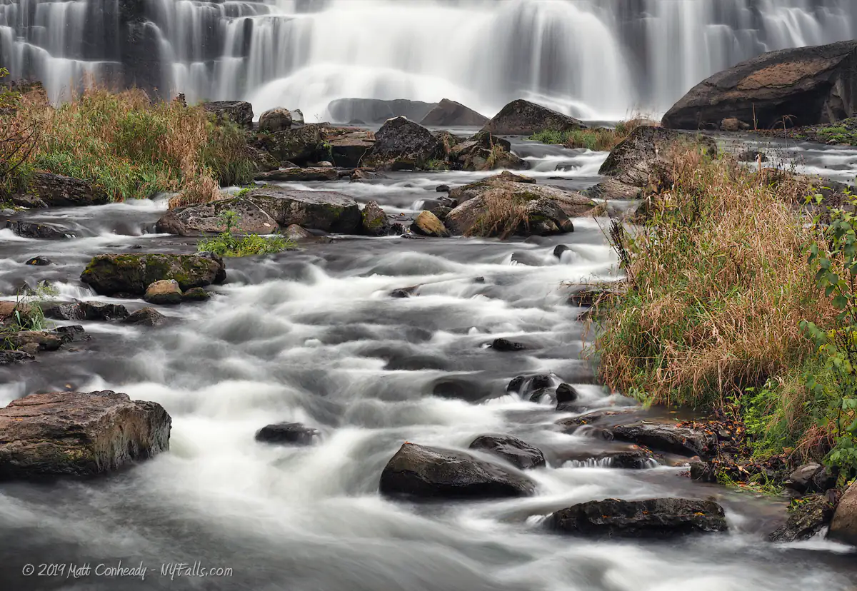
Chittenango Falls could be considered a staircase cascade, with its nearly even drops, one after another down Onondaga Limestone. The number and height of the drops, sends water flying into the air. In the creek below, the water then twists and turns around rocks and small outcroppings of plants and grasses. The creek below is dotted with large boulders and downed trees, while a few trails shoot off into the surrounding woods. There’s much to explore here, but we found no additional waterfalls within the park boundaries.
History
Chittenango Creek has been cutting through the north end of the Allegany Plateau since the end of the last ice age.
In the mid-1800s the falls were the driving industry for Chittenango. Numerous mills and factories were built in the vicinity, the foundations of which can still be found along the creek. In 1866, Revered George Boardman owned roughly 40 acres around the falls and had no problem with local residents coming by to enjoy the waterfall. Derrick Boardman, son of George, was approached by a gunpowder manufacturer who wanted to buy the land and construct a mill on the gorge. He decided to instead sell the land at a reduced price to Helen Fairchild, a Cazenovia resident, as long as she promised to keep it open to the public.
Helen Fairchild formed the Chittenango Falls Park Association, which managed the privately owned park from 1887 through 1922, when she handed over control to the state. Since then the state has increased those original 40 acres to 194.
The park once featured a campground, but due to budget issues, it has been closed.
Hiking / Walking Trails
Difficulty: Easy (to view the falls from above).
Medium (hundreds of steps) descending 170 ft into the gorge. It gets a bit more challenging to head back up the last stretch of the gorge trail, but it’s worth it.
Markings: Wooden signs, orange blazes, wood steps, dirt trail.
Distance: Less than 1/2 mile.
To check out the falls from the top, just walk east from the parking area towards the Gorge Rd Bridge. Follow the paved trail towards the top of the falls. You won’t be able to see all of it, but it’s worth a glance.
The gorge trail leads down from the main entrance to the base of the falls. This winding path of steps is humid, uneven, slippery, and full of plant life. A bridge then takes you across the creek bed to the remainder of the trail, which climbs back up on the other side of the creek. From time-to-time this section of the trail closes due to landslides, but it was recently reconstructed and is definitely worth checking out if it’s open. Following the road south will take you to an overlook of the fall’s crest and then back to the beginning. An extension of that trail proceeds upstream under the Gorge St Bridge, towards the south-east end of the park, passing small curtain falls along the way.
The park has additional trails that wind through the wooded area to the north. Check out the trail map for information on those additional trails.
Map: Trail-Map (PDF); Interactive.

Chittenango Falls State Park Interactive Map
Chittenango Falls State Park Media
More Videos, 3D audio, and photos coming soon…

Interesting Stuff
Fossils
The falls were sculpted by glaciers revealing 40 million year old layers of limestone rock. Look for coral fossils in rock layers as millions of years ago the area was flooded and tropical. A great place to fossil hunt is downstream from the pedestrian bridge.
Off to see the Wizard
Wizard of Oz writer L. Frank Baum was born in Chittenango. The All Things Oz Museum is a worthy stop. There are yellow bricks along Genesee St in Chittenango – although they are sidewalks, not roads. There’s now an Oz-themed casino run by the Oneida Nation.
Ovate Amber Snail
Novisuccinea chittenangoensis is unique to the environment created by the high humidity, concentrated calcium (from the limestone bedrock) and high quantity of microflora below the falls. This species of snail is found only around the rocks below Chittenango Falls where it feeds on both living and dead vegetation Their ovate shells are brittle and at only 20mm in length, their highest threat is listed as “trampling by humans.”
They are listed as a Federally Endangered Species. It is critical that you do not enter into their habitat. For more information on the Chittenango Ovate Amber Snail, see the article on Wikipedia.

Photography Tips
Foot bridge
- The primary shooting location is a bridge at the base of the falls. The bridge shakes when people walk on it. It’s best to photograph from this location when there aren’t many people around, or to use image stabilization.
- It may be tempting to walk in or along the creek to get closer to the falls, but this is prohibited because it is a habitat for an endangered species of snail. Bring a telephoto lens instead.
Humidity
- Down in the gorge, the humidity rises to nearly 100%. Protect your camera gear by sealing in a plastic bag with packets of silica gel.
- Check and wipe your lens frequently. Moisture builds up in no time.
Silky water effect
- To get that smooth cotton-candy look to the falls, you need to use a Neutral Density (ND) filter on your lens. The ND filter will block some of the light from entering the lens without altering the color, and thus allow your shutter to stay open longer. This blurs the water and creates a soft white gloss to the foamy areas of the falls. Check out the article for the all the details.
More tips
- See the Articles for more photography tips.


Who to Contact
Chittenango State Park
2300 Rathburn Road
Cazenovia, NY 13035
Phone: (315) 655-9620
