
Wilson-Tuscarora State Park


Location: Village of Wilson; Town of Wilson; Niagara County, New York.
Maps: Google Map, Topographic, Bird’s Eye, Trail Map.
GPS Coordinates:
- North entrance: N 43.30702 / W 78.85292
- South entrance: N 43.30718 / W 78.85592
- Swimming area: N 43.31192 / W 78.85105
Directions: Located on Rt 18, ten miles east of Fort Niagara. Coming from 104, take Rt 425 north through Wilson and turn west (left) onto Rt 18 and take it to the park. Or use Google Maps.
Weather
Information / Accessibility / Accommodations
Seasons/Hours: Year round.
Best time to visit: Summer.
Parking: Parking is available in two lots on the west side of the park. The marina on the east side has a lot for additional cars as well as trailers. There is a roadside parking area off of Rt 18 in Wilson right near the bridge that passes over the east branch. This lot is used for fishermen and hikers.
Admission: $6 parking fee, $7 when swimming is available.
Handicap accessibility: Yes, some areas. A handicap fishing area is located on the west branch.
Pets: On leash, with proof of inoculation. Not allowed in buildings or on boardwalks and improved pathways. Not allowed in the swimming area.
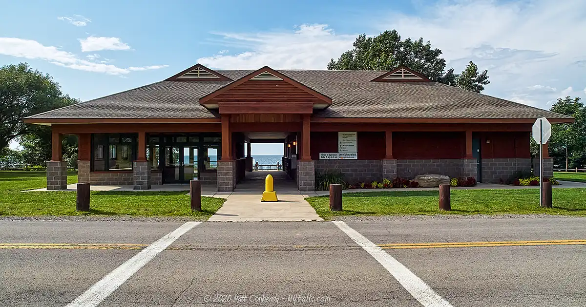
Accommodations: Benches; restrooms; picnic tables; grills; pavilions (2); indoor pavilion (1); fishing access; cross-country skiing; hiking trails; marina; playground; disc golf.
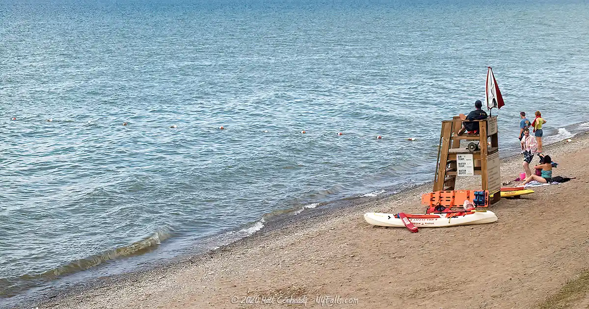
Swimming: Yes, in the guarded area only. Call (716) 751-6361 for specific days/hours.
Boat launch: A car-top launch is located near the handicap fishing access area on the west branch of Twelvemile Creek. Car-top and trailer launch at the marina at the bay on the east branch. $7/day launch fee.
Description
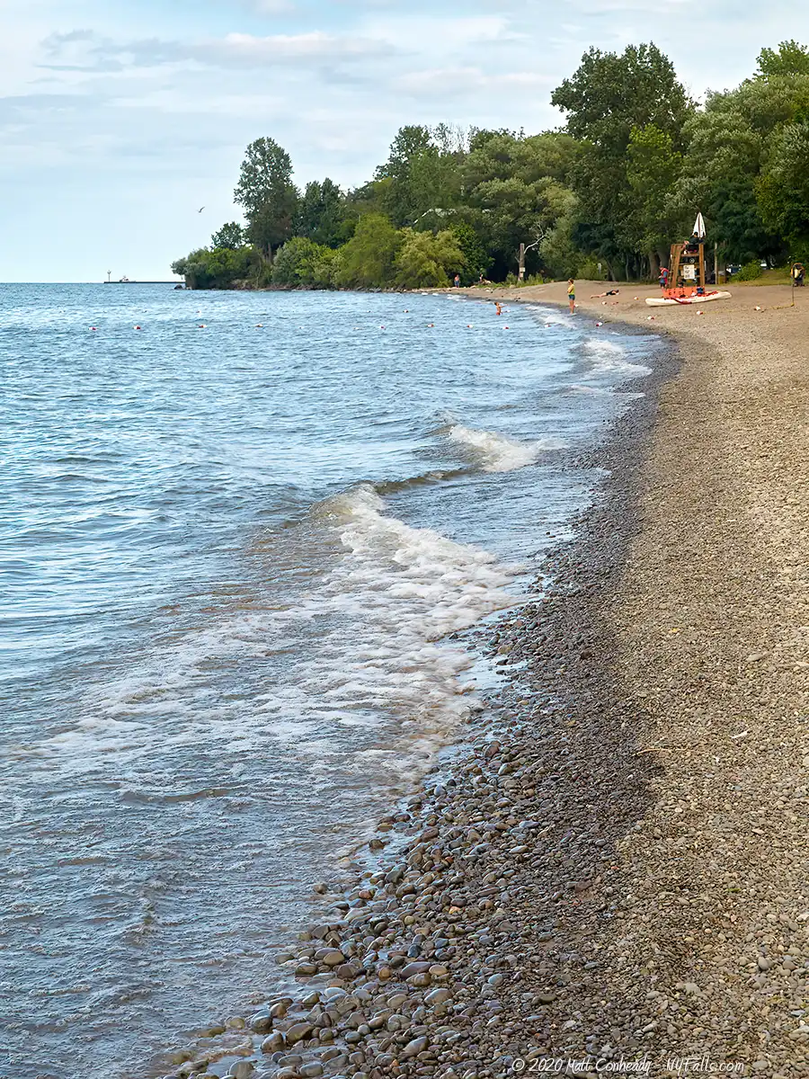
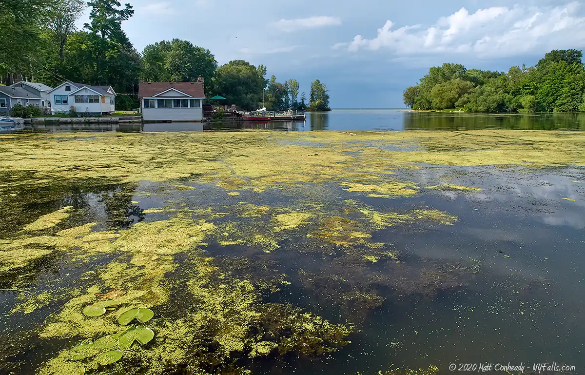
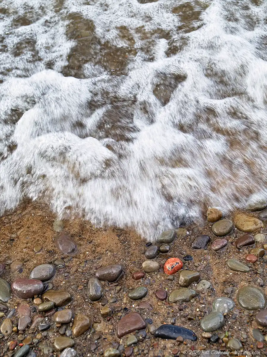
The west and east branches of Twelvemile Creek meet Lake Ontario at Wilson-Tuscarora State Park, between the villages of Wilson and Tuscarora Beach. The park is filled with nearly 400 acres of relatively flat grassy fields, immature deciduous forest, and protected wetlands, but is most noted for its excellent pebble beach and breathtaking views of Lake Ontario.
A popular destination for picnickers, the park offers plenty of tables and grills as well as a few pavilions for larger get-togethers. The guarded beach, which rarely closes unexpectedly, brings in the crowds on hot summer days. Visitors are welcome to explore nearly 3.5 miles of waterfront property along the lake and surrounding creeks. A large disc golf course is centered within the park and gets lots of play throughout most of the year. In winter, cross-country skiers and snowshoers are scattered about the park’s wide and easy-going trails.
The east branch of Twelvemile Creek, lined with state-protected wetlands, empties into Tuscarora Bay at Lake Ontario. A hike along the creek will treat visitors to a wide variety of wetland animals, including muskrats, various species of turtles, frogs, herons, and waterfowl. The bay is home to the park’s boat launch, fully-equipped marina (as well as several private marinas), and some of the more popular picnicking and fishing sites in the park. Sunset Island, packed with private homes, protects the bay from the lake and is considered to be one of the best places to catch a Lake Ontario sunset.
The west branch of the creek, although larger than the east branch, is often choked with aquatic plants and clouded with sediment. It does not see as much action from boats as Tuscarora Bay does. When we visited in mid-summer we did find several fishermen casting from this side of the park. The park’s “South Area” extends from private property along West Lake Rd. along the west branch to a sharp bend called Bullhead Point. A short network of trails winds through the South Area’s wild woodland and grassy field, taking visitors to commonly used fishing sites.

History
When settlers first arrived here, the east and west branches of Twelvemile Creek met at Tuscarora Bay. In the last century, rising lake levels and accelerated erosion have dissolved the land that directed the west branch towards the bay. Now the west branch meets the lake further to the west.
The town (and village within) was named after one of the most prominent settlers in the region, Reuben Wilson, a Massachusetts native who built his home here in 1818. The house still exists and is located on Young St near the creek. Reuben’s son Luther founded the village and town. The town of Wilson was incorporated in 1858.
The land that is now the park, with the notable exception of the marsh along the creeks, was farmland up until the state began acquiring parcels and founded the park in 1965.


Hiking / Walking Trails
Difficulty: Easy.
Markings: Trailheads are labeled and trails are clearly defined with color markings.
Distance: Over 4 miles of trails.
Description: Three primary trail systems traverse the diverse habitats found within the park and offer relaxing hikes that can get one close to wildlife of all sorts. The largest of the three, the Green Hiking Trail runs through forest in the center of the park. The Red Interpretive Trail runs along the east branch of Twelvemile Creek and the wetlands. The shorter Yellow Field Discovery Trail winds through grass fields on the west side of the park.
Maps: Trail Map.
Wilson-Tuscarora Interactive Map
More Lake Ontario Parks & Beaches
Find a new summer hangout spot or place to swim in our comprehensive guide to Lake Ontario Parks and Beaches in New York State.
Fishing
Fishing is allowed at the park. Prime spots include the pier on the west side of the park on Twelvemile Creek, the sandbar where Twelvemile Creek meets Lake Ontario. and from the beach on the extreme east of the park near Sunset Island Blvd.
Interesting Stuff
Wilson Pier
The Wilson Pier started as a small dock built by Luther Wilson in 1845. Since then it has been extended and reinforced and now serves as a tiny community park. Used for fishing and enjoying the sights of Lake Ontario, the pier is a popular place during the warm summer months. Cement walkways and benches lead out to the pier and a few monuments decorate the small parcel. On windy days one can get soaked here by crashing waves. The pier is located off of Ontario St in the Village of Wilson.
On a clear day, the City of Toronto is visible from across the lake. Look for the needle-like CN Tower. That’s 36 miles away!
A small parking area and a sliver of lakefront property on Ontario St, just east of the pier, has a set of pay-binoculars and a gazebo. Look for the flagpole. Map
Photography Tips
Sunsets
- Because of the angle of the beach, sunsets are best (positioned more over the water) in mid-summer.
Pebble Beach
- The interesting jewel-like glacial pebbles of the beach are great for macro shots.
More tips
- See the Articles and Message Board sections for more photography tips.

Who to Contact
State Park:
NYSDEC Region 7 Fisheries
3371 Lake Road
Wilson, NY 14172
Phone: (716) 751-6361
