
Thompson Park at Bear Creek Harbor


Location: On the south end of Lake Ontario; west of the village of Pultneyville; in the town of Ontario; Wayne County; New York.
Maps: Google map; Topographic; Interactive map
GPS Coordinates:
- Parking & Boat Launch: N 43.27674 / W 77.27570
- Beacon: N 43.27788 / W 77.27701
Directions: From NY-104 in Ontario Center, take Ontario Center Road north for 3 miles. Turn right onto Lake Road (CR-101). The park entrance will be on your left at just under two miles. If you pass over Bear Creek, you have gone too far. Use Google Maps.
Parking: Right after the entrance is the parking area. Several cars and boat trailers will fit in this lot.
Weather
Information / Accessibility / Accommodations
Seasons/Hours: Open year-round, from dawn until dusk.
Parking: Right after the entrance is the parking area. Several cars and boat trailers will fit in this lot.
Admission: Free.
Best time to visit: Summer through fall.
Time: Just a minute or two to see the lake.
Handicap accessibility: Along the harbor, but not to Memorial Point.
Pets: Allowed if on a leash. For your pet’s safety, and the safety of other hikers, keep your pet on the leash! It doesn’t matter if your dog is “friendly,” it’s the law. Please clean up after.
Swimming: Not allowed. No lifeguard on duty. The water quality here is questionable.
Boat launch: A concrete launch is available for those with a permit. One day rate is $5. More information.
Accommodations: Port-a-potty (in warm months); fishing; No swimming.

Description
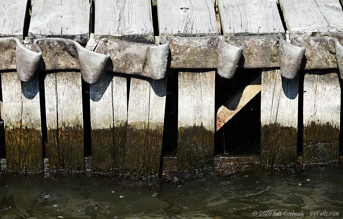
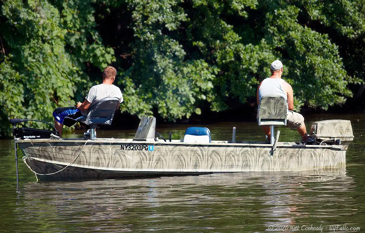
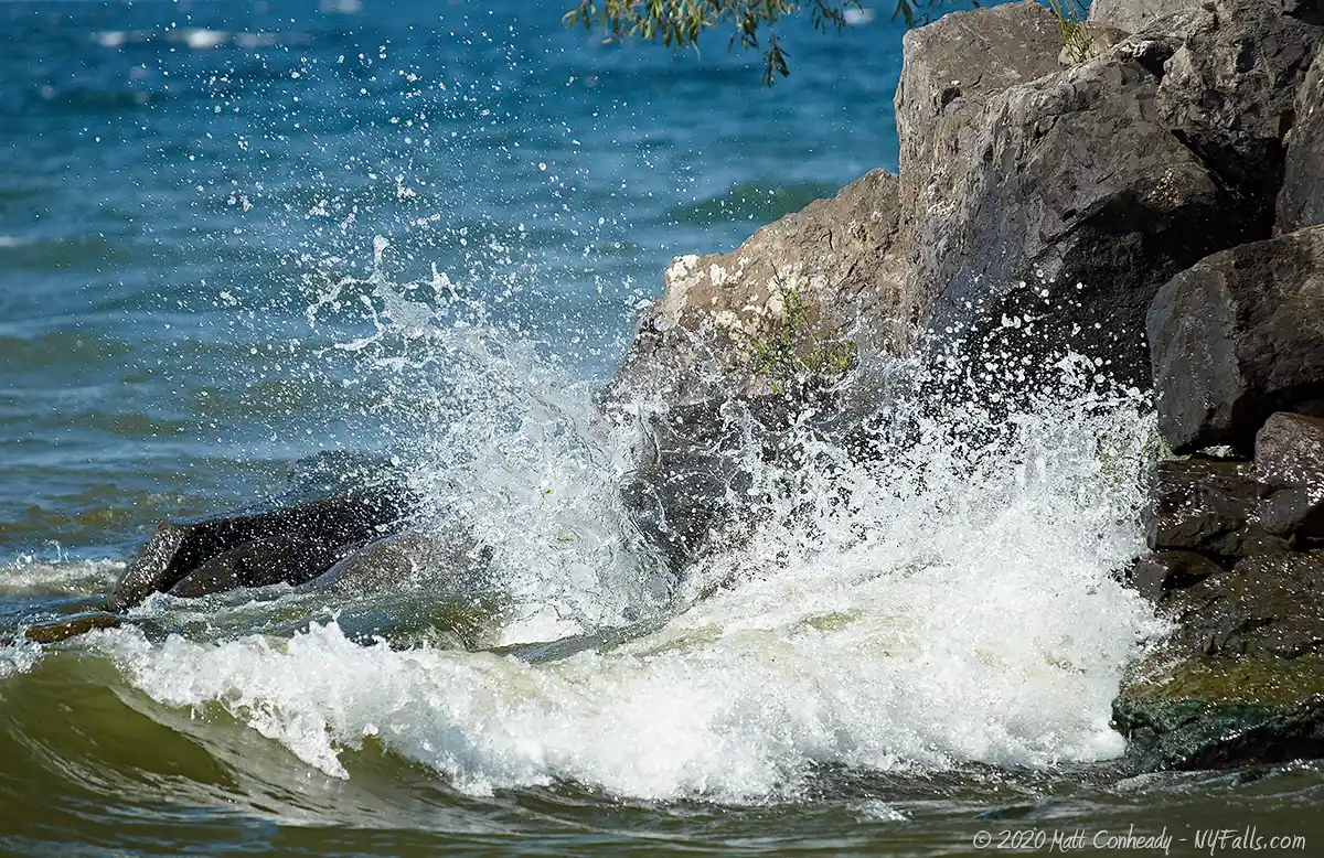
The primary use for this small town park is the neighborhood boat launch, frequently used, and the harbor itself, by neighborhood fisherman looking for an easy catch. The park serves as a local access point to the lake, enabling boaters, fishermen, and passers-by to enjoy a little slice of lakefront land, and a beautiful view of the lake. With a waste-water treatment plant right downstream, and this tiny harbor filled with algae blooms for most of the year, it is not the prettiest feature along our coast, but it is easily appreciated by anyone who uses it.
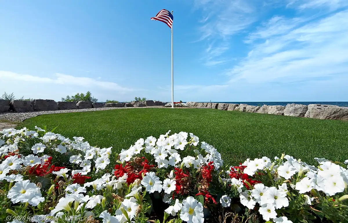
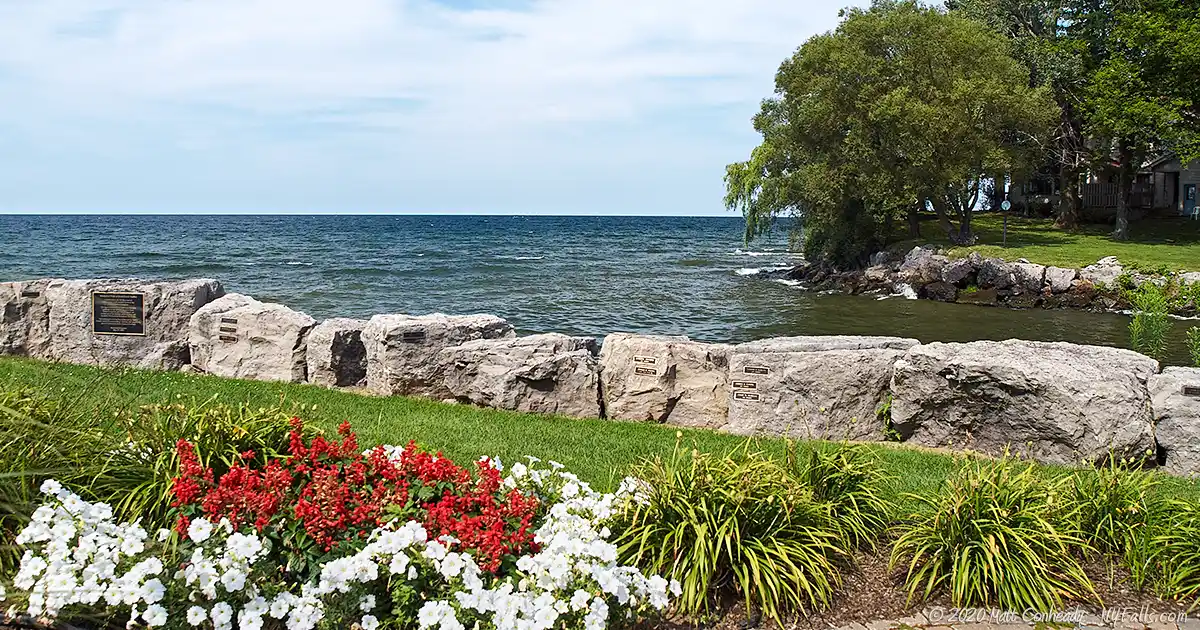
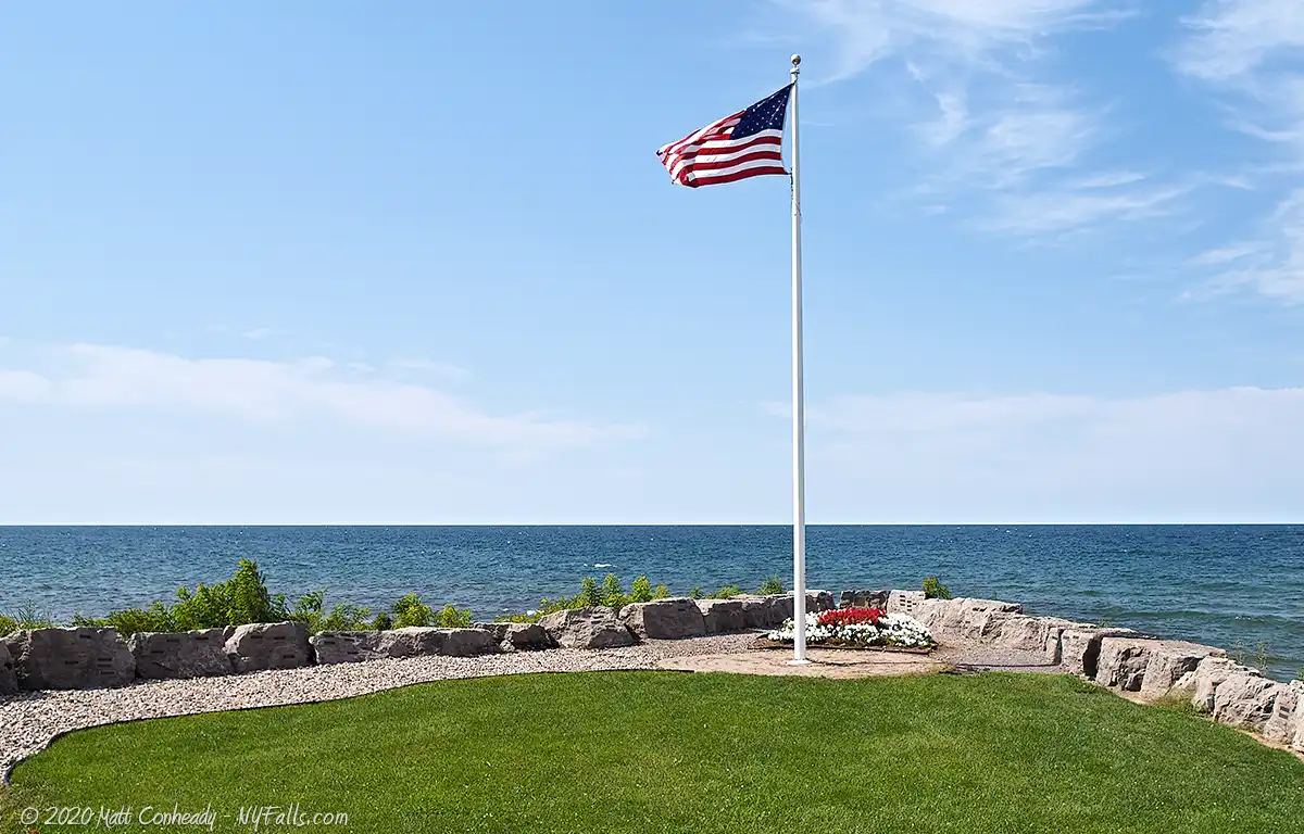
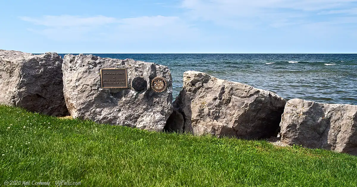
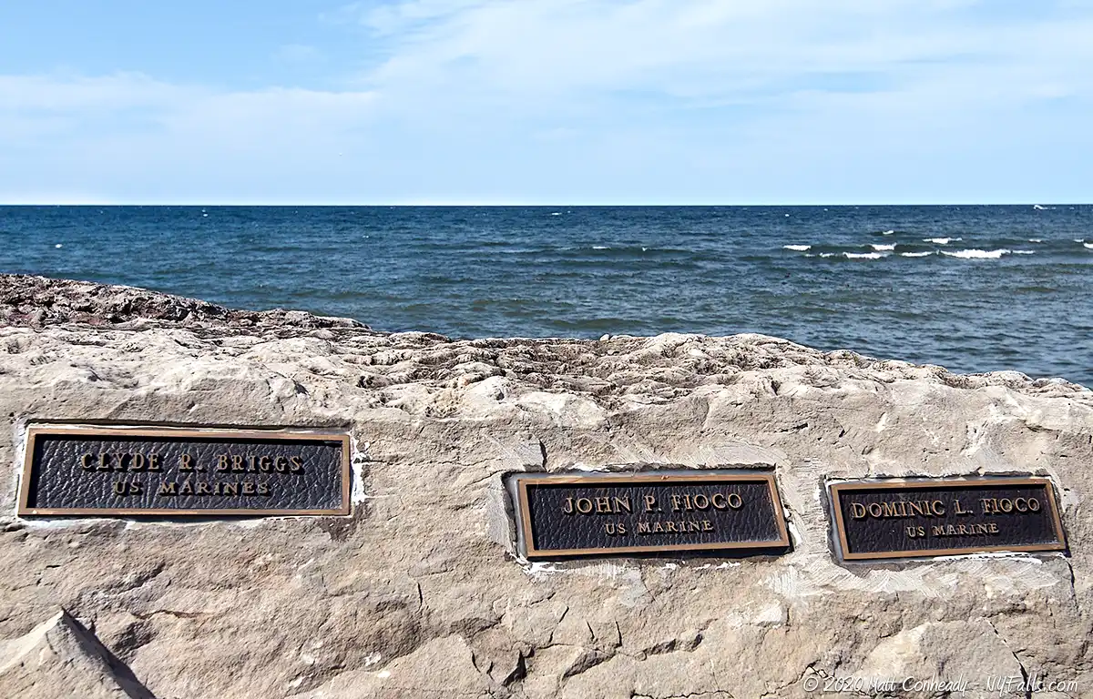
On the west side of this historic harbor is a small developed park that doubles as a monument to local veterans. Memorial Point is a charming tribute to fallen soldiers with its peaceful gardens and brick and stone monuments. It’s a beautiful place (when kempt) and perfect for looking out over a calm Lake Ontario for a moment of contemplation of the sacrifices our military servicemen and women have made. Kudos to the organizations that made Memorial Point possible.
History
In 1816 Samuel Smith set up a forge along Bear Creek to process newly discovered iron ore, and sparked the booming iron mining industry in Wayne County that lasted decades.
Bear Creek harbor, despite being small and overshadowed by larger, more urban harbors (including the Genesee River 20 miles to the west), was an important shipping hub from the late 1800s through the early 20th century. As early as the 1870s the Wayne County Mining Company and the Ontario Furnace Company almost exclusively utilized Bear Creek to ship iron ore, which was mined just upstream. Records from 1872 show that the harbor handled 79 schooners; 81 canal boats; 2 steamer barges; and one bark. These documents cataloged imports of 2,820 tons of limestone; 2,529 tons of iron ore; 130 barrels of salt; 9,000 feet of lumber. Also documented were exports of 16,340 tons of iron ore; 6,000 tons of iron; and 100 barrels of apples.
Eventually the construction of a larger harbor in nearby Pultneyville, and the success of a rail line connected dock at Sodus Point, diminished the need for shipping at Bear Creek.
Hiking / Walking Trails
Difficulty: Easy
Distance: A hundred feet.
Markings: None.
Description: There’s nothing to it. Just walk towards the lake. Try not to fall in.
Map: Click here
Bear Creek Harbor Interactive Map
Fishing
Fishing is allowed at the park and in the harbor. Fish from edge of the park along Bear Creek or by boat.
Interesting Stuff
Memorial Point
This tribute is made possible by the Town of Ontario; the workers at the neighboring Ginna Nuclear Power Plant; Rotary International; and the American Legion.
The beautifully landscaped park is best seen in late spring.
To apply to have a plaque dedicated at Memorial point, see the Town of Ontario’s website for an application.
Photography Tips
Sunsets
- Because of the angle of the beach, sunsets are best (positioned more over the water) in mid-summer.
Layers
- When photographing the lake, include the foreground elements of Memorial Point to add depth and color contrast.
More tips
- See the Articles and Message Board sections for more photography tips.
Nearby Waterfalls


More Lake Ontario Parks & Beaches
Find a new summer hangout spot or place to swim in our comprehensive guide to Lake Ontario Parks and Beaches in New York State.
Who to Contact
Town of Ontario – Parks and Recreation
6551 Knickerbocker Rd.
Ontario, NY 14519
Phone (315) 524-7447
Fax (315) 524-7465
ontariotown.org
